Deprecated: Creation of dynamic property Zend_View::$sMode is deprecated in /var/www/stall-frei/htdocs/staging.stall-frei.de/library/vendor/shardj/zf1-future/library/Zend/View/Abstract.php on line 308
Stallplatz oder Offenstall in Godern
Gesucht wird in "Godern, Mecklenburg-Vorpommern, Deutschland"
6.330 Einträge
Deprecated: Creation of dynamic property Zend_View::$listObjects is deprecated in /var/www/stall-frei/htdocs/staging.stall-frei.de/library/vendor/shardj/zf1-future/library/Zend/View/Abstract.php on line 308
Gesponsort


Deprecated: Creation of dynamic property Zend_View::$listMode is deprecated in /var/www/stall-frei/htdocs/staging.stall-frei.de/library/vendor/shardj/zf1-future/library/Zend/View/Abstract.php on line 308
Deprecated: Creation of dynamic property Zend_View::$renderedObjects is deprecated in /var/www/stall-frei/htdocs/staging.stall-frei.de/library/vendor/shardj/zf1-future/library/Zend/View/Abstract.php on line 308
Deprecated: Creation of dynamic property Zend_View::$index is deprecated in /var/www/stall-frei/htdocs/staging.stall-frei.de/library/vendor/shardj/zf1-future/library/Zend/View/Abstract.php on line 308
Deprecated: Creation of dynamic property Zend_View::$displayMode is deprecated in /var/www/stall-frei/htdocs/staging.stall-frei.de/library/vendor/shardj/zf1-future/library/Zend/View/Abstract.php on line 308
Deprecated: Creation of dynamic property Zend_View::$remarketingIds is deprecated in /var/www/stall-frei/htdocs/staging.stall-frei.de/library/vendor/shardj/zf1-future/library/Zend/View/Abstract.php on line 308
Deprecated: Creation of dynamic property Zend_View::$listItem is deprecated in /var/www/stall-frei/htdocs/staging.stall-frei.de/library/vendor/shardj/zf1-future/library/Zend/View/Abstract.php on line 308
Deprecated: Creation of dynamic property Zend_View::$object is deprecated in /var/www/stall-frei/htdocs/staging.stall-frei.de/library/vendor/shardj/zf1-future/library/Zend/View/Abstract.php on line 308
Deprecated: Creation of dynamic property Zend_View::$attributes is deprecated in /var/www/stall-frei/htdocs/staging.stall-frei.de/library/vendor/shardj/zf1-future/library/Zend/View/Abstract.php on line 308


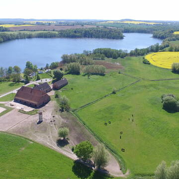
Pensionspferdehaltung bei Schwerin – Komfort pur
Wendorf
Bernsteinreiter
@Bernsteinreiter
FN-Mitglied
Freizeitstall
Vermieten
Führanlage
Hunde willkommen
Hengsthaltung möglich
Pferdezucht
38 weitere...
P+
Deprecated: Creation of dynamic property Zend_View_Helper_Ads::$adLink is deprecated in /var/www/stall-frei/htdocs/staging.stall-frei.de/library/Psf/View/Helper/Ads.php on line 108

Persönlichkeitsentwicklung mit Pferden
Bad Salzuflen
Katja Dors
@Pferdezeiten
Begleite andere auf ihrem Entwicklungsweg und entdecke die transformative Kraft der pferdegestützten Persönlichkeitsentwicklung !
neu
R
Gut Häven - Pensionsplatz im gepflegten Offensta...
Kloster Tempzin OT Häven
Gut-Haeven
@Gut-Haeven
Fahrstall, Kutschwagen
Freizeitstall
Vermieten
Krankenbox
Longierzirkel/Roundpen
Allergikerstall
Notfallboxen
28 weitere...
P
Leider kein Vorschaubild
Leider kein Vorschaubild
Offenstall, Paddocktrail, Paddockparadies
Sülstorf
Vogel-Ranch
@VogelRanch
Freizeitstall
Geländestrecke
Vermieten
Hunde willkommen
Krankenbox
Notfallboxen
23 weitere...
B
Leider kein Vorschaubild
Leider kein Vorschaubild
Box frei Stall frei Weide Pensionsplatz
Goldenstädt
Eckstein
@Eckstein
Pferdeausbildung
Paddock
Parkplatz für Pferdeanhänger
Innenbox
Halbpension
10 weitere...
B
Leider kein Vorschaubild
Leider kein Vorschaubild
Box frei in kleinem Privatstall
Alt Meteln Ausbau
Pensionsstall Alt Meteln
@Pensionsstall-Alt-Meteln
Freizeitstall
Vermieten
Paddock
Pensions- und Gastboxen
Innenbox
8 weitere...
B

Das Zuhause für dein Pferd
Klein Labenz
L. Zucker
@MTReitanlage
Freizeitstall
Rehabilitationsstall
Führanlage
Hunde willkommen
Allergikerstall
bedampftes/gewaschenes Heu
Außenbox mit Paddock
Außenboxen
30 weitere...
P
Leider kein Vorschaubild
Leider kein Vorschaubild
Box frei
Klein Warin
Reitstall-Klein-Warin
@Reitstall-Klein-Warin
Vermieten
Hunde willkommen
Paddock
Einzelne Boxen oder Stallplätze
9 weitere...
ganz aktuell
B


Ostseebad-Boltenhagen
Boltenhagen
Reiterhof Boltenhagen
@Reiterhof-Boltenhagen
FN-Mitglied
Freizeitstall
Vermieten
Hunde willkommen
Krankenbox
Außenboxen
26 weitere...
aktuell
S

Futtersack HeuToy, Fressbremse in pink
Mechtersen
STALL-FREIde Marketing
@STALL-FREI-Marketing
Stundenlange Beschäftigung die
Koliken vorbeugt, geringe Staubinhalation mit
steuerbarer Futterentnahme
Leider kein Vorschaubild
Leider kein Vorschaubild
Offenstall Weide Koppel Ganzjährige Wiedehaltung
Dorf Mecklenburg -Steffin
Hof-Steffin
@Hof-Steffin
Freizeitstall
Geländestrecke
Vermieten
Verpachten
Krankenbox
Longierzirkel/Roundpen
Allergikerstall
Gnadenbrothof
33 weitere...
B
Leider kein Vorschaubild
Leider kein Vorschaubild
Offenstall Frei im Privatstall gleich bei Wismar
Dorf Mecklenburg -Steffin
Hof-Steffin
@Hof-Steffin
Freizeitstall
Vermieten
Verpachten
Krankenbox
Longierzirkel/Roundpen
Allergikerstall
Gnadenbrothof
26 weitere...
B
Deprecated: Creation of dynamic property Zend_View::$pageCount is deprecated in /var/www/stall-frei/htdocs/staging.stall-frei.de/library/vendor/shardj/zf1-future/library/Zend/View/Abstract.php on line 308
Deprecated: Creation of dynamic property Zend_View::$itemCountPerPage is deprecated in /var/www/stall-frei/htdocs/staging.stall-frei.de/library/vendor/shardj/zf1-future/library/Zend/View/Abstract.php on line 308
Deprecated: Creation of dynamic property Zend_View::$first is deprecated in /var/www/stall-frei/htdocs/staging.stall-frei.de/library/vendor/shardj/zf1-future/library/Zend/View/Abstract.php on line 308
Deprecated: Creation of dynamic property Zend_View::$current is deprecated in /var/www/stall-frei/htdocs/staging.stall-frei.de/library/vendor/shardj/zf1-future/library/Zend/View/Abstract.php on line 308
Deprecated: Creation of dynamic property Zend_View::$last is deprecated in /var/www/stall-frei/htdocs/staging.stall-frei.de/library/vendor/shardj/zf1-future/library/Zend/View/Abstract.php on line 308
Deprecated: Creation of dynamic property Zend_View::$next is deprecated in /var/www/stall-frei/htdocs/staging.stall-frei.de/library/vendor/shardj/zf1-future/library/Zend/View/Abstract.php on line 308
Deprecated: Creation of dynamic property Zend_View::$pagesInRange is deprecated in /var/www/stall-frei/htdocs/staging.stall-frei.de/library/vendor/shardj/zf1-future/library/Zend/View/Abstract.php on line 308
Deprecated: Creation of dynamic property Zend_View::$firstPageInRange is deprecated in /var/www/stall-frei/htdocs/staging.stall-frei.de/library/vendor/shardj/zf1-future/library/Zend/View/Abstract.php on line 308
Deprecated: Creation of dynamic property Zend_View::$lastPageInRange is deprecated in /var/www/stall-frei/htdocs/staging.stall-frei.de/library/vendor/shardj/zf1-future/library/Zend/View/Abstract.php on line 308
Deprecated: Creation of dynamic property Zend_View::$currentItemCount is deprecated in /var/www/stall-frei/htdocs/staging.stall-frei.de/library/vendor/shardj/zf1-future/library/Zend/View/Abstract.php on line 308
Deprecated: Creation of dynamic property Zend_View::$totalItemCount is deprecated in /var/www/stall-frei/htdocs/staging.stall-frei.de/library/vendor/shardj/zf1-future/library/Zend/View/Abstract.php on line 308
Deprecated: Creation of dynamic property Zend_View::$firstItemNumber is deprecated in /var/www/stall-frei/htdocs/staging.stall-frei.de/library/vendor/shardj/zf1-future/library/Zend/View/Abstract.php on line 308
Deprecated: Creation of dynamic property Zend_View::$lastItemNumber is deprecated in /var/www/stall-frei/htdocs/staging.stall-frei.de/library/vendor/shardj/zf1-future/library/Zend/View/Abstract.php on line 308
Deprecated: Creation of dynamic property Zend_View::$router is deprecated in /var/www/stall-frei/htdocs/staging.stall-frei.de/library/vendor/shardj/zf1-future/library/Zend/View/Abstract.php on line 308
Deprecated: Creation of dynamic property Zend_View::$urlParams is deprecated in /var/www/stall-frei/htdocs/staging.stall-frei.de/library/vendor/shardj/zf1-future/library/Zend/View/Abstract.php on line 308
Deprecated: Creation of dynamic property Zend_View::$showAds is deprecated in /var/www/stall-frei/htdocs/staging.stall-frei.de/library/vendor/shardj/zf1-future/library/Zend/View/Abstract.php on line 308
Deprecated: Creation of dynamic property Zend_View::$objectIds is deprecated in /var/www/stall-frei/htdocs/staging.stall-frei.de/library/vendor/shardj/zf1-future/library/Zend/View/Abstract.php on line 308
Deprecated: Creation of dynamic property Zend_View::$showNavbar is deprecated in /var/www/stall-frei/htdocs/staging.stall-frei.de/library/vendor/shardj/zf1-future/library/Zend/View/Abstract.php on line 308
Deprecated: Creation of dynamic property Zend_View::$showBreadcrumb is deprecated in /var/www/stall-frei/htdocs/staging.stall-frei.de/library/vendor/shardj/zf1-future/library/Zend/View/Abstract.php on line 308
Deprecated: Creation of dynamic property Zend_View::$showFooter is deprecated in /var/www/stall-frei/htdocs/staging.stall-frei.de/library/vendor/shardj/zf1-future/library/Zend/View/Abstract.php on line 308
Deprecated: Creation of dynamic property Zend_View::$showInternalAds is deprecated in /var/www/stall-frei/htdocs/staging.stall-frei.de/library/vendor/shardj/zf1-future/library/Zend/View/Abstract.php on line 308
Deprecated: Creation of dynamic property Zend_View::$blNoContent is deprecated in /var/www/stall-frei/htdocs/staging.stall-frei.de/library/vendor/shardj/zf1-future/library/Zend/View/Abstract.php on line 308
Deprecated: Creation of dynamic property Zend_View::$sMetaDesc is deprecated in /var/www/stall-frei/htdocs/staging.stall-frei.de/library/vendor/shardj/zf1-future/library/Zend/View/Abstract.php on line 308
Deprecated: Creation of dynamic property Zend_View::$useGmaps is deprecated in /var/www/stall-frei/htdocs/staging.stall-frei.de/library/vendor/shardj/zf1-future/library/Zend/View/Abstract.php on line 308
Deprecated: Creation of dynamic property Zend_View::$touches is deprecated in /var/www/stall-frei/htdocs/staging.stall-frei.de/library/vendor/shardj/zf1-future/library/Zend/View/Abstract.php on line 308
Deprecated: Creation of dynamic property Zend_View::$oProject is deprecated in /var/www/stall-frei/htdocs/staging.stall-frei.de/library/vendor/shardj/zf1-future/library/Zend/View/Abstract.php on line 308
Deprecated: Creation of dynamic property Zend_View::$pageHeadline is deprecated in /var/www/stall-frei/htdocs/staging.stall-frei.de/library/vendor/shardj/zf1-future/library/Zend/View/Abstract.php on line 308
Deprecated: Creation of dynamic property Zend_View::$disableLocationField is deprecated in /var/www/stall-frei/htdocs/staging.stall-frei.de/library/vendor/shardj/zf1-future/library/Zend/View/Abstract.php on line 308
Deprecated: Creation of dynamic property Zend_View::$isSearch is deprecated in /var/www/stall-frei/htdocs/staging.stall-frei.de/library/vendor/shardj/zf1-future/library/Zend/View/Abstract.php on line 308
Deprecated: Creation of dynamic property Zend_View::$pageTitle is deprecated in /var/www/stall-frei/htdocs/staging.stall-frei.de/library/vendor/shardj/zf1-future/library/Zend/View/Abstract.php on line 308
Deprecated: Creation of dynamic property Psf_Form_Element_Text::$class is deprecated in /var/www/stall-frei/htdocs/staging.stall-frei.de/library/vendor/shardj/zf1-future/library/Zend/Form/Element.php on line 874
Deprecated: Creation of dynamic property Psf_Form_Element_Text::$size is deprecated in /var/www/stall-frei/htdocs/staging.stall-frei.de/library/vendor/shardj/zf1-future/library/Zend/Form/Element.php on line 874
Deprecated: Creation of dynamic property Psf_Form_Element_Text::$placeholder is deprecated in /var/www/stall-frei/htdocs/staging.stall-frei.de/library/vendor/shardj/zf1-future/library/Zend/Form/Element.php on line 874
Deprecated: Creation of dynamic property Psf_Form_Element_Hidden::$class is deprecated in /var/www/stall-frei/htdocs/staging.stall-frei.de/library/vendor/shardj/zf1-future/library/Zend/Form/Element.php on line 874
Deprecated: Creation of dynamic property Psf_Form_Element_Hidden::$class is deprecated in /var/www/stall-frei/htdocs/staging.stall-frei.de/library/vendor/shardj/zf1-future/library/Zend/Form/Element.php on line 874
Deprecated: Creation of dynamic property Psf_Form_Element_Hidden::$class is deprecated in /var/www/stall-frei/htdocs/staging.stall-frei.de/library/vendor/shardj/zf1-future/library/Zend/Form/Element.php on line 874
Deprecated: Creation of dynamic property Psf_Form_Element_Hidden::$class is deprecated in /var/www/stall-frei/htdocs/staging.stall-frei.de/library/vendor/shardj/zf1-future/library/Zend/Form/Element.php on line 874
Deprecated: Creation of dynamic property Psf_Form_Element_Select::$class is deprecated in /var/www/stall-frei/htdocs/staging.stall-frei.de/library/vendor/shardj/zf1-future/library/Zend/Form/Element.php on line 874
Deprecated: Creation of dynamic property Psf_Form_Element_Select::$class is deprecated in /var/www/stall-frei/htdocs/staging.stall-frei.de/library/vendor/shardj/zf1-future/library/Zend/Form/Element.php on line 874
Deprecated: Creation of dynamic property Psf_Form_Element_Select::$class is deprecated in /var/www/stall-frei/htdocs/staging.stall-frei.de/library/vendor/shardj/zf1-future/library/Zend/Form/Element.php on line 874
Deprecated: Creation of dynamic property Psf_Form_Element_Select::$class is deprecated in /var/www/stall-frei/htdocs/staging.stall-frei.de/library/vendor/shardj/zf1-future/library/Zend/Form/Element.php on line 874
Deprecated: Creation of dynamic property Psf_Form_Element_Text::$class is deprecated in /var/www/stall-frei/htdocs/staging.stall-frei.de/library/vendor/shardj/zf1-future/library/Zend/Form/Element.php on line 874
Deprecated: Creation of dynamic property Psf_Form_Element_Checkbox::$label is deprecated in /var/www/stall-frei/htdocs/staging.stall-frei.de/library/vendor/shardj/zf1-future/library/Zend/Form/Element.php on line 874
Deprecated: Creation of dynamic property Zend_View::$sort is deprecated in /var/www/stall-frei/htdocs/staging.stall-frei.de/library/vendor/shardj/zf1-future/library/Zend/View/Abstract.php on line 308
Deprecated: Creation of dynamic property Zend_View::$searchLocation is deprecated in /var/www/stall-frei/htdocs/staging.stall-frei.de/library/vendor/shardj/zf1-future/library/Zend/View/Abstract.php on line 308
Deprecated: Creation of dynamic property Zend_View::$locationHint is deprecated in /var/www/stall-frei/htdocs/staging.stall-frei.de/library/vendor/shardj/zf1-future/library/Zend/View/Abstract.php on line 308
Psf_GeoCoder_Abstract::getLocation: Godern Get Location CachedOrLive
Psf_GeoCoder_Abstract::getCachedOrLive: Godern
Psf_GeoCoder_OpenCageData::makeApiRequest: response:
Array
(
[documentation] => https://opencagedata.com/api
[licenses] => Array
(
[0] => Array
(
[name] => see attribution guide
[url] => https://opencagedata.com/credits
)
)
[results] => Array
(
[0] => Array
(
[bounds] => Array
(
[northeast] => Array
(
[lat] => 53.634371
[lng] => 11.569396
)
[southwest] => Array
(
[lat] => 53.609937
[lng] => 11.518724
)
)
[components] => Array
(
[ISO_3166-1_alpha-2] => DE
[ISO_3166-1_alpha-3] => DEU
[ISO_3166-2] => Array
(
[0] => DE-MV
)
[_category] => place
[_normalized_city] => Godern
[_type] => village
[continent] => Europe
[country] => Deutschland
[country_code] => de
[county] => Ludwigslust-Parchim
[municipality] => Crivitz
[political_union] => European Union
[state] => Mecklenburg-Vorpommern
[state_code] => MV
[village] => Godern
)
[confidence] => 7
[formatted] => Godern, Mecklenburg-Vorpommern, Deutschland
[geometry] => Array
(
[lat] => 53.6222
[lng] => 11.5404525
)
)
[1] => Array
(
[bounds] => Array
(
[northeast] => Array
(
[lat] => 53.6373713
[lng] => 11.5618174
)
[southwest] => Array
(
[lat] => 53.5973713
[lng] => 11.5218174
)
)
[components] => Array
(
[ISO_3166-1_alpha-2] => DE
[ISO_3166-1_alpha-3] => DEU
[ISO_3166-2] => Array
(
[0] => DE-MV
)
[_category] => place
[_normalized_city] => Pinnow
[_type] => village
[city] => Pinnow
[continent] => Europe
[country] => Deutschland
[country_code] => de
[county] => Ludwigslust-Parchim
[municipality] => Crivitz
[political_union] => European Union
[postcode] => 19065
[state] => Mecklenburg-Vorpommern
[state_code] => MV
[village] => Godern
)
[confidence] => 7
[formatted] => 19065 Godern, Deutschland
[geometry] => Array
(
[lat] => 53.6173713
[lng] => 11.5418174
)
)
[2] => Array
(
[bounds] => Array
(
[northeast] => Array
(
[lat] => 50.9963415
[lng] => 12.3735333
)
[southwest] => Array
(
[lat] => 50.9563415
[lng] => 12.3335333
)
)
[components] => Array
(
[ISO_3166-1_alpha-2] => DE
[ISO_3166-1_alpha-3] => DEU
[ISO_3166-2] => Array
(
[0] => DE-TH
)
[_category] => place
[_normalized_city] => Göhren
[_type] => city
[city] => Göhren
[continent] => Europe
[country] => Deutschland
[country_code] => de
[county] => Altenburger Land
[municipality] => Rositz
[political_union] => European Union
[postcode] => 04617
[state] => Thüringen
[state_code] => TH
)
[confidence] => 7
[formatted] => Göhren, Thüringen, Deutschland
[geometry] => Array
(
[lat] => 50.9763415
[lng] => 12.3535333
)
)
[3] => Array
(
[components] => Array
(
[ISO_3166-1_alpha-2] => FR
[ISO_3166-1_alpha-3] => FRA
[ISO_3166-2] => Array
(
[0] => FR-BRE
[1] => FR-56
)
[_category] => road
[_normalized_city] => Vannes
[_type] => road
[city] => Vannes
[continent] => Europe
[country] => France
[country_code] => fr
[county] => Morbihan
[local_authority] => Golfe du Morbihan - Vannes agglomération
[political_union] => European Union
[postcode] => 56000
[road] => Allée de Lann Godern
[state] => Bretagne
[state_code] => BRE
)
[confidence] => 4
[formatted] => Allée de Lann Godern, 56000 Vannes, France
[geometry] => Array
(
[lat] => 47.653334
[lng] => -2.792954
)
)
[4] => Array
(
[components] => Array
(
[ISO_3166-1_alpha-2] => FR
[ISO_3166-1_alpha-3] => FRA
[ISO_3166-2] => Array
(
[0] => FR-PDL
[1] => FR-72
)
[_category] => road
[_normalized_city] => Arnage
[_type] => road
[city] => Arnage
[continent] => Europe
[country] => France
[country_code] => fr
[county] => Sarthe
[local_authority] => Le Mans Métropole
[political_union] => European Union
[postcode] => 72230
[road] => Chemin de la Goderie
[state] => Pays de la Loire
[state_code] => PDL
)
[confidence] => 3
[formatted] => Chemin de la Goderie, 72230 Arnage, France
[geometry] => Array
(
[lat] => 47.921575
[lng] => 0.180198
)
)
[5] => Array
(
[components] => Array
(
[ISO_3166-1_alpha-2] => FR
[ISO_3166-1_alpha-3] => FRA
[ISO_3166-2] => Array
(
[0] => FR-PDL
[1] => FR-53
)
[_category] => road
[_normalized_city] => Saint-Ouën-des-Toits
[_type] => road
[city] => Saint-Ouën-des-Toits
[continent] => Europe
[country] => France
[country_code] => fr
[county] => Mayenne
[local_authority] => Laval Agglomération
[political_union] => European Union
[postcode] => 53410
[road] => Chemin de la Grande Goderie
[state] => Pays de la Loire
[state_code] => PDL
)
[confidence] => 3
[formatted] => Chemin de la Grande Goderie, 53410 Saint-Ouën-des-Toits, France
[geometry] => Array
(
[lat] => 48.132638
[lng] => -0.915014
)
)
[6] => Array
(
[components] => Array
(
[ISO_3166-1_alpha-2] => FR
[ISO_3166-1_alpha-3] => FRA
[ISO_3166-2] => Array
(
[0] => FR-PDL
[1] => FR-53
)
[_category] => road
[_normalized_city] => Soulgé-sur-Ouette
[_type] => road
[city] => Soulgé-sur-Ouette
[continent] => Europe
[country] => France
[country_code] => fr
[county] => Mayenne
[local_authority] => Laval Agglomération
[political_union] => European Union
[postcode] => 53210
[road] => chemin de la grande goderie
[state] => Pays de la Loire
[state_code] => PDL
)
[confidence] => 3
[formatted] => chemin de la grande goderie, 53210 Soulgé-sur-Ouette, France
[geometry] => Array
(
[lat] => 48.085408
[lng] => -0.543064
)
)
[7] => Array
(
[components] => Array
(
[ISO_3166-1_alpha-2] => FR
[ISO_3166-1_alpha-3] => FRA
[ISO_3166-2] => Array
(
[0] => FR-PDL
[1] => FR-53
)
[_category] => road
[_normalized_city] => Le Horps
[_type] => road
[city] => Le Horps
[continent] => Europe
[country] => France
[country_code] => fr
[county] => Mayenne
[local_authority] => Communauté de communes Mayenne Communauté
[political_union] => European Union
[postcode] => 53640
[road] => Chemin de la Goderie
[state] => Pays de la Loire
[state_code] => PDL
)
[confidence] => 3
[formatted] => Chemin de la Goderie, 53640 Le Horps, France
[geometry] => Array
(
[lat] => 48.411688
[lng] => -0.467427
)
)
[8] => Array
(
[components] => Array
(
[ISO_3166-1_alpha-2] => FR
[ISO_3166-1_alpha-3] => FRA
[ISO_3166-2] => Array
(
[0] => FR-NOR
[1] => FR-14
)
[_category] => road
[_normalized_city] => Périers-en-Auge
[_type] => road
[city] => Périers-en-Auge
[continent] => Europe
[country] => France
[country_code] => fr
[county] => Calvados
[local_authority] => Communauté de communes Normandie-Cabourg-Pays d'Auge
[political_union] => European Union
[postcode] => 14160
[road] => Chemin de la Goderie
[state] => Normandie
[state_code] => NOR
)
[confidence] => 3
[formatted] => Chemin de la Goderie, 14160 Périers-en-Auge, France
[geometry] => Array
(
[lat] => 49.25828
[lng] => -0.074608
)
)
[9] => Array
(
[components] => Array
(
[ISO_3166-1_alpha-2] => FR
[ISO_3166-1_alpha-3] => FRA
[ISO_3166-2] => Array
(
[0] => FR-NOR
[1] => FR-14
)
[_category] => road
[_normalized_city] => Grangues
[_type] => road
[city] => Grangues
[continent] => Europe
[country] => France
[country_code] => fr
[county] => Calvados
[local_authority] => Communauté de communes Normandie-Cabourg-Pays d'Auge
[political_union] => European Union
[postcode] => 14160
[road] => Chemin de la Goderie
[state] => Normandie
[state_code] => NOR
)
[confidence] => 3
[formatted] => Chemin de la Goderie, 14160 Grangues, France
[geometry] => Array
(
[lat] => 49.260646
[lng] => -0.0758
)
)
)
[status] => Array
(
[code] => 200
[message] => OK
)
[stay_informed] => Array
(
[blog] => https://blog.opencagedata.com
[mastodon] => https://en.osm.town/@opencage
)
[thanks] => For using an OpenCage API
[timestamp] => Array
(
[created_http] => Sun, 08 Feb 2026 11:39:58 GMT
[created_unix] => 1770550798
)
[total_results] => 10
)
Psf_GeoCoder_Abstract::convertLocationResult
{"documentation":"https:\/\/opencagedata.com\/api","licenses":[{"name":"see attribution guide","url":"https:\/\/opencagedata.com\/credits"}],"results":[{"bounds":{"northeast":{"lat":53.634371,"lng":11.569396},"southwest":{"lat":53.609937,"lng":11.518724}},"components":{"ISO_3166-1_alpha-2":"DE","ISO_3166-1_alpha-3":"DEU","ISO_3166-2":["DE-MV"],"_category":"place","_normalized_city":"Godern","_type":"village","continent":"Europe","country":"Deutschland","country_code":"de","county":"Ludwigslust-Parchim","municipality":"Crivitz","political_union":"European Union","state":"Mecklenburg-Vorpommern","state_code":"MV","village":"Godern"},"confidence":7,"formatted":"Godern, Mecklenburg-Vorpommern, Deutschland","geometry":{"lat":53.6222,"lng":11.5404525}},{"bounds":{"northeast":{"lat":53.6373713,"lng":11.5618174},"southwest":{"lat":53.5973713,"lng":11.5218174}},"components":{"ISO_3166-1_alpha-2":"DE","ISO_3166-1_alpha-3":"DEU","ISO_3166-2":["DE-MV"],"_category":"place","_normalized_city":"Pinnow","_type":"village","city":"Pinnow","continent":"Europe","country":"Deutschland","country_code":"de","county":"Ludwigslust-Parchim","municipality":"Crivitz","political_union":"European Union","postcode":"19065","state":"Mecklenburg-Vorpommern","state_code":"MV","village":"Godern"},"confidence":7,"formatted":"19065 Godern, Deutschland","geometry":{"lat":53.6173713,"lng":11.5418174}},{"bounds":{"northeast":{"lat":50.9963415,"lng":12.3735333},"southwest":{"lat":50.9563415,"lng":12.3335333}},"components":{"ISO_3166-1_alpha-2":"DE","ISO_3166-1_alpha-3":"DEU","ISO_3166-2":["DE-TH"],"_category":"place","_normalized_city":"G\u00f6hren","_type":"city","city":"G\u00f6hren","continent":"Europe","country":"Deutschland","country_code":"de","county":"Altenburger Land","municipality":"Rositz","political_union":"European Union","postcode":"04617","state":"Th\u00fcringen","state_code":"TH"},"confidence":7,"formatted":"G\u00f6hren, Th\u00fcringen, Deutschland","geometry":{"lat":50.9763415,"lng":12.3535333}},{"components":{"ISO_3166-1_alpha-2":"FR","ISO_3166-1_alpha-3":"FRA","ISO_3166-2":["FR-BRE","FR-56"],"_category":"road","_normalized_city":"Vannes","_type":"road","city":"Vannes","continent":"Europe","country":"France","country_code":"fr","county":"Morbihan","local_authority":"Golfe du Morbihan - Vannes agglom\u00e9ration","political_union":"European Union","postcode":"56000","road":"All\u00e9e de Lann Godern","state":"Bretagne","state_code":"BRE"},"confidence":4,"formatted":"All\u00e9e de Lann Godern, 56000 Vannes, France","geometry":{"lat":47.653334,"lng":-2.792954}},{"components":{"ISO_3166-1_alpha-2":"FR","ISO_3166-1_alpha-3":"FRA","ISO_3166-2":["FR-PDL","FR-72"],"_category":"road","_normalized_city":"Arnage","_type":"road","city":"Arnage","continent":"Europe","country":"France","country_code":"fr","county":"Sarthe","local_authority":"Le Mans M\u00e9tropole","political_union":"European Union","postcode":"72230","road":"Chemin de la Goderie","state":"Pays de la Loire","state_code":"PDL"},"confidence":3,"formatted":"Chemin de la Goderie, 72230 Arnage, France","geometry":{"lat":47.921575,"lng":0.180198}},{"components":{"ISO_3166-1_alpha-2":"FR","ISO_3166-1_alpha-3":"FRA","ISO_3166-2":["FR-PDL","FR-53"],"_category":"road","_normalized_city":"Saint-Ou\u00ebn-des-Toits","_type":"road","city":"Saint-Ou\u00ebn-des-Toits","continent":"Europe","country":"France","country_code":"fr","county":"Mayenne","local_authority":"Laval Agglom\u00e9ration","political_union":"European Union","postcode":"53410","road":"Chemin de la Grande Goderie","state":"Pays de la Loire","state_code":"PDL"},"confidence":3,"formatted":"Chemin de la Grande Goderie, 53410 Saint-Ou\u00ebn-des-Toits, France","geometry":{"lat":48.132638,"lng":-0.915014}},{"components":{"ISO_3166-1_alpha-2":"FR","ISO_3166-1_alpha-3":"FRA","ISO_3166-2":["FR-PDL","FR-53"],"_category":"road","_normalized_city":"Soulg\u00e9-sur-Ouette","_type":"road","city":"Soulg\u00e9-sur-Ouette","continent":"Europe","country":"France","country_code":"fr","county":"Mayenne","local_authority":"Laval Agglom\u00e9ration","political_union":"European Union","postcode":"53210","road":"chemin de la grande goderie","state":"Pays de la Loire","state_code":"PDL"},"confidence":3,"formatted":"chemin de la grande goderie, 53210 Soulg\u00e9-sur-Ouette, France","geometry":{"lat":48.085408,"lng":-0.543064}},{"components":{"ISO_3166-1_alpha-2":"FR","ISO_3166-1_alpha-3":"FRA","ISO_3166-2":["FR-PDL","FR-53"],"_category":"road","_normalized_city":"Le Horps","_type":"road","city":"Le Horps","continent":"Europe","country":"France","country_code":"fr","county":"Mayenne","local_authority":"Communaut\u00e9 de communes Mayenne Communaut\u00e9","political_union":"European Union","postcode":"53640","road":"Chemin de la Goderie","state":"Pays de la Loire","state_code":"PDL"},"confidence":3,"formatted":"Chemin de la Goderie, 53640 Le Horps, France","geometry":{"lat":48.411688,"lng":-0.467427}},{"components":{"ISO_3166-1_alpha-2":"FR","ISO_3166-1_alpha-3":"FRA","ISO_3166-2":["FR-NOR","FR-14"],"_category":"road","_normalized_city":"P\u00e9riers-en-Auge","_type":"road","city":"P\u00e9riers-en-Auge","continent":"Europe","country":"France","country_code":"fr","county":"Calvados","local_authority":"Communaut\u00e9 de communes Normandie-Cabourg-Pays d'Auge","political_union":"European Union","postcode":"14160","road":"Chemin de la Goderie","state":"Normandie","state_code":"NOR"},"confidence":3,"formatted":"Chemin de la Goderie, 14160 P\u00e9riers-en-Auge, France","geometry":{"lat":49.25828,"lng":-0.074608}},{"components":{"ISO_3166-1_alpha-2":"FR","ISO_3166-1_alpha-3":"FRA","ISO_3166-2":["FR-NOR","FR-14"],"_category":"road","_normalized_city":"Grangues","_type":"road","city":"Grangues","continent":"Europe","country":"France","country_code":"fr","county":"Calvados","local_authority":"Communaut\u00e9 de communes Normandie-Cabourg-Pays d'Auge","political_union":"European Union","postcode":"14160","road":"Chemin de la Goderie","state":"Normandie","state_code":"NOR"},"confidence":3,"formatted":"Chemin de la Goderie, 14160 Grangues, France","geometry":{"lat":49.260646,"lng":-0.0758}}],"status":{"code":200,"message":"OK"},"stay_informed":{"blog":"https:\/\/blog.opencagedata.com","mastodon":"https:\/\/en.osm.town\/@opencage"},"thanks":"For using an OpenCage API","timestamp":{"created_http":"Sun, 08 Feb 2026 11:39:58 GMT","created_unix":1770550798},"total_results":10}Array
(
[0] => stdClass Object
(
[bounds] => stdClass Object
(
[northeast] => stdClass Object
(
[lat] => 53.634371
[lng] => 11.569396
)
[southwest] => stdClass Object
(
[lat] => 53.609937
[lng] => 11.518724
)
)
[components] => stdClass Object
(
[ISO_3166-1_alpha-2] => DE
[ISO_3166-1_alpha-3] => DEU
[ISO_3166-2] => Array
(
[0] => DE-MV
)
[_category] => place
[_normalized_city] => Godern
[_type] => village
[continent] => Europe
[country] => Deutschland
[country_code] => de
[county] => Ludwigslust-Parchim
[municipality] => Crivitz
[political_union] => European Union
[state] => Mecklenburg-Vorpommern
[state_code] => MV
[village] => Godern
)
[confidence] => 7
[formatted] => Godern, Mecklenburg-Vorpommern, Deutschland
[geometry] => stdClass Object
(
[lat] => 53.6222
[lng] => 11.5404525
)
)
[1] => stdClass Object
(
[bounds] => stdClass Object
(
[northeast] => stdClass Object
(
[lat] => 53.6373713
[lng] => 11.5618174
)
[southwest] => stdClass Object
(
[lat] => 53.5973713
[lng] => 11.5218174
)
)
[components] => stdClass Object
(
[ISO_3166-1_alpha-2] => DE
[ISO_3166-1_alpha-3] => DEU
[ISO_3166-2] => Array
(
[0] => DE-MV
)
[_category] => place
[_normalized_city] => Pinnow
[_type] => village
[city] => Pinnow
[continent] => Europe
[country] => Deutschland
[country_code] => de
[county] => Ludwigslust-Parchim
[municipality] => Crivitz
[political_union] => European Union
[postcode] => 19065
[state] => Mecklenburg-Vorpommern
[state_code] => MV
[village] => Godern
)
[confidence] => 7
[formatted] => 19065 Godern, Deutschland
[geometry] => stdClass Object
(
[lat] => 53.6173713
[lng] => 11.5418174
)
)
[2] => stdClass Object
(
[bounds] => stdClass Object
(
[northeast] => stdClass Object
(
[lat] => 50.9963415
[lng] => 12.3735333
)
[southwest] => stdClass Object
(
[lat] => 50.9563415
[lng] => 12.3335333
)
)
[components] => stdClass Object
(
[ISO_3166-1_alpha-2] => DE
[ISO_3166-1_alpha-3] => DEU
[ISO_3166-2] => Array
(
[0] => DE-TH
)
[_category] => place
[_normalized_city] => Göhren
[_type] => city
[city] => Göhren
[continent] => Europe
[country] => Deutschland
[country_code] => de
[county] => Altenburger Land
[municipality] => Rositz
[political_union] => European Union
[postcode] => 04617
[state] => Thüringen
[state_code] => TH
)
[confidence] => 7
[formatted] => Göhren, Thüringen, Deutschland
[geometry] => stdClass Object
(
[lat] => 50.9763415
[lng] => 12.3535333
)
)
[3] => stdClass Object
(
[components] => stdClass Object
(
[ISO_3166-1_alpha-2] => FR
[ISO_3166-1_alpha-3] => FRA
[ISO_3166-2] => Array
(
[0] => FR-BRE
[1] => FR-56
)
[_category] => road
[_normalized_city] => Vannes
[_type] => road
[city] => Vannes
[continent] => Europe
[country] => France
[country_code] => fr
[county] => Morbihan
[local_authority] => Golfe du Morbihan - Vannes agglomération
[political_union] => European Union
[postcode] => 56000
[road] => Allée de Lann Godern
[state] => Bretagne
[state_code] => BRE
)
[confidence] => 4
[formatted] => Allée de Lann Godern, 56000 Vannes, France
[geometry] => stdClass Object
(
[lat] => 47.653334
[lng] => -2.792954
)
)
[4] => stdClass Object
(
[components] => stdClass Object
(
[ISO_3166-1_alpha-2] => FR
[ISO_3166-1_alpha-3] => FRA
[ISO_3166-2] => Array
(
[0] => FR-PDL
[1] => FR-72
)
[_category] => road
[_normalized_city] => Arnage
[_type] => road
[city] => Arnage
[continent] => Europe
[country] => France
[country_code] => fr
[county] => Sarthe
[local_authority] => Le Mans Métropole
[political_union] => European Union
[postcode] => 72230
[road] => Chemin de la Goderie
[state] => Pays de la Loire
[state_code] => PDL
)
[confidence] => 3
[formatted] => Chemin de la Goderie, 72230 Arnage, France
[geometry] => stdClass Object
(
[lat] => 47.921575
[lng] => 0.180198
)
)
[5] => stdClass Object
(
[components] => stdClass Object
(
[ISO_3166-1_alpha-2] => FR
[ISO_3166-1_alpha-3] => FRA
[ISO_3166-2] => Array
(
[0] => FR-PDL
[1] => FR-53
)
[_category] => road
[_normalized_city] => Saint-Ouën-des-Toits
[_type] => road
[city] => Saint-Ouën-des-Toits
[continent] => Europe
[country] => France
[country_code] => fr
[county] => Mayenne
[local_authority] => Laval Agglomération
[political_union] => European Union
[postcode] => 53410
[road] => Chemin de la Grande Goderie
[state] => Pays de la Loire
[state_code] => PDL
)
[confidence] => 3
[formatted] => Chemin de la Grande Goderie, 53410 Saint-Ouën-des-Toits, France
[geometry] => stdClass Object
(
[lat] => 48.132638
[lng] => -0.915014
)
)
[6] => stdClass Object
(
[components] => stdClass Object
(
[ISO_3166-1_alpha-2] => FR
[ISO_3166-1_alpha-3] => FRA
[ISO_3166-2] => Array
(
[0] => FR-PDL
[1] => FR-53
)
[_category] => road
[_normalized_city] => Soulgé-sur-Ouette
[_type] => road
[city] => Soulgé-sur-Ouette
[continent] => Europe
[country] => France
[country_code] => fr
[county] => Mayenne
[local_authority] => Laval Agglomération
[political_union] => European Union
[postcode] => 53210
[road] => chemin de la grande goderie
[state] => Pays de la Loire
[state_code] => PDL
)
[confidence] => 3
[formatted] => chemin de la grande goderie, 53210 Soulgé-sur-Ouette, France
[geometry] => stdClass Object
(
[lat] => 48.085408
[lng] => -0.543064
)
)
[7] => stdClass Object
(
[components] => stdClass Object
(
[ISO_3166-1_alpha-2] => FR
[ISO_3166-1_alpha-3] => FRA
[ISO_3166-2] => Array
(
[0] => FR-PDL
[1] => FR-53
)
[_category] => road
[_normalized_city] => Le Horps
[_type] => road
[city] => Le Horps
[continent] => Europe
[country] => France
[country_code] => fr
[county] => Mayenne
[local_authority] => Communauté de communes Mayenne Communauté
[political_union] => European Union
[postcode] => 53640
[road] => Chemin de la Goderie
[state] => Pays de la Loire
[state_code] => PDL
)
[confidence] => 3
[formatted] => Chemin de la Goderie, 53640 Le Horps, France
[geometry] => stdClass Object
(
[lat] => 48.411688
[lng] => -0.467427
)
)
[8] => stdClass Object
(
[components] => stdClass Object
(
[ISO_3166-1_alpha-2] => FR
[ISO_3166-1_alpha-3] => FRA
[ISO_3166-2] => Array
(
[0] => FR-NOR
[1] => FR-14
)
[_category] => road
[_normalized_city] => Périers-en-Auge
[_type] => road
[city] => Périers-en-Auge
[continent] => Europe
[country] => France
[country_code] => fr
[county] => Calvados
[local_authority] => Communauté de communes Normandie-Cabourg-Pays d'Auge
[political_union] => European Union
[postcode] => 14160
[road] => Chemin de la Goderie
[state] => Normandie
[state_code] => NOR
)
[confidence] => 3
[formatted] => Chemin de la Goderie, 14160 Périers-en-Auge, France
[geometry] => stdClass Object
(
[lat] => 49.25828
[lng] => -0.074608
)
)
[9] => stdClass Object
(
[components] => stdClass Object
(
[ISO_3166-1_alpha-2] => FR
[ISO_3166-1_alpha-3] => FRA
[ISO_3166-2] => Array
(
[0] => FR-NOR
[1] => FR-14
)
[_category] => road
[_normalized_city] => Grangues
[_type] => road
[city] => Grangues
[continent] => Europe
[country] => France
[country_code] => fr
[county] => Calvados
[local_authority] => Communauté de communes Normandie-Cabourg-Pays d'Auge
[political_union] => European Union
[postcode] => 14160
[road] => Chemin de la Goderie
[state] => Normandie
[state_code] => NOR
)
[confidence] => 3
[formatted] => Chemin de la Goderie, 14160 Grangues, France
[geometry] => stdClass Object
(
[lat] => 49.260646
[lng] => -0.0758
)
)
)
Psf_GeoCoder_OpenCageData::getKeyMap: 0
stdClass Object
(
    [bounds] => stdClass Object
        (
            [northeast] => stdClass Object
                (
                    [lat] => 53.634371
                    [lng] => 11.569396
                )

            [southwest] => stdClass Object
                (
                    [lat] => 53.609937
                    [lng] => 11.518724
                )

        )

    [components] => stdClass Object
        (
            [ISO_3166-1_alpha-2] => DE
            [ISO_3166-1_alpha-3] => DEU
            [ISO_3166-2] => Array
                (
                    [0] => DE-MV
                )

            [_category] => place
            [_normalized_city] => Godern
            [_type] => village
            [continent] => Europe
            [country] => Deutschland
            [country_code] => de
            [county] => Ludwigslust-Parchim
            [municipality] => Crivitz
            [political_union] => European Union
            [state] => Mecklenburg-Vorpommern
            [state_code] => MV
            [village] => Godern
        )

    [confidence] => 7
    [formatted] => Godern, Mecklenburg-Vorpommern, Deutschland
    [geometry] => stdClass Object
        (
            [lat] => 53.6222
            [lng] => 11.5404525
        )

)
Psf_GeoCoder_OpenCageData::getCounty: Ludwigslust-Parchim
Psf_GeoCoder_OpenCageData::addMissingData REFETCH!
Array
(
    [address] => Godern, Mecklenburg-Vorpommern, Deutschland
    [type] => village
    [street] =>
    [city] => Godern
    [county] => Ludwigslust-Parchim
    [state] => Mecklenburg-Vorpommern
    [zip] =>
    [country] => Deutschland
    [suburb] =>
    [countrycode] => de
    [latitude] => 53.6222
    [longitude] => 11.5404525
    [accuracy] => 1
    [confidence] => 7
    [bounds] => stdClass Object
        (
            [northeast] => stdClass Object
                (
                    [lat] => 53.634371
                    [lng] => 11.569396
                )

            [southwest] => stdClass Object
                (
                    [lat] => 53.609937
                    [lng] => 11.518724
                )

        )

)
reformat!
Array
(
    [address] => Godern, Mecklenburg-Vorpommern, Deutschland
    [type] => village
    [street] =>
    [city] => Godern
    [county] => Ludwigslust-Parchim
    [state] => Mecklenburg-Vorpommern
    [zip] =>
    [country] => Deutschland
    [suburb] =>
    [countrycode] => de
    [latitude] => 53.6222
    [longitude] => 11.5404525
    [accuracy] => 1
    [confidence] => 7
    [bounds] => stdClass Object
        (
            [northeast] => stdClass Object
                (
                    [lat] => 53.634371
                    [lng] => 11.569396
                )

            [southwest] => stdClass Object
                (
                    [lat] => 53.609937
                    [lng] => 11.518724
                )

        )

    [place] => Godern, Mecklenburg-Vorpommern
    [hash] => eb739c1d87301e60411366d4a7cb549a
)
Psf_GeoCoder_OpenCageData::getKeyMap: 1
stdClass Object
(
    [bounds] => stdClass Object
        (
            [northeast] => stdClass Object
                (
                    [lat] => 53.6373713
                    [lng] => 11.5618174
                )

            [southwest] => stdClass Object
                (
                    [lat] => 53.5973713
                    [lng] => 11.5218174
                )

        )

    [components] => stdClass Object
        (
            [ISO_3166-1_alpha-2] => DE
            [ISO_3166-1_alpha-3] => DEU
            [ISO_3166-2] => Array
                (
                    [0] => DE-MV
                )

            [_category] => place
            [_normalized_city] => Pinnow
            [_type] => village
            [city] => Pinnow
            [continent] => Europe
            [country] => Deutschland
            [country_code] => de
            [county] => Ludwigslust-Parchim
            [municipality] => Crivitz
            [political_union] => European Union
            [postcode] => 19065
            [state] => Mecklenburg-Vorpommern
            [state_code] => MV
            [village] => Godern
        )

    [confidence] => 7
    [formatted] => 19065 Godern, Deutschland
    [geometry] => stdClass Object
        (
            [lat] => 53.6173713
            [lng] => 11.5418174
        )

)
Psf_GeoCoder_OpenCageData::getCounty: Ludwigslust-Parchim
Psf_GeoCoder_OpenCageData::addMissingData REFETCH!
Array
(
    [address] => 19065 Godern, Deutschland
    [type] => village
    [street] =>
    [city] => Godern
    [county] => Ludwigslust-Parchim
    [state] => Mecklenburg-Vorpommern
    [zip] => 19065
    [country] => Deutschland
    [suburb] =>
    [countrycode] => de
    [latitude] => 53.6173713
    [longitude] => 11.5418174
    [accuracy] => 1
    [confidence] => 7
    [bounds] => stdClass Object
        (
            [northeast] => stdClass Object
                (
                    [lat] => 53.6373713
                    [lng] => 11.5618174
                )

            [southwest] => stdClass Object
                (
                    [lat] => 53.5973713
                    [lng] => 11.5218174
                )

        )

)
reformat!
Array
(
    [address] => 19065 Godern, Deutschland
    [type] => village
    [street] =>
    [city] => Godern
    [county] => Ludwigslust-Parchim
    [state] => Mecklenburg-Vorpommern
    [zip] => 19065
    [country] => Deutschland
    [suburb] =>
    [countrycode] => de
    [latitude] => 53.6173713
    [longitude] => 11.5418174
    [accuracy] => 1
    [confidence] => 7
    [bounds] => stdClass Object
        (
            [northeast] => stdClass Object
                (
                    [lat] => 53.6373713
                    [lng] => 11.5618174
                )

            [southwest] => stdClass Object
                (
                    [lat] => 53.5973713
                    [lng] => 11.5218174
                )

        )

    [place] => 19065 Godern, Mecklenburg-Vorpommern
    [hash] => ccc5428a04a7885ffc2af80b4d03ed92
)
Psf_GeoCoder_OpenCageData::getKeyMap: 2
stdClass Object
(
    [bounds] => stdClass Object
        (
            [northeast] => stdClass Object
                (
                    [lat] => 50.9963415
                    [lng] => 12.3735333
                )

            [southwest] => stdClass Object
                (
                    [lat] => 50.9563415
                    [lng] => 12.3335333
                )

        )

    [components] => stdClass Object
        (
            [ISO_3166-1_alpha-2] => DE
            [ISO_3166-1_alpha-3] => DEU
            [ISO_3166-2] => Array
                (
                    [0] => DE-TH
                )

            [_category] => place
            [_normalized_city] => Göhren
            [_type] => city
            [city] => Göhren
            [continent] => Europe
            [country] => Deutschland
            [country_code] => de
            [county] => Altenburger Land
            [municipality] => Rositz
            [political_union] => European Union
            [postcode] => 04617
            [state] => Thüringen
            [state_code] => TH
        )

    [confidence] => 7
    [formatted] => Göhren, Thüringen, Deutschland
    [geometry] => stdClass Object
        (
            [lat] => 50.9763415
            [lng] => 12.3535333
        )

)
Psf_GeoCoder_OpenCageData::getCounty: Altenburger Land
Psf_GeoCoder_OpenCageData::addMissingData REFETCH!
Array
(
    [address] => Göhren, Thüringen, Deutschland
    [type] => city
    [street] =>
    [city] => Göhren
    [county] => Altenburger Land
    [state] => Thüringen
    [zip] => 04617
    [country] => Deutschland
    [suburb] =>
    [countrycode] => de
    [latitude] => 50.9763415
    [longitude] => 12.3535333
    [accuracy] => 1
    [confidence] => 7
    [bounds] => stdClass Object
        (
            [northeast] => stdClass Object
                (
                    [lat] => 50.9963415
                    [lng] => 12.3735333
                )

            [southwest] => stdClass Object
                (
                    [lat] => 50.9563415
                    [lng] => 12.3335333
                )

        )

)
reformat!
Array
(
    [address] => Göhren, Thüringen, Deutschland
    [type] => city
    [street] =>
    [city] => Göhren
    [county] => Altenburger Land
    [state] => Thüringen
    [zip] => 04617
    [country] => Deutschland
    [suburb] =>
    [countrycode] => de
    [latitude] => 50.9763415
    [longitude] => 12.3535333
    [accuracy] => 1
    [confidence] => 7
    [bounds] => stdClass Object
        (
            [northeast] => stdClass Object
                (
                    [lat] => 50.9963415
                    [lng] => 12.3735333
                )

            [southwest] => stdClass Object
                (
                    [lat] => 50.9563415
                    [lng] => 12.3335333
                )

        )

    [place] => 04617 Göhren, Thüringen
    [hash] => 09ca67feda35eb8a0f27bee5a90798db
)
Psf_GeoCoder_OpenCageData::getKeyMap: 3
stdClass Object
(
    [components] => stdClass Object
        (
            [ISO_3166-1_alpha-2] => FR
            [ISO_3166-1_alpha-3] => FRA
            [ISO_3166-2] => Array
                (
                    [0] => FR-BRE
                    [1] => FR-56
                )

            [_category] => road
            [_normalized_city] => Vannes
            [_type] => road
            [city] => Vannes
            [continent] => Europe
            [country] => France
            [country_code] => fr
            [county] => Morbihan
            [local_authority] => Golfe du Morbihan - Vannes agglomération
            [political_union] => European Union
            [postcode] => 56000
            [road] => Allée de Lann Godern
            [state] => Bretagne
            [state_code] => BRE
        )

    [confidence] => 4
    [formatted] => Allée de Lann Godern, 56000 Vannes, France
    [geometry] => stdClass Object
        (
            [lat] => 47.653334
            [lng] => -2.792954
        )

)
Psf_GeoCoder_OpenCageData::getCounty: Morbihan
Psf_GeoCoder_OpenCageData::addMissingData REFETCH!
Array
(
    [address] => Allée de Lann Godern, 56000 Vannes, France
    [type] => road
    [street] => Allée de Lann Godern
    [city] => Vannes
    [county] => Morbihan
    [state] => Bretagne
    [zip] => 56000
    [country] => France
    [suburb] =>
    [countrycode] => fr
    [latitude] => 47.653334
    [longitude] => -2.792954
    [accuracy] => 1
    [confidence] => 4
    [bounds] =>
)
reformat!
Array
(
    [address] => Allée de Lann Godern, 56000 Vannes, France
    [type] => road
    [street] => Allée de Lann Godern
    [city] => Vannes
    [county] => Morbihan
    [state] => Bretagne
    [zip] => 56000
    [country] => France
    [suburb] =>
    [countrycode] => fr
    [latitude] => 47.653334
    [longitude] => -2.792954
    [accuracy] => 1
    [confidence] => 4
    [bounds] =>
    [place] => Allée de Lann Godern, 56000 Vannes, Bretagne
    [hash] => 51b6d8598d1f0ac780b60ddc1b3295f8
)
Psf_GeoCoder_OpenCageData::getKeyMap: 4
stdClass Object
(
    [components] => stdClass Object
        (
            [ISO_3166-1_alpha-2] => FR
            [ISO_3166-1_alpha-3] => FRA
            [ISO_3166-2] => Array
                (
                    [0] => FR-PDL
                    [1] => FR-72
                )

            [_category] => road
            [_normalized_city] => Arnage
            [_type] => road
            [city] => Arnage
            [continent] => Europe
            [country] => France
            [country_code] => fr
            [county] => Sarthe
            [local_authority] => Le Mans Métropole
            [political_union] => European Union
            [postcode] => 72230
            [road] => Chemin de la Goderie
            [state] => Pays de la Loire
            [state_code] => PDL
        )

    [confidence] => 3
    [formatted] => Chemin de la Goderie, 72230 Arnage, France
    [geometry] => stdClass Object
        (
            [lat] => 47.921575
            [lng] => 0.180198
        )

)
Psf_GeoCoder_OpenCageData::getCounty: Sarthe
Psf_GeoCoder_OpenCageData::addMissingData REFETCH!
Array
(
    [address] => Chemin de la Goderie, 72230 Arnage, France
    [type] => road
    [street] => Chemin de la Goderie
    [city] => Arnage
    [county] => Sarthe
    [state] => Pays de la Loire
    [zip] => 72230
    [country] => France
    [suburb] =>
    [countrycode] => fr
    [latitude] => 47.921575
    [longitude] => 0.180198
    [accuracy] => 1
    [confidence] => 3
    [bounds] =>
)
reformat!
Array
(
    [address] => Chemin de la Goderie, 72230 Arnage, France
    [type] => road
    [street] => Chemin de la Goderie
    [city] => Arnage
    [county] => Sarthe
    [state] => Pays de la Loire
    [zip] => 72230
    [country] => France
    [suburb] =>
    [countrycode] => fr
    [latitude] => 47.921575
    [longitude] => 0.180198
    [accuracy] => 1
    [confidence] => 3
    [bounds] =>
    [place] => Chemin de la Goderie, 72230 Arnage, Pays de la Loire
    [hash] => 951397a7443adbc1465d8d81481aa347
)
Psf_GeoCoder_OpenCageData::getKeyMap: 5
stdClass Object
(
    [components] => stdClass Object
        (
            [ISO_3166-1_alpha-2] => FR
            [ISO_3166-1_alpha-3] => FRA
            [ISO_3166-2] => Array
                (
                    [0] => FR-PDL
                    [1] => FR-53
                )

            [_category] => road
            [_normalized_city] => Saint-Ouën-des-Toits
            [_type] => road
            [city] => Saint-Ouën-des-Toits
            [continent] => Europe
            [country] => France
            [country_code] => fr
            [county] => Mayenne
            [local_authority] => Laval Agglomération
            [political_union] => European Union
            [postcode] => 53410
            [road] => Chemin de la Grande Goderie
            [state] => Pays de la Loire
            [state_code] => PDL
        )

    [confidence] => 3
    [formatted] => Chemin de la Grande Goderie, 53410 Saint-Ouën-des-Toits, France
    [geometry] => stdClass Object
        (
            [lat] => 48.132638
            [lng] => -0.915014
        )

)
Psf_GeoCoder_OpenCageData::getCounty: Mayenne
Psf_GeoCoder_OpenCageData::addMissingData REFETCH!
Array
(
    [address] => Chemin de la Grande Goderie, 53410 Saint-Ouën-des-Toits, France
    [type] => road
    [street] => Chemin de la Grande Goderie
    [city] => Saint-Ouën-des-Toits
    [county] => Mayenne
    [state] => Pays de la Loire
    [zip] => 53410
    [country] => France
    [suburb] =>
    [countrycode] => fr
    [latitude] => 48.132638
    [longitude] => -0.915014
    [accuracy] => 1
    [confidence] => 3
    [bounds] =>
)
reformat!
Array
(
    [address] => Chemin de la Grande Goderie, 53410 Saint-Ouën-des-Toits, France
    [type] => road
    [street] => Chemin de la Grande Goderie
    [city] => Saint-Ouën-des-Toits
    [county] => Mayenne
    [state] => Pays de la Loire
    [zip] => 53410
    [country] => France
    [suburb] =>
    [countrycode] => fr
    [latitude] => 48.132638
    [longitude] => -0.915014
    [accuracy] => 1
    [confidence] => 3
    [bounds] =>
    [place] => Chemin de la Grande Goderie, 53410 Saint-Ouën-des-Toits, Pays de la Loire
    [hash] => bdffe40145d5163c5c12a35d92e19f2e
)
Psf_GeoCoder_OpenCageData::getKeyMap: 6
stdClass Object
(
    [components] => stdClass Object
        (
            [ISO_3166-1_alpha-2] => FR
            [ISO_3166-1_alpha-3] => FRA
            [ISO_3166-2] => Array
                (
                    [0] => FR-PDL
                    [1] => FR-53
                )

            [_category] => road
            [_normalized_city] => Soulgé-sur-Ouette
            [_type] => road
            [city] => Soulgé-sur-Ouette
            [continent] => Europe
            [country] => France
            [country_code] => fr
            [county] => Mayenne
            [local_authority] => Laval Agglomération
            [political_union] => European Union
            [postcode] => 53210
            [road] => chemin de la grande goderie
            [state] => Pays de la Loire
            [state_code] => PDL
        )

    [confidence] => 3
    [formatted] => chemin de la grande goderie, 53210 Soulgé-sur-Ouette, France
    [geometry] => stdClass Object
        (
            [lat] => 48.085408
            [lng] => -0.543064
        )

)
Psf_GeoCoder_OpenCageData::getCounty: Mayenne
Psf_GeoCoder_OpenCageData::addMissingData REFETCH!
Array
(
    [address] => chemin de la grande goderie, 53210 Soulgé-sur-Ouette, France
    [type] => road
    [street] => chemin de la grande goderie
    [city] => Soulgé-sur-Ouette
    [county] => Mayenne
    [state] => Pays de la Loire
    [zip] => 53210
    [country] => France
    [suburb] =>
    [countrycode] => fr
    [latitude] => 48.085408
    [longitude] => -0.543064
    [accuracy] => 1
    [confidence] => 3
    [bounds] =>
)
reformat!
Array
(
    [address] => chemin de la grande goderie, 53210 Soulgé-sur-Ouette, France
    [type] => road
    [street] => chemin de la grande goderie
    [city] => Soulgé-sur-Ouette
    [county] => Mayenne
    [state] => Pays de la Loire
    [zip] => 53210
    [country] => France
    [suburb] =>
    [countrycode] => fr
    [latitude] => 48.085408
    [longitude] => -0.543064
    [accuracy] => 1
    [confidence] => 3
    [bounds] =>
    [place] => chemin de la grande goderie, 53210 Soulgé-sur-Ouette, Pays de la Loire
    [hash] => 4a3e25115b4c30739f446c4e2f113a2f
)
Psf_GeoCoder_OpenCageData::getKeyMap: 7
stdClass Object
(
    [components] => stdClass Object
        (
            [ISO_3166-1_alpha-2] => FR
            [ISO_3166-1_alpha-3] => FRA
            [ISO_3166-2] => Array
                (
                    [0] => FR-PDL
                    [1] => FR-53
                )

            [_category] => road
            [_normalized_city] => Le Horps
            [_type] => road
            [city] => Le Horps
            [continent] => Europe
            [country] => France
            [country_code] => fr
            [county] => Mayenne
            [local_authority] => Communauté de communes Mayenne Communauté
            [political_union] => European Union
            [postcode] => 53640
            [road] => Chemin de la Goderie
            [state] => Pays de la Loire
            [state_code] => PDL
        )

    [confidence] => 3
    [formatted] => Chemin de la Goderie, 53640 Le Horps, France
    [geometry] => stdClass Object
        (
            [lat] => 48.411688
            [lng] => -0.467427
        )

)
Psf_GeoCoder_OpenCageData::getCounty: Mayenne
Psf_GeoCoder_OpenCageData::addMissingData REFETCH!
Array
(
    [address] => Chemin de la Goderie, 53640 Le Horps, France
    [type] => road
    [street] => Chemin de la Goderie
    [city] => Le Horps
    [county] => Mayenne
    [state] => Pays de la Loire
    [zip] => 53640
    [country] => France
    [suburb] =>
    [countrycode] => fr
    [latitude] => 48.411688
    [longitude] => -0.467427
    [accuracy] => 1
    [confidence] => 3
    [bounds] =>
)
reformat!
Array
(
    [address] => Chemin de la Goderie, 53640 Le Horps, France
    [type] => road
    [street] => Chemin de la Goderie
    [city] => Le Horps
    [county] => Mayenne
    [state] => Pays de la Loire
    [zip] => 53640
    [country] => France
    [suburb] =>
    [countrycode] => fr
    [latitude] => 48.411688
    [longitude] => -0.467427
    [accuracy] => 1
    [confidence] => 3
    [bounds] =>
    [place] => Chemin de la Goderie, 53640 Le Horps, Pays de la Loire
    [hash] => ef4b0cb6c29e911f0c708df29cc06c29
)
Psf_GeoCoder_OpenCageData::getKeyMap: 8
stdClass Object
(
    [components] => stdClass Object
        (
            [ISO_3166-1_alpha-2] => FR
            [ISO_3166-1_alpha-3] => FRA
            [ISO_3166-2] => Array
                (
                    [0] => FR-NOR
                    [1] => FR-14
                )

            [_category] => road
            [_normalized_city] => Périers-en-Auge
            [_type] => road
            [city] => Périers-en-Auge
            [continent] => Europe
            [country] => France
            [country_code] => fr
            [county] => Calvados
            [local_authority] => Communauté de communes Normandie-Cabourg-Pays d'Auge
            [political_union] => European Union
            [postcode] => 14160
            [road] => Chemin de la Goderie
            [state] => Normandie
            [state_code] => NOR
        )

    [confidence] => 3
    [formatted] => Chemin de la Goderie, 14160 Périers-en-Auge, France
    [geometry] => stdClass Object
        (
            [lat] => 49.25828
            [lng] => -0.074608
        )

)
Psf_GeoCoder_OpenCageData::getCounty: Calvados
Psf_GeoCoder_OpenCageData::addMissingData REFETCH!
Array
(
    [address] => Chemin de la Goderie, 14160 Périers-en-Auge, France
    [type] => road
    [street] => Chemin de la Goderie
    [city] => Périers-en-Auge
    [county] => Calvados
    [state] => Normandie
    [zip] => 14160
    [country] => France
    [suburb] =>
    [countrycode] => fr
    [latitude] => 49.25828
    [longitude] => -0.074608
    [accuracy] => 1
    [confidence] => 3
    [bounds] =>
)
reformat!
Array
(
    [address] => Chemin de la Goderie, 14160 Périers-en-Auge, France
    [type] => road
    [street] => Chemin de la Goderie
    [city] => Périers-en-Auge
    [county] => Calvados
    [state] => Normandie
    [zip] => 14160
    [country] => France
    [suburb] =>
    [countrycode] => fr
    [latitude] => 49.25828
    [longitude] => -0.074608
    [accuracy] => 1
    [confidence] => 3
    [bounds] =>
    [place] => Chemin de la Goderie, 14160 Périers-en-Auge, Normandie
    [hash] => a15acfcf15a3f99060bb998e6a9b2e51
)
Psf_GeoCoder_OpenCageData::getKeyMap: 9
stdClass Object
(
    [components] => stdClass Object
        (
            [ISO_3166-1_alpha-2] => FR
            [ISO_3166-1_alpha-3] => FRA
            [ISO_3166-2] => Array
                (
                    [0] => FR-NOR
                    [1] => FR-14
                )

            [_category] => road
            [_normalized_city] => Grangues
            [_type] => road
            [city] => Grangues
            [continent] => Europe
            [country] => France
            [country_code] => fr
            [county] => Calvados
            [local_authority] => Communauté de communes Normandie-Cabourg-Pays d'Auge
            [political_union] => European Union
            [postcode] => 14160
            [road] => Chemin de la Goderie
            [state] => Normandie
            [state_code] => NOR
        )

    [confidence] => 3
    [formatted] => Chemin de la Goderie, 14160 Grangues, France
    [geometry] => stdClass Object
        (
            [lat] => 49.260646
            [lng] => -0.0758
        )

)
Psf_GeoCoder_OpenCageData::getCounty: Calvados
Psf_GeoCoder_OpenCageData::addMissingData REFETCH!
Array
(
    [address] => Chemin de la Goderie, 14160 Grangues, France
    [type] => road
    [street] => Chemin de la Goderie
    [city] => Grangues
    [county] => Calvados
    [state] => Normandie
    [zip] => 14160
    [country] => France
    [suburb] =>
    [countrycode] => fr
    [latitude] => 49.260646
    [longitude] => -0.0758
    [accuracy] => 1
    [confidence] => 3
    [bounds] =>
)
reformat!
Array
(
    [address] => Chemin de la Goderie, 14160 Grangues, France
    [type] => road
    [street] => Chemin de la Goderie
    [city] => Grangues
    [county] => Calvados
    [state] => Normandie
    [zip] => 14160
    [country] => France
    [suburb] =>
    [countrycode] => fr
    [latitude] => 49.260646
    [longitude] => -0.0758
    [accuracy] => 1
    [confidence] => 3
    [bounds] =>
    [place] => Chemin de la Goderie, 14160 Grangues, Normandie
    [hash] => b8ddc170d2af6c28e1ec2d36bbc8619f
)
Deprecated: Creation of dynamic property Zend_View::$locationHintStyle is deprecated in /var/www/stall-frei/htdocs/staging.stall-frei.de/library/vendor/shardj/zf1-future/library/Zend/View/Abstract.php on line 308
Deprecated: Creation of dynamic property Zend_View::$adGeoLocation is deprecated in /var/www/stall-frei/htdocs/staging.stall-frei.de/library/vendor/shardj/zf1-future/library/Zend/View/Abstract.php on line 308
Deprecated: Creation of dynamic property Zend_View::$recordCount is deprecated in /var/www/stall-frei/htdocs/staging.stall-frei.de/library/vendor/shardj/zf1-future/library/Zend/View/Abstract.php on line 308
Deprecated: explode(): Passing null to parameter #2 ($string) of type string is deprecated in /var/www/stall-frei/htdocs/staging.stall-frei.de/application/models/SearchAgent.php on line 100
Deprecated: explode(): Passing null to parameter #2 ($string) of type string is deprecated in /var/www/stall-frei/htdocs/staging.stall-frei.de/application/models/SearchAgent.php on line 100
Deprecated: explode(): Passing null to parameter #2 ($string) of type string is deprecated in /var/www/stall-frei/htdocs/staging.stall-frei.de/application/models/SearchAgent.php on line 100
Deprecated: explode(): Passing null to parameter #2 ($string) of type string is deprecated in /var/www/stall-frei/htdocs/staging.stall-frei.de/application/models/SearchAgent.php on line 100
Deprecated: explode(): Passing null to parameter #2 ($string) of type string is deprecated in /var/www/stall-frei/htdocs/staging.stall-frei.de/application/models/SearchAgent.php on line 100
Deprecated: explode(): Passing null to parameter #2 ($string) of type string is deprecated in /var/www/stall-frei/htdocs/staging.stall-frei.de/application/models/SearchAgent.php on line 100
Deprecated: explode(): Passing null to parameter #2 ($string) of type string is deprecated in /var/www/stall-frei/htdocs/staging.stall-frei.de/application/models/SearchAgent.php on line 100
Deprecated: explode(): Passing null to parameter #2 ($string) of type string is deprecated in /var/www/stall-frei/htdocs/staging.stall-frei.de/application/models/SearchAgent.php on line 100
Deprecated: explode(): Passing null to parameter #2 ($string) of type string is deprecated in /var/www/stall-frei/htdocs/staging.stall-frei.de/application/models/SearchAgent.php on line 100
Deprecated: trim(): Passing null to parameter #1 ($string) of type string is deprecated in /var/www/stall-frei/htdocs/staging.stall-frei.de/application/models/Account/Search.php on line 82
Warning: Cannot modify header information - headers already sent by (output started at /var/www/stall-frei/htdocs/staging.stall-frei.de/library/vendor/shardj/zf1-future/library/Zend/View/Abstract.php:308) in /var/www/stall-frei/htdocs/staging.stall-frei.de/application/models/Account/Search.php on line 71
Deprecated: Creation of dynamic property Zend_View::$paginationParams is deprecated in /var/www/stall-frei/htdocs/staging.stall-frei.de/library/vendor/shardj/zf1-future/library/Zend/View/Abstract.php on line 308
Deprecated: Creation of dynamic property Zend_View::$objectPaginator is deprecated in /var/www/stall-frei/htdocs/staging.stall-frei.de/library/vendor/shardj/zf1-future/library/Zend/View/Abstract.php on line 308
Deprecated: Creation of dynamic property Zend_View::$featuredObjects is deprecated in /var/www/stall-frei/htdocs/staging.stall-frei.de/library/vendor/shardj/zf1-future/library/Zend/View/Abstract.php on line 308
Deprecated: Creation of dynamic property Zend_View::$hints is deprecated in /var/www/stall-frei/htdocs/staging.stall-frei.de/library/vendor/shardj/zf1-future/library/Zend/View/Abstract.php on line 308
Deprecated: Creation of dynamic property Zend_View::$attributeHints is deprecated in /var/www/stall-frei/htdocs/staging.stall-frei.de/library/vendor/shardj/zf1-future/library/Zend/View/Abstract.php on line 308
Deprecated: Creation of dynamic property Zend_View::$oSearchForm is deprecated in /var/www/stall-frei/htdocs/staging.stall-frei.de/library/vendor/shardj/zf1-future/library/Zend/View/Abstract.php on line 308