Deprecated: Creation of dynamic property Zend_View::$sMode is deprecated in /var/www/stall-frei/htdocs/staging.stall-frei.de/library/vendor/shardj/zf1-future/library/Zend/View/Abstract.php on line 308
Stallplatz oder Offenstall in Raa
Gesucht wird in "25370 Raa, Deutschland"
6.331 Einträge
Deprecated: Creation of dynamic property Zend_View::$listObjects is deprecated in /var/www/stall-frei/htdocs/staging.stall-frei.de/library/vendor/shardj/zf1-future/library/Zend/View/Abstract.php on line 308
Gesponsort


Deprecated: Creation of dynamic property Zend_View::$listMode is deprecated in /var/www/stall-frei/htdocs/staging.stall-frei.de/library/vendor/shardj/zf1-future/library/Zend/View/Abstract.php on line 308
Deprecated: Creation of dynamic property Zend_View::$renderedObjects is deprecated in /var/www/stall-frei/htdocs/staging.stall-frei.de/library/vendor/shardj/zf1-future/library/Zend/View/Abstract.php on line 308
Deprecated: Creation of dynamic property Zend_View::$index is deprecated in /var/www/stall-frei/htdocs/staging.stall-frei.de/library/vendor/shardj/zf1-future/library/Zend/View/Abstract.php on line 308
Deprecated: Creation of dynamic property Zend_View::$displayMode is deprecated in /var/www/stall-frei/htdocs/staging.stall-frei.de/library/vendor/shardj/zf1-future/library/Zend/View/Abstract.php on line 308
Deprecated: Creation of dynamic property Zend_View::$remarketingIds is deprecated in /var/www/stall-frei/htdocs/staging.stall-frei.de/library/vendor/shardj/zf1-future/library/Zend/View/Abstract.php on line 308
Deprecated: Creation of dynamic property Zend_View::$listItem is deprecated in /var/www/stall-frei/htdocs/staging.stall-frei.de/library/vendor/shardj/zf1-future/library/Zend/View/Abstract.php on line 308
Deprecated: Creation of dynamic property Zend_View::$object is deprecated in /var/www/stall-frei/htdocs/staging.stall-frei.de/library/vendor/shardj/zf1-future/library/Zend/View/Abstract.php on line 308
Deprecated: Creation of dynamic property Zend_View::$attributes is deprecated in /var/www/stall-frei/htdocs/staging.stall-frei.de/library/vendor/shardj/zf1-future/library/Zend/View/Abstract.php on line 308

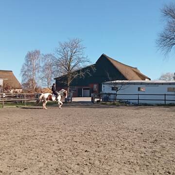


Box, Allergiker, COPD, Rehe geeignet
Seester
Pensionsstall Kurzenmoor
@Jessyri
Freizeitstall
Vermieten
Hunde willkommen
Krankenbox
Allergikerstall
bedampftes/gewaschenes Heu
21 weitere...
P+


Hof Sonnengrund
Seeth- Ekholt
Familie-Menke
@Familie-Menke
Freizeitstall
Geländestrecke
Vermieten
Hunde willkommen
Longierzirkel/Roundpen
Allergikerstall
bedampftes/gewaschenes Heu
22 weitere...
P+
Deprecated: Creation of dynamic property Zend_View_Helper_Ads::$adLink is deprecated in /var/www/stall-frei/htdocs/staging.stall-frei.de/library/Psf/View/Helper/Ads.php on line 108

Heu aus neuer Ernte
Mechtersen
STALL-FREIde Marketing
@STALL-FREI-Marketing
Heulage und Pferdeheu aus der neuen Ernte findest du in unserem Futtermarkt

Stall Hauschildt
Seester
Helen Hauschildt
@Hauschildt
Führanlage
Longierzirkel/Roundpen
Außenboxen
Innenbox
Vollpension
Einzelne Boxen oder Stallplätze
11 weitere...
P


Reiten am Kloevensteen-Familie Ramcke
Pinneberg
Ramcke
@Reitstall_Ramcke
Freizeitstall
Vermieten
Longierzirkel/Roundpen
Paddock
Allergikerstall
Hufrehe geeignet
13 weitere...
S


Artgerechte Pferdehaltung/ Pro Pferd
Ellerhoop
Klippstein
@Klippstein
Freizeitstall
Rehabilitationsstall
Vermieten
Hunde willkommen
Longierzirkel/Roundpen
Allergikerstall
bedampftes/gewaschenes Heu
19 weitere...
P+

Das Beste für die Hufe
Mechtersen
STALL-FREIde Marketing
@STALL-FREI-Marketing
Hufschmiede und Hufpfleger in Ihrer Nähe

Paddockboxen und Innenboxen
Horst
s_f_schulz
@s_f_schulz
Fahrstall, Kutschwagen
FN-Mitglied
Vermieten
Führanlage
Paddock
Gnadenbrothof
Pferdezucht
20 weitere...
P


Einstellplatz Asthmatiker Stute + Wallach frei!
Heede
Wendt
@HofHeede
Longierzirkel/Roundpen
Pensions- und Gastboxen
Allergikerstall
Hufrehe geeignet
Außenboxen
Innenbox
Vollpension
13 weitere...
P+

Dressurstall Sauer
Seeth-Ekholt
Lindenhof Sauer
@Franziska-Sauer
FN-Mitglied
Freizeitstall
Vermieten
Hunde willkommen
Paddock
Außenboxen
13 weitere...
P
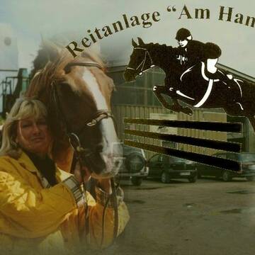
Reitanlage am Hammoor
Seeth-Ekholt
Reitanlage am Hammoor
@ReitanlageamHammoor
FN-Mitglied
Freizeitstall
Führanlage
Longierzirkel/Roundpen
Hengsthaltung möglich
Pferdezucht
Außenbox mit Paddock
Außenboxen
23 weitere...
P
Leider kein Vorschaubild
Leider kein Vorschaubild
Sonnendeicher Hof
Seester
Sonnendeicher Hof
@Sonnendeicher_Hof
Freizeitstall
Reitlehrer und -unterricht
Vermieten
Krankenbox
Longierzirkel/Roundpen
Hufrehe geeignet
Notfallboxen
17 weitere...
B
Deprecated: Creation of dynamic property Zend_View::$pageCount is deprecated in /var/www/stall-frei/htdocs/staging.stall-frei.de/library/vendor/shardj/zf1-future/library/Zend/View/Abstract.php on line 308
Deprecated: Creation of dynamic property Zend_View::$itemCountPerPage is deprecated in /var/www/stall-frei/htdocs/staging.stall-frei.de/library/vendor/shardj/zf1-future/library/Zend/View/Abstract.php on line 308
Deprecated: Creation of dynamic property Zend_View::$first is deprecated in /var/www/stall-frei/htdocs/staging.stall-frei.de/library/vendor/shardj/zf1-future/library/Zend/View/Abstract.php on line 308
Deprecated: Creation of dynamic property Zend_View::$current is deprecated in /var/www/stall-frei/htdocs/staging.stall-frei.de/library/vendor/shardj/zf1-future/library/Zend/View/Abstract.php on line 308
Deprecated: Creation of dynamic property Zend_View::$last is deprecated in /var/www/stall-frei/htdocs/staging.stall-frei.de/library/vendor/shardj/zf1-future/library/Zend/View/Abstract.php on line 308
Deprecated: Creation of dynamic property Zend_View::$next is deprecated in /var/www/stall-frei/htdocs/staging.stall-frei.de/library/vendor/shardj/zf1-future/library/Zend/View/Abstract.php on line 308
Deprecated: Creation of dynamic property Zend_View::$pagesInRange is deprecated in /var/www/stall-frei/htdocs/staging.stall-frei.de/library/vendor/shardj/zf1-future/library/Zend/View/Abstract.php on line 308
Deprecated: Creation of dynamic property Zend_View::$firstPageInRange is deprecated in /var/www/stall-frei/htdocs/staging.stall-frei.de/library/vendor/shardj/zf1-future/library/Zend/View/Abstract.php on line 308
Deprecated: Creation of dynamic property Zend_View::$lastPageInRange is deprecated in /var/www/stall-frei/htdocs/staging.stall-frei.de/library/vendor/shardj/zf1-future/library/Zend/View/Abstract.php on line 308
Deprecated: Creation of dynamic property Zend_View::$currentItemCount is deprecated in /var/www/stall-frei/htdocs/staging.stall-frei.de/library/vendor/shardj/zf1-future/library/Zend/View/Abstract.php on line 308
Deprecated: Creation of dynamic property Zend_View::$totalItemCount is deprecated in /var/www/stall-frei/htdocs/staging.stall-frei.de/library/vendor/shardj/zf1-future/library/Zend/View/Abstract.php on line 308
Deprecated: Creation of dynamic property Zend_View::$firstItemNumber is deprecated in /var/www/stall-frei/htdocs/staging.stall-frei.de/library/vendor/shardj/zf1-future/library/Zend/View/Abstract.php on line 308
Deprecated: Creation of dynamic property Zend_View::$lastItemNumber is deprecated in /var/www/stall-frei/htdocs/staging.stall-frei.de/library/vendor/shardj/zf1-future/library/Zend/View/Abstract.php on line 308
Deprecated: Creation of dynamic property Zend_View::$router is deprecated in /var/www/stall-frei/htdocs/staging.stall-frei.de/library/vendor/shardj/zf1-future/library/Zend/View/Abstract.php on line 308
Deprecated: Creation of dynamic property Zend_View::$urlParams is deprecated in /var/www/stall-frei/htdocs/staging.stall-frei.de/library/vendor/shardj/zf1-future/library/Zend/View/Abstract.php on line 308
Deprecated: Creation of dynamic property Zend_View::$showAds is deprecated in /var/www/stall-frei/htdocs/staging.stall-frei.de/library/vendor/shardj/zf1-future/library/Zend/View/Abstract.php on line 308
Deprecated: Creation of dynamic property Zend_View::$objectIds is deprecated in /var/www/stall-frei/htdocs/staging.stall-frei.de/library/vendor/shardj/zf1-future/library/Zend/View/Abstract.php on line 308
Deprecated: Creation of dynamic property Zend_View::$showNavbar is deprecated in /var/www/stall-frei/htdocs/staging.stall-frei.de/library/vendor/shardj/zf1-future/library/Zend/View/Abstract.php on line 308
Deprecated: Creation of dynamic property Zend_View::$showBreadcrumb is deprecated in /var/www/stall-frei/htdocs/staging.stall-frei.de/library/vendor/shardj/zf1-future/library/Zend/View/Abstract.php on line 308
Deprecated: Creation of dynamic property Zend_View::$showFooter is deprecated in /var/www/stall-frei/htdocs/staging.stall-frei.de/library/vendor/shardj/zf1-future/library/Zend/View/Abstract.php on line 308
Deprecated: Creation of dynamic property Zend_View::$showInternalAds is deprecated in /var/www/stall-frei/htdocs/staging.stall-frei.de/library/vendor/shardj/zf1-future/library/Zend/View/Abstract.php on line 308
Deprecated: Creation of dynamic property Zend_View::$blNoContent is deprecated in /var/www/stall-frei/htdocs/staging.stall-frei.de/library/vendor/shardj/zf1-future/library/Zend/View/Abstract.php on line 308
Deprecated: Creation of dynamic property Zend_View::$sMetaDesc is deprecated in /var/www/stall-frei/htdocs/staging.stall-frei.de/library/vendor/shardj/zf1-future/library/Zend/View/Abstract.php on line 308
Deprecated: Creation of dynamic property Zend_View::$useGmaps is deprecated in /var/www/stall-frei/htdocs/staging.stall-frei.de/library/vendor/shardj/zf1-future/library/Zend/View/Abstract.php on line 308
Deprecated: Creation of dynamic property Zend_View::$touches is deprecated in /var/www/stall-frei/htdocs/staging.stall-frei.de/library/vendor/shardj/zf1-future/library/Zend/View/Abstract.php on line 308
Deprecated: Creation of dynamic property Zend_View::$oProject is deprecated in /var/www/stall-frei/htdocs/staging.stall-frei.de/library/vendor/shardj/zf1-future/library/Zend/View/Abstract.php on line 308
Deprecated: Creation of dynamic property Zend_View::$pageHeadline is deprecated in /var/www/stall-frei/htdocs/staging.stall-frei.de/library/vendor/shardj/zf1-future/library/Zend/View/Abstract.php on line 308
Deprecated: Creation of dynamic property Zend_View::$disableLocationField is deprecated in /var/www/stall-frei/htdocs/staging.stall-frei.de/library/vendor/shardj/zf1-future/library/Zend/View/Abstract.php on line 308
Deprecated: Creation of dynamic property Zend_View::$isSearch is deprecated in /var/www/stall-frei/htdocs/staging.stall-frei.de/library/vendor/shardj/zf1-future/library/Zend/View/Abstract.php on line 308
Deprecated: Creation of dynamic property Zend_View::$pageTitle is deprecated in /var/www/stall-frei/htdocs/staging.stall-frei.de/library/vendor/shardj/zf1-future/library/Zend/View/Abstract.php on line 308
Deprecated: Creation of dynamic property Psf_Form_Element_Text::$class is deprecated in /var/www/stall-frei/htdocs/staging.stall-frei.de/library/vendor/shardj/zf1-future/library/Zend/Form/Element.php on line 874
Deprecated: Creation of dynamic property Psf_Form_Element_Text::$size is deprecated in /var/www/stall-frei/htdocs/staging.stall-frei.de/library/vendor/shardj/zf1-future/library/Zend/Form/Element.php on line 874
Deprecated: Creation of dynamic property Psf_Form_Element_Text::$placeholder is deprecated in /var/www/stall-frei/htdocs/staging.stall-frei.de/library/vendor/shardj/zf1-future/library/Zend/Form/Element.php on line 874
Deprecated: Creation of dynamic property Psf_Form_Element_Hidden::$class is deprecated in /var/www/stall-frei/htdocs/staging.stall-frei.de/library/vendor/shardj/zf1-future/library/Zend/Form/Element.php on line 874
Deprecated: Creation of dynamic property Psf_Form_Element_Hidden::$class is deprecated in /var/www/stall-frei/htdocs/staging.stall-frei.de/library/vendor/shardj/zf1-future/library/Zend/Form/Element.php on line 874
Deprecated: Creation of dynamic property Psf_Form_Element_Hidden::$class is deprecated in /var/www/stall-frei/htdocs/staging.stall-frei.de/library/vendor/shardj/zf1-future/library/Zend/Form/Element.php on line 874
Deprecated: Creation of dynamic property Psf_Form_Element_Hidden::$class is deprecated in /var/www/stall-frei/htdocs/staging.stall-frei.de/library/vendor/shardj/zf1-future/library/Zend/Form/Element.php on line 874
Deprecated: Creation of dynamic property Psf_Form_Element_Select::$class is deprecated in /var/www/stall-frei/htdocs/staging.stall-frei.de/library/vendor/shardj/zf1-future/library/Zend/Form/Element.php on line 874
Deprecated: Creation of dynamic property Psf_Form_Element_Select::$class is deprecated in /var/www/stall-frei/htdocs/staging.stall-frei.de/library/vendor/shardj/zf1-future/library/Zend/Form/Element.php on line 874
Deprecated: Creation of dynamic property Psf_Form_Element_Select::$class is deprecated in /var/www/stall-frei/htdocs/staging.stall-frei.de/library/vendor/shardj/zf1-future/library/Zend/Form/Element.php on line 874
Deprecated: Creation of dynamic property Psf_Form_Element_Select::$class is deprecated in /var/www/stall-frei/htdocs/staging.stall-frei.de/library/vendor/shardj/zf1-future/library/Zend/Form/Element.php on line 874
Deprecated: Creation of dynamic property Psf_Form_Element_Text::$class is deprecated in /var/www/stall-frei/htdocs/staging.stall-frei.de/library/vendor/shardj/zf1-future/library/Zend/Form/Element.php on line 874
Deprecated: Creation of dynamic property Psf_Form_Element_Checkbox::$label is deprecated in /var/www/stall-frei/htdocs/staging.stall-frei.de/library/vendor/shardj/zf1-future/library/Zend/Form/Element.php on line 874
Deprecated: Creation of dynamic property Zend_View::$sort is deprecated in /var/www/stall-frei/htdocs/staging.stall-frei.de/library/vendor/shardj/zf1-future/library/Zend/View/Abstract.php on line 308
Deprecated: Creation of dynamic property Zend_View::$searchLocation is deprecated in /var/www/stall-frei/htdocs/staging.stall-frei.de/library/vendor/shardj/zf1-future/library/Zend/View/Abstract.php on line 308
Deprecated: Creation of dynamic property Zend_View::$locationHint is deprecated in /var/www/stall-frei/htdocs/staging.stall-frei.de/library/vendor/shardj/zf1-future/library/Zend/View/Abstract.php on line 308
Psf_GeoCoder_Abstract::getLocation: Raa Get Location CachedOrLive
Psf_GeoCoder_Abstract::getCachedOrLive: Raa
Psf_GeoCoder_OpenCageData::makeApiRequest: response:
Array
(
[documentation] => https://opencagedata.com/api
[licenses] => Array
(
[0] => Array
(
[name] => see attribution guide
[url] => https://opencagedata.com/credits
)
)
[results] => Array
(
[0] => Array
(
[bounds] => Array
(
[northeast] => Array
(
[lat] => 53.7700821
[lng] => 9.6187063
)
[southwest] => Array
(
[lat] => 53.7300821
[lng] => 9.5787063
)
)
[components] => Array
(
[ISO_3166-1_alpha-2] => DE
[ISO_3166-1_alpha-3] => DEU
[ISO_3166-2] => Array
(
[0] => DE-SH
)
[_category] => place
[_normalized_city] => Raa-Besenbek
[_type] => village
[city] => Raa-Besenbek
[continent] => Europe
[country] => Deutschland
[country_code] => de
[county] => Kreis Pinneberg
[municipality] => Elmshorn-Land
[political_union] => European Union
[postcode] => 25370
[state] => Schleswig-Holstein
[state_code] => SH
[village] => Raa
)
[confidence] => 7
[formatted] => 25370 Raa, Deutschland
[geometry] => Array
(
[lat] => 53.7500821
[lng] => 9.5987063
)
)
[1] => Array
(
[bounds] => Array
(
[northeast] => Array
(
[lat] => 51.8213724
[lng] => 7.9974351
)
[southwest] => Array
(
[lat] => 51.2130913
[lng] => 6.2919939
)
)
[components] => Array
(
[ISO_3166-1_alpha-2] => DE
[ISO_3166-1_alpha-3] => DEU
[ISO_3166-2] => Array
(
[0] => DE-NW
)
[_category] => place
[_type] => region
[continent] => Europe
[country] => Deutschland
[country_code] => de
[political_union] => European Union
[region] => Ruhrgebiet
[state] => Nordrhein-Westfalen
[state_code] => NW
)
[confidence] => 1
[formatted] => Nordrhein-Westfalen, Deutschland
[geometry] => Array
(
[lat] => 51.5173864
[lng] => 7.1439387
)
)
[2] => Array
(
[bounds] => Array
(
[northeast] => Array
(
[lat] => 53.7708837
[lng] => 9.6373075
)
[southwest] => Array
(
[lat] => 53.7220028
[lng] => 9.5642693
)
)
[components] => Array
(
[ISO_3166-1_alpha-2] => DE
[ISO_3166-1_alpha-3] => DEU
[ISO_3166-2] => Array
(
[0] => DE-SH
)
[_category] => place
[_normalized_city] => Raa-Besenbek
[_type] => village
[continent] => Europe
[country] => Deutschland
[country_code] => de
[county] => Kreis Pinneberg
[municipality] => Elmshorn-Land
[political_union] => European Union
[state] => Schleswig-Holstein
[state_code] => SH
[village] => Raa-Besenbek
)
[confidence] => 7
[formatted] => Raa-Besenbek, Schleswig-Holstein, Deutschland
[geometry] => Array
(
[lat] => 53.7584202
[lng] => 9.6172561
)
)
[3] => Array
(
[components] => Array
(
[ISO_3166-1_alpha-2] => FR
[ISO_3166-1_alpha-3] => FRA
[ISO_3166-2] => Array
(
[0] => FR-ARA
[1] => FR-01
)
[_category] => road
[_normalized_city] => Saint-Didier-sur-Chalaronne
[_type] => road
[city] => Saint-Didier-sur-Chalaronne
[continent] => Europe
[country] => France
[country_code] => fr
[county] => Ain
[local_authority] => Communauté de communes Val de Saône Centre
[political_union] => European Union
[postcode] => 01140
[road] => Chemin des Rats
[state] => Auvergne-Rhône-Alpes
[state_code] => ARA
)
[confidence] => 2
[formatted] => Chemin des Rats, 01140 Saint-Didier-sur-Chalaronne, France
[geometry] => Array
(
[lat] => 46.173983
[lng] => 4.843554
)
)
[4] => Array
(
[components] => Array
(
[ISO_3166-1_alpha-2] => FR
[ISO_3166-1_alpha-3] => FRA
[ISO_3166-2] => Array
(
[0] => FR-HDF
[1] => FR-02
)
[_category] => road
[_normalized_city] => La Ferté-Milon
[_type] => road
[city] => La Ferté-Milon
[continent] => Europe
[country] => France
[country_code] => fr
[county] => Aisne
[local_authority] => Communauté de communes Retz-en-Valois
[political_union] => European Union
[postcode] => 02460
[road] => Rue des Rats
[state] => Hauts-de-France
[state_code] => HDF
)
[confidence] => 2
[formatted] => Rue des Rats, 02460 La Ferté-Milon, France
[geometry] => Array
(
[lat] => 49.174005
[lng] => 3.126929
)
)
[5] => Array
(
[components] => Array
(
[ISO_3166-1_alpha-2] => FR
[ISO_3166-1_alpha-3] => FRA
[ISO_3166-2] => Array
(
[0] => FR-OCC
[1] => FR-12
)
[_category] => place
[_normalized_city] => Conques-en-Rouergue
[_type] => place
[city] => Conques-en-Rouergue
[continent] => Europe
[country] => France
[country_code] => fr
[county] => Aveyron
[local_authority] => Communauté de communes Conques-Marcillac
[place] => Puech Del Rat
[political_union] => European Union
[postcode] => 12320
[state] => Occitanie
[state_code] => OCC
)
[confidence] => 10
[formatted] => Puech Del Rat, 12320 Conques-en-Rouergue, France
[geometry] => Array
(
[lat] => 44.608328
[lng] => 2.391899
)
)
[6] => Array
(
[components] => Array
(
[ISO_3166-1_alpha-2] => FR
[ISO_3166-1_alpha-3] => FRA
[ISO_3166-2] => Array
(
[0] => FR-ARA
[1] => FR-69
)
[_category] => road
[_normalized_city] => Grézieu-la-Varenne
[_type] => road
[city] => Grézieu-la-Varenne
[continent] => Europe
[country] => France
[country_code] => fr
[county] => Rhône
[local_authority] => Communauté de communes des Vallons du Lyonnais
[political_union] => European Union
[postcode] => 69290
[road] => Chemin du Rat
[state] => Auvergne-Rhône-Alpes
[state_code] => ARA
)
[confidence] => 10
[formatted] => Chemin du Rat, 69290 Grézieu-la-Varenne, France
[geometry] => Array
(
[lat] => 45.741706
[lng] => 4.688586
)
)
[7] => Array
(
[components] => Array
(
[ISO_3166-1_alpha-2] => FR
[ISO_3166-1_alpha-3] => FRA
[ISO_3166-2] => Array
(
[0] => FR-GES
[1] => FR-88
)
[_category] => road
[_normalized_city] => Rambervillers
[_type] => road
[city] => Rambervillers
[continent] => Europe
[country] => France
[country_code] => fr
[county] => Vosges
[local_authority] => Communauté de communes de la Région de Rambervillers
[political_union] => European Union
[postcode] => 88700
[road] => Ruelle des Rats
[state] => Grand Est
[state_code] => GES
)
[confidence] => 10
[formatted] => Ruelle des Rats, 88700 Rambervillers, France
[geometry] => Array
(
[lat] => 48.347218
[lng] => 6.638807
)
)
[8] => Array
(
[components] => Array
(
[ISO_3166-1_alpha-2] => FR
[ISO_3166-1_alpha-3] => FRA
[ISO_3166-2] => Array
(
[0] => FR-OCC
[1] => FR-31
)
[_category] => road
[_normalized_city] => Toulouse
[_type] => road
[city] => Toulouse
[continent] => Europe
[country] => France
[country_code] => fr
[county] => Haute-Garonne
[local_authority] => Toulouse Métropole
[political_union] => European Union
[postcode] => 31400
[road] => Chemin du Rat
[state] => Occitanie
[state_code] => OCC
)
[confidence] => 10
[formatted] => Chemin du Rat, 31400 Toulouse, France
[geometry] => Array
(
[lat] => 43.548683
[lng] => 1.457119
)
)
[9] => Array
(
[components] => Array
(
[ISO_3166-1_alpha-2] => FR
[ISO_3166-1_alpha-3] => FRA
[ISO_3166-2] => Array
(
[0] => FR-GES
[1] => FR-6AE
[2] => FR-67
)
[_category] => road
[_normalized_city] => Strasbourg
[_type] => road
[city] => Strasbourg
[continent] => Europe
[country] => France
[country_code] => fr
[county] => Bas-Rhin
[local_authority] => Strasbourg Eurométropole
[political_union] => European Union
[postcode] => 67000
[road] => Place du Rad
[state] => Grand Est
[state_code] => GES
)
[confidence] => 10
[formatted] => Place du Rad, 67000 Strasbourg, France
[geometry] => Array
(
[lat] => 48.623471
[lng] => 7.786799
)
)
)
[status] => Array
(
[code] => 200
[message] => OK
)
[stay_informed] => Array
(
[blog] => https://blog.opencagedata.com
[mastodon] => https://en.osm.town/@opencage
)
[thanks] => For using an OpenCage API
[timestamp] => Array
(
[created_http] => Sat, 07 Feb 2026 17:58:32 GMT
[created_unix] => 1770487112
)
[total_results] => 10
)
Psf_GeoCoder_Abstract::convertLocationResult
{"documentation":"https:\/\/opencagedata.com\/api","licenses":[{"name":"see attribution guide","url":"https:\/\/opencagedata.com\/credits"}],"results":[{"bounds":{"northeast":{"lat":53.7700821,"lng":9.6187063},"southwest":{"lat":53.7300821,"lng":9.5787063}},"components":{"ISO_3166-1_alpha-2":"DE","ISO_3166-1_alpha-3":"DEU","ISO_3166-2":["DE-SH"],"_category":"place","_normalized_city":"Raa-Besenbek","_type":"village","city":"Raa-Besenbek","continent":"Europe","country":"Deutschland","country_code":"de","county":"Kreis Pinneberg","municipality":"Elmshorn-Land","political_union":"European Union","postcode":"25370","state":"Schleswig-Holstein","state_code":"SH","village":"Raa"},"confidence":7,"formatted":"25370 Raa, Deutschland","geometry":{"lat":53.7500821,"lng":9.5987063}},{"bounds":{"northeast":{"lat":51.8213724,"lng":7.9974351},"southwest":{"lat":51.2130913,"lng":6.2919939}},"components":{"ISO_3166-1_alpha-2":"DE","ISO_3166-1_alpha-3":"DEU","ISO_3166-2":["DE-NW"],"_category":"place","_type":"region","continent":"Europe","country":"Deutschland","country_code":"de","political_union":"European Union","region":"Ruhrgebiet","state":"Nordrhein-Westfalen","state_code":"NW"},"confidence":1,"formatted":"Nordrhein-Westfalen, Deutschland","geometry":{"lat":51.5173864,"lng":7.1439387}},{"bounds":{"northeast":{"lat":53.7708837,"lng":9.6373075},"southwest":{"lat":53.7220028,"lng":9.5642693}},"components":{"ISO_3166-1_alpha-2":"DE","ISO_3166-1_alpha-3":"DEU","ISO_3166-2":["DE-SH"],"_category":"place","_normalized_city":"Raa-Besenbek","_type":"village","continent":"Europe","country":"Deutschland","country_code":"de","county":"Kreis Pinneberg","municipality":"Elmshorn-Land","political_union":"European Union","state":"Schleswig-Holstein","state_code":"SH","village":"Raa-Besenbek"},"confidence":7,"formatted":"Raa-Besenbek, Schleswig-Holstein, Deutschland","geometry":{"lat":53.7584202,"lng":9.6172561}},{"components":{"ISO_3166-1_alpha-2":"FR","ISO_3166-1_alpha-3":"FRA","ISO_3166-2":["FR-ARA","FR-01"],"_category":"road","_normalized_city":"Saint-Didier-sur-Chalaronne","_type":"road","city":"Saint-Didier-sur-Chalaronne","continent":"Europe","country":"France","country_code":"fr","county":"Ain","local_authority":"Communaut\u00e9 de communes Val de Sa\u00f4ne Centre","political_union":"European Union","postcode":"01140","road":"Chemin des Rats","state":"Auvergne-Rh\u00f4ne-Alpes","state_code":"ARA"},"confidence":2,"formatted":"Chemin des Rats, 01140 Saint-Didier-sur-Chalaronne, France","geometry":{"lat":46.173983,"lng":4.843554}},{"components":{"ISO_3166-1_alpha-2":"FR","ISO_3166-1_alpha-3":"FRA","ISO_3166-2":["FR-HDF","FR-02"],"_category":"road","_normalized_city":"La Fert\u00e9-Milon","_type":"road","city":"La Fert\u00e9-Milon","continent":"Europe","country":"France","country_code":"fr","county":"Aisne","local_authority":"Communaut\u00e9 de communes Retz-en-Valois","political_union":"European Union","postcode":"02460","road":"Rue des Rats","state":"Hauts-de-France","state_code":"HDF"},"confidence":2,"formatted":"Rue des Rats, 02460 La Fert\u00e9-Milon, France","geometry":{"lat":49.174005,"lng":3.126929}},{"components":{"ISO_3166-1_alpha-2":"FR","ISO_3166-1_alpha-3":"FRA","ISO_3166-2":["FR-OCC","FR-12"],"_category":"place","_normalized_city":"Conques-en-Rouergue","_type":"place","city":"Conques-en-Rouergue","continent":"Europe","country":"France","country_code":"fr","county":"Aveyron","local_authority":"Communaut\u00e9 de communes Conques-Marcillac","place":"Puech Del Rat","political_union":"European Union","postcode":"12320","state":"Occitanie","state_code":"OCC"},"confidence":10,"formatted":"Puech Del Rat, 12320 Conques-en-Rouergue, France","geometry":{"lat":44.608328,"lng":2.391899}},{"components":{"ISO_3166-1_alpha-2":"FR","ISO_3166-1_alpha-3":"FRA","ISO_3166-2":["FR-ARA","FR-69"],"_category":"road","_normalized_city":"Gr\u00e9zieu-la-Varenne","_type":"road","city":"Gr\u00e9zieu-la-Varenne","continent":"Europe","country":"France","country_code":"fr","county":"Rh\u00f4ne","local_authority":"Communaut\u00e9 de communes des Vallons du Lyonnais","political_union":"European Union","postcode":"69290","road":"Chemin du Rat","state":"Auvergne-Rh\u00f4ne-Alpes","state_code":"ARA"},"confidence":10,"formatted":"Chemin du Rat, 69290 Gr\u00e9zieu-la-Varenne, France","geometry":{"lat":45.741706,"lng":4.688586}},{"components":{"ISO_3166-1_alpha-2":"FR","ISO_3166-1_alpha-3":"FRA","ISO_3166-2":["FR-GES","FR-88"],"_category":"road","_normalized_city":"Rambervillers","_type":"road","city":"Rambervillers","continent":"Europe","country":"France","country_code":"fr","county":"Vosges","local_authority":"Communaut\u00e9 de communes de la R\u00e9gion de Rambervillers","political_union":"European Union","postcode":"88700","road":"Ruelle des Rats","state":"Grand Est","state_code":"GES"},"confidence":10,"formatted":"Ruelle des Rats, 88700 Rambervillers, France","geometry":{"lat":48.347218,"lng":6.638807}},{"components":{"ISO_3166-1_alpha-2":"FR","ISO_3166-1_alpha-3":"FRA","ISO_3166-2":["FR-OCC","FR-31"],"_category":"road","_normalized_city":"Toulouse","_type":"road","city":"Toulouse","continent":"Europe","country":"France","country_code":"fr","county":"Haute-Garonne","local_authority":"Toulouse M\u00e9tropole","political_union":"European Union","postcode":"31400","road":"Chemin du Rat","state":"Occitanie","state_code":"OCC"},"confidence":10,"formatted":"Chemin du Rat, 31400 Toulouse, France","geometry":{"lat":43.548683,"lng":1.457119}},{"components":{"ISO_3166-1_alpha-2":"FR","ISO_3166-1_alpha-3":"FRA","ISO_3166-2":["FR-GES","FR-6AE","FR-67"],"_category":"road","_normalized_city":"Strasbourg","_type":"road","city":"Strasbourg","continent":"Europe","country":"France","country_code":"fr","county":"Bas-Rhin","local_authority":"Strasbourg Eurom\u00e9tropole","political_union":"European Union","postcode":"67000","road":"Place du Rad","state":"Grand Est","state_code":"GES"},"confidence":10,"formatted":"Place du Rad, 67000 Strasbourg, France","geometry":{"lat":48.623471,"lng":7.786799}}],"status":{"code":200,"message":"OK"},"stay_informed":{"blog":"https:\/\/blog.opencagedata.com","mastodon":"https:\/\/en.osm.town\/@opencage"},"thanks":"For using an OpenCage API","timestamp":{"created_http":"Sat, 07 Feb 2026 17:58:32 GMT","created_unix":1770487112},"total_results":10}Array
(
[0] => stdClass Object
(
[bounds] => stdClass Object
(
[northeast] => stdClass Object
(
[lat] => 53.7700821
[lng] => 9.6187063
)
[southwest] => stdClass Object
(
[lat] => 53.7300821
[lng] => 9.5787063
)
)
[components] => stdClass Object
(
[ISO_3166-1_alpha-2] => DE
[ISO_3166-1_alpha-3] => DEU
[ISO_3166-2] => Array
(
[0] => DE-SH
)
[_category] => place
[_normalized_city] => Raa-Besenbek
[_type] => village
[city] => Raa-Besenbek
[continent] => Europe
[country] => Deutschland
[country_code] => de
[county] => Kreis Pinneberg
[municipality] => Elmshorn-Land
[political_union] => European Union
[postcode] => 25370
[state] => Schleswig-Holstein
[state_code] => SH
[village] => Raa
)
[confidence] => 7
[formatted] => 25370 Raa, Deutschland
[geometry] => stdClass Object
(
[lat] => 53.7500821
[lng] => 9.5987063
)
)
[1] => stdClass Object
(
[bounds] => stdClass Object
(
[northeast] => stdClass Object
(
[lat] => 51.8213724
[lng] => 7.9974351
)
[southwest] => stdClass Object
(
[lat] => 51.2130913
[lng] => 6.2919939
)
)
[components] => stdClass Object
(
[ISO_3166-1_alpha-2] => DE
[ISO_3166-1_alpha-3] => DEU
[ISO_3166-2] => Array
(
[0] => DE-NW
)
[_category] => place
[_type] => region
[continent] => Europe
[country] => Deutschland
[country_code] => de
[political_union] => European Union
[region] => Ruhrgebiet
[state] => Nordrhein-Westfalen
[state_code] => NW
)
[confidence] => 1
[formatted] => Nordrhein-Westfalen, Deutschland
[geometry] => stdClass Object
(
[lat] => 51.5173864
[lng] => 7.1439387
)
)
[2] => stdClass Object
(
[bounds] => stdClass Object
(
[northeast] => stdClass Object
(
[lat] => 53.7708837
[lng] => 9.6373075
)
[southwest] => stdClass Object
(
[lat] => 53.7220028
[lng] => 9.5642693
)
)
[components] => stdClass Object
(
[ISO_3166-1_alpha-2] => DE
[ISO_3166-1_alpha-3] => DEU
[ISO_3166-2] => Array
(
[0] => DE-SH
)
[_category] => place
[_normalized_city] => Raa-Besenbek
[_type] => village
[continent] => Europe
[country] => Deutschland
[country_code] => de
[county] => Kreis Pinneberg
[municipality] => Elmshorn-Land
[political_union] => European Union
[state] => Schleswig-Holstein
[state_code] => SH
[village] => Raa-Besenbek
)
[confidence] => 7
[formatted] => Raa-Besenbek, Schleswig-Holstein, Deutschland
[geometry] => stdClass Object
(
[lat] => 53.7584202
[lng] => 9.6172561
)
)
[3] => stdClass Object
(
[components] => stdClass Object
(
[ISO_3166-1_alpha-2] => FR
[ISO_3166-1_alpha-3] => FRA
[ISO_3166-2] => Array
(
[0] => FR-ARA
[1] => FR-01
)
[_category] => road
[_normalized_city] => Saint-Didier-sur-Chalaronne
[_type] => road
[city] => Saint-Didier-sur-Chalaronne
[continent] => Europe
[country] => France
[country_code] => fr
[county] => Ain
[local_authority] => Communauté de communes Val de Saône Centre
[political_union] => European Union
[postcode] => 01140
[road] => Chemin des Rats
[state] => Auvergne-Rhône-Alpes
[state_code] => ARA
)
[confidence] => 2
[formatted] => Chemin des Rats, 01140 Saint-Didier-sur-Chalaronne, France
[geometry] => stdClass Object
(
[lat] => 46.173983
[lng] => 4.843554
)
)
[4] => stdClass Object
(
[components] => stdClass Object
(
[ISO_3166-1_alpha-2] => FR
[ISO_3166-1_alpha-3] => FRA
[ISO_3166-2] => Array
(
[0] => FR-HDF
[1] => FR-02
)
[_category] => road
[_normalized_city] => La Ferté-Milon
[_type] => road
[city] => La Ferté-Milon
[continent] => Europe
[country] => France
[country_code] => fr
[county] => Aisne
[local_authority] => Communauté de communes Retz-en-Valois
[political_union] => European Union
[postcode] => 02460
[road] => Rue des Rats
[state] => Hauts-de-France
[state_code] => HDF
)
[confidence] => 2
[formatted] => Rue des Rats, 02460 La Ferté-Milon, France
[geometry] => stdClass Object
(
[lat] => 49.174005
[lng] => 3.126929
)
)
[5] => stdClass Object
(
[components] => stdClass Object
(
[ISO_3166-1_alpha-2] => FR
[ISO_3166-1_alpha-3] => FRA
[ISO_3166-2] => Array
(
[0] => FR-OCC
[1] => FR-12
)
[_category] => place
[_normalized_city] => Conques-en-Rouergue
[_type] => place
[city] => Conques-en-Rouergue
[continent] => Europe
[country] => France
[country_code] => fr
[county] => Aveyron
[local_authority] => Communauté de communes Conques-Marcillac
[place] => Puech Del Rat
[political_union] => European Union
[postcode] => 12320
[state] => Occitanie
[state_code] => OCC
)
[confidence] => 10
[formatted] => Puech Del Rat, 12320 Conques-en-Rouergue, France
[geometry] => stdClass Object
(
[lat] => 44.608328
[lng] => 2.391899
)
)
[6] => stdClass Object
(
[components] => stdClass Object
(
[ISO_3166-1_alpha-2] => FR
[ISO_3166-1_alpha-3] => FRA
[ISO_3166-2] => Array
(
[0] => FR-ARA
[1] => FR-69
)
[_category] => road
[_normalized_city] => Grézieu-la-Varenne
[_type] => road
[city] => Grézieu-la-Varenne
[continent] => Europe
[country] => France
[country_code] => fr
[county] => Rhône
[local_authority] => Communauté de communes des Vallons du Lyonnais
[political_union] => European Union
[postcode] => 69290
[road] => Chemin du Rat
[state] => Auvergne-Rhône-Alpes
[state_code] => ARA
)
[confidence] => 10
[formatted] => Chemin du Rat, 69290 Grézieu-la-Varenne, France
[geometry] => stdClass Object
(
[lat] => 45.741706
[lng] => 4.688586
)
)
[7] => stdClass Object
(
[components] => stdClass Object
(
[ISO_3166-1_alpha-2] => FR
[ISO_3166-1_alpha-3] => FRA
[ISO_3166-2] => Array
(
[0] => FR-GES
[1] => FR-88
)
[_category] => road
[_normalized_city] => Rambervillers
[_type] => road
[city] => Rambervillers
[continent] => Europe
[country] => France
[country_code] => fr
[county] => Vosges
[local_authority] => Communauté de communes de la Région de Rambervillers
[political_union] => European Union
[postcode] => 88700
[road] => Ruelle des Rats
[state] => Grand Est
[state_code] => GES
)
[confidence] => 10
[formatted] => Ruelle des Rats, 88700 Rambervillers, France
[geometry] => stdClass Object
(
[lat] => 48.347218
[lng] => 6.638807
)
)
[8] => stdClass Object
(
[components] => stdClass Object
(
[ISO_3166-1_alpha-2] => FR
[ISO_3166-1_alpha-3] => FRA
[ISO_3166-2] => Array
(
[0] => FR-OCC
[1] => FR-31
)
[_category] => road
[_normalized_city] => Toulouse
[_type] => road
[city] => Toulouse
[continent] => Europe
[country] => France
[country_code] => fr
[county] => Haute-Garonne
[local_authority] => Toulouse Métropole
[political_union] => European Union
[postcode] => 31400
[road] => Chemin du Rat
[state] => Occitanie
[state_code] => OCC
)
[confidence] => 10
[formatted] => Chemin du Rat, 31400 Toulouse, France
[geometry] => stdClass Object
(
[lat] => 43.548683
[lng] => 1.457119
)
)
[9] => stdClass Object
(
[components] => stdClass Object
(
[ISO_3166-1_alpha-2] => FR
[ISO_3166-1_alpha-3] => FRA
[ISO_3166-2] => Array
(
[0] => FR-GES
[1] => FR-6AE
[2] => FR-67
)
[_category] => road
[_normalized_city] => Strasbourg
[_type] => road
[city] => Strasbourg
[continent] => Europe
[country] => France
[country_code] => fr
[county] => Bas-Rhin
[local_authority] => Strasbourg Eurométropole
[political_union] => European Union
[postcode] => 67000
[road] => Place du Rad
[state] => Grand Est
[state_code] => GES
)
[confidence] => 10
[formatted] => Place du Rad, 67000 Strasbourg, France
[geometry] => stdClass Object
(
[lat] => 48.623471
[lng] => 7.786799
)
)
)
Psf_GeoCoder_OpenCageData::getKeyMap: 0
stdClass Object
(
    [bounds] => stdClass Object
        (
            [northeast] => stdClass Object
                (
                    [lat] => 53.7700821
                    [lng] => 9.6187063
                )

            [southwest] => stdClass Object
                (
                    [lat] => 53.7300821
                    [lng] => 9.5787063
                )

        )

    [components] => stdClass Object
        (
            [ISO_3166-1_alpha-2] => DE
            [ISO_3166-1_alpha-3] => DEU
            [ISO_3166-2] => Array
                (
                    [0] => DE-SH
                )

            [_category] => place
            [_normalized_city] => Raa-Besenbek
            [_type] => village
            [city] => Raa-Besenbek
            [continent] => Europe
            [country] => Deutschland
            [country_code] => de
            [county] => Kreis Pinneberg
            [municipality] => Elmshorn-Land
            [political_union] => European Union
            [postcode] => 25370
            [state] => Schleswig-Holstein
            [state_code] => SH
            [village] => Raa
        )

    [confidence] => 7
    [formatted] => 25370 Raa, Deutschland
    [geometry] => stdClass Object
        (
            [lat] => 53.7500821
            [lng] => 9.5987063
        )

)
Psf_GeoCoder_OpenCageData::getCounty: Pinneberg
Psf_GeoCoder_OpenCageData::addMissingData REFETCH!
Array
(
    [address] => 25370 Raa, Deutschland
    [type] => village
    [street] =>
    [city] => Raa
    [county] => Pinneberg
    [state] => Schleswig-Holstein
    [zip] => 25370
    [country] => Deutschland
    [suburb] =>
    [countrycode] => de
    [latitude] => 53.7500821
    [longitude] => 9.5987063
    [accuracy] => 1
    [confidence] => 7
    [bounds] => stdClass Object
        (
            [northeast] => stdClass Object
                (
                    [lat] => 53.7700821
                    [lng] => 9.6187063
                )

            [southwest] => stdClass Object
                (
                    [lat] => 53.7300821
                    [lng] => 9.5787063
                )

        )

)
reformat!
Array
(
    [address] => 25370 Raa, Deutschland
    [type] => village
    [street] =>
    [city] => Raa
    [county] => Pinneberg
    [state] => Schleswig-Holstein
    [zip] => 25370
    [country] => Deutschland
    [suburb] =>
    [countrycode] => de
    [latitude] => 53.7500821
    [longitude] => 9.5987063
    [accuracy] => 1
    [confidence] => 7
    [bounds] => stdClass Object
        (
            [northeast] => stdClass Object
                (
                    [lat] => 53.7700821
                    [lng] => 9.6187063
                )

            [southwest] => stdClass Object
                (
                    [lat] => 53.7300821
                    [lng] => 9.5787063
                )

        )

    [place] => 25370 Raa, Schleswig-Holstein
    [hash] => 4f98a77db3c8026aa50d689230c11472
)
Psf_GeoCoder_OpenCageData::getKeyMap: 1
stdClass Object
(
    [bounds] => stdClass Object
        (
            [northeast] => stdClass Object
                (
                    [lat] => 51.8213724
                    [lng] => 7.9974351
                )

            [southwest] => stdClass Object
                (
                    [lat] => 51.2130913
                    [lng] => 6.2919939
                )

        )

    [components] => stdClass Object
        (
            [ISO_3166-1_alpha-2] => DE
            [ISO_3166-1_alpha-3] => DEU
            [ISO_3166-2] => Array
                (
                    [0] => DE-NW
                )

            [_category] => place
            [_type] => region
            [continent] => Europe
            [country] => Deutschland
            [country_code] => de
            [political_union] => European Union
            [region] => Ruhrgebiet
            [state] => Nordrhein-Westfalen
            [state_code] => NW
        )

    [confidence] => 1
    [formatted] => Nordrhein-Westfalen, Deutschland
    [geometry] => stdClass Object
        (
            [lat] => 51.5173864
            [lng] => 7.1439387
        )

)
Psf_GeoCoder_OpenCageData::getCounty:
Psf_GeoCoder_OpenCageData::addMissingData REFETCH!
Array
(
    [address] => Nordrhein-Westfalen, Deutschland
    [type] => region
    [street] =>
    [city] =>
    [county] =>
    [state] => Nordrhein-Westfalen
    [zip] =>
    [country] => Deutschland
    [suburb] =>
    [countrycode] => de
    [latitude] => 51.5173864
    [longitude] => 7.1439387
    [accuracy] => 1
    [confidence] => 1
    [bounds] => stdClass Object
        (
            [northeast] => stdClass Object
                (
                    [lat] => 51.8213724
                    [lng] => 7.9974351
                )

            [southwest] => stdClass Object
                (
                    [lat] => 51.2130913
                    [lng] => 6.2919939
                )

        )

)
reformat!
Array
(
    [address] => Nordrhein-Westfalen, Deutschland
    [type] => region
    [street] =>
    [city] =>
    [county] =>
    [state] => Nordrhein-Westfalen
    [zip] =>
    [country] => Deutschland
    [suburb] =>
    [countrycode] => de
    [latitude] => 51.5173864
    [longitude] => 7.1439387
    [accuracy] => 1
    [confidence] => 1
    [bounds] => stdClass Object
        (
            [northeast] => stdClass Object
                (
                    [lat] => 51.8213724
                    [lng] => 7.9974351
                )

            [southwest] => stdClass Object
                (
                    [lat] => 51.2130913
                    [lng] => 6.2919939
                )

        )

    [place] => , Nordrhein-Westfalen
    [hash] => 644b8c15c8948e95434516b8ef8d7312
)
Psf_GeoCoder_OpenCageData::getKeyMap: 2
stdClass Object
(
    [bounds] => stdClass Object
        (
            [northeast] => stdClass Object
                (
                    [lat] => 53.7708837
                    [lng] => 9.6373075
                )

            [southwest] => stdClass Object
                (
                    [lat] => 53.7220028
                    [lng] => 9.5642693
                )

        )

    [components] => stdClass Object
        (
            [ISO_3166-1_alpha-2] => DE
            [ISO_3166-1_alpha-3] => DEU
            [ISO_3166-2] => Array
                (
                    [0] => DE-SH
                )

            [_category] => place
            [_normalized_city] => Raa-Besenbek
            [_type] => village
            [continent] => Europe
            [country] => Deutschland
            [country_code] => de
            [county] => Kreis Pinneberg
            [municipality] => Elmshorn-Land
            [political_union] => European Union
            [state] => Schleswig-Holstein
            [state_code] => SH
            [village] => Raa-Besenbek
        )

    [confidence] => 7
    [formatted] => Raa-Besenbek, Schleswig-Holstein, Deutschland
    [geometry] => stdClass Object
        (
            [lat] => 53.7584202
            [lng] => 9.6172561
        )

)
Psf_GeoCoder_OpenCageData::getCounty: Pinneberg
Psf_GeoCoder_OpenCageData::addMissingData REFETCH!
Array
(
    [address] => Raa-Besenbek, Schleswig-Holstein, Deutschland
    [type] => village
    [street] =>
    [city] => Raa-Besenbek
    [county] => Pinneberg
    [state] => Schleswig-Holstein
    [zip] =>
    [country] => Deutschland
    [suburb] =>
    [countrycode] => de
    [latitude] => 53.7584202
    [longitude] => 9.6172561
    [accuracy] => 1
    [confidence] => 7
    [bounds] => stdClass Object
        (
            [northeast] => stdClass Object
                (
                    [lat] => 53.7708837
                    [lng] => 9.6373075
                )

            [southwest] => stdClass Object
                (
                    [lat] => 53.7220028
                    [lng] => 9.5642693
                )

        )

)
reformat!
Array
(
    [address] => Raa-Besenbek, Schleswig-Holstein, Deutschland
    [type] => village
    [street] =>
    [city] => Raa-Besenbek
    [county] => Pinneberg
    [state] => Schleswig-Holstein
    [zip] =>
    [country] => Deutschland
    [suburb] =>
    [countrycode] => de
    [latitude] => 53.7584202
    [longitude] => 9.6172561
    [accuracy] => 1
    [confidence] => 7
    [bounds] => stdClass Object
        (
            [northeast] => stdClass Object
                (
                    [lat] => 53.7708837
                    [lng] => 9.6373075
                )

            [southwest] => stdClass Object
                (
                    [lat] => 53.7220028
                    [lng] => 9.5642693
                )

        )

    [place] => Raa-Besenbek, Schleswig-Holstein
    [hash] => a7ac8a6505a20803f36f3700e50fd29d
)
Psf_GeoCoder_OpenCageData::getKeyMap: 3
stdClass Object
(
    [components] => stdClass Object
        (
            [ISO_3166-1_alpha-2] => FR
            [ISO_3166-1_alpha-3] => FRA
            [ISO_3166-2] => Array
                (
                    [0] => FR-ARA
                    [1] => FR-01
                )

            [_category] => road
            [_normalized_city] => Saint-Didier-sur-Chalaronne
            [_type] => road
            [city] => Saint-Didier-sur-Chalaronne
            [continent] => Europe
            [country] => France
            [country_code] => fr
            [county] => Ain
            [local_authority] => Communauté de communes Val de Saône Centre
            [political_union] => European Union
            [postcode] => 01140
            [road] => Chemin des Rats
            [state] => Auvergne-Rhône-Alpes
            [state_code] => ARA
        )

    [confidence] => 2
    [formatted] => Chemin des Rats, 01140 Saint-Didier-sur-Chalaronne, France
    [geometry] => stdClass Object
        (
            [lat] => 46.173983
            [lng] => 4.843554
        )

)
Psf_GeoCoder_OpenCageData::getCounty: Ain
Psf_GeoCoder_OpenCageData::addMissingData REFETCH!
Array
(
    [address] => Chemin des Rats, 01140 Saint-Didier-sur-Chalaronne, France
    [type] => road
    [street] => Chemin des Rats
    [city] => Saint-Didier-sur-Chalaronne
    [county] => Ain
    [state] => Auvergne-Rhône-Alpes
    [zip] => 01140
    [country] => France
    [suburb] =>
    [countrycode] => fr
    [latitude] => 46.173983
    [longitude] => 4.843554
    [accuracy] => 1
    [confidence] => 2
    [bounds] =>
)
reformat!
Array
(
    [address] => Chemin des Rats, 01140 Saint-Didier-sur-Chalaronne, France
    [type] => road
    [street] => Chemin des Rats
    [city] => Saint-Didier-sur-Chalaronne
    [county] => Ain
    [state] => Auvergne-Rhône-Alpes
    [zip] => 01140
    [country] => France
    [suburb] =>
    [countrycode] => fr
    [latitude] => 46.173983
    [longitude] => 4.843554
    [accuracy] => 1
    [confidence] => 2
    [bounds] =>
    [place] => Chemin des Rats, 01140 Saint-Didier-sur-Chalaronne, Auvergne-Rhône-Alpes
    [hash] => 186b6a4bef78c3ae38f430737e8a9247
)
Psf_GeoCoder_OpenCageData::getKeyMap: 4
stdClass Object
(
    [components] => stdClass Object
        (
            [ISO_3166-1_alpha-2] => FR
            [ISO_3166-1_alpha-3] => FRA
            [ISO_3166-2] => Array
                (
                    [0] => FR-HDF
                    [1] => FR-02
                )

            [_category] => road
            [_normalized_city] => La Ferté-Milon
            [_type] => road
            [city] => La Ferté-Milon
            [continent] => Europe
            [country] => France
            [country_code] => fr
            [county] => Aisne
            [local_authority] => Communauté de communes Retz-en-Valois
            [political_union] => European Union
            [postcode] => 02460
            [road] => Rue des Rats
            [state] => Hauts-de-France
            [state_code] => HDF
        )

    [confidence] => 2
    [formatted] => Rue des Rats, 02460 La Ferté-Milon, France
    [geometry] => stdClass Object
        (
            [lat] => 49.174005
            [lng] => 3.126929
        )

)
Psf_GeoCoder_OpenCageData::getCounty: Aisne
Psf_GeoCoder_OpenCageData::addMissingData REFETCH!
Array
(
    [address] => Rue des Rats, 02460 La Ferté-Milon, France
    [type] => road
    [street] => Rue des Rats
    [city] => La Ferté-Milon
    [county] => Aisne
    [state] => Hauts-de-France
    [zip] => 02460
    [country] => France
    [suburb] =>
    [countrycode] => fr
    [latitude] => 49.174005
    [longitude] => 3.126929
    [accuracy] => 1
    [confidence] => 2
    [bounds] =>
)
reformat!
Array
(
    [address] => Rue des Rats, 02460 La Ferté-Milon, France
    [type] => road
    [street] => Rue des Rats
    [city] => La Ferté-Milon
    [county] => Aisne
    [state] => Hauts-de-France
    [zip] => 02460
    [country] => France
    [suburb] =>
    [countrycode] => fr
    [latitude] => 49.174005
    [longitude] => 3.126929
    [accuracy] => 1
    [confidence] => 2
    [bounds] =>
    [place] => Rue des Rats, 02460 La Ferté-Milon, Hauts-de-France
    [hash] => e8765a6dbe824c471ddabdf5032a02bd
)
Psf_GeoCoder_OpenCageData::getKeyMap: 5
stdClass Object
(
    [components] => stdClass Object
        (
            [ISO_3166-1_alpha-2] => FR
            [ISO_3166-1_alpha-3] => FRA
            [ISO_3166-2] => Array
                (
                    [0] => FR-OCC
                    [1] => FR-12
                )

            [_category] => place
            [_normalized_city] => Conques-en-Rouergue
            [_type] => place
            [city] => Conques-en-Rouergue
            [continent] => Europe
            [country] => France
            [country_code] => fr
            [county] => Aveyron
            [local_authority] => Communauté de communes Conques-Marcillac
            [place] => Puech Del Rat
            [political_union] => European Union
            [postcode] => 12320
            [state] => Occitanie
            [state_code] => OCC
        )

    [confidence] => 10
    [formatted] => Puech Del Rat, 12320 Conques-en-Rouergue, France
    [geometry] => stdClass Object
        (
            [lat] => 44.608328
            [lng] => 2.391899
        )

)
Psf_GeoCoder_OpenCageData::getCounty: Aveyron
Psf_GeoCoder_OpenCageData::addMissingData REFETCH!
Array
(
    [address] => Puech Del Rat, 12320 Conques-en-Rouergue, France
    [type] => place
    [street] =>
    [city] => Conques-en-Rouergue
    [county] => Aveyron
    [state] => Occitanie
    [zip] => 12320
    [country] => France
    [suburb] =>
    [countrycode] => fr
    [latitude] => 44.608328
    [longitude] => 2.391899
    [accuracy] => 1
    [confidence] => 10
    [bounds] =>
)
reformat!
Array
(
    [address] => Puech Del Rat, 12320 Conques-en-Rouergue, France
    [type] => place
    [street] =>
    [city] => Conques-en-Rouergue
    [county] => Aveyron
    [state] => Occitanie
    [zip] => 12320
    [country] => France
    [suburb] =>
    [countrycode] => fr
    [latitude] => 44.608328
    [longitude] => 2.391899
    [accuracy] => 1
    [confidence] => 10
    [bounds] =>
    [place] => 12320 Conques-en-Rouergue, Occitanie
    [hash] => 2b435f0dd4100cc15abae1521da1c5ae
)
Psf_GeoCoder_OpenCageData::getKeyMap: 6
stdClass Object
(
    [components] => stdClass Object
        (
            [ISO_3166-1_alpha-2] => FR
            [ISO_3166-1_alpha-3] => FRA
            [ISO_3166-2] => Array
                (
                    [0] => FR-ARA
                    [1] => FR-69
                )

            [_category] => road
            [_normalized_city] => Grézieu-la-Varenne
            [_type] => road
            [city] => Grézieu-la-Varenne
            [continent] => Europe
            [country] => France
            [country_code] => fr
            [county] => Rhône
            [local_authority] => Communauté de communes des Vallons du Lyonnais
            [political_union] => European Union
            [postcode] => 69290
            [road] => Chemin du Rat
            [state] => Auvergne-Rhône-Alpes
            [state_code] => ARA
        )

    [confidence] => 10
    [formatted] => Chemin du Rat, 69290 Grézieu-la-Varenne, France
    [geometry] => stdClass Object
        (
            [lat] => 45.741706
            [lng] => 4.688586
        )

)
Psf_GeoCoder_OpenCageData::getCounty: Rhône
Psf_GeoCoder_OpenCageData::addMissingData REFETCH!
Array
(
    [address] => Chemin du Rat, 69290 Grézieu-la-Varenne, France
    [type] => road
    [street] => Chemin du Rat
    [city] => Grézieu-la-Varenne
    [county] => Rhône
    [state] => Auvergne-Rhône-Alpes
    [zip] => 69290
    [country] => France
    [suburb] =>
    [countrycode] => fr
    [latitude] => 45.741706
    [longitude] => 4.688586
    [accuracy] => 1
    [confidence] => 10
    [bounds] =>
)
reformat!
Array
(
    [address] => Chemin du Rat, 69290 Grézieu-la-Varenne, France
    [type] => road
    [street] => Chemin du Rat
    [city] => Grézieu-la-Varenne
    [county] => Rhône
    [state] => Auvergne-Rhône-Alpes
    [zip] => 69290
    [country] => France
    [suburb] =>
    [countrycode] => fr
    [latitude] => 45.741706
    [longitude] => 4.688586
    [accuracy] => 1
    [confidence] => 10
    [bounds] =>
    [place] => Chemin du Rat, 69290 Grézieu-la-Varenne, Auvergne-Rhône-Alpes
    [hash] => 7911d44f31a1ab7d96ddb6be72c32a8a
)
Psf_GeoCoder_OpenCageData::getKeyMap: 7
stdClass Object
(
    [components] => stdClass Object
        (
            [ISO_3166-1_alpha-2] => FR
            [ISO_3166-1_alpha-3] => FRA
            [ISO_3166-2] => Array
                (
                    [0] => FR-GES
                    [1] => FR-88
                )

            [_category] => road
            [_normalized_city] => Rambervillers
            [_type] => road
            [city] => Rambervillers
            [continent] => Europe
            [country] => France
            [country_code] => fr
            [county] => Vosges
            [local_authority] => Communauté de communes de la Région de Rambervillers
            [political_union] => European Union
            [postcode] => 88700
            [road] => Ruelle des Rats
            [state] => Grand Est
            [state_code] => GES
        )

    [confidence] => 10
    [formatted] => Ruelle des Rats, 88700 Rambervillers, France
    [geometry] => stdClass Object
        (
            [lat] => 48.347218
            [lng] => 6.638807
        )

)
Psf_GeoCoder_OpenCageData::getCounty: Vosges
Psf_GeoCoder_OpenCageData::addMissingData REFETCH!
Array
(
    [address] => Ruelle des Rats, 88700 Rambervillers, France
    [type] => road
    [street] => Ruelle des Rats
    [city] => Rambervillers
    [county] => Vosges
    [state] => Grand Est
    [zip] => 88700
    [country] => France
    [suburb] =>
    [countrycode] => fr
    [latitude] => 48.347218
    [longitude] => 6.638807
    [accuracy] => 1
    [confidence] => 10
    [bounds] =>
)
reformat!
Array
(
    [address] => Ruelle des Rats, 88700 Rambervillers, France
    [type] => road
    [street] => Ruelle des Rats
    [city] => Rambervillers
    [county] => Vosges
    [state] => Grand Est
    [zip] => 88700
    [country] => France
    [suburb] =>
    [countrycode] => fr
    [latitude] => 48.347218
    [longitude] => 6.638807
    [accuracy] => 1
    [confidence] => 10
    [bounds] =>
    [place] => Ruelle des Rats, 88700 Rambervillers, Grand Est
    [hash] => e9aa1c2d0e7dafff7863cf09cc1f5cff
)
Psf_GeoCoder_OpenCageData::getKeyMap: 8
stdClass Object
(
    [components] => stdClass Object
        (
            [ISO_3166-1_alpha-2] => FR
            [ISO_3166-1_alpha-3] => FRA
            [ISO_3166-2] => Array
                (
                    [0] => FR-OCC
                    [1] => FR-31
                )

            [_category] => road
            [_normalized_city] => Toulouse
            [_type] => road
            [city] => Toulouse
            [continent] => Europe
            [country] => France
            [country_code] => fr
            [county] => Haute-Garonne
            [local_authority] => Toulouse Métropole
            [political_union] => European Union
            [postcode] => 31400
            [road] => Chemin du Rat
            [state] => Occitanie
            [state_code] => OCC
        )

    [confidence] => 10
    [formatted] => Chemin du Rat, 31400 Toulouse, France
    [geometry] => stdClass Object
        (
            [lat] => 43.548683
            [lng] => 1.457119
        )

)
Psf_GeoCoder_OpenCageData::getCounty: Haute-Garonne
Psf_GeoCoder_OpenCageData::addMissingData REFETCH!
Array
(
    [address] => Chemin du Rat, 31400 Toulouse, France
    [type] => road
    [street] => Chemin du Rat
    [city] => Toulouse
    [county] => Haute-Garonne
    [state] => Occitanie
    [zip] => 31400
    [country] => France
    [suburb] =>
    [countrycode] => fr
    [latitude] => 43.548683
    [longitude] => 1.457119
    [accuracy] => 1
    [confidence] => 10
    [bounds] =>
)
reformat!
Array
(
    [address] => Chemin du Rat, 31400 Toulouse, France
    [type] => road
    [street] => Chemin du Rat
    [city] => Toulouse
    [county] => Haute-Garonne
    [state] => Occitanie
    [zip] => 31400
    [country] => France
    [suburb] =>
    [countrycode] => fr
    [latitude] => 43.548683
    [longitude] => 1.457119
    [accuracy] => 1
    [confidence] => 10
    [bounds] =>
    [place] => Chemin du Rat, 31400 Toulouse, Occitanie
    [hash] => 55beb615bf4e06adf10d3613a7796022
)
Psf_GeoCoder_OpenCageData::getKeyMap: 9
stdClass Object
(
    [components] => stdClass Object
        (
            [ISO_3166-1_alpha-2] => FR
            [ISO_3166-1_alpha-3] => FRA
            [ISO_3166-2] => Array
                (
                    [0] => FR-GES
                    [1] => FR-6AE
                    [2] => FR-67
                )

            [_category] => road
            [_normalized_city] => Strasbourg
            [_type] => road
            [city] => Strasbourg
            [continent] => Europe
            [country] => France
            [country_code] => fr
            [county] => Bas-Rhin
            [local_authority] => Strasbourg Eurométropole
            [political_union] => European Union
            [postcode] => 67000
            [road] => Place du Rad
            [state] => Grand Est
            [state_code] => GES
        )

    [confidence] => 10
    [formatted] => Place du Rad, 67000 Strasbourg, France
    [geometry] => stdClass Object
        (
            [lat] => 48.623471
            [lng] => 7.786799
        )

)
Psf_GeoCoder_OpenCageData::getCounty: Bas-Rhin
Psf_GeoCoder_OpenCageData::addMissingData REFETCH!
Array
(
    [address] => Place du Rad, 67000 Strasbourg, France
    [type] => road
    [street] => Place du Rad
    [city] => Strasbourg
    [county] => Bas-Rhin
    [state] => Grand Est
    [zip] => 67000
    [country] => France
    [suburb] =>
    [countrycode] => fr
    [latitude] => 48.623471
    [longitude] => 7.786799
    [accuracy] => 1
    [confidence] => 10
    [bounds] =>
)
reformat!
Array
(
    [address] => Place du Rad, 67000 Strasbourg, France
    [type] => road
    [street] => Place du Rad
    [city] => Strasbourg
    [county] => Bas-Rhin
    [state] => Grand Est
    [zip] => 67000
    [country] => France
    [suburb] =>
    [countrycode] => fr
    [latitude] => 48.623471
    [longitude] => 7.786799
    [accuracy] => 1
    [confidence] => 10
    [bounds] =>
    [place] => Place du Rad, 67000 Strasbourg, Grand Est
    [hash] => 116bae0de1b1681946089385f9811bb5
)
Deprecated: Creation of dynamic property Zend_View::$locationHintStyle is deprecated in /var/www/stall-frei/htdocs/staging.stall-frei.de/library/vendor/shardj/zf1-future/library/Zend/View/Abstract.php on line 308
Deprecated: Creation of dynamic property Zend_View::$adGeoLocation is deprecated in /var/www/stall-frei/htdocs/staging.stall-frei.de/library/vendor/shardj/zf1-future/library/Zend/View/Abstract.php on line 308
Deprecated: Creation of dynamic property Zend_View::$recordCount is deprecated in /var/www/stall-frei/htdocs/staging.stall-frei.de/library/vendor/shardj/zf1-future/library/Zend/View/Abstract.php on line 308
Deprecated: explode(): Passing null to parameter #2 ($string) of type string is deprecated in /var/www/stall-frei/htdocs/staging.stall-frei.de/application/models/SearchAgent.php on line 100
Deprecated: explode(): Passing null to parameter #2 ($string) of type string is deprecated in /var/www/stall-frei/htdocs/staging.stall-frei.de/application/models/SearchAgent.php on line 100
Deprecated: explode(): Passing null to parameter #2 ($string) of type string is deprecated in /var/www/stall-frei/htdocs/staging.stall-frei.de/application/models/SearchAgent.php on line 100
Deprecated: explode(): Passing null to parameter #2 ($string) of type string is deprecated in /var/www/stall-frei/htdocs/staging.stall-frei.de/application/models/SearchAgent.php on line 100
Deprecated: explode(): Passing null to parameter #2 ($string) of type string is deprecated in /var/www/stall-frei/htdocs/staging.stall-frei.de/application/models/SearchAgent.php on line 100
Deprecated: explode(): Passing null to parameter #2 ($string) of type string is deprecated in /var/www/stall-frei/htdocs/staging.stall-frei.de/application/models/SearchAgent.php on line 100
Deprecated: explode(): Passing null to parameter #2 ($string) of type string is deprecated in /var/www/stall-frei/htdocs/staging.stall-frei.de/application/models/SearchAgent.php on line 100
Deprecated: explode(): Passing null to parameter #2 ($string) of type string is deprecated in /var/www/stall-frei/htdocs/staging.stall-frei.de/application/models/SearchAgent.php on line 100
Deprecated: explode(): Passing null to parameter #2 ($string) of type string is deprecated in /var/www/stall-frei/htdocs/staging.stall-frei.de/application/models/SearchAgent.php on line 100
Deprecated: trim(): Passing null to parameter #1 ($string) of type string is deprecated in /var/www/stall-frei/htdocs/staging.stall-frei.de/application/models/Account/Search.php on line 82
Warning: Cannot modify header information - headers already sent by (output started at /var/www/stall-frei/htdocs/staging.stall-frei.de/library/vendor/shardj/zf1-future/library/Zend/View/Abstract.php:308) in /var/www/stall-frei/htdocs/staging.stall-frei.de/application/models/Account/Search.php on line 71
Deprecated: Creation of dynamic property Zend_View::$paginationParams is deprecated in /var/www/stall-frei/htdocs/staging.stall-frei.de/library/vendor/shardj/zf1-future/library/Zend/View/Abstract.php on line 308
Deprecated: Creation of dynamic property Zend_View::$objectPaginator is deprecated in /var/www/stall-frei/htdocs/staging.stall-frei.de/library/vendor/shardj/zf1-future/library/Zend/View/Abstract.php on line 308
Deprecated: Creation of dynamic property Zend_View::$featuredObjects is deprecated in /var/www/stall-frei/htdocs/staging.stall-frei.de/library/vendor/shardj/zf1-future/library/Zend/View/Abstract.php on line 308
Deprecated: Creation of dynamic property Zend_View::$hints is deprecated in /var/www/stall-frei/htdocs/staging.stall-frei.de/library/vendor/shardj/zf1-future/library/Zend/View/Abstract.php on line 308
Deprecated: Creation of dynamic property Zend_View::$attributeHints is deprecated in /var/www/stall-frei/htdocs/staging.stall-frei.de/library/vendor/shardj/zf1-future/library/Zend/View/Abstract.php on line 308
Deprecated: Creation of dynamic property Zend_View::$oSearchForm is deprecated in /var/www/stall-frei/htdocs/staging.stall-frei.de/library/vendor/shardj/zf1-future/library/Zend/View/Abstract.php on line 308