Deprecated: Creation of dynamic property Zend_View::$sMode is deprecated in /var/www/stall-frei/htdocs/staging.stall-frei.de/library/vendor/shardj/zf1-future/library/Zend/View/Abstract.php on line 308
Stallplatz oder Offenstall in Bullendorf
Gesucht wird in "21522 Bullendorf, Deutschland"
6.346 Einträge
Deprecated: Creation of dynamic property Zend_View::$listObjects is deprecated in /var/www/stall-frei/htdocs/staging.stall-frei.de/library/vendor/shardj/zf1-future/library/Zend/View/Abstract.php on line 308
Gesponsort


Deprecated: Creation of dynamic property Zend_View::$listMode is deprecated in /var/www/stall-frei/htdocs/staging.stall-frei.de/library/vendor/shardj/zf1-future/library/Zend/View/Abstract.php on line 308
Deprecated: Creation of dynamic property Zend_View::$renderedObjects is deprecated in /var/www/stall-frei/htdocs/staging.stall-frei.de/library/vendor/shardj/zf1-future/library/Zend/View/Abstract.php on line 308
Deprecated: Creation of dynamic property Zend_View::$index is deprecated in /var/www/stall-frei/htdocs/staging.stall-frei.de/library/vendor/shardj/zf1-future/library/Zend/View/Abstract.php on line 308
Deprecated: Creation of dynamic property Zend_View::$displayMode is deprecated in /var/www/stall-frei/htdocs/staging.stall-frei.de/library/vendor/shardj/zf1-future/library/Zend/View/Abstract.php on line 308
Deprecated: Creation of dynamic property Zend_View::$remarketingIds is deprecated in /var/www/stall-frei/htdocs/staging.stall-frei.de/library/vendor/shardj/zf1-future/library/Zend/View/Abstract.php on line 308
Deprecated: Creation of dynamic property Zend_View::$listItem is deprecated in /var/www/stall-frei/htdocs/staging.stall-frei.de/library/vendor/shardj/zf1-future/library/Zend/View/Abstract.php on line 308
Deprecated: Creation of dynamic property Zend_View::$object is deprecated in /var/www/stall-frei/htdocs/staging.stall-frei.de/library/vendor/shardj/zf1-future/library/Zend/View/Abstract.php on line 308
Deprecated: Creation of dynamic property Zend_View::$attributes is deprecated in /var/www/stall-frei/htdocs/staging.stall-frei.de/library/vendor/shardj/zf1-future/library/Zend/View/Abstract.php on line 308
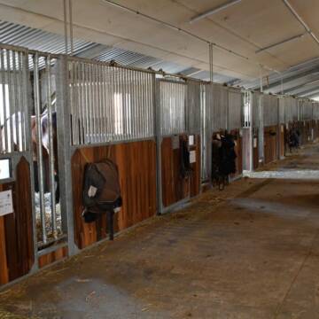
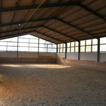
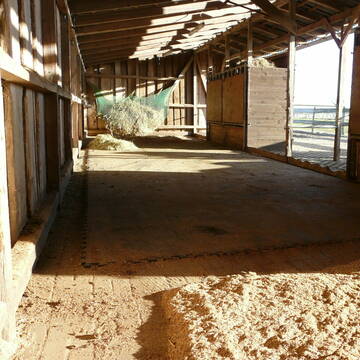
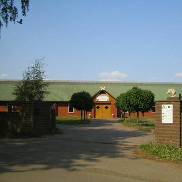
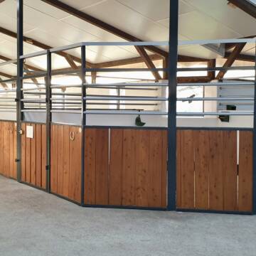
Ausbildungs- und TherapieZentrum Handorf
Handorf
ATZ Handorf
@Mathias-Bauch
Freizeitstall
Geländestrecke
Führanlage
Hunde willkommen
Allergikerstall
Fohlenaufzucht möglich
Außenbox mit Paddock
Außenboxen
35 weitere...
S
Deprecated: Creation of dynamic property Zend_View_Helper_Ads::$adLink is deprecated in /var/www/stall-frei/htdocs/staging.stall-frei.de/library/Psf/View/Helper/Ads.php on line 108

Heu und Heulage verkaufen
Mechtersen
STALL-FREIde Marketing
@STALL-FREI-Marketing
Verkaufen Sie Ihr Heu und Ihre Heulage direkt an Reiter, Pferdeställe und Reitanlagen


Aufzuchtplatz für Hengstfohlen aus 2025 frei
Bleckede
Bonny-Island
@Bonny-Island
Longierzirkel/Roundpen
Paddock
Fohlenaufzucht möglich
Pferdezucht
Bewegungsstall
Offenstall
6 weitere...
P+


Zur Zeit sind alle Plätze belegt.
Bleckede
Daniela-B
@Daniela-B
Freizeitstall
Hunde willkommen
Krankenbox
Notfallboxen
Offenstall
Paddock Trail
11 weitere...
P+


Reit- und Traberhof Meyer
Geesthacht
Reit-und-Traberhof-Kurt-Meyer
@Reit-und-Traberhof-Kurt-Meyer
Fahrstall, Kutschwagen
FN-Mitglied
Führanlage
Hunde willkommen
Allergikerstall
Hufrehe geeignet
Außenboxen
Offenstall
19 weitere...
S


Ganzjahres-Stallplatz in 19258 Nostorf
Nostorf
Hof-Lindemann
@Hof-Lindemann1
Fahrstall, Kutschwagen
Freizeitstall
Vermieten
Krankenbox
Longierzirkel/Roundpen
Gnadenbrothof
Notfallboxen
11 weitere...
P+

Das Beste für die Hufe
Mechtersen
STALL-FREIde Marketing
@STALL-FREI-Marketing
Hufschmiede und Hufpfleger in Ihrer Nähe
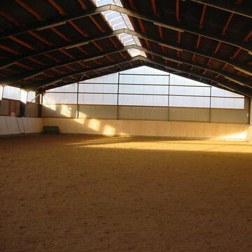
Reitanlage Vogelsang, familiärer Pensionsstall
Rullstorf
Reitstall-Vogelsang
@Reitstall-Vogelsang
FN-Mitglied
Freizeitstall
Pensions- und Gastboxen
Reithalle
Allergikerstall
10 weitere...
P
Reitsportanlage und Zuchthof Rabeler
Winsen/Luhe
Hof Rabeler
@Hof-Rabeler
FN-Mitglied
Pferdeausbildung
Vermieten
Führanlage
Longierzirkel/Roundpen
Fohlenaufzucht möglich
Notfallboxen
23 weitere...
S


Reitanlage Gut Hasenthal
Geesthacht
Gut-Hasenthal
@Gut-Hasenthal
FN-Mitglied
Geländestrecke
Hunde willkommen
Paddock
Außenboxen
Innenbox
Vollpension
13 weitere...
P+
Alexandra Bender
Brietlingen
Reitanlage-Bender
@Reitanlage-Bender
Geländestrecke
Pferdeausbildung
Vermieten
Longierzirkel/Roundpen
Paddock
Außenboxen
Innenbox
13 weitere...
P

Ganzjährige Herdenhaltung im Offenstall
Bleckede
Elbrosshof
@Elbrosshof
Freizeitstall
Vermieten
Hunde willkommen
Krankenbox
Notfallboxen
zuckerreduziertes Heu
13 weitere...
ganz aktuell
P
Deprecated: Creation of dynamic property Zend_View::$pageCount is deprecated in /var/www/stall-frei/htdocs/staging.stall-frei.de/library/vendor/shardj/zf1-future/library/Zend/View/Abstract.php on line 308
Deprecated: Creation of dynamic property Zend_View::$itemCountPerPage is deprecated in /var/www/stall-frei/htdocs/staging.stall-frei.de/library/vendor/shardj/zf1-future/library/Zend/View/Abstract.php on line 308
Deprecated: Creation of dynamic property Zend_View::$first is deprecated in /var/www/stall-frei/htdocs/staging.stall-frei.de/library/vendor/shardj/zf1-future/library/Zend/View/Abstract.php on line 308
Deprecated: Creation of dynamic property Zend_View::$current is deprecated in /var/www/stall-frei/htdocs/staging.stall-frei.de/library/vendor/shardj/zf1-future/library/Zend/View/Abstract.php on line 308
Deprecated: Creation of dynamic property Zend_View::$last is deprecated in /var/www/stall-frei/htdocs/staging.stall-frei.de/library/vendor/shardj/zf1-future/library/Zend/View/Abstract.php on line 308
Deprecated: Creation of dynamic property Zend_View::$next is deprecated in /var/www/stall-frei/htdocs/staging.stall-frei.de/library/vendor/shardj/zf1-future/library/Zend/View/Abstract.php on line 308
Deprecated: Creation of dynamic property Zend_View::$pagesInRange is deprecated in /var/www/stall-frei/htdocs/staging.stall-frei.de/library/vendor/shardj/zf1-future/library/Zend/View/Abstract.php on line 308
Deprecated: Creation of dynamic property Zend_View::$firstPageInRange is deprecated in /var/www/stall-frei/htdocs/staging.stall-frei.de/library/vendor/shardj/zf1-future/library/Zend/View/Abstract.php on line 308
Deprecated: Creation of dynamic property Zend_View::$lastPageInRange is deprecated in /var/www/stall-frei/htdocs/staging.stall-frei.de/library/vendor/shardj/zf1-future/library/Zend/View/Abstract.php on line 308
Deprecated: Creation of dynamic property Zend_View::$currentItemCount is deprecated in /var/www/stall-frei/htdocs/staging.stall-frei.de/library/vendor/shardj/zf1-future/library/Zend/View/Abstract.php on line 308
Deprecated: Creation of dynamic property Zend_View::$totalItemCount is deprecated in /var/www/stall-frei/htdocs/staging.stall-frei.de/library/vendor/shardj/zf1-future/library/Zend/View/Abstract.php on line 308
Deprecated: Creation of dynamic property Zend_View::$firstItemNumber is deprecated in /var/www/stall-frei/htdocs/staging.stall-frei.de/library/vendor/shardj/zf1-future/library/Zend/View/Abstract.php on line 308
Deprecated: Creation of dynamic property Zend_View::$lastItemNumber is deprecated in /var/www/stall-frei/htdocs/staging.stall-frei.de/library/vendor/shardj/zf1-future/library/Zend/View/Abstract.php on line 308
Deprecated: Creation of dynamic property Zend_View::$router is deprecated in /var/www/stall-frei/htdocs/staging.stall-frei.de/library/vendor/shardj/zf1-future/library/Zend/View/Abstract.php on line 308
Deprecated: Creation of dynamic property Zend_View::$urlParams is deprecated in /var/www/stall-frei/htdocs/staging.stall-frei.de/library/vendor/shardj/zf1-future/library/Zend/View/Abstract.php on line 308
Deprecated: Creation of dynamic property Zend_View::$showAds is deprecated in /var/www/stall-frei/htdocs/staging.stall-frei.de/library/vendor/shardj/zf1-future/library/Zend/View/Abstract.php on line 308
Deprecated: Creation of dynamic property Zend_View::$objectIds is deprecated in /var/www/stall-frei/htdocs/staging.stall-frei.de/library/vendor/shardj/zf1-future/library/Zend/View/Abstract.php on line 308
Deprecated: Creation of dynamic property Zend_View::$showNavbar is deprecated in /var/www/stall-frei/htdocs/staging.stall-frei.de/library/vendor/shardj/zf1-future/library/Zend/View/Abstract.php on line 308
Deprecated: Creation of dynamic property Zend_View::$showBreadcrumb is deprecated in /var/www/stall-frei/htdocs/staging.stall-frei.de/library/vendor/shardj/zf1-future/library/Zend/View/Abstract.php on line 308
Deprecated: Creation of dynamic property Zend_View::$showFooter is deprecated in /var/www/stall-frei/htdocs/staging.stall-frei.de/library/vendor/shardj/zf1-future/library/Zend/View/Abstract.php on line 308
Deprecated: Creation of dynamic property Zend_View::$showInternalAds is deprecated in /var/www/stall-frei/htdocs/staging.stall-frei.de/library/vendor/shardj/zf1-future/library/Zend/View/Abstract.php on line 308
Deprecated: Creation of dynamic property Zend_View::$blNoContent is deprecated in /var/www/stall-frei/htdocs/staging.stall-frei.de/library/vendor/shardj/zf1-future/library/Zend/View/Abstract.php on line 308
Deprecated: Creation of dynamic property Zend_View::$sMetaDesc is deprecated in /var/www/stall-frei/htdocs/staging.stall-frei.de/library/vendor/shardj/zf1-future/library/Zend/View/Abstract.php on line 308
Deprecated: Creation of dynamic property Zend_View::$useGmaps is deprecated in /var/www/stall-frei/htdocs/staging.stall-frei.de/library/vendor/shardj/zf1-future/library/Zend/View/Abstract.php on line 308
Deprecated: Creation of dynamic property Zend_View::$touches is deprecated in /var/www/stall-frei/htdocs/staging.stall-frei.de/library/vendor/shardj/zf1-future/library/Zend/View/Abstract.php on line 308
Deprecated: Creation of dynamic property Zend_View::$oProject is deprecated in /var/www/stall-frei/htdocs/staging.stall-frei.de/library/vendor/shardj/zf1-future/library/Zend/View/Abstract.php on line 308
Deprecated: Creation of dynamic property Zend_View::$pageHeadline is deprecated in /var/www/stall-frei/htdocs/staging.stall-frei.de/library/vendor/shardj/zf1-future/library/Zend/View/Abstract.php on line 308
Deprecated: Creation of dynamic property Zend_View::$disableLocationField is deprecated in /var/www/stall-frei/htdocs/staging.stall-frei.de/library/vendor/shardj/zf1-future/library/Zend/View/Abstract.php on line 308
Deprecated: Creation of dynamic property Zend_View::$isSearch is deprecated in /var/www/stall-frei/htdocs/staging.stall-frei.de/library/vendor/shardj/zf1-future/library/Zend/View/Abstract.php on line 308
Deprecated: Creation of dynamic property Zend_View::$pageTitle is deprecated in /var/www/stall-frei/htdocs/staging.stall-frei.de/library/vendor/shardj/zf1-future/library/Zend/View/Abstract.php on line 308
Deprecated: Creation of dynamic property Psf_Form_Element_Text::$class is deprecated in /var/www/stall-frei/htdocs/staging.stall-frei.de/library/vendor/shardj/zf1-future/library/Zend/Form/Element.php on line 874
Deprecated: Creation of dynamic property Psf_Form_Element_Text::$size is deprecated in /var/www/stall-frei/htdocs/staging.stall-frei.de/library/vendor/shardj/zf1-future/library/Zend/Form/Element.php on line 874
Deprecated: Creation of dynamic property Psf_Form_Element_Text::$placeholder is deprecated in /var/www/stall-frei/htdocs/staging.stall-frei.de/library/vendor/shardj/zf1-future/library/Zend/Form/Element.php on line 874
Deprecated: Creation of dynamic property Psf_Form_Element_Hidden::$class is deprecated in /var/www/stall-frei/htdocs/staging.stall-frei.de/library/vendor/shardj/zf1-future/library/Zend/Form/Element.php on line 874
Deprecated: Creation of dynamic property Psf_Form_Element_Hidden::$class is deprecated in /var/www/stall-frei/htdocs/staging.stall-frei.de/library/vendor/shardj/zf1-future/library/Zend/Form/Element.php on line 874
Deprecated: Creation of dynamic property Psf_Form_Element_Hidden::$class is deprecated in /var/www/stall-frei/htdocs/staging.stall-frei.de/library/vendor/shardj/zf1-future/library/Zend/Form/Element.php on line 874
Deprecated: Creation of dynamic property Psf_Form_Element_Hidden::$class is deprecated in /var/www/stall-frei/htdocs/staging.stall-frei.de/library/vendor/shardj/zf1-future/library/Zend/Form/Element.php on line 874
Deprecated: Creation of dynamic property Psf_Form_Element_Select::$class is deprecated in /var/www/stall-frei/htdocs/staging.stall-frei.de/library/vendor/shardj/zf1-future/library/Zend/Form/Element.php on line 874
Deprecated: Creation of dynamic property Psf_Form_Element_Select::$class is deprecated in /var/www/stall-frei/htdocs/staging.stall-frei.de/library/vendor/shardj/zf1-future/library/Zend/Form/Element.php on line 874
Deprecated: Creation of dynamic property Psf_Form_Element_Select::$class is deprecated in /var/www/stall-frei/htdocs/staging.stall-frei.de/library/vendor/shardj/zf1-future/library/Zend/Form/Element.php on line 874
Deprecated: Creation of dynamic property Psf_Form_Element_Select::$class is deprecated in /var/www/stall-frei/htdocs/staging.stall-frei.de/library/vendor/shardj/zf1-future/library/Zend/Form/Element.php on line 874
Deprecated: Creation of dynamic property Psf_Form_Element_Text::$class is deprecated in /var/www/stall-frei/htdocs/staging.stall-frei.de/library/vendor/shardj/zf1-future/library/Zend/Form/Element.php on line 874
Deprecated: Creation of dynamic property Psf_Form_Element_Checkbox::$label is deprecated in /var/www/stall-frei/htdocs/staging.stall-frei.de/library/vendor/shardj/zf1-future/library/Zend/Form/Element.php on line 874
Deprecated: Creation of dynamic property Zend_View::$sort is deprecated in /var/www/stall-frei/htdocs/staging.stall-frei.de/library/vendor/shardj/zf1-future/library/Zend/View/Abstract.php on line 308
Deprecated: Creation of dynamic property Zend_View::$searchLocation is deprecated in /var/www/stall-frei/htdocs/staging.stall-frei.de/library/vendor/shardj/zf1-future/library/Zend/View/Abstract.php on line 308
Deprecated: Creation of dynamic property Zend_View::$locationHint is deprecated in /var/www/stall-frei/htdocs/staging.stall-frei.de/library/vendor/shardj/zf1-future/library/Zend/View/Abstract.php on line 308
Psf_GeoCoder_Abstract::getLocation: Bullendorf Get Location CachedOrLive
Psf_GeoCoder_Abstract::getCachedOrLive: Bullendorf
Psf_GeoCoder_OpenCageData::makeApiRequest: response:
Array
(
[documentation] => https://opencagedata.com/api
[licenses] => Array
(
[0] => Array
(
[name] => see attribution guide
[url] => https://opencagedata.com/credits
)
)
[results] => Array
(
[0] => Array
(
[bounds] => Array
(
[northeast] => Array
(
[lat] => 53.3677979
[lng] => 10.5916965
)
[southwest] => Array
(
[lat] => 53.3277979
[lng] => 10.5516965
)
)
[components] => Array
(
[ISO_3166-1_alpha-2] => DE
[ISO_3166-1_alpha-3] => DEU
[ISO_3166-2] => Array
(
[0] => DE-NI
)
[_category] => place
[_normalized_city] => Hohnstorf (Elbe)
[_type] => village
[city] => Hohnstorf (Elbe)
[continent] => Europe
[country] => Deutschland
[country_code] => de
[county] => Landkreis Lüneburg
[municipality] => Samtgemeinde Scharnebeck
[political_union] => European Union
[postcode] => 21522
[state] => Niedersachsen
[state_code] => NI
[village] => Bullendorf
)
[confidence] => 7
[formatted] => 21522 Bullendorf, Deutschland
[geometry] => Array
(
[lat] => 53.3477979
[lng] => 10.5716965
)
)
[1] => Array
(
[bounds] => Array
(
[northeast] => Array
(
[lat] => 53.7857125
[lng] => 9.6303232
)
[southwest] => Array
(
[lat] => 53.7457125
[lng] => 9.5903232
)
)
[components] => Array
(
[ISO_3166-1_alpha-2] => DE
[ISO_3166-1_alpha-3] => DEU
[ISO_3166-2] => Array
(
[0] => DE-SH
)
[_category] => place
[_normalized_city] => Bullendorf
[_type] => village
[continent] => Europe
[country] => Deutschland
[country_code] => de
[county] => Kreis Steinburg
[municipality] => Horst-Herzhorn
[political_union] => European Union
[postcode] => 25368
[state] => Schleswig-Holstein
[state_code] => SH
[town] => Bullendorf
[village] => Altenmoor
)
[confidence] => 7
[formatted] => 25368 Altenmoor, Deutschland
[geometry] => Array
(
[lat] => 53.7657125
[lng] => 9.6103232
)
)
[2] => Array
(
[bounds] => Array
(
[northeast] => Array
(
[lat] => 53.1270238
[lng] => 12.128841
)
[southwest] => Array
(
[lat] => 53.0870238
[lng] => 12.088841
)
)
[components] => Array
(
[ISO_3166-1_alpha-2] => DE
[ISO_3166-1_alpha-3] => DEU
[ISO_3166-2] => Array
(
[0] => DE-BB
)
[_category] => place
[_normalized_city] => Groß Pankow (Prignitz)
[_type] => hamlet
[continent] => Europe
[country] => Deutschland
[country_code] => de
[county] => Prignitz
[hamlet] => Bullendorf
[political_union] => European Union
[postcode] => 16928
[state] => Brandenburg
[state_code] => BB
[village] => Groß Pankow (Prignitz)
)
[confidence] => 7
[formatted] => Bullendorf, 16928 Groß Pankow (Prignitz), Deutschland
[geometry] => Array
(
[lat] => 53.1070238
[lng] => 12.108841
)
)
[3] => Array
(
[bounds] => Array
(
[northeast] => Array
(
[lat] => 53.7644038
[lng] => 9.6087507
)
[southwest] => Array
(
[lat] => 53.7610017
[lng] => 9.5961685
)
)
[components] => Array
(
[ISO_3166-1_alpha-2] => DE
[ISO_3166-1_alpha-3] => DEU
[ISO_3166-2] => Array
(
[0] => DE-SH
)
[_category] => road
[_normalized_city] => Bullendorf
[_type] => road
[continent] => Europe
[country] => Deutschland
[country_code] => de
[county] => Kreis Steinburg
[municipality] => Horst-Herzhorn
[political_union] => European Union
[postcode] => 25335
[road] => Bullendorf
[state] => Schleswig-Holstein
[state_code] => SH
[town] => Bullendorf
[village] => Altenmoor
)
[confidence] => 9
[formatted] => Bullendorf, 25335 Altenmoor, Deutschland
[geometry] => Array
(
[lat] => 53.7627745
[lng] => 9.6024473
)
)
[4] => Array
(
[bounds] => Array
(
[northeast] => Array
(
[lat] => 53.1069062
[lng] => 12.1123996
)
[southwest] => Array
(
[lat] => 53.1054342
[lng] => 12.106478
)
)
[components] => Array
(
[ISO_3166-1_alpha-2] => DE
[ISO_3166-1_alpha-3] => DEU
[ISO_3166-2] => Array
(
[0] => DE-BB
)
[_category] => road
[_normalized_city] => Groß Pankow (Prignitz)
[_type] => road
[continent] => Europe
[country] => Deutschland
[country_code] => de
[county] => Prignitz
[hamlet] => Bullendorf
[political_union] => European Union
[postcode] => 16928
[road] => Bullendorf
[road_type] => residential
[state] => Brandenburg
[state_code] => BB
[village] => Groß Pankow (Prignitz)
)
[confidence] => 9
[formatted] => Bullendorf, 16928 Groß Pankow (Prignitz), Deutschland
[geometry] => Array
(
[lat] => 53.1066952
[lng] => 12.1094357
)
)
[5] => Array
(
[components] => Array
(
[ISO_3166-1_alpha-2] => FR
[ISO_3166-1_alpha-3] => FRA
[ISO_3166-2] => Array
(
[0] => FR-GES
[1] => FR-6AE
[2] => FR-67
)
[_category] => road
[_normalized_city] => Betschdorf
[_type] => road
[city] => Betschdorf
[continent] => Europe
[country] => France
[country_code] => fr
[county] => Bas-Rhin
[local_authority] => Communauté de communes de l'Outre-Forêt
[political_union] => European Union
[postcode] => 67660
[road] => Rue de Kuhlendorf
[state] => Grand Est
[state_code] => GES
)
[confidence] => 3
[formatted] => Rue de Kuhlendorf, 67660 Betschdorf, France
[geometry] => Array
(
[lat] => 48.900348
[lng] => 7.914409
)
)
[6] => Array
(
[components] => Array
(
[ISO_3166-1_alpha-2] => FR
[ISO_3166-1_alpha-3] => FRA
[ISO_3166-2] => Array
(
[0] => FR-GES
[1] => FR-6AE
[2] => FR-67
)
[_category] => road
[_normalized_city] => Betschdorf
[_type] => road
[city] => Betschdorf
[continent] => Europe
[country] => France
[country_code] => fr
[county] => Bas-Rhin
[local_authority] => Communauté de communes de l'Outre-Forêt
[political_union] => European Union
[postcode] => 67660
[road] => Kuhlendorf
[state] => Grand Est
[state_code] => GES
)
[confidence] => 3
[formatted] => Kuhlendorf, 67660 Betschdorf, France
[geometry] => Array
(
[lat] => 48.914189
[lng] => 7.921557
)
)
[7] => Array
(
[components] => Array
(
[ISO_3166-1_alpha-2] => FR
[ISO_3166-1_alpha-3] => FRA
[ISO_3166-2] => Array
(
[0] => FR-GES
[1] => FR-6AE
[2] => FR-67
)
[_category] => road
[_normalized_city] => Betschdorf
[_type] => road
[city] => Betschdorf
[continent] => Europe
[country] => France
[country_code] => fr
[county] => Bas-Rhin
[local_authority] => Communauté de communes de l'Outre-Forêt
[political_union] => European Union
[postcode] => 67660
[road] => Rue du Village Kuhlendorf
[state] => Grand Est
[state_code] => GES
)
[confidence] => 3
[formatted] => Rue du Village Kuhlendorf, 67660 Betschdorf, France
[geometry] => Array
(
[lat] => 48.914492
[lng] => 7.922092
)
)
[8] => Array
(
[components] => Array
(
[ISO_3166-1_alpha-2] => FR
[ISO_3166-1_alpha-3] => FRA
[ISO_3166-2] => Array
(
[0] => FR-GES
[1] => FR-6AE
[2] => FR-67
)
[_category] => road
[_normalized_city] => Rittershoffen
[_type] => road
[city] => Rittershoffen
[continent] => Europe
[country] => France
[country_code] => fr
[county] => Bas-Rhin
[local_authority] => Communauté de communes de l'Outre-Forêt
[political_union] => European Union
[postcode] => 67690
[road] => route de Kuhlendorf
[state] => Grand Est
[state_code] => GES
)
[confidence] => 3
[formatted] => route de Kuhlendorf, 67690 Rittershoffen, France
[geometry] => Array
(
[lat] => 48.907941
[lng] => 7.940395
)
)
[9] => Array
(
[components] => Array
(
[ISO_3166-1_alpha-2] => FR
[ISO_3166-1_alpha-3] => FRA
[ISO_3166-2] => Array
(
[0] => FR-GES
[1] => FR-6AE
[2] => FR-67
)
[_category] => road
[_normalized_city] => Betschdorf
[_type] => road
[city] => Betschdorf
[continent] => Europe
[country] => France
[country_code] => fr
[county] => Bas-Rhin
[local_authority] => Communauté de communes de l'Outre-Forêt
[political_union] => European Union
[postcode] => 67660
[road] => Rue de la Wacht Kuhlendorf
[state] => Grand Est
[state_code] => GES
)
[confidence] => 3
[formatted] => Rue de la Wacht Kuhlendorf, 67660 Betschdorf, France
[geometry] => Array
(
[lat] => 48.913116
[lng] => 7.922636
)
)
)
[status] => Array
(
[code] => 200
[message] => OK
)
[stay_informed] => Array
(
[blog] => https://blog.opencagedata.com
[mastodon] => https://en.osm.town/@opencage
)
[thanks] => For using an OpenCage API
[timestamp] => Array
(
[created_http] => Sat, 07 Feb 2026 08:32:21 GMT
[created_unix] => 1770453141
)
[total_results] => 10
)
Psf_GeoCoder_Abstract::convertLocationResult
{"documentation":"https:\/\/opencagedata.com\/api","licenses":[{"name":"see attribution guide","url":"https:\/\/opencagedata.com\/credits"}],"results":[{"bounds":{"northeast":{"lat":53.3677979,"lng":10.5916965},"southwest":{"lat":53.3277979,"lng":10.5516965}},"components":{"ISO_3166-1_alpha-2":"DE","ISO_3166-1_alpha-3":"DEU","ISO_3166-2":["DE-NI"],"_category":"place","_normalized_city":"Hohnstorf (Elbe)","_type":"village","city":"Hohnstorf (Elbe)","continent":"Europe","country":"Deutschland","country_code":"de","county":"Landkreis L\u00fcneburg","municipality":"Samtgemeinde Scharnebeck","political_union":"European Union","postcode":"21522","state":"Niedersachsen","state_code":"NI","village":"Bullendorf"},"confidence":7,"formatted":"21522 Bullendorf, Deutschland","geometry":{"lat":53.3477979,"lng":10.5716965}},{"bounds":{"northeast":{"lat":53.7857125,"lng":9.6303232},"southwest":{"lat":53.7457125,"lng":9.5903232}},"components":{"ISO_3166-1_alpha-2":"DE","ISO_3166-1_alpha-3":"DEU","ISO_3166-2":["DE-SH"],"_category":"place","_normalized_city":"Bullendorf","_type":"village","continent":"Europe","country":"Deutschland","country_code":"de","county":"Kreis Steinburg","municipality":"Horst-Herzhorn","political_union":"European Union","postcode":"25368","state":"Schleswig-Holstein","state_code":"SH","town":"Bullendorf","village":"Altenmoor"},"confidence":7,"formatted":"25368 Altenmoor, Deutschland","geometry":{"lat":53.7657125,"lng":9.6103232}},{"bounds":{"northeast":{"lat":53.1270238,"lng":12.128841},"southwest":{"lat":53.0870238,"lng":12.088841}},"components":{"ISO_3166-1_alpha-2":"DE","ISO_3166-1_alpha-3":"DEU","ISO_3166-2":["DE-BB"],"_category":"place","_normalized_city":"Gro\u00df Pankow (Prignitz)","_type":"hamlet","continent":"Europe","country":"Deutschland","country_code":"de","county":"Prignitz","hamlet":"Bullendorf","political_union":"European Union","postcode":"16928","state":"Brandenburg","state_code":"BB","village":"Gro\u00df Pankow (Prignitz)"},"confidence":7,"formatted":"Bullendorf, 16928 Gro\u00df Pankow (Prignitz), Deutschland","geometry":{"lat":53.1070238,"lng":12.108841}},{"bounds":{"northeast":{"lat":53.7644038,"lng":9.6087507},"southwest":{"lat":53.7610017,"lng":9.5961685}},"components":{"ISO_3166-1_alpha-2":"DE","ISO_3166-1_alpha-3":"DEU","ISO_3166-2":["DE-SH"],"_category":"road","_normalized_city":"Bullendorf","_type":"road","continent":"Europe","country":"Deutschland","country_code":"de","county":"Kreis Steinburg","municipality":"Horst-Herzhorn","political_union":"European Union","postcode":"25335","road":"Bullendorf","state":"Schleswig-Holstein","state_code":"SH","town":"Bullendorf","village":"Altenmoor"},"confidence":9,"formatted":"Bullendorf, 25335 Altenmoor, Deutschland","geometry":{"lat":53.7627745,"lng":9.6024473}},{"bounds":{"northeast":{"lat":53.1069062,"lng":12.1123996},"southwest":{"lat":53.1054342,"lng":12.106478}},"components":{"ISO_3166-1_alpha-2":"DE","ISO_3166-1_alpha-3":"DEU","ISO_3166-2":["DE-BB"],"_category":"road","_normalized_city":"Gro\u00df Pankow (Prignitz)","_type":"road","continent":"Europe","country":"Deutschland","country_code":"de","county":"Prignitz","hamlet":"Bullendorf","political_union":"European Union","postcode":"16928","road":"Bullendorf","road_type":"residential","state":"Brandenburg","state_code":"BB","village":"Gro\u00df Pankow (Prignitz)"},"confidence":9,"formatted":"Bullendorf, 16928 Gro\u00df Pankow (Prignitz), Deutschland","geometry":{"lat":53.1066952,"lng":12.1094357}},{"components":{"ISO_3166-1_alpha-2":"FR","ISO_3166-1_alpha-3":"FRA","ISO_3166-2":["FR-GES","FR-6AE","FR-67"],"_category":"road","_normalized_city":"Betschdorf","_type":"road","city":"Betschdorf","continent":"Europe","country":"France","country_code":"fr","county":"Bas-Rhin","local_authority":"Communaut\u00e9 de communes de l'Outre-For\u00eat","political_union":"European Union","postcode":"67660","road":"Rue de Kuhlendorf","state":"Grand Est","state_code":"GES"},"confidence":3,"formatted":"Rue de Kuhlendorf, 67660 Betschdorf, France","geometry":{"lat":48.900348,"lng":7.914409}},{"components":{"ISO_3166-1_alpha-2":"FR","ISO_3166-1_alpha-3":"FRA","ISO_3166-2":["FR-GES","FR-6AE","FR-67"],"_category":"road","_normalized_city":"Betschdorf","_type":"road","city":"Betschdorf","continent":"Europe","country":"France","country_code":"fr","county":"Bas-Rhin","local_authority":"Communaut\u00e9 de communes de l'Outre-For\u00eat","political_union":"European Union","postcode":"67660","road":"Kuhlendorf","state":"Grand Est","state_code":"GES"},"confidence":3,"formatted":"Kuhlendorf, 67660 Betschdorf, France","geometry":{"lat":48.914189,"lng":7.921557}},{"components":{"ISO_3166-1_alpha-2":"FR","ISO_3166-1_alpha-3":"FRA","ISO_3166-2":["FR-GES","FR-6AE","FR-67"],"_category":"road","_normalized_city":"Betschdorf","_type":"road","city":"Betschdorf","continent":"Europe","country":"France","country_code":"fr","county":"Bas-Rhin","local_authority":"Communaut\u00e9 de communes de l'Outre-For\u00eat","political_union":"European Union","postcode":"67660","road":"Rue du Village Kuhlendorf","state":"Grand Est","state_code":"GES"},"confidence":3,"formatted":"Rue du Village Kuhlendorf, 67660 Betschdorf, France","geometry":{"lat":48.914492,"lng":7.922092}},{"components":{"ISO_3166-1_alpha-2":"FR","ISO_3166-1_alpha-3":"FRA","ISO_3166-2":["FR-GES","FR-6AE","FR-67"],"_category":"road","_normalized_city":"Rittershoffen","_type":"road","city":"Rittershoffen","continent":"Europe","country":"France","country_code":"fr","county":"Bas-Rhin","local_authority":"Communaut\u00e9 de communes de l'Outre-For\u00eat","political_union":"European Union","postcode":"67690","road":"route de Kuhlendorf","state":"Grand Est","state_code":"GES"},"confidence":3,"formatted":"route de Kuhlendorf, 67690 Rittershoffen, France","geometry":{"lat":48.907941,"lng":7.940395}},{"components":{"ISO_3166-1_alpha-2":"FR","ISO_3166-1_alpha-3":"FRA","ISO_3166-2":["FR-GES","FR-6AE","FR-67"],"_category":"road","_normalized_city":"Betschdorf","_type":"road","city":"Betschdorf","continent":"Europe","country":"France","country_code":"fr","county":"Bas-Rhin","local_authority":"Communaut\u00e9 de communes de l'Outre-For\u00eat","political_union":"European Union","postcode":"67660","road":"Rue de la Wacht Kuhlendorf","state":"Grand Est","state_code":"GES"},"confidence":3,"formatted":"Rue de la Wacht Kuhlendorf, 67660 Betschdorf, France","geometry":{"lat":48.913116,"lng":7.922636}}],"status":{"code":200,"message":"OK"},"stay_informed":{"blog":"https:\/\/blog.opencagedata.com","mastodon":"https:\/\/en.osm.town\/@opencage"},"thanks":"For using an OpenCage API","timestamp":{"created_http":"Sat, 07 Feb 2026 08:32:21 GMT","created_unix":1770453141},"total_results":10}Array
(
[0] => stdClass Object
(
[bounds] => stdClass Object
(
[northeast] => stdClass Object
(
[lat] => 53.3677979
[lng] => 10.5916965
)
[southwest] => stdClass Object
(
[lat] => 53.3277979
[lng] => 10.5516965
)
)
[components] => stdClass Object
(
[ISO_3166-1_alpha-2] => DE
[ISO_3166-1_alpha-3] => DEU
[ISO_3166-2] => Array
(
[0] => DE-NI
)
[_category] => place
[_normalized_city] => Hohnstorf (Elbe)
[_type] => village
[city] => Hohnstorf (Elbe)
[continent] => Europe
[country] => Deutschland
[country_code] => de
[county] => Landkreis Lüneburg
[municipality] => Samtgemeinde Scharnebeck
[political_union] => European Union
[postcode] => 21522
[state] => Niedersachsen
[state_code] => NI
[village] => Bullendorf
)
[confidence] => 7
[formatted] => 21522 Bullendorf, Deutschland
[geometry] => stdClass Object
(
[lat] => 53.3477979
[lng] => 10.5716965
)
)
[1] => stdClass Object
(
[bounds] => stdClass Object
(
[northeast] => stdClass Object
(
[lat] => 53.7857125
[lng] => 9.6303232
)
[southwest] => stdClass Object
(
[lat] => 53.7457125
[lng] => 9.5903232
)
)
[components] => stdClass Object
(
[ISO_3166-1_alpha-2] => DE
[ISO_3166-1_alpha-3] => DEU
[ISO_3166-2] => Array
(
[0] => DE-SH
)
[_category] => place
[_normalized_city] => Bullendorf
[_type] => village
[continent] => Europe
[country] => Deutschland
[country_code] => de
[county] => Kreis Steinburg
[municipality] => Horst-Herzhorn
[political_union] => European Union
[postcode] => 25368
[state] => Schleswig-Holstein
[state_code] => SH
[town] => Bullendorf
[village] => Altenmoor
)
[confidence] => 7
[formatted] => 25368 Altenmoor, Deutschland
[geometry] => stdClass Object
(
[lat] => 53.7657125
[lng] => 9.6103232
)
)
[2] => stdClass Object
(
[bounds] => stdClass Object
(
[northeast] => stdClass Object
(
[lat] => 53.1270238
[lng] => 12.128841
)
[southwest] => stdClass Object
(
[lat] => 53.0870238
[lng] => 12.088841
)
)
[components] => stdClass Object
(
[ISO_3166-1_alpha-2] => DE
[ISO_3166-1_alpha-3] => DEU
[ISO_3166-2] => Array
(
[0] => DE-BB
)
[_category] => place
[_normalized_city] => Groß Pankow (Prignitz)
[_type] => hamlet
[continent] => Europe
[country] => Deutschland
[country_code] => de
[county] => Prignitz
[hamlet] => Bullendorf
[political_union] => European Union
[postcode] => 16928
[state] => Brandenburg
[state_code] => BB
[village] => Groß Pankow (Prignitz)
)
[confidence] => 7
[formatted] => Bullendorf, 16928 Groß Pankow (Prignitz), Deutschland
[geometry] => stdClass Object
(
[lat] => 53.1070238
[lng] => 12.108841
)
)
[3] => stdClass Object
(
[bounds] => stdClass Object
(
[northeast] => stdClass Object
(
[lat] => 53.7644038
[lng] => 9.6087507
)
[southwest] => stdClass Object
(
[lat] => 53.7610017
[lng] => 9.5961685
)
)
[components] => stdClass Object
(
[ISO_3166-1_alpha-2] => DE
[ISO_3166-1_alpha-3] => DEU
[ISO_3166-2] => Array
(
[0] => DE-SH
)
[_category] => road
[_normalized_city] => Bullendorf
[_type] => road
[continent] => Europe
[country] => Deutschland
[country_code] => de
[county] => Kreis Steinburg
[municipality] => Horst-Herzhorn
[political_union] => European Union
[postcode] => 25335
[road] => Bullendorf
[state] => Schleswig-Holstein
[state_code] => SH
[town] => Bullendorf
[village] => Altenmoor
)
[confidence] => 9
[formatted] => Bullendorf, 25335 Altenmoor, Deutschland
[geometry] => stdClass Object
(
[lat] => 53.7627745
[lng] => 9.6024473
)
)
[4] => stdClass Object
(
[bounds] => stdClass Object
(
[northeast] => stdClass Object
(
[lat] => 53.1069062
[lng] => 12.1123996
)
[southwest] => stdClass Object
(
[lat] => 53.1054342
[lng] => 12.106478
)
)
[components] => stdClass Object
(
[ISO_3166-1_alpha-2] => DE
[ISO_3166-1_alpha-3] => DEU
[ISO_3166-2] => Array
(
[0] => DE-BB
)
[_category] => road
[_normalized_city] => Groß Pankow (Prignitz)
[_type] => road
[continent] => Europe
[country] => Deutschland
[country_code] => de
[county] => Prignitz
[hamlet] => Bullendorf
[political_union] => European Union
[postcode] => 16928
[road] => Bullendorf
[road_type] => residential
[state] => Brandenburg
[state_code] => BB
[village] => Groß Pankow (Prignitz)
)
[confidence] => 9
[formatted] => Bullendorf, 16928 Groß Pankow (Prignitz), Deutschland
[geometry] => stdClass Object
(
[lat] => 53.1066952
[lng] => 12.1094357
)
)
[5] => stdClass Object
(
[components] => stdClass Object
(
[ISO_3166-1_alpha-2] => FR
[ISO_3166-1_alpha-3] => FRA
[ISO_3166-2] => Array
(
[0] => FR-GES
[1] => FR-6AE
[2] => FR-67
)
[_category] => road
[_normalized_city] => Betschdorf
[_type] => road
[city] => Betschdorf
[continent] => Europe
[country] => France
[country_code] => fr
[county] => Bas-Rhin
[local_authority] => Communauté de communes de l'Outre-Forêt
[political_union] => European Union
[postcode] => 67660
[road] => Rue de Kuhlendorf
[state] => Grand Est
[state_code] => GES
)
[confidence] => 3
[formatted] => Rue de Kuhlendorf, 67660 Betschdorf, France
[geometry] => stdClass Object
(
[lat] => 48.900348
[lng] => 7.914409
)
)
[6] => stdClass Object
(
[components] => stdClass Object
(
[ISO_3166-1_alpha-2] => FR
[ISO_3166-1_alpha-3] => FRA
[ISO_3166-2] => Array
(
[0] => FR-GES
[1] => FR-6AE
[2] => FR-67
)
[_category] => road
[_normalized_city] => Betschdorf
[_type] => road
[city] => Betschdorf
[continent] => Europe
[country] => France
[country_code] => fr
[county] => Bas-Rhin
[local_authority] => Communauté de communes de l'Outre-Forêt
[political_union] => European Union
[postcode] => 67660
[road] => Kuhlendorf
[state] => Grand Est
[state_code] => GES
)
[confidence] => 3
[formatted] => Kuhlendorf, 67660 Betschdorf, France
[geometry] => stdClass Object
(
[lat] => 48.914189
[lng] => 7.921557
)
)
[7] => stdClass Object
(
[components] => stdClass Object
(
[ISO_3166-1_alpha-2] => FR
[ISO_3166-1_alpha-3] => FRA
[ISO_3166-2] => Array
(
[0] => FR-GES
[1] => FR-6AE
[2] => FR-67
)
[_category] => road
[_normalized_city] => Betschdorf
[_type] => road
[city] => Betschdorf
[continent] => Europe
[country] => France
[country_code] => fr
[county] => Bas-Rhin
[local_authority] => Communauté de communes de l'Outre-Forêt
[political_union] => European Union
[postcode] => 67660
[road] => Rue du Village Kuhlendorf
[state] => Grand Est
[state_code] => GES
)
[confidence] => 3
[formatted] => Rue du Village Kuhlendorf, 67660 Betschdorf, France
[geometry] => stdClass Object
(
[lat] => 48.914492
[lng] => 7.922092
)
)
[8] => stdClass Object
(
[components] => stdClass Object
(
[ISO_3166-1_alpha-2] => FR
[ISO_3166-1_alpha-3] => FRA
[ISO_3166-2] => Array
(
[0] => FR-GES
[1] => FR-6AE
[2] => FR-67
)
[_category] => road
[_normalized_city] => Rittershoffen
[_type] => road
[city] => Rittershoffen
[continent] => Europe
[country] => France
[country_code] => fr
[county] => Bas-Rhin
[local_authority] => Communauté de communes de l'Outre-Forêt
[political_union] => European Union
[postcode] => 67690
[road] => route de Kuhlendorf
[state] => Grand Est
[state_code] => GES
)
[confidence] => 3
[formatted] => route de Kuhlendorf, 67690 Rittershoffen, France
[geometry] => stdClass Object
(
[lat] => 48.907941
[lng] => 7.940395
)
)
[9] => stdClass Object
(
[components] => stdClass Object
(
[ISO_3166-1_alpha-2] => FR
[ISO_3166-1_alpha-3] => FRA
[ISO_3166-2] => Array
(
[0] => FR-GES
[1] => FR-6AE
[2] => FR-67
)
[_category] => road
[_normalized_city] => Betschdorf
[_type] => road
[city] => Betschdorf
[continent] => Europe
[country] => France
[country_code] => fr
[county] => Bas-Rhin
[local_authority] => Communauté de communes de l'Outre-Forêt
[political_union] => European Union
[postcode] => 67660
[road] => Rue de la Wacht Kuhlendorf
[state] => Grand Est
[state_code] => GES
)
[confidence] => 3
[formatted] => Rue de la Wacht Kuhlendorf, 67660 Betschdorf, France
[geometry] => stdClass Object
(
[lat] => 48.913116
[lng] => 7.922636
)
)
)
Psf_GeoCoder_OpenCageData::getKeyMap: 0
stdClass Object
(
    [bounds] => stdClass Object
        (
            [northeast] => stdClass Object
                (
                    [lat] => 53.3677979
                    [lng] => 10.5916965
                )

            [southwest] => stdClass Object
                (
                    [lat] => 53.3277979
                    [lng] => 10.5516965
                )

        )

    [components] => stdClass Object
        (
            [ISO_3166-1_alpha-2] => DE
            [ISO_3166-1_alpha-3] => DEU
            [ISO_3166-2] => Array
                (
                    [0] => DE-NI
                )

            [_category] => place
            [_normalized_city] => Hohnstorf (Elbe)
            [_type] => village
            [city] => Hohnstorf (Elbe)
            [continent] => Europe
            [country] => Deutschland
            [country_code] => de
            [county] => Landkreis Lüneburg
            [municipality] => Samtgemeinde Scharnebeck
            [political_union] => European Union
            [postcode] => 21522
            [state] => Niedersachsen
            [state_code] => NI
            [village] => Bullendorf
        )

    [confidence] => 7
    [formatted] => 21522 Bullendorf, Deutschland
    [geometry] => stdClass Object
        (
            [lat] => 53.3477979
            [lng] => 10.5716965
        )

)
Psf_GeoCoder_OpenCageData::getCounty: Lüneburg
Psf_GeoCoder_OpenCageData::addMissingData REFETCH!
Array
(
    [address] => 21522 Bullendorf, Deutschland
    [type] => village
    [street] =>
    [city] => Bullendorf
    [county] => Lüneburg
    [state] => Niedersachsen
    [zip] => 21522
    [country] => Deutschland
    [suburb] =>
    [countrycode] => de
    [latitude] => 53.3477979
    [longitude] => 10.5716965
    [accuracy] => 1
    [confidence] => 7
    [bounds] => stdClass Object
        (
            [northeast] => stdClass Object
                (
                    [lat] => 53.3677979
                    [lng] => 10.5916965
                )

            [southwest] => stdClass Object
                (
                    [lat] => 53.3277979
                    [lng] => 10.5516965
                )

        )

)
reformat!
Array
(
    [address] => 21522 Bullendorf, Deutschland
    [type] => village
    [street] =>
    [city] => Bullendorf
    [county] => Lüneburg
    [state] => Niedersachsen
    [zip] => 21522
    [country] => Deutschland
    [suburb] =>
    [countrycode] => de
    [latitude] => 53.3477979
    [longitude] => 10.5716965
    [accuracy] => 1
    [confidence] => 7
    [bounds] => stdClass Object
        (
            [northeast] => stdClass Object
                (
                    [lat] => 53.3677979
                    [lng] => 10.5916965
                )

            [southwest] => stdClass Object
                (
                    [lat] => 53.3277979
                    [lng] => 10.5516965
                )

        )

    [place] => 21522 Bullendorf, Niedersachsen
    [hash] => 83f545e6bbf0abed6757c9f1e28d4b84
)
Psf_GeoCoder_OpenCageData::getKeyMap: 1
stdClass Object
(
    [bounds] => stdClass Object
        (
            [northeast] => stdClass Object
                (
                    [lat] => 53.7857125
                    [lng] => 9.6303232
                )

            [southwest] => stdClass Object
                (
                    [lat] => 53.7457125
                    [lng] => 9.5903232
                )

        )

    [components] => stdClass Object
        (
            [ISO_3166-1_alpha-2] => DE
            [ISO_3166-1_alpha-3] => DEU
            [ISO_3166-2] => Array
                (
                    [0] => DE-SH
                )

            [_category] => place
            [_normalized_city] => Bullendorf
            [_type] => village
            [continent] => Europe
            [country] => Deutschland
            [country_code] => de
            [county] => Kreis Steinburg
            [municipality] => Horst-Herzhorn
            [political_union] => European Union
            [postcode] => 25368
            [state] => Schleswig-Holstein
            [state_code] => SH
            [town] => Bullendorf
            [village] => Altenmoor
        )

    [confidence] => 7
    [formatted] => 25368 Altenmoor, Deutschland
    [geometry] => stdClass Object
        (
            [lat] => 53.7657125
            [lng] => 9.6103232
        )

)
Psf_GeoCoder_OpenCageData::getCounty: Steinburg
Psf_GeoCoder_OpenCageData::addMissingData REFETCH!
Array
(
    [address] => 25368 Altenmoor, Deutschland
    [type] => village
    [street] =>
    [city] => Bullendorf
    [county] => Steinburg
    [state] => Schleswig-Holstein
    [zip] => 25368
    [country] => Deutschland
    [suburb] =>
    [countrycode] => de
    [latitude] => 53.7657125
    [longitude] => 9.6103232
    [accuracy] => 1
    [confidence] => 7
    [bounds] => stdClass Object
        (
            [northeast] => stdClass Object
                (
                    [lat] => 53.7857125
                    [lng] => 9.6303232
                )

            [southwest] => stdClass Object
                (
                    [lat] => 53.7457125
                    [lng] => 9.5903232
                )

        )

)
reformat!
Array
(
    [address] => 25368 Bullendorf
    [type] => village
    [street] =>
    [city] => Bullendorf
    [county] => Steinburg
    [state] => Schleswig-Holstein
    [zip] => 25368
    [country] => Deutschland
    [suburb] =>
    [countrycode] => de
    [latitude] => 53.7657125
    [longitude] => 9.6103232
    [accuracy] => 1
    [confidence] => 7
    [bounds] => stdClass Object
        (
            [northeast] => stdClass Object
                (
                    [lat] => 53.7857125
                    [lng] => 9.6303232
                )

            [southwest] => stdClass Object
                (
                    [lat] => 53.7457125
                    [lng] => 9.5903232
                )

        )

    [place] => 25368 Bullendorf, Schleswig-Holstein
    [hash] => c35229c21edd232e824514b0177fe41a
)
Psf_GeoCoder_OpenCageData::getKeyMap: 2
stdClass Object
(
    [bounds] => stdClass Object
        (
            [northeast] => stdClass Object
                (
                    [lat] => 53.1270238
                    [lng] => 12.128841
                )

            [southwest] => stdClass Object
                (
                    [lat] => 53.0870238
                    [lng] => 12.088841
                )

        )

    [components] => stdClass Object
        (
            [ISO_3166-1_alpha-2] => DE
            [ISO_3166-1_alpha-3] => DEU
            [ISO_3166-2] => Array
                (
                    [0] => DE-BB
                )

            [_category] => place
            [_normalized_city] => Groß Pankow (Prignitz)
            [_type] => hamlet
            [continent] => Europe
            [country] => Deutschland
            [country_code] => de
            [county] => Prignitz
            [hamlet] => Bullendorf
            [political_union] => European Union
            [postcode] => 16928
            [state] => Brandenburg
            [state_code] => BB
            [village] => Groß Pankow (Prignitz)
        )

    [confidence] => 7
    [formatted] => Bullendorf, 16928 Groß Pankow (Prignitz), Deutschland
    [geometry] => stdClass Object
        (
            [lat] => 53.1070238
            [lng] => 12.108841
        )

)
Psf_GeoCoder_OpenCageData::getCounty: Prignitz
Psf_GeoCoder_OpenCageData::addMissingData REFETCH!
Array
(
    [address] => Bullendorf, 16928 Groß Pankow (Prignitz), Deutschland
    [type] => hamlet
    [street] => Bullendorf
    [city] => Groß Pankow (Prignitz)
    [county] => Prignitz
    [state] => Brandenburg
    [zip] => 16928
    [country] => Deutschland
    [suburb] =>
    [countrycode] => de
    [latitude] => 53.1070238
    [longitude] => 12.108841
    [accuracy] => 1
    [confidence] => 7
    [bounds] => stdClass Object
        (
            [northeast] => stdClass Object
                (
                    [lat] => 53.1270238
                    [lng] => 12.128841
                )

            [southwest] => stdClass Object
                (
                    [lat] => 53.0870238
                    [lng] => 12.088841
                )

        )

)
reformat!
Array
(
    [address] => Bullendorf, 16928 Groß Pankow (Prignitz), Deutschland
    [type] => hamlet
    [street] => Bullendorf
    [city] => Groß Pankow (Prignitz)
    [county] => Prignitz
    [state] => Brandenburg
    [zip] => 16928
    [country] => Deutschland
    [suburb] =>
    [countrycode] => de
    [latitude] => 53.1070238
    [longitude] => 12.108841
    [accuracy] => 1
    [confidence] => 7
    [bounds] => stdClass Object
        (
            [northeast] => stdClass Object
                (
                    [lat] => 53.1270238
                    [lng] => 12.128841
                )

            [southwest] => stdClass Object
                (
                    [lat] => 53.0870238
                    [lng] => 12.088841
                )

        )

    [place] => Bullendorf, 16928 Groß Pankow (Prignitz), Brandenburg
    [hash] => 71901ec35cb538ad444e15ce5b2fca3f
)
Psf_GeoCoder_OpenCageData::getKeyMap: 3
stdClass Object
(
    [bounds] => stdClass Object
        (
            [northeast] => stdClass Object
                (
                    [lat] => 53.7644038
                    [lng] => 9.6087507
                )

            [southwest] => stdClass Object
                (
                    [lat] => 53.7610017
                    [lng] => 9.5961685
                )

        )

    [components] => stdClass Object
        (
            [ISO_3166-1_alpha-2] => DE
            [ISO_3166-1_alpha-3] => DEU
            [ISO_3166-2] => Array
                (
                    [0] => DE-SH
                )

            [_category] => road
            [_normalized_city] => Bullendorf
            [_type] => road
            [continent] => Europe
            [country] => Deutschland
            [country_code] => de
            [county] => Kreis Steinburg
            [municipality] => Horst-Herzhorn
            [political_union] => European Union
            [postcode] => 25335
            [road] => Bullendorf
            [state] => Schleswig-Holstein
            [state_code] => SH
            [town] => Bullendorf
            [village] => Altenmoor
        )

    [confidence] => 9
    [formatted] => Bullendorf, 25335 Altenmoor, Deutschland
    [geometry] => stdClass Object
        (
            [lat] => 53.7627745
            [lng] => 9.6024473
        )

)
Psf_GeoCoder_OpenCageData::getCounty: Steinburg
Psf_GeoCoder_OpenCageData::addMissingData REFETCH!
Array
(
    [address] => Bullendorf, 25335 Altenmoor, Deutschland
    [type] => road
    [street] => Bullendorf
    [city] => Bullendorf
    [county] => Steinburg
    [state] => Schleswig-Holstein
    [zip] => 25335
    [country] => Deutschland
    [suburb] =>
    [countrycode] => de
    [latitude] => 53.7627745
    [longitude] => 9.6024473
    [accuracy] => 1
    [confidence] => 9
    [bounds] => stdClass Object
        (
            [northeast] => stdClass Object
                (
                    [lat] => 53.7644038
                    [lng] => 9.6087507
                )

            [southwest] => stdClass Object
                (
                    [lat] => 53.7610017
                    [lng] => 9.5961685
                )

        )

)
reformat!
Array
(
    [address] => Bullendorf, 25335 Altenmoor, Deutschland
    [type] => road
    [street] => Bullendorf
    [city] => Bullendorf
    [county] => Steinburg
    [state] => Schleswig-Holstein
    [zip] => 25335
    [country] => Deutschland
    [suburb] =>
    [countrycode] => de
    [latitude] => 53.7627745
    [longitude] => 9.6024473
    [accuracy] => 1
    [confidence] => 9
    [bounds] => stdClass Object
        (
            [northeast] => stdClass Object
                (
                    [lat] => 53.7644038
                    [lng] => 9.6087507
                )

            [southwest] => stdClass Object
                (
                    [lat] => 53.7610017
                    [lng] => 9.5961685
                )

        )

    [place] => Bullendorf, 25335 Bullendorf, Schleswig-Holstein
    [hash] => deaa978989fcdcbbc46682f44c088064
)
Psf_GeoCoder_OpenCageData::getKeyMap: 4
stdClass Object
(
    [bounds] => stdClass Object
        (
            [northeast] => stdClass Object
                (
                    [lat] => 53.1069062
                    [lng] => 12.1123996
                )

            [southwest] => stdClass Object
                (
                    [lat] => 53.1054342
                    [lng] => 12.106478
                )

        )

    [components] => stdClass Object
        (
            [ISO_3166-1_alpha-2] => DE
            [ISO_3166-1_alpha-3] => DEU
            [ISO_3166-2] => Array
                (
                    [0] => DE-BB
                )

            [_category] => road
            [_normalized_city] => Groß Pankow (Prignitz)
            [_type] => road
            [continent] => Europe
            [country] => Deutschland
            [country_code] => de
            [county] => Prignitz
            [hamlet] => Bullendorf
            [political_union] => European Union
            [postcode] => 16928
            [road] => Bullendorf
            [road_type] => residential
            [state] => Brandenburg
            [state_code] => BB
            [village] => Groß Pankow (Prignitz)
        )

    [confidence] => 9
    [formatted] => Bullendorf, 16928 Groß Pankow (Prignitz), Deutschland
    [geometry] => stdClass Object
        (
            [lat] => 53.1066952
            [lng] => 12.1094357
        )

)
Psf_GeoCoder_OpenCageData::getCounty: Prignitz
Psf_GeoCoder_OpenCageData::addMissingData REFETCH!
Array
(
    [address] => Bullendorf, 16928 Groß Pankow (Prignitz), Deutschland
    [type] => road
    [street] => Bullendorf
    [city] => Groß Pankow (Prignitz)
    [county] => Prignitz
    [state] => Brandenburg
    [zip] => 16928
    [country] => Deutschland
    [suburb] =>
    [countrycode] => de
    [latitude] => 53.1066952
    [longitude] => 12.1094357
    [accuracy] => 1
    [confidence] => 9
    [bounds] => stdClass Object
        (
            [northeast] => stdClass Object
                (
                    [lat] => 53.1069062
                    [lng] => 12.1123996
                )

            [southwest] => stdClass Object
                (
                    [lat] => 53.1054342
                    [lng] => 12.106478
                )

        )

)
reformat!
Array
(
    [address] => Bullendorf, 16928 Groß Pankow (Prignitz), Deutschland
    [type] => road
    [street] => Bullendorf
    [city] => Groß Pankow (Prignitz)
    [county] => Prignitz
    [state] => Brandenburg
    [zip] => 16928
    [country] => Deutschland
    [suburb] =>
    [countrycode] => de
    [latitude] => 53.1066952
    [longitude] => 12.1094357
    [accuracy] => 1
    [confidence] => 9
    [bounds] => stdClass Object
        (
            [northeast] => stdClass Object
                (
                    [lat] => 53.1069062
                    [lng] => 12.1123996
                )

            [southwest] => stdClass Object
                (
                    [lat] => 53.1054342
                    [lng] => 12.106478
                )

        )

    [place] => Bullendorf, 16928 Groß Pankow (Prignitz), Brandenburg
    [hash] => 71901ec35cb538ad444e15ce5b2fca3f
)
Psf_GeoCoder_OpenCageData::getKeyMap: 5
stdClass Object
(
    [components] => stdClass Object
        (
            [ISO_3166-1_alpha-2] => FR
            [ISO_3166-1_alpha-3] => FRA
            [ISO_3166-2] => Array
                (
                    [0] => FR-GES
                    [1] => FR-6AE
                    [2] => FR-67
                )

            [_category] => road
            [_normalized_city] => Betschdorf
            [_type] => road
            [city] => Betschdorf
            [continent] => Europe
            [country] => France
            [country_code] => fr
            [county] => Bas-Rhin
            [local_authority] => Communauté de communes de l'Outre-Forêt
            [political_union] => European Union
            [postcode] => 67660
            [road] => Rue de Kuhlendorf
            [state] => Grand Est
            [state_code] => GES
        )

    [confidence] => 3
    [formatted] => Rue de Kuhlendorf, 67660 Betschdorf, France
    [geometry] => stdClass Object
        (
            [lat] => 48.900348
            [lng] => 7.914409
        )

)
Psf_GeoCoder_OpenCageData::getCounty: Bas-Rhin
Psf_GeoCoder_OpenCageData::addMissingData REFETCH!
Array
(
    [address] => Rue de Kuhlendorf, 67660 Betschdorf, France
    [type] => road
    [street] => Rue de Kuhlendorf
    [city] => Betschdorf
    [county] => Bas-Rhin
    [state] => Grand Est
    [zip] => 67660
    [country] => France
    [suburb] =>
    [countrycode] => fr
    [latitude] => 48.900348
    [longitude] => 7.914409
    [accuracy] => 1
    [confidence] => 3
    [bounds] =>
)
reformat!
Array
(
    [address] => Rue de Kuhlendorf, 67660 Betschdorf, France
    [type] => road
    [street] => Rue de Kuhlendorf
    [city] => Betschdorf
    [county] => Bas-Rhin
    [state] => Grand Est
    [zip] => 67660
    [country] => France
    [suburb] =>
    [countrycode] => fr
    [latitude] => 48.900348
    [longitude] => 7.914409
    [accuracy] => 1
    [confidence] => 3
    [bounds] =>
    [place] => Rue de Kuhlendorf, 67660 Betschdorf, Grand Est
    [hash] => 01e50d6bd9e650770f86101ae1799e99
)
Psf_GeoCoder_OpenCageData::getKeyMap: 6
stdClass Object
(
    [components] => stdClass Object
        (
            [ISO_3166-1_alpha-2] => FR
            [ISO_3166-1_alpha-3] => FRA
            [ISO_3166-2] => Array
                (
                    [0] => FR-GES
                    [1] => FR-6AE
                    [2] => FR-67
                )

            [_category] => road
            [_normalized_city] => Betschdorf
            [_type] => road
            [city] => Betschdorf
            [continent] => Europe
            [country] => France
            [country_code] => fr
            [county] => Bas-Rhin
            [local_authority] => Communauté de communes de l'Outre-Forêt
            [political_union] => European Union
            [postcode] => 67660
            [road] => Kuhlendorf
            [state] => Grand Est
            [state_code] => GES
        )

    [confidence] => 3
    [formatted] => Kuhlendorf, 67660 Betschdorf, France
    [geometry] => stdClass Object
        (
            [lat] => 48.914189
            [lng] => 7.921557
        )

)
Psf_GeoCoder_OpenCageData::getCounty: Bas-Rhin
Psf_GeoCoder_OpenCageData::addMissingData REFETCH!
Array
(
    [address] => Kuhlendorf, 67660 Betschdorf, France
    [type] => road
    [street] => Kuhlendorf
    [city] => Betschdorf
    [county] => Bas-Rhin
    [state] => Grand Est
    [zip] => 67660
    [country] => France
    [suburb] =>
    [countrycode] => fr
    [latitude] => 48.914189
    [longitude] => 7.921557
    [accuracy] => 1
    [confidence] => 3
    [bounds] =>
)
reformat!
Array
(
    [address] => Kuhlendorf, 67660 Betschdorf, France
    [type] => road
    [street] => Kuhlendorf
    [city] => Betschdorf
    [county] => Bas-Rhin
    [state] => Grand Est
    [zip] => 67660
    [country] => France
    [suburb] =>
    [countrycode] => fr
    [latitude] => 48.914189
    [longitude] => 7.921557
    [accuracy] => 1
    [confidence] => 3
    [bounds] =>
    [place] => Kuhlendorf, 67660 Betschdorf, Grand Est
    [hash] => b40046971e79e17a800c04fe3ec420a9
)
Psf_GeoCoder_OpenCageData::getKeyMap: 7
stdClass Object
(
    [components] => stdClass Object
        (
            [ISO_3166-1_alpha-2] => FR
            [ISO_3166-1_alpha-3] => FRA
            [ISO_3166-2] => Array
                (
                    [0] => FR-GES
                    [1] => FR-6AE
                    [2] => FR-67
                )

            [_category] => road
            [_normalized_city] => Betschdorf
            [_type] => road
            [city] => Betschdorf
            [continent] => Europe
            [country] => France
            [country_code] => fr
            [county] => Bas-Rhin
            [local_authority] => Communauté de communes de l'Outre-Forêt
            [political_union] => European Union
            [postcode] => 67660
            [road] => Rue du Village Kuhlendorf
            [state] => Grand Est
            [state_code] => GES
        )

    [confidence] => 3
    [formatted] => Rue du Village Kuhlendorf, 67660 Betschdorf, France
    [geometry] => stdClass Object
        (
            [lat] => 48.914492
            [lng] => 7.922092
        )

)
Psf_GeoCoder_OpenCageData::getCounty: Bas-Rhin
Psf_GeoCoder_OpenCageData::addMissingData REFETCH!
Array
(
    [address] => Rue du Village Kuhlendorf, 67660 Betschdorf, France
    [type] => road
    [street] => Rue du Village Kuhlendorf
    [city] => Betschdorf
    [county] => Bas-Rhin
    [state] => Grand Est
    [zip] => 67660
    [country] => France
    [suburb] =>
    [countrycode] => fr
    [latitude] => 48.914492
    [longitude] => 7.922092
    [accuracy] => 1
    [confidence] => 3
    [bounds] =>
)
reformat!
Array
(
    [address] => Rue du Village Kuhlendorf, 67660 Betschdorf, France
    [type] => road
    [street] => Rue du Village Kuhlendorf
    [city] => Betschdorf
    [county] => Bas-Rhin
    [state] => Grand Est
    [zip] => 67660
    [country] => France
    [suburb] =>
    [countrycode] => fr
    [latitude] => 48.914492
    [longitude] => 7.922092
    [accuracy] => 1
    [confidence] => 3
    [bounds] =>
    [place] => Rue du Village Kuhlendorf, 67660 Betschdorf, Grand Est
    [hash] => 807dfbe29ae4920cc3440471120d46ac
)
Psf_GeoCoder_OpenCageData::getKeyMap: 8
stdClass Object
(
    [components] => stdClass Object
        (
            [ISO_3166-1_alpha-2] => FR
            [ISO_3166-1_alpha-3] => FRA
            [ISO_3166-2] => Array
                (
                    [0] => FR-GES
                    [1] => FR-6AE
                    [2] => FR-67
                )

            [_category] => road
            [_normalized_city] => Rittershoffen
            [_type] => road
            [city] => Rittershoffen
            [continent] => Europe
            [country] => France
            [country_code] => fr
            [county] => Bas-Rhin
            [local_authority] => Communauté de communes de l'Outre-Forêt
            [political_union] => European Union
            [postcode] => 67690
            [road] => route de Kuhlendorf
            [state] => Grand Est
            [state_code] => GES
        )

    [confidence] => 3
    [formatted] => route de Kuhlendorf, 67690 Rittershoffen, France
    [geometry] => stdClass Object
        (
            [lat] => 48.907941
            [lng] => 7.940395
        )

)
Psf_GeoCoder_OpenCageData::getCounty: Bas-Rhin
Psf_GeoCoder_OpenCageData::addMissingData REFETCH!
Array
(
    [address] => route de Kuhlendorf, 67690 Rittershoffen, France
    [type] => road
    [street] => route de Kuhlendorf
    [city] => Rittershoffen
    [county] => Bas-Rhin
    [state] => Grand Est
    [zip] => 67690
    [country] => France
    [suburb] =>
    [countrycode] => fr
    [latitude] => 48.907941
    [longitude] => 7.940395
    [accuracy] => 1
    [confidence] => 3
    [bounds] =>
)
reformat!
Array
(
    [address] => route de Kuhlendorf, 67690 Rittershoffen, France
    [type] => road
    [street] => route de Kuhlendorf
    [city] => Rittershoffen
    [county] => Bas-Rhin
    [state] => Grand Est
    [zip] => 67690
    [country] => France
    [suburb] =>
    [countrycode] => fr
    [latitude] => 48.907941
    [longitude] => 7.940395
    [accuracy] => 1
    [confidence] => 3
    [bounds] =>
    [place] => route de Kuhlendorf, 67690 Rittershoffen, Grand Est
    [hash] => f048a76869f8ea756df9cccfc86e8517
)
Psf_GeoCoder_OpenCageData::getKeyMap: 9
stdClass Object
(
    [components] => stdClass Object
        (
            [ISO_3166-1_alpha-2] => FR
            [ISO_3166-1_alpha-3] => FRA
            [ISO_3166-2] => Array
                (
                    [0] => FR-GES
                    [1] => FR-6AE
                    [2] => FR-67
                )

            [_category] => road
            [_normalized_city] => Betschdorf
            [_type] => road
            [city] => Betschdorf
            [continent] => Europe
            [country] => France
            [country_code] => fr
            [county] => Bas-Rhin
            [local_authority] => Communauté de communes de l'Outre-Forêt
            [political_union] => European Union
            [postcode] => 67660
            [road] => Rue de la Wacht Kuhlendorf
            [state] => Grand Est
            [state_code] => GES
        )

    [confidence] => 3
    [formatted] => Rue de la Wacht Kuhlendorf, 67660 Betschdorf, France
    [geometry] => stdClass Object
        (
            [lat] => 48.913116
            [lng] => 7.922636
        )

)
Psf_GeoCoder_OpenCageData::getCounty: Bas-Rhin
Psf_GeoCoder_OpenCageData::addMissingData REFETCH!
Array
(
    [address] => Rue de la Wacht Kuhlendorf, 67660 Betschdorf, France
    [type] => road
    [street] => Rue de la Wacht Kuhlendorf
    [city] => Betschdorf
    [county] => Bas-Rhin
    [state] => Grand Est
    [zip] => 67660
    [country] => France
    [suburb] =>
    [countrycode] => fr
    [latitude] => 48.913116
    [longitude] => 7.922636
    [accuracy] => 1
    [confidence] => 3
    [bounds] =>
)
reformat!
Array
(
    [address] => Rue de la Wacht Kuhlendorf, 67660 Betschdorf, France
    [type] => road
    [street] => Rue de la Wacht Kuhlendorf
    [city] => Betschdorf
    [county] => Bas-Rhin
    [state] => Grand Est
    [zip] => 67660
    [country] => France
    [suburb] =>
    [countrycode] => fr
    [latitude] => 48.913116
    [longitude] => 7.922636
    [accuracy] => 1
    [confidence] => 3
    [bounds] =>
    [place] => Rue de la Wacht Kuhlendorf, 67660 Betschdorf, Grand Est
    [hash] => ee446edb5f478f77da27bfa12ea65d43
)
Deprecated: Creation of dynamic property Zend_View::$locationHintStyle is deprecated in /var/www/stall-frei/htdocs/staging.stall-frei.de/library/vendor/shardj/zf1-future/library/Zend/View/Abstract.php on line 308
Deprecated: Creation of dynamic property Zend_View::$adGeoLocation is deprecated in /var/www/stall-frei/htdocs/staging.stall-frei.de/library/vendor/shardj/zf1-future/library/Zend/View/Abstract.php on line 308
Deprecated: Creation of dynamic property Zend_View::$recordCount is deprecated in /var/www/stall-frei/htdocs/staging.stall-frei.de/library/vendor/shardj/zf1-future/library/Zend/View/Abstract.php on line 308
Deprecated: explode(): Passing null to parameter #2 ($string) of type string is deprecated in /var/www/stall-frei/htdocs/staging.stall-frei.de/application/models/SearchAgent.php on line 100
Deprecated: explode(): Passing null to parameter #2 ($string) of type string is deprecated in /var/www/stall-frei/htdocs/staging.stall-frei.de/application/models/SearchAgent.php on line 100
Deprecated: explode(): Passing null to parameter #2 ($string) of type string is deprecated in /var/www/stall-frei/htdocs/staging.stall-frei.de/application/models/SearchAgent.php on line 100
Deprecated: explode(): Passing null to parameter #2 ($string) of type string is deprecated in /var/www/stall-frei/htdocs/staging.stall-frei.de/application/models/SearchAgent.php on line 100
Deprecated: explode(): Passing null to parameter #2 ($string) of type string is deprecated in /var/www/stall-frei/htdocs/staging.stall-frei.de/application/models/SearchAgent.php on line 100
Deprecated: explode(): Passing null to parameter #2 ($string) of type string is deprecated in /var/www/stall-frei/htdocs/staging.stall-frei.de/application/models/SearchAgent.php on line 100
Deprecated: explode(): Passing null to parameter #2 ($string) of type string is deprecated in /var/www/stall-frei/htdocs/staging.stall-frei.de/application/models/SearchAgent.php on line 100
Deprecated: explode(): Passing null to parameter #2 ($string) of type string is deprecated in /var/www/stall-frei/htdocs/staging.stall-frei.de/application/models/SearchAgent.php on line 100
Deprecated: explode(): Passing null to parameter #2 ($string) of type string is deprecated in /var/www/stall-frei/htdocs/staging.stall-frei.de/application/models/SearchAgent.php on line 100
Deprecated: trim(): Passing null to parameter #1 ($string) of type string is deprecated in /var/www/stall-frei/htdocs/staging.stall-frei.de/application/models/Account/Search.php on line 82
Warning: Cannot modify header information - headers already sent by (output started at /var/www/stall-frei/htdocs/staging.stall-frei.de/library/vendor/shardj/zf1-future/library/Zend/View/Abstract.php:308) in /var/www/stall-frei/htdocs/staging.stall-frei.de/application/models/Account/Search.php on line 71
Deprecated: Creation of dynamic property Zend_View::$paginationParams is deprecated in /var/www/stall-frei/htdocs/staging.stall-frei.de/library/vendor/shardj/zf1-future/library/Zend/View/Abstract.php on line 308
Deprecated: Creation of dynamic property Zend_View::$objectPaginator is deprecated in /var/www/stall-frei/htdocs/staging.stall-frei.de/library/vendor/shardj/zf1-future/library/Zend/View/Abstract.php on line 308
Deprecated: Creation of dynamic property Zend_View::$featuredObjects is deprecated in /var/www/stall-frei/htdocs/staging.stall-frei.de/library/vendor/shardj/zf1-future/library/Zend/View/Abstract.php on line 308
Deprecated: Creation of dynamic property Zend_View::$hints is deprecated in /var/www/stall-frei/htdocs/staging.stall-frei.de/library/vendor/shardj/zf1-future/library/Zend/View/Abstract.php on line 308
Deprecated: Creation of dynamic property Zend_View::$attributeHints is deprecated in /var/www/stall-frei/htdocs/staging.stall-frei.de/library/vendor/shardj/zf1-future/library/Zend/View/Abstract.php on line 308
Deprecated: Creation of dynamic property Zend_View::$oSearchForm is deprecated in /var/www/stall-frei/htdocs/staging.stall-frei.de/library/vendor/shardj/zf1-future/library/Zend/View/Abstract.php on line 308