Deprecated: Creation of dynamic property Zend_View::$sMode is deprecated in /var/www/stall-frei/htdocs/staging.stall-frei.de/library/vendor/shardj/zf1-future/library/Zend/View/Abstract.php on line 308
Stallplatz oder Offenstall in Langenhagen
Gesucht wird in "Langenhagen"
6.328 Einträge
Deprecated: Creation of dynamic property Zend_View::$listObjects is deprecated in /var/www/stall-frei/htdocs/staging.stall-frei.de/library/vendor/shardj/zf1-future/library/Zend/View/Abstract.php on line 308
Gesponsort


Deprecated: Creation of dynamic property Zend_View::$listMode is deprecated in /var/www/stall-frei/htdocs/staging.stall-frei.de/library/vendor/shardj/zf1-future/library/Zend/View/Abstract.php on line 308
Deprecated: Creation of dynamic property Zend_View::$renderedObjects is deprecated in /var/www/stall-frei/htdocs/staging.stall-frei.de/library/vendor/shardj/zf1-future/library/Zend/View/Abstract.php on line 308
Deprecated: Creation of dynamic property Zend_View::$index is deprecated in /var/www/stall-frei/htdocs/staging.stall-frei.de/library/vendor/shardj/zf1-future/library/Zend/View/Abstract.php on line 308
Deprecated: Creation of dynamic property Zend_View::$displayMode is deprecated in /var/www/stall-frei/htdocs/staging.stall-frei.de/library/vendor/shardj/zf1-future/library/Zend/View/Abstract.php on line 308
Deprecated: Creation of dynamic property Zend_View::$remarketingIds is deprecated in /var/www/stall-frei/htdocs/staging.stall-frei.de/library/vendor/shardj/zf1-future/library/Zend/View/Abstract.php on line 308
Deprecated: Creation of dynamic property Zend_View::$listItem is deprecated in /var/www/stall-frei/htdocs/staging.stall-frei.de/library/vendor/shardj/zf1-future/library/Zend/View/Abstract.php on line 308
Deprecated: Creation of dynamic property Zend_View::$object is deprecated in /var/www/stall-frei/htdocs/staging.stall-frei.de/library/vendor/shardj/zf1-future/library/Zend/View/Abstract.php on line 308
Deprecated: Creation of dynamic property Zend_View::$attributes is deprecated in /var/www/stall-frei/htdocs/staging.stall-frei.de/library/vendor/shardj/zf1-future/library/Zend/View/Abstract.php on line 308
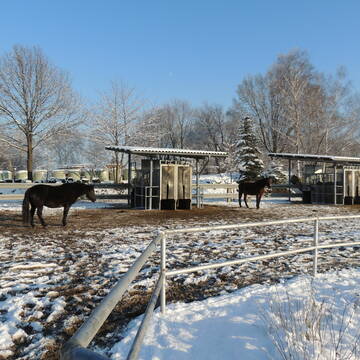
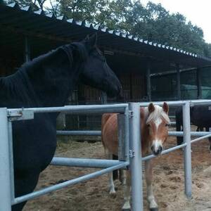
Pensionspferdebetrieb Less ?
Stelingen
Pensionspferdebetrieb-Less
@Pensionspferdebetrieb-Less
FN-Mitglied
Freizeitstall
Vermieten
Führanlage
Krankenbox
Außenbox mit Paddock
Außenboxen
24 weitere...
aktuell
P+
Deprecated: Creation of dynamic property Zend_View_Helper_Ads::$adLink is deprecated in /var/www/stall-frei/htdocs/staging.stall-frei.de/library/Psf/View/Helper/Ads.php on line 108

Job gesucht?
Mechtersen
STALL-FREIde Marketing
@STALL-FREI-Marketing
Sie suchen einen Job und arbeiten gerne mit Pferden oder auf Reitanlagen?
Besuchen Sie jetzt unseren Stellenmarkt!
Aktiv- u. Bewegungsstall mit Gastboxen
Garbsen / Stelingen
Rust-Heinfried
@Rust-Heinfried
FN-Mitglied
Freizeitstall
Krankenbox
Longierzirkel/Roundpen
Notfallboxen
Bewegungsstall
13 weitere...
P+


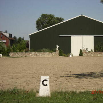
STALL - NEUBAU- REITHALLE 2023
Garbsen
Ebbecke Pferdepension
@Ebbecke
Pflegepferd
Vermieten
Longierzirkel/Roundpen
Paddock
Hufrehe geeignet
Pferdezucht
16 weitere...
P+


Reitstall Bremer - Ein Besuch lohnt sich!
Barsinghausen
Familie Wiedemann
@Familie_Wiedemann
Pferdeausbildung
Reitlehrer und -unterricht
Vermieten
Hunde willkommen
Krankenbox
Fohlenaufzucht möglich
Hengsthaltung möglich
20 weitere...
S
Leider kein Vorschaubild
Leider kein Vorschaubild
Pferdepension Papperitz
Langenhagen
Pferdepension Papperitz
@PferdepensionPapperitz
Westernreiten
Vermieten
Führanlage
Longierzirkel/Roundpen
Außenbox mit Paddock
Außenboxen
14 weitere...
P
Reithof- Leiseberg
Langenhagen
Pina-Sorighe-Leiseberg
@Pina-Sorighe-Leiseberg
Freizeitstall
Longierzirkel/Roundpen
Paddock
Außenbox mit Paddock
Innenbox
Halbpension
8 weitere...
P

Pferdebox, aktuell auch für Rehepferde
Langenhagen
Frank-S
@Frank-S
Freizeitstall
Vermieten
Hunde willkommen
Paddock
Hufrehe geeignet
8 weitere...
P

Frisches Stroh zu verkaufen!
Mechtersen
STALL-FREIde Marketing
@STALL-FREI-Marketing
Kaufe frisches Stroh für dein Pferd!

Pferdeboxen zu vermieten
Langenhagen
Pensionsstall Mürau-Balke
@Eric
Freizeitstall
Vermieten
Hunde willkommen
Longierzirkel/Roundpen
Fohlenaufzucht möglich
Hufrehe geeignet
13 weitere...
P


Hof Körber
Garbsen
Koerber
@Koerber
FN-Mitglied
Freizeitstall
Vermieten
Verpachten
Hunde willkommen
Krankenbox
Fohlenaufzucht möglich
Hufrehe geeignet
30 weitere...
P+

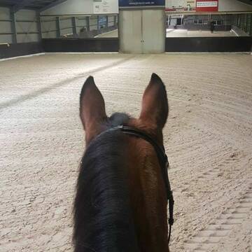
Paddock- und Innenboxen und 2 Offenställe
Garbsen
Laurien`s Hof
@Laurien
Hunde willkommen
Longierzirkel/Roundpen
Notfallboxen
Außenbox mit Paddock
Bewegungsstall
Schauer-Bewegungsstall
9 weitere...
aktuell
P
Deprecated: Creation of dynamic property Zend_View::$pageCount is deprecated in /var/www/stall-frei/htdocs/staging.stall-frei.de/library/vendor/shardj/zf1-future/library/Zend/View/Abstract.php on line 308
Deprecated: Creation of dynamic property Zend_View::$itemCountPerPage is deprecated in /var/www/stall-frei/htdocs/staging.stall-frei.de/library/vendor/shardj/zf1-future/library/Zend/View/Abstract.php on line 308
Deprecated: Creation of dynamic property Zend_View::$first is deprecated in /var/www/stall-frei/htdocs/staging.stall-frei.de/library/vendor/shardj/zf1-future/library/Zend/View/Abstract.php on line 308
Deprecated: Creation of dynamic property Zend_View::$current is deprecated in /var/www/stall-frei/htdocs/staging.stall-frei.de/library/vendor/shardj/zf1-future/library/Zend/View/Abstract.php on line 308
Deprecated: Creation of dynamic property Zend_View::$last is deprecated in /var/www/stall-frei/htdocs/staging.stall-frei.de/library/vendor/shardj/zf1-future/library/Zend/View/Abstract.php on line 308
Deprecated: Creation of dynamic property Zend_View::$next is deprecated in /var/www/stall-frei/htdocs/staging.stall-frei.de/library/vendor/shardj/zf1-future/library/Zend/View/Abstract.php on line 308
Deprecated: Creation of dynamic property Zend_View::$pagesInRange is deprecated in /var/www/stall-frei/htdocs/staging.stall-frei.de/library/vendor/shardj/zf1-future/library/Zend/View/Abstract.php on line 308
Deprecated: Creation of dynamic property Zend_View::$firstPageInRange is deprecated in /var/www/stall-frei/htdocs/staging.stall-frei.de/library/vendor/shardj/zf1-future/library/Zend/View/Abstract.php on line 308
Deprecated: Creation of dynamic property Zend_View::$lastPageInRange is deprecated in /var/www/stall-frei/htdocs/staging.stall-frei.de/library/vendor/shardj/zf1-future/library/Zend/View/Abstract.php on line 308
Deprecated: Creation of dynamic property Zend_View::$currentItemCount is deprecated in /var/www/stall-frei/htdocs/staging.stall-frei.de/library/vendor/shardj/zf1-future/library/Zend/View/Abstract.php on line 308
Deprecated: Creation of dynamic property Zend_View::$totalItemCount is deprecated in /var/www/stall-frei/htdocs/staging.stall-frei.de/library/vendor/shardj/zf1-future/library/Zend/View/Abstract.php on line 308
Deprecated: Creation of dynamic property Zend_View::$firstItemNumber is deprecated in /var/www/stall-frei/htdocs/staging.stall-frei.de/library/vendor/shardj/zf1-future/library/Zend/View/Abstract.php on line 308
Deprecated: Creation of dynamic property Zend_View::$lastItemNumber is deprecated in /var/www/stall-frei/htdocs/staging.stall-frei.de/library/vendor/shardj/zf1-future/library/Zend/View/Abstract.php on line 308
Deprecated: Creation of dynamic property Zend_View::$router is deprecated in /var/www/stall-frei/htdocs/staging.stall-frei.de/library/vendor/shardj/zf1-future/library/Zend/View/Abstract.php on line 308
Deprecated: Creation of dynamic property Zend_View::$urlParams is deprecated in /var/www/stall-frei/htdocs/staging.stall-frei.de/library/vendor/shardj/zf1-future/library/Zend/View/Abstract.php on line 308
Deprecated: Creation of dynamic property Zend_View::$showAds is deprecated in /var/www/stall-frei/htdocs/staging.stall-frei.de/library/vendor/shardj/zf1-future/library/Zend/View/Abstract.php on line 308
Deprecated: Creation of dynamic property Zend_View::$objectIds is deprecated in /var/www/stall-frei/htdocs/staging.stall-frei.de/library/vendor/shardj/zf1-future/library/Zend/View/Abstract.php on line 308
Deprecated: Creation of dynamic property Zend_View::$showNavbar is deprecated in /var/www/stall-frei/htdocs/staging.stall-frei.de/library/vendor/shardj/zf1-future/library/Zend/View/Abstract.php on line 308
Deprecated: Creation of dynamic property Zend_View::$showBreadcrumb is deprecated in /var/www/stall-frei/htdocs/staging.stall-frei.de/library/vendor/shardj/zf1-future/library/Zend/View/Abstract.php on line 308
Deprecated: Creation of dynamic property Zend_View::$showFooter is deprecated in /var/www/stall-frei/htdocs/staging.stall-frei.de/library/vendor/shardj/zf1-future/library/Zend/View/Abstract.php on line 308
Deprecated: Creation of dynamic property Zend_View::$showInternalAds is deprecated in /var/www/stall-frei/htdocs/staging.stall-frei.de/library/vendor/shardj/zf1-future/library/Zend/View/Abstract.php on line 308
Deprecated: Creation of dynamic property Zend_View::$blNoContent is deprecated in /var/www/stall-frei/htdocs/staging.stall-frei.de/library/vendor/shardj/zf1-future/library/Zend/View/Abstract.php on line 308
Deprecated: Creation of dynamic property Zend_View::$sMetaDesc is deprecated in /var/www/stall-frei/htdocs/staging.stall-frei.de/library/vendor/shardj/zf1-future/library/Zend/View/Abstract.php on line 308
Deprecated: Creation of dynamic property Zend_View::$useGmaps is deprecated in /var/www/stall-frei/htdocs/staging.stall-frei.de/library/vendor/shardj/zf1-future/library/Zend/View/Abstract.php on line 308
Deprecated: Creation of dynamic property Zend_View::$touches is deprecated in /var/www/stall-frei/htdocs/staging.stall-frei.de/library/vendor/shardj/zf1-future/library/Zend/View/Abstract.php on line 308
Deprecated: Creation of dynamic property Zend_View::$oProject is deprecated in /var/www/stall-frei/htdocs/staging.stall-frei.de/library/vendor/shardj/zf1-future/library/Zend/View/Abstract.php on line 308
Deprecated: Creation of dynamic property Zend_View::$pageHeadline is deprecated in /var/www/stall-frei/htdocs/staging.stall-frei.de/library/vendor/shardj/zf1-future/library/Zend/View/Abstract.php on line 308
Deprecated: Creation of dynamic property Zend_View::$disableLocationField is deprecated in /var/www/stall-frei/htdocs/staging.stall-frei.de/library/vendor/shardj/zf1-future/library/Zend/View/Abstract.php on line 308
Deprecated: Creation of dynamic property Zend_View::$isSearch is deprecated in /var/www/stall-frei/htdocs/staging.stall-frei.de/library/vendor/shardj/zf1-future/library/Zend/View/Abstract.php on line 308
Deprecated: Creation of dynamic property Zend_View::$pageTitle is deprecated in /var/www/stall-frei/htdocs/staging.stall-frei.de/library/vendor/shardj/zf1-future/library/Zend/View/Abstract.php on line 308
Deprecated: Creation of dynamic property Psf_Form_Element_Text::$class is deprecated in /var/www/stall-frei/htdocs/staging.stall-frei.de/library/vendor/shardj/zf1-future/library/Zend/Form/Element.php on line 874
Deprecated: Creation of dynamic property Psf_Form_Element_Text::$size is deprecated in /var/www/stall-frei/htdocs/staging.stall-frei.de/library/vendor/shardj/zf1-future/library/Zend/Form/Element.php on line 874
Deprecated: Creation of dynamic property Psf_Form_Element_Text::$placeholder is deprecated in /var/www/stall-frei/htdocs/staging.stall-frei.de/library/vendor/shardj/zf1-future/library/Zend/Form/Element.php on line 874
Deprecated: Creation of dynamic property Psf_Form_Element_Hidden::$class is deprecated in /var/www/stall-frei/htdocs/staging.stall-frei.de/library/vendor/shardj/zf1-future/library/Zend/Form/Element.php on line 874
Deprecated: Creation of dynamic property Psf_Form_Element_Hidden::$class is deprecated in /var/www/stall-frei/htdocs/staging.stall-frei.de/library/vendor/shardj/zf1-future/library/Zend/Form/Element.php on line 874
Deprecated: Creation of dynamic property Psf_Form_Element_Hidden::$class is deprecated in /var/www/stall-frei/htdocs/staging.stall-frei.de/library/vendor/shardj/zf1-future/library/Zend/Form/Element.php on line 874
Deprecated: Creation of dynamic property Psf_Form_Element_Hidden::$class is deprecated in /var/www/stall-frei/htdocs/staging.stall-frei.de/library/vendor/shardj/zf1-future/library/Zend/Form/Element.php on line 874
Deprecated: Creation of dynamic property Psf_Form_Element_Select::$class is deprecated in /var/www/stall-frei/htdocs/staging.stall-frei.de/library/vendor/shardj/zf1-future/library/Zend/Form/Element.php on line 874
Deprecated: Creation of dynamic property Psf_Form_Element_Select::$class is deprecated in /var/www/stall-frei/htdocs/staging.stall-frei.de/library/vendor/shardj/zf1-future/library/Zend/Form/Element.php on line 874
Deprecated: Creation of dynamic property Psf_Form_Element_Select::$class is deprecated in /var/www/stall-frei/htdocs/staging.stall-frei.de/library/vendor/shardj/zf1-future/library/Zend/Form/Element.php on line 874
Deprecated: Creation of dynamic property Psf_Form_Element_Select::$class is deprecated in /var/www/stall-frei/htdocs/staging.stall-frei.de/library/vendor/shardj/zf1-future/library/Zend/Form/Element.php on line 874
Deprecated: Creation of dynamic property Psf_Form_Element_Text::$class is deprecated in /var/www/stall-frei/htdocs/staging.stall-frei.de/library/vendor/shardj/zf1-future/library/Zend/Form/Element.php on line 874
Deprecated: Creation of dynamic property Psf_Form_Element_Checkbox::$label is deprecated in /var/www/stall-frei/htdocs/staging.stall-frei.de/library/vendor/shardj/zf1-future/library/Zend/Form/Element.php on line 874
Deprecated: Creation of dynamic property Zend_View::$sort is deprecated in /var/www/stall-frei/htdocs/staging.stall-frei.de/library/vendor/shardj/zf1-future/library/Zend/View/Abstract.php on line 308
Deprecated: Creation of dynamic property Zend_View::$searchLocation is deprecated in /var/www/stall-frei/htdocs/staging.stall-frei.de/library/vendor/shardj/zf1-future/library/Zend/View/Abstract.php on line 308
Deprecated: Creation of dynamic property Zend_View::$locationHint is deprecated in /var/www/stall-frei/htdocs/staging.stall-frei.de/library/vendor/shardj/zf1-future/library/Zend/View/Abstract.php on line 308
Psf_GeoCoder_Abstract::getLocation: Schulenburg Get Location CachedOrLive
Psf_GeoCoder_Abstract::getCachedOrLive: Schulenburg
Psf_GeoCoder_OpenCageData::makeApiRequest: response:
Array
(
[documentation] => https://opencagedata.com/api
[licenses] => Array
(
[0] => Array
(
[name] => see attribution guide
[url] => https://opencagedata.com/credits
)
)
[results] => Array
(
[0] => Array
(
[bounds] => Array
(
[northeast] => Array
(
[lat] => 52.4754291
[lng] => 9.6869972
)
[southwest] => Array
(
[lat] => 52.4307662
[lng] => 9.6589418
)
)
[components] => Array
(
[ISO_3166-1_alpha-2] => DE
[ISO_3166-1_alpha-3] => DEU
[ISO_3166-2] => Array
(
[0] => DE-NI
)
[_category] => place
[_normalized_city] => Langenhagen
[_type] => village
[continent] => Europe
[country] => Deutschland
[country_code] => de
[county] => Region Hannover
[political_union] => European Union
[state] => Niedersachsen
[state_code] => NI
[town] => Langenhagen
[village] => Schulenburg
)
[confidence] => 7
[formatted] => Schulenburg, Niedersachsen, Deutschland
[geometry] => Array
(
[lat] => 52.4419685
[lng] => 9.6734712
)
)
[1] => Array
(
[bounds] => Array
(
[northeast] => Array
(
[lat] => 53.927636
[lng] => 9.5352973
)
[southwest] => Array
(
[lat] => 53.887636
[lng] => 9.4952973
)
)
[components] => Array
(
[ISO_3166-1_alpha-2] => DE
[ISO_3166-1_alpha-3] => DEU
[ISO_3166-2] => Array
(
[0] => DE-SH
)
[_category] => place
[_normalized_city] => Itzehoe
[_type] => village
[continent] => Europe
[country] => Deutschland
[country_code] => de
[county] => Kreis Steinburg
[political_union] => European Union
[postcode] => 25524
[state] => Schleswig-Holstein
[state_code] => SH
[town] => Itzehoe
[village] => Schulenburg
)
[confidence] => 7
[formatted] => 25524 Schulenburg, Deutschland
[geometry] => Array
(
[lat] => 53.907636
[lng] => 9.5152973
)
)
[2] => Array
(
[bounds] => Array
(
[northeast] => Array
(
[lat] => 53.7784719
[lng] => 10.447759
)
[southwest] => Array
(
[lat] => 53.7384719
[lng] => 10.407759
)
)
[components] => Array
(
[ISO_3166-1_alpha-2] => DE
[ISO_3166-1_alpha-3] => DEU
[ISO_3166-2] => Array
(
[0] => DE-SH
)
[_category] => place
[_normalized_city] => Pölitz
[_type] => hamlet
[city] => Pölitz
[continent] => Europe
[country] => Deutschland
[country_code] => de
[county] => Kreis Stormarn
[hamlet] => Schulenburg
[municipality] => Bad Oldesloe-Land
[political_union] => European Union
[postcode] => 23847
[state] => Schleswig-Holstein
[state_code] => SH
)
[confidence] => 7
[formatted] => Schulenburg, 23847 Pölitz, Deutschland
[geometry] => Array
(
[lat] => 53.7584719
[lng] => 10.427759
)
)
[3] => Array
(
[bounds] => Array
(
[northeast] => Array
(
[lat] => 53.5203079
[lng] => 7.2549722
)
[southwest] => Array
(
[lat] => 53.5189451
[lng] => 7.2517464
)
)
[components] => Array
(
[ISO_3166-1_alpha-2] => DE
[ISO_3166-1_alpha-3] => DEU
[ISO_3166-2] => Array
(
[0] => DE-NI
)
[_category] => agriculture
[_normalized_city] => Upgant-Schott
[_type] => farmland
[continent] => Europe
[country] => Deutschland
[country_code] => de
[county] => Landkreis Aurich
[farmland] => Schulenburg
[municipality] => Samtgemeinde Brookmerland
[political_union] => European Union
[postcode] => 26529
[state] => Niedersachsen
[state_code] => NI
[town] => Upgant-Schott
[village] => Upgant-Schott
)
[confidence] => 9
[formatted] => Schulenburg, 26529 Upgant-Schott, Deutschland
[geometry] => Array
(
[lat] => 53.5194604
[lng] => 7.2533568
)
)
[4] => Array
(
[bounds] => Array
(
[northeast] => Array
(
[lat] => 51.8275584
[lng] => 9.2137919
)
[southwest] => Array
(
[lat] => 51.8264611
[lng] => 9.2129374
)
)
[components] => Array
(
[ISO_3166-1_alpha-2] => DE
[ISO_3166-1_alpha-3] => DEU
[ISO_3166-2] => Array
(
[0] => DE-NW
)
[_category] => place
[_normalized_city] => Vörden
[_type] => neighbourhood
[continent] => Europe
[country] => Deutschland
[country_code] => de
[county] => Kreis Höxter
[municipality] => Marienmünster
[political_union] => European Union
[postcode] => 37696
[residential] => Schulenburg
[state] => Nordrhein-Westfalen
[state_code] => NW
[town] => Vörden
)
[confidence] => 9
[formatted] => 37696 Vörden, Deutschland
[geometry] => Array
(
[lat] => 51.8268714
[lng] => 9.2132662
)
)
[5] => Array
(
[bounds] => Array
(
[northeast] => Array
(
[lat] => 53.9090686
[lng] => 9.5194507
)
[southwest] => Array
(
[lat] => 53.9061996
[lng] => 9.5062845
)
)
[components] => Array
(
[ISO_3166-1_alpha-2] => DE
[ISO_3166-1_alpha-3] => DEU
[ISO_3166-2] => Array
(
[0] => DE-SH
)
[_category] => road
[_normalized_city] => Itzehoe
[_type] => road
[continent] => Europe
[country] => Deutschland
[country_code] => de
[county] => Kreis Steinburg
[political_union] => European Union
[postcode] => 25524
[road] => Schulenburg
[road_type] => residential
[state] => Schleswig-Holstein
[state_code] => SH
[suburb] => Wellenkamp
[town] => Itzehoe
[village] => Schulenburg
)
[confidence] => 9
[formatted] => Schulenburg, 25524 Schulenburg, Deutschland
[geometry] => Array
(
[lat] => 53.9068896
[lng] => 9.5127694
)
)
[6] => Array
(
[bounds] => Array
(
[northeast] => Array
(
[lat] => 52.6280549
[lng] => 7.9803628
)
[southwest] => Array
(
[lat] => 52.6252935
[lng] => 7.9777231
)
)
[components] => Array
(
[ISO_3166-1_alpha-2] => DE
[ISO_3166-1_alpha-3] => DEU
[ISO_3166-2] => Array
(
[0] => DE-NI
)
[_category] => road
[_normalized_city] => Badbergen
[_type] => road
[continent] => Europe
[country] => Deutschland
[country_code] => de
[county] => Landkreis Osnabrück
[municipality] => Samtgemeinde Artland
[political_union] => European Union
[postcode] => 49635
[road] => Schulenburg
[road_type] => track
[state] => Niedersachsen
[state_code] => NI
[village] => Badbergen
)
[confidence] => 9
[formatted] => Schulenburg, 49635 Badbergen, Deutschland
[geometry] => Array
(
[lat] => 52.6266917
[lng] => 7.9790607
)
)
[7] => Array
(
[bounds] => Array
(
[northeast] => Array
(
[lat] => 51.7838585
[lng] => 10.06614
)
[southwest] => Array
(
[lat] => 51.7819275
[lng] => 10.0658253
)
)
[components] => Array
(
[ISO_3166-1_alpha-2] => DE
[ISO_3166-1_alpha-3] => DEU
[ISO_3166-2] => Array
(
[0] => DE-NI
)
[_category] => road
[_normalized_city] => Kalefeld
[_type] => road
[city] => Kalefeld
[continent] => Europe
[country] => Deutschland
[country_code] => de
[county] => Landkreis Northeim
[political_union] => European Union
[postcode] => 37589
[road] => Schulenburg
[road_type] => residential
[state] => Niedersachsen
[state_code] => NI
)
[confidence] => 9
[formatted] => Schulenburg, 37589 Kalefeld, Deutschland
[geometry] => Array
(
[lat] => 51.7828489
[lng] => 10.065921
)
)
[8] => Array
(
[bounds] => Array
(
[northeast] => Array
(
[lat] => 51.8277365
[lng] => 9.2178801
)
[southwest] => Array
(
[lat] => 51.8261455
[lng] => 9.2134281
)
)
[components] => Array
(
[ISO_3166-1_alpha-2] => DE
[ISO_3166-1_alpha-3] => DEU
[ISO_3166-2] => Array
(
[0] => DE-NW
)
[_category] => road
[_normalized_city] => Vörden
[_type] => road
[continent] => Europe
[country] => Deutschland
[country_code] => de
[county] => Kreis Höxter
[municipality] => Marienmünster
[political_union] => European Union
[postcode] => 37696
[residential] => Schulenburg
[road] => Schulenburg
[road_type] => service
[state] => Nordrhein-Westfalen
[state_code] => NW
[town] => Vörden
)
[confidence] => 9
[formatted] => Schulenburg, 37696 Vörden, Deutschland
[geometry] => Array
(
[lat] => 51.8275808
[lng] => 9.2149559
)
)
[9] => Array
(
[components] => Array
(
[ISO_3166-1_alpha-2] => FR
[ISO_3166-1_alpha-3] => FRA
[ISO_3166-2] => Array
(
[0] => FR-IDF
[1] => FR-92
)
[_category] => road
[_normalized_city] => Levallois-Perret
[_type] => road
[city] => Levallois-Perret
[continent] => Europe
[country] => France
[country_code] => fr
[county] => Hauts-de-Seine
[local_authority] => Métropole du Grand Paris
[political_union] => European Union
[postcode] => 92300
[road] => Rue Charles Deutschmann
[state] => Île-de-France
[state_code] => IDF
)
[confidence] => 3
[formatted] => Rue Charles Deutschmann, 92300 Levallois-Perret, France
[geometry] => Array
(
[lat] => 48.900049
[lng] => 2.2842
)
)
)
[status] => Array
(
[code] => 200
[message] => OK
)
[stay_informed] => Array
(
[blog] => https://blog.opencagedata.com
[mastodon] => https://en.osm.town/@opencage
)
[thanks] => For using an OpenCage API
[timestamp] => Array
(
[created_http] => Sun, 08 Feb 2026 09:58:50 GMT
[created_unix] => 1770544730
)
[total_results] => 10
)
Psf_GeoCoder_Abstract::convertLocationResult
{"documentation":"https:\/\/opencagedata.com\/api","licenses":[{"name":"see attribution guide","url":"https:\/\/opencagedata.com\/credits"}],"results":[{"bounds":{"northeast":{"lat":52.4754291,"lng":9.6869972},"southwest":{"lat":52.4307662,"lng":9.6589418}},"components":{"ISO_3166-1_alpha-2":"DE","ISO_3166-1_alpha-3":"DEU","ISO_3166-2":["DE-NI"],"_category":"place","_normalized_city":"Langenhagen","_type":"village","continent":"Europe","country":"Deutschland","country_code":"de","county":"Region Hannover","political_union":"European Union","state":"Niedersachsen","state_code":"NI","town":"Langenhagen","village":"Schulenburg"},"confidence":7,"formatted":"Schulenburg, Niedersachsen, Deutschland","geometry":{"lat":52.4419685,"lng":9.6734712}},{"bounds":{"northeast":{"lat":53.927636,"lng":9.5352973},"southwest":{"lat":53.887636,"lng":9.4952973}},"components":{"ISO_3166-1_alpha-2":"DE","ISO_3166-1_alpha-3":"DEU","ISO_3166-2":["DE-SH"],"_category":"place","_normalized_city":"Itzehoe","_type":"village","continent":"Europe","country":"Deutschland","country_code":"de","county":"Kreis Steinburg","political_union":"European Union","postcode":"25524","state":"Schleswig-Holstein","state_code":"SH","town":"Itzehoe","village":"Schulenburg"},"confidence":7,"formatted":"25524 Schulenburg, Deutschland","geometry":{"lat":53.907636,"lng":9.5152973}},{"bounds":{"northeast":{"lat":53.7784719,"lng":10.447759},"southwest":{"lat":53.7384719,"lng":10.407759}},"components":{"ISO_3166-1_alpha-2":"DE","ISO_3166-1_alpha-3":"DEU","ISO_3166-2":["DE-SH"],"_category":"place","_normalized_city":"P\u00f6litz","_type":"hamlet","city":"P\u00f6litz","continent":"Europe","country":"Deutschland","country_code":"de","county":"Kreis Stormarn","hamlet":"Schulenburg","municipality":"Bad Oldesloe-Land","political_union":"European Union","postcode":"23847","state":"Schleswig-Holstein","state_code":"SH"},"confidence":7,"formatted":"Schulenburg, 23847 P\u00f6litz, Deutschland","geometry":{"lat":53.7584719,"lng":10.427759}},{"bounds":{"northeast":{"lat":53.5203079,"lng":7.2549722},"southwest":{"lat":53.5189451,"lng":7.2517464}},"components":{"ISO_3166-1_alpha-2":"DE","ISO_3166-1_alpha-3":"DEU","ISO_3166-2":["DE-NI"],"_category":"agriculture","_normalized_city":"Upgant-Schott","_type":"farmland","continent":"Europe","country":"Deutschland","country_code":"de","county":"Landkreis Aurich","farmland":"Schulenburg","municipality":"Samtgemeinde Brookmerland","political_union":"European Union","postcode":"26529","state":"Niedersachsen","state_code":"NI","town":"Upgant-Schott","village":"Upgant-Schott"},"confidence":9,"formatted":"Schulenburg, 26529 Upgant-Schott, Deutschland","geometry":{"lat":53.5194604,"lng":7.2533568}},{"bounds":{"northeast":{"lat":51.8275584,"lng":9.2137919},"southwest":{"lat":51.8264611,"lng":9.2129374}},"components":{"ISO_3166-1_alpha-2":"DE","ISO_3166-1_alpha-3":"DEU","ISO_3166-2":["DE-NW"],"_category":"place","_normalized_city":"V\u00f6rden","_type":"neighbourhood","continent":"Europe","country":"Deutschland","country_code":"de","county":"Kreis H\u00f6xter","municipality":"Marienm\u00fcnster","political_union":"European Union","postcode":"37696","residential":"Schulenburg","state":"Nordrhein-Westfalen","state_code":"NW","town":"V\u00f6rden"},"confidence":9,"formatted":"37696 V\u00f6rden, Deutschland","geometry":{"lat":51.8268714,"lng":9.2132662}},{"bounds":{"northeast":{"lat":53.9090686,"lng":9.5194507},"southwest":{"lat":53.9061996,"lng":9.5062845}},"components":{"ISO_3166-1_alpha-2":"DE","ISO_3166-1_alpha-3":"DEU","ISO_3166-2":["DE-SH"],"_category":"road","_normalized_city":"Itzehoe","_type":"road","continent":"Europe","country":"Deutschland","country_code":"de","county":"Kreis Steinburg","political_union":"European Union","postcode":"25524","road":"Schulenburg","road_type":"residential","state":"Schleswig-Holstein","state_code":"SH","suburb":"Wellenkamp","town":"Itzehoe","village":"Schulenburg"},"confidence":9,"formatted":"Schulenburg, 25524 Schulenburg, Deutschland","geometry":{"lat":53.9068896,"lng":9.5127694}},{"bounds":{"northeast":{"lat":52.6280549,"lng":7.9803628},"southwest":{"lat":52.6252935,"lng":7.9777231}},"components":{"ISO_3166-1_alpha-2":"DE","ISO_3166-1_alpha-3":"DEU","ISO_3166-2":["DE-NI"],"_category":"road","_normalized_city":"Badbergen","_type":"road","continent":"Europe","country":"Deutschland","country_code":"de","county":"Landkreis Osnabr\u00fcck","municipality":"Samtgemeinde Artland","political_union":"European Union","postcode":"49635","road":"Schulenburg","road_type":"track","state":"Niedersachsen","state_code":"NI","village":"Badbergen"},"confidence":9,"formatted":"Schulenburg, 49635 Badbergen, Deutschland","geometry":{"lat":52.6266917,"lng":7.9790607}},{"bounds":{"northeast":{"lat":51.7838585,"lng":10.06614},"southwest":{"lat":51.7819275,"lng":10.0658253}},"components":{"ISO_3166-1_alpha-2":"DE","ISO_3166-1_alpha-3":"DEU","ISO_3166-2":["DE-NI"],"_category":"road","_normalized_city":"Kalefeld","_type":"road","city":"Kalefeld","continent":"Europe","country":"Deutschland","country_code":"de","county":"Landkreis Northeim","political_union":"European Union","postcode":"37589","road":"Schulenburg","road_type":"residential","state":"Niedersachsen","state_code":"NI"},"confidence":9,"formatted":"Schulenburg, 37589 Kalefeld, Deutschland","geometry":{"lat":51.7828489,"lng":10.065921}},{"bounds":{"northeast":{"lat":51.8277365,"lng":9.2178801},"southwest":{"lat":51.8261455,"lng":9.2134281}},"components":{"ISO_3166-1_alpha-2":"DE","ISO_3166-1_alpha-3":"DEU","ISO_3166-2":["DE-NW"],"_category":"road","_normalized_city":"V\u00f6rden","_type":"road","continent":"Europe","country":"Deutschland","country_code":"de","county":"Kreis H\u00f6xter","municipality":"Marienm\u00fcnster","political_union":"European Union","postcode":"37696","residential":"Schulenburg","road":"Schulenburg","road_type":"service","state":"Nordrhein-Westfalen","state_code":"NW","town":"V\u00f6rden"},"confidence":9,"formatted":"Schulenburg, 37696 V\u00f6rden, Deutschland","geometry":{"lat":51.8275808,"lng":9.2149559}},{"components":{"ISO_3166-1_alpha-2":"FR","ISO_3166-1_alpha-3":"FRA","ISO_3166-2":["FR-IDF","FR-92"],"_category":"road","_normalized_city":"Levallois-Perret","_type":"road","city":"Levallois-Perret","continent":"Europe","country":"France","country_code":"fr","county":"Hauts-de-Seine","local_authority":"M\u00e9tropole du Grand Paris","political_union":"European Union","postcode":"92300","road":"Rue Charles Deutschmann","state":"\u00cele-de-France","state_code":"IDF"},"confidence":3,"formatted":"Rue Charles Deutschmann, 92300 Levallois-Perret, France","geometry":{"lat":48.900049,"lng":2.2842}}],"status":{"code":200,"message":"OK"},"stay_informed":{"blog":"https:\/\/blog.opencagedata.com","mastodon":"https:\/\/en.osm.town\/@opencage"},"thanks":"For using an OpenCage API","timestamp":{"created_http":"Sun, 08 Feb 2026 09:58:50 GMT","created_unix":1770544730},"total_results":10}Array
(
[0] => stdClass Object
(
[bounds] => stdClass Object
(
[northeast] => stdClass Object
(
[lat] => 52.4754291
[lng] => 9.6869972
)
[southwest] => stdClass Object
(
[lat] => 52.4307662
[lng] => 9.6589418
)
)
[components] => stdClass Object
(
[ISO_3166-1_alpha-2] => DE
[ISO_3166-1_alpha-3] => DEU
[ISO_3166-2] => Array
(
[0] => DE-NI
)
[_category] => place
[_normalized_city] => Langenhagen
[_type] => village
[continent] => Europe
[country] => Deutschland
[country_code] => de
[county] => Region Hannover
[political_union] => European Union
[state] => Niedersachsen
[state_code] => NI
[town] => Langenhagen
[village] => Schulenburg
)
[confidence] => 7
[formatted] => Schulenburg, Niedersachsen, Deutschland
[geometry] => stdClass Object
(
[lat] => 52.4419685
[lng] => 9.6734712
)
)
[1] => stdClass Object
(
[bounds] => stdClass Object
(
[northeast] => stdClass Object
(
[lat] => 53.927636
[lng] => 9.5352973
)
[southwest] => stdClass Object
(
[lat] => 53.887636
[lng] => 9.4952973
)
)
[components] => stdClass Object
(
[ISO_3166-1_alpha-2] => DE
[ISO_3166-1_alpha-3] => DEU
[ISO_3166-2] => Array
(
[0] => DE-SH
)
[_category] => place
[_normalized_city] => Itzehoe
[_type] => village
[continent] => Europe
[country] => Deutschland
[country_code] => de
[county] => Kreis Steinburg
[political_union] => European Union
[postcode] => 25524
[state] => Schleswig-Holstein
[state_code] => SH
[town] => Itzehoe
[village] => Schulenburg
)
[confidence] => 7
[formatted] => 25524 Schulenburg, Deutschland
[geometry] => stdClass Object
(
[lat] => 53.907636
[lng] => 9.5152973
)
)
[2] => stdClass Object
(
[bounds] => stdClass Object
(
[northeast] => stdClass Object
(
[lat] => 53.7784719
[lng] => 10.447759
)
[southwest] => stdClass Object
(
[lat] => 53.7384719
[lng] => 10.407759
)
)
[components] => stdClass Object
(
[ISO_3166-1_alpha-2] => DE
[ISO_3166-1_alpha-3] => DEU
[ISO_3166-2] => Array
(
[0] => DE-SH
)
[_category] => place
[_normalized_city] => Pölitz
[_type] => hamlet
[city] => Pölitz
[continent] => Europe
[country] => Deutschland
[country_code] => de
[county] => Kreis Stormarn
[hamlet] => Schulenburg
[municipality] => Bad Oldesloe-Land
[political_union] => European Union
[postcode] => 23847
[state] => Schleswig-Holstein
[state_code] => SH
)
[confidence] => 7
[formatted] => Schulenburg, 23847 Pölitz, Deutschland
[geometry] => stdClass Object
(
[lat] => 53.7584719
[lng] => 10.427759
)
)
[3] => stdClass Object
(
[bounds] => stdClass Object
(
[northeast] => stdClass Object
(
[lat] => 53.5203079
[lng] => 7.2549722
)
[southwest] => stdClass Object
(
[lat] => 53.5189451
[lng] => 7.2517464
)
)
[components] => stdClass Object
(
[ISO_3166-1_alpha-2] => DE
[ISO_3166-1_alpha-3] => DEU
[ISO_3166-2] => Array
(
[0] => DE-NI
)
[_category] => agriculture
[_normalized_city] => Upgant-Schott
[_type] => farmland
[continent] => Europe
[country] => Deutschland
[country_code] => de
[county] => Landkreis Aurich
[farmland] => Schulenburg
[municipality] => Samtgemeinde Brookmerland
[political_union] => European Union
[postcode] => 26529
[state] => Niedersachsen
[state_code] => NI
[town] => Upgant-Schott
[village] => Upgant-Schott
)
[confidence] => 9
[formatted] => Schulenburg, 26529 Upgant-Schott, Deutschland
[geometry] => stdClass Object
(
[lat] => 53.5194604
[lng] => 7.2533568
)
)
[4] => stdClass Object
(
[bounds] => stdClass Object
(
[northeast] => stdClass Object
(
[lat] => 51.8275584
[lng] => 9.2137919
)
[southwest] => stdClass Object
(
[lat] => 51.8264611
[lng] => 9.2129374
)
)
[components] => stdClass Object
(
[ISO_3166-1_alpha-2] => DE
[ISO_3166-1_alpha-3] => DEU
[ISO_3166-2] => Array
(
[0] => DE-NW
)
[_category] => place
[_normalized_city] => Vörden
[_type] => neighbourhood
[continent] => Europe
[country] => Deutschland
[country_code] => de
[county] => Kreis Höxter
[municipality] => Marienmünster
[political_union] => European Union
[postcode] => 37696
[residential] => Schulenburg
[state] => Nordrhein-Westfalen
[state_code] => NW
[town] => Vörden
)
[confidence] => 9
[formatted] => 37696 Vörden, Deutschland
[geometry] => stdClass Object
(
[lat] => 51.8268714
[lng] => 9.2132662
)
)
[5] => stdClass Object
(
[bounds] => stdClass Object
(
[northeast] => stdClass Object
(
[lat] => 53.9090686
[lng] => 9.5194507
)
[southwest] => stdClass Object
(
[lat] => 53.9061996
[lng] => 9.5062845
)
)
[components] => stdClass Object
(
[ISO_3166-1_alpha-2] => DE
[ISO_3166-1_alpha-3] => DEU
[ISO_3166-2] => Array
(
[0] => DE-SH
)
[_category] => road
[_normalized_city] => Itzehoe
[_type] => road
[continent] => Europe
[country] => Deutschland
[country_code] => de
[county] => Kreis Steinburg
[political_union] => European Union
[postcode] => 25524
[road] => Schulenburg
[road_type] => residential
[state] => Schleswig-Holstein
[state_code] => SH
[suburb] => Wellenkamp
[town] => Itzehoe
[village] => Schulenburg
)
[confidence] => 9
[formatted] => Schulenburg, 25524 Schulenburg, Deutschland
[geometry] => stdClass Object
(
[lat] => 53.9068896
[lng] => 9.5127694
)
)
[6] => stdClass Object
(
[bounds] => stdClass Object
(
[northeast] => stdClass Object
(
[lat] => 52.6280549
[lng] => 7.9803628
)
[southwest] => stdClass Object
(
[lat] => 52.6252935
[lng] => 7.9777231
)
)
[components] => stdClass Object
(
[ISO_3166-1_alpha-2] => DE
[ISO_3166-1_alpha-3] => DEU
[ISO_3166-2] => Array
(
[0] => DE-NI
)
[_category] => road
[_normalized_city] => Badbergen
[_type] => road
[continent] => Europe
[country] => Deutschland
[country_code] => de
[county] => Landkreis Osnabrück
[municipality] => Samtgemeinde Artland
[political_union] => European Union
[postcode] => 49635
[road] => Schulenburg
[road_type] => track
[state] => Niedersachsen
[state_code] => NI
[village] => Badbergen
)
[confidence] => 9
[formatted] => Schulenburg, 49635 Badbergen, Deutschland
[geometry] => stdClass Object
(
[lat] => 52.6266917
[lng] => 7.9790607
)
)
[7] => stdClass Object
(
[bounds] => stdClass Object
(
[northeast] => stdClass Object
(
[lat] => 51.7838585
[lng] => 10.06614
)
[southwest] => stdClass Object
(
[lat] => 51.7819275
[lng] => 10.0658253
)
)
[components] => stdClass Object
(
[ISO_3166-1_alpha-2] => DE
[ISO_3166-1_alpha-3] => DEU
[ISO_3166-2] => Array
(
[0] => DE-NI
)
[_category] => road
[_normalized_city] => Kalefeld
[_type] => road
[city] => Kalefeld
[continent] => Europe
[country] => Deutschland
[country_code] => de
[county] => Landkreis Northeim
[political_union] => European Union
[postcode] => 37589
[road] => Schulenburg
[road_type] => residential
[state] => Niedersachsen
[state_code] => NI
)
[confidence] => 9
[formatted] => Schulenburg, 37589 Kalefeld, Deutschland
[geometry] => stdClass Object
(
[lat] => 51.7828489
[lng] => 10.065921
)
)
[8] => stdClass Object
(
[bounds] => stdClass Object
(
[northeast] => stdClass Object
(
[lat] => 51.8277365
[lng] => 9.2178801
)
[southwest] => stdClass Object
(
[lat] => 51.8261455
[lng] => 9.2134281
)
)
[components] => stdClass Object
(
[ISO_3166-1_alpha-2] => DE
[ISO_3166-1_alpha-3] => DEU
[ISO_3166-2] => Array
(
[0] => DE-NW
)
[_category] => road
[_normalized_city] => Vörden
[_type] => road
[continent] => Europe
[country] => Deutschland
[country_code] => de
[county] => Kreis Höxter
[municipality] => Marienmünster
[political_union] => European Union
[postcode] => 37696
[residential] => Schulenburg
[road] => Schulenburg
[road_type] => service
[state] => Nordrhein-Westfalen
[state_code] => NW
[town] => Vörden
)
[confidence] => 9
[formatted] => Schulenburg, 37696 Vörden, Deutschland
[geometry] => stdClass Object
(
[lat] => 51.8275808
[lng] => 9.2149559
)
)
[9] => stdClass Object
(
[components] => stdClass Object
(
[ISO_3166-1_alpha-2] => FR
[ISO_3166-1_alpha-3] => FRA
[ISO_3166-2] => Array
(
[0] => FR-IDF
[1] => FR-92
)
[_category] => road
[_normalized_city] => Levallois-Perret
[_type] => road
[city] => Levallois-Perret
[continent] => Europe
[country] => France
[country_code] => fr
[county] => Hauts-de-Seine
[local_authority] => Métropole du Grand Paris
[political_union] => European Union
[postcode] => 92300
[road] => Rue Charles Deutschmann
[state] => Île-de-France
[state_code] => IDF
)
[confidence] => 3
[formatted] => Rue Charles Deutschmann, 92300 Levallois-Perret, France
[geometry] => stdClass Object
(
[lat] => 48.900049
[lng] => 2.2842
)
)
)
Psf_GeoCoder_OpenCageData::getKeyMap: 0
stdClass Object
(
    [bounds] => stdClass Object
        (
            [northeast] => stdClass Object
                (
                    [lat] => 52.4754291
                    [lng] => 9.6869972
                )

            [southwest] => stdClass Object
                (
                    [lat] => 52.4307662
                    [lng] => 9.6589418
                )

        )

    [components] => stdClass Object
        (
            [ISO_3166-1_alpha-2] => DE
            [ISO_3166-1_alpha-3] => DEU
            [ISO_3166-2] => Array
                (
                    [0] => DE-NI
                )

            [_category] => place
            [_normalized_city] => Langenhagen
            [_type] => village
            [continent] => Europe
            [country] => Deutschland
            [country_code] => de
            [county] => Region Hannover
            [political_union] => European Union
            [state] => Niedersachsen
            [state_code] => NI
            [town] => Langenhagen
            [village] => Schulenburg
        )

    [confidence] => 7
    [formatted] => Schulenburg, Niedersachsen, Deutschland
    [geometry] => stdClass Object
        (
            [lat] => 52.4419685
            [lng] => 9.6734712
        )

)
Psf_GeoCoder_OpenCageData::getCounty: Hannover
Psf_GeoCoder_OpenCageData::addMissingData REFETCH!
Array
(
    [address] => Schulenburg, Niedersachsen, Deutschland
    [type] => village
    [street] =>
    [city] => Langenhagen
    [county] => Hannover
    [state] => Niedersachsen
    [zip] =>
    [country] => Deutschland
    [suburb] =>
    [countrycode] => de
    [latitude] => 52.4419685
    [longitude] => 9.6734712
    [accuracy] => 1
    [confidence] => 7
    [bounds] => stdClass Object
        (
            [northeast] => stdClass Object
                (
                    [lat] => 52.4754291
                    [lng] => 9.6869972
                )

            [southwest] => stdClass Object
                (
                    [lat] => 52.4307662
                    [lng] => 9.6589418
                )

        )

)
reformat!
Array
(
    [address] => Langenhagen
    [type] => village
    [street] =>
    [city] => Langenhagen
    [county] => Hannover
    [state] => Niedersachsen
    [zip] =>
    [country] => Deutschland
    [suburb] =>
    [countrycode] => de
    [latitude] => 52.4419685
    [longitude] => 9.6734712
    [accuracy] => 1
    [confidence] => 7
    [bounds] => stdClass Object
        (
            [northeast] => stdClass Object
                (
                    [lat] => 52.4754291
                    [lng] => 9.6869972
                )

            [southwest] => stdClass Object
                (
                    [lat] => 52.4307662
                    [lng] => 9.6589418
                )

        )

    [place] => Langenhagen, Niedersachsen
    [hash] => a614ca43ca106756e10738e5527942b8
)
Psf_GeoCoder_OpenCageData::getKeyMap: 1
stdClass Object
(
    [bounds] => stdClass Object
        (
            [northeast] => stdClass Object
                (
                    [lat] => 53.927636
                    [lng] => 9.5352973
                )

            [southwest] => stdClass Object
                (
                    [lat] => 53.887636
                    [lng] => 9.4952973
                )

        )

    [components] => stdClass Object
        (
            [ISO_3166-1_alpha-2] => DE
            [ISO_3166-1_alpha-3] => DEU
            [ISO_3166-2] => Array
                (
                    [0] => DE-SH
                )

            [_category] => place
            [_normalized_city] => Itzehoe
            [_type] => village
            [continent] => Europe
            [country] => Deutschland
            [country_code] => de
            [county] => Kreis Steinburg
            [political_union] => European Union
            [postcode] => 25524
            [state] => Schleswig-Holstein
            [state_code] => SH
            [town] => Itzehoe
            [village] => Schulenburg
        )

    [confidence] => 7
    [formatted] => 25524 Schulenburg, Deutschland
    [geometry] => stdClass Object
        (
            [lat] => 53.907636
            [lng] => 9.5152973
        )

)
Psf_GeoCoder_OpenCageData::getCounty: Steinburg
Psf_GeoCoder_OpenCageData::addMissingData REFETCH!
Array
(
    [address] => 25524 Schulenburg, Deutschland
    [type] => village
    [street] =>
    [city] => Itzehoe
    [county] => Steinburg
    [state] => Schleswig-Holstein
    [zip] => 25524
    [country] => Deutschland
    [suburb] =>
    [countrycode] => de
    [latitude] => 53.907636
    [longitude] => 9.5152973
    [accuracy] => 1
    [confidence] => 7
    [bounds] => stdClass Object
        (
            [northeast] => stdClass Object
                (
                    [lat] => 53.927636
                    [lng] => 9.5352973
                )

            [southwest] => stdClass Object
                (
                    [lat] => 53.887636
                    [lng] => 9.4952973
                )

        )

)
reformat!
Array
(
    [address] => 25524 Itzehoe
    [type] => village
    [street] =>
    [city] => Itzehoe
    [county] => Steinburg
    [state] => Schleswig-Holstein
    [zip] => 25524
    [country] => Deutschland
    [suburb] =>
    [countrycode] => de
    [latitude] => 53.907636
    [longitude] => 9.5152973
    [accuracy] => 1
    [confidence] => 7
    [bounds] => stdClass Object
        (
            [northeast] => stdClass Object
                (
                    [lat] => 53.927636
                    [lng] => 9.5352973
                )

            [southwest] => stdClass Object
                (
                    [lat] => 53.887636
                    [lng] => 9.4952973
                )

        )

    [place] => 25524 Itzehoe, Schleswig-Holstein
    [hash] => 8aefd00b2f67bbfd4fc3a0ca1f8ab53c
)
Psf_GeoCoder_OpenCageData::getKeyMap: 2
stdClass Object
(
    [bounds] => stdClass Object
        (
            [northeast] => stdClass Object
                (
                    [lat] => 53.7784719
                    [lng] => 10.447759
                )

            [southwest] => stdClass Object
                (
                    [lat] => 53.7384719
                    [lng] => 10.407759
                )

        )

    [components] => stdClass Object
        (
            [ISO_3166-1_alpha-2] => DE
            [ISO_3166-1_alpha-3] => DEU
            [ISO_3166-2] => Array
                (
                    [0] => DE-SH
                )

            [_category] => place
            [_normalized_city] => Pölitz
            [_type] => hamlet
            [city] => Pölitz
            [continent] => Europe
            [country] => Deutschland
            [country_code] => de
            [county] => Kreis Stormarn
            [hamlet] => Schulenburg
            [municipality] => Bad Oldesloe-Land
            [political_union] => European Union
            [postcode] => 23847
            [state] => Schleswig-Holstein
            [state_code] => SH
        )

    [confidence] => 7
    [formatted] => Schulenburg, 23847 Pölitz, Deutschland
    [geometry] => stdClass Object
        (
            [lat] => 53.7584719
            [lng] => 10.427759
        )

)
Psf_GeoCoder_OpenCageData::getCounty: Stormarn
Psf_GeoCoder_OpenCageData::addMissingData REFETCH!
Array
(
    [address] => Schulenburg, 23847 Pölitz, Deutschland
    [type] => hamlet
    [street] => Schulenburg
    [city] => Pölitz
    [county] => Stormarn
    [state] => Schleswig-Holstein
    [zip] => 23847
    [country] => Deutschland
    [suburb] =>
    [countrycode] => de
    [latitude] => 53.7584719
    [longitude] => 10.427759
    [accuracy] => 1
    [confidence] => 7
    [bounds] => stdClass Object
        (
            [northeast] => stdClass Object
                (
                    [lat] => 53.7784719
                    [lng] => 10.447759
                )

            [southwest] => stdClass Object
                (
                    [lat] => 53.7384719
                    [lng] => 10.407759
                )

        )

)
reformat!
Array
(
    [address] => Schulenburg, 23847 Pölitz, Deutschland
    [type] => hamlet
    [street] => Schulenburg
    [city] => Pölitz
    [county] => Stormarn
    [state] => Schleswig-Holstein
    [zip] => 23847
    [country] => Deutschland
    [suburb] =>
    [countrycode] => de
    [latitude] => 53.7584719
    [longitude] => 10.427759
    [accuracy] => 1
    [confidence] => 7
    [bounds] => stdClass Object
        (
            [northeast] => stdClass Object
                (
                    [lat] => 53.7784719
                    [lng] => 10.447759
                )

            [southwest] => stdClass Object
                (
                    [lat] => 53.7384719
                    [lng] => 10.407759
                )

        )

    [place] => Schulenburg, 23847 Pölitz, Schleswig-Holstein
    [hash] => 7c12420792d77a124bead5be6a2e40b8
)
Psf_GeoCoder_OpenCageData::getKeyMap: 3
stdClass Object
(
    [bounds] => stdClass Object
        (
            [northeast] => stdClass Object
                (
                    [lat] => 53.5203079
                    [lng] => 7.2549722
                )

            [southwest] => stdClass Object
                (
                    [lat] => 53.5189451
                    [lng] => 7.2517464
                )

        )

    [components] => stdClass Object
        (
            [ISO_3166-1_alpha-2] => DE
            [ISO_3166-1_alpha-3] => DEU
            [ISO_3166-2] => Array
                (
                    [0] => DE-NI
                )

            [_category] => agriculture
            [_normalized_city] => Upgant-Schott
            [_type] => farmland
            [continent] => Europe
            [country] => Deutschland
            [country_code] => de
            [county] => Landkreis Aurich
            [farmland] => Schulenburg
            [municipality] => Samtgemeinde Brookmerland
            [political_union] => European Union
            [postcode] => 26529
            [state] => Niedersachsen
            [state_code] => NI
            [town] => Upgant-Schott
            [village] => Upgant-Schott
        )

    [confidence] => 9
    [formatted] => Schulenburg, 26529 Upgant-Schott, Deutschland
    [geometry] => stdClass Object
        (
            [lat] => 53.5194604
            [lng] => 7.2533568
        )

)
Psf_GeoCoder_OpenCageData::getCounty: Aurich
Psf_GeoCoder_OpenCageData::addMissingData REFETCH!
Array
(
    [address] => Schulenburg, 26529 Upgant-Schott, Deutschland
    [type] => farmland
    [street] =>
    [city] => Upgant-Schott
    [county] => Aurich
    [state] => Niedersachsen
    [zip] => 26529
    [country] => Deutschland
    [suburb] =>
    [countrycode] => de
    [latitude] => 53.5194604
    [longitude] => 7.2533568
    [accuracy] => 1
    [confidence] => 9
    [bounds] => stdClass Object
        (
            [northeast] => stdClass Object
                (
                    [lat] => 53.5203079
                    [lng] => 7.2549722
                )

            [southwest] => stdClass Object
                (
                    [lat] => 53.5189451
                    [lng] => 7.2517464
                )

        )

)
reformat!
Array
(
    [address] => Schulenburg, 26529 Upgant-Schott, Deutschland
    [type] => farmland
    [street] =>
    [city] => Upgant-Schott
    [county] => Aurich
    [state] => Niedersachsen
    [zip] => 26529
    [country] => Deutschland
    [suburb] =>
    [countrycode] => de
    [latitude] => 53.5194604
    [longitude] => 7.2533568
    [accuracy] => 1
    [confidence] => 9
    [bounds] => stdClass Object
        (
            [northeast] => stdClass Object
                (
                    [lat] => 53.5203079
                    [lng] => 7.2549722
                )

            [southwest] => stdClass Object
                (
                    [lat] => 53.5189451
                    [lng] => 7.2517464
                )

        )

    [place] => 26529 Upgant-Schott, Niedersachsen
    [hash] => 8b1ce24b8fa6673a290b9bd9e7022475
)
Psf_GeoCoder_OpenCageData::getKeyMap: 4
stdClass Object
(
    [bounds] => stdClass Object
        (
            [northeast] => stdClass Object
                (
                    [lat] => 51.8275584
                    [lng] => 9.2137919
                )

            [southwest] => stdClass Object
                (
                    [lat] => 51.8264611
                    [lng] => 9.2129374
                )

        )

    [components] => stdClass Object
        (
            [ISO_3166-1_alpha-2] => DE
            [ISO_3166-1_alpha-3] => DEU
            [ISO_3166-2] => Array
                (
                    [0] => DE-NW
                )

            [_category] => place
            [_normalized_city] => Vörden
            [_type] => neighbourhood
            [continent] => Europe
            [country] => Deutschland
            [country_code] => de
            [county] => Kreis Höxter
            [municipality] => Marienmünster
            [political_union] => European Union
            [postcode] => 37696
            [residential] => Schulenburg
            [state] => Nordrhein-Westfalen
            [state_code] => NW
            [town] => Vörden
        )

    [confidence] => 9
    [formatted] => 37696 Vörden, Deutschland
    [geometry] => stdClass Object
        (
            [lat] => 51.8268714
            [lng] => 9.2132662
        )

)
Psf_GeoCoder_OpenCageData::getCounty: Höxter
Psf_GeoCoder_OpenCageData::addMissingData REFETCH!
Array
(
    [address] => 37696 Vörden, Deutschland
    [type] => neighbourhood
    [street] =>
    [city] => Vörden
    [county] => Höxter
    [state] => Nordrhein-Westfalen
    [zip] => 37696
    [country] => Deutschland
    [suburb] =>
    [countrycode] => de
    [latitude] => 51.8268714
    [longitude] => 9.2132662
    [accuracy] => 1
    [confidence] => 9
    [bounds] => stdClass Object
        (
            [northeast] => stdClass Object
                (
                    [lat] => 51.8275584
                    [lng] => 9.2137919
                )

            [southwest] => stdClass Object
                (
                    [lat] => 51.8264611
                    [lng] => 9.2129374
                )

        )

)
reformat!
Array
(
    [address] => 37696 Vörden, Deutschland
    [type] => neighbourhood
    [street] =>
    [city] => Vörden
    [county] => Höxter
    [state] => Nordrhein-Westfalen
    [zip] => 37696
    [country] => Deutschland
    [suburb] =>
    [countrycode] => de
    [latitude] => 51.8268714
    [longitude] => 9.2132662
    [accuracy] => 1
    [confidence] => 9
    [bounds] => stdClass Object
        (
            [northeast] => stdClass Object
                (
                    [lat] => 51.8275584
                    [lng] => 9.2137919
                )

            [southwest] => stdClass Object
                (
                    [lat] => 51.8264611
                    [lng] => 9.2129374
                )

        )

    [place] => 37696 Vörden, Nordrhein-Westfalen
    [hash] => dae5ad1cd1db3f6d246b6b231e2445bb
)
Psf_GeoCoder_OpenCageData::getKeyMap: 5
stdClass Object
(
    [bounds] => stdClass Object
        (
            [northeast] => stdClass Object
                (
                    [lat] => 53.9090686
                    [lng] => 9.5194507
                )

            [southwest] => stdClass Object
                (
                    [lat] => 53.9061996
                    [lng] => 9.5062845
                )

        )

    [components] => stdClass Object
        (
            [ISO_3166-1_alpha-2] => DE
            [ISO_3166-1_alpha-3] => DEU
            [ISO_3166-2] => Array
                (
                    [0] => DE-SH
                )

            [_category] => road
            [_normalized_city] => Itzehoe
            [_type] => road
            [continent] => Europe
            [country] => Deutschland
            [country_code] => de
            [county] => Kreis Steinburg
            [political_union] => European Union
            [postcode] => 25524
            [road] => Schulenburg
            [road_type] => residential
            [state] => Schleswig-Holstein
            [state_code] => SH
            [suburb] => Wellenkamp
            [town] => Itzehoe
            [village] => Schulenburg
        )

    [confidence] => 9
    [formatted] => Schulenburg, 25524 Schulenburg, Deutschland
    [geometry] => stdClass Object
        (
            [lat] => 53.9068896
            [lng] => 9.5127694
        )

)
Psf_GeoCoder_OpenCageData::getCounty: Steinburg
Psf_GeoCoder_OpenCageData::addMissingData REFETCH!
Array
(
    [address] => Schulenburg, 25524 Schulenburg, Deutschland
    [type] => road
    [street] => Schulenburg
    [city] => Itzehoe
    [county] => Steinburg
    [state] => Schleswig-Holstein
    [zip] => 25524
    [country] => Deutschland
    [suburb] => Wellenkamp
    [countrycode] => de
    [latitude] => 53.9068896
    [longitude] => 9.5127694
    [accuracy] => 1
    [confidence] => 9
    [bounds] => stdClass Object
        (
            [northeast] => stdClass Object
                (
                    [lat] => 53.9090686
                    [lng] => 9.5194507
                )

            [southwest] => stdClass Object
                (
                    [lat] => 53.9061996
                    [lng] => 9.5062845
                )

        )

)
reformat!
Array
(
    [address] => Schulenburg, 25524 Itzehoe
    [type] => road
    [street] => Schulenburg
    [city] => Itzehoe
    [county] => Steinburg
    [state] => Schleswig-Holstein
    [zip] => 25524
    [country] => Deutschland
    [suburb] => Wellenkamp
    [countrycode] => de
    [latitude] => 53.9068896
    [longitude] => 9.5127694
    [accuracy] => 1
    [confidence] => 9
    [bounds] => stdClass Object
        (
            [northeast] => stdClass Object
                (
                    [lat] => 53.9090686
                    [lng] => 9.5194507
                )

            [southwest] => stdClass Object
                (
                    [lat] => 53.9061996
                    [lng] => 9.5062845
                )

        )

    [place] => Schulenburg, 25524 Itzehoe, Schleswig-Holstein
    [hash] => 40b2bc847ea9b0288b245e6d60e751f3
)
Psf_GeoCoder_OpenCageData::getKeyMap: 6
stdClass Object
(
    [bounds] => stdClass Object
        (
            [northeast] => stdClass Object
                (
                    [lat] => 52.6280549
                    [lng] => 7.9803628
                )

            [southwest] => stdClass Object
                (
                    [lat] => 52.6252935
                    [lng] => 7.9777231
                )

        )

    [components] => stdClass Object
        (
            [ISO_3166-1_alpha-2] => DE
            [ISO_3166-1_alpha-3] => DEU
            [ISO_3166-2] => Array
                (
                    [0] => DE-NI
                )

            [_category] => road
            [_normalized_city] => Badbergen
            [_type] => road
            [continent] => Europe
            [country] => Deutschland
            [country_code] => de
            [county] => Landkreis Osnabrück
            [municipality] => Samtgemeinde Artland
            [political_union] => European Union
            [postcode] => 49635
            [road] => Schulenburg
            [road_type] => track
            [state] => Niedersachsen
            [state_code] => NI
            [village] => Badbergen
        )

    [confidence] => 9
    [formatted] => Schulenburg, 49635 Badbergen, Deutschland
    [geometry] => stdClass Object
        (
            [lat] => 52.6266917
            [lng] => 7.9790607
        )

)
Psf_GeoCoder_OpenCageData::getCounty: Osnabrück
Psf_GeoCoder_OpenCageData::addMissingData REFETCH!
Array
(
    [address] => Schulenburg, 49635 Badbergen, Deutschland
    [type] => road
    [street] => Schulenburg
    [city] => Badbergen
    [county] => Osnabrück
    [state] => Niedersachsen
    [zip] => 49635
    [country] => Deutschland
    [suburb] =>
    [countrycode] => de
    [latitude] => 52.6266917
    [longitude] => 7.9790607
    [accuracy] => 1
    [confidence] => 9
    [bounds] => stdClass Object
        (
            [northeast] => stdClass Object
                (
                    [lat] => 52.6280549
                    [lng] => 7.9803628
                )

            [southwest] => stdClass Object
                (
                    [lat] => 52.6252935
                    [lng] => 7.9777231
                )

        )

)
reformat!
Array
(
    [address] => Schulenburg, 49635 Badbergen, Deutschland
    [type] => road
    [street] => Schulenburg
    [city] => Badbergen
    [county] => Osnabrück
    [state] => Niedersachsen
    [zip] => 49635
    [country] => Deutschland
    [suburb] =>
    [countrycode] => de
    [latitude] => 52.6266917
    [longitude] => 7.9790607
    [accuracy] => 1
    [confidence] => 9
    [bounds] => stdClass Object
        (
            [northeast] => stdClass Object
                (
                    [lat] => 52.6280549
                    [lng] => 7.9803628
                )

            [southwest] => stdClass Object
                (
                    [lat] => 52.6252935
                    [lng] => 7.9777231
                )

        )

    [place] => Schulenburg, 49635 Badbergen, Niedersachsen
    [hash] => 465b2974760838713147d5a5fc356ac7
)
Psf_GeoCoder_OpenCageData::getKeyMap: 7
stdClass Object
(
    [bounds] => stdClass Object
        (
            [northeast] => stdClass Object
                (
                    [lat] => 51.7838585
                    [lng] => 10.06614
                )

            [southwest] => stdClass Object
                (
                    [lat] => 51.7819275
                    [lng] => 10.0658253
                )

        )

    [components] => stdClass Object
        (
            [ISO_3166-1_alpha-2] => DE
            [ISO_3166-1_alpha-3] => DEU
            [ISO_3166-2] => Array
                (
                    [0] => DE-NI
                )

            [_category] => road
            [_normalized_city] => Kalefeld
            [_type] => road
            [city] => Kalefeld
            [continent] => Europe
            [country] => Deutschland
            [country_code] => de
            [county] => Landkreis Northeim
            [political_union] => European Union
            [postcode] => 37589
            [road] => Schulenburg
            [road_type] => residential
            [state] => Niedersachsen
            [state_code] => NI
        )

    [confidence] => 9
    [formatted] => Schulenburg, 37589 Kalefeld, Deutschland
    [geometry] => stdClass Object
        (
            [lat] => 51.7828489
            [lng] => 10.065921
        )

)
Psf_GeoCoder_OpenCageData::getCounty: Northeim
Psf_GeoCoder_OpenCageData::addMissingData REFETCH!
Array
(
    [address] => Schulenburg, 37589 Kalefeld, Deutschland
    [type] => road
    [street] => Schulenburg
    [city] => Kalefeld
    [county] => Northeim
    [state] => Niedersachsen
    [zip] => 37589
    [country] => Deutschland
    [suburb] =>
    [countrycode] => de
    [latitude] => 51.7828489
    [longitude] => 10.065921
    [accuracy] => 1
    [confidence] => 9
    [bounds] => stdClass Object
        (
            [northeast] => stdClass Object
                (
                    [lat] => 51.7838585
                    [lng] => 10.06614
                )

            [southwest] => stdClass Object
                (
                    [lat] => 51.7819275
                    [lng] => 10.0658253
                )

        )

)
reformat!
Array
(
    [address] => Schulenburg, 37589 Kalefeld, Deutschland
    [type] => road
    [street] => Schulenburg
    [city] => Kalefeld
    [county] => Northeim
    [state] => Niedersachsen
    [zip] => 37589
    [country] => Deutschland
    [suburb] =>
    [countrycode] => de
    [latitude] => 51.7828489
    [longitude] => 10.065921
    [accuracy] => 1
    [confidence] => 9
    [bounds] => stdClass Object
        (
            [northeast] => stdClass Object
                (
                    [lat] => 51.7838585
                    [lng] => 10.06614
                )

            [southwest] => stdClass Object
                (
                    [lat] => 51.7819275
                    [lng] => 10.0658253
                )

        )

    [place] => Schulenburg, 37589 Kalefeld, Niedersachsen
    [hash] => 9fd122c63756cee5648c1c4103b66eab
)
Psf_GeoCoder_OpenCageData::getKeyMap: 8
stdClass Object
(
    [bounds] => stdClass Object
        (
            [northeast] => stdClass Object
                (
                    [lat] => 51.8277365
                    [lng] => 9.2178801
                )

            [southwest] => stdClass Object
                (
                    [lat] => 51.8261455
                    [lng] => 9.2134281
                )

        )

    [components] => stdClass Object
        (
            [ISO_3166-1_alpha-2] => DE
            [ISO_3166-1_alpha-3] => DEU
            [ISO_3166-2] => Array
                (
                    [0] => DE-NW
                )

            [_category] => road
            [_normalized_city] => Vörden
            [_type] => road
            [continent] => Europe
            [country] => Deutschland
            [country_code] => de
            [county] => Kreis Höxter
            [municipality] => Marienmünster
            [political_union] => European Union
            [postcode] => 37696
            [residential] => Schulenburg
            [road] => Schulenburg
            [road_type] => service
            [state] => Nordrhein-Westfalen
            [state_code] => NW
            [town] => Vörden
        )

    [confidence] => 9
    [formatted] => Schulenburg, 37696 Vörden, Deutschland
    [geometry] => stdClass Object
        (
            [lat] => 51.8275808
            [lng] => 9.2149559
        )

)
Psf_GeoCoder_OpenCageData::getCounty: Höxter
Psf_GeoCoder_OpenCageData::addMissingData REFETCH!
Array
(
    [address] => Schulenburg, 37696 Vörden, Deutschland
    [type] => road
    [street] => Schulenburg
    [city] => Vörden
    [county] => Höxter
    [state] => Nordrhein-Westfalen
    [zip] => 37696
    [country] => Deutschland
    [suburb] =>
    [countrycode] => de
    [latitude] => 51.8275808
    [longitude] => 9.2149559
    [accuracy] => 1
    [confidence] => 9
    [bounds] => stdClass Object
        (
            [northeast] => stdClass Object
                (
                    [lat] => 51.8277365
                    [lng] => 9.2178801
                )

            [southwest] => stdClass Object
                (
                    [lat] => 51.8261455
                    [lng] => 9.2134281
                )

        )

)
reformat!
Array
(
    [address] => Schulenburg, 37696 Vörden, Deutschland
    [type] => road
    [street] => Schulenburg
    [city] => Vörden
    [county] => Höxter
    [state] => Nordrhein-Westfalen
    [zip] => 37696
    [country] => Deutschland
    [suburb] =>
    [countrycode] => de
    [latitude] => 51.8275808
    [longitude] => 9.2149559
    [accuracy] => 1
    [confidence] => 9
    [bounds] => stdClass Object
        (
            [northeast] => stdClass Object
                (
                    [lat] => 51.8277365
                    [lng] => 9.2178801
                )

            [southwest] => stdClass Object
                (
                    [lat] => 51.8261455
                    [lng] => 9.2134281
                )

        )

    [place] => Schulenburg, 37696 Vörden, Nordrhein-Westfalen
    [hash] => e49e384b0d2a118f56840162d5cb7928
)
Psf_GeoCoder_OpenCageData::getKeyMap: 9
stdClass Object
(
    [components] => stdClass Object
        (
            [ISO_3166-1_alpha-2] => FR
            [ISO_3166-1_alpha-3] => FRA
            [ISO_3166-2] => Array
                (
                    [0] => FR-IDF
                    [1] => FR-92
                )

            [_category] => road
            [_normalized_city] => Levallois-Perret
            [_type] => road
            [city] => Levallois-Perret
            [continent] => Europe
            [country] => France
            [country_code] => fr
            [county] => Hauts-de-Seine
            [local_authority] => Métropole du Grand Paris
            [political_union] => European Union
            [postcode] => 92300
            [road] => Rue Charles Deutschmann
            [state] => Île-de-France
            [state_code] => IDF
        )

    [confidence] => 3
    [formatted] => Rue Charles Deutschmann, 92300 Levallois-Perret, France
    [geometry] => stdClass Object
        (
            [lat] => 48.900049
            [lng] => 2.2842
        )

)
Psf_GeoCoder_OpenCageData::getCounty: Hauts-de-Seine
Psf_GeoCoder_OpenCageData::addMissingData REFETCH!
Array
(
    [address] => Rue Charles Deutschmann, 92300 Levallois-Perret, France
    [type] => road
    [street] => Rue Charles Deutschmann
    [city] => Levallois-Perret
    [county] => Hauts-de-Seine
    [state] => Île-de-France
    [zip] => 92300
    [country] => France
    [suburb] =>
    [countrycode] => fr
    [latitude] => 48.900049
    [longitude] => 2.2842
    [accuracy] => 1
    [confidence] => 3
    [bounds] =>
)
reformat!
Array
(
    [address] => Rue Charles Deutschmann, 92300 Levallois-Perret, France
    [type] => road
    [street] => Rue Charles Deutschmann
    [city] => Levallois-Perret
    [county] => Hauts-de-Seine
    [state] => Île-de-France
    [zip] => 92300
    [country] => France
    [suburb] =>
    [countrycode] => fr
    [latitude] => 48.900049
    [longitude] => 2.2842
    [accuracy] => 1
    [confidence] => 3
    [bounds] =>
    [place] => Rue Charles Deutschmann, 92300 Levallois-Perret, Île-de-France
    [hash] => b7dc44def3990e8a7eaf18e019eca466
)
Deprecated: Creation of dynamic property Zend_View::$locationHintStyle is deprecated in /var/www/stall-frei/htdocs/staging.stall-frei.de/library/vendor/shardj/zf1-future/library/Zend/View/Abstract.php on line 308
Deprecated: Creation of dynamic property Zend_View::$adGeoLocation is deprecated in /var/www/stall-frei/htdocs/staging.stall-frei.de/library/vendor/shardj/zf1-future/library/Zend/View/Abstract.php on line 308
Deprecated: Creation of dynamic property Zend_View::$recordCount is deprecated in /var/www/stall-frei/htdocs/staging.stall-frei.de/library/vendor/shardj/zf1-future/library/Zend/View/Abstract.php on line 308
Deprecated: explode(): Passing null to parameter #2 ($string) of type string is deprecated in /var/www/stall-frei/htdocs/staging.stall-frei.de/application/models/SearchAgent.php on line 100
Deprecated: explode(): Passing null to parameter #2 ($string) of type string is deprecated in /var/www/stall-frei/htdocs/staging.stall-frei.de/application/models/SearchAgent.php on line 100
Deprecated: explode(): Passing null to parameter #2 ($string) of type string is deprecated in /var/www/stall-frei/htdocs/staging.stall-frei.de/application/models/SearchAgent.php on line 100
Deprecated: explode(): Passing null to parameter #2 ($string) of type string is deprecated in /var/www/stall-frei/htdocs/staging.stall-frei.de/application/models/SearchAgent.php on line 100
Deprecated: explode(): Passing null to parameter #2 ($string) of type string is deprecated in /var/www/stall-frei/htdocs/staging.stall-frei.de/application/models/SearchAgent.php on line 100
Deprecated: explode(): Passing null to parameter #2 ($string) of type string is deprecated in /var/www/stall-frei/htdocs/staging.stall-frei.de/application/models/SearchAgent.php on line 100
Deprecated: explode(): Passing null to parameter #2 ($string) of type string is deprecated in /var/www/stall-frei/htdocs/staging.stall-frei.de/application/models/SearchAgent.php on line 100
Deprecated: explode(): Passing null to parameter #2 ($string) of type string is deprecated in /var/www/stall-frei/htdocs/staging.stall-frei.de/application/models/SearchAgent.php on line 100
Deprecated: explode(): Passing null to parameter #2 ($string) of type string is deprecated in /var/www/stall-frei/htdocs/staging.stall-frei.de/application/models/SearchAgent.php on line 100
Deprecated: trim(): Passing null to parameter #1 ($string) of type string is deprecated in /var/www/stall-frei/htdocs/staging.stall-frei.de/application/models/Account/Search.php on line 82
Warning: Cannot modify header information - headers already sent by (output started at /var/www/stall-frei/htdocs/staging.stall-frei.de/library/vendor/shardj/zf1-future/library/Zend/View/Abstract.php:308) in /var/www/stall-frei/htdocs/staging.stall-frei.de/application/models/Account/Search.php on line 71
Deprecated: Creation of dynamic property Zend_View::$paginationParams is deprecated in /var/www/stall-frei/htdocs/staging.stall-frei.de/library/vendor/shardj/zf1-future/library/Zend/View/Abstract.php on line 308
Deprecated: Creation of dynamic property Zend_View::$objectPaginator is deprecated in /var/www/stall-frei/htdocs/staging.stall-frei.de/library/vendor/shardj/zf1-future/library/Zend/View/Abstract.php on line 308
Deprecated: Creation of dynamic property Zend_View::$featuredObjects is deprecated in /var/www/stall-frei/htdocs/staging.stall-frei.de/library/vendor/shardj/zf1-future/library/Zend/View/Abstract.php on line 308
Deprecated: Creation of dynamic property Zend_View::$hints is deprecated in /var/www/stall-frei/htdocs/staging.stall-frei.de/library/vendor/shardj/zf1-future/library/Zend/View/Abstract.php on line 308
Deprecated: Creation of dynamic property Zend_View::$attributeHints is deprecated in /var/www/stall-frei/htdocs/staging.stall-frei.de/library/vendor/shardj/zf1-future/library/Zend/View/Abstract.php on line 308
Deprecated: Creation of dynamic property Zend_View::$oSearchForm is deprecated in /var/www/stall-frei/htdocs/staging.stall-frei.de/library/vendor/shardj/zf1-future/library/Zend/View/Abstract.php on line 308