Deprecated: Creation of dynamic property Zend_View::$sMode is deprecated in /var/www/stall-frei/htdocs/staging.stall-frei.de/library/vendor/shardj/zf1-future/library/Zend/View/Abstract.php on line 308
Stallplatz oder Offenstall in Padenstedt-Kamp
Gesucht wird in "24537 Padenstedt-Kamp, Deutschland"
6.350 Einträge
Deprecated: Creation of dynamic property Zend_View::$listObjects is deprecated in /var/www/stall-frei/htdocs/staging.stall-frei.de/library/vendor/shardj/zf1-future/library/Zend/View/Abstract.php on line 308
Gesponsort


Deprecated: Creation of dynamic property Zend_View::$listMode is deprecated in /var/www/stall-frei/htdocs/staging.stall-frei.de/library/vendor/shardj/zf1-future/library/Zend/View/Abstract.php on line 308
Deprecated: Creation of dynamic property Zend_View::$renderedObjects is deprecated in /var/www/stall-frei/htdocs/staging.stall-frei.de/library/vendor/shardj/zf1-future/library/Zend/View/Abstract.php on line 308
Deprecated: Creation of dynamic property Zend_View::$index is deprecated in /var/www/stall-frei/htdocs/staging.stall-frei.de/library/vendor/shardj/zf1-future/library/Zend/View/Abstract.php on line 308
Deprecated: Creation of dynamic property Zend_View::$displayMode is deprecated in /var/www/stall-frei/htdocs/staging.stall-frei.de/library/vendor/shardj/zf1-future/library/Zend/View/Abstract.php on line 308
Deprecated: Creation of dynamic property Zend_View::$remarketingIds is deprecated in /var/www/stall-frei/htdocs/staging.stall-frei.de/library/vendor/shardj/zf1-future/library/Zend/View/Abstract.php on line 308
Deprecated: Creation of dynamic property Zend_View::$listItem is deprecated in /var/www/stall-frei/htdocs/staging.stall-frei.de/library/vendor/shardj/zf1-future/library/Zend/View/Abstract.php on line 308
Deprecated: Creation of dynamic property Zend_View::$object is deprecated in /var/www/stall-frei/htdocs/staging.stall-frei.de/library/vendor/shardj/zf1-future/library/Zend/View/Abstract.php on line 308
Deprecated: Creation of dynamic property Zend_View::$attributes is deprecated in /var/www/stall-frei/htdocs/staging.stall-frei.de/library/vendor/shardj/zf1-future/library/Zend/View/Abstract.php on line 308


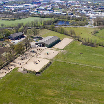
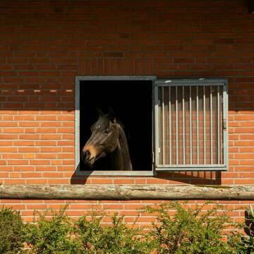
Boxen frei, Offenstall Plätze frei
Willenscharen
Yvonne-Thun
@Yvonne-Thun
FN-Mitglied
Freizeitstall
Führanlage
Hunde willkommen
Allergikerstall
Pferdezucht
Außenboxen
Innenbox
27 weitere...
aktuell
S


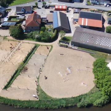
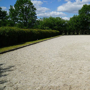
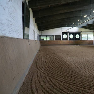
Paddock, Weidehaltung+Unterst. m. Reithalle 20x55m
Grossenaspe-Brokenlande
Nicole Hausdorf - Gem. Landw.
@hausdorf-landwirtschaft.de
FN-Mitglied
Freizeitstall
Vermieten
Hunde willkommen
Krankenbox
Fohlenaufzucht möglich
Hufrehe geeignet
26 weitere...
P+
Deprecated: Creation of dynamic property Zend_View_Helper_Ads::$adLink is deprecated in /var/www/stall-frei/htdocs/staging.stall-frei.de/library/Psf/View/Helper/Ads.php on line 108

Futtersack HeuToy, Fressbremse in pink
Mechtersen
STALL-FREIde Marketing
@STALL-FREI-Marketing
Stundenlange Beschäftigung die
Koliken vorbeugt, geringe Staubinhalation mit
steuerbarer Futterentnahme
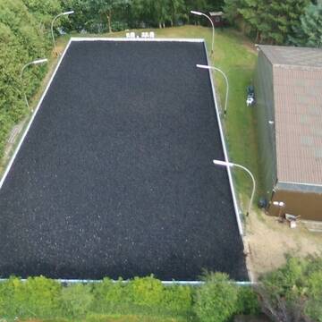
Paddock-Trail plus Reithalle, Round Pen & Co
Boostedt
Hof Immenklint
@Immenklint
Freizeitstall
Geländestrecke
Vermieten
Hunde willkommen
Krankenbox
Notfallboxen
16 weitere...
P+


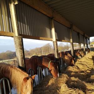
Boxen, Laufstallplätze und Stalltrakt frei
Großharrie
Inneres Reiten
@InneresReiten
Freizeitstall
Geländestrecke
Vermieten
Hunde willkommen
Krankenbox
Allergikerstall
bedampftes/gewaschenes Heu
31 weitere...
P+

Marieannenhof hat Boxen frei
Wasbek
claudia specht
@claudiaspecht
Freizeitstall
Hunde willkommen
Parkplatz für Pferdeanhänger
Halbpension
Einzelne Boxen oder Stallplätze
10 weitere...
P

Heu und Heulage verkaufen
Mechtersen
STALL-FREIde Marketing
@STALL-FREI-Marketing
Verkaufen Sie Ihr Heu und Ihre Heulage direkt an Reiter, Pferdeställe und Reitanlagen

Box integriert im Offenstall, Offenstall Heu satt
Aukrug
Reiterhof-Bodenstein
@Reiterhof-Bodenstein
Freizeitstall
Reitlehrer und -unterricht
Krankenbox
Parkplatz für Pferdeanhänger
Allergikerstall
Hufrehe geeignet
Offenstall
12 weitere...
ganz aktuell
P

Offenstall mit kleinem Paddocktrail
Großenaspe
Zoe T
@Zoe.T
Hunde willkommen
Longierzirkel/Roundpen
Hufrehe geeignet
zuckerreduziertes Heu
Bewegungsstall
Offenstall
Halbpension
Selbstversorgung
8 weitere...
aktuell
P
Weidehof Kisdorf - ab 01/26 Platz für 1 Wallach
Kisdorf
Weidehof
@Weidehof-Kisdorf
Freizeitstall
Geländestrecke
Hunde willkommen
Longierzirkel/Roundpen
bedampftes/gewaschenes Heu
Außenboxen
14 weitere...
S

Reitanlage Schop
Wiemersdorf
Susanne Schop
@Susanne-Schop
FN-Mitglied
Freizeitstall
Vermieten
Hunde willkommen
Longierzirkel/Roundpen
zuckerreduziertes Heu
18 weitere...
P
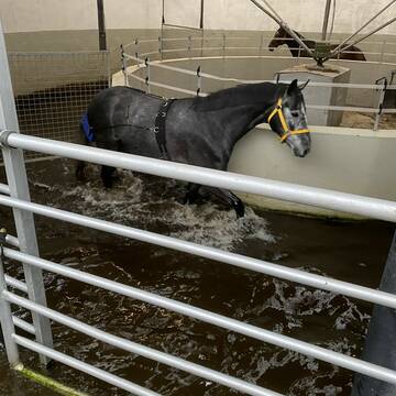
Bewegungsstall mit computergesteuerter Fütterung
Großenaspe
de-peerstaller
@de-peerstaller
Fahrstall, Kutschwagen
FN-Mitglied
Vermieten
Hunde willkommen
Krankenbox
Gnadenbrothof
Notfallboxen
29 weitere...
P
Deprecated: Creation of dynamic property Zend_View::$pageCount is deprecated in /var/www/stall-frei/htdocs/staging.stall-frei.de/library/vendor/shardj/zf1-future/library/Zend/View/Abstract.php on line 308
Deprecated: Creation of dynamic property Zend_View::$itemCountPerPage is deprecated in /var/www/stall-frei/htdocs/staging.stall-frei.de/library/vendor/shardj/zf1-future/library/Zend/View/Abstract.php on line 308
Deprecated: Creation of dynamic property Zend_View::$first is deprecated in /var/www/stall-frei/htdocs/staging.stall-frei.de/library/vendor/shardj/zf1-future/library/Zend/View/Abstract.php on line 308
Deprecated: Creation of dynamic property Zend_View::$current is deprecated in /var/www/stall-frei/htdocs/staging.stall-frei.de/library/vendor/shardj/zf1-future/library/Zend/View/Abstract.php on line 308
Deprecated: Creation of dynamic property Zend_View::$last is deprecated in /var/www/stall-frei/htdocs/staging.stall-frei.de/library/vendor/shardj/zf1-future/library/Zend/View/Abstract.php on line 308
Deprecated: Creation of dynamic property Zend_View::$next is deprecated in /var/www/stall-frei/htdocs/staging.stall-frei.de/library/vendor/shardj/zf1-future/library/Zend/View/Abstract.php on line 308
Deprecated: Creation of dynamic property Zend_View::$pagesInRange is deprecated in /var/www/stall-frei/htdocs/staging.stall-frei.de/library/vendor/shardj/zf1-future/library/Zend/View/Abstract.php on line 308
Deprecated: Creation of dynamic property Zend_View::$firstPageInRange is deprecated in /var/www/stall-frei/htdocs/staging.stall-frei.de/library/vendor/shardj/zf1-future/library/Zend/View/Abstract.php on line 308
Deprecated: Creation of dynamic property Zend_View::$lastPageInRange is deprecated in /var/www/stall-frei/htdocs/staging.stall-frei.de/library/vendor/shardj/zf1-future/library/Zend/View/Abstract.php on line 308
Deprecated: Creation of dynamic property Zend_View::$currentItemCount is deprecated in /var/www/stall-frei/htdocs/staging.stall-frei.de/library/vendor/shardj/zf1-future/library/Zend/View/Abstract.php on line 308
Deprecated: Creation of dynamic property Zend_View::$totalItemCount is deprecated in /var/www/stall-frei/htdocs/staging.stall-frei.de/library/vendor/shardj/zf1-future/library/Zend/View/Abstract.php on line 308
Deprecated: Creation of dynamic property Zend_View::$firstItemNumber is deprecated in /var/www/stall-frei/htdocs/staging.stall-frei.de/library/vendor/shardj/zf1-future/library/Zend/View/Abstract.php on line 308
Deprecated: Creation of dynamic property Zend_View::$lastItemNumber is deprecated in /var/www/stall-frei/htdocs/staging.stall-frei.de/library/vendor/shardj/zf1-future/library/Zend/View/Abstract.php on line 308
Deprecated: Creation of dynamic property Zend_View::$router is deprecated in /var/www/stall-frei/htdocs/staging.stall-frei.de/library/vendor/shardj/zf1-future/library/Zend/View/Abstract.php on line 308
Deprecated: Creation of dynamic property Zend_View::$urlParams is deprecated in /var/www/stall-frei/htdocs/staging.stall-frei.de/library/vendor/shardj/zf1-future/library/Zend/View/Abstract.php on line 308
Deprecated: Creation of dynamic property Zend_View::$showAds is deprecated in /var/www/stall-frei/htdocs/staging.stall-frei.de/library/vendor/shardj/zf1-future/library/Zend/View/Abstract.php on line 308
Deprecated: Creation of dynamic property Zend_View::$objectIds is deprecated in /var/www/stall-frei/htdocs/staging.stall-frei.de/library/vendor/shardj/zf1-future/library/Zend/View/Abstract.php on line 308
Deprecated: Creation of dynamic property Zend_View::$showNavbar is deprecated in /var/www/stall-frei/htdocs/staging.stall-frei.de/library/vendor/shardj/zf1-future/library/Zend/View/Abstract.php on line 308
Deprecated: Creation of dynamic property Zend_View::$showBreadcrumb is deprecated in /var/www/stall-frei/htdocs/staging.stall-frei.de/library/vendor/shardj/zf1-future/library/Zend/View/Abstract.php on line 308
Deprecated: Creation of dynamic property Zend_View::$showFooter is deprecated in /var/www/stall-frei/htdocs/staging.stall-frei.de/library/vendor/shardj/zf1-future/library/Zend/View/Abstract.php on line 308
Deprecated: Creation of dynamic property Zend_View::$showInternalAds is deprecated in /var/www/stall-frei/htdocs/staging.stall-frei.de/library/vendor/shardj/zf1-future/library/Zend/View/Abstract.php on line 308
Deprecated: Creation of dynamic property Zend_View::$blNoContent is deprecated in /var/www/stall-frei/htdocs/staging.stall-frei.de/library/vendor/shardj/zf1-future/library/Zend/View/Abstract.php on line 308
Deprecated: Creation of dynamic property Zend_View::$sMetaDesc is deprecated in /var/www/stall-frei/htdocs/staging.stall-frei.de/library/vendor/shardj/zf1-future/library/Zend/View/Abstract.php on line 308
Deprecated: Creation of dynamic property Zend_View::$useGmaps is deprecated in /var/www/stall-frei/htdocs/staging.stall-frei.de/library/vendor/shardj/zf1-future/library/Zend/View/Abstract.php on line 308
Deprecated: Creation of dynamic property Zend_View::$touches is deprecated in /var/www/stall-frei/htdocs/staging.stall-frei.de/library/vendor/shardj/zf1-future/library/Zend/View/Abstract.php on line 308
Deprecated: Creation of dynamic property Zend_View::$oProject is deprecated in /var/www/stall-frei/htdocs/staging.stall-frei.de/library/vendor/shardj/zf1-future/library/Zend/View/Abstract.php on line 308
Deprecated: Creation of dynamic property Zend_View::$pageHeadline is deprecated in /var/www/stall-frei/htdocs/staging.stall-frei.de/library/vendor/shardj/zf1-future/library/Zend/View/Abstract.php on line 308
Deprecated: Creation of dynamic property Zend_View::$disableLocationField is deprecated in /var/www/stall-frei/htdocs/staging.stall-frei.de/library/vendor/shardj/zf1-future/library/Zend/View/Abstract.php on line 308
Deprecated: Creation of dynamic property Zend_View::$isSearch is deprecated in /var/www/stall-frei/htdocs/staging.stall-frei.de/library/vendor/shardj/zf1-future/library/Zend/View/Abstract.php on line 308
Deprecated: Creation of dynamic property Zend_View::$pageTitle is deprecated in /var/www/stall-frei/htdocs/staging.stall-frei.de/library/vendor/shardj/zf1-future/library/Zend/View/Abstract.php on line 308
Deprecated: Creation of dynamic property Psf_Form_Element_Text::$class is deprecated in /var/www/stall-frei/htdocs/staging.stall-frei.de/library/vendor/shardj/zf1-future/library/Zend/Form/Element.php on line 874
Deprecated: Creation of dynamic property Psf_Form_Element_Text::$size is deprecated in /var/www/stall-frei/htdocs/staging.stall-frei.de/library/vendor/shardj/zf1-future/library/Zend/Form/Element.php on line 874
Deprecated: Creation of dynamic property Psf_Form_Element_Text::$placeholder is deprecated in /var/www/stall-frei/htdocs/staging.stall-frei.de/library/vendor/shardj/zf1-future/library/Zend/Form/Element.php on line 874
Deprecated: Creation of dynamic property Psf_Form_Element_Hidden::$class is deprecated in /var/www/stall-frei/htdocs/staging.stall-frei.de/library/vendor/shardj/zf1-future/library/Zend/Form/Element.php on line 874
Deprecated: Creation of dynamic property Psf_Form_Element_Hidden::$class is deprecated in /var/www/stall-frei/htdocs/staging.stall-frei.de/library/vendor/shardj/zf1-future/library/Zend/Form/Element.php on line 874
Deprecated: Creation of dynamic property Psf_Form_Element_Hidden::$class is deprecated in /var/www/stall-frei/htdocs/staging.stall-frei.de/library/vendor/shardj/zf1-future/library/Zend/Form/Element.php on line 874
Deprecated: Creation of dynamic property Psf_Form_Element_Hidden::$class is deprecated in /var/www/stall-frei/htdocs/staging.stall-frei.de/library/vendor/shardj/zf1-future/library/Zend/Form/Element.php on line 874
Deprecated: Creation of dynamic property Psf_Form_Element_Select::$class is deprecated in /var/www/stall-frei/htdocs/staging.stall-frei.de/library/vendor/shardj/zf1-future/library/Zend/Form/Element.php on line 874
Deprecated: Creation of dynamic property Psf_Form_Element_Select::$class is deprecated in /var/www/stall-frei/htdocs/staging.stall-frei.de/library/vendor/shardj/zf1-future/library/Zend/Form/Element.php on line 874
Deprecated: Creation of dynamic property Psf_Form_Element_Select::$class is deprecated in /var/www/stall-frei/htdocs/staging.stall-frei.de/library/vendor/shardj/zf1-future/library/Zend/Form/Element.php on line 874
Deprecated: Creation of dynamic property Psf_Form_Element_Select::$class is deprecated in /var/www/stall-frei/htdocs/staging.stall-frei.de/library/vendor/shardj/zf1-future/library/Zend/Form/Element.php on line 874
Deprecated: Creation of dynamic property Psf_Form_Element_Text::$class is deprecated in /var/www/stall-frei/htdocs/staging.stall-frei.de/library/vendor/shardj/zf1-future/library/Zend/Form/Element.php on line 874
Deprecated: Creation of dynamic property Psf_Form_Element_Checkbox::$label is deprecated in /var/www/stall-frei/htdocs/staging.stall-frei.de/library/vendor/shardj/zf1-future/library/Zend/Form/Element.php on line 874
Deprecated: Creation of dynamic property Zend_View::$sort is deprecated in /var/www/stall-frei/htdocs/staging.stall-frei.de/library/vendor/shardj/zf1-future/library/Zend/View/Abstract.php on line 308
Deprecated: Creation of dynamic property Zend_View::$searchLocation is deprecated in /var/www/stall-frei/htdocs/staging.stall-frei.de/library/vendor/shardj/zf1-future/library/Zend/View/Abstract.php on line 308
Deprecated: Creation of dynamic property Zend_View::$locationHint is deprecated in /var/www/stall-frei/htdocs/staging.stall-frei.de/library/vendor/shardj/zf1-future/library/Zend/View/Abstract.php on line 308
Psf_GeoCoder_Abstract::getLocation: Padenstedt-Kamp Get Location CachedOrLive
Psf_GeoCoder_Abstract::getCachedOrLive: Padenstedt-Kamp
Psf_GeoCoder_OpenCageData::makeApiRequest: response:
Array
(
[documentation] => https://opencagedata.com/api
[licenses] => Array
(
[0] => Array
(
[name] => see attribution guide
[url] => https://opencagedata.com/credits
)
)
[results] => Array
(
[0] => Array
(
[bounds] => Array
(
[northeast] => Array
(
[lat] => 54.070398
[lng] => 9.9705783
)
[southwest] => Array
(
[lat] => 54.030398
[lng] => 9.9305783
)
)
[components] => Array
(
[ISO_3166-1_alpha-2] => DE
[ISO_3166-1_alpha-3] => DEU
[ISO_3166-2] => Array
(
[0] => DE-SH
)
[_category] => place
[_normalized_city] => Padenstedt
[_type] => village
[city] => Padenstedt
[continent] => Europe
[country] => Deutschland
[country_code] => de
[county] => Kreis Rendsburg-Eckernförde
[municipality] => Amt Mittelholstein
[political_union] => European Union
[postcode] => 24537
[state] => Schleswig-Holstein
[state_code] => SH
[village] => Padenstedt-Kamp
)
[confidence] => 7
[formatted] => 24537 Padenstedt-Kamp, Deutschland
[geometry] => Array
(
[lat] => 54.050398
[lng] => 9.9505783
)
)
[1] => Array
(
[bounds] => Array
(
[northeast] => Array
(
[lat] => 54.0503169
[lng] => 9.9453444
)
[southwest] => Array
(
[lat] => 54.0502169
[lng] => 9.9452444
)
)
[components] => Array
(
[ISO_3166-1_alpha-2] => DE
[ISO_3166-1_alpha-3] => DEU
[ISO_3166-2] => Array
(
[0] => DE-SH
)
[_category] => transportation
[_normalized_city] => Padenstedt
[_type] => bus_stop
[city] => Padenstedt
[continent] => Europe
[country] => Deutschland
[country_code] => de
[county] => Kreis Rendsburg-Eckernförde
[highway] => Padenstedt, Kamp
[municipality] => Amt Mittelholstein
[political_union] => European Union
[postcode] => 24634
[road] => Hauptstraße
[state] => Schleswig-Holstein
[state_code] => SH
[village] => Padenstedt-Kamp
)
[confidence] => 9
[formatted] => Padenstedt, Kamp, Hauptstraße, 24634 Padenstedt-Kamp, Deutschland
[geometry] => Array
(
[lat] => 54.0502669
[lng] => 9.9452944
)
)
[2] => Array
(
[components] => Array
(
[ISO_3166-1_alpha-2] => GF
[ISO_3166-1_alpha-3] => GUF
[ISO_3166-2] => Array
(
[0] => FR-973
)
[_category] => road
[_normalized_city] => Apatou
[_type] => road
[city] => Apatou
[continent] => South America
[country] => France
[country_code] => fr
[county] => Guyane
[local_authority] => Communauté de communes de l'Ouest guyanais
[political_union] => European Union
[postcode] => 97317
[road] => Route Kampoes
[state] =>
)
[confidence] => 2
[formatted] => Route Kampoes, 97317 Apatou, France
[geometry] => Array
(
[lat] => 5.190871
[lng] => -54.320706
)
)
[3] => Array
(
[components] => Array
(
[ISO_3166-1_alpha-2] => FR
[ISO_3166-1_alpha-3] => FRA
[ISO_3166-2] => Array
(
[0] => FR-OCC
[1] => FR-09
)
[_category] => road
[_normalized_city] => Montjoie-en-Couserans
[_type] => road
[city] => Montjoie-en-Couserans
[continent] => Europe
[country] => France
[country_code] => fr
[county] => Ariège
[local_authority] => Communauté de communes Couserans-Pyrénées
[political_union] => European Union
[postcode] => 09200
[road] => Camp Dadeou
[state] => Occitanie
[state_code] => OCC
)
[confidence] => 2
[formatted] => Camp Dadeou, 09200 Montjoie-en-Couserans, France
[geometry] => Array
(
[lat] => 43.00915
[lng] => 1.177103
)
)
[4] => Array
(
[components] => Array
(
[ISO_3166-1_alpha-2] => FR
[ISO_3166-1_alpha-3] => FRA
[ISO_3166-2] => Array
(
[0] => FR-PAC
[1] => FR-84
)
[_category] => road
[_normalized_city] => Châteauneuf-de-Gadagne
[_type] => road
[city] => Châteauneuf-de-Gadagne
[continent] => Europe
[country] => France
[country_code] => fr
[county] => Vaucluse
[local_authority] => Communauté de communes du Pays des Sorgues et des Monts de Vaucluse
[political_union] => European Union
[postcode] => 84470
[road] => Camp Revès
[state] => Provence-Alpes-Côte d'Azur
[state_code] => PAC
)
[confidence] => 2
[formatted] => Camp Revès, 84470 Châteauneuf-de-Gadagne, France
[geometry] => Array
(
[lat] => 43.947046
[lng] => 4.926767
)
)
[5] => Array
(
[components] => Array
(
[ISO_3166-1_alpha-2] => FR
[ISO_3166-1_alpha-3] => FRA
[ISO_3166-2] => Array
(
[0] => FR-BRE
[1] => FR-29
)
[_category] => road
[_normalized_city] => Saint-Renan
[_type] => road
[city] => Saint-Renan
[continent] => Europe
[country] => France
[country_code] => fr
[county] => Finistère
[local_authority] => Pays d'Iroise Communauté
[political_union] => European Union
[postcode] => 29290
[road] => Camp Huella
[state] => Bretagne
[state_code] => BRE
)
[confidence] => 10
[formatted] => Camp Huella, 29290 Saint-Renan, France
[geometry] => Array
(
[lat] => 48.429805
[lng] => -4.637434
)
)
[6] => Array
(
[components] => Array
(
[ISO_3166-1_alpha-2] => FR
[ISO_3166-1_alpha-3] => FRA
[ISO_3166-2] => Array
(
[0] => FR-PAC
[1] => FR-83
)
[_category] => road
[_normalized_city] => Le Cannet-des-Maures
[_type] => road
[city] => Le Cannet-des-Maures
[continent] => Europe
[country] => France
[country_code] => fr
[county] => Var
[local_authority] => Communauté de communes Cœur du Var
[political_union] => European Union
[postcode] => 83340
[road] => Camp Redon
[state] => Provence-Alpes-Côte d'Azur
[state_code] => PAC
)
[confidence] => 10
[formatted] => Camp Redon, 83340 Le Cannet-des-Maures, France
[geometry] => Array
(
[lat] => 43.404966
[lng] => 6.353801
)
)
[7] => Array
(
[components] => Array
(
[ISO_3166-1_alpha-2] => FR
[ISO_3166-1_alpha-3] => FRA
[ISO_3166-2] => Array
(
[0] => FR-BRE
[1] => FR-29
)
[_category] => place
[_normalized_city] => Saint-Renan
[_type] => place
[city] => Saint-Renan
[continent] => Europe
[country] => France
[country_code] => fr
[county] => Finistère
[local_authority] => Pays d'Iroise Communauté
[place] => Camp Huella
[political_union] => European Union
[postcode] => 29290
[state] => Bretagne
[state_code] => BRE
)
[confidence] => 10
[formatted] => Camp Huella, 29290 Saint-Renan, France
[geometry] => Array
(
[lat] => 48.429893
[lng] => -4.637175
)
)
[8] => Array
(
[components] => Array
(
[ISO_3166-1_alpha-2] => FR
[ISO_3166-1_alpha-3] => FRA
[ISO_3166-2] => Array
(
[0] => FR-OCC
[1] => FR-66
)
[_category] => road
[_normalized_city] => Saint-Jean-Pla-de-Corts
[_type] => road
[city] => Saint-Jean-Pla-de-Corts
[continent] => Europe
[country] => France
[country_code] => fr
[county] => Pyrénées-Orientales
[local_authority] => Communauté de communes du Vallespir
[political_union] => European Union
[postcode] => 66490
[road] => Camp Figuera
[state] => Occitanie
[state_code] => OCC
)
[confidence] => 10
[formatted] => Camp Figuera, 66490 Saint-Jean-Pla-de-Corts, France
[geometry] => Array
(
[lat] => 42.510084
[lng] => 2.796881
)
)
[9] => Array
(
[components] => Array
(
[ISO_3166-1_alpha-2] => FR
[ISO_3166-1_alpha-3] => FRA
[ISO_3166-2] => Array
(
[0] => FR-OCC
[1] => FR-66
)
[_category] => road
[_normalized_city] => Saint-Jean-Pla-de-Corts
[_type] => road
[city] => Saint-Jean-Pla-de-Corts
[continent] => Europe
[country] => France
[country_code] => fr
[county] => Pyrénées-Orientales
[local_authority] => Communauté de communes du Vallespir
[political_union] => European Union
[postcode] => 66490
[road] => Camp Barquer
[state] => Occitanie
[state_code] => OCC
)
[confidence] => 10
[formatted] => Camp Barquer, 66490 Saint-Jean-Pla-de-Corts, France
[geometry] => Array
(
[lat] => 42.517804
[lng] => 2.804861
)
)
)
[status] => Array
(
[code] => 200
[message] => OK
)
[stay_informed] => Array
(
[blog] => https://blog.opencagedata.com
[mastodon] => https://en.osm.town/@opencage
)
[thanks] => For using an OpenCage API
[timestamp] => Array
(
[created_http] => Sat, 07 Feb 2026 04:38:19 GMT
[created_unix] => 1770439099
)
[total_results] => 10
)
Psf_GeoCoder_Abstract::convertLocationResult
{"documentation":"https:\/\/opencagedata.com\/api","licenses":[{"name":"see attribution guide","url":"https:\/\/opencagedata.com\/credits"}],"results":[{"bounds":{"northeast":{"lat":54.070398,"lng":9.9705783},"southwest":{"lat":54.030398,"lng":9.9305783}},"components":{"ISO_3166-1_alpha-2":"DE","ISO_3166-1_alpha-3":"DEU","ISO_3166-2":["DE-SH"],"_category":"place","_normalized_city":"Padenstedt","_type":"village","city":"Padenstedt","continent":"Europe","country":"Deutschland","country_code":"de","county":"Kreis Rendsburg-Eckernf\u00f6rde","municipality":"Amt Mittelholstein","political_union":"European Union","postcode":"24537","state":"Schleswig-Holstein","state_code":"SH","village":"Padenstedt-Kamp"},"confidence":7,"formatted":"24537 Padenstedt-Kamp, Deutschland","geometry":{"lat":54.050398,"lng":9.9505783}},{"bounds":{"northeast":{"lat":54.0503169,"lng":9.9453444},"southwest":{"lat":54.0502169,"lng":9.9452444}},"components":{"ISO_3166-1_alpha-2":"DE","ISO_3166-1_alpha-3":"DEU","ISO_3166-2":["DE-SH"],"_category":"transportation","_normalized_city":"Padenstedt","_type":"bus_stop","city":"Padenstedt","continent":"Europe","country":"Deutschland","country_code":"de","county":"Kreis Rendsburg-Eckernf\u00f6rde","highway":"Padenstedt, Kamp","municipality":"Amt Mittelholstein","political_union":"European Union","postcode":"24634","road":"Hauptstra\u00dfe","state":"Schleswig-Holstein","state_code":"SH","village":"Padenstedt-Kamp"},"confidence":9,"formatted":"Padenstedt, Kamp, Hauptstra\u00dfe, 24634 Padenstedt-Kamp, Deutschland","geometry":{"lat":54.0502669,"lng":9.9452944}},{"components":{"ISO_3166-1_alpha-2":"GF","ISO_3166-1_alpha-3":"GUF","ISO_3166-2":["FR-973"],"_category":"road","_normalized_city":"Apatou","_type":"road","city":"Apatou","continent":"South America","country":"France","country_code":"fr","county":"Guyane","local_authority":"Communaut\u00e9 de communes de l'Ouest guyanais","political_union":"European Union","postcode":"97317","road":"Route Kampoes","state":null},"confidence":2,"formatted":"Route Kampoes, 97317 Apatou, France","geometry":{"lat":5.190871,"lng":-54.320706}},{"components":{"ISO_3166-1_alpha-2":"FR","ISO_3166-1_alpha-3":"FRA","ISO_3166-2":["FR-OCC","FR-09"],"_category":"road","_normalized_city":"Montjoie-en-Couserans","_type":"road","city":"Montjoie-en-Couserans","continent":"Europe","country":"France","country_code":"fr","county":"Ari\u00e8ge","local_authority":"Communaut\u00e9 de communes Couserans-Pyr\u00e9n\u00e9es","political_union":"European Union","postcode":"09200","road":"Camp Dadeou","state":"Occitanie","state_code":"OCC"},"confidence":2,"formatted":"Camp Dadeou, 09200 Montjoie-en-Couserans, France","geometry":{"lat":43.00915,"lng":1.177103}},{"components":{"ISO_3166-1_alpha-2":"FR","ISO_3166-1_alpha-3":"FRA","ISO_3166-2":["FR-PAC","FR-84"],"_category":"road","_normalized_city":"Ch\u00e2teauneuf-de-Gadagne","_type":"road","city":"Ch\u00e2teauneuf-de-Gadagne","continent":"Europe","country":"France","country_code":"fr","county":"Vaucluse","local_authority":"Communaut\u00e9 de communes du Pays des Sorgues et des Monts de Vaucluse","political_union":"European Union","postcode":"84470","road":"Camp Rev\u00e8s","state":"Provence-Alpes-C\u00f4te d'Azur","state_code":"PAC"},"confidence":2,"formatted":"Camp Rev\u00e8s, 84470 Ch\u00e2teauneuf-de-Gadagne, France","geometry":{"lat":43.947046,"lng":4.926767}},{"components":{"ISO_3166-1_alpha-2":"FR","ISO_3166-1_alpha-3":"FRA","ISO_3166-2":["FR-BRE","FR-29"],"_category":"road","_normalized_city":"Saint-Renan","_type":"road","city":"Saint-Renan","continent":"Europe","country":"France","country_code":"fr","county":"Finist\u00e8re","local_authority":"Pays d'Iroise Communaut\u00e9","political_union":"European Union","postcode":"29290","road":"Camp Huella","state":"Bretagne","state_code":"BRE"},"confidence":10,"formatted":"Camp Huella, 29290 Saint-Renan, France","geometry":{"lat":48.429805,"lng":-4.637434}},{"components":{"ISO_3166-1_alpha-2":"FR","ISO_3166-1_alpha-3":"FRA","ISO_3166-2":["FR-PAC","FR-83"],"_category":"road","_normalized_city":"Le Cannet-des-Maures","_type":"road","city":"Le Cannet-des-Maures","continent":"Europe","country":"France","country_code":"fr","county":"Var","local_authority":"Communaut\u00e9 de communes C\u0153ur du Var","political_union":"European Union","postcode":"83340","road":"Camp Redon","state":"Provence-Alpes-C\u00f4te d'Azur","state_code":"PAC"},"confidence":10,"formatted":"Camp Redon, 83340 Le Cannet-des-Maures, France","geometry":{"lat":43.404966,"lng":6.353801}},{"components":{"ISO_3166-1_alpha-2":"FR","ISO_3166-1_alpha-3":"FRA","ISO_3166-2":["FR-BRE","FR-29"],"_category":"place","_normalized_city":"Saint-Renan","_type":"place","city":"Saint-Renan","continent":"Europe","country":"France","country_code":"fr","county":"Finist\u00e8re","local_authority":"Pays d'Iroise Communaut\u00e9","place":"Camp Huella","political_union":"European Union","postcode":"29290","state":"Bretagne","state_code":"BRE"},"confidence":10,"formatted":"Camp Huella, 29290 Saint-Renan, France","geometry":{"lat":48.429893,"lng":-4.637175}},{"components":{"ISO_3166-1_alpha-2":"FR","ISO_3166-1_alpha-3":"FRA","ISO_3166-2":["FR-OCC","FR-66"],"_category":"road","_normalized_city":"Saint-Jean-Pla-de-Corts","_type":"road","city":"Saint-Jean-Pla-de-Corts","continent":"Europe","country":"France","country_code":"fr","county":"Pyr\u00e9n\u00e9es-Orientales","local_authority":"Communaut\u00e9 de communes du Vallespir","political_union":"European Union","postcode":"66490","road":"Camp Figuera","state":"Occitanie","state_code":"OCC"},"confidence":10,"formatted":"Camp Figuera, 66490 Saint-Jean-Pla-de-Corts, France","geometry":{"lat":42.510084,"lng":2.796881}},{"components":{"ISO_3166-1_alpha-2":"FR","ISO_3166-1_alpha-3":"FRA","ISO_3166-2":["FR-OCC","FR-66"],"_category":"road","_normalized_city":"Saint-Jean-Pla-de-Corts","_type":"road","city":"Saint-Jean-Pla-de-Corts","continent":"Europe","country":"France","country_code":"fr","county":"Pyr\u00e9n\u00e9es-Orientales","local_authority":"Communaut\u00e9 de communes du Vallespir","political_union":"European Union","postcode":"66490","road":"Camp Barquer","state":"Occitanie","state_code":"OCC"},"confidence":10,"formatted":"Camp Barquer, 66490 Saint-Jean-Pla-de-Corts, France","geometry":{"lat":42.517804,"lng":2.804861}}],"status":{"code":200,"message":"OK"},"stay_informed":{"blog":"https:\/\/blog.opencagedata.com","mastodon":"https:\/\/en.osm.town\/@opencage"},"thanks":"For using an OpenCage API","timestamp":{"created_http":"Sat, 07 Feb 2026 04:38:19 GMT","created_unix":1770439099},"total_results":10}Array
(
[0] => stdClass Object
(
[bounds] => stdClass Object
(
[northeast] => stdClass Object
(
[lat] => 54.070398
[lng] => 9.9705783
)
[southwest] => stdClass Object
(
[lat] => 54.030398
[lng] => 9.9305783
)
)
[components] => stdClass Object
(
[ISO_3166-1_alpha-2] => DE
[ISO_3166-1_alpha-3] => DEU
[ISO_3166-2] => Array
(
[0] => DE-SH
)
[_category] => place
[_normalized_city] => Padenstedt
[_type] => village
[city] => Padenstedt
[continent] => Europe
[country] => Deutschland
[country_code] => de
[county] => Kreis Rendsburg-Eckernförde
[municipality] => Amt Mittelholstein
[political_union] => European Union
[postcode] => 24537
[state] => Schleswig-Holstein
[state_code] => SH
[village] => Padenstedt-Kamp
)
[confidence] => 7
[formatted] => 24537 Padenstedt-Kamp, Deutschland
[geometry] => stdClass Object
(
[lat] => 54.050398
[lng] => 9.9505783
)
)
[1] => stdClass Object
(
[bounds] => stdClass Object
(
[northeast] => stdClass Object
(
[lat] => 54.0503169
[lng] => 9.9453444
)
[southwest] => stdClass Object
(
[lat] => 54.0502169
[lng] => 9.9452444
)
)
[components] => stdClass Object
(
[ISO_3166-1_alpha-2] => DE
[ISO_3166-1_alpha-3] => DEU
[ISO_3166-2] => Array
(
[0] => DE-SH
)
[_category] => transportation
[_normalized_city] => Padenstedt
[_type] => bus_stop
[city] => Padenstedt
[continent] => Europe
[country] => Deutschland
[country_code] => de
[county] => Kreis Rendsburg-Eckernförde
[highway] => Padenstedt, Kamp
[municipality] => Amt Mittelholstein
[political_union] => European Union
[postcode] => 24634
[road] => Hauptstraße
[state] => Schleswig-Holstein
[state_code] => SH
[village] => Padenstedt-Kamp
)
[confidence] => 9
[formatted] => Padenstedt, Kamp, Hauptstraße, 24634 Padenstedt-Kamp, Deutschland
[geometry] => stdClass Object
(
[lat] => 54.0502669
[lng] => 9.9452944
)
)
[2] => stdClass Object
(
[components] => stdClass Object
(
[ISO_3166-1_alpha-2] => GF
[ISO_3166-1_alpha-3] => GUF
[ISO_3166-2] => Array
(
[0] => FR-973
)
[_category] => road
[_normalized_city] => Apatou
[_type] => road
[city] => Apatou
[continent] => South America
[country] => France
[country_code] => fr
[county] => Guyane
[local_authority] => Communauté de communes de l'Ouest guyanais
[political_union] => European Union
[postcode] => 97317
[road] => Route Kampoes
[state] =>
)
[confidence] => 2
[formatted] => Route Kampoes, 97317 Apatou, France
[geometry] => stdClass Object
(
[lat] => 5.190871
[lng] => -54.320706
)
)
[3] => stdClass Object
(
[components] => stdClass Object
(
[ISO_3166-1_alpha-2] => FR
[ISO_3166-1_alpha-3] => FRA
[ISO_3166-2] => Array
(
[0] => FR-OCC
[1] => FR-09
)
[_category] => road
[_normalized_city] => Montjoie-en-Couserans
[_type] => road
[city] => Montjoie-en-Couserans
[continent] => Europe
[country] => France
[country_code] => fr
[county] => Ariège
[local_authority] => Communauté de communes Couserans-Pyrénées
[political_union] => European Union
[postcode] => 09200
[road] => Camp Dadeou
[state] => Occitanie
[state_code] => OCC
)
[confidence] => 2
[formatted] => Camp Dadeou, 09200 Montjoie-en-Couserans, France
[geometry] => stdClass Object
(
[lat] => 43.00915
[lng] => 1.177103
)
)
[4] => stdClass Object
(
[components] => stdClass Object
(
[ISO_3166-1_alpha-2] => FR
[ISO_3166-1_alpha-3] => FRA
[ISO_3166-2] => Array
(
[0] => FR-PAC
[1] => FR-84
)
[_category] => road
[_normalized_city] => Châteauneuf-de-Gadagne
[_type] => road
[city] => Châteauneuf-de-Gadagne
[continent] => Europe
[country] => France
[country_code] => fr
[county] => Vaucluse
[local_authority] => Communauté de communes du Pays des Sorgues et des Monts de Vaucluse
[political_union] => European Union
[postcode] => 84470
[road] => Camp Revès
[state] => Provence-Alpes-Côte d'Azur
[state_code] => PAC
)
[confidence] => 2
[formatted] => Camp Revès, 84470 Châteauneuf-de-Gadagne, France
[geometry] => stdClass Object
(
[lat] => 43.947046
[lng] => 4.926767
)
)
[5] => stdClass Object
(
[components] => stdClass Object
(
[ISO_3166-1_alpha-2] => FR
[ISO_3166-1_alpha-3] => FRA
[ISO_3166-2] => Array
(
[0] => FR-BRE
[1] => FR-29
)
[_category] => road
[_normalized_city] => Saint-Renan
[_type] => road
[city] => Saint-Renan
[continent] => Europe
[country] => France
[country_code] => fr
[county] => Finistère
[local_authority] => Pays d'Iroise Communauté
[political_union] => European Union
[postcode] => 29290
[road] => Camp Huella
[state] => Bretagne
[state_code] => BRE
)
[confidence] => 10
[formatted] => Camp Huella, 29290 Saint-Renan, France
[geometry] => stdClass Object
(
[lat] => 48.429805
[lng] => -4.637434
)
)
[6] => stdClass Object
(
[components] => stdClass Object
(
[ISO_3166-1_alpha-2] => FR
[ISO_3166-1_alpha-3] => FRA
[ISO_3166-2] => Array
(
[0] => FR-PAC
[1] => FR-83
)
[_category] => road
[_normalized_city] => Le Cannet-des-Maures
[_type] => road
[city] => Le Cannet-des-Maures
[continent] => Europe
[country] => France
[country_code] => fr
[county] => Var
[local_authority] => Communauté de communes Cœur du Var
[political_union] => European Union
[postcode] => 83340
[road] => Camp Redon
[state] => Provence-Alpes-Côte d'Azur
[state_code] => PAC
)
[confidence] => 10
[formatted] => Camp Redon, 83340 Le Cannet-des-Maures, France
[geometry] => stdClass Object
(
[lat] => 43.404966
[lng] => 6.353801
)
)
[7] => stdClass Object
(
[components] => stdClass Object
(
[ISO_3166-1_alpha-2] => FR
[ISO_3166-1_alpha-3] => FRA
[ISO_3166-2] => Array
(
[0] => FR-BRE
[1] => FR-29
)
[_category] => place
[_normalized_city] => Saint-Renan
[_type] => place
[city] => Saint-Renan
[continent] => Europe
[country] => France
[country_code] => fr
[county] => Finistère
[local_authority] => Pays d'Iroise Communauté
[place] => Camp Huella
[political_union] => European Union
[postcode] => 29290
[state] => Bretagne
[state_code] => BRE
)
[confidence] => 10
[formatted] => Camp Huella, 29290 Saint-Renan, France
[geometry] => stdClass Object
(
[lat] => 48.429893
[lng] => -4.637175
)
)
[8] => stdClass Object
(
[components] => stdClass Object
(
[ISO_3166-1_alpha-2] => FR
[ISO_3166-1_alpha-3] => FRA
[ISO_3166-2] => Array
(
[0] => FR-OCC
[1] => FR-66
)
[_category] => road
[_normalized_city] => Saint-Jean-Pla-de-Corts
[_type] => road
[city] => Saint-Jean-Pla-de-Corts
[continent] => Europe
[country] => France
[country_code] => fr
[county] => Pyrénées-Orientales
[local_authority] => Communauté de communes du Vallespir
[political_union] => European Union
[postcode] => 66490
[road] => Camp Figuera
[state] => Occitanie
[state_code] => OCC
)
[confidence] => 10
[formatted] => Camp Figuera, 66490 Saint-Jean-Pla-de-Corts, France
[geometry] => stdClass Object
(
[lat] => 42.510084
[lng] => 2.796881
)
)
[9] => stdClass Object
(
[components] => stdClass Object
(
[ISO_3166-1_alpha-2] => FR
[ISO_3166-1_alpha-3] => FRA
[ISO_3166-2] => Array
(
[0] => FR-OCC
[1] => FR-66
)
[_category] => road
[_normalized_city] => Saint-Jean-Pla-de-Corts
[_type] => road
[city] => Saint-Jean-Pla-de-Corts
[continent] => Europe
[country] => France
[country_code] => fr
[county] => Pyrénées-Orientales
[local_authority] => Communauté de communes du Vallespir
[political_union] => European Union
[postcode] => 66490
[road] => Camp Barquer
[state] => Occitanie
[state_code] => OCC
)
[confidence] => 10
[formatted] => Camp Barquer, 66490 Saint-Jean-Pla-de-Corts, France
[geometry] => stdClass Object
(
[lat] => 42.517804
[lng] => 2.804861
)
)
)
Psf_GeoCoder_OpenCageData::getKeyMap: 0
stdClass Object
(
    [bounds] => stdClass Object
        (
            [northeast] => stdClass Object
                (
                    [lat] => 54.070398
                    [lng] => 9.9705783
                )

            [southwest] => stdClass Object
                (
                    [lat] => 54.030398
                    [lng] => 9.9305783
                )

        )

    [components] => stdClass Object
        (
            [ISO_3166-1_alpha-2] => DE
            [ISO_3166-1_alpha-3] => DEU
            [ISO_3166-2] => Array
                (
                    [0] => DE-SH
                )

            [_category] => place
            [_normalized_city] => Padenstedt
            [_type] => village
            [city] => Padenstedt
            [continent] => Europe
            [country] => Deutschland
            [country_code] => de
            [county] => Kreis Rendsburg-Eckernförde
            [municipality] => Amt Mittelholstein
            [political_union] => European Union
            [postcode] => 24537
            [state] => Schleswig-Holstein
            [state_code] => SH
            [village] => Padenstedt-Kamp
        )

    [confidence] => 7
    [formatted] => 24537 Padenstedt-Kamp, Deutschland
    [geometry] => stdClass Object
        (
            [lat] => 54.050398
            [lng] => 9.9505783
        )

)
Psf_GeoCoder_OpenCageData::getCounty: Rendsburg-Eckernförde
Psf_GeoCoder_OpenCageData::addMissingData REFETCH!
Array
(
    [address] => 24537 Padenstedt-Kamp, Deutschland
    [type] => village
    [street] =>
    [city] => Padenstedt-Kamp
    [county] => Rendsburg-Eckernförde
    [state] => Schleswig-Holstein
    [zip] => 24537
    [country] => Deutschland
    [suburb] =>
    [countrycode] => de
    [latitude] => 54.050398
    [longitude] => 9.9505783
    [accuracy] => 1
    [confidence] => 7
    [bounds] => stdClass Object
        (
            [northeast] => stdClass Object
                (
                    [lat] => 54.070398
                    [lng] => 9.9705783
                )

            [southwest] => stdClass Object
                (
                    [lat] => 54.030398
                    [lng] => 9.9305783
                )

        )

)
reformat!
Array
(
    [address] => 24537 Padenstedt-Kamp, Deutschland
    [type] => village
    [street] =>
    [city] => Padenstedt-Kamp
    [county] => Rendsburg-Eckernförde
    [state] => Schleswig-Holstein
    [zip] => 24537
    [country] => Deutschland
    [suburb] =>
    [countrycode] => de
    [latitude] => 54.050398
    [longitude] => 9.9505783
    [accuracy] => 1
    [confidence] => 7
    [bounds] => stdClass Object
        (
            [northeast] => stdClass Object
                (
                    [lat] => 54.070398
                    [lng] => 9.9705783
                )

            [southwest] => stdClass Object
                (
                    [lat] => 54.030398
                    [lng] => 9.9305783
                )

        )

    [place] => 24537 Padenstedt-Kamp, Schleswig-Holstein
    [hash] => 42321f44ba3610e8105bc6d5ebacf045
)
Psf_GeoCoder_OpenCageData::getKeyMap: 1
stdClass Object
(
    [bounds] => stdClass Object
        (
            [northeast] => stdClass Object
                (
                    [lat] => 54.0503169
                    [lng] => 9.9453444
                )

            [southwest] => stdClass Object
                (
                    [lat] => 54.0502169
                    [lng] => 9.9452444
                )

        )

    [components] => stdClass Object
        (
            [ISO_3166-1_alpha-2] => DE
            [ISO_3166-1_alpha-3] => DEU
            [ISO_3166-2] => Array
                (
                    [0] => DE-SH
                )

            [_category] => transportation
            [_normalized_city] => Padenstedt
            [_type] => bus_stop
            [city] => Padenstedt
            [continent] => Europe
            [country] => Deutschland
            [country_code] => de
            [county] => Kreis Rendsburg-Eckernförde
            [highway] => Padenstedt, Kamp
            [municipality] => Amt Mittelholstein
            [political_union] => European Union
            [postcode] => 24634
            [road] => Hauptstraße
            [state] => Schleswig-Holstein
            [state_code] => SH
            [village] => Padenstedt-Kamp
        )

    [confidence] => 9
    [formatted] => Padenstedt, Kamp, Hauptstraße, 24634 Padenstedt-Kamp, Deutschland
    [geometry] => stdClass Object
        (
            [lat] => 54.0502669
            [lng] => 9.9452944
        )

)
Psf_GeoCoder_OpenCageData::getCounty: Rendsburg-Eckernförde
Psf_GeoCoder_OpenCageData::addMissingData REFETCH!
Array
(
    [address] => Padenstedt, Kamp, Hauptstraße, 24634 Padenstedt-Kamp, Deutschland
    [type] => bus_stop
    [street] => Hauptstraße
    [city] => Padenstedt-Kamp
    [county] => Rendsburg-Eckernförde
    [state] => Schleswig-Holstein
    [zip] => 24634
    [country] => Deutschland
    [suburb] =>
    [countrycode] => de
    [latitude] => 54.0502669
    [longitude] => 9.9452944
    [accuracy] => 1
    [confidence] => 9
    [bounds] => stdClass Object
        (
            [northeast] => stdClass Object
                (
                    [lat] => 54.0503169
                    [lng] => 9.9453444
                )

            [southwest] => stdClass Object
                (
                    [lat] => 54.0502169
                    [lng] => 9.9452444
                )

        )

)
reformat!
Array
(
    [address] => Padenstedt, Kamp, Hauptstraße, 24634 Padenstedt-Kamp, Deutschland
    [type] => bus_stop
    [street] => Hauptstraße
    [city] => Padenstedt-Kamp
    [county] => Rendsburg-Eckernförde
    [state] => Schleswig-Holstein
    [zip] => 24634
    [country] => Deutschland
    [suburb] =>
    [countrycode] => de
    [latitude] => 54.0502669
    [longitude] => 9.9452944
    [accuracy] => 1
    [confidence] => 9
    [bounds] => stdClass Object
        (
            [northeast] => stdClass Object
                (
                    [lat] => 54.0503169
                    [lng] => 9.9453444
                )

            [southwest] => stdClass Object
                (
                    [lat] => 54.0502169
                    [lng] => 9.9452444
                )

        )

    [place] => Hauptstraße, 24634 Padenstedt-Kamp, Schleswig-Holstein
    [hash] => 5cb9d5bf46b6ccafd06ac21477c3dad8
)
Psf_GeoCoder_OpenCageData::getKeyMap: 2
stdClass Object
(
    [components] => stdClass Object
        (
            [ISO_3166-1_alpha-2] => GF
            [ISO_3166-1_alpha-3] => GUF
            [ISO_3166-2] => Array
                (
                    [0] => FR-973
                )

            [_category] => road
            [_normalized_city] => Apatou
            [_type] => road
            [city] => Apatou
            [continent] => South America
            [country] => France
            [country_code] => fr
            [county] => Guyane
            [local_authority] => Communauté de communes de l'Ouest guyanais
            [political_union] => European Union
            [postcode] => 97317
            [road] => Route Kampoes
            [state] =>
        )

    [confidence] => 2
    [formatted] => Route Kampoes, 97317 Apatou, France
    [geometry] => stdClass Object
        (
            [lat] => 5.190871
            [lng] => -54.320706
        )

)
Psf_GeoCoder_OpenCageData::getCounty: Guyane
Psf_GeoCoder_OpenCageData::addMissingData REFETCH!
Array
(
    [address] => Route Kampoes, 97317 Apatou, France
    [type] => road
    [street] => Route Kampoes
    [city] => Apatou
    [county] => Guyane
    [state] =>
    [zip] => 97317
    [country] => France
    [suburb] =>
    [countrycode] => fr
    [latitude] => 5.190871
    [longitude] => -54.320706
    [accuracy] => 1
    [confidence] => 2
    [bounds] =>
)
reformat!
Array
(
    [address] => Route Kampoes, 97317 Apatou, France
    [type] => road
    [street] => Route Kampoes
    [city] => Apatou
    [county] => Guyane
    [state] =>
    [zip] => 97317
    [country] => France
    [suburb] =>
    [countrycode] => fr
    [latitude] => 5.190871
    [longitude] => -54.320706
    [accuracy] => 1
    [confidence] => 2
    [bounds] =>
    [place] => Route Kampoes, 97317 Apatou, France
    [hash] => 1a23c4ed88cc9b8ec5237f0da0e528af
)
Psf_GeoCoder_OpenCageData::getKeyMap: 3
stdClass Object
(
    [components] => stdClass Object
        (
            [ISO_3166-1_alpha-2] => FR
            [ISO_3166-1_alpha-3] => FRA
            [ISO_3166-2] => Array
                (
                    [0] => FR-OCC
                    [1] => FR-09
                )

            [_category] => road
            [_normalized_city] => Montjoie-en-Couserans
            [_type] => road
            [city] => Montjoie-en-Couserans
            [continent] => Europe
            [country] => France
            [country_code] => fr
            [county] => Ariège
            [local_authority] => Communauté de communes Couserans-Pyrénées
            [political_union] => European Union
            [postcode] => 09200
            [road] => Camp Dadeou
            [state] => Occitanie
            [state_code] => OCC
        )

    [confidence] => 2
    [formatted] => Camp Dadeou, 09200 Montjoie-en-Couserans, France
    [geometry] => stdClass Object
        (
            [lat] => 43.00915
            [lng] => 1.177103
        )

)
Psf_GeoCoder_OpenCageData::getCounty: Ariège
Psf_GeoCoder_OpenCageData::addMissingData REFETCH!
Array
(
    [address] => Camp Dadeou, 09200 Montjoie-en-Couserans, France
    [type] => road
    [street] => Camp Dadeou
    [city] => Montjoie-en-Couserans
    [county] => Ariège
    [state] => Occitanie
    [zip] => 09200
    [country] => France
    [suburb] =>
    [countrycode] => fr
    [latitude] => 43.00915
    [longitude] => 1.177103
    [accuracy] => 1
    [confidence] => 2
    [bounds] =>
)
reformat!
Array
(
    [address] => Camp Dadeou, 09200 Montjoie-en-Couserans, France
    [type] => road
    [street] => Camp Dadeou
    [city] => Montjoie-en-Couserans
    [county] => Ariège
    [state] => Occitanie
    [zip] => 09200
    [country] => France
    [suburb] =>
    [countrycode] => fr
    [latitude] => 43.00915
    [longitude] => 1.177103
    [accuracy] => 1
    [confidence] => 2
    [bounds] =>
    [place] => Camp Dadeou, 09200 Montjoie-en-Couserans, Occitanie
    [hash] => 7a09c132b5055c14bda560897cc120dd
)
Psf_GeoCoder_OpenCageData::getKeyMap: 4
stdClass Object
(
    [components] => stdClass Object
        (
            [ISO_3166-1_alpha-2] => FR
            [ISO_3166-1_alpha-3] => FRA
            [ISO_3166-2] => Array
                (
                    [0] => FR-PAC
                    [1] => FR-84
                )

            [_category] => road
            [_normalized_city] => Châteauneuf-de-Gadagne
            [_type] => road
            [city] => Châteauneuf-de-Gadagne
            [continent] => Europe
            [country] => France
            [country_code] => fr
            [county] => Vaucluse
            [local_authority] => Communauté de communes du Pays des Sorgues et des Monts de Vaucluse
            [political_union] => European Union
            [postcode] => 84470
            [road] => Camp Revès
            [state] => Provence-Alpes-Côte d'Azur
            [state_code] => PAC
        )

    [confidence] => 2
    [formatted] => Camp Revès, 84470 Châteauneuf-de-Gadagne, France
    [geometry] => stdClass Object
        (
            [lat] => 43.947046
            [lng] => 4.926767
        )

)
Psf_GeoCoder_OpenCageData::getCounty: Vaucluse
Psf_GeoCoder_OpenCageData::addMissingData REFETCH!
Array
(
    [address] => Camp Revès, 84470 Châteauneuf-de-Gadagne, France
    [type] => road
    [street] => Camp Revès
    [city] => Châteauneuf-de-Gadagne
    [county] => Vaucluse
    [state] => Provence-Alpes-Côte d'Azur
    [zip] => 84470
    [country] => France
    [suburb] =>
    [countrycode] => fr
    [latitude] => 43.947046
    [longitude] => 4.926767
    [accuracy] => 1
    [confidence] => 2
    [bounds] =>
)
reformat!
Array
(
    [address] => Camp Revès, 84470 Châteauneuf-de-Gadagne, France
    [type] => road
    [street] => Camp Revès
    [city] => Châteauneuf-de-Gadagne
    [county] => Vaucluse
    [state] => Provence-Alpes-Côte d'Azur
    [zip] => 84470
    [country] => France
    [suburb] =>
    [countrycode] => fr
    [latitude] => 43.947046
    [longitude] => 4.926767
    [accuracy] => 1
    [confidence] => 2
    [bounds] =>
    [place] => Camp Revès, 84470 Châteauneuf-de-Gadagne, Provence-Alpes-Côte d'Azur
    [hash] => 42bbbe8110a1a54f581096bfe92e5dc8
)
Psf_GeoCoder_OpenCageData::getKeyMap: 5
stdClass Object
(
    [components] => stdClass Object
        (
            [ISO_3166-1_alpha-2] => FR
            [ISO_3166-1_alpha-3] => FRA
            [ISO_3166-2] => Array
                (
                    [0] => FR-BRE
                    [1] => FR-29
                )

            [_category] => road
            [_normalized_city] => Saint-Renan
            [_type] => road
            [city] => Saint-Renan
            [continent] => Europe
            [country] => France
            [country_code] => fr
            [county] => Finistère
            [local_authority] => Pays d'Iroise Communauté
            [political_union] => European Union
            [postcode] => 29290
            [road] => Camp Huella
            [state] => Bretagne
            [state_code] => BRE
        )

    [confidence] => 10
    [formatted] => Camp Huella, 29290 Saint-Renan, France
    [geometry] => stdClass Object
        (
            [lat] => 48.429805
            [lng] => -4.637434
        )

)
Psf_GeoCoder_OpenCageData::getCounty: Finistère
Psf_GeoCoder_OpenCageData::addMissingData REFETCH!
Array
(
    [address] => Camp Huella, 29290 Saint-Renan, France
    [type] => road
    [street] => Camp Huella
    [city] => Saint-Renan
    [county] => Finistère
    [state] => Bretagne
    [zip] => 29290
    [country] => France
    [suburb] =>
    [countrycode] => fr
    [latitude] => 48.429805
    [longitude] => -4.637434
    [accuracy] => 1
    [confidence] => 10
    [bounds] =>
)
reformat!
Array
(
    [address] => Camp Huella, 29290 Saint-Renan, France
    [type] => road
    [street] => Camp Huella
    [city] => Saint-Renan
    [county] => Finistère
    [state] => Bretagne
    [zip] => 29290
    [country] => France
    [suburb] =>
    [countrycode] => fr
    [latitude] => 48.429805
    [longitude] => -4.637434
    [accuracy] => 1
    [confidence] => 10
    [bounds] =>
    [place] => Camp Huella, 29290 Saint-Renan, Bretagne
    [hash] => 1aa2123e666218acff8f6ad0038f2261
)
Psf_GeoCoder_OpenCageData::getKeyMap: 6
stdClass Object
(
    [components] => stdClass Object
        (
            [ISO_3166-1_alpha-2] => FR
            [ISO_3166-1_alpha-3] => FRA
            [ISO_3166-2] => Array
                (
                    [0] => FR-PAC
                    [1] => FR-83
                )

            [_category] => road
            [_normalized_city] => Le Cannet-des-Maures
            [_type] => road
            [city] => Le Cannet-des-Maures
            [continent] => Europe
            [country] => France
            [country_code] => fr
            [county] => Var
            [local_authority] => Communauté de communes Cœur du Var
            [political_union] => European Union
            [postcode] => 83340
            [road] => Camp Redon
            [state] => Provence-Alpes-Côte d'Azur
            [state_code] => PAC
        )

    [confidence] => 10
    [formatted] => Camp Redon, 83340 Le Cannet-des-Maures, France
    [geometry] => stdClass Object
        (
            [lat] => 43.404966
            [lng] => 6.353801
        )

)
Psf_GeoCoder_OpenCageData::getCounty: Var
Psf_GeoCoder_OpenCageData::addMissingData REFETCH!
Array
(
    [address] => Camp Redon, 83340 Le Cannet-des-Maures, France
    [type] => road
    [street] => Camp Redon
    [city] => Le Cannet-des-Maures
    [county] => Var
    [state] => Provence-Alpes-Côte d'Azur
    [zip] => 83340
    [country] => France
    [suburb] =>
    [countrycode] => fr
    [latitude] => 43.404966
    [longitude] => 6.353801
    [accuracy] => 1
    [confidence] => 10
    [bounds] =>
)
reformat!
Array
(
    [address] => Camp Redon, 83340 Le Cannet-des-Maures, France
    [type] => road
    [street] => Camp Redon
    [city] => Le Cannet-des-Maures
    [county] => Var
    [state] => Provence-Alpes-Côte d'Azur
    [zip] => 83340
    [country] => France
    [suburb] =>
    [countrycode] => fr
    [latitude] => 43.404966
    [longitude] => 6.353801
    [accuracy] => 1
    [confidence] => 10
    [bounds] =>
    [place] => Camp Redon, 83340 Le Cannet-des-Maures, Provence-Alpes-Côte d'Azur
    [hash] => 5ec6c00a37d85d8538af7ea8acaa5475
)
Psf_GeoCoder_OpenCageData::getKeyMap: 7
stdClass Object
(
    [components] => stdClass Object
        (
            [ISO_3166-1_alpha-2] => FR
            [ISO_3166-1_alpha-3] => FRA
            [ISO_3166-2] => Array
                (
                    [0] => FR-BRE
                    [1] => FR-29
                )

            [_category] => place
            [_normalized_city] => Saint-Renan
            [_type] => place
            [city] => Saint-Renan
            [continent] => Europe
            [country] => France
            [country_code] => fr
            [county] => Finistère
            [local_authority] => Pays d'Iroise Communauté
            [place] => Camp Huella
            [political_union] => European Union
            [postcode] => 29290
            [state] => Bretagne
            [state_code] => BRE
        )

    [confidence] => 10
    [formatted] => Camp Huella, 29290 Saint-Renan, France
    [geometry] => stdClass Object
        (
            [lat] => 48.429893
            [lng] => -4.637175
        )

)
Psf_GeoCoder_OpenCageData::getCounty: Finistère
Psf_GeoCoder_OpenCageData::addMissingData REFETCH!
Array
(
    [address] => Camp Huella, 29290 Saint-Renan, France
    [type] => place
    [street] =>
    [city] => Saint-Renan
    [county] => Finistère
    [state] => Bretagne
    [zip] => 29290
    [country] => France
    [suburb] =>
    [countrycode] => fr
    [latitude] => 48.429893
    [longitude] => -4.637175
    [accuracy] => 1
    [confidence] => 10
    [bounds] =>
)
reformat!
Array
(
    [address] => Camp Huella, 29290 Saint-Renan, France
    [type] => place
    [street] =>
    [city] => Saint-Renan
    [county] => Finistère
    [state] => Bretagne
    [zip] => 29290
    [country] => France
    [suburb] =>
    [countrycode] => fr
    [latitude] => 48.429893
    [longitude] => -4.637175
    [accuracy] => 1
    [confidence] => 10
    [bounds] =>
    [place] => 29290 Saint-Renan, Bretagne
    [hash] => e3d1075b04c840adaf54a1da3de60bde
)
Psf_GeoCoder_OpenCageData::getKeyMap: 8
stdClass Object
(
    [components] => stdClass Object
        (
            [ISO_3166-1_alpha-2] => FR
            [ISO_3166-1_alpha-3] => FRA
            [ISO_3166-2] => Array
                (
                    [0] => FR-OCC
                    [1] => FR-66
                )

            [_category] => road
            [_normalized_city] => Saint-Jean-Pla-de-Corts
            [_type] => road
            [city] => Saint-Jean-Pla-de-Corts
            [continent] => Europe
            [country] => France
            [country_code] => fr
            [county] => Pyrénées-Orientales
            [local_authority] => Communauté de communes du Vallespir
            [political_union] => European Union
            [postcode] => 66490
            [road] => Camp Figuera
            [state] => Occitanie
            [state_code] => OCC
        )

    [confidence] => 10
    [formatted] => Camp Figuera, 66490 Saint-Jean-Pla-de-Corts, France
    [geometry] => stdClass Object
        (
            [lat] => 42.510084
            [lng] => 2.796881
        )

)
Psf_GeoCoder_OpenCageData::getCounty: Pyrénées-Orientales
Psf_GeoCoder_OpenCageData::addMissingData REFETCH!
Array
(
    [address] => Camp Figuera, 66490 Saint-Jean-Pla-de-Corts, France
    [type] => road
    [street] => Camp Figuera
    [city] => Saint-Jean-Pla-de-Corts
    [county] => Pyrénées-Orientales
    [state] => Occitanie
    [zip] => 66490
    [country] => France
    [suburb] =>
    [countrycode] => fr
    [latitude] => 42.510084
    [longitude] => 2.796881
    [accuracy] => 1
    [confidence] => 10
    [bounds] =>
)
reformat!
Array
(
    [address] => Camp Figuera, 66490 Saint-Jean-Pla-de-Corts, France
    [type] => road
    [street] => Camp Figuera
    [city] => Saint-Jean-Pla-de-Corts
    [county] => Pyrénées-Orientales
    [state] => Occitanie
    [zip] => 66490
    [country] => France
    [suburb] =>
    [countrycode] => fr
    [latitude] => 42.510084
    [longitude] => 2.796881
    [accuracy] => 1
    [confidence] => 10
    [bounds] =>
    [place] => Camp Figuera, 66490 Saint-Jean-Pla-de-Corts, Occitanie
    [hash] => ef70df6788b7fe70be10f1ff5ddfc16a
)
Psf_GeoCoder_OpenCageData::getKeyMap: 9
stdClass Object
(
    [components] => stdClass Object
        (
            [ISO_3166-1_alpha-2] => FR
            [ISO_3166-1_alpha-3] => FRA
            [ISO_3166-2] => Array
                (
                    [0] => FR-OCC
                    [1] => FR-66
                )

            [_category] => road
            [_normalized_city] => Saint-Jean-Pla-de-Corts
            [_type] => road
            [city] => Saint-Jean-Pla-de-Corts
            [continent] => Europe
            [country] => France
            [country_code] => fr
            [county] => Pyrénées-Orientales
            [local_authority] => Communauté de communes du Vallespir
            [political_union] => European Union
            [postcode] => 66490
            [road] => Camp Barquer
            [state] => Occitanie
            [state_code] => OCC
        )

    [confidence] => 10
    [formatted] => Camp Barquer, 66490 Saint-Jean-Pla-de-Corts, France
    [geometry] => stdClass Object
        (
            [lat] => 42.517804
            [lng] => 2.804861
        )

)
Psf_GeoCoder_OpenCageData::getCounty: Pyrénées-Orientales
Psf_GeoCoder_OpenCageData::addMissingData REFETCH!
Array
(
    [address] => Camp Barquer, 66490 Saint-Jean-Pla-de-Corts, France
    [type] => road
    [street] => Camp Barquer
    [city] => Saint-Jean-Pla-de-Corts
    [county] => Pyrénées-Orientales
    [state] => Occitanie
    [zip] => 66490
    [country] => France
    [suburb] =>
    [countrycode] => fr
    [latitude] => 42.517804
    [longitude] => 2.804861
    [accuracy] => 1
    [confidence] => 10
    [bounds] =>
)
reformat!
Array
(
    [address] => Camp Barquer, 66490 Saint-Jean-Pla-de-Corts, France
    [type] => road
    [street] => Camp Barquer
    [city] => Saint-Jean-Pla-de-Corts
    [county] => Pyrénées-Orientales
    [state] => Occitanie
    [zip] => 66490
    [country] => France
    [suburb] =>
    [countrycode] => fr
    [latitude] => 42.517804
    [longitude] => 2.804861
    [accuracy] => 1
    [confidence] => 10
    [bounds] =>
    [place] => Camp Barquer, 66490 Saint-Jean-Pla-de-Corts, Occitanie
    [hash] => 80e5b2e8e2098d8a2d258b876b0fc467
)
Deprecated: Creation of dynamic property Zend_View::$locationHintStyle is deprecated in /var/www/stall-frei/htdocs/staging.stall-frei.de/library/vendor/shardj/zf1-future/library/Zend/View/Abstract.php on line 308
Deprecated: Creation of dynamic property Zend_View::$adGeoLocation is deprecated in /var/www/stall-frei/htdocs/staging.stall-frei.de/library/vendor/shardj/zf1-future/library/Zend/View/Abstract.php on line 308
Deprecated: Creation of dynamic property Zend_View::$recordCount is deprecated in /var/www/stall-frei/htdocs/staging.stall-frei.de/library/vendor/shardj/zf1-future/library/Zend/View/Abstract.php on line 308
Deprecated: explode(): Passing null to parameter #2 ($string) of type string is deprecated in /var/www/stall-frei/htdocs/staging.stall-frei.de/application/models/SearchAgent.php on line 100
Deprecated: explode(): Passing null to parameter #2 ($string) of type string is deprecated in /var/www/stall-frei/htdocs/staging.stall-frei.de/application/models/SearchAgent.php on line 100
Deprecated: explode(): Passing null to parameter #2 ($string) of type string is deprecated in /var/www/stall-frei/htdocs/staging.stall-frei.de/application/models/SearchAgent.php on line 100
Deprecated: explode(): Passing null to parameter #2 ($string) of type string is deprecated in /var/www/stall-frei/htdocs/staging.stall-frei.de/application/models/SearchAgent.php on line 100
Deprecated: explode(): Passing null to parameter #2 ($string) of type string is deprecated in /var/www/stall-frei/htdocs/staging.stall-frei.de/application/models/SearchAgent.php on line 100
Deprecated: explode(): Passing null to parameter #2 ($string) of type string is deprecated in /var/www/stall-frei/htdocs/staging.stall-frei.de/application/models/SearchAgent.php on line 100
Deprecated: explode(): Passing null to parameter #2 ($string) of type string is deprecated in /var/www/stall-frei/htdocs/staging.stall-frei.de/application/models/SearchAgent.php on line 100
Deprecated: explode(): Passing null to parameter #2 ($string) of type string is deprecated in /var/www/stall-frei/htdocs/staging.stall-frei.de/application/models/SearchAgent.php on line 100
Deprecated: explode(): Passing null to parameter #2 ($string) of type string is deprecated in /var/www/stall-frei/htdocs/staging.stall-frei.de/application/models/SearchAgent.php on line 100
Deprecated: trim(): Passing null to parameter #1 ($string) of type string is deprecated in /var/www/stall-frei/htdocs/staging.stall-frei.de/application/models/Account/Search.php on line 82
Warning: Cannot modify header information - headers already sent by (output started at /var/www/stall-frei/htdocs/staging.stall-frei.de/library/vendor/shardj/zf1-future/library/Zend/View/Abstract.php:308) in /var/www/stall-frei/htdocs/staging.stall-frei.de/application/models/Account/Search.php on line 71
Deprecated: Creation of dynamic property Zend_View::$paginationParams is deprecated in /var/www/stall-frei/htdocs/staging.stall-frei.de/library/vendor/shardj/zf1-future/library/Zend/View/Abstract.php on line 308
Deprecated: Creation of dynamic property Zend_View::$objectPaginator is deprecated in /var/www/stall-frei/htdocs/staging.stall-frei.de/library/vendor/shardj/zf1-future/library/Zend/View/Abstract.php on line 308
Deprecated: Creation of dynamic property Zend_View::$featuredObjects is deprecated in /var/www/stall-frei/htdocs/staging.stall-frei.de/library/vendor/shardj/zf1-future/library/Zend/View/Abstract.php on line 308
Deprecated: Creation of dynamic property Zend_View::$hints is deprecated in /var/www/stall-frei/htdocs/staging.stall-frei.de/library/vendor/shardj/zf1-future/library/Zend/View/Abstract.php on line 308
Deprecated: Creation of dynamic property Zend_View::$attributeHints is deprecated in /var/www/stall-frei/htdocs/staging.stall-frei.de/library/vendor/shardj/zf1-future/library/Zend/View/Abstract.php on line 308
Deprecated: Creation of dynamic property Zend_View::$oSearchForm is deprecated in /var/www/stall-frei/htdocs/staging.stall-frei.de/library/vendor/shardj/zf1-future/library/Zend/View/Abstract.php on line 308