Deprecated: Creation of dynamic property Zend_View::$sMode is deprecated in /var/www/stall-frei/htdocs/staging.stall-frei.de/library/vendor/shardj/zf1-future/library/Zend/View/Abstract.php on line 308
Stallplatz oder Offenstall in Olsberg
Gesucht wird in "Ruthenberg, 59939 Olsberg, Deutschland"
6.331 Einträge
Deprecated: Creation of dynamic property Zend_View::$listObjects is deprecated in /var/www/stall-frei/htdocs/staging.stall-frei.de/library/vendor/shardj/zf1-future/library/Zend/View/Abstract.php on line 308
Gesponsort


Deprecated: Creation of dynamic property Zend_View::$listMode is deprecated in /var/www/stall-frei/htdocs/staging.stall-frei.de/library/vendor/shardj/zf1-future/library/Zend/View/Abstract.php on line 308
Deprecated: Creation of dynamic property Zend_View::$renderedObjects is deprecated in /var/www/stall-frei/htdocs/staging.stall-frei.de/library/vendor/shardj/zf1-future/library/Zend/View/Abstract.php on line 308
Deprecated: Creation of dynamic property Zend_View::$index is deprecated in /var/www/stall-frei/htdocs/staging.stall-frei.de/library/vendor/shardj/zf1-future/library/Zend/View/Abstract.php on line 308
Deprecated: Creation of dynamic property Zend_View::$displayMode is deprecated in /var/www/stall-frei/htdocs/staging.stall-frei.de/library/vendor/shardj/zf1-future/library/Zend/View/Abstract.php on line 308
Deprecated: Creation of dynamic property Zend_View::$remarketingIds is deprecated in /var/www/stall-frei/htdocs/staging.stall-frei.de/library/vendor/shardj/zf1-future/library/Zend/View/Abstract.php on line 308
Deprecated: Creation of dynamic property Zend_View::$listItem is deprecated in /var/www/stall-frei/htdocs/staging.stall-frei.de/library/vendor/shardj/zf1-future/library/Zend/View/Abstract.php on line 308
Deprecated: Creation of dynamic property Zend_View::$object is deprecated in /var/www/stall-frei/htdocs/staging.stall-frei.de/library/vendor/shardj/zf1-future/library/Zend/View/Abstract.php on line 308
Deprecated: Creation of dynamic property Zend_View::$attributes is deprecated in /var/www/stall-frei/htdocs/staging.stall-frei.de/library/vendor/shardj/zf1-future/library/Zend/View/Abstract.php on line 308
Leider kein Vorschaubild
Leider kein Vorschaubild
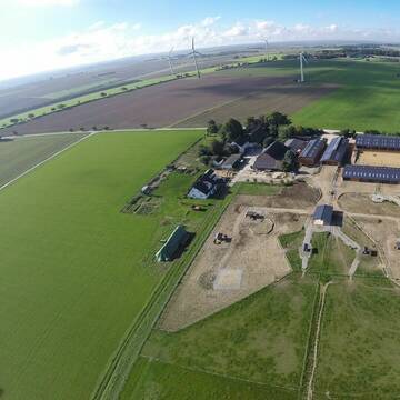
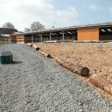
Helle Pferdeboxen frei
Olsberg
Pferdeoase-Gevelinghausen
@Pferdeoase-Gevelinghausen
Freizeitstall
Vermieten
Paddock
Parkplatz für Pferdeanhänger
Außenboxen
Innenbox
9 weitere...
B
Leider kein Vorschaubild
Leider kein Vorschaubild
Pferdebox oder Offenstall Greitekenhof
Diemelsee-Sudeck
Lara Wiens
@Lara2609
Freizeitstall
Gangpferdereiten
Vermieten
Hunde willkommen
Krankenbox
Fohlenaufzucht möglich
Hufrehe geeignet
18 weitere...
B
Deprecated: Creation of dynamic property Zend_View_Helper_Ads::$adLink is deprecated in /var/www/stall-frei/htdocs/staging.stall-frei.de/library/Psf/View/Helper/Ads.php on line 108

Futtersack HeuToy, Fressbremse in pink
Mechtersen
STALL-FREIde Marketing
@STALL-FREI-Marketing
Stundenlange Beschäftigung die
Koliken vorbeugt, geringe Staubinhalation mit
steuerbarer Futterentnahme


Großzügige Paddockboxen
Lichtenfels
Tanja Hartmann
@TanjaHartmann
Freizeitstall
Vermieten
Hunde willkommen
Paddock
Hufrehe geeignet
15 weitere...
P+
Aktivstall Springob - Ihr Offenstall in Anröchte
Anröchte-Altenmellrich
Aktivstall Springob
@Aktivstall-Springob
FN-Mitglied
Freizeitstall
Vermieten
Krankenbox
Longierzirkel/Roundpen
Allergikerstall
Hufrehe geeignet
24 weitere...
P+

HIT-Aktivstall Hof Schenuit
Eslohe
Hof-Schenuit
@Hof-Schenuit
Freizeitstall
Vermieten
Hunde willkommen
Krankenbox
Hufrehe geeignet
Notfallboxen
13 weitere...
aktuell
P
Leider kein Vorschaubild
Leider kein Vorschaubild
Günstige Ponybox zu vermieten
Meschede
Kirsten Neitemeier
@Franz Neitemeier
FN-Mitglied
Freizeitstall
Vermieten
Führanlage
Paddock
Gnadenbrothof
Pferdezucht
20 weitere...
P

Das Beste für die Hufe
Mechtersen
STALL-FREIde Marketing
@STALL-FREI-Marketing
Hufschmiede und Hufpfleger in Ihrer Nähe
Leider kein Vorschaubild
Leider kein Vorschaubild
2 Boxen zu vermieten
Meschede
Kirsten Neitemeier
@Franz Neitemeier
FN-Mitglied
Freizeitstall
Vermieten
Führanlage
Paddock
Gnadenbrothof
Pferdezucht
20 weitere...
P

Offenstallplatz frei
Sellinghausen
Stephanie Franke
@Stephaniefranke
Geländestrecke
Vermieten
Hunde willkommen
Krankenbox
Notfallboxen
7 weitere...
aktuell
P
Leider kein Vorschaubild
Leider kein Vorschaubild
Große, helle Boxen weitläufige Weiden
Schmallenberg
Wilmeshof
@Einalem
Freizeitstall
Vermieten
Longierzirkel/Roundpen
Paddock
Allergikerstall
bedampftes/gewaschenes Heu
20 weitere...
aktuell
B


Aktiv- &Bewegungsstall-artgerechte Pferdehal...
Lippstadt
Aktivstall Bücker
@Aktivstall-Buecker
Freizeitstall
Vermieten
Hunde willkommen
Krankenbox
Allergikerstall
Hufrehe geeignet
19 weitere...
aktuell
S
Deprecated: Creation of dynamic property Zend_View::$pageCount is deprecated in /var/www/stall-frei/htdocs/staging.stall-frei.de/library/vendor/shardj/zf1-future/library/Zend/View/Abstract.php on line 308
Deprecated: Creation of dynamic property Zend_View::$itemCountPerPage is deprecated in /var/www/stall-frei/htdocs/staging.stall-frei.de/library/vendor/shardj/zf1-future/library/Zend/View/Abstract.php on line 308
Deprecated: Creation of dynamic property Zend_View::$first is deprecated in /var/www/stall-frei/htdocs/staging.stall-frei.de/library/vendor/shardj/zf1-future/library/Zend/View/Abstract.php on line 308
Deprecated: Creation of dynamic property Zend_View::$current is deprecated in /var/www/stall-frei/htdocs/staging.stall-frei.de/library/vendor/shardj/zf1-future/library/Zend/View/Abstract.php on line 308
Deprecated: Creation of dynamic property Zend_View::$last is deprecated in /var/www/stall-frei/htdocs/staging.stall-frei.de/library/vendor/shardj/zf1-future/library/Zend/View/Abstract.php on line 308
Deprecated: Creation of dynamic property Zend_View::$next is deprecated in /var/www/stall-frei/htdocs/staging.stall-frei.de/library/vendor/shardj/zf1-future/library/Zend/View/Abstract.php on line 308
Deprecated: Creation of dynamic property Zend_View::$pagesInRange is deprecated in /var/www/stall-frei/htdocs/staging.stall-frei.de/library/vendor/shardj/zf1-future/library/Zend/View/Abstract.php on line 308
Deprecated: Creation of dynamic property Zend_View::$firstPageInRange is deprecated in /var/www/stall-frei/htdocs/staging.stall-frei.de/library/vendor/shardj/zf1-future/library/Zend/View/Abstract.php on line 308
Deprecated: Creation of dynamic property Zend_View::$lastPageInRange is deprecated in /var/www/stall-frei/htdocs/staging.stall-frei.de/library/vendor/shardj/zf1-future/library/Zend/View/Abstract.php on line 308
Deprecated: Creation of dynamic property Zend_View::$currentItemCount is deprecated in /var/www/stall-frei/htdocs/staging.stall-frei.de/library/vendor/shardj/zf1-future/library/Zend/View/Abstract.php on line 308
Deprecated: Creation of dynamic property Zend_View::$totalItemCount is deprecated in /var/www/stall-frei/htdocs/staging.stall-frei.de/library/vendor/shardj/zf1-future/library/Zend/View/Abstract.php on line 308
Deprecated: Creation of dynamic property Zend_View::$firstItemNumber is deprecated in /var/www/stall-frei/htdocs/staging.stall-frei.de/library/vendor/shardj/zf1-future/library/Zend/View/Abstract.php on line 308
Deprecated: Creation of dynamic property Zend_View::$lastItemNumber is deprecated in /var/www/stall-frei/htdocs/staging.stall-frei.de/library/vendor/shardj/zf1-future/library/Zend/View/Abstract.php on line 308
Deprecated: Creation of dynamic property Zend_View::$router is deprecated in /var/www/stall-frei/htdocs/staging.stall-frei.de/library/vendor/shardj/zf1-future/library/Zend/View/Abstract.php on line 308
Deprecated: Creation of dynamic property Zend_View::$urlParams is deprecated in /var/www/stall-frei/htdocs/staging.stall-frei.de/library/vendor/shardj/zf1-future/library/Zend/View/Abstract.php on line 308
Deprecated: Creation of dynamic property Zend_View::$showAds is deprecated in /var/www/stall-frei/htdocs/staging.stall-frei.de/library/vendor/shardj/zf1-future/library/Zend/View/Abstract.php on line 308
Deprecated: Creation of dynamic property Zend_View::$objectIds is deprecated in /var/www/stall-frei/htdocs/staging.stall-frei.de/library/vendor/shardj/zf1-future/library/Zend/View/Abstract.php on line 308
Deprecated: Creation of dynamic property Zend_View::$showNavbar is deprecated in /var/www/stall-frei/htdocs/staging.stall-frei.de/library/vendor/shardj/zf1-future/library/Zend/View/Abstract.php on line 308
Deprecated: Creation of dynamic property Zend_View::$showBreadcrumb is deprecated in /var/www/stall-frei/htdocs/staging.stall-frei.de/library/vendor/shardj/zf1-future/library/Zend/View/Abstract.php on line 308
Deprecated: Creation of dynamic property Zend_View::$showFooter is deprecated in /var/www/stall-frei/htdocs/staging.stall-frei.de/library/vendor/shardj/zf1-future/library/Zend/View/Abstract.php on line 308
Deprecated: Creation of dynamic property Zend_View::$showInternalAds is deprecated in /var/www/stall-frei/htdocs/staging.stall-frei.de/library/vendor/shardj/zf1-future/library/Zend/View/Abstract.php on line 308
Deprecated: Creation of dynamic property Zend_View::$blNoContent is deprecated in /var/www/stall-frei/htdocs/staging.stall-frei.de/library/vendor/shardj/zf1-future/library/Zend/View/Abstract.php on line 308
Deprecated: Creation of dynamic property Zend_View::$sMetaDesc is deprecated in /var/www/stall-frei/htdocs/staging.stall-frei.de/library/vendor/shardj/zf1-future/library/Zend/View/Abstract.php on line 308
Deprecated: Creation of dynamic property Zend_View::$useGmaps is deprecated in /var/www/stall-frei/htdocs/staging.stall-frei.de/library/vendor/shardj/zf1-future/library/Zend/View/Abstract.php on line 308
Deprecated: Creation of dynamic property Zend_View::$touches is deprecated in /var/www/stall-frei/htdocs/staging.stall-frei.de/library/vendor/shardj/zf1-future/library/Zend/View/Abstract.php on line 308
Deprecated: Creation of dynamic property Zend_View::$oProject is deprecated in /var/www/stall-frei/htdocs/staging.stall-frei.de/library/vendor/shardj/zf1-future/library/Zend/View/Abstract.php on line 308
Deprecated: Creation of dynamic property Zend_View::$pageHeadline is deprecated in /var/www/stall-frei/htdocs/staging.stall-frei.de/library/vendor/shardj/zf1-future/library/Zend/View/Abstract.php on line 308
Deprecated: Creation of dynamic property Zend_View::$disableLocationField is deprecated in /var/www/stall-frei/htdocs/staging.stall-frei.de/library/vendor/shardj/zf1-future/library/Zend/View/Abstract.php on line 308
Deprecated: Creation of dynamic property Zend_View::$isSearch is deprecated in /var/www/stall-frei/htdocs/staging.stall-frei.de/library/vendor/shardj/zf1-future/library/Zend/View/Abstract.php on line 308
Deprecated: Creation of dynamic property Zend_View::$pageTitle is deprecated in /var/www/stall-frei/htdocs/staging.stall-frei.de/library/vendor/shardj/zf1-future/library/Zend/View/Abstract.php on line 308
Deprecated: Creation of dynamic property Psf_Form_Element_Text::$class is deprecated in /var/www/stall-frei/htdocs/staging.stall-frei.de/library/vendor/shardj/zf1-future/library/Zend/Form/Element.php on line 874
Deprecated: Creation of dynamic property Psf_Form_Element_Text::$size is deprecated in /var/www/stall-frei/htdocs/staging.stall-frei.de/library/vendor/shardj/zf1-future/library/Zend/Form/Element.php on line 874
Deprecated: Creation of dynamic property Psf_Form_Element_Text::$placeholder is deprecated in /var/www/stall-frei/htdocs/staging.stall-frei.de/library/vendor/shardj/zf1-future/library/Zend/Form/Element.php on line 874
Deprecated: Creation of dynamic property Psf_Form_Element_Hidden::$class is deprecated in /var/www/stall-frei/htdocs/staging.stall-frei.de/library/vendor/shardj/zf1-future/library/Zend/Form/Element.php on line 874
Deprecated: Creation of dynamic property Psf_Form_Element_Hidden::$class is deprecated in /var/www/stall-frei/htdocs/staging.stall-frei.de/library/vendor/shardj/zf1-future/library/Zend/Form/Element.php on line 874
Deprecated: Creation of dynamic property Psf_Form_Element_Hidden::$class is deprecated in /var/www/stall-frei/htdocs/staging.stall-frei.de/library/vendor/shardj/zf1-future/library/Zend/Form/Element.php on line 874
Deprecated: Creation of dynamic property Psf_Form_Element_Hidden::$class is deprecated in /var/www/stall-frei/htdocs/staging.stall-frei.de/library/vendor/shardj/zf1-future/library/Zend/Form/Element.php on line 874
Deprecated: Creation of dynamic property Psf_Form_Element_Select::$class is deprecated in /var/www/stall-frei/htdocs/staging.stall-frei.de/library/vendor/shardj/zf1-future/library/Zend/Form/Element.php on line 874
Deprecated: Creation of dynamic property Psf_Form_Element_Select::$class is deprecated in /var/www/stall-frei/htdocs/staging.stall-frei.de/library/vendor/shardj/zf1-future/library/Zend/Form/Element.php on line 874
Deprecated: Creation of dynamic property Psf_Form_Element_Select::$class is deprecated in /var/www/stall-frei/htdocs/staging.stall-frei.de/library/vendor/shardj/zf1-future/library/Zend/Form/Element.php on line 874
Deprecated: Creation of dynamic property Psf_Form_Element_Select::$class is deprecated in /var/www/stall-frei/htdocs/staging.stall-frei.de/library/vendor/shardj/zf1-future/library/Zend/Form/Element.php on line 874
Deprecated: Creation of dynamic property Psf_Form_Element_Text::$class is deprecated in /var/www/stall-frei/htdocs/staging.stall-frei.de/library/vendor/shardj/zf1-future/library/Zend/Form/Element.php on line 874
Deprecated: Creation of dynamic property Psf_Form_Element_Checkbox::$label is deprecated in /var/www/stall-frei/htdocs/staging.stall-frei.de/library/vendor/shardj/zf1-future/library/Zend/Form/Element.php on line 874
Deprecated: Creation of dynamic property Zend_View::$sort is deprecated in /var/www/stall-frei/htdocs/staging.stall-frei.de/library/vendor/shardj/zf1-future/library/Zend/View/Abstract.php on line 308
Deprecated: Creation of dynamic property Zend_View::$searchLocation is deprecated in /var/www/stall-frei/htdocs/staging.stall-frei.de/library/vendor/shardj/zf1-future/library/Zend/View/Abstract.php on line 308
Deprecated: Creation of dynamic property Zend_View::$locationHint is deprecated in /var/www/stall-frei/htdocs/staging.stall-frei.de/library/vendor/shardj/zf1-future/library/Zend/View/Abstract.php on line 308
Psf_GeoCoder_Abstract::getLocation: Ruthenberg Get Location CachedOrLive
Psf_GeoCoder_Abstract::getCachedOrLive: Ruthenberg
Psf_GeoCoder_OpenCageData::makeApiRequest: response:
Array
(
[documentation] => https://opencagedata.com/api
[licenses] => Array
(
[0] => Array
(
[name] => see attribution guide
[url] => https://opencagedata.com/credits
)
)
[results] => Array
(
[0] => Array
(
[bounds] => Array
(
[northeast] => Array
(
[lat] => 51.3422937
[lng] => 8.5275796
)
[southwest] => Array
(
[lat] => 51.3421937
[lng] => 8.5274796
)
)
[components] => Array
(
[ISO_3166-1_alpha-2] => DE
[ISO_3166-1_alpha-3] => DEU
[ISO_3166-2] => Array
(
[0] => DE-NW
)
[_category] => natural/water
[_normalized_city] => Olsberg
[_type] => peak
[continent] => Europe
[country] => Deutschland
[country_code] => de
[county] => Hochsauerlandkreis
[peak] => Ruthenberg
[political_union] => European Union
[postcode] => 59939
[state] => Nordrhein-Westfalen
[state_code] => NW
[town] => Olsberg
)
[confidence] => 9
[formatted] => Ruthenberg, 59939 Olsberg, Deutschland
[geometry] => Array
(
[lat] => 51.3422437
[lng] => 8.5275296
)
)
[1] => Array
(
[bounds] => Array
(
[northeast] => Array
(
[lat] => 51.2341489
[lng] => 7.9378628
)
[southwest] => Array
(
[lat] => 51.2340489
[lng] => 7.9377628
)
)
[components] => Array
(
[ISO_3166-1_alpha-2] => DE
[ISO_3166-1_alpha-3] => DEU
[ISO_3166-2] => Array
(
[0] => DE-NW
)
[_category] => natural/water
[_normalized_city] => Sundern
[_type] => peak
[continent] => Europe
[country] => Deutschland
[country_code] => de
[county] => Hochsauerlandkreis
[peak] => Ruthenberg
[political_union] => European Union
[state] => Nordrhein-Westfalen
[state_code] => NW
[town] => Sundern
)
[confidence] => 9
[formatted] => Ruthenberg, Sundern, Nordrhein-Westfalen, Deutschland
[geometry] => Array
(
[lat] => 51.2340989
[lng] => 7.9378128
)
)
[2] => Array
(
[bounds] => Array
(
[northeast] => Array
(
[lat] => 54.087415
[lng] => 10.0389881
)
[southwest] => Array
(
[lat] => 54.047415
[lng] => 9.9989881
)
)
[components] => Array
(
[ISO_3166-1_alpha-2] => DE
[ISO_3166-1_alpha-3] => DEU
[ISO_3166-2] => Array
(
[0] => DE-SH
)
[_category] => place
[_normalized_city] => Neumünster
[_type] => neighbourhood
[continent] => Europe
[country] => Deutschland
[country_code] => de
[county] => Neumünster
[political_union] => European Union
[postcode] => 24539
[state] => Schleswig-Holstein
[state_code] => SH
[suburb] => Ruthenberg
[town] => Neumünster
)
[confidence] => 7
[formatted] => 24539 Neumünster, Deutschland
[geometry] => Array
(
[lat] => 54.067415
[lng] => 10.0189881
)
)
[3] => Array
(
[components] => Array
(
[ISO_3166-1_alpha-2] => FR
[ISO_3166-1_alpha-3] => FRA
[ISO_3166-2] => Array
(
[0] => FR-IDF
[1] => FR-93
)
[_category] => road
[_normalized_city] => Drancy
[_type] => road
[city] => Drancy
[continent] => Europe
[country] => France
[country_code] => fr
[county] => Seine-Saint-Denis
[local_authority] => Métropole du Grand Paris
[political_union] => European Union
[postcode] => 93700
[road] => Rue Gutenberg
[state] => Île-de-France
[state_code] => IDF
)
[confidence] => 3
[formatted] => Rue Gutenberg, 93700 Drancy, France
[geometry] => Array
(
[lat] => 48.922644
[lng] => 2.430775
)
)
[4] => Array
(
[components] => Array
(
[ISO_3166-1_alpha-2] => FR
[ISO_3166-1_alpha-3] => FRA
[ISO_3166-2] => Array
(
[0] => FR-GES
[1] => FR-6AE
[2] => FR-67
)
[_category] => road
[_normalized_city] => Dambach-la-Ville
[_type] => road
[city] => Dambach-la-Ville
[continent] => Europe
[country] => France
[country_code] => fr
[county] => Bas-Rhin
[local_authority] => Communauté de communes du Pays de Barr
[political_union] => European Union
[postcode] => 67650
[road] => Chemin du Rutenberg
[state] => Grand Est
[state_code] => GES
)
[confidence] => 3
[formatted] => Chemin du Rutenberg, 67650 Dambach-la-Ville, France
[geometry] => Array
(
[lat] => 48.320128
[lng] => 7.42426
)
)
[5] => Array
(
[components] => Array
(
[ISO_3166-1_alpha-2] => FR
[ISO_3166-1_alpha-3] => FRA
[ISO_3166-2] => Array
(
[0] => FR-ARA
[1] => FR-42
)
[_category] => road
[_normalized_city] => Veauche
[_type] => road
[city] => Veauche
[continent] => Europe
[country] => France
[country_code] => fr
[county] => Loire
[local_authority] => Communauté de communes de Forez-Est
[political_union] => European Union
[postcode] => 42340
[road] => Rue Gutenberg
[state] => Auvergne-Rhône-Alpes
[state_code] => ARA
)
[confidence] => 3
[formatted] => Rue Gutenberg, 42340 Veauche, France
[geometry] => Array
(
[lat] => 45.552012
[lng] => 4.292029
)
)
[6] => Array
(
[components] => Array
(
[ISO_3166-1_alpha-2] => FR
[ISO_3166-1_alpha-3] => FRA
[ISO_3166-2] => Array
(
[0] => FR-ARA
[1] => FR-69
)
[_category] => road
[_normalized_city] => Décines-Charpieu
[_type] => road
[city] => Décines-Charpieu
[continent] => Europe
[country] => France
[country_code] => fr
[county] => Rhône
[local_authority] => Métropole de Lyon
[political_union] => European Union
[postcode] => 69150
[road] => Rue Gutenberg
[state] => Auvergne-Rhône-Alpes
[state_code] => ARA
)
[confidence] => 3
[formatted] => Rue Gutenberg, 69150 Décines-Charpieu, France
[geometry] => Array
(
[lat] => 45.76979
[lng] => 4.945556
)
)
[7] => Array
(
[components] => Array
(
[ISO_3166-1_alpha-2] => FR
[ISO_3166-1_alpha-3] => FRA
[ISO_3166-2] => Array
(
[0] => FR-PDL
[1] => FR-44
)
[_category] => road
[_normalized_city] => Nantes
[_type] => road
[city] => Nantes
[continent] => Europe
[country] => France
[country_code] => fr
[county] => Loire-Atlantique
[local_authority] => Nantes Métropole
[political_union] => European Union
[postcode] => 44100
[road] => Rue Gutenberg
[state] => Pays de la Loire
[state_code] => PDL
)
[confidence] => 3
[formatted] => Rue Gutenberg, 44100 Nantes, France
[geometry] => Array
(
[lat] => 47.201531
[lng] => -1.586251
)
)
[8] => Array
(
[components] => Array
(
[ISO_3166-1_alpha-2] => FR
[ISO_3166-1_alpha-3] => FRA
[ISO_3166-2] => Array
(
[0] => FR-PAC
[1] => FR-83
)
[_category] => road
[_normalized_city] => La Seyne-sur-Mer
[_type] => road
[city] => La Seyne-sur-Mer
[continent] => Europe
[country] => France
[country_code] => fr
[county] => Var
[local_authority] => Métropole Toulon-Provence-Méditerranée
[political_union] => European Union
[postcode] => 83500
[road] => esplanade gutenberg
[state] => Provence-Alpes-Côte d'Azur
[state_code] => PAC
)
[confidence] => 3
[formatted] => esplanade gutenberg, 83500 La Seyne-sur-Mer, France
[geometry] => Array
(
[lat] => 43.103185
[lng] => 5.875812
)
)
[9] => Array
(
[components] => Array
(
[ISO_3166-1_alpha-2] => FR
[ISO_3166-1_alpha-3] => FRA
[ISO_3166-2] => Array
(
[0] => FR-NAQ
[1] => FR-79
)
[_category] => road
[_normalized_city] => Parthenay
[_type] => road
[city] => Parthenay
[continent] => Europe
[country] => France
[country_code] => fr
[county] => Deux-Sèvres
[local_authority] => Communauté de communes de Parthenay-Gâtine
[political_union] => European Union
[postcode] => 79200
[road] => Rue Gutenberg
[state] => Nouvelle-Aquitaine
[state_code] => NAQ
)
[confidence] => 3
[formatted] => Rue Gutenberg, 79200 Parthenay, France
[geometry] => Array
(
[lat] => 46.645977
[lng] => -0.246709
)
)
)
[status] => Array
(
[code] => 200
[message] => OK
)
[stay_informed] => Array
(
[blog] => https://blog.opencagedata.com
[mastodon] => https://en.osm.town/@opencage
)
[thanks] => For using an OpenCage API
[timestamp] => Array
(
[created_http] => Sun, 08 Feb 2026 10:35:42 GMT
[created_unix] => 1770546942
)
[total_results] => 10
)
Psf_GeoCoder_Abstract::convertLocationResult
{"documentation":"https:\/\/opencagedata.com\/api","licenses":[{"name":"see attribution guide","url":"https:\/\/opencagedata.com\/credits"}],"results":[{"bounds":{"northeast":{"lat":51.3422937,"lng":8.5275796},"southwest":{"lat":51.3421937,"lng":8.5274796}},"components":{"ISO_3166-1_alpha-2":"DE","ISO_3166-1_alpha-3":"DEU","ISO_3166-2":["DE-NW"],"_category":"natural\/water","_normalized_city":"Olsberg","_type":"peak","continent":"Europe","country":"Deutschland","country_code":"de","county":"Hochsauerlandkreis","peak":"Ruthenberg","political_union":"European Union","postcode":"59939","state":"Nordrhein-Westfalen","state_code":"NW","town":"Olsberg"},"confidence":9,"formatted":"Ruthenberg, 59939 Olsberg, Deutschland","geometry":{"lat":51.3422437,"lng":8.5275296}},{"bounds":{"northeast":{"lat":51.2341489,"lng":7.9378628},"southwest":{"lat":51.2340489,"lng":7.9377628}},"components":{"ISO_3166-1_alpha-2":"DE","ISO_3166-1_alpha-3":"DEU","ISO_3166-2":["DE-NW"],"_category":"natural\/water","_normalized_city":"Sundern","_type":"peak","continent":"Europe","country":"Deutschland","country_code":"de","county":"Hochsauerlandkreis","peak":"Ruthenberg","political_union":"European Union","state":"Nordrhein-Westfalen","state_code":"NW","town":"Sundern"},"confidence":9,"formatted":"Ruthenberg, Sundern, Nordrhein-Westfalen, Deutschland","geometry":{"lat":51.2340989,"lng":7.9378128}},{"bounds":{"northeast":{"lat":54.087415,"lng":10.0389881},"southwest":{"lat":54.047415,"lng":9.9989881}},"components":{"ISO_3166-1_alpha-2":"DE","ISO_3166-1_alpha-3":"DEU","ISO_3166-2":["DE-SH"],"_category":"place","_normalized_city":"Neum\u00fcnster","_type":"neighbourhood","continent":"Europe","country":"Deutschland","country_code":"de","county":"Neum\u00fcnster","political_union":"European Union","postcode":"24539","state":"Schleswig-Holstein","state_code":"SH","suburb":"Ruthenberg","town":"Neum\u00fcnster"},"confidence":7,"formatted":"24539 Neum\u00fcnster, Deutschland","geometry":{"lat":54.067415,"lng":10.0189881}},{"components":{"ISO_3166-1_alpha-2":"FR","ISO_3166-1_alpha-3":"FRA","ISO_3166-2":["FR-IDF","FR-93"],"_category":"road","_normalized_city":"Drancy","_type":"road","city":"Drancy","continent":"Europe","country":"France","country_code":"fr","county":"Seine-Saint-Denis","local_authority":"M\u00e9tropole du Grand Paris","political_union":"European Union","postcode":"93700","road":"Rue Gutenberg","state":"\u00cele-de-France","state_code":"IDF"},"confidence":3,"formatted":"Rue Gutenberg, 93700 Drancy, France","geometry":{"lat":48.922644,"lng":2.430775}},{"components":{"ISO_3166-1_alpha-2":"FR","ISO_3166-1_alpha-3":"FRA","ISO_3166-2":["FR-GES","FR-6AE","FR-67"],"_category":"road","_normalized_city":"Dambach-la-Ville","_type":"road","city":"Dambach-la-Ville","continent":"Europe","country":"France","country_code":"fr","county":"Bas-Rhin","local_authority":"Communaut\u00e9 de communes du Pays de Barr","political_union":"European Union","postcode":"67650","road":"Chemin du Rutenberg","state":"Grand Est","state_code":"GES"},"confidence":3,"formatted":"Chemin du Rutenberg, 67650 Dambach-la-Ville, France","geometry":{"lat":48.320128,"lng":7.42426}},{"components":{"ISO_3166-1_alpha-2":"FR","ISO_3166-1_alpha-3":"FRA","ISO_3166-2":["FR-ARA","FR-42"],"_category":"road","_normalized_city":"Veauche","_type":"road","city":"Veauche","continent":"Europe","country":"France","country_code":"fr","county":"Loire","local_authority":"Communaut\u00e9 de communes de Forez-Est","political_union":"European Union","postcode":"42340","road":"Rue Gutenberg","state":"Auvergne-Rh\u00f4ne-Alpes","state_code":"ARA"},"confidence":3,"formatted":"Rue Gutenberg, 42340 Veauche, France","geometry":{"lat":45.552012,"lng":4.292029}},{"components":{"ISO_3166-1_alpha-2":"FR","ISO_3166-1_alpha-3":"FRA","ISO_3166-2":["FR-ARA","FR-69"],"_category":"road","_normalized_city":"D\u00e9cines-Charpieu","_type":"road","city":"D\u00e9cines-Charpieu","continent":"Europe","country":"France","country_code":"fr","county":"Rh\u00f4ne","local_authority":"M\u00e9tropole de Lyon","political_union":"European Union","postcode":"69150","road":"Rue Gutenberg","state":"Auvergne-Rh\u00f4ne-Alpes","state_code":"ARA"},"confidence":3,"formatted":"Rue Gutenberg, 69150 D\u00e9cines-Charpieu, France","geometry":{"lat":45.76979,"lng":4.945556}},{"components":{"ISO_3166-1_alpha-2":"FR","ISO_3166-1_alpha-3":"FRA","ISO_3166-2":["FR-PDL","FR-44"],"_category":"road","_normalized_city":"Nantes","_type":"road","city":"Nantes","continent":"Europe","country":"France","country_code":"fr","county":"Loire-Atlantique","local_authority":"Nantes M\u00e9tropole","political_union":"European Union","postcode":"44100","road":"Rue Gutenberg","state":"Pays de la Loire","state_code":"PDL"},"confidence":3,"formatted":"Rue Gutenberg, 44100 Nantes, France","geometry":{"lat":47.201531,"lng":-1.586251}},{"components":{"ISO_3166-1_alpha-2":"FR","ISO_3166-1_alpha-3":"FRA","ISO_3166-2":["FR-PAC","FR-83"],"_category":"road","_normalized_city":"La Seyne-sur-Mer","_type":"road","city":"La Seyne-sur-Mer","continent":"Europe","country":"France","country_code":"fr","county":"Var","local_authority":"M\u00e9tropole Toulon-Provence-M\u00e9diterran\u00e9e","political_union":"European Union","postcode":"83500","road":"esplanade gutenberg","state":"Provence-Alpes-C\u00f4te d'Azur","state_code":"PAC"},"confidence":3,"formatted":"esplanade gutenberg, 83500 La Seyne-sur-Mer, France","geometry":{"lat":43.103185,"lng":5.875812}},{"components":{"ISO_3166-1_alpha-2":"FR","ISO_3166-1_alpha-3":"FRA","ISO_3166-2":["FR-NAQ","FR-79"],"_category":"road","_normalized_city":"Parthenay","_type":"road","city":"Parthenay","continent":"Europe","country":"France","country_code":"fr","county":"Deux-S\u00e8vres","local_authority":"Communaut\u00e9 de communes de Parthenay-G\u00e2tine","political_union":"European Union","postcode":"79200","road":"Rue Gutenberg","state":"Nouvelle-Aquitaine","state_code":"NAQ"},"confidence":3,"formatted":"Rue Gutenberg, 79200 Parthenay, France","geometry":{"lat":46.645977,"lng":-0.246709}}],"status":{"code":200,"message":"OK"},"stay_informed":{"blog":"https:\/\/blog.opencagedata.com","mastodon":"https:\/\/en.osm.town\/@opencage"},"thanks":"For using an OpenCage API","timestamp":{"created_http":"Sun, 08 Feb 2026 10:35:42 GMT","created_unix":1770546942},"total_results":10}Array
(
[0] => stdClass Object
(
[bounds] => stdClass Object
(
[northeast] => stdClass Object
(
[lat] => 51.3422937
[lng] => 8.5275796
)
[southwest] => stdClass Object
(
[lat] => 51.3421937
[lng] => 8.5274796
)
)
[components] => stdClass Object
(
[ISO_3166-1_alpha-2] => DE
[ISO_3166-1_alpha-3] => DEU
[ISO_3166-2] => Array
(
[0] => DE-NW
)
[_category] => natural/water
[_normalized_city] => Olsberg
[_type] => peak
[continent] => Europe
[country] => Deutschland
[country_code] => de
[county] => Hochsauerlandkreis
[peak] => Ruthenberg
[political_union] => European Union
[postcode] => 59939
[state] => Nordrhein-Westfalen
[state_code] => NW
[town] => Olsberg
)
[confidence] => 9
[formatted] => Ruthenberg, 59939 Olsberg, Deutschland
[geometry] => stdClass Object
(
[lat] => 51.3422437
[lng] => 8.5275296
)
)
[1] => stdClass Object
(
[bounds] => stdClass Object
(
[northeast] => stdClass Object
(
[lat] => 51.2341489
[lng] => 7.9378628
)
[southwest] => stdClass Object
(
[lat] => 51.2340489
[lng] => 7.9377628
)
)
[components] => stdClass Object
(
[ISO_3166-1_alpha-2] => DE
[ISO_3166-1_alpha-3] => DEU
[ISO_3166-2] => Array
(
[0] => DE-NW
)
[_category] => natural/water
[_normalized_city] => Sundern
[_type] => peak
[continent] => Europe
[country] => Deutschland
[country_code] => de
[county] => Hochsauerlandkreis
[peak] => Ruthenberg
[political_union] => European Union
[state] => Nordrhein-Westfalen
[state_code] => NW
[town] => Sundern
)
[confidence] => 9
[formatted] => Ruthenberg, Sundern, Nordrhein-Westfalen, Deutschland
[geometry] => stdClass Object
(
[lat] => 51.2340989
[lng] => 7.9378128
)
)
[2] => stdClass Object
(
[bounds] => stdClass Object
(
[northeast] => stdClass Object
(
[lat] => 54.087415
[lng] => 10.0389881
)
[southwest] => stdClass Object
(
[lat] => 54.047415
[lng] => 9.9989881
)
)
[components] => stdClass Object
(
[ISO_3166-1_alpha-2] => DE
[ISO_3166-1_alpha-3] => DEU
[ISO_3166-2] => Array
(
[0] => DE-SH
)
[_category] => place
[_normalized_city] => Neumünster
[_type] => neighbourhood
[continent] => Europe
[country] => Deutschland
[country_code] => de
[county] => Neumünster
[political_union] => European Union
[postcode] => 24539
[state] => Schleswig-Holstein
[state_code] => SH
[suburb] => Ruthenberg
[town] => Neumünster
)
[confidence] => 7
[formatted] => 24539 Neumünster, Deutschland
[geometry] => stdClass Object
(
[lat] => 54.067415
[lng] => 10.0189881
)
)
[3] => stdClass Object
(
[components] => stdClass Object
(
[ISO_3166-1_alpha-2] => FR
[ISO_3166-1_alpha-3] => FRA
[ISO_3166-2] => Array
(
[0] => FR-IDF
[1] => FR-93
)
[_category] => road
[_normalized_city] => Drancy
[_type] => road
[city] => Drancy
[continent] => Europe
[country] => France
[country_code] => fr
[county] => Seine-Saint-Denis
[local_authority] => Métropole du Grand Paris
[political_union] => European Union
[postcode] => 93700
[road] => Rue Gutenberg
[state] => Île-de-France
[state_code] => IDF
)
[confidence] => 3
[formatted] => Rue Gutenberg, 93700 Drancy, France
[geometry] => stdClass Object
(
[lat] => 48.922644
[lng] => 2.430775
)
)
[4] => stdClass Object
(
[components] => stdClass Object
(
[ISO_3166-1_alpha-2] => FR
[ISO_3166-1_alpha-3] => FRA
[ISO_3166-2] => Array
(
[0] => FR-GES
[1] => FR-6AE
[2] => FR-67
)
[_category] => road
[_normalized_city] => Dambach-la-Ville
[_type] => road
[city] => Dambach-la-Ville
[continent] => Europe
[country] => France
[country_code] => fr
[county] => Bas-Rhin
[local_authority] => Communauté de communes du Pays de Barr
[political_union] => European Union
[postcode] => 67650
[road] => Chemin du Rutenberg
[state] => Grand Est
[state_code] => GES
)
[confidence] => 3
[formatted] => Chemin du Rutenberg, 67650 Dambach-la-Ville, France
[geometry] => stdClass Object
(
[lat] => 48.320128
[lng] => 7.42426
)
)
[5] => stdClass Object
(
[components] => stdClass Object
(
[ISO_3166-1_alpha-2] => FR
[ISO_3166-1_alpha-3] => FRA
[ISO_3166-2] => Array
(
[0] => FR-ARA
[1] => FR-42
)
[_category] => road
[_normalized_city] => Veauche
[_type] => road
[city] => Veauche
[continent] => Europe
[country] => France
[country_code] => fr
[county] => Loire
[local_authority] => Communauté de communes de Forez-Est
[political_union] => European Union
[postcode] => 42340
[road] => Rue Gutenberg
[state] => Auvergne-Rhône-Alpes
[state_code] => ARA
)
[confidence] => 3
[formatted] => Rue Gutenberg, 42340 Veauche, France
[geometry] => stdClass Object
(
[lat] => 45.552012
[lng] => 4.292029
)
)
[6] => stdClass Object
(
[components] => stdClass Object
(
[ISO_3166-1_alpha-2] => FR
[ISO_3166-1_alpha-3] => FRA
[ISO_3166-2] => Array
(
[0] => FR-ARA
[1] => FR-69
)
[_category] => road
[_normalized_city] => Décines-Charpieu
[_type] => road
[city] => Décines-Charpieu
[continent] => Europe
[country] => France
[country_code] => fr
[county] => Rhône
[local_authority] => Métropole de Lyon
[political_union] => European Union
[postcode] => 69150
[road] => Rue Gutenberg
[state] => Auvergne-Rhône-Alpes
[state_code] => ARA
)
[confidence] => 3
[formatted] => Rue Gutenberg, 69150 Décines-Charpieu, France
[geometry] => stdClass Object
(
[lat] => 45.76979
[lng] => 4.945556
)
)
[7] => stdClass Object
(
[components] => stdClass Object
(
[ISO_3166-1_alpha-2] => FR
[ISO_3166-1_alpha-3] => FRA
[ISO_3166-2] => Array
(
[0] => FR-PDL
[1] => FR-44
)
[_category] => road
[_normalized_city] => Nantes
[_type] => road
[city] => Nantes
[continent] => Europe
[country] => France
[country_code] => fr
[county] => Loire-Atlantique
[local_authority] => Nantes Métropole
[political_union] => European Union
[postcode] => 44100
[road] => Rue Gutenberg
[state] => Pays de la Loire
[state_code] => PDL
)
[confidence] => 3
[formatted] => Rue Gutenberg, 44100 Nantes, France
[geometry] => stdClass Object
(
[lat] => 47.201531
[lng] => -1.586251
)
)
[8] => stdClass Object
(
[components] => stdClass Object
(
[ISO_3166-1_alpha-2] => FR
[ISO_3166-1_alpha-3] => FRA
[ISO_3166-2] => Array
(
[0] => FR-PAC
[1] => FR-83
)
[_category] => road
[_normalized_city] => La Seyne-sur-Mer
[_type] => road
[city] => La Seyne-sur-Mer
[continent] => Europe
[country] => France
[country_code] => fr
[county] => Var
[local_authority] => Métropole Toulon-Provence-Méditerranée
[political_union] => European Union
[postcode] => 83500
[road] => esplanade gutenberg
[state] => Provence-Alpes-Côte d'Azur
[state_code] => PAC
)
[confidence] => 3
[formatted] => esplanade gutenberg, 83500 La Seyne-sur-Mer, France
[geometry] => stdClass Object
(
[lat] => 43.103185
[lng] => 5.875812
)
)
[9] => stdClass Object
(
[components] => stdClass Object
(
[ISO_3166-1_alpha-2] => FR
[ISO_3166-1_alpha-3] => FRA
[ISO_3166-2] => Array
(
[0] => FR-NAQ
[1] => FR-79
)
[_category] => road
[_normalized_city] => Parthenay
[_type] => road
[city] => Parthenay
[continent] => Europe
[country] => France
[country_code] => fr
[county] => Deux-Sèvres
[local_authority] => Communauté de communes de Parthenay-Gâtine
[political_union] => European Union
[postcode] => 79200
[road] => Rue Gutenberg
[state] => Nouvelle-Aquitaine
[state_code] => NAQ
)
[confidence] => 3
[formatted] => Rue Gutenberg, 79200 Parthenay, France
[geometry] => stdClass Object
(
[lat] => 46.645977
[lng] => -0.246709
)
)
)
Psf_GeoCoder_OpenCageData::getKeyMap: 0
stdClass Object
(
    [bounds] => stdClass Object
        (
            [northeast] => stdClass Object
                (
                    [lat] => 51.3422937
                    [lng] => 8.5275796
                )

            [southwest] => stdClass Object
                (
                    [lat] => 51.3421937
                    [lng] => 8.5274796
                )

        )

    [components] => stdClass Object
        (
            [ISO_3166-1_alpha-2] => DE
            [ISO_3166-1_alpha-3] => DEU
            [ISO_3166-2] => Array
                (
                    [0] => DE-NW
                )

            [_category] => natural/water
            [_normalized_city] => Olsberg
            [_type] => peak
            [continent] => Europe
            [country] => Deutschland
            [country_code] => de
            [county] => Hochsauerlandkreis
            [peak] => Ruthenberg
            [political_union] => European Union
            [postcode] => 59939
            [state] => Nordrhein-Westfalen
            [state_code] => NW
            [town] => Olsberg
        )

    [confidence] => 9
    [formatted] => Ruthenberg, 59939 Olsberg, Deutschland
    [geometry] => stdClass Object
        (
            [lat] => 51.3422437
            [lng] => 8.5275296
        )

)
Psf_GeoCoder_OpenCageData::getCounty: Hochsauerlandkreis
Psf_GeoCoder_OpenCageData::addMissingData REFETCH!
Array
(
    [address] => Ruthenberg, 59939 Olsberg, Deutschland
    [type] => peak
    [street] =>
    [city] => Olsberg
    [county] => Hochsauerlandkreis
    [state] => Nordrhein-Westfalen
    [zip] => 59939
    [country] => Deutschland
    [suburb] =>
    [countrycode] => de
    [latitude] => 51.3422437
    [longitude] => 8.5275296
    [accuracy] => 1
    [confidence] => 9
    [bounds] => stdClass Object
        (
            [northeast] => stdClass Object
                (
                    [lat] => 51.3422937
                    [lng] => 8.5275796
                )

            [southwest] => stdClass Object
                (
                    [lat] => 51.3421937
                    [lng] => 8.5274796
                )

        )

)
reformat!
Array
(
    [address] => Ruthenberg, 59939 Olsberg, Deutschland
    [type] => peak
    [street] =>
    [city] => Olsberg
    [county] => Hochsauerlandkreis
    [state] => Nordrhein-Westfalen
    [zip] => 59939
    [country] => Deutschland
    [suburb] =>
    [countrycode] => de
    [latitude] => 51.3422437
    [longitude] => 8.5275296
    [accuracy] => 1
    [confidence] => 9
    [bounds] => stdClass Object
        (
            [northeast] => stdClass Object
                (
                    [lat] => 51.3422937
                    [lng] => 8.5275796
                )

            [southwest] => stdClass Object
                (
                    [lat] => 51.3421937
                    [lng] => 8.5274796
                )

        )

    [place] => 59939 Olsberg, Nordrhein-Westfalen
    [hash] => 10193293fcc22ece7ee12d60bfc3d61e
)
Psf_GeoCoder_OpenCageData::getKeyMap: 1
stdClass Object
(
    [bounds] => stdClass Object
        (
            [northeast] => stdClass Object
                (
                    [lat] => 51.2341489
                    [lng] => 7.9378628
                )

            [southwest] => stdClass Object
                (
                    [lat] => 51.2340489
                    [lng] => 7.9377628
                )

        )

    [components] => stdClass Object
        (
            [ISO_3166-1_alpha-2] => DE
            [ISO_3166-1_alpha-3] => DEU
            [ISO_3166-2] => Array
                (
                    [0] => DE-NW
                )

            [_category] => natural/water
            [_normalized_city] => Sundern
            [_type] => peak
            [continent] => Europe
            [country] => Deutschland
            [country_code] => de
            [county] => Hochsauerlandkreis
            [peak] => Ruthenberg
            [political_union] => European Union
            [state] => Nordrhein-Westfalen
            [state_code] => NW
            [town] => Sundern
        )

    [confidence] => 9
    [formatted] => Ruthenberg, Sundern, Nordrhein-Westfalen, Deutschland
    [geometry] => stdClass Object
        (
            [lat] => 51.2340989
            [lng] => 7.9378128
        )

)
Psf_GeoCoder_OpenCageData::getCounty: Hochsauerlandkreis
Psf_GeoCoder_OpenCageData::addMissingData REFETCH!
Array
(
    [address] => Ruthenberg, Sundern, Nordrhein-Westfalen, Deutschland
    [type] => peak
    [street] =>
    [city] => Sundern
    [county] => Hochsauerlandkreis
    [state] => Nordrhein-Westfalen
    [zip] =>
    [country] => Deutschland
    [suburb] =>
    [countrycode] => de
    [latitude] => 51.2340989
    [longitude] => 7.9378128
    [accuracy] => 1
    [confidence] => 9
    [bounds] => stdClass Object
        (
            [northeast] => stdClass Object
                (
                    [lat] => 51.2341489
                    [lng] => 7.9378628
                )

            [southwest] => stdClass Object
                (
                    [lat] => 51.2340489
                    [lng] => 7.9377628
                )

        )

)
reformat!
Array
(
    [address] => Ruthenberg, Sundern, Nordrhein-Westfalen, Deutschland
    [type] => peak
    [street] =>
    [city] => Sundern
    [county] => Hochsauerlandkreis
    [state] => Nordrhein-Westfalen
    [zip] =>
    [country] => Deutschland
    [suburb] =>
    [countrycode] => de
    [latitude] => 51.2340989
    [longitude] => 7.9378128
    [accuracy] => 1
    [confidence] => 9
    [bounds] => stdClass Object
        (
            [northeast] => stdClass Object
                (
                    [lat] => 51.2341489
                    [lng] => 7.9378628
                )

            [southwest] => stdClass Object
                (
                    [lat] => 51.2340489
                    [lng] => 7.9377628
                )

        )

    [place] => Sundern, Nordrhein-Westfalen
    [hash] => b56e711c8bf18547bf9b8fee07b4331e
)
Psf_GeoCoder_OpenCageData::getKeyMap: 2
stdClass Object
(
    [bounds] => stdClass Object
        (
            [northeast] => stdClass Object
                (
                    [lat] => 54.087415
                    [lng] => 10.0389881
                )

            [southwest] => stdClass Object
                (
                    [lat] => 54.047415
                    [lng] => 9.9989881
                )

        )

    [components] => stdClass Object
        (
            [ISO_3166-1_alpha-2] => DE
            [ISO_3166-1_alpha-3] => DEU
            [ISO_3166-2] => Array
                (
                    [0] => DE-SH
                )

            [_category] => place
            [_normalized_city] => Neumünster
            [_type] => neighbourhood
            [continent] => Europe
            [country] => Deutschland
            [country_code] => de
            [county] => Neumünster
            [political_union] => European Union
            [postcode] => 24539
            [state] => Schleswig-Holstein
            [state_code] => SH
            [suburb] => Ruthenberg
            [town] => Neumünster
        )

    [confidence] => 7
    [formatted] => 24539 Neumünster, Deutschland
    [geometry] => stdClass Object
        (
            [lat] => 54.067415
            [lng] => 10.0189881
        )

)
Psf_GeoCoder_OpenCageData::getCounty: Neumünster
Psf_GeoCoder_OpenCageData::addMissingData REFETCH!
Array
(
    [address] => 24539 Neumünster, Deutschland
    [type] => neighbourhood
    [street] =>
    [city] => Neumünster
    [county] => Neumünster
    [state] => Schleswig-Holstein
    [zip] => 24539
    [country] => Deutschland
    [suburb] => Ruthenberg
    [countrycode] => de
    [latitude] => 54.067415
    [longitude] => 10.0189881
    [accuracy] => 1
    [confidence] => 7
    [bounds] => stdClass Object
        (
            [northeast] => stdClass Object
                (
                    [lat] => 54.087415
                    [lng] => 10.0389881
                )

            [southwest] => stdClass Object
                (
                    [lat] => 54.047415
                    [lng] => 9.9989881
                )

        )

)
reformat!
Array
(
    [address] => 24539 Neumünster, Deutschland
    [type] => neighbourhood
    [street] =>
    [city] => Neumünster
    [county] => Neumünster
    [state] => Schleswig-Holstein
    [zip] => 24539
    [country] => Deutschland
    [suburb] => Ruthenberg
    [countrycode] => de
    [latitude] => 54.067415
    [longitude] => 10.0189881
    [accuracy] => 1
    [confidence] => 7
    [bounds] => stdClass Object
        (
            [northeast] => stdClass Object
                (
                    [lat] => 54.087415
                    [lng] => 10.0389881
                )

            [southwest] => stdClass Object
                (
                    [lat] => 54.047415
                    [lng] => 9.9989881
                )

        )

    [place] => 24539 Neumünster, Schleswig-Holstein
    [hash] => 37d0521fe53e8d9def533885525b7105
)
Psf_GeoCoder_OpenCageData::getKeyMap: 3
stdClass Object
(
    [components] => stdClass Object
        (
            [ISO_3166-1_alpha-2] => FR
            [ISO_3166-1_alpha-3] => FRA
            [ISO_3166-2] => Array
                (
                    [0] => FR-IDF
                    [1] => FR-93
                )

            [_category] => road
            [_normalized_city] => Drancy
            [_type] => road
            [city] => Drancy
            [continent] => Europe
            [country] => France
            [country_code] => fr
            [county] => Seine-Saint-Denis
            [local_authority] => Métropole du Grand Paris
            [political_union] => European Union
            [postcode] => 93700
            [road] => Rue Gutenberg
            [state] => Île-de-France
            [state_code] => IDF
        )

    [confidence] => 3
    [formatted] => Rue Gutenberg, 93700 Drancy, France
    [geometry] => stdClass Object
        (
            [lat] => 48.922644
            [lng] => 2.430775
        )

)
Psf_GeoCoder_OpenCageData::getCounty: Seine-Saint-Denis
Psf_GeoCoder_OpenCageData::addMissingData REFETCH!
Array
(
    [address] => Rue Gutenberg, 93700 Drancy, France
    [type] => road
    [street] => Rue Gutenberg
    [city] => Drancy
    [county] => Seine-Saint-Denis
    [state] => Île-de-France
    [zip] => 93700
    [country] => France
    [suburb] =>
    [countrycode] => fr
    [latitude] => 48.922644
    [longitude] => 2.430775
    [accuracy] => 1
    [confidence] => 3
    [bounds] =>
)
reformat!
Array
(
    [address] => Rue Gutenberg, 93700 Drancy, France
    [type] => road
    [street] => Rue Gutenberg
    [city] => Drancy
    [county] => Seine-Saint-Denis
    [state] => Île-de-France
    [zip] => 93700
    [country] => France
    [suburb] =>
    [countrycode] => fr
    [latitude] => 48.922644
    [longitude] => 2.430775
    [accuracy] => 1
    [confidence] => 3
    [bounds] =>
    [place] => Rue Gutenberg, 93700 Drancy, Île-de-France
    [hash] => 8220649534a6acdaacdba61c92ef06b1
)
Psf_GeoCoder_OpenCageData::getKeyMap: 4
stdClass Object
(
    [components] => stdClass Object
        (
            [ISO_3166-1_alpha-2] => FR
            [ISO_3166-1_alpha-3] => FRA
            [ISO_3166-2] => Array
                (
                    [0] => FR-GES
                    [1] => FR-6AE
                    [2] => FR-67
                )

            [_category] => road
            [_normalized_city] => Dambach-la-Ville
            [_type] => road
            [city] => Dambach-la-Ville
            [continent] => Europe
            [country] => France
            [country_code] => fr
            [county] => Bas-Rhin
            [local_authority] => Communauté de communes du Pays de Barr
            [political_union] => European Union
            [postcode] => 67650
            [road] => Chemin du Rutenberg
            [state] => Grand Est
            [state_code] => GES
        )

    [confidence] => 3
    [formatted] => Chemin du Rutenberg, 67650 Dambach-la-Ville, France
    [geometry] => stdClass Object
        (
            [lat] => 48.320128
            [lng] => 7.42426
        )

)
Psf_GeoCoder_OpenCageData::getCounty: Bas-Rhin
Psf_GeoCoder_OpenCageData::addMissingData REFETCH!
Array
(
    [address] => Chemin du Rutenberg, 67650 Dambach-la-Ville, France
    [type] => road
    [street] => Chemin du Rutenberg
    [city] => Dambach-la-Ville
    [county] => Bas-Rhin
    [state] => Grand Est
    [zip] => 67650
    [country] => France
    [suburb] =>
    [countrycode] => fr
    [latitude] => 48.320128
    [longitude] => 7.42426
    [accuracy] => 1
    [confidence] => 3
    [bounds] =>
)
reformat!
Array
(
    [address] => Chemin du Rutenberg, 67650 Dambach-la-Ville, France
    [type] => road
    [street] => Chemin du Rutenberg
    [city] => Dambach-la-Ville
    [county] => Bas-Rhin
    [state] => Grand Est
    [zip] => 67650
    [country] => France
    [suburb] =>
    [countrycode] => fr
    [latitude] => 48.320128
    [longitude] => 7.42426
    [accuracy] => 1
    [confidence] => 3
    [bounds] =>
    [place] => Chemin du Rutenberg, 67650 Dambach-la-Ville, Grand Est
    [hash] => 3b265a0fdd8e90273401f911823e0465
)
Psf_GeoCoder_OpenCageData::getKeyMap: 5
stdClass Object
(
    [components] => stdClass Object
        (
            [ISO_3166-1_alpha-2] => FR
            [ISO_3166-1_alpha-3] => FRA
            [ISO_3166-2] => Array
                (
                    [0] => FR-ARA
                    [1] => FR-42
                )

            [_category] => road
            [_normalized_city] => Veauche
            [_type] => road
            [city] => Veauche
            [continent] => Europe
            [country] => France
            [country_code] => fr
            [county] => Loire
            [local_authority] => Communauté de communes de Forez-Est
            [political_union] => European Union
            [postcode] => 42340
            [road] => Rue Gutenberg
            [state] => Auvergne-Rhône-Alpes
            [state_code] => ARA
        )

    [confidence] => 3
    [formatted] => Rue Gutenberg, 42340 Veauche, France
    [geometry] => stdClass Object
        (
            [lat] => 45.552012
            [lng] => 4.292029
        )

)
Psf_GeoCoder_OpenCageData::getCounty: Loire
Psf_GeoCoder_OpenCageData::addMissingData REFETCH!
Array
(
    [address] => Rue Gutenberg, 42340 Veauche, France
    [type] => road
    [street] => Rue Gutenberg
    [city] => Veauche
    [county] => Loire
    [state] => Auvergne-Rhône-Alpes
    [zip] => 42340
    [country] => France
    [suburb] =>
    [countrycode] => fr
    [latitude] => 45.552012
    [longitude] => 4.292029
    [accuracy] => 1
    [confidence] => 3
    [bounds] =>
)
reformat!
Array
(
    [address] => Rue Gutenberg, 42340 Veauche, France
    [type] => road
    [street] => Rue Gutenberg
    [city] => Veauche
    [county] => Loire
    [state] => Auvergne-Rhône-Alpes
    [zip] => 42340
    [country] => France
    [suburb] =>
    [countrycode] => fr
    [latitude] => 45.552012
    [longitude] => 4.292029
    [accuracy] => 1
    [confidence] => 3
    [bounds] =>
    [place] => Rue Gutenberg, 42340 Veauche, Auvergne-Rhône-Alpes
    [hash] => df4af31bf114d512a4734f002d8f7006
)
Psf_GeoCoder_OpenCageData::getKeyMap: 6
stdClass Object
(
    [components] => stdClass Object
        (
            [ISO_3166-1_alpha-2] => FR
            [ISO_3166-1_alpha-3] => FRA
            [ISO_3166-2] => Array
                (
                    [0] => FR-ARA
                    [1] => FR-69
                )

            [_category] => road
            [_normalized_city] => Décines-Charpieu
            [_type] => road
            [city] => Décines-Charpieu
            [continent] => Europe
            [country] => France
            [country_code] => fr
            [county] => Rhône
            [local_authority] => Métropole de Lyon
            [political_union] => European Union
            [postcode] => 69150
            [road] => Rue Gutenberg
            [state] => Auvergne-Rhône-Alpes
            [state_code] => ARA
        )

    [confidence] => 3
    [formatted] => Rue Gutenberg, 69150 Décines-Charpieu, France
    [geometry] => stdClass Object
        (
            [lat] => 45.76979
            [lng] => 4.945556
        )

)
Psf_GeoCoder_OpenCageData::getCounty: Rhône
Psf_GeoCoder_OpenCageData::addMissingData REFETCH!
Array
(
    [address] => Rue Gutenberg, 69150 Décines-Charpieu, France
    [type] => road
    [street] => Rue Gutenberg
    [city] => Décines-Charpieu
    [county] => Rhône
    [state] => Auvergne-Rhône-Alpes
    [zip] => 69150
    [country] => France
    [suburb] =>
    [countrycode] => fr
    [latitude] => 45.76979
    [longitude] => 4.945556
    [accuracy] => 1
    [confidence] => 3
    [bounds] =>
)
reformat!
Array
(
    [address] => Rue Gutenberg, 69150 Décines-Charpieu, France
    [type] => road
    [street] => Rue Gutenberg
    [city] => Décines-Charpieu
    [county] => Rhône
    [state] => Auvergne-Rhône-Alpes
    [zip] => 69150
    [country] => France
    [suburb] =>
    [countrycode] => fr
    [latitude] => 45.76979
    [longitude] => 4.945556
    [accuracy] => 1
    [confidence] => 3
    [bounds] =>
    [place] => Rue Gutenberg, 69150 Décines-Charpieu, Auvergne-Rhône-Alpes
    [hash] => 7b18505f2c70bdfb7f7b6c362f80de75
)
Psf_GeoCoder_OpenCageData::getKeyMap: 7
stdClass Object
(
    [components] => stdClass Object
        (
            [ISO_3166-1_alpha-2] => FR
            [ISO_3166-1_alpha-3] => FRA
            [ISO_3166-2] => Array
                (
                    [0] => FR-PDL
                    [1] => FR-44
                )

            [_category] => road
            [_normalized_city] => Nantes
            [_type] => road
            [city] => Nantes
            [continent] => Europe
            [country] => France
            [country_code] => fr
            [county] => Loire-Atlantique
            [local_authority] => Nantes Métropole
            [political_union] => European Union
            [postcode] => 44100
            [road] => Rue Gutenberg
            [state] => Pays de la Loire
            [state_code] => PDL
        )

    [confidence] => 3
    [formatted] => Rue Gutenberg, 44100 Nantes, France
    [geometry] => stdClass Object
        (
            [lat] => 47.201531
            [lng] => -1.586251
        )

)
Psf_GeoCoder_OpenCageData::getCounty: Loire-Atlantique
Psf_GeoCoder_OpenCageData::addMissingData REFETCH!
Array
(
    [address] => Rue Gutenberg, 44100 Nantes, France
    [type] => road
    [street] => Rue Gutenberg
    [city] => Nantes
    [county] => Loire-Atlantique
    [state] => Pays de la Loire
    [zip] => 44100
    [country] => France
    [suburb] =>
    [countrycode] => fr
    [latitude] => 47.201531
    [longitude] => -1.586251
    [accuracy] => 1
    [confidence] => 3
    [bounds] =>
)
reformat!
Array
(
    [address] => Rue Gutenberg, 44100 Nantes, France
    [type] => road
    [street] => Rue Gutenberg
    [city] => Nantes
    [county] => Loire-Atlantique
    [state] => Pays de la Loire
    [zip] => 44100
    [country] => France
    [suburb] =>
    [countrycode] => fr
    [latitude] => 47.201531
    [longitude] => -1.586251
    [accuracy] => 1
    [confidence] => 3
    [bounds] =>
    [place] => Rue Gutenberg, 44100 Nantes, Pays de la Loire
    [hash] => 1ef6eca9bb24770051f71110f7e54820
)
Psf_GeoCoder_OpenCageData::getKeyMap: 8
stdClass Object
(
    [components] => stdClass Object
        (
            [ISO_3166-1_alpha-2] => FR
            [ISO_3166-1_alpha-3] => FRA
            [ISO_3166-2] => Array
                (
                    [0] => FR-PAC
                    [1] => FR-83
                )

            [_category] => road
            [_normalized_city] => La Seyne-sur-Mer
            [_type] => road
            [city] => La Seyne-sur-Mer
            [continent] => Europe
            [country] => France
            [country_code] => fr
            [county] => Var
            [local_authority] => Métropole Toulon-Provence-Méditerranée
            [political_union] => European Union
            [postcode] => 83500
            [road] => esplanade gutenberg
            [state] => Provence-Alpes-Côte d'Azur
            [state_code] => PAC
        )

    [confidence] => 3
    [formatted] => esplanade gutenberg, 83500 La Seyne-sur-Mer, France
    [geometry] => stdClass Object
        (
            [lat] => 43.103185
            [lng] => 5.875812
        )

)
Psf_GeoCoder_OpenCageData::getCounty: Var
Psf_GeoCoder_OpenCageData::addMissingData REFETCH!
Array
(
    [address] => esplanade gutenberg, 83500 La Seyne-sur-Mer, France
    [type] => road
    [street] => esplanade gutenberg
    [city] => La Seyne-sur-Mer
    [county] => Var
    [state] => Provence-Alpes-Côte d'Azur
    [zip] => 83500
    [country] => France
    [suburb] =>
    [countrycode] => fr
    [latitude] => 43.103185
    [longitude] => 5.875812
    [accuracy] => 1
    [confidence] => 3
    [bounds] =>
)
reformat!
Array
(
    [address] => esplanade gutenberg, 83500 La Seyne-sur-Mer, France
    [type] => road
    [street] => esplanade gutenberg
    [city] => La Seyne-sur-Mer
    [county] => Var
    [state] => Provence-Alpes-Côte d'Azur
    [zip] => 83500
    [country] => France
    [suburb] =>
    [countrycode] => fr
    [latitude] => 43.103185
    [longitude] => 5.875812
    [accuracy] => 1
    [confidence] => 3
    [bounds] =>
    [place] => esplanade gutenberg, 83500 La Seyne-sur-Mer, Provence-Alpes-Côte d'Azur
    [hash] => af34fb164a5707aae0fd90f1016d164d
)
Psf_GeoCoder_OpenCageData::getKeyMap: 9
stdClass Object
(
    [components] => stdClass Object
        (
            [ISO_3166-1_alpha-2] => FR
            [ISO_3166-1_alpha-3] => FRA
            [ISO_3166-2] => Array
                (
                    [0] => FR-NAQ
                    [1] => FR-79
                )

            [_category] => road
            [_normalized_city] => Parthenay
            [_type] => road
            [city] => Parthenay
            [continent] => Europe
            [country] => France
            [country_code] => fr
            [county] => Deux-Sèvres
            [local_authority] => Communauté de communes de Parthenay-Gâtine
            [political_union] => European Union
            [postcode] => 79200
            [road] => Rue Gutenberg
            [state] => Nouvelle-Aquitaine
            [state_code] => NAQ
        )

    [confidence] => 3
    [formatted] => Rue Gutenberg, 79200 Parthenay, France
    [geometry] => stdClass Object
        (
            [lat] => 46.645977
            [lng] => -0.246709
        )

)
Psf_GeoCoder_OpenCageData::getCounty: Deux-Sèvres
Psf_GeoCoder_OpenCageData::addMissingData REFETCH!
Array
(
    [address] => Rue Gutenberg, 79200 Parthenay, France
    [type] => road
    [street] => Rue Gutenberg
    [city] => Parthenay
    [county] => Deux-Sèvres
    [state] => Nouvelle-Aquitaine
    [zip] => 79200
    [country] => France
    [suburb] =>
    [countrycode] => fr
    [latitude] => 46.645977
    [longitude] => -0.246709
    [accuracy] => 1
    [confidence] => 3
    [bounds] =>
)
reformat!
Array
(
    [address] => Rue Gutenberg, 79200 Parthenay, France
    [type] => road
    [street] => Rue Gutenberg
    [city] => Parthenay
    [county] => Deux-Sèvres
    [state] => Nouvelle-Aquitaine
    [zip] => 79200
    [country] => France
    [suburb] =>
    [countrycode] => fr
    [latitude] => 46.645977
    [longitude] => -0.246709
    [accuracy] => 1
    [confidence] => 3
    [bounds] =>
    [place] => Rue Gutenberg, 79200 Parthenay, Nouvelle-Aquitaine
    [hash] => 4aa53c6d2ca4ff4ac743d73f2892571d
)
Deprecated: Creation of dynamic property Zend_View::$locationHintStyle is deprecated in /var/www/stall-frei/htdocs/staging.stall-frei.de/library/vendor/shardj/zf1-future/library/Zend/View/Abstract.php on line 308
Deprecated: Creation of dynamic property Zend_View::$adGeoLocation is deprecated in /var/www/stall-frei/htdocs/staging.stall-frei.de/library/vendor/shardj/zf1-future/library/Zend/View/Abstract.php on line 308
Deprecated: Creation of dynamic property Zend_View::$recordCount is deprecated in /var/www/stall-frei/htdocs/staging.stall-frei.de/library/vendor/shardj/zf1-future/library/Zend/View/Abstract.php on line 308
Deprecated: explode(): Passing null to parameter #2 ($string) of type string is deprecated in /var/www/stall-frei/htdocs/staging.stall-frei.de/application/models/SearchAgent.php on line 100
Deprecated: explode(): Passing null to parameter #2 ($string) of type string is deprecated in /var/www/stall-frei/htdocs/staging.stall-frei.de/application/models/SearchAgent.php on line 100
Deprecated: explode(): Passing null to parameter #2 ($string) of type string is deprecated in /var/www/stall-frei/htdocs/staging.stall-frei.de/application/models/SearchAgent.php on line 100
Deprecated: explode(): Passing null to parameter #2 ($string) of type string is deprecated in /var/www/stall-frei/htdocs/staging.stall-frei.de/application/models/SearchAgent.php on line 100
Deprecated: explode(): Passing null to parameter #2 ($string) of type string is deprecated in /var/www/stall-frei/htdocs/staging.stall-frei.de/application/models/SearchAgent.php on line 100
Deprecated: explode(): Passing null to parameter #2 ($string) of type string is deprecated in /var/www/stall-frei/htdocs/staging.stall-frei.de/application/models/SearchAgent.php on line 100
Deprecated: explode(): Passing null to parameter #2 ($string) of type string is deprecated in /var/www/stall-frei/htdocs/staging.stall-frei.de/application/models/SearchAgent.php on line 100
Deprecated: explode(): Passing null to parameter #2 ($string) of type string is deprecated in /var/www/stall-frei/htdocs/staging.stall-frei.de/application/models/SearchAgent.php on line 100
Deprecated: explode(): Passing null to parameter #2 ($string) of type string is deprecated in /var/www/stall-frei/htdocs/staging.stall-frei.de/application/models/SearchAgent.php on line 100
Deprecated: trim(): Passing null to parameter #1 ($string) of type string is deprecated in /var/www/stall-frei/htdocs/staging.stall-frei.de/application/models/Account/Search.php on line 82
Warning: Cannot modify header information - headers already sent by (output started at /var/www/stall-frei/htdocs/staging.stall-frei.de/library/vendor/shardj/zf1-future/library/Zend/View/Abstract.php:308) in /var/www/stall-frei/htdocs/staging.stall-frei.de/application/models/Account/Search.php on line 71
Deprecated: Creation of dynamic property Zend_View::$paginationParams is deprecated in /var/www/stall-frei/htdocs/staging.stall-frei.de/library/vendor/shardj/zf1-future/library/Zend/View/Abstract.php on line 308
Deprecated: Creation of dynamic property Zend_View::$objectPaginator is deprecated in /var/www/stall-frei/htdocs/staging.stall-frei.de/library/vendor/shardj/zf1-future/library/Zend/View/Abstract.php on line 308
Deprecated: Creation of dynamic property Zend_View::$featuredObjects is deprecated in /var/www/stall-frei/htdocs/staging.stall-frei.de/library/vendor/shardj/zf1-future/library/Zend/View/Abstract.php on line 308
Deprecated: Creation of dynamic property Zend_View::$hints is deprecated in /var/www/stall-frei/htdocs/staging.stall-frei.de/library/vendor/shardj/zf1-future/library/Zend/View/Abstract.php on line 308
Deprecated: Creation of dynamic property Zend_View::$attributeHints is deprecated in /var/www/stall-frei/htdocs/staging.stall-frei.de/library/vendor/shardj/zf1-future/library/Zend/View/Abstract.php on line 308
Deprecated: Creation of dynamic property Zend_View::$oSearchForm is deprecated in /var/www/stall-frei/htdocs/staging.stall-frei.de/library/vendor/shardj/zf1-future/library/Zend/View/Abstract.php on line 308