Deprecated: Creation of dynamic property Zend_View::$sMode is deprecated in /var/www/stall-frei/htdocs/staging.stall-frei.de/library/vendor/shardj/zf1-future/library/Zend/View/Abstract.php on line 308
Stallplatz oder Offenstall in Freden (Leine)
Gesucht wird in "Landwehr, Freden (Leine), Niedersachsen, Deutschland"
6.328 Einträge
Deprecated: Creation of dynamic property Zend_View::$listObjects is deprecated in /var/www/stall-frei/htdocs/staging.stall-frei.de/library/vendor/shardj/zf1-future/library/Zend/View/Abstract.php on line 308
Gesponsort


Deprecated: Creation of dynamic property Zend_View::$listMode is deprecated in /var/www/stall-frei/htdocs/staging.stall-frei.de/library/vendor/shardj/zf1-future/library/Zend/View/Abstract.php on line 308
Deprecated: Creation of dynamic property Zend_View::$renderedObjects is deprecated in /var/www/stall-frei/htdocs/staging.stall-frei.de/library/vendor/shardj/zf1-future/library/Zend/View/Abstract.php on line 308
Deprecated: Creation of dynamic property Zend_View::$index is deprecated in /var/www/stall-frei/htdocs/staging.stall-frei.de/library/vendor/shardj/zf1-future/library/Zend/View/Abstract.php on line 308
Deprecated: Creation of dynamic property Zend_View::$displayMode is deprecated in /var/www/stall-frei/htdocs/staging.stall-frei.de/library/vendor/shardj/zf1-future/library/Zend/View/Abstract.php on line 308
Deprecated: Creation of dynamic property Zend_View::$remarketingIds is deprecated in /var/www/stall-frei/htdocs/staging.stall-frei.de/library/vendor/shardj/zf1-future/library/Zend/View/Abstract.php on line 308
Deprecated: Creation of dynamic property Zend_View::$listItem is deprecated in /var/www/stall-frei/htdocs/staging.stall-frei.de/library/vendor/shardj/zf1-future/library/Zend/View/Abstract.php on line 308
Deprecated: Creation of dynamic property Zend_View::$object is deprecated in /var/www/stall-frei/htdocs/staging.stall-frei.de/library/vendor/shardj/zf1-future/library/Zend/View/Abstract.php on line 308
Deprecated: Creation of dynamic property Zend_View::$attributes is deprecated in /var/www/stall-frei/htdocs/staging.stall-frei.de/library/vendor/shardj/zf1-future/library/Zend/View/Abstract.php on line 308

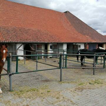
Offenstall mit Trail
Freden
Reiterhof_Burmeister
@Reiterhof-Burmeister
Freizeitstall
Vermieten
Krankenbox
Longierzirkel/Roundpen
Notfallboxen
14 weitere...
P

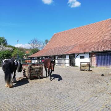
Box mit Reithalle, ganzjähriger Weideauslauf
Bad Gandersheim
Familie Grober, Clus
@FamGrober
FN-Mitglied
Führanlage
Hunde willkommen
Allergikerstall
Außenboxen
Offenstall
16 weitere...
P
Deprecated: Creation of dynamic property Zend_View_Helper_Ads::$adLink is deprecated in /var/www/stall-frei/htdocs/staging.stall-frei.de/library/Psf/View/Helper/Ads.php on line 108

Futtersack HeuToy, Fressbremse in pink
Mechtersen
STALL-FREIde Marketing
@STALL-FREI-Marketing
Stundenlange Beschäftigung die
Koliken vorbeugt, geringe Staubinhalation mit
steuerbarer Futterentnahme

Dr. Vivian Gabor - IVK
Einbeck
Westernreitzentrum-Greene
@Westernreitzentrum-Greene
FN-Mitglied
Pferdeausbildung
Longierzirkel/Roundpen
Paddock
Hengsthaltung möglich
Außenbox mit Paddock
Bewegungsstall
13 weitere...
P

Freie Pferdeboxen in Bilderlahe
Bilderlahe/Seesen
Familie Bernardt
@DomaeneBilderlahe
Hunde willkommen
Krankenbox
Hufrehe geeignet
Notfallboxen
Außenbox mit Paddock
Außenboxen
Halbpension
Vollpension
13 weitere...
aktuell
P

Pferdebox, Offenstall mit Reithalle in 38723
Bilderlahe
Andreas Holst
@Highway7Ranch
Freizeitstall
Geländestrecke
Vermieten
Hunde willkommen
Krankenbox
Notfallboxen
Zuchtstutenhaltung möglich
23 weitere...
P

Paddockbox
Einbeck
Josephine Neumann
@JosephineNeumann
Freizeitstall
Pferdeausbildung
Vermieten
Hunde willkommen
Longierzirkel/Roundpen
Allergikerstall
bedampftes/gewaschenes Heu
21 weitere...
P

Persönlichkeitsentwicklung mit Pferden
Bad Salzuflen
Katja Dors
@Pferdezeiten
Begleite andere auf ihrem Entwicklungsweg und entdecke die transformative Kraft der pferdegestützten Persönlichkeitsentwicklung !
neu
R

Ausbildungsstall Dillsburg
Bockenem
Bianca Klaproth
@Dillsburg
Freizeitstall
Pferdeausbildung
Vermieten
Paddock
Pensions- und Gastboxen
Hengsthaltung möglich
Hufrehe geeignet
16 weitere...
P

Freie Pferdeboxen
Einbeck
RFV Einbeck e.V.
@rfveinbeck
FN-Mitglied
Freizeitstall
Hunde willkommen
Krankenbox
Notfallboxen
Außenboxen
Innenbox
20 weitere...
P

Stall Fricke
Langelsheim / Nauen
Stall-Fricke
@Stall-Fricke
FN-Mitglied
Freizeitstall
Vermieten
Paddock
Reitplatz (z.B. Dressur, Springen, Reining)
Außenbox mit Paddock
Innenbox
9 weitere...
P+
Reitanlage Birkenhof
Seesen
Reitanlage Birkenhof
@Reitanlage_Birkenhof
Freizeitstall
Vermieten
Hunde willkommen
Paddock
Allergikerstall
Hufrehe geeignet
16 weitere...
P
Deprecated: Creation of dynamic property Zend_View::$pageCount is deprecated in /var/www/stall-frei/htdocs/staging.stall-frei.de/library/vendor/shardj/zf1-future/library/Zend/View/Abstract.php on line 308
Deprecated: Creation of dynamic property Zend_View::$itemCountPerPage is deprecated in /var/www/stall-frei/htdocs/staging.stall-frei.de/library/vendor/shardj/zf1-future/library/Zend/View/Abstract.php on line 308
Deprecated: Creation of dynamic property Zend_View::$first is deprecated in /var/www/stall-frei/htdocs/staging.stall-frei.de/library/vendor/shardj/zf1-future/library/Zend/View/Abstract.php on line 308
Deprecated: Creation of dynamic property Zend_View::$current is deprecated in /var/www/stall-frei/htdocs/staging.stall-frei.de/library/vendor/shardj/zf1-future/library/Zend/View/Abstract.php on line 308
Deprecated: Creation of dynamic property Zend_View::$last is deprecated in /var/www/stall-frei/htdocs/staging.stall-frei.de/library/vendor/shardj/zf1-future/library/Zend/View/Abstract.php on line 308
Deprecated: Creation of dynamic property Zend_View::$next is deprecated in /var/www/stall-frei/htdocs/staging.stall-frei.de/library/vendor/shardj/zf1-future/library/Zend/View/Abstract.php on line 308
Deprecated: Creation of dynamic property Zend_View::$pagesInRange is deprecated in /var/www/stall-frei/htdocs/staging.stall-frei.de/library/vendor/shardj/zf1-future/library/Zend/View/Abstract.php on line 308
Deprecated: Creation of dynamic property Zend_View::$firstPageInRange is deprecated in /var/www/stall-frei/htdocs/staging.stall-frei.de/library/vendor/shardj/zf1-future/library/Zend/View/Abstract.php on line 308
Deprecated: Creation of dynamic property Zend_View::$lastPageInRange is deprecated in /var/www/stall-frei/htdocs/staging.stall-frei.de/library/vendor/shardj/zf1-future/library/Zend/View/Abstract.php on line 308
Deprecated: Creation of dynamic property Zend_View::$currentItemCount is deprecated in /var/www/stall-frei/htdocs/staging.stall-frei.de/library/vendor/shardj/zf1-future/library/Zend/View/Abstract.php on line 308
Deprecated: Creation of dynamic property Zend_View::$totalItemCount is deprecated in /var/www/stall-frei/htdocs/staging.stall-frei.de/library/vendor/shardj/zf1-future/library/Zend/View/Abstract.php on line 308
Deprecated: Creation of dynamic property Zend_View::$firstItemNumber is deprecated in /var/www/stall-frei/htdocs/staging.stall-frei.de/library/vendor/shardj/zf1-future/library/Zend/View/Abstract.php on line 308
Deprecated: Creation of dynamic property Zend_View::$lastItemNumber is deprecated in /var/www/stall-frei/htdocs/staging.stall-frei.de/library/vendor/shardj/zf1-future/library/Zend/View/Abstract.php on line 308
Deprecated: Creation of dynamic property Zend_View::$router is deprecated in /var/www/stall-frei/htdocs/staging.stall-frei.de/library/vendor/shardj/zf1-future/library/Zend/View/Abstract.php on line 308
Deprecated: Creation of dynamic property Zend_View::$urlParams is deprecated in /var/www/stall-frei/htdocs/staging.stall-frei.de/library/vendor/shardj/zf1-future/library/Zend/View/Abstract.php on line 308
Deprecated: Creation of dynamic property Zend_View::$showAds is deprecated in /var/www/stall-frei/htdocs/staging.stall-frei.de/library/vendor/shardj/zf1-future/library/Zend/View/Abstract.php on line 308
Deprecated: Creation of dynamic property Zend_View::$objectIds is deprecated in /var/www/stall-frei/htdocs/staging.stall-frei.de/library/vendor/shardj/zf1-future/library/Zend/View/Abstract.php on line 308
Deprecated: Creation of dynamic property Zend_View::$showNavbar is deprecated in /var/www/stall-frei/htdocs/staging.stall-frei.de/library/vendor/shardj/zf1-future/library/Zend/View/Abstract.php on line 308
Deprecated: Creation of dynamic property Zend_View::$showBreadcrumb is deprecated in /var/www/stall-frei/htdocs/staging.stall-frei.de/library/vendor/shardj/zf1-future/library/Zend/View/Abstract.php on line 308
Deprecated: Creation of dynamic property Zend_View::$showFooter is deprecated in /var/www/stall-frei/htdocs/staging.stall-frei.de/library/vendor/shardj/zf1-future/library/Zend/View/Abstract.php on line 308
Deprecated: Creation of dynamic property Zend_View::$showInternalAds is deprecated in /var/www/stall-frei/htdocs/staging.stall-frei.de/library/vendor/shardj/zf1-future/library/Zend/View/Abstract.php on line 308
Deprecated: Creation of dynamic property Zend_View::$blNoContent is deprecated in /var/www/stall-frei/htdocs/staging.stall-frei.de/library/vendor/shardj/zf1-future/library/Zend/View/Abstract.php on line 308
Deprecated: Creation of dynamic property Zend_View::$sMetaDesc is deprecated in /var/www/stall-frei/htdocs/staging.stall-frei.de/library/vendor/shardj/zf1-future/library/Zend/View/Abstract.php on line 308
Deprecated: Creation of dynamic property Zend_View::$useGmaps is deprecated in /var/www/stall-frei/htdocs/staging.stall-frei.de/library/vendor/shardj/zf1-future/library/Zend/View/Abstract.php on line 308
Deprecated: Creation of dynamic property Zend_View::$touches is deprecated in /var/www/stall-frei/htdocs/staging.stall-frei.de/library/vendor/shardj/zf1-future/library/Zend/View/Abstract.php on line 308
Deprecated: Creation of dynamic property Zend_View::$oProject is deprecated in /var/www/stall-frei/htdocs/staging.stall-frei.de/library/vendor/shardj/zf1-future/library/Zend/View/Abstract.php on line 308
Deprecated: Creation of dynamic property Zend_View::$pageHeadline is deprecated in /var/www/stall-frei/htdocs/staging.stall-frei.de/library/vendor/shardj/zf1-future/library/Zend/View/Abstract.php on line 308
Deprecated: Creation of dynamic property Zend_View::$disableLocationField is deprecated in /var/www/stall-frei/htdocs/staging.stall-frei.de/library/vendor/shardj/zf1-future/library/Zend/View/Abstract.php on line 308
Deprecated: Creation of dynamic property Zend_View::$isSearch is deprecated in /var/www/stall-frei/htdocs/staging.stall-frei.de/library/vendor/shardj/zf1-future/library/Zend/View/Abstract.php on line 308
Deprecated: Creation of dynamic property Zend_View::$pageTitle is deprecated in /var/www/stall-frei/htdocs/staging.stall-frei.de/library/vendor/shardj/zf1-future/library/Zend/View/Abstract.php on line 308
Deprecated: Creation of dynamic property Psf_Form_Element_Text::$class is deprecated in /var/www/stall-frei/htdocs/staging.stall-frei.de/library/vendor/shardj/zf1-future/library/Zend/Form/Element.php on line 874
Deprecated: Creation of dynamic property Psf_Form_Element_Text::$size is deprecated in /var/www/stall-frei/htdocs/staging.stall-frei.de/library/vendor/shardj/zf1-future/library/Zend/Form/Element.php on line 874
Deprecated: Creation of dynamic property Psf_Form_Element_Text::$placeholder is deprecated in /var/www/stall-frei/htdocs/staging.stall-frei.de/library/vendor/shardj/zf1-future/library/Zend/Form/Element.php on line 874
Deprecated: Creation of dynamic property Psf_Form_Element_Hidden::$class is deprecated in /var/www/stall-frei/htdocs/staging.stall-frei.de/library/vendor/shardj/zf1-future/library/Zend/Form/Element.php on line 874
Deprecated: Creation of dynamic property Psf_Form_Element_Hidden::$class is deprecated in /var/www/stall-frei/htdocs/staging.stall-frei.de/library/vendor/shardj/zf1-future/library/Zend/Form/Element.php on line 874
Deprecated: Creation of dynamic property Psf_Form_Element_Hidden::$class is deprecated in /var/www/stall-frei/htdocs/staging.stall-frei.de/library/vendor/shardj/zf1-future/library/Zend/Form/Element.php on line 874
Deprecated: Creation of dynamic property Psf_Form_Element_Hidden::$class is deprecated in /var/www/stall-frei/htdocs/staging.stall-frei.de/library/vendor/shardj/zf1-future/library/Zend/Form/Element.php on line 874
Deprecated: Creation of dynamic property Psf_Form_Element_Select::$class is deprecated in /var/www/stall-frei/htdocs/staging.stall-frei.de/library/vendor/shardj/zf1-future/library/Zend/Form/Element.php on line 874
Deprecated: Creation of dynamic property Psf_Form_Element_Select::$class is deprecated in /var/www/stall-frei/htdocs/staging.stall-frei.de/library/vendor/shardj/zf1-future/library/Zend/Form/Element.php on line 874
Deprecated: Creation of dynamic property Psf_Form_Element_Select::$class is deprecated in /var/www/stall-frei/htdocs/staging.stall-frei.de/library/vendor/shardj/zf1-future/library/Zend/Form/Element.php on line 874
Deprecated: Creation of dynamic property Psf_Form_Element_Select::$class is deprecated in /var/www/stall-frei/htdocs/staging.stall-frei.de/library/vendor/shardj/zf1-future/library/Zend/Form/Element.php on line 874
Deprecated: Creation of dynamic property Psf_Form_Element_Text::$class is deprecated in /var/www/stall-frei/htdocs/staging.stall-frei.de/library/vendor/shardj/zf1-future/library/Zend/Form/Element.php on line 874
Deprecated: Creation of dynamic property Psf_Form_Element_Checkbox::$label is deprecated in /var/www/stall-frei/htdocs/staging.stall-frei.de/library/vendor/shardj/zf1-future/library/Zend/Form/Element.php on line 874
Deprecated: Creation of dynamic property Zend_View::$sort is deprecated in /var/www/stall-frei/htdocs/staging.stall-frei.de/library/vendor/shardj/zf1-future/library/Zend/View/Abstract.php on line 308
Deprecated: Creation of dynamic property Zend_View::$searchLocation is deprecated in /var/www/stall-frei/htdocs/staging.stall-frei.de/library/vendor/shardj/zf1-future/library/Zend/View/Abstract.php on line 308
Deprecated: Creation of dynamic property Zend_View::$locationHint is deprecated in /var/www/stall-frei/htdocs/staging.stall-frei.de/library/vendor/shardj/zf1-future/library/Zend/View/Abstract.php on line 308
Psf_GeoCoder_Abstract::getLocation: Landwehr Get Location CachedOrLive
Psf_GeoCoder_Abstract::getCachedOrLive: Landwehr
Psf_GeoCoder_OpenCageData::makeApiRequest: response:
Array
(
[documentation] => https://opencagedata.com/api
[licenses] => Array
(
[0] => Array
(
[name] => see attribution guide
[url] => https://opencagedata.com/credits
)
)
[results] => Array
(
[0] => Array
(
[bounds] => Array
(
[northeast] => Array
(
[lat] => 51.9409559
[lng] => 10.012762
)
[southwest] => Array
(
[lat] => 51.8968709
[lng] => 9.943816
)
)
[components] => Array
(
[ISO_3166-1_alpha-2] => DE
[ISO_3166-1_alpha-3] => DEU
[ISO_3166-2] => Array
(
[0] => DE-NI
)
[_category] => place
[_normalized_city] => Freden (Leine)
[_type] => neighbourhood
[city_district] => Landwehr
[continent] => Europe
[country] => Deutschland
[country_code] => de
[county] => Landkreis Hildesheim
[political_union] => European Union
[state] => Niedersachsen
[state_code] => NI
[town] => Freden (Leine)
)
[confidence] => 7
[formatted] => Landwehr, Freden (Leine), Niedersachsen, Deutschland
[geometry] => Array
(
[lat] => 51.9189086
[lng] => 9.9771534
)
)
[1] => Array
(
[bounds] => Array
(
[northeast] => Array
(
[lat] => 50.9595387
[lng] => 7.3689847
)
[southwest] => Array
(
[lat] => 50.9195387
[lng] => 7.3289847
)
)
[components] => Array
(
[ISO_3166-1_alpha-2] => DE
[ISO_3166-1_alpha-3] => DEU
[ISO_3166-2] => Array
(
[0] => DE-NW
)
[_category] => place
[_normalized_city] => Overath
[_type] => hamlet
[continent] => Europe
[country] => Deutschland
[country_code] => de
[county] => Rheinisch-Bergischer Kreis
[hamlet] => Landwehr
[political_union] => European Union
[state] => Nordrhein-Westfalen
[state_code] => NW
[town] => Overath
)
[confidence] => 7
[formatted] => Landwehr, Overath, Nordrhein-Westfalen, Deutschland
[geometry] => Array
(
[lat] => 50.9395387
[lng] => 7.3489847
)
)
[2] => Array
(
[bounds] => Array
(
[northeast] => Array
(
[lat] => 51.1423569
[lng] => 7.0079845
)
[southwest] => Array
(
[lat] => 51.1223569
[lng] => 6.9879845
)
)
[components] => Array
(
[ISO_3166-1_alpha-2] => DE
[ISO_3166-1_alpha-3] => DEU
[ISO_3166-2] => Array
(
[0] => DE-NW
)
[_category] => place
[_normalized_city] => Solingen
[_type] => hamlet
[city] => Solingen
[continent] => Europe
[country] => Deutschland
[country_code] => de
[hamlet] => Holzkamp
[neighbourhood] => Landwehr
[political_union] => European Union
[postcode] => 42697
[state] => Nordrhein-Westfalen
[state_code] => NW
[suburb] => Ohligs/Aufderhöhe/Merscheid
)
[confidence] => 8
[formatted] => Holzkamp, 42697 Solingen, Deutschland
[geometry] => Array
(
[lat] => 51.1323569
[lng] => 6.9979845
)
)
[3] => Array
(
[bounds] => Array
(
[northeast] => Array
(
[lat] => 51.0693869
[lng] => 7.2070647
)
[southwest] => Array
(
[lat] => 51.0293869
[lng] => 7.1670647
)
)
[components] => Array
(
[ISO_3166-1_alpha-2] => DE
[ISO_3166-1_alpha-3] => DEU
[ISO_3166-2] => Array
(
[0] => DE-NW
)
[_category] => place
[_normalized_city] => Odenthal
[_type] => hamlet
[continent] => Europe
[country] => Deutschland
[country_code] => de
[county] => Rheinisch-Bergischer Kreis
[hamlet] => Landwehr
[political_union] => European Union
[state] => Nordrhein-Westfalen
[state_code] => NW
[town] => Odenthal
)
[confidence] => 7
[formatted] => Landwehr, Odenthal, Nordrhein-Westfalen, Deutschland
[geometry] => Array
(
[lat] => 51.0493869
[lng] => 7.1870647
)
)
[4] => Array
(
[bounds] => Array
(
[northeast] => Array
(
[lat] => 53.5661691
[lng] => 10.0428965
)
[southwest] => Array
(
[lat] => 53.5561691
[lng] => 10.0328965
)
)
[components] => Array
(
[ISO_3166-1_alpha-2] => DE
[ISO_3166-1_alpha-3] => DEU
[ISO_3166-2] => Array
(
[0] => DE-HH
)
[_category] => transportation
[_normalized_city] => Hamburg
[_type] => railway
[city] => Hamburg
[city_district] => Wandsbek
[continent] => Europe
[country] => Deutschland
[country_code] => de
[political_union] => European Union
[postcode] => 22087
[railway] => Landwehr
[road] => Landwehr
[state] => Hamburg
[state_code] => HH
[suburb] => Eilbek
)
[confidence] => 9
[formatted] => Landwehr, 22087 Hamburg, Deutschland
[geometry] => Array
(
[lat] => 53.5611691
[lng] => 10.0378965
)
)
[5] => Array
(
[bounds] => Array
(
[northeast] => Array
(
[lat] => 51.9708742
[lng] => 13.6060532
)
[southwest] => Array
(
[lat] => 51.9473238
[lng] => 13.5629744
)
)
[components] => Array
(
[ISO_3166-1_alpha-2] => DE
[ISO_3166-1_alpha-3] => DEU
[ISO_3166-2] => Array
(
[0] => DE-BB
)
[_category] => place
[_normalized_city] => Golßen
[_type] => village
[continent] => Europe
[country] => Deutschland
[country_code] => de
[county] => Dahme-Spreewald
[municipality] => Unterspreewald
[political_union] => European Union
[postcode] => 15938
[state] => Brandenburg
[state_code] => BB
[town] => Golßen
[village] => Stadt Golßen
)
[confidence] => 7
[formatted] => 15938 Stadt Golßen, Deutschland
[geometry] => Array
(
[lat] => 51.9607543
[lng] => 13.5890154
)
)
[6] => Array
(
[bounds] => Array
(
[northeast] => Array
(
[lat] => 52.9564324
[lng] => 9.1243322
)
[southwest] => Array
(
[lat] => 52.8381371
[lng] => 9.0315718
)
)
[components] => Array
(
[ISO_3166-1_alpha-2] => DE
[ISO_3166-1_alpha-3] => DEU
[ISO_3166-2] => Array
(
[0] => DE-NI
)
[_category] => natural/water
[_normalized_city] => Samtgemeinde Thedinghausen
[_type] => river
[continent] => Europe
[country] => Deutschland
[country_code] => de
[county] => Landkreis Verden
[municipality] => Samtgemeinde Grafschaft Hoya
[political_union] => European Union
[river] => Landwehr
[state] => Niedersachsen
[state_code] => NI
[town] => Samtgemeinde Thedinghausen
)
[confidence] => 6
[formatted] => Landwehr, Samtgemeinde Thedinghausen, Niedersachsen, Deutschland
[geometry] => Array
(
[lat] => 52.9071789
[lng] => 9.1078532
)
)
[7] => Array
(
[bounds] => Array
(
[northeast] => Array
(
[lat] => 50.4745423
[lng] => 10.8231678
)
[southwest] => Array
(
[lat] => 50.4744423
[lng] => 10.8230678
)
)
[components] => Array
(
[ISO_3166-1_alpha-2] => DE
[ISO_3166-1_alpha-3] => DEU
[ISO_3166-2] => Array
(
[0] => DE-TH
)
[_category] => natural/water
[_normalized_city] => Auengrund
[_type] => peak
[city] => Auengrund
[continent] => Europe
[country] => Deutschland
[country_code] => de
[county] => Landkreis Hildburghausen
[municipality] => Auengrund
[peak] => Landwehr
[political_union] => European Union
[state] => Thüringen
[state_code] => TH
)
[confidence] => 9
[formatted] => Landwehr, Auengrund, Thüringen, Deutschland
[geometry] => Array
(
[lat] => 50.4744923
[lng] => 10.8231178
)
)
[8] => Array
(
[bounds] => Array
(
[northeast] => Array
(
[lat] => 49.8344985
[lng] => 9.6634204
)
[southwest] => Array
(
[lat] => 49.8343985
[lng] => 9.6633204
)
)
[components] => Array
(
[ISO_3166-1_alpha-2] => DE
[ISO_3166-1_alpha-3] => DEU
[ISO_3166-2] => Array
(
[0] => DE-BY
)
[_category] => natural/water
[_normalized_city] => Erlenbach bei Marktheidenfeld
[_type] => peak
[continent] => Europe
[country] => Deutschland
[country_code] => de
[county] => Landkreis Main-Spessart
[municipality] => Verwaltungsgemeinschaft Marktheidenfeld
[peak] => Landwehr
[political_union] => European Union
[postcode] => 97834
[state] => Bayern
[state_code] => BY
[village] => Erlenbach bei Marktheidenfeld
)
[confidence] => 9
[formatted] => Landwehr, 97834 Erlenbach bei Marktheidenfeld, Deutschland
[geometry] => Array
(
[lat] => 49.8344485
[lng] => 9.6633704
)
)
[9] => Array
(
[bounds] => Array
(
[northeast] => Array
(
[lat] => 54.3639662
[lng] => 10.0093732
)
[southwest] => Array
(
[lat] => 54.3239662
[lng] => 9.9693732
)
)
[components] => Array
(
[ISO_3166-1_alpha-2] => DE
[ISO_3166-1_alpha-3] => DEU
[ISO_3166-2] => Array
(
[0] => DE-SH
)
[_category] => place
[_normalized_city] => Quarnbek
[_type] => village
[city] => Quarnbek
[continent] => Europe
[country] => Deutschland
[country_code] => de
[county] => Kreis Rendsburg-Eckernförde
[municipality] => Amt Achterwehr
[political_union] => European Union
[postcode] => 24239
[state] => Schleswig-Holstein
[state_code] => SH
[village] => Landwehr
)
[confidence] => 7
[formatted] => 24239 Landwehr, Deutschland
[geometry] => Array
(
[lat] => 54.3439662
[lng] => 9.9893732
)
)
)
[status] => Array
(
[code] => 200
[message] => OK
)
[stay_informed] => Array
(
[blog] => https://blog.opencagedata.com
[mastodon] => https://en.osm.town/@opencage
)
[thanks] => For using an OpenCage API
[timestamp] => Array
(
[created_http] => Sun, 08 Feb 2026 09:32:30 GMT
[created_unix] => 1770543150
)
[total_results] => 10
)
Psf_GeoCoder_Abstract::convertLocationResult
{"documentation":"https:\/\/opencagedata.com\/api","licenses":[{"name":"see attribution guide","url":"https:\/\/opencagedata.com\/credits"}],"results":[{"bounds":{"northeast":{"lat":51.9409559,"lng":10.012762},"southwest":{"lat":51.8968709,"lng":9.943816}},"components":{"ISO_3166-1_alpha-2":"DE","ISO_3166-1_alpha-3":"DEU","ISO_3166-2":["DE-NI"],"_category":"place","_normalized_city":"Freden (Leine)","_type":"neighbourhood","city_district":"Landwehr","continent":"Europe","country":"Deutschland","country_code":"de","county":"Landkreis Hildesheim","political_union":"European Union","state":"Niedersachsen","state_code":"NI","town":"Freden (Leine)"},"confidence":7,"formatted":"Landwehr, Freden (Leine), Niedersachsen, Deutschland","geometry":{"lat":51.9189086,"lng":9.9771534}},{"bounds":{"northeast":{"lat":50.9595387,"lng":7.3689847},"southwest":{"lat":50.9195387,"lng":7.3289847}},"components":{"ISO_3166-1_alpha-2":"DE","ISO_3166-1_alpha-3":"DEU","ISO_3166-2":["DE-NW"],"_category":"place","_normalized_city":"Overath","_type":"hamlet","continent":"Europe","country":"Deutschland","country_code":"de","county":"Rheinisch-Bergischer Kreis","hamlet":"Landwehr","political_union":"European Union","state":"Nordrhein-Westfalen","state_code":"NW","town":"Overath"},"confidence":7,"formatted":"Landwehr, Overath, Nordrhein-Westfalen, Deutschland","geometry":{"lat":50.9395387,"lng":7.3489847}},{"bounds":{"northeast":{"lat":51.1423569,"lng":7.0079845},"southwest":{"lat":51.1223569,"lng":6.9879845}},"components":{"ISO_3166-1_alpha-2":"DE","ISO_3166-1_alpha-3":"DEU","ISO_3166-2":["DE-NW"],"_category":"place","_normalized_city":"Solingen","_type":"hamlet","city":"Solingen","continent":"Europe","country":"Deutschland","country_code":"de","hamlet":"Holzkamp","neighbourhood":"Landwehr","political_union":"European Union","postcode":"42697","state":"Nordrhein-Westfalen","state_code":"NW","suburb":"Ohligs\/Aufderh\u00f6he\/Merscheid"},"confidence":8,"formatted":"Holzkamp, 42697 Solingen, Deutschland","geometry":{"lat":51.1323569,"lng":6.9979845}},{"bounds":{"northeast":{"lat":51.0693869,"lng":7.2070647},"southwest":{"lat":51.0293869,"lng":7.1670647}},"components":{"ISO_3166-1_alpha-2":"DE","ISO_3166-1_alpha-3":"DEU","ISO_3166-2":["DE-NW"],"_category":"place","_normalized_city":"Odenthal","_type":"hamlet","continent":"Europe","country":"Deutschland","country_code":"de","county":"Rheinisch-Bergischer Kreis","hamlet":"Landwehr","political_union":"European Union","state":"Nordrhein-Westfalen","state_code":"NW","town":"Odenthal"},"confidence":7,"formatted":"Landwehr, Odenthal, Nordrhein-Westfalen, Deutschland","geometry":{"lat":51.0493869,"lng":7.1870647}},{"bounds":{"northeast":{"lat":53.5661691,"lng":10.0428965},"southwest":{"lat":53.5561691,"lng":10.0328965}},"components":{"ISO_3166-1_alpha-2":"DE","ISO_3166-1_alpha-3":"DEU","ISO_3166-2":["DE-HH"],"_category":"transportation","_normalized_city":"Hamburg","_type":"railway","city":"Hamburg","city_district":"Wandsbek","continent":"Europe","country":"Deutschland","country_code":"de","political_union":"European Union","postcode":"22087","railway":"Landwehr","road":"Landwehr","state":"Hamburg","state_code":"HH","suburb":"Eilbek"},"confidence":9,"formatted":"Landwehr, 22087 Hamburg, Deutschland","geometry":{"lat":53.5611691,"lng":10.0378965}},{"bounds":{"northeast":{"lat":51.9708742,"lng":13.6060532},"southwest":{"lat":51.9473238,"lng":13.5629744}},"components":{"ISO_3166-1_alpha-2":"DE","ISO_3166-1_alpha-3":"DEU","ISO_3166-2":["DE-BB"],"_category":"place","_normalized_city":"Gol\u00dfen","_type":"village","continent":"Europe","country":"Deutschland","country_code":"de","county":"Dahme-Spreewald","municipality":"Unterspreewald","political_union":"European Union","postcode":"15938","state":"Brandenburg","state_code":"BB","town":"Gol\u00dfen","village":"Stadt Gol\u00dfen"},"confidence":7,"formatted":"15938 Stadt Gol\u00dfen, Deutschland","geometry":{"lat":51.9607543,"lng":13.5890154}},{"bounds":{"northeast":{"lat":52.9564324,"lng":9.1243322},"southwest":{"lat":52.8381371,"lng":9.0315718}},"components":{"ISO_3166-1_alpha-2":"DE","ISO_3166-1_alpha-3":"DEU","ISO_3166-2":["DE-NI"],"_category":"natural\/water","_normalized_city":"Samtgemeinde Thedinghausen","_type":"river","continent":"Europe","country":"Deutschland","country_code":"de","county":"Landkreis Verden","municipality":"Samtgemeinde Grafschaft Hoya","political_union":"European Union","river":"Landwehr","state":"Niedersachsen","state_code":"NI","town":"Samtgemeinde Thedinghausen"},"confidence":6,"formatted":"Landwehr, Samtgemeinde Thedinghausen, Niedersachsen, Deutschland","geometry":{"lat":52.9071789,"lng":9.1078532}},{"bounds":{"northeast":{"lat":50.4745423,"lng":10.8231678},"southwest":{"lat":50.4744423,"lng":10.8230678}},"components":{"ISO_3166-1_alpha-2":"DE","ISO_3166-1_alpha-3":"DEU","ISO_3166-2":["DE-TH"],"_category":"natural\/water","_normalized_city":"Auengrund","_type":"peak","city":"Auengrund","continent":"Europe","country":"Deutschland","country_code":"de","county":"Landkreis Hildburghausen","municipality":"Auengrund","peak":"Landwehr","political_union":"European Union","state":"Th\u00fcringen","state_code":"TH"},"confidence":9,"formatted":"Landwehr, Auengrund, Th\u00fcringen, Deutschland","geometry":{"lat":50.4744923,"lng":10.8231178}},{"bounds":{"northeast":{"lat":49.8344985,"lng":9.6634204},"southwest":{"lat":49.8343985,"lng":9.6633204}},"components":{"ISO_3166-1_alpha-2":"DE","ISO_3166-1_alpha-3":"DEU","ISO_3166-2":["DE-BY"],"_category":"natural\/water","_normalized_city":"Erlenbach bei Marktheidenfeld","_type":"peak","continent":"Europe","country":"Deutschland","country_code":"de","county":"Landkreis Main-Spessart","municipality":"Verwaltungsgemeinschaft Marktheidenfeld","peak":"Landwehr","political_union":"European Union","postcode":"97834","state":"Bayern","state_code":"BY","village":"Erlenbach bei Marktheidenfeld"},"confidence":9,"formatted":"Landwehr, 97834 Erlenbach bei Marktheidenfeld, Deutschland","geometry":{"lat":49.8344485,"lng":9.6633704}},{"bounds":{"northeast":{"lat":54.3639662,"lng":10.0093732},"southwest":{"lat":54.3239662,"lng":9.9693732}},"components":{"ISO_3166-1_alpha-2":"DE","ISO_3166-1_alpha-3":"DEU","ISO_3166-2":["DE-SH"],"_category":"place","_normalized_city":"Quarnbek","_type":"village","city":"Quarnbek","continent":"Europe","country":"Deutschland","country_code":"de","county":"Kreis Rendsburg-Eckernf\u00f6rde","municipality":"Amt Achterwehr","political_union":"European Union","postcode":"24239","state":"Schleswig-Holstein","state_code":"SH","village":"Landwehr"},"confidence":7,"formatted":"24239 Landwehr, Deutschland","geometry":{"lat":54.3439662,"lng":9.9893732}}],"status":{"code":200,"message":"OK"},"stay_informed":{"blog":"https:\/\/blog.opencagedata.com","mastodon":"https:\/\/en.osm.town\/@opencage"},"thanks":"For using an OpenCage API","timestamp":{"created_http":"Sun, 08 Feb 2026 09:32:30 GMT","created_unix":1770543150},"total_results":10}Array
(
[0] => stdClass Object
(
[bounds] => stdClass Object
(
[northeast] => stdClass Object
(
[lat] => 51.9409559
[lng] => 10.012762
)
[southwest] => stdClass Object
(
[lat] => 51.8968709
[lng] => 9.943816
)
)
[components] => stdClass Object
(
[ISO_3166-1_alpha-2] => DE
[ISO_3166-1_alpha-3] => DEU
[ISO_3166-2] => Array
(
[0] => DE-NI
)
[_category] => place
[_normalized_city] => Freden (Leine)
[_type] => neighbourhood
[city_district] => Landwehr
[continent] => Europe
[country] => Deutschland
[country_code] => de
[county] => Landkreis Hildesheim
[political_union] => European Union
[state] => Niedersachsen
[state_code] => NI
[town] => Freden (Leine)
)
[confidence] => 7
[formatted] => Landwehr, Freden (Leine), Niedersachsen, Deutschland
[geometry] => stdClass Object
(
[lat] => 51.9189086
[lng] => 9.9771534
)
)
[1] => stdClass Object
(
[bounds] => stdClass Object
(
[northeast] => stdClass Object
(
[lat] => 50.9595387
[lng] => 7.3689847
)
[southwest] => stdClass Object
(
[lat] => 50.9195387
[lng] => 7.3289847
)
)
[components] => stdClass Object
(
[ISO_3166-1_alpha-2] => DE
[ISO_3166-1_alpha-3] => DEU
[ISO_3166-2] => Array
(
[0] => DE-NW
)
[_category] => place
[_normalized_city] => Overath
[_type] => hamlet
[continent] => Europe
[country] => Deutschland
[country_code] => de
[county] => Rheinisch-Bergischer Kreis
[hamlet] => Landwehr
[political_union] => European Union
[state] => Nordrhein-Westfalen
[state_code] => NW
[town] => Overath
)
[confidence] => 7
[formatted] => Landwehr, Overath, Nordrhein-Westfalen, Deutschland
[geometry] => stdClass Object
(
[lat] => 50.9395387
[lng] => 7.3489847
)
)
[2] => stdClass Object
(
[bounds] => stdClass Object
(
[northeast] => stdClass Object
(
[lat] => 51.1423569
[lng] => 7.0079845
)
[southwest] => stdClass Object
(
[lat] => 51.1223569
[lng] => 6.9879845
)
)
[components] => stdClass Object
(
[ISO_3166-1_alpha-2] => DE
[ISO_3166-1_alpha-3] => DEU
[ISO_3166-2] => Array
(
[0] => DE-NW
)
[_category] => place
[_normalized_city] => Solingen
[_type] => hamlet
[city] => Solingen
[continent] => Europe
[country] => Deutschland
[country_code] => de
[hamlet] => Holzkamp
[neighbourhood] => Landwehr
[political_union] => European Union
[postcode] => 42697
[state] => Nordrhein-Westfalen
[state_code] => NW
[suburb] => Ohligs/Aufderhöhe/Merscheid
)
[confidence] => 8
[formatted] => Holzkamp, 42697 Solingen, Deutschland
[geometry] => stdClass Object
(
[lat] => 51.1323569
[lng] => 6.9979845
)
)
[3] => stdClass Object
(
[bounds] => stdClass Object
(
[northeast] => stdClass Object
(
[lat] => 51.0693869
[lng] => 7.2070647
)
[southwest] => stdClass Object
(
[lat] => 51.0293869
[lng] => 7.1670647
)
)
[components] => stdClass Object
(
[ISO_3166-1_alpha-2] => DE
[ISO_3166-1_alpha-3] => DEU
[ISO_3166-2] => Array
(
[0] => DE-NW
)
[_category] => place
[_normalized_city] => Odenthal
[_type] => hamlet
[continent] => Europe
[country] => Deutschland
[country_code] => de
[county] => Rheinisch-Bergischer Kreis
[hamlet] => Landwehr
[political_union] => European Union
[state] => Nordrhein-Westfalen
[state_code] => NW
[town] => Odenthal
)
[confidence] => 7
[formatted] => Landwehr, Odenthal, Nordrhein-Westfalen, Deutschland
[geometry] => stdClass Object
(
[lat] => 51.0493869
[lng] => 7.1870647
)
)
[4] => stdClass Object
(
[bounds] => stdClass Object
(
[northeast] => stdClass Object
(
[lat] => 53.5661691
[lng] => 10.0428965
)
[southwest] => stdClass Object
(
[lat] => 53.5561691
[lng] => 10.0328965
)
)
[components] => stdClass Object
(
[ISO_3166-1_alpha-2] => DE
[ISO_3166-1_alpha-3] => DEU
[ISO_3166-2] => Array
(
[0] => DE-HH
)
[_category] => transportation
[_normalized_city] => Hamburg
[_type] => railway
[city] => Hamburg
[city_district] => Wandsbek
[continent] => Europe
[country] => Deutschland
[country_code] => de
[political_union] => European Union
[postcode] => 22087
[railway] => Landwehr
[road] => Landwehr
[state] => Hamburg
[state_code] => HH
[suburb] => Eilbek
)
[confidence] => 9
[formatted] => Landwehr, 22087 Hamburg, Deutschland
[geometry] => stdClass Object
(
[lat] => 53.5611691
[lng] => 10.0378965
)
)
[5] => stdClass Object
(
[bounds] => stdClass Object
(
[northeast] => stdClass Object
(
[lat] => 51.9708742
[lng] => 13.6060532
)
[southwest] => stdClass Object
(
[lat] => 51.9473238
[lng] => 13.5629744
)
)
[components] => stdClass Object
(
[ISO_3166-1_alpha-2] => DE
[ISO_3166-1_alpha-3] => DEU
[ISO_3166-2] => Array
(
[0] => DE-BB
)
[_category] => place
[_normalized_city] => Golßen
[_type] => village
[continent] => Europe
[country] => Deutschland
[country_code] => de
[county] => Dahme-Spreewald
[municipality] => Unterspreewald
[political_union] => European Union
[postcode] => 15938
[state] => Brandenburg
[state_code] => BB
[town] => Golßen
[village] => Stadt Golßen
)
[confidence] => 7
[formatted] => 15938 Stadt Golßen, Deutschland
[geometry] => stdClass Object
(
[lat] => 51.9607543
[lng] => 13.5890154
)
)
[6] => stdClass Object
(
[bounds] => stdClass Object
(
[northeast] => stdClass Object
(
[lat] => 52.9564324
[lng] => 9.1243322
)
[southwest] => stdClass Object
(
[lat] => 52.8381371
[lng] => 9.0315718
)
)
[components] => stdClass Object
(
[ISO_3166-1_alpha-2] => DE
[ISO_3166-1_alpha-3] => DEU
[ISO_3166-2] => Array
(
[0] => DE-NI
)
[_category] => natural/water
[_normalized_city] => Samtgemeinde Thedinghausen
[_type] => river
[continent] => Europe
[country] => Deutschland
[country_code] => de
[county] => Landkreis Verden
[municipality] => Samtgemeinde Grafschaft Hoya
[political_union] => European Union
[river] => Landwehr
[state] => Niedersachsen
[state_code] => NI
[town] => Samtgemeinde Thedinghausen
)
[confidence] => 6
[formatted] => Landwehr, Samtgemeinde Thedinghausen, Niedersachsen, Deutschland
[geometry] => stdClass Object
(
[lat] => 52.9071789
[lng] => 9.1078532
)
)
[7] => stdClass Object
(
[bounds] => stdClass Object
(
[northeast] => stdClass Object
(
[lat] => 50.4745423
[lng] => 10.8231678
)
[southwest] => stdClass Object
(
[lat] => 50.4744423
[lng] => 10.8230678
)
)
[components] => stdClass Object
(
[ISO_3166-1_alpha-2] => DE
[ISO_3166-1_alpha-3] => DEU
[ISO_3166-2] => Array
(
[0] => DE-TH
)
[_category] => natural/water
[_normalized_city] => Auengrund
[_type] => peak
[city] => Auengrund
[continent] => Europe
[country] => Deutschland
[country_code] => de
[county] => Landkreis Hildburghausen
[municipality] => Auengrund
[peak] => Landwehr
[political_union] => European Union
[state] => Thüringen
[state_code] => TH
)
[confidence] => 9
[formatted] => Landwehr, Auengrund, Thüringen, Deutschland
[geometry] => stdClass Object
(
[lat] => 50.4744923
[lng] => 10.8231178
)
)
[8] => stdClass Object
(
[bounds] => stdClass Object
(
[northeast] => stdClass Object
(
[lat] => 49.8344985
[lng] => 9.6634204
)
[southwest] => stdClass Object
(
[lat] => 49.8343985
[lng] => 9.6633204
)
)
[components] => stdClass Object
(
[ISO_3166-1_alpha-2] => DE
[ISO_3166-1_alpha-3] => DEU
[ISO_3166-2] => Array
(
[0] => DE-BY
)
[_category] => natural/water
[_normalized_city] => Erlenbach bei Marktheidenfeld
[_type] => peak
[continent] => Europe
[country] => Deutschland
[country_code] => de
[county] => Landkreis Main-Spessart
[municipality] => Verwaltungsgemeinschaft Marktheidenfeld
[peak] => Landwehr
[political_union] => European Union
[postcode] => 97834
[state] => Bayern
[state_code] => BY
[village] => Erlenbach bei Marktheidenfeld
)
[confidence] => 9
[formatted] => Landwehr, 97834 Erlenbach bei Marktheidenfeld, Deutschland
[geometry] => stdClass Object
(
[lat] => 49.8344485
[lng] => 9.6633704
)
)
[9] => stdClass Object
(
[bounds] => stdClass Object
(
[northeast] => stdClass Object
(
[lat] => 54.3639662
[lng] => 10.0093732
)
[southwest] => stdClass Object
(
[lat] => 54.3239662
[lng] => 9.9693732
)
)
[components] => stdClass Object
(
[ISO_3166-1_alpha-2] => DE
[ISO_3166-1_alpha-3] => DEU
[ISO_3166-2] => Array
(
[0] => DE-SH
)
[_category] => place
[_normalized_city] => Quarnbek
[_type] => village
[city] => Quarnbek
[continent] => Europe
[country] => Deutschland
[country_code] => de
[county] => Kreis Rendsburg-Eckernförde
[municipality] => Amt Achterwehr
[political_union] => European Union
[postcode] => 24239
[state] => Schleswig-Holstein
[state_code] => SH
[village] => Landwehr
)
[confidence] => 7
[formatted] => 24239 Landwehr, Deutschland
[geometry] => stdClass Object
(
[lat] => 54.3439662
[lng] => 9.9893732
)
)
)
Psf_GeoCoder_OpenCageData::getKeyMap: 0
stdClass Object
(
    [bounds] => stdClass Object
        (
            [northeast] => stdClass Object
                (
                    [lat] => 51.9409559
                    [lng] => 10.012762
                )

            [southwest] => stdClass Object
                (
                    [lat] => 51.8968709
                    [lng] => 9.943816
                )

        )

    [components] => stdClass Object
        (
            [ISO_3166-1_alpha-2] => DE
            [ISO_3166-1_alpha-3] => DEU
            [ISO_3166-2] => Array
                (
                    [0] => DE-NI
                )

            [_category] => place
            [_normalized_city] => Freden (Leine)
            [_type] => neighbourhood
            [city_district] => Landwehr
            [continent] => Europe
            [country] => Deutschland
            [country_code] => de
            [county] => Landkreis Hildesheim
            [political_union] => European Union
            [state] => Niedersachsen
            [state_code] => NI
            [town] => Freden (Leine)
        )

    [confidence] => 7
    [formatted] => Landwehr, Freden (Leine), Niedersachsen, Deutschland
    [geometry] => stdClass Object
        (
            [lat] => 51.9189086
            [lng] => 9.9771534
        )

)
Psf_GeoCoder_OpenCageData::getCounty: Hildesheim
Psf_GeoCoder_OpenCageData::addMissingData REFETCH!
Array
(
    [address] => Landwehr, Freden (Leine), Niedersachsen, Deutschland
    [type] => neighbourhood
    [street] =>
    [city] => Freden (Leine)
    [county] => Hildesheim
    [state] => Niedersachsen
    [zip] =>
    [country] => Deutschland
    [suburb] =>
    [countrycode] => de
    [latitude] => 51.9189086
    [longitude] => 9.9771534
    [accuracy] => 1
    [confidence] => 7
    [bounds] => stdClass Object
        (
            [northeast] => stdClass Object
                (
                    [lat] => 51.9409559
                    [lng] => 10.012762
                )

            [southwest] => stdClass Object
                (
                    [lat] => 51.8968709
                    [lng] => 9.943816
                )

        )

)
reformat!
Array
(
    [address] => Landwehr, Freden (Leine), Niedersachsen, Deutschland
    [type] => neighbourhood
    [street] =>
    [city] => Freden (Leine)
    [county] => Hildesheim
    [state] => Niedersachsen
    [zip] =>
    [country] => Deutschland
    [suburb] =>
    [countrycode] => de
    [latitude] => 51.9189086
    [longitude] => 9.9771534
    [accuracy] => 1
    [confidence] => 7
    [bounds] => stdClass Object
        (
            [northeast] => stdClass Object
                (
                    [lat] => 51.9409559
                    [lng] => 10.012762
                )

            [southwest] => stdClass Object
                (
                    [lat] => 51.8968709
                    [lng] => 9.943816
                )

        )

    [place] => Freden (Leine), Niedersachsen
    [hash] => 2d5ec806fb4f72dae604286424386f57
)
Psf_GeoCoder_OpenCageData::getKeyMap: 1
stdClass Object
(
    [bounds] => stdClass Object
        (
            [northeast] => stdClass Object
                (
                    [lat] => 50.9595387
                    [lng] => 7.3689847
                )

            [southwest] => stdClass Object
                (
                    [lat] => 50.9195387
                    [lng] => 7.3289847
                )

        )

    [components] => stdClass Object
        (
            [ISO_3166-1_alpha-2] => DE
            [ISO_3166-1_alpha-3] => DEU
            [ISO_3166-2] => Array
                (
                    [0] => DE-NW
                )

            [_category] => place
            [_normalized_city] => Overath
            [_type] => hamlet
            [continent] => Europe
            [country] => Deutschland
            [country_code] => de
            [county] => Rheinisch-Bergischer Kreis
            [hamlet] => Landwehr
            [political_union] => European Union
            [state] => Nordrhein-Westfalen
            [state_code] => NW
            [town] => Overath
        )

    [confidence] => 7
    [formatted] => Landwehr, Overath, Nordrhein-Westfalen, Deutschland
    [geometry] => stdClass Object
        (
            [lat] => 50.9395387
            [lng] => 7.3489847
        )

)
Psf_GeoCoder_OpenCageData::getCounty: Rheinisch-Bergischer Kreis
Psf_GeoCoder_OpenCageData::addMissingData REFETCH!
Array
(
    [address] => Landwehr, Overath, Nordrhein-Westfalen, Deutschland
    [type] => hamlet
    [street] => Landwehr
    [city] => Overath
    [county] => Rheinisch-Bergischer Kreis
    [state] => Nordrhein-Westfalen
    [zip] =>
    [country] => Deutschland
    [suburb] =>
    [countrycode] => de
    [latitude] => 50.9395387
    [longitude] => 7.3489847
    [accuracy] => 1
    [confidence] => 7
    [bounds] => stdClass Object
        (
            [northeast] => stdClass Object
                (
                    [lat] => 50.9595387
                    [lng] => 7.3689847
                )

            [southwest] => stdClass Object
                (
                    [lat] => 50.9195387
                    [lng] => 7.3289847
                )

        )

)
reformat!
Array
(
    [address] => Landwehr, Overath, Nordrhein-Westfalen, Deutschland
    [type] => hamlet
    [street] => Landwehr
    [city] => Overath
    [county] => Rheinisch-Bergischer Kreis
    [state] => Nordrhein-Westfalen
    [zip] =>
    [country] => Deutschland
    [suburb] =>
    [countrycode] => de
    [latitude] => 50.9395387
    [longitude] => 7.3489847
    [accuracy] => 1
    [confidence] => 7
    [bounds] => stdClass Object
        (
            [northeast] => stdClass Object
                (
                    [lat] => 50.9595387
                    [lng] => 7.3689847
                )

            [southwest] => stdClass Object
                (
                    [lat] => 50.9195387
                    [lng] => 7.3289847
                )

        )

    [place] => Landwehr, Overath, Nordrhein-Westfalen
    [hash] => 6c636466412ddbfda99505371485f749
)
Psf_GeoCoder_OpenCageData::getKeyMap: 2
stdClass Object
(
    [bounds] => stdClass Object
        (
            [northeast] => stdClass Object
                (
                    [lat] => 51.1423569
                    [lng] => 7.0079845
                )

            [southwest] => stdClass Object
                (
                    [lat] => 51.1223569
                    [lng] => 6.9879845
                )

        )

    [components] => stdClass Object
        (
            [ISO_3166-1_alpha-2] => DE
            [ISO_3166-1_alpha-3] => DEU
            [ISO_3166-2] => Array
                (
                    [0] => DE-NW
                )

            [_category] => place
            [_normalized_city] => Solingen
            [_type] => hamlet
            [city] => Solingen
            [continent] => Europe
            [country] => Deutschland
            [country_code] => de
            [hamlet] => Holzkamp
            [neighbourhood] => Landwehr
            [political_union] => European Union
            [postcode] => 42697
            [state] => Nordrhein-Westfalen
            [state_code] => NW
            [suburb] => Ohligs/Aufderhöhe/Merscheid
        )

    [confidence] => 8
    [formatted] => Holzkamp, 42697 Solingen, Deutschland
    [geometry] => stdClass Object
        (
            [lat] => 51.1323569
            [lng] => 6.9979845
        )

)
Psf_GeoCoder_OpenCageData::getCounty: Solingen
Psf_GeoCoder_OpenCageData::addMissingData REFETCH!
Array
(
    [address] => Holzkamp, 42697 Solingen, Deutschland
    [type] => hamlet
    [street] => Holzkamp
    [city] => Ohligs/Aufderhöhe/Merscheid
    [county] => Solingen
    [state] => Nordrhein-Westfalen
    [zip] => 42697
    [country] => Deutschland
    [suburb] => Ohligs/Aufderhöhe/Merscheid
    [countrycode] => de
    [latitude] => 51.1323569
    [longitude] => 6.9979845
    [accuracy] => 1
    [confidence] => 8
    [bounds] => stdClass Object
        (
            [northeast] => stdClass Object
                (
                    [lat] => 51.1423569
                    [lng] => 7.0079845
                )

            [southwest] => stdClass Object
                (
                    [lat] => 51.1223569
                    [lng] => 6.9879845
                )

        )

)
reformat!
Array
(
    [address] => Holzkamp, 42697 Ohligs/Aufderhöhe/Merscheid
    [type] => hamlet
    [street] => Holzkamp
    [city] => Ohligs/Aufderhöhe/Merscheid
    [county] => Solingen
    [state] => Nordrhein-Westfalen
    [zip] => 42697
    [country] => Deutschland
    [suburb] => Ohligs/Aufderhöhe/Merscheid
    [countrycode] => de
    [latitude] => 51.1323569
    [longitude] => 6.9979845
    [accuracy] => 1
    [confidence] => 8
    [bounds] => stdClass Object
        (
            [northeast] => stdClass Object
                (
                    [lat] => 51.1423569
                    [lng] => 7.0079845
                )

            [southwest] => stdClass Object
                (
                    [lat] => 51.1223569
                    [lng] => 6.9879845
                )

        )

    [place] => Holzkamp, 42697 Ohligs/Aufderhöhe/Merscheid, Nordrhein-Westfalen
    [hash] => 39301ae1206eeb7d3f1b980d71df42b1
)
Psf_GeoCoder_OpenCageData::getKeyMap: 3
stdClass Object
(
    [bounds] => stdClass Object
        (
            [northeast] => stdClass Object
                (
                    [lat] => 51.0693869
                    [lng] => 7.2070647
                )

            [southwest] => stdClass Object
                (
                    [lat] => 51.0293869
                    [lng] => 7.1670647
                )

        )

    [components] => stdClass Object
        (
            [ISO_3166-1_alpha-2] => DE
            [ISO_3166-1_alpha-3] => DEU
            [ISO_3166-2] => Array
                (
                    [0] => DE-NW
                )

            [_category] => place
            [_normalized_city] => Odenthal
            [_type] => hamlet
            [continent] => Europe
            [country] => Deutschland
            [country_code] => de
            [county] => Rheinisch-Bergischer Kreis
            [hamlet] => Landwehr
            [political_union] => European Union
            [state] => Nordrhein-Westfalen
            [state_code] => NW
            [town] => Odenthal
        )

    [confidence] => 7
    [formatted] => Landwehr, Odenthal, Nordrhein-Westfalen, Deutschland
    [geometry] => stdClass Object
        (
            [lat] => 51.0493869
            [lng] => 7.1870647
        )

)
Psf_GeoCoder_OpenCageData::getCounty: Rheinisch-Bergischer Kreis
Psf_GeoCoder_OpenCageData::addMissingData REFETCH!
Array
(
    [address] => Landwehr, Odenthal, Nordrhein-Westfalen, Deutschland
    [type] => hamlet
    [street] => Landwehr
    [city] => Odenthal
    [county] => Rheinisch-Bergischer Kreis
    [state] => Nordrhein-Westfalen
    [zip] =>
    [country] => Deutschland
    [suburb] =>
    [countrycode] => de
    [latitude] => 51.0493869
    [longitude] => 7.1870647
    [accuracy] => 1
    [confidence] => 7
    [bounds] => stdClass Object
        (
            [northeast] => stdClass Object
                (
                    [lat] => 51.0693869
                    [lng] => 7.2070647
                )

            [southwest] => stdClass Object
                (
                    [lat] => 51.0293869
                    [lng] => 7.1670647
                )

        )

)
reformat!
Array
(
    [address] => Landwehr, Odenthal, Nordrhein-Westfalen, Deutschland
    [type] => hamlet
    [street] => Landwehr
    [city] => Odenthal
    [county] => Rheinisch-Bergischer Kreis
    [state] => Nordrhein-Westfalen
    [zip] =>
    [country] => Deutschland
    [suburb] =>
    [countrycode] => de
    [latitude] => 51.0493869
    [longitude] => 7.1870647
    [accuracy] => 1
    [confidence] => 7
    [bounds] => stdClass Object
        (
            [northeast] => stdClass Object
                (
                    [lat] => 51.0693869
                    [lng] => 7.2070647
                )

            [southwest] => stdClass Object
                (
                    [lat] => 51.0293869
                    [lng] => 7.1670647
                )

        )

    [place] => Landwehr, Odenthal, Nordrhein-Westfalen
    [hash] => e88048186bbd91e871fb04b9cd19a859
)
Psf_GeoCoder_OpenCageData::getKeyMap: 4
stdClass Object
(
    [bounds] => stdClass Object
        (
            [northeast] => stdClass Object
                (
                    [lat] => 53.5661691
                    [lng] => 10.0428965
                )

            [southwest] => stdClass Object
                (
                    [lat] => 53.5561691
                    [lng] => 10.0328965
                )

        )

    [components] => stdClass Object
        (
            [ISO_3166-1_alpha-2] => DE
            [ISO_3166-1_alpha-3] => DEU
            [ISO_3166-2] => Array
                (
                    [0] => DE-HH
                )

            [_category] => transportation
            [_normalized_city] => Hamburg
            [_type] => railway
            [city] => Hamburg
            [city_district] => Wandsbek
            [continent] => Europe
            [country] => Deutschland
            [country_code] => de
            [political_union] => European Union
            [postcode] => 22087
            [railway] => Landwehr
            [road] => Landwehr
            [state] => Hamburg
            [state_code] => HH
            [suburb] => Eilbek
        )

    [confidence] => 9
    [formatted] => Landwehr, 22087 Hamburg, Deutschland
    [geometry] => stdClass Object
        (
            [lat] => 53.5611691
            [lng] => 10.0378965
        )

)
Psf_GeoCoder_OpenCageData::getCounty: Hamburg
Psf_GeoCoder_OpenCageData::addMissingData REFETCH!
Array
(
    [address] => Landwehr, 22087 Hamburg, Deutschland
    [type] => railway
    [street] => Landwehr
    [city] => Eilbek
    [county] => Hamburg
    [state] => Hamburg
    [zip] => 22087
    [country] => Deutschland
    [suburb] => Eilbek
    [countrycode] => de
    [latitude] => 53.5611691
    [longitude] => 10.0378965
    [accuracy] => 1
    [confidence] => 9
    [bounds] => stdClass Object
        (
            [northeast] => stdClass Object
                (
                    [lat] => 53.5661691
                    [lng] => 10.0428965
                )

            [southwest] => stdClass Object
                (
                    [lat] => 53.5561691
                    [lng] => 10.0328965
                )

        )

)
reformat!
Array
(
    [address] => Landwehr, 22087 Eilbek
    [type] => railway
    [street] => Landwehr
    [city] => Eilbek
    [county] => Hamburg
    [state] => Hamburg
    [zip] => 22087
    [country] => Deutschland
    [suburb] => Eilbek
    [countrycode] => de
    [latitude] => 53.5611691
    [longitude] => 10.0378965
    [accuracy] => 1
    [confidence] => 9
    [bounds] => stdClass Object
        (
            [northeast] => stdClass Object
                (
                    [lat] => 53.5661691
                    [lng] => 10.0428965
                )

            [southwest] => stdClass Object
                (
                    [lat] => 53.5561691
                    [lng] => 10.0328965
                )

        )

    [place] => Landwehr, 22087 Eilbek, Hamburg
    [hash] => 2fbbe5ccf53414d57457e4568fc7fff8
)
Psf_GeoCoder_OpenCageData::getKeyMap: 5
stdClass Object
(
    [bounds] => stdClass Object
        (
            [northeast] => stdClass Object
                (
                    [lat] => 51.9708742
                    [lng] => 13.6060532
                )

            [southwest] => stdClass Object
                (
                    [lat] => 51.9473238
                    [lng] => 13.5629744
                )

        )

    [components] => stdClass Object
        (
            [ISO_3166-1_alpha-2] => DE
            [ISO_3166-1_alpha-3] => DEU
            [ISO_3166-2] => Array
                (
                    [0] => DE-BB
                )

            [_category] => place
            [_normalized_city] => Golßen
            [_type] => village
            [continent] => Europe
            [country] => Deutschland
            [country_code] => de
            [county] => Dahme-Spreewald
            [municipality] => Unterspreewald
            [political_union] => European Union
            [postcode] => 15938
            [state] => Brandenburg
            [state_code] => BB
            [town] => Golßen
            [village] => Stadt Golßen
        )

    [confidence] => 7
    [formatted] => 15938 Stadt Golßen, Deutschland
    [geometry] => stdClass Object
        (
            [lat] => 51.9607543
            [lng] => 13.5890154
        )

)
Psf_GeoCoder_OpenCageData::getCounty: Dahme-Spreewald
Psf_GeoCoder_OpenCageData::addMissingData REFETCH!
Array
(
    [address] => 15938 Stadt Golßen, Deutschland
    [type] => village
    [street] =>
    [city] => Golßen
    [county] => Dahme-Spreewald
    [state] => Brandenburg
    [zip] => 15938
    [country] => Deutschland
    [suburb] =>
    [countrycode] => de
    [latitude] => 51.9607543
    [longitude] => 13.5890154
    [accuracy] => 1
    [confidence] => 7
    [bounds] => stdClass Object
        (
            [northeast] => stdClass Object
                (
                    [lat] => 51.9708742
                    [lng] => 13.6060532
                )

            [southwest] => stdClass Object
                (
                    [lat] => 51.9473238
                    [lng] => 13.5629744
                )

        )

)
reformat!
Array
(
    [address] => 15938 Stadt Golßen, Deutschland
    [type] => village
    [street] =>
    [city] => Golßen
    [county] => Dahme-Spreewald
    [state] => Brandenburg
    [zip] => 15938
    [country] => Deutschland
    [suburb] =>
    [countrycode] => de
    [latitude] => 51.9607543
    [longitude] => 13.5890154
    [accuracy] => 1
    [confidence] => 7
    [bounds] => stdClass Object
        (
            [northeast] => stdClass Object
                (
                    [lat] => 51.9708742
                    [lng] => 13.6060532
                )

            [southwest] => stdClass Object
                (
                    [lat] => 51.9473238
                    [lng] => 13.5629744
                )

        )

    [place] => 15938 Golßen, Brandenburg
    [hash] => ce0bd970d24f8f58af1f1866c1fd4984
)
Psf_GeoCoder_OpenCageData::getKeyMap: 6
stdClass Object
(
    [bounds] => stdClass Object
        (
            [northeast] => stdClass Object
                (
                    [lat] => 52.9564324
                    [lng] => 9.1243322
                )

            [southwest] => stdClass Object
                (
                    [lat] => 52.8381371
                    [lng] => 9.0315718
                )

        )

    [components] => stdClass Object
        (
            [ISO_3166-1_alpha-2] => DE
            [ISO_3166-1_alpha-3] => DEU
            [ISO_3166-2] => Array
                (
                    [0] => DE-NI
                )

            [_category] => natural/water
            [_normalized_city] => Samtgemeinde Thedinghausen
            [_type] => river
            [continent] => Europe
            [country] => Deutschland
            [country_code] => de
            [county] => Landkreis Verden
            [municipality] => Samtgemeinde Grafschaft Hoya
            [political_union] => European Union
            [river] => Landwehr
            [state] => Niedersachsen
            [state_code] => NI
            [town] => Samtgemeinde Thedinghausen
        )

    [confidence] => 6
    [formatted] => Landwehr, Samtgemeinde Thedinghausen, Niedersachsen, Deutschland
    [geometry] => stdClass Object
        (
            [lat] => 52.9071789
            [lng] => 9.1078532
        )

)
Psf_GeoCoder_OpenCageData::getCounty: Verden
Psf_GeoCoder_OpenCageData::addMissingData REFETCH!
Array
(
    [address] => Landwehr, Samtgemeinde Thedinghausen, Niedersachsen, Deutschland
    [type] => river
    [street] =>
    [city] => Samtgemeinde Thedinghausen
    [county] => Verden
    [state] => Niedersachsen
    [zip] =>
    [country] => Deutschland
    [suburb] =>
    [countrycode] => de
    [latitude] => 52.9071789
    [longitude] => 9.1078532
    [accuracy] => 1
    [confidence] => 6
    [bounds] => stdClass Object
        (
            [northeast] => stdClass Object
                (
                    [lat] => 52.9564324
                    [lng] => 9.1243322
                )

            [southwest] => stdClass Object
                (
                    [lat] => 52.8381371
                    [lng] => 9.0315718
                )

        )

)
reformat!
Array
(
    [address] => Landwehr, Samtgemeinde Thedinghausen, Niedersachsen, Deutschland
    [type] => river
    [street] =>
    [city] => Samtgemeinde Thedinghausen
    [county] => Verden
    [state] => Niedersachsen
    [zip] =>
    [country] => Deutschland
    [suburb] =>
    [countrycode] => de
    [latitude] => 52.9071789
    [longitude] => 9.1078532
    [accuracy] => 1
    [confidence] => 6
    [bounds] => stdClass Object
        (
            [northeast] => stdClass Object
                (
                    [lat] => 52.9564324
                    [lng] => 9.1243322
                )

            [southwest] => stdClass Object
                (
                    [lat] => 52.8381371
                    [lng] => 9.0315718
                )

        )

    [place] => Samtgemeinde Thedinghausen, Niedersachsen
    [hash] => dffa721d5d8343d33f69d6c41ac87ead
)
Psf_GeoCoder_OpenCageData::getKeyMap: 7
stdClass Object
(
    [bounds] => stdClass Object
        (
            [northeast] => stdClass Object
                (
                    [lat] => 50.4745423
                    [lng] => 10.8231678
                )

            [southwest] => stdClass Object
                (
                    [lat] => 50.4744423
                    [lng] => 10.8230678
                )

        )

    [components] => stdClass Object
        (
            [ISO_3166-1_alpha-2] => DE
            [ISO_3166-1_alpha-3] => DEU
            [ISO_3166-2] => Array
                (
                    [0] => DE-TH
                )

            [_category] => natural/water
            [_normalized_city] => Auengrund
            [_type] => peak
            [city] => Auengrund
            [continent] => Europe
            [country] => Deutschland
            [country_code] => de
            [county] => Landkreis Hildburghausen
            [municipality] => Auengrund
            [peak] => Landwehr
            [political_union] => European Union
            [state] => Thüringen
            [state_code] => TH
        )

    [confidence] => 9
    [formatted] => Landwehr, Auengrund, Thüringen, Deutschland
    [geometry] => stdClass Object
        (
            [lat] => 50.4744923
            [lng] => 10.8231178
        )

)
Psf_GeoCoder_OpenCageData::getCounty: Hildburghausen
Psf_GeoCoder_OpenCageData::addMissingData REFETCH!
Array
(
    [address] => Landwehr, Auengrund, Thüringen, Deutschland
    [type] => peak
    [street] =>
    [city] => Auengrund
    [county] => Hildburghausen
    [state] => Thüringen
    [zip] =>
    [country] => Deutschland
    [suburb] =>
    [countrycode] => de
    [latitude] => 50.4744923
    [longitude] => 10.8231178
    [accuracy] => 1
    [confidence] => 9
    [bounds] => stdClass Object
        (
            [northeast] => stdClass Object
                (
                    [lat] => 50.4745423
                    [lng] => 10.8231678
                )

            [southwest] => stdClass Object
                (
                    [lat] => 50.4744423
                    [lng] => 10.8230678
                )

        )

)
reformat!
Array
(
    [address] => Landwehr, Auengrund, Thüringen, Deutschland
    [type] => peak
    [street] =>
    [city] => Auengrund
    [county] => Hildburghausen
    [state] => Thüringen
    [zip] =>
    [country] => Deutschland
    [suburb] =>
    [countrycode] => de
    [latitude] => 50.4744923
    [longitude] => 10.8231178
    [accuracy] => 1
    [confidence] => 9
    [bounds] => stdClass Object
        (
            [northeast] => stdClass Object
                (
                    [lat] => 50.4745423
                    [lng] => 10.8231678
                )

            [southwest] => stdClass Object
                (
                    [lat] => 50.4744423
                    [lng] => 10.8230678
                )

        )

    [place] => Auengrund, Thüringen
    [hash] => dfb7419ddacf2310a40eabfdd1fe1366
)
Psf_GeoCoder_OpenCageData::getKeyMap: 8
stdClass Object
(
    [bounds] => stdClass Object
        (
            [northeast] => stdClass Object
                (
                    [lat] => 49.8344985
                    [lng] => 9.6634204
                )

            [southwest] => stdClass Object
                (
                    [lat] => 49.8343985
                    [lng] => 9.6633204
                )

        )

    [components] => stdClass Object
        (
            [ISO_3166-1_alpha-2] => DE
            [ISO_3166-1_alpha-3] => DEU
            [ISO_3166-2] => Array
                (
                    [0] => DE-BY
                )

            [_category] => natural/water
            [_normalized_city] => Erlenbach bei Marktheidenfeld
            [_type] => peak
            [continent] => Europe
            [country] => Deutschland
            [country_code] => de
            [county] => Landkreis Main-Spessart
            [municipality] => Verwaltungsgemeinschaft Marktheidenfeld
            [peak] => Landwehr
            [political_union] => European Union
            [postcode] => 97834
            [state] => Bayern
            [state_code] => BY
            [village] => Erlenbach bei Marktheidenfeld
        )

    [confidence] => 9
    [formatted] => Landwehr, 97834 Erlenbach bei Marktheidenfeld, Deutschland
    [geometry] => stdClass Object
        (
            [lat] => 49.8344485
            [lng] => 9.6633704
        )

)
Psf_GeoCoder_OpenCageData::getCounty: Main-Spessart
Psf_GeoCoder_OpenCageData::addMissingData REFETCH!
Array
(
    [address] => Landwehr, 97834 Erlenbach bei Marktheidenfeld, Deutschland
    [type] => peak
    [street] =>
    [city] => Erlenbach bei Marktheidenfeld
    [county] => Main-Spessart
    [state] => Bayern
    [zip] => 97834
    [country] => Deutschland
    [suburb] =>
    [countrycode] => de
    [latitude] => 49.8344485
    [longitude] => 9.6633704
    [accuracy] => 1
    [confidence] => 9
    [bounds] => stdClass Object
        (
            [northeast] => stdClass Object
                (
                    [lat] => 49.8344985
                    [lng] => 9.6634204
                )

            [southwest] => stdClass Object
                (
                    [lat] => 49.8343985
                    [lng] => 9.6633204
                )

        )

)
reformat!
Array
(
    [address] => Landwehr, 97834 Erlenbach bei Marktheidenfeld, Deutschland
    [type] => peak
    [street] =>
    [city] => Erlenbach bei Marktheidenfeld
    [county] => Main-Spessart
    [state] => Bayern
    [zip] => 97834
    [country] => Deutschland
    [suburb] =>
    [countrycode] => de
    [latitude] => 49.8344485
    [longitude] => 9.6633704
    [accuracy] => 1
    [confidence] => 9
    [bounds] => stdClass Object
        (
            [northeast] => stdClass Object
                (
                    [lat] => 49.8344985
                    [lng] => 9.6634204
                )

            [southwest] => stdClass Object
                (
                    [lat] => 49.8343985
                    [lng] => 9.6633204
                )

        )

    [place] => 97834 Erlenbach bei Marktheidenfeld, Bayern
    [hash] => 7018d8664812b68a2e1adbce37e3c8b3
)
Psf_GeoCoder_OpenCageData::getKeyMap: 9
stdClass Object
(
    [bounds] => stdClass Object
        (
            [northeast] => stdClass Object
                (
                    [lat] => 54.3639662
                    [lng] => 10.0093732
                )

            [southwest] => stdClass Object
                (
                    [lat] => 54.3239662
                    [lng] => 9.9693732
                )

        )

    [components] => stdClass Object
        (
            [ISO_3166-1_alpha-2] => DE
            [ISO_3166-1_alpha-3] => DEU
            [ISO_3166-2] => Array
                (
                    [0] => DE-SH
                )

            [_category] => place
            [_normalized_city] => Quarnbek
            [_type] => village
            [city] => Quarnbek
            [continent] => Europe
            [country] => Deutschland
            [country_code] => de
            [county] => Kreis Rendsburg-Eckernförde
            [municipality] => Amt Achterwehr
            [political_union] => European Union
            [postcode] => 24239
            [state] => Schleswig-Holstein
            [state_code] => SH
            [village] => Landwehr
        )

    [confidence] => 7
    [formatted] => 24239 Landwehr, Deutschland
    [geometry] => stdClass Object
        (
            [lat] => 54.3439662
            [lng] => 9.9893732
        )

)
Psf_GeoCoder_OpenCageData::getCounty: Rendsburg-Eckernförde
Psf_GeoCoder_OpenCageData::addMissingData REFETCH!
Array
(
    [address] => 24239 Landwehr, Deutschland
    [type] => village
    [street] =>
    [city] => Landwehr
    [county] => Rendsburg-Eckernförde
    [state] => Schleswig-Holstein
    [zip] => 24239
    [country] => Deutschland
    [suburb] =>
    [countrycode] => de
    [latitude] => 54.3439662
    [longitude] => 9.9893732
    [accuracy] => 1
    [confidence] => 7
    [bounds] => stdClass Object
        (
            [northeast] => stdClass Object
                (
                    [lat] => 54.3639662
                    [lng] => 10.0093732
                )

            [southwest] => stdClass Object
                (
                    [lat] => 54.3239662
                    [lng] => 9.9693732
                )

        )

)
reformat!
Array
(
    [address] => 24239 Landwehr, Deutschland
    [type] => village
    [street] =>
    [city] => Landwehr
    [county] => Rendsburg-Eckernförde
    [state] => Schleswig-Holstein
    [zip] => 24239
    [country] => Deutschland
    [suburb] =>
    [countrycode] => de
    [latitude] => 54.3439662
    [longitude] => 9.9893732
    [accuracy] => 1
    [confidence] => 7
    [bounds] => stdClass Object
        (
            [northeast] => stdClass Object
                (
                    [lat] => 54.3639662
                    [lng] => 10.0093732
                )

            [southwest] => stdClass Object
                (
                    [lat] => 54.3239662
                    [lng] => 9.9693732
                )

        )

    [place] => 24239 Landwehr, Schleswig-Holstein
    [hash] => 53c39dd8e2367d3cb0e4060e7a973e4b
)
Deprecated: Creation of dynamic property Zend_View::$locationHintStyle is deprecated in /var/www/stall-frei/htdocs/staging.stall-frei.de/library/vendor/shardj/zf1-future/library/Zend/View/Abstract.php on line 308
Deprecated: Creation of dynamic property Zend_View::$adGeoLocation is deprecated in /var/www/stall-frei/htdocs/staging.stall-frei.de/library/vendor/shardj/zf1-future/library/Zend/View/Abstract.php on line 308
Deprecated: Creation of dynamic property Zend_View::$recordCount is deprecated in /var/www/stall-frei/htdocs/staging.stall-frei.de/library/vendor/shardj/zf1-future/library/Zend/View/Abstract.php on line 308
Deprecated: explode(): Passing null to parameter #2 ($string) of type string is deprecated in /var/www/stall-frei/htdocs/staging.stall-frei.de/application/models/SearchAgent.php on line 100
Deprecated: explode(): Passing null to parameter #2 ($string) of type string is deprecated in /var/www/stall-frei/htdocs/staging.stall-frei.de/application/models/SearchAgent.php on line 100
Deprecated: explode(): Passing null to parameter #2 ($string) of type string is deprecated in /var/www/stall-frei/htdocs/staging.stall-frei.de/application/models/SearchAgent.php on line 100
Deprecated: explode(): Passing null to parameter #2 ($string) of type string is deprecated in /var/www/stall-frei/htdocs/staging.stall-frei.de/application/models/SearchAgent.php on line 100
Deprecated: explode(): Passing null to parameter #2 ($string) of type string is deprecated in /var/www/stall-frei/htdocs/staging.stall-frei.de/application/models/SearchAgent.php on line 100
Deprecated: explode(): Passing null to parameter #2 ($string) of type string is deprecated in /var/www/stall-frei/htdocs/staging.stall-frei.de/application/models/SearchAgent.php on line 100
Deprecated: explode(): Passing null to parameter #2 ($string) of type string is deprecated in /var/www/stall-frei/htdocs/staging.stall-frei.de/application/models/SearchAgent.php on line 100
Deprecated: explode(): Passing null to parameter #2 ($string) of type string is deprecated in /var/www/stall-frei/htdocs/staging.stall-frei.de/application/models/SearchAgent.php on line 100
Deprecated: explode(): Passing null to parameter #2 ($string) of type string is deprecated in /var/www/stall-frei/htdocs/staging.stall-frei.de/application/models/SearchAgent.php on line 100
Deprecated: trim(): Passing null to parameter #1 ($string) of type string is deprecated in /var/www/stall-frei/htdocs/staging.stall-frei.de/application/models/Account/Search.php on line 82
Warning: Cannot modify header information - headers already sent by (output started at /var/www/stall-frei/htdocs/staging.stall-frei.de/library/vendor/shardj/zf1-future/library/Zend/View/Abstract.php:308) in /var/www/stall-frei/htdocs/staging.stall-frei.de/application/models/Account/Search.php on line 71
Deprecated: Creation of dynamic property Zend_View::$paginationParams is deprecated in /var/www/stall-frei/htdocs/staging.stall-frei.de/library/vendor/shardj/zf1-future/library/Zend/View/Abstract.php on line 308
Deprecated: Creation of dynamic property Zend_View::$objectPaginator is deprecated in /var/www/stall-frei/htdocs/staging.stall-frei.de/library/vendor/shardj/zf1-future/library/Zend/View/Abstract.php on line 308
Deprecated: Creation of dynamic property Zend_View::$featuredObjects is deprecated in /var/www/stall-frei/htdocs/staging.stall-frei.de/library/vendor/shardj/zf1-future/library/Zend/View/Abstract.php on line 308
Deprecated: Creation of dynamic property Zend_View::$hints is deprecated in /var/www/stall-frei/htdocs/staging.stall-frei.de/library/vendor/shardj/zf1-future/library/Zend/View/Abstract.php on line 308
Deprecated: Creation of dynamic property Zend_View::$attributeHints is deprecated in /var/www/stall-frei/htdocs/staging.stall-frei.de/library/vendor/shardj/zf1-future/library/Zend/View/Abstract.php on line 308
Deprecated: Creation of dynamic property Zend_View::$oSearchForm is deprecated in /var/www/stall-frei/htdocs/staging.stall-frei.de/library/vendor/shardj/zf1-future/library/Zend/View/Abstract.php on line 308