Deprecated: Creation of dynamic property Zend_View::$sMode is deprecated in /var/www/stall-frei/htdocs/staging.stall-frei.de/library/vendor/shardj/zf1-future/library/Zend/View/Abstract.php on line 308
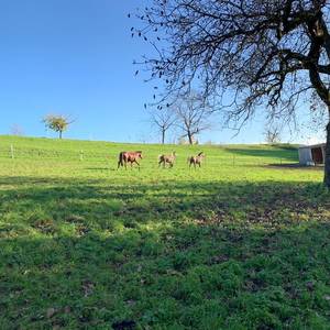
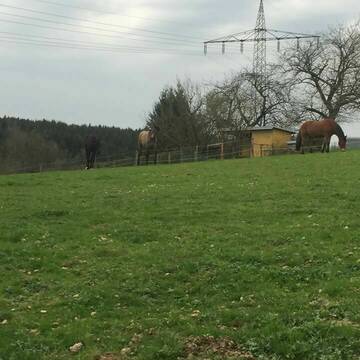
Weide in Leichlingen
Gesucht wird in "42799 Leichlingen"
118 Einträge
Deprecated: Creation of dynamic property Zend_View::$listObjects is deprecated in /var/www/stall-frei/htdocs/staging.stall-frei.de/library/vendor/shardj/zf1-future/library/Zend/View/Abstract.php on line 308
Deprecated: Creation of dynamic property Zend_View::$listMode is deprecated in /var/www/stall-frei/htdocs/staging.stall-frei.de/library/vendor/shardj/zf1-future/library/Zend/View/Abstract.php on line 308
Deprecated: Creation of dynamic property Zend_View::$renderedObjects is deprecated in /var/www/stall-frei/htdocs/staging.stall-frei.de/library/vendor/shardj/zf1-future/library/Zend/View/Abstract.php on line 308
Deprecated: Creation of dynamic property Zend_View::$index is deprecated in /var/www/stall-frei/htdocs/staging.stall-frei.de/library/vendor/shardj/zf1-future/library/Zend/View/Abstract.php on line 308
Deprecated: Creation of dynamic property Zend_View::$displayMode is deprecated in /var/www/stall-frei/htdocs/staging.stall-frei.de/library/vendor/shardj/zf1-future/library/Zend/View/Abstract.php on line 308
Deprecated: Creation of dynamic property Zend_View::$remarketingIds is deprecated in /var/www/stall-frei/htdocs/staging.stall-frei.de/library/vendor/shardj/zf1-future/library/Zend/View/Abstract.php on line 308
Deprecated: Creation of dynamic property Zend_View::$listItem is deprecated in /var/www/stall-frei/htdocs/staging.stall-frei.de/library/vendor/shardj/zf1-future/library/Zend/View/Abstract.php on line 308
Deprecated: Creation of dynamic property Zend_View::$object is deprecated in /var/www/stall-frei/htdocs/staging.stall-frei.de/library/vendor/shardj/zf1-future/library/Zend/View/Abstract.php on line 308
Deprecated: Creation of dynamic property Zend_View::$attributes is deprecated in /var/www/stall-frei/htdocs/staging.stall-frei.de/library/vendor/shardj/zf1-future/library/Zend/View/Abstract.php on line 308
Leider kein Vorschaubild
Leider kein Vorschaubild
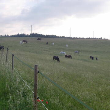
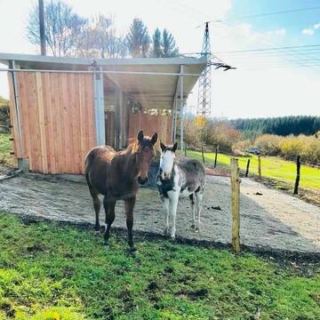
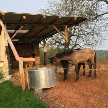
Pferdeparadies Beckstein
Roth / Bernlohe
Eva-Maria-Beckstein
@Eva-Maria-Beckstein
Gemischte Herde
Rentnerweide
Elektrozaun
Mit Auto und Anhänger erreichbar
Ganzjahresweide
Besuch der Weide: täglich
Zufütterung von Heu oder Silage
3 weitere...
B
Deprecated: Creation of dynamic property Zend_View_Helper_Ads::$adLink is deprecated in /var/www/stall-frei/htdocs/staging.stall-frei.de/library/Psf/View/Helper/Ads.php on line 108

Futtersack HeuToy, Fressbremse in pink
Mechtersen
STALL-FREIde Marketing
@STALL-FREI-Marketing
Stundenlange Beschäftigung die
Koliken vorbeugt, geringe Staubinhalation mit
steuerbarer Futterentnahme
Leider kein Vorschaubild
Leider kein Vorschaubild
Weide frei ab März 2026!
Tangstedt Wilstedt
Francesca Lischke
@Lischke2025
Elektrozaun
Mit Auto und Anhänger erreichbar
Ganzjahresweide
3 weitere...
B
Leider kein Vorschaubild
Leider kein Vorschaubild
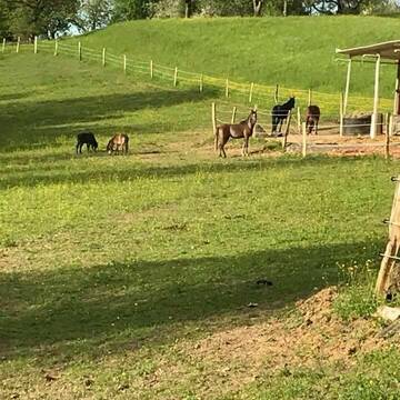
Ganzjährig Weideplatz
Trittau
f-mueller-dsd
@f-mueller-dsd
Gemischte Herde
Jungtierweide
Bremsenfalle
Elektrozaun
Ganzjahresweide
Besuch der Weide: täglich
Zufütterung von Heu oder Silage
7 weitere...
B
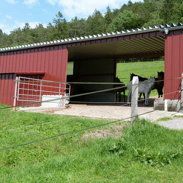
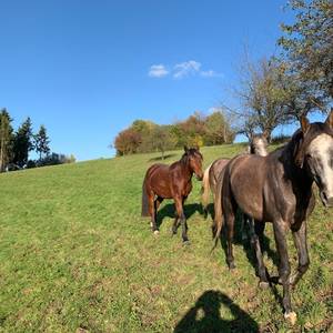
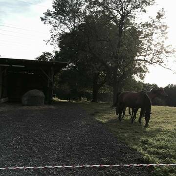
Traumhafter Offenstall
Waldshut-Tiengen
Pferdepension-Allmut
@Pferdepension-Allmut
Gemischte Herde
Elektrozaun
Mit Auto und Anhänger erreichbar
Ganzjahresweide
Besuch der Weide: täglich
Zufütterung von Heu oder Silage
3 weitere...
P+


2 Offenställplätze mit großer Sommer/Winterweide...
Eggingen
Privat-Offenstall-Eggingen
@Privat-Offenstall-Eggingen
Gemischte Herde
Rentnerweide
Elektrozaun
Mit Auto und Anhänger erreichbar
Ganzjahresweide
Besuch der Weide: täglich
Zufütterung von Heu oder Silage
6 weitere...
P+
![Vollzeitkraft[m/w/d] zur Verstärkung unseres Tea... (Anzeige)](/bilder/359853_largemedium.jpg)
Vollzeitkraft[m/w/d] zur Verstärkung unseres Tea...
Meckenbeuren
Pensionsstall-Weiler
@Pensionsstall-Weiler
Wir, der Pensionsstall Weiler, sucht eine Vollzeitkraft [m/w/d] zur Verstärkung unseres Mitarbeiterteams für Aufgaben rund um Pf

Alpakawanderungen, Pferdehofkornrade, Hofladen
Mönkhagen
Corinna-Fischer
@Corinna-Fischer
Jungtierweide
Rentnerweide
Elektrozaun
Mit Auto und Anhänger erreichbar
Frühjahrsweide
Ganzjahresweide
Besuch der Weide: täglich
Zufütterung von Heu oder Silage
8 weitere...
P
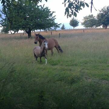
Altersweide für Wallache
Rheinfelden
Frech-City-Pferdepension
@Frech-City-Pferdepension
Jungtierweide
Rentnerweide
Elektrozaun
Mit Auto und Anhänger erreichbar
Ganzjahresweide
Besuch der Weide: täglich
Zufütterung von Heu oder Silage
4 weitere...
P+
Alters- und Fohlenweide für Stuten
Rheinfelden
Frech-City-Pferdepension
@Frech-City-Pferdepension
Jungtierweide
Rentnerweide
Elektrozaun
Mit Auto und Anhänger erreichbar
Ganzjahresweide
Besuch der Weide: täglich
Zufütterung von Heu oder Silage
4 weitere...
P+
Leider kein Vorschaubild
Leider kein Vorschaubild
Aktivstall/Trail mit Ganzjahresweide auf 15 Hektar
Detzeln
Carina-Bremer
@Carina-Bremer
Gemischte Herde
Hengstweide
Bremsenfalle
Elektrozaun
Frühjahrsweide
Ganzjahresweide
Besuch der Weide: täglich
Zufütterung von Heu oder Silage
14 weitere...
B
Leider kein Vorschaubild
Leider kein Vorschaubild
Ihr Pferd in besten Händen
FRONHOFEN
Anna Pfeffer
@Privatstall_Fronhofen
Gemischte Herde
Rentnerweide
Elektrozaun
Lattenzaun
Frühjahrsweide
Herbstweide
Besuch der Weide: täglich
5 weitere...
B
Deprecated: Creation of dynamic property Zend_View::$pageCount is deprecated in /var/www/stall-frei/htdocs/staging.stall-frei.de/library/vendor/shardj/zf1-future/library/Zend/View/Abstract.php on line 308
Deprecated: Creation of dynamic property Zend_View::$itemCountPerPage is deprecated in /var/www/stall-frei/htdocs/staging.stall-frei.de/library/vendor/shardj/zf1-future/library/Zend/View/Abstract.php on line 308
Deprecated: Creation of dynamic property Zend_View::$first is deprecated in /var/www/stall-frei/htdocs/staging.stall-frei.de/library/vendor/shardj/zf1-future/library/Zend/View/Abstract.php on line 308
Deprecated: Creation of dynamic property Zend_View::$current is deprecated in /var/www/stall-frei/htdocs/staging.stall-frei.de/library/vendor/shardj/zf1-future/library/Zend/View/Abstract.php on line 308
Deprecated: Creation of dynamic property Zend_View::$last is deprecated in /var/www/stall-frei/htdocs/staging.stall-frei.de/library/vendor/shardj/zf1-future/library/Zend/View/Abstract.php on line 308
Deprecated: Creation of dynamic property Zend_View::$previous is deprecated in /var/www/stall-frei/htdocs/staging.stall-frei.de/library/vendor/shardj/zf1-future/library/Zend/View/Abstract.php on line 308
Deprecated: Creation of dynamic property Zend_View::$next is deprecated in /var/www/stall-frei/htdocs/staging.stall-frei.de/library/vendor/shardj/zf1-future/library/Zend/View/Abstract.php on line 308
Deprecated: Creation of dynamic property Zend_View::$pagesInRange is deprecated in /var/www/stall-frei/htdocs/staging.stall-frei.de/library/vendor/shardj/zf1-future/library/Zend/View/Abstract.php on line 308
Deprecated: Creation of dynamic property Zend_View::$firstPageInRange is deprecated in /var/www/stall-frei/htdocs/staging.stall-frei.de/library/vendor/shardj/zf1-future/library/Zend/View/Abstract.php on line 308
Deprecated: Creation of dynamic property Zend_View::$lastPageInRange is deprecated in /var/www/stall-frei/htdocs/staging.stall-frei.de/library/vendor/shardj/zf1-future/library/Zend/View/Abstract.php on line 308
Deprecated: Creation of dynamic property Zend_View::$currentItemCount is deprecated in /var/www/stall-frei/htdocs/staging.stall-frei.de/library/vendor/shardj/zf1-future/library/Zend/View/Abstract.php on line 308
Deprecated: Creation of dynamic property Zend_View::$totalItemCount is deprecated in /var/www/stall-frei/htdocs/staging.stall-frei.de/library/vendor/shardj/zf1-future/library/Zend/View/Abstract.php on line 308
Deprecated: Creation of dynamic property Zend_View::$firstItemNumber is deprecated in /var/www/stall-frei/htdocs/staging.stall-frei.de/library/vendor/shardj/zf1-future/library/Zend/View/Abstract.php on line 308
Deprecated: Creation of dynamic property Zend_View::$lastItemNumber is deprecated in /var/www/stall-frei/htdocs/staging.stall-frei.de/library/vendor/shardj/zf1-future/library/Zend/View/Abstract.php on line 308
Deprecated: Creation of dynamic property Zend_View::$router is deprecated in /var/www/stall-frei/htdocs/staging.stall-frei.de/library/vendor/shardj/zf1-future/library/Zend/View/Abstract.php on line 308
Deprecated: Creation of dynamic property Zend_View::$urlParams is deprecated in /var/www/stall-frei/htdocs/staging.stall-frei.de/library/vendor/shardj/zf1-future/library/Zend/View/Abstract.php on line 308
Deprecated: Creation of dynamic property Zend_View::$showAds is deprecated in /var/www/stall-frei/htdocs/staging.stall-frei.de/library/vendor/shardj/zf1-future/library/Zend/View/Abstract.php on line 308
Deprecated: Creation of dynamic property Zend_View::$objectIds is deprecated in /var/www/stall-frei/htdocs/staging.stall-frei.de/library/vendor/shardj/zf1-future/library/Zend/View/Abstract.php on line 308
Deprecated: Creation of dynamic property Zend_View::$showNavbar is deprecated in /var/www/stall-frei/htdocs/staging.stall-frei.de/library/vendor/shardj/zf1-future/library/Zend/View/Abstract.php on line 308
Deprecated: Creation of dynamic property Zend_View::$showBreadcrumb is deprecated in /var/www/stall-frei/htdocs/staging.stall-frei.de/library/vendor/shardj/zf1-future/library/Zend/View/Abstract.php on line 308
Deprecated: Creation of dynamic property Zend_View::$showFooter is deprecated in /var/www/stall-frei/htdocs/staging.stall-frei.de/library/vendor/shardj/zf1-future/library/Zend/View/Abstract.php on line 308
Deprecated: Creation of dynamic property Zend_View::$showInternalAds is deprecated in /var/www/stall-frei/htdocs/staging.stall-frei.de/library/vendor/shardj/zf1-future/library/Zend/View/Abstract.php on line 308
Deprecated: Creation of dynamic property Zend_View::$blNoContent is deprecated in /var/www/stall-frei/htdocs/staging.stall-frei.de/library/vendor/shardj/zf1-future/library/Zend/View/Abstract.php on line 308
Deprecated: Creation of dynamic property Zend_View::$sMetaDesc is deprecated in /var/www/stall-frei/htdocs/staging.stall-frei.de/library/vendor/shardj/zf1-future/library/Zend/View/Abstract.php on line 308
Deprecated: Creation of dynamic property Zend_View::$useGmaps is deprecated in /var/www/stall-frei/htdocs/staging.stall-frei.de/library/vendor/shardj/zf1-future/library/Zend/View/Abstract.php on line 308
Deprecated: Creation of dynamic property Zend_View::$touches is deprecated in /var/www/stall-frei/htdocs/staging.stall-frei.de/library/vendor/shardj/zf1-future/library/Zend/View/Abstract.php on line 308
Deprecated: Creation of dynamic property Zend_View::$oProject is deprecated in /var/www/stall-frei/htdocs/staging.stall-frei.de/library/vendor/shardj/zf1-future/library/Zend/View/Abstract.php on line 308
Deprecated: Creation of dynamic property Zend_View::$pageHeadline is deprecated in /var/www/stall-frei/htdocs/staging.stall-frei.de/library/vendor/shardj/zf1-future/library/Zend/View/Abstract.php on line 308
Deprecated: Creation of dynamic property Zend_View::$disableLocationField is deprecated in /var/www/stall-frei/htdocs/staging.stall-frei.de/library/vendor/shardj/zf1-future/library/Zend/View/Abstract.php on line 308
Deprecated: Creation of dynamic property Zend_View::$isSearch is deprecated in /var/www/stall-frei/htdocs/staging.stall-frei.de/library/vendor/shardj/zf1-future/library/Zend/View/Abstract.php on line 308
Deprecated: Creation of dynamic property Zend_View::$pageTitle is deprecated in /var/www/stall-frei/htdocs/staging.stall-frei.de/library/vendor/shardj/zf1-future/library/Zend/View/Abstract.php on line 308
Deprecated: Creation of dynamic property Psf_Form_Element_Text::$class is deprecated in /var/www/stall-frei/htdocs/staging.stall-frei.de/library/vendor/shardj/zf1-future/library/Zend/Form/Element.php on line 874
Deprecated: Creation of dynamic property Psf_Form_Element_Text::$size is deprecated in /var/www/stall-frei/htdocs/staging.stall-frei.de/library/vendor/shardj/zf1-future/library/Zend/Form/Element.php on line 874
Deprecated: Creation of dynamic property Psf_Form_Element_Text::$placeholder is deprecated in /var/www/stall-frei/htdocs/staging.stall-frei.de/library/vendor/shardj/zf1-future/library/Zend/Form/Element.php on line 874
Deprecated: Creation of dynamic property Psf_Form_Element_Hidden::$class is deprecated in /var/www/stall-frei/htdocs/staging.stall-frei.de/library/vendor/shardj/zf1-future/library/Zend/Form/Element.php on line 874
Deprecated: Creation of dynamic property Psf_Form_Element_Hidden::$class is deprecated in /var/www/stall-frei/htdocs/staging.stall-frei.de/library/vendor/shardj/zf1-future/library/Zend/Form/Element.php on line 874
Deprecated: Creation of dynamic property Psf_Form_Element_Hidden::$class is deprecated in /var/www/stall-frei/htdocs/staging.stall-frei.de/library/vendor/shardj/zf1-future/library/Zend/Form/Element.php on line 874
Deprecated: Creation of dynamic property Psf_Form_Element_Hidden::$class is deprecated in /var/www/stall-frei/htdocs/staging.stall-frei.de/library/vendor/shardj/zf1-future/library/Zend/Form/Element.php on line 874
Deprecated: Creation of dynamic property Psf_Form_Element_Select::$class is deprecated in /var/www/stall-frei/htdocs/staging.stall-frei.de/library/vendor/shardj/zf1-future/library/Zend/Form/Element.php on line 874
Deprecated: Creation of dynamic property Psf_Form_Element_Select::$class is deprecated in /var/www/stall-frei/htdocs/staging.stall-frei.de/library/vendor/shardj/zf1-future/library/Zend/Form/Element.php on line 874
Deprecated: Creation of dynamic property Psf_Form_Element_Select::$class is deprecated in /var/www/stall-frei/htdocs/staging.stall-frei.de/library/vendor/shardj/zf1-future/library/Zend/Form/Element.php on line 874
Deprecated: Creation of dynamic property Psf_Form_Element_Text::$class is deprecated in /var/www/stall-frei/htdocs/staging.stall-frei.de/library/vendor/shardj/zf1-future/library/Zend/Form/Element.php on line 874
Deprecated: Creation of dynamic property Psf_Form_Element_Checkbox::$label is deprecated in /var/www/stall-frei/htdocs/staging.stall-frei.de/library/vendor/shardj/zf1-future/library/Zend/Form/Element.php on line 874
Deprecated: Creation of dynamic property Zend_View::$sort is deprecated in /var/www/stall-frei/htdocs/staging.stall-frei.de/library/vendor/shardj/zf1-future/library/Zend/View/Abstract.php on line 308
Deprecated: Creation of dynamic property Zend_View::$searchLocation is deprecated in /var/www/stall-frei/htdocs/staging.stall-frei.de/library/vendor/shardj/zf1-future/library/Zend/View/Abstract.php on line 308
Deprecated: Creation of dynamic property Zend_View::$locationHint is deprecated in /var/www/stall-frei/htdocs/staging.stall-frei.de/library/vendor/shardj/zf1-future/library/Zend/View/Abstract.php on line 308
Psf_GeoCoder_Abstract::getLocation: Unterberg Get Location CachedOrLive
Psf_GeoCoder_Abstract::getCachedOrLive: Unterberg
Psf_GeoCoder_Abstract::convertLocationResult
{"documentation":"https:\/\/opencagedata.com\/api","licenses":[{"name":"see attribution guide","url":"https:\/\/opencagedata.com\/credits"}],"results":[{"bounds":{"northeast":{"lat":51.1380163,"lng":7.0347734},"southwest":{"lat":51.0980163,"lng":6.9947734}},"components":{"ISO_3166-1_alpha-2":"DE","ISO_3166-1_alpha-3":"DEU","ISO_3166-2":["DE-NW"],"_category":"place","_normalized_city":"Leichlingen","_type":"village","continent":"Europe","country":"Deutschland","country_code":"de","county":"Rheinisch-Bergischer Kreis","political_union":"European Union","postcode":"42799","state":"Nordrhein-Westfalen","state_code":"NW","town":"Leichlingen","village":"Unterberg"},"confidence":7,"formatted":"42799 Unterberg, Deutschland","geometry":{"lat":51.1180163,"lng":7.0147734}},{"bounds":{"northeast":{"lat":47.5756538,"lng":9.9358601},"southwest":{"lat":47.5755538,"lng":9.9357601}},"components":{"ISO_3166-1_alpha-2":"DE","ISO_3166-1_alpha-3":"DEU","ISO_3166-2":["DE-BY"],"_category":"building","_normalized_city":"Weiler-Simmerberg","_type":"building","city":"Weiler-Simmerberg","continent":"Europe","country":"Deutschland","country_code":"de","county":"Landkreis Lindau","hamlet":"Rieder","isolated_dwelling":"Unterberg","political_union":"European Union","postcode":"88171","state":"Bayern","state_code":"BY"},"confidence":10,"formatted":"Unterberg, Rieder, 88171 Weiler-Simmerberg, Deutschland","geometry":{"lat":47.5756038,"lng":9.9358101}},{"bounds":{"northeast":{"lat":50.2197284,"lng":11.2598466},"southwest":{"lat":50.2196284,"lng":11.2597466}},"components":{"ISO_3166-1_alpha-2":"DE","ISO_3166-1_alpha-3":"DEU","ISO_3166-2":["DE-BY"],"_category":"building","_normalized_city":"K\u00fcps","_type":"building","city":"K\u00fcps","continent":"Europe","country":"Deutschland","country_code":"de","county":"Landkreis Kronach","hamlet":"Wachholder","isolated_dwelling":"Unterberg","political_union":"European Union","postcode":"96328","state":"Bayern","state_code":"BY"},"confidence":10,"formatted":"Unterberg, Wachholder, 96328 K\u00fcps, Deutschland","geometry":{"lat":50.2196784,"lng":11.2597966}},{"bounds":{"northeast":{"lat":48.593843,"lng":10.2932182},"southwest":{"lat":48.553843,"lng":10.2532182}},"components":{"ISO_3166-1_alpha-2":"DE","ISO_3166-1_alpha-3":"DEU","ISO_3166-2":["DE-BW"],"_category":"place","_normalized_city":"Sontheim an der Brenz","_type":"city","city":"Sontheim an der Brenz","continent":"Europe","country":"Deutschland","country_code":"de","county":"Landkreis Heidenheim","municipality":"GVV Sontheim-Niederstotzingen","political_union":"European Union","postcode":"89567","state":"Baden-W\u00fcrttemberg","state_code":"BW"},"confidence":7,"formatted":"Sontheim an der Brenz, Baden-W\u00fcrttemberg, Deutschland","geometry":{"lat":48.573843,"lng":10.2732182}},{"bounds":{"northeast":{"lat":50.1435273,"lng":9.9195975},"southwest":{"lat":50.1434273,"lng":9.9194975}},"components":{"ISO_3166-1_alpha-2":"DE","ISO_3166-1_alpha-3":"DEU","ISO_3166-2":["DE-BY"],"_category":"natural\/water","_normalized_city":"Hammelburg","_type":"peak","continent":"Europe","country":"Deutschland","country_code":"de","county":"Landkreis Bad Kissingen","peak":"Unterberg","political_union":"European Union","postcode":"97727","state":"Bayern","state_code":"BY","town":"Hammelburg"},"confidence":9,"formatted":"Unterberg, 97727 Hammelburg, Deutschland","geometry":{"lat":50.1434773,"lng":9.9195475}},{"bounds":{"northeast":{"lat":47.793345,"lng":12.900807},"southwest":{"lat":47.753345,"lng":12.860807}},"components":{"ISO_3166-1_alpha-2":"DE","ISO_3166-1_alpha-3":"DEU","ISO_3166-2":["DE-BY"],"_category":"place","_normalized_city":"Anger","_type":"hamlet","city":"Anger","continent":"Europe","country":"Deutschland","country_code":"de","county":"Landkreis Berchtesgadener Land","hamlet":"Unterberg","political_union":"European Union","postcode":"83454","state":"Bayern","state_code":"BY"},"confidence":7,"formatted":"Unterberg, 83454 Anger, Deutschland","geometry":{"lat":47.773345,"lng":12.880807}},{"bounds":{"northeast":{"lat":48.1838404,"lng":12.7417114},"southwest":{"lat":48.1438404,"lng":12.7017114}},"components":{"ISO_3166-1_alpha-2":"DE","ISO_3166-1_alpha-3":"DEU","ISO_3166-2":["DE-BY"],"_category":"place","_normalized_city":"Burgkirchen an der Alz","_type":"hamlet","continent":"Europe","country":"Deutschland","country_code":"de","county":"Landkreis Alt\u00f6tting","hamlet":"Unterberg","political_union":"European Union","postcode":"84508","state":"Bayern","state_code":"BY","town":"Burgkirchen an der Alz"},"confidence":7,"formatted":"Unterberg, 84508 Burgkirchen an der Alz, Deutschland","geometry":{"lat":48.1638404,"lng":12.7217114}},{"bounds":{"northeast":{"lat":51.1052111,"lng":7.2707472},"southwest":{"lat":51.0652111,"lng":7.2307472}},"components":{"ISO_3166-1_alpha-2":"DE","ISO_3166-1_alpha-3":"DEU","ISO_3166-2":["DE-NW"],"_category":"place","_normalized_city":"Wermelskirchen","_type":"hamlet","continent":"Europe","country":"Deutschland","country_code":"de","county":"Rheinisch-Bergischer Kreis","hamlet":"Unterberg","political_union":"European Union","state":"Nordrhein-Westfalen","state_code":"NW","town":"Wermelskirchen"},"confidence":7,"formatted":"Unterberg, Wermelskirchen, Nordrhein-Westfalen, Deutschland","geometry":{"lat":51.0852111,"lng":7.2507472}},{"bounds":{"northeast":{"lat":47.8374479,"lng":12.7413367},"southwest":{"lat":47.7974479,"lng":12.7013367}},"components":{"ISO_3166-1_alpha-2":"DE","ISO_3166-1_alpha-3":"DEU","ISO_3166-2":["DE-BY"],"_category":"place","_normalized_city":"Siegsdorf","_type":"hamlet","continent":"Europe","country":"Deutschland","country_code":"de","county":"Landkreis Traunstein","hamlet":"Unterberg","political_union":"European Union","postcode":"83364","state":"Bayern","state_code":"BY","town":"Siegsdorf"},"confidence":7,"formatted":"Unterberg, 83364 Siegsdorf, Deutschland","geometry":{"lat":47.8174479,"lng":12.7213367}},{"bounds":{"northeast":{"lat":48.8522866,"lng":13.0592479},"southwest":{"lat":48.8122866,"lng":13.0192479}},"components":{"ISO_3166-1_alpha-2":"DE","ISO_3166-1_alpha-3":"DEU","ISO_3166-2":["DE-BY"],"_category":"place","_normalized_city":"Schaufling","_type":"hamlet","city":"Schaufling","continent":"Europe","country":"Deutschland","country_code":"de","county":"Landkreis Deggendorf","hamlet":"Unterberg","municipality":"Lalling (VGem)","political_union":"European Union","postcode":"94571","state":"Bayern","state_code":"BY"},"confidence":7,"formatted":"Unterberg, 94571 Schaufling, Deutschland","geometry":{"lat":48.8322866,"lng":13.0392479}}],"status":{"code":200,"message":"OK"},"stay_informed":{"blog":"https:\/\/blog.opencagedata.com","mastodon":"https:\/\/en.osm.town\/@opencage"},"thanks":"For using an OpenCage API","timestamp":{"created_http":"Sun, 08 Feb 2026 01:20:09 GMT","created_unix":1770513609},"total_results":10}Array
(
[0] => stdClass Object
(
[bounds] => stdClass Object
(
[northeast] => stdClass Object
(
[lat] => 51.1380163
[lng] => 7.0347734
)
[southwest] => stdClass Object
(
[lat] => 51.0980163
[lng] => 6.9947734
)
)
[components] => stdClass Object
(
[ISO_3166-1_alpha-2] => DE
[ISO_3166-1_alpha-3] => DEU
[ISO_3166-2] => Array
(
[0] => DE-NW
)
[_category] => place
[_normalized_city] => Leichlingen
[_type] => village
[continent] => Europe
[country] => Deutschland
[country_code] => de
[county] => Rheinisch-Bergischer Kreis
[political_union] => European Union
[postcode] => 42799
[state] => Nordrhein-Westfalen
[state_code] => NW
[town] => Leichlingen
[village] => Unterberg
)
[confidence] => 7
[formatted] => 42799 Unterberg, Deutschland
[geometry] => stdClass Object
(
[lat] => 51.1180163
[lng] => 7.0147734
)
)
[1] => stdClass Object
(
[bounds] => stdClass Object
(
[northeast] => stdClass Object
(
[lat] => 47.5756538
[lng] => 9.9358601
)
[southwest] => stdClass Object
(
[lat] => 47.5755538
[lng] => 9.9357601
)
)
[components] => stdClass Object
(
[ISO_3166-1_alpha-2] => DE
[ISO_3166-1_alpha-3] => DEU
[ISO_3166-2] => Array
(
[0] => DE-BY
)
[_category] => building
[_normalized_city] => Weiler-Simmerberg
[_type] => building
[city] => Weiler-Simmerberg
[continent] => Europe
[country] => Deutschland
[country_code] => de
[county] => Landkreis Lindau
[hamlet] => Rieder
[isolated_dwelling] => Unterberg
[political_union] => European Union
[postcode] => 88171
[state] => Bayern
[state_code] => BY
)
[confidence] => 10
[formatted] => Unterberg, Rieder, 88171 Weiler-Simmerberg, Deutschland
[geometry] => stdClass Object
(
[lat] => 47.5756038
[lng] => 9.9358101
)
)
[2] => stdClass Object
(
[bounds] => stdClass Object
(
[northeast] => stdClass Object
(
[lat] => 50.2197284
[lng] => 11.2598466
)
[southwest] => stdClass Object
(
[lat] => 50.2196284
[lng] => 11.2597466
)
)
[components] => stdClass Object
(
[ISO_3166-1_alpha-2] => DE
[ISO_3166-1_alpha-3] => DEU
[ISO_3166-2] => Array
(
[0] => DE-BY
)
[_category] => building
[_normalized_city] => Küps
[_type] => building
[city] => Küps
[continent] => Europe
[country] => Deutschland
[country_code] => de
[county] => Landkreis Kronach
[hamlet] => Wachholder
[isolated_dwelling] => Unterberg
[political_union] => European Union
[postcode] => 96328
[state] => Bayern
[state_code] => BY
)
[confidence] => 10
[formatted] => Unterberg, Wachholder, 96328 Küps, Deutschland
[geometry] => stdClass Object
(
[lat] => 50.2196784
[lng] => 11.2597966
)
)
[3] => stdClass Object
(
[bounds] => stdClass Object
(
[northeast] => stdClass Object
(
[lat] => 48.593843
[lng] => 10.2932182
)
[southwest] => stdClass Object
(
[lat] => 48.553843
[lng] => 10.2532182
)
)
[components] => stdClass Object
(
[ISO_3166-1_alpha-2] => DE
[ISO_3166-1_alpha-3] => DEU
[ISO_3166-2] => Array
(
[0] => DE-BW
)
[_category] => place
[_normalized_city] => Sontheim an der Brenz
[_type] => city
[city] => Sontheim an der Brenz
[continent] => Europe
[country] => Deutschland
[country_code] => de
[county] => Landkreis Heidenheim
[municipality] => GVV Sontheim-Niederstotzingen
[political_union] => European Union
[postcode] => 89567
[state] => Baden-Württemberg
[state_code] => BW
)
[confidence] => 7
[formatted] => Sontheim an der Brenz, Baden-Württemberg, Deutschland
[geometry] => stdClass Object
(
[lat] => 48.573843
[lng] => 10.2732182
)
)
[4] => stdClass Object
(
[bounds] => stdClass Object
(
[northeast] => stdClass Object
(
[lat] => 50.1435273
[lng] => 9.9195975
)
[southwest] => stdClass Object
(
[lat] => 50.1434273
[lng] => 9.9194975
)
)
[components] => stdClass Object
(
[ISO_3166-1_alpha-2] => DE
[ISO_3166-1_alpha-3] => DEU
[ISO_3166-2] => Array
(
[0] => DE-BY
)
[_category] => natural/water
[_normalized_city] => Hammelburg
[_type] => peak
[continent] => Europe
[country] => Deutschland
[country_code] => de
[county] => Landkreis Bad Kissingen
[peak] => Unterberg
[political_union] => European Union
[postcode] => 97727
[state] => Bayern
[state_code] => BY
[town] => Hammelburg
)
[confidence] => 9
[formatted] => Unterberg, 97727 Hammelburg, Deutschland
[geometry] => stdClass Object
(
[lat] => 50.1434773
[lng] => 9.9195475
)
)
[5] => stdClass Object
(
[bounds] => stdClass Object
(
[northeast] => stdClass Object
(
[lat] => 47.793345
[lng] => 12.900807
)
[southwest] => stdClass Object
(
[lat] => 47.753345
[lng] => 12.860807
)
)
[components] => stdClass Object
(
[ISO_3166-1_alpha-2] => DE
[ISO_3166-1_alpha-3] => DEU
[ISO_3166-2] => Array
(
[0] => DE-BY
)
[_category] => place
[_normalized_city] => Anger
[_type] => hamlet
[city] => Anger
[continent] => Europe
[country] => Deutschland
[country_code] => de
[county] => Landkreis Berchtesgadener Land
[hamlet] => Unterberg
[political_union] => European Union
[postcode] => 83454
[state] => Bayern
[state_code] => BY
)
[confidence] => 7
[formatted] => Unterberg, 83454 Anger, Deutschland
[geometry] => stdClass Object
(
[lat] => 47.773345
[lng] => 12.880807
)
)
[6] => stdClass Object
(
[bounds] => stdClass Object
(
[northeast] => stdClass Object
(
[lat] => 48.1838404
[lng] => 12.7417114
)
[southwest] => stdClass Object
(
[lat] => 48.1438404
[lng] => 12.7017114
)
)
[components] => stdClass Object
(
[ISO_3166-1_alpha-2] => DE
[ISO_3166-1_alpha-3] => DEU
[ISO_3166-2] => Array
(
[0] => DE-BY
)
[_category] => place
[_normalized_city] => Burgkirchen an der Alz
[_type] => hamlet
[continent] => Europe
[country] => Deutschland
[country_code] => de
[county] => Landkreis Altötting
[hamlet] => Unterberg
[political_union] => European Union
[postcode] => 84508
[state] => Bayern
[state_code] => BY
[town] => Burgkirchen an der Alz
)
[confidence] => 7
[formatted] => Unterberg, 84508 Burgkirchen an der Alz, Deutschland
[geometry] => stdClass Object
(
[lat] => 48.1638404
[lng] => 12.7217114
)
)
[7] => stdClass Object
(
[bounds] => stdClass Object
(
[northeast] => stdClass Object
(
[lat] => 51.1052111
[lng] => 7.2707472
)
[southwest] => stdClass Object
(
[lat] => 51.0652111
[lng] => 7.2307472
)
)
[components] => stdClass Object
(
[ISO_3166-1_alpha-2] => DE
[ISO_3166-1_alpha-3] => DEU
[ISO_3166-2] => Array
(
[0] => DE-NW
)
[_category] => place
[_normalized_city] => Wermelskirchen
[_type] => hamlet
[continent] => Europe
[country] => Deutschland
[country_code] => de
[county] => Rheinisch-Bergischer Kreis
[hamlet] => Unterberg
[political_union] => European Union
[state] => Nordrhein-Westfalen
[state_code] => NW
[town] => Wermelskirchen
)
[confidence] => 7
[formatted] => Unterberg, Wermelskirchen, Nordrhein-Westfalen, Deutschland
[geometry] => stdClass Object
(
[lat] => 51.0852111
[lng] => 7.2507472
)
)
[8] => stdClass Object
(
[bounds] => stdClass Object
(
[northeast] => stdClass Object
(
[lat] => 47.8374479
[lng] => 12.7413367
)
[southwest] => stdClass Object
(
[lat] => 47.7974479
[lng] => 12.7013367
)
)
[components] => stdClass Object
(
[ISO_3166-1_alpha-2] => DE
[ISO_3166-1_alpha-3] => DEU
[ISO_3166-2] => Array
(
[0] => DE-BY
)
[_category] => place
[_normalized_city] => Siegsdorf
[_type] => hamlet
[continent] => Europe
[country] => Deutschland
[country_code] => de
[county] => Landkreis Traunstein
[hamlet] => Unterberg
[political_union] => European Union
[postcode] => 83364
[state] => Bayern
[state_code] => BY
[town] => Siegsdorf
)
[confidence] => 7
[formatted] => Unterberg, 83364 Siegsdorf, Deutschland
[geometry] => stdClass Object
(
[lat] => 47.8174479
[lng] => 12.7213367
)
)
[9] => stdClass Object
(
[bounds] => stdClass Object
(
[northeast] => stdClass Object
(
[lat] => 48.8522866
[lng] => 13.0592479
)
[southwest] => stdClass Object
(
[lat] => 48.8122866
[lng] => 13.0192479
)
)
[components] => stdClass Object
(
[ISO_3166-1_alpha-2] => DE
[ISO_3166-1_alpha-3] => DEU
[ISO_3166-2] => Array
(
[0] => DE-BY
)
[_category] => place
[_normalized_city] => Schaufling
[_type] => hamlet
[city] => Schaufling
[continent] => Europe
[country] => Deutschland
[country_code] => de
[county] => Landkreis Deggendorf
[hamlet] => Unterberg
[municipality] => Lalling (VGem)
[political_union] => European Union
[postcode] => 94571
[state] => Bayern
[state_code] => BY
)
[confidence] => 7
[formatted] => Unterberg, 94571 Schaufling, Deutschland
[geometry] => stdClass Object
(
[lat] => 48.8322866
[lng] => 13.0392479
)
)
)
Psf_GeoCoder_OpenCageData::getKeyMap: 0
stdClass Object
(
    [bounds] => stdClass Object
        (
            [northeast] => stdClass Object
                (
                    [lat] => 51.1380163
                    [lng] => 7.0347734
                )

            [southwest] => stdClass Object
                (
                    [lat] => 51.0980163
                    [lng] => 6.9947734
                )

        )

    [components] => stdClass Object
        (
            [ISO_3166-1_alpha-2] => DE
            [ISO_3166-1_alpha-3] => DEU
            [ISO_3166-2] => Array
                (
                    [0] => DE-NW
                )

            [_category] => place
            [_normalized_city] => Leichlingen
            [_type] => village
            [continent] => Europe
            [country] => Deutschland
            [country_code] => de
            [county] => Rheinisch-Bergischer Kreis
            [political_union] => European Union
            [postcode] => 42799
            [state] => Nordrhein-Westfalen
            [state_code] => NW
            [town] => Leichlingen
            [village] => Unterberg
        )

    [confidence] => 7
    [formatted] => 42799 Unterberg, Deutschland
    [geometry] => stdClass Object
        (
            [lat] => 51.1180163
            [lng] => 7.0147734
        )

)
Psf_GeoCoder_OpenCageData::getCounty: Rheinisch-Bergischer Kreis
Psf_GeoCoder_OpenCageData::addMissingData REFETCH!
Array
(
    [address] => 42799 Unterberg, Deutschland
    [type] => village
    [street] =>
    [city] => Leichlingen
    [county] => Rheinisch-Bergischer Kreis
    [state] => Nordrhein-Westfalen
    [zip] => 42799
    [country] => Deutschland
    [suburb] =>
    [countrycode] => de
    [latitude] => 51.1180163
    [longitude] => 7.0147734
    [accuracy] => 1
    [confidence] => 7
    [bounds] => stdClass Object
        (
            [northeast] => stdClass Object
                (
                    [lat] => 51.1380163
                    [lng] => 7.0347734
                )

            [southwest] => stdClass Object
                (
                    [lat] => 51.0980163
                    [lng] => 6.9947734
                )

        )

)
reformat!
Array
(
    [address] => 42799 Leichlingen
    [type] => village
    [street] =>
    [city] => Leichlingen
    [county] => Rheinisch-Bergischer Kreis
    [state] => Nordrhein-Westfalen
    [zip] => 42799
    [country] => Deutschland
    [suburb] =>
    [countrycode] => de
    [latitude] => 51.1180163
    [longitude] => 7.0147734
    [accuracy] => 1
    [confidence] => 7
    [bounds] => stdClass Object
        (
            [northeast] => stdClass Object
                (
                    [lat] => 51.1380163
                    [lng] => 7.0347734
                )

            [southwest] => stdClass Object
                (
                    [lat] => 51.0980163
                    [lng] => 6.9947734
                )

        )

    [place] => 42799 Leichlingen, Nordrhein-Westfalen
    [hash] => 6e061a5f4da2eba504b48b79c4c29d20
)
Psf_GeoCoder_OpenCageData::getKeyMap: 1
stdClass Object
(
    [bounds] => stdClass Object
        (
            [northeast] => stdClass Object
                (
                    [lat] => 47.5756538
                    [lng] => 9.9358601
                )

            [southwest] => stdClass Object
                (
                    [lat] => 47.5755538
                    [lng] => 9.9357601
                )

        )

    [components] => stdClass Object
        (
            [ISO_3166-1_alpha-2] => DE
            [ISO_3166-1_alpha-3] => DEU
            [ISO_3166-2] => Array
                (
                    [0] => DE-BY
                )

            [_category] => building
            [_normalized_city] => Weiler-Simmerberg
            [_type] => building
            [city] => Weiler-Simmerberg
            [continent] => Europe
            [country] => Deutschland
            [country_code] => de
            [county] => Landkreis Lindau
            [hamlet] => Rieder
            [isolated_dwelling] => Unterberg
            [political_union] => European Union
            [postcode] => 88171
            [state] => Bayern
            [state_code] => BY
        )

    [confidence] => 10
    [formatted] => Unterberg, Rieder, 88171 Weiler-Simmerberg, Deutschland
    [geometry] => stdClass Object
        (
            [lat] => 47.5756038
            [lng] => 9.9358101
        )

)
Psf_GeoCoder_OpenCageData::getCounty: Lindau
Psf_GeoCoder_OpenCageData::addMissingData REFETCH!
Array
(
    [address] => Unterberg, Rieder, 88171 Weiler-Simmerberg, Deutschland
    [type] => building
    [street] => Rieder
    [city] => Weiler-Simmerberg
    [county] => Lindau
    [state] => Bayern
    [zip] => 88171
    [country] => Deutschland
    [suburb] =>
    [countrycode] => de
    [latitude] => 47.5756038
    [longitude] => 9.9358101
    [accuracy] => 1
    [confidence] => 10
    [bounds] => stdClass Object
        (
            [northeast] => stdClass Object
                (
                    [lat] => 47.5756538
                    [lng] => 9.9358601
                )

            [southwest] => stdClass Object
                (
                    [lat] => 47.5755538
                    [lng] => 9.9357601
                )

        )

)
reformat!
Array
(
    [address] => Unterberg, Rieder, 88171 Weiler-Simmerberg, Deutschland
    [type] => building
    [street] => Rieder
    [city] => Weiler-Simmerberg
    [county] => Lindau
    [state] => Bayern
    [zip] => 88171
    [country] => Deutschland
    [suburb] =>
    [countrycode] => de
    [latitude] => 47.5756038
    [longitude] => 9.9358101
    [accuracy] => 1
    [confidence] => 10
    [bounds] => stdClass Object
        (
            [northeast] => stdClass Object
                (
                    [lat] => 47.5756538
                    [lng] => 9.9358601
                )

            [southwest] => stdClass Object
                (
                    [lat] => 47.5755538
                    [lng] => 9.9357601
                )

        )

    [place] => Rieder, 88171 Weiler-Simmerberg, Bayern
    [hash] => 21652d1e1146953140ceaf8257248b8b
)
Psf_GeoCoder_OpenCageData::getKeyMap: 2
stdClass Object
(
    [bounds] => stdClass Object
        (
            [northeast] => stdClass Object
                (
                    [lat] => 50.2197284
                    [lng] => 11.2598466
                )

            [southwest] => stdClass Object
                (
                    [lat] => 50.2196284
                    [lng] => 11.2597466
                )

        )

    [components] => stdClass Object
        (
            [ISO_3166-1_alpha-2] => DE
            [ISO_3166-1_alpha-3] => DEU
            [ISO_3166-2] => Array
                (
                    [0] => DE-BY
                )

            [_category] => building
            [_normalized_city] => Küps
            [_type] => building
            [city] => Küps
            [continent] => Europe
            [country] => Deutschland
            [country_code] => de
            [county] => Landkreis Kronach
            [hamlet] => Wachholder
            [isolated_dwelling] => Unterberg
            [political_union] => European Union
            [postcode] => 96328
            [state] => Bayern
            [state_code] => BY
        )

    [confidence] => 10
    [formatted] => Unterberg, Wachholder, 96328 Küps, Deutschland
    [geometry] => stdClass Object
        (
            [lat] => 50.2196784
            [lng] => 11.2597966
        )

)
Psf_GeoCoder_OpenCageData::getCounty: Kronach
Psf_GeoCoder_OpenCageData::addMissingData REFETCH!
Array
(
    [address] => Unterberg, Wachholder, 96328 Küps, Deutschland
    [type] => building
    [street] => Wachholder
    [city] => Küps
    [county] => Kronach
    [state] => Bayern
    [zip] => 96328
    [country] => Deutschland
    [suburb] =>
    [countrycode] => de
    [latitude] => 50.2196784
    [longitude] => 11.2597966
    [accuracy] => 1
    [confidence] => 10
    [bounds] => stdClass Object
        (
            [northeast] => stdClass Object
                (
                    [lat] => 50.2197284
                    [lng] => 11.2598466
                )

            [southwest] => stdClass Object
                (
                    [lat] => 50.2196284
                    [lng] => 11.2597466
                )

        )

)
reformat!
Array
(
    [address] => Unterberg, Wachholder, 96328 Küps, Deutschland
    [type] => building
    [street] => Wachholder
    [city] => Küps
    [county] => Kronach
    [state] => Bayern
    [zip] => 96328
    [country] => Deutschland
    [suburb] =>
    [countrycode] => de
    [latitude] => 50.2196784
    [longitude] => 11.2597966
    [accuracy] => 1
    [confidence] => 10
    [bounds] => stdClass Object
        (
            [northeast] => stdClass Object
                (
                    [lat] => 50.2197284
                    [lng] => 11.2598466
                )

            [southwest] => stdClass Object
                (
                    [lat] => 50.2196284
                    [lng] => 11.2597466
                )

        )

    [place] => Wachholder, 96328 Küps, Bayern
    [hash] => a07797cd38fd03617104910bb36e8588
)
Psf_GeoCoder_OpenCageData::getKeyMap: 3
stdClass Object
(
    [bounds] => stdClass Object
        (
            [northeast] => stdClass Object
                (
                    [lat] => 48.593843
                    [lng] => 10.2932182
                )

            [southwest] => stdClass Object
                (
                    [lat] => 48.553843
                    [lng] => 10.2532182
                )

        )

    [components] => stdClass Object
        (
            [ISO_3166-1_alpha-2] => DE
            [ISO_3166-1_alpha-3] => DEU
            [ISO_3166-2] => Array
                (
                    [0] => DE-BW
                )

            [_category] => place
            [_normalized_city] => Sontheim an der Brenz
            [_type] => city
            [city] => Sontheim an der Brenz
            [continent] => Europe
            [country] => Deutschland
            [country_code] => de
            [county] => Landkreis Heidenheim
            [municipality] => GVV Sontheim-Niederstotzingen
            [political_union] => European Union
            [postcode] => 89567
            [state] => Baden-Württemberg
            [state_code] => BW
        )

    [confidence] => 7
    [formatted] => Sontheim an der Brenz, Baden-Württemberg, Deutschland
    [geometry] => stdClass Object
        (
            [lat] => 48.573843
            [lng] => 10.2732182
        )

)
Psf_GeoCoder_OpenCageData::getCounty: Heidenheim
Psf_GeoCoder_OpenCageData::addMissingData REFETCH!
Array
(
    [address] => Sontheim an der Brenz, Baden-Württemberg, Deutschland
    [type] => city
    [street] =>
    [city] => Sontheim an der Brenz
    [county] => Heidenheim
    [state] => Baden-Württemberg
    [zip] => 89567
    [country] => Deutschland
    [suburb] =>
    [countrycode] => de
    [latitude] => 48.573843
    [longitude] => 10.2732182
    [accuracy] => 1
    [confidence] => 7
    [bounds] => stdClass Object
        (
            [northeast] => stdClass Object
                (
                    [lat] => 48.593843
                    [lng] => 10.2932182
                )

            [southwest] => stdClass Object
                (
                    [lat] => 48.553843
                    [lng] => 10.2532182
                )

        )

)
reformat!
Array
(
    [address] => Sontheim an der Brenz, Baden-Württemberg, Deutschland
    [type] => city
    [street] =>
    [city] => Sontheim an der Brenz
    [county] => Heidenheim
    [state] => Baden-Württemberg
    [zip] => 89567
    [country] => Deutschland
    [suburb] =>
    [countrycode] => de
    [latitude] => 48.573843
    [longitude] => 10.2732182
    [accuracy] => 1
    [confidence] => 7
    [bounds] => stdClass Object
        (
            [northeast] => stdClass Object
                (
                    [lat] => 48.593843
                    [lng] => 10.2932182
                )

            [southwest] => stdClass Object
                (
                    [lat] => 48.553843
                    [lng] => 10.2532182
                )

        )

    [place] => 89567 Sontheim an der Brenz, Baden-Württemberg
    [hash] => a29747b0e8712a2e8cd88913be537f90
)
Psf_GeoCoder_OpenCageData::getKeyMap: 4
stdClass Object
(
    [bounds] => stdClass Object
        (
            [northeast] => stdClass Object
                (
                    [lat] => 50.1435273
                    [lng] => 9.9195975
                )

            [southwest] => stdClass Object
                (
                    [lat] => 50.1434273
                    [lng] => 9.9194975
                )

        )

    [components] => stdClass Object
        (
            [ISO_3166-1_alpha-2] => DE
            [ISO_3166-1_alpha-3] => DEU
            [ISO_3166-2] => Array
                (
                    [0] => DE-BY
                )

            [_category] => natural/water
            [_normalized_city] => Hammelburg
            [_type] => peak
            [continent] => Europe
            [country] => Deutschland
            [country_code] => de
            [county] => Landkreis Bad Kissingen
            [peak] => Unterberg
            [political_union] => European Union
            [postcode] => 97727
            [state] => Bayern
            [state_code] => BY
            [town] => Hammelburg
        )

    [confidence] => 9
    [formatted] => Unterberg, 97727 Hammelburg, Deutschland
    [geometry] => stdClass Object
        (
            [lat] => 50.1434773
            [lng] => 9.9195475
        )

)
Psf_GeoCoder_OpenCageData::getCounty: Bad Kissingen
Psf_GeoCoder_OpenCageData::addMissingData REFETCH!
Array
(
    [address] => Unterberg, 97727 Hammelburg, Deutschland
    [type] => peak
    [street] =>
    [city] => Hammelburg
    [county] => Bad Kissingen
    [state] => Bayern
    [zip] => 97727
    [country] => Deutschland
    [suburb] =>
    [countrycode] => de
    [latitude] => 50.1434773
    [longitude] => 9.9195475
    [accuracy] => 1
    [confidence] => 9
    [bounds] => stdClass Object
        (
            [northeast] => stdClass Object
                (
                    [lat] => 50.1435273
                    [lng] => 9.9195975
                )

            [southwest] => stdClass Object
                (
                    [lat] => 50.1434273
                    [lng] => 9.9194975
                )

        )

)
reformat!
Array
(
    [address] => Unterberg, 97727 Hammelburg, Deutschland
    [type] => peak
    [street] =>
    [city] => Hammelburg
    [county] => Bad Kissingen
    [state] => Bayern
    [zip] => 97727
    [country] => Deutschland
    [suburb] =>
    [countrycode] => de
    [latitude] => 50.1434773
    [longitude] => 9.9195475
    [accuracy] => 1
    [confidence] => 9
    [bounds] => stdClass Object
        (
            [northeast] => stdClass Object
                (
                    [lat] => 50.1435273
                    [lng] => 9.9195975
                )

            [southwest] => stdClass Object
                (
                    [lat] => 50.1434273
                    [lng] => 9.9194975
                )

        )

    [place] => 97727 Hammelburg, Bayern
    [hash] => 3930d53b50ad24008ad6f43de322a65e
)
Psf_GeoCoder_OpenCageData::getKeyMap: 5
stdClass Object
(
    [bounds] => stdClass Object
        (
            [northeast] => stdClass Object
                (
                    [lat] => 47.793345
                    [lng] => 12.900807
                )

            [southwest] => stdClass Object
                (
                    [lat] => 47.753345
                    [lng] => 12.860807
                )

        )

    [components] => stdClass Object
        (
            [ISO_3166-1_alpha-2] => DE
            [ISO_3166-1_alpha-3] => DEU
            [ISO_3166-2] => Array
                (
                    [0] => DE-BY
                )

            [_category] => place
            [_normalized_city] => Anger
            [_type] => hamlet
            [city] => Anger
            [continent] => Europe
            [country] => Deutschland
            [country_code] => de
            [county] => Landkreis Berchtesgadener Land
            [hamlet] => Unterberg
            [political_union] => European Union
            [postcode] => 83454
            [state] => Bayern
            [state_code] => BY
        )

    [confidence] => 7
    [formatted] => Unterberg, 83454 Anger, Deutschland
    [geometry] => stdClass Object
        (
            [lat] => 47.773345
            [lng] => 12.880807
        )

)
Psf_GeoCoder_OpenCageData::getCounty: Berchtesgadener Land
Psf_GeoCoder_OpenCageData::addMissingData REFETCH!
Array
(
    [address] => Unterberg, 83454 Anger, Deutschland
    [type] => hamlet
    [street] => Unterberg
    [city] => Anger
    [county] => Berchtesgadener Land
    [state] => Bayern
    [zip] => 83454
    [country] => Deutschland
    [suburb] =>
    [countrycode] => de
    [latitude] => 47.773345
    [longitude] => 12.880807
    [accuracy] => 1
    [confidence] => 7
    [bounds] => stdClass Object
        (
            [northeast] => stdClass Object
                (
                    [lat] => 47.793345
                    [lng] => 12.900807
                )

            [southwest] => stdClass Object
                (
                    [lat] => 47.753345
                    [lng] => 12.860807
                )

        )

)
reformat!
Array
(
    [address] => Unterberg, 83454 Anger, Deutschland
    [type] => hamlet
    [street] => Unterberg
    [city] => Anger
    [county] => Berchtesgadener Land
    [state] => Bayern
    [zip] => 83454
    [country] => Deutschland
    [suburb] =>
    [countrycode] => de
    [latitude] => 47.773345
    [longitude] => 12.880807
    [accuracy] => 1
    [confidence] => 7
    [bounds] => stdClass Object
        (
            [northeast] => stdClass Object
                (
                    [lat] => 47.793345
                    [lng] => 12.900807
                )

            [southwest] => stdClass Object
                (
                    [lat] => 47.753345
                    [lng] => 12.860807
                )

        )

    [place] => Unterberg, 83454 Anger, Bayern
    [hash] => 393cbfba09e707ff313ebec5a9446013
)
Psf_GeoCoder_OpenCageData::getKeyMap: 6
stdClass Object
(
    [bounds] => stdClass Object
        (
            [northeast] => stdClass Object
                (
                    [lat] => 48.1838404
                    [lng] => 12.7417114
                )

            [southwest] => stdClass Object
                (
                    [lat] => 48.1438404
                    [lng] => 12.7017114
                )

        )

    [components] => stdClass Object
        (
            [ISO_3166-1_alpha-2] => DE
            [ISO_3166-1_alpha-3] => DEU
            [ISO_3166-2] => Array
                (
                    [0] => DE-BY
                )

            [_category] => place
            [_normalized_city] => Burgkirchen an der Alz
            [_type] => hamlet
            [continent] => Europe
            [country] => Deutschland
            [country_code] => de
            [county] => Landkreis Altötting
            [hamlet] => Unterberg
            [political_union] => European Union
            [postcode] => 84508
            [state] => Bayern
            [state_code] => BY
            [town] => Burgkirchen an der Alz
        )

    [confidence] => 7
    [formatted] => Unterberg, 84508 Burgkirchen an der Alz, Deutschland
    [geometry] => stdClass Object
        (
            [lat] => 48.1638404
            [lng] => 12.7217114
        )

)
Psf_GeoCoder_OpenCageData::getCounty: Altötting
Psf_GeoCoder_OpenCageData::addMissingData REFETCH!
Array
(
    [address] => Unterberg, 84508 Burgkirchen an der Alz, Deutschland
    [type] => hamlet
    [street] => Unterberg
    [city] => Burgkirchen an der Alz
    [county] => Altötting
    [state] => Bayern
    [zip] => 84508
    [country] => Deutschland
    [suburb] =>
    [countrycode] => de
    [latitude] => 48.1638404
    [longitude] => 12.7217114
    [accuracy] => 1
    [confidence] => 7
    [bounds] => stdClass Object
        (
            [northeast] => stdClass Object
                (
                    [lat] => 48.1838404
                    [lng] => 12.7417114
                )

            [southwest] => stdClass Object
                (
                    [lat] => 48.1438404
                    [lng] => 12.7017114
                )

        )

)
reformat!
Array
(
    [address] => Unterberg, 84508 Burgkirchen an der Alz, Deutschland
    [type] => hamlet
    [street] => Unterberg
    [city] => Burgkirchen an der Alz
    [county] => Altötting
    [state] => Bayern
    [zip] => 84508
    [country] => Deutschland
    [suburb] =>
    [countrycode] => de
    [latitude] => 48.1638404
    [longitude] => 12.7217114
    [accuracy] => 1
    [confidence] => 7
    [bounds] => stdClass Object
        (
            [northeast] => stdClass Object
                (
                    [lat] => 48.1838404
                    [lng] => 12.7417114
                )

            [southwest] => stdClass Object
                (
                    [lat] => 48.1438404
                    [lng] => 12.7017114
                )

        )

    [place] => Unterberg, 84508 Burgkirchen an der Alz, Bayern
    [hash] => 5ae596f14e4f4c0d2bf16c785f37e30e
)
Psf_GeoCoder_OpenCageData::getKeyMap: 7
stdClass Object
(
    [bounds] => stdClass Object
        (
            [northeast] => stdClass Object
                (
                    [lat] => 51.1052111
                    [lng] => 7.2707472
                )

            [southwest] => stdClass Object
                (
                    [lat] => 51.0652111
                    [lng] => 7.2307472
                )

        )

    [components] => stdClass Object
        (
            [ISO_3166-1_alpha-2] => DE
            [ISO_3166-1_alpha-3] => DEU
            [ISO_3166-2] => Array
                (
                    [0] => DE-NW
                )

            [_category] => place
            [_normalized_city] => Wermelskirchen
            [_type] => hamlet
            [continent] => Europe
            [country] => Deutschland
            [country_code] => de
            [county] => Rheinisch-Bergischer Kreis
            [hamlet] => Unterberg
            [political_union] => European Union
            [state] => Nordrhein-Westfalen
            [state_code] => NW
            [town] => Wermelskirchen
        )

    [confidence] => 7
    [formatted] => Unterberg, Wermelskirchen, Nordrhein-Westfalen, Deutschland
    [geometry] => stdClass Object
        (
            [lat] => 51.0852111
            [lng] => 7.2507472
        )

)
Psf_GeoCoder_OpenCageData::getCounty: Rheinisch-Bergischer Kreis
Psf_GeoCoder_OpenCageData::addMissingData REFETCH!
Array
(
    [address] => Unterberg, Wermelskirchen, Nordrhein-Westfalen, Deutschland
    [type] => hamlet
    [street] => Unterberg
    [city] => Wermelskirchen
    [county] => Rheinisch-Bergischer Kreis
    [state] => Nordrhein-Westfalen
    [zip] =>
    [country] => Deutschland
    [suburb] =>
    [countrycode] => de
    [latitude] => 51.0852111
    [longitude] => 7.2507472
    [accuracy] => 1
    [confidence] => 7
    [bounds] => stdClass Object
        (
            [northeast] => stdClass Object
                (
                    [lat] => 51.1052111
                    [lng] => 7.2707472
                )

            [southwest] => stdClass Object
                (
                    [lat] => 51.0652111
                    [lng] => 7.2307472
                )

        )

)
reformat!
Array
(
    [address] => Unterberg, Wermelskirchen, Nordrhein-Westfalen, Deutschland
    [type] => hamlet
    [street] => Unterberg
    [city] => Wermelskirchen
    [county] => Rheinisch-Bergischer Kreis
    [state] => Nordrhein-Westfalen
    [zip] =>
    [country] => Deutschland
    [suburb] =>
    [countrycode] => de
    [latitude] => 51.0852111
    [longitude] => 7.2507472
    [accuracy] => 1
    [confidence] => 7
    [bounds] => stdClass Object
        (
            [northeast] => stdClass Object
                (
                    [lat] => 51.1052111
                    [lng] => 7.2707472
                )

            [southwest] => stdClass Object
                (
                    [lat] => 51.0652111
                    [lng] => 7.2307472
                )

        )

    [place] => Unterberg, Wermelskirchen, Nordrhein-Westfalen
    [hash] => 8a236f8430b078c9764d31113e450826
)
Psf_GeoCoder_OpenCageData::getKeyMap: 8
stdClass Object
(
    [bounds] => stdClass Object
        (
            [northeast] => stdClass Object
                (
                    [lat] => 47.8374479
                    [lng] => 12.7413367
                )

            [southwest] => stdClass Object
                (
                    [lat] => 47.7974479
                    [lng] => 12.7013367
                )

        )

    [components] => stdClass Object
        (
            [ISO_3166-1_alpha-2] => DE
            [ISO_3166-1_alpha-3] => DEU
            [ISO_3166-2] => Array
                (
                    [0] => DE-BY
                )

            [_category] => place
            [_normalized_city] => Siegsdorf
            [_type] => hamlet
            [continent] => Europe
            [country] => Deutschland
            [country_code] => de
            [county] => Landkreis Traunstein
            [hamlet] => Unterberg
            [political_union] => European Union
            [postcode] => 83364
            [state] => Bayern
            [state_code] => BY
            [town] => Siegsdorf
        )

    [confidence] => 7
    [formatted] => Unterberg, 83364 Siegsdorf, Deutschland
    [geometry] => stdClass Object
        (
            [lat] => 47.8174479
            [lng] => 12.7213367
        )

)
Psf_GeoCoder_OpenCageData::getCounty: Traunstein
Psf_GeoCoder_OpenCageData::addMissingData REFETCH!
Array
(
    [address] => Unterberg, 83364 Siegsdorf, Deutschland
    [type] => hamlet
    [street] => Unterberg
    [city] => Siegsdorf
    [county] => Traunstein
    [state] => Bayern
    [zip] => 83364
    [country] => Deutschland
    [suburb] =>
    [countrycode] => de
    [latitude] => 47.8174479
    [longitude] => 12.7213367
    [accuracy] => 1
    [confidence] => 7
    [bounds] => stdClass Object
        (
            [northeast] => stdClass Object
                (
                    [lat] => 47.8374479
                    [lng] => 12.7413367
                )

            [southwest] => stdClass Object
                (
                    [lat] => 47.7974479
                    [lng] => 12.7013367
                )

        )

)
reformat!
Array
(
    [address] => Unterberg, 83364 Siegsdorf, Deutschland
    [type] => hamlet
    [street] => Unterberg
    [city] => Siegsdorf
    [county] => Traunstein
    [state] => Bayern
    [zip] => 83364
    [country] => Deutschland
    [suburb] =>
    [countrycode] => de
    [latitude] => 47.8174479
    [longitude] => 12.7213367
    [accuracy] => 1
    [confidence] => 7
    [bounds] => stdClass Object
        (
            [northeast] => stdClass Object
                (
                    [lat] => 47.8374479
                    [lng] => 12.7413367
                )

            [southwest] => stdClass Object
                (
                    [lat] => 47.7974479
                    [lng] => 12.7013367
                )

        )

    [place] => Unterberg, 83364 Siegsdorf, Bayern
    [hash] => 8d2407c4ae72528e016ef468136fded9
)
Psf_GeoCoder_OpenCageData::getKeyMap: 9
stdClass Object
(
    [bounds] => stdClass Object
        (
            [northeast] => stdClass Object
                (
                    [lat] => 48.8522866
                    [lng] => 13.0592479
                )

            [southwest] => stdClass Object
                (
                    [lat] => 48.8122866
                    [lng] => 13.0192479
                )

        )

    [components] => stdClass Object
        (
            [ISO_3166-1_alpha-2] => DE
            [ISO_3166-1_alpha-3] => DEU
            [ISO_3166-2] => Array
                (
                    [0] => DE-BY
                )

            [_category] => place
            [_normalized_city] => Schaufling
            [_type] => hamlet
            [city] => Schaufling
            [continent] => Europe
            [country] => Deutschland
            [country_code] => de
            [county] => Landkreis Deggendorf
            [hamlet] => Unterberg
            [municipality] => Lalling (VGem)
            [political_union] => European Union
            [postcode] => 94571
            [state] => Bayern
            [state_code] => BY
        )

    [confidence] => 7
    [formatted] => Unterberg, 94571 Schaufling, Deutschland
    [geometry] => stdClass Object
        (
            [lat] => 48.8322866
            [lng] => 13.0392479
        )

)
Psf_GeoCoder_OpenCageData::getCounty: Deggendorf
Psf_GeoCoder_OpenCageData::addMissingData REFETCH!
Array
(
    [address] => Unterberg, 94571 Schaufling, Deutschland
    [type] => hamlet
    [street] => Unterberg
    [city] => Schaufling
    [county] => Deggendorf
    [state] => Bayern
    [zip] => 94571
    [country] => Deutschland
    [suburb] =>
    [countrycode] => de
    [latitude] => 48.8322866
    [longitude] => 13.0392479
    [accuracy] => 1
    [confidence] => 7
    [bounds] => stdClass Object
        (
            [northeast] => stdClass Object
                (
                    [lat] => 48.8522866
                    [lng] => 13.0592479
                )

            [southwest] => stdClass Object
                (
                    [lat] => 48.8122866
                    [lng] => 13.0192479
                )

        )

)
reformat!
Array
(
    [address] => Unterberg, 94571 Schaufling, Deutschland
    [type] => hamlet
    [street] => Unterberg
    [city] => Schaufling
    [county] => Deggendorf
    [state] => Bayern
    [zip] => 94571
    [country] => Deutschland
    [suburb] =>
    [countrycode] => de
    [latitude] => 48.8322866
    [longitude] => 13.0392479
    [accuracy] => 1
    [confidence] => 7
    [bounds] => stdClass Object
        (
            [northeast] => stdClass Object
                (
                    [lat] => 48.8522866
                    [lng] => 13.0592479
                )

            [southwest] => stdClass Object
                (
                    [lat] => 48.8122866
                    [lng] => 13.0192479
                )

        )

    [place] => Unterberg, 94571 Schaufling, Bayern
    [hash] => 0dccafcaeb4430194209c73d5848b608
)
Deprecated: Creation of dynamic property Zend_View::$locationHintStyle is deprecated in /var/www/stall-frei/htdocs/staging.stall-frei.de/library/vendor/shardj/zf1-future/library/Zend/View/Abstract.php on line 308
Deprecated: Creation of dynamic property Zend_View::$adGeoLocation is deprecated in /var/www/stall-frei/htdocs/staging.stall-frei.de/library/vendor/shardj/zf1-future/library/Zend/View/Abstract.php on line 308
Deprecated: Creation of dynamic property Zend_View::$recordCount is deprecated in /var/www/stall-frei/htdocs/staging.stall-frei.de/library/vendor/shardj/zf1-future/library/Zend/View/Abstract.php on line 308
Deprecated: Creation of dynamic property Zend_View::$paginationParams is deprecated in /var/www/stall-frei/htdocs/staging.stall-frei.de/library/vendor/shardj/zf1-future/library/Zend/View/Abstract.php on line 308
Deprecated: Creation of dynamic property Zend_View::$objectPaginator is deprecated in /var/www/stall-frei/htdocs/staging.stall-frei.de/library/vendor/shardj/zf1-future/library/Zend/View/Abstract.php on line 308
Deprecated: Creation of dynamic property Zend_View::$featuredObjects is deprecated in /var/www/stall-frei/htdocs/staging.stall-frei.de/library/vendor/shardj/zf1-future/library/Zend/View/Abstract.php on line 308
Deprecated: Creation of dynamic property Zend_View::$hints is deprecated in /var/www/stall-frei/htdocs/staging.stall-frei.de/library/vendor/shardj/zf1-future/library/Zend/View/Abstract.php on line 308
Deprecated: Creation of dynamic property Zend_View::$attributeHints is deprecated in /var/www/stall-frei/htdocs/staging.stall-frei.de/library/vendor/shardj/zf1-future/library/Zend/View/Abstract.php on line 308
Deprecated: Creation of dynamic property Zend_View::$oSearchForm is deprecated in /var/www/stall-frei/htdocs/staging.stall-frei.de/library/vendor/shardj/zf1-future/library/Zend/View/Abstract.php on line 308