Deprecated: Creation of dynamic property Zend_View::$sMode is deprecated in /var/www/stall-frei/htdocs/staging.stall-frei.de/library/vendor/shardj/zf1-future/library/Zend/View/Abstract.php on line 308
Weide in Wöhrd
Gesucht wird in "90489 Wöhrd"
117 Einträge
Deprecated: Creation of dynamic property Zend_View::$listObjects is deprecated in /var/www/stall-frei/htdocs/staging.stall-frei.de/library/vendor/shardj/zf1-future/library/Zend/View/Abstract.php on line 308
Deprecated: Creation of dynamic property Zend_View::$listMode is deprecated in /var/www/stall-frei/htdocs/staging.stall-frei.de/library/vendor/shardj/zf1-future/library/Zend/View/Abstract.php on line 308
Deprecated: Creation of dynamic property Zend_View::$renderedObjects is deprecated in /var/www/stall-frei/htdocs/staging.stall-frei.de/library/vendor/shardj/zf1-future/library/Zend/View/Abstract.php on line 308
Deprecated: Creation of dynamic property Zend_View::$index is deprecated in /var/www/stall-frei/htdocs/staging.stall-frei.de/library/vendor/shardj/zf1-future/library/Zend/View/Abstract.php on line 308
Deprecated: Creation of dynamic property Zend_View::$displayMode is deprecated in /var/www/stall-frei/htdocs/staging.stall-frei.de/library/vendor/shardj/zf1-future/library/Zend/View/Abstract.php on line 308
Deprecated: Creation of dynamic property Zend_View::$remarketingIds is deprecated in /var/www/stall-frei/htdocs/staging.stall-frei.de/library/vendor/shardj/zf1-future/library/Zend/View/Abstract.php on line 308
Deprecated: Creation of dynamic property Zend_View::$listItem is deprecated in /var/www/stall-frei/htdocs/staging.stall-frei.de/library/vendor/shardj/zf1-future/library/Zend/View/Abstract.php on line 308
Deprecated: Creation of dynamic property Zend_View::$object is deprecated in /var/www/stall-frei/htdocs/staging.stall-frei.de/library/vendor/shardj/zf1-future/library/Zend/View/Abstract.php on line 308
Deprecated: Creation of dynamic property Zend_View::$attributes is deprecated in /var/www/stall-frei/htdocs/staging.stall-frei.de/library/vendor/shardj/zf1-future/library/Zend/View/Abstract.php on line 308
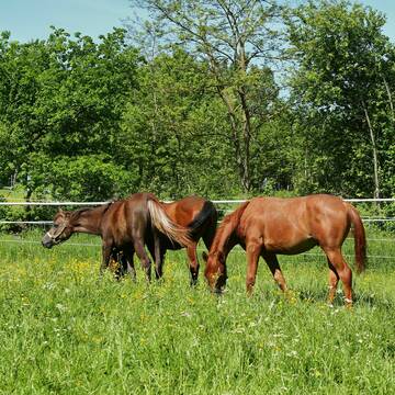
Fohlenaufzucht und Abfohlung
Reutlingen
R. und B. Armbruster GbR
@R.-u.-B.-Armbruster-
Hengstweide
Jungtierweide
Elektrozaun
Tränke
Frühjahrsweide
Herbstweide
Besuch der Weide: täglich
Zufütterung von Heu oder Silage
4 weitere...
P+
Deprecated: Creation of dynamic property Zend_View_Helper_Ads::$adLink is deprecated in /var/www/stall-frei/htdocs/staging.stall-frei.de/library/Psf/View/Helper/Ads.php on line 108

Job gesucht?
Mechtersen
STALL-FREIde Marketing
@STALL-FREI-Marketing
Sie suchen einen Job und arbeiten gerne mit Pferden oder auf Reitanlagen?
Besuchen Sie jetzt unseren Stellenmarkt!
Leider kein Vorschaubild
Leider kein Vorschaubild
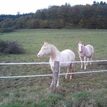
ganzj.Weidehaltung mit matschfreien Zonen
Erfurt
janine lohbrandt
@JaLoh
Gemischte Herde
Rentnerweide
Elektrozaun
Mit Auto und Anhänger erreichbar
Ganzjahresweide
Besuch der Weide: täglich
Zufütterung von Heu oder Silage
4 weitere...
B
Leider kein Vorschaubild
Leider kein Vorschaubild
Selbstversorger-Weideplätze in DA-Eberstadt frei
Darmstadt
Mirabel
@Mirabel
Gemischte Herde
Elektrozaun
Mit Auto und Anhänger erreichbar
Ganzjahresweide
Besuch der Weide: täglich
Zufütterung von Heu oder Silage
3 weitere...
B

Weideflächen zu verpachten
Pfinztal
Ellen Herrmann
@Reitanlage-Berghausen
Frühjahrsweide
Ganzjahresweide
3 weitere...
P+
Leider kein Vorschaubild
Leider kein Vorschaubild
Sommerkoppel in Blofeld 2 Plätze frei
Reichelsheim
Sattlerhof Blofeld
@Sattlerhof
Stutenweide
Wallachweide
Elektrozaun
Mit Auto und Anhänger erreichbar
Sommerweide
Besuch der Weide: täglich
Zufütterung von Kraftfutter
3 weitere...
B
Leider kein Vorschaubild
Leider kein Vorschaubild
1 Platz für Jung- oder Rentnerpferd
Kestrich
Seraina Burri
@Seraina
Gemischte Herde
Jungtierweide
Elektrozaun
Mit Auto und Anhänger erreichbar
Ganzjahresweide
Besuch der Weide: täglich
Zufütterung von Heu oder Silage
7 weitere...
B
Leider kein Vorschaubild
Leider kein Vorschaubild
Islandpferde Hülbehof
Rottenburg-Weiler
Islandpferde-Huelbehof
@Islandpferde-Huelbehof
Hengstweide
Jungtierweide
Elektrozaun
Mit Auto und Anhänger erreichbar
Frühjahrsweide
Herbstweide
Besuch der Weide: täglich
7 weitere...
B
![Vollzeitkraft[m/w/d] zur Verstärkung unseres Tea... (Anzeige)](/bilder/359854_largemedium.jpg)
Vollzeitkraft[m/w/d] zur Verstärkung unseres Tea...
Meckenbeuren
Pensionsstall-Weiler
@Pensionsstall-Weiler
Wir, der Pensionsstall Weiler, sucht eine Vollzeitkraft [m/w/d] zur Verstärkung unseres Mitarbeiterteams für Aufgaben rund um Pf
Leider kein Vorschaubild
Leider kein Vorschaubild
Pensionsplätze in Robusthaltung/Weidehaltung
Neubulach
Biohof Silberberg Altbulach
@Biohof-Silberberg-Altbulach
Gemischte Herde
Jungtierweide
Elektrozaun
Mit Auto und Anhänger erreichbar
Ganzjahresweide
Besuch der Weide: täglich
3 weitere...
B
Ganzjahresweide f. Fohlen & Freizeitpferde
Gemünden
Nanuks-Ranch1
@Nanuks-Ranch1
Gemischte Herde
Jungtierweide
Elektrozaun
Mit Auto und Anhänger erreichbar
Ganzjahresweide
Sommerweide
Besuch der Weide: täglich
Zufütterung von Heu oder Silage
5 weitere...
P
Werde Teil von STALL-FREI.de
Du hast noch einen Platz in der Herde frei? Freie Plätze auf der Weide kostenlos anbieten.
Deprecated: Creation of dynamic property Zend_View::$pageCount is deprecated in /var/www/stall-frei/htdocs/staging.stall-frei.de/library/vendor/shardj/zf1-future/library/Zend/View/Abstract.php on line 308
Deprecated: Creation of dynamic property Zend_View::$itemCountPerPage is deprecated in /var/www/stall-frei/htdocs/staging.stall-frei.de/library/vendor/shardj/zf1-future/library/Zend/View/Abstract.php on line 308
Deprecated: Creation of dynamic property Zend_View::$first is deprecated in /var/www/stall-frei/htdocs/staging.stall-frei.de/library/vendor/shardj/zf1-future/library/Zend/View/Abstract.php on line 308
Deprecated: Creation of dynamic property Zend_View::$current is deprecated in /var/www/stall-frei/htdocs/staging.stall-frei.de/library/vendor/shardj/zf1-future/library/Zend/View/Abstract.php on line 308
Deprecated: Creation of dynamic property Zend_View::$last is deprecated in /var/www/stall-frei/htdocs/staging.stall-frei.de/library/vendor/shardj/zf1-future/library/Zend/View/Abstract.php on line 308
Deprecated: Creation of dynamic property Zend_View::$previous is deprecated in /var/www/stall-frei/htdocs/staging.stall-frei.de/library/vendor/shardj/zf1-future/library/Zend/View/Abstract.php on line 308
Deprecated: Creation of dynamic property Zend_View::$next is deprecated in /var/www/stall-frei/htdocs/staging.stall-frei.de/library/vendor/shardj/zf1-future/library/Zend/View/Abstract.php on line 308
Deprecated: Creation of dynamic property Zend_View::$pagesInRange is deprecated in /var/www/stall-frei/htdocs/staging.stall-frei.de/library/vendor/shardj/zf1-future/library/Zend/View/Abstract.php on line 308
Deprecated: Creation of dynamic property Zend_View::$firstPageInRange is deprecated in /var/www/stall-frei/htdocs/staging.stall-frei.de/library/vendor/shardj/zf1-future/library/Zend/View/Abstract.php on line 308
Deprecated: Creation of dynamic property Zend_View::$lastPageInRange is deprecated in /var/www/stall-frei/htdocs/staging.stall-frei.de/library/vendor/shardj/zf1-future/library/Zend/View/Abstract.php on line 308
Deprecated: Creation of dynamic property Zend_View::$currentItemCount is deprecated in /var/www/stall-frei/htdocs/staging.stall-frei.de/library/vendor/shardj/zf1-future/library/Zend/View/Abstract.php on line 308
Deprecated: Creation of dynamic property Zend_View::$totalItemCount is deprecated in /var/www/stall-frei/htdocs/staging.stall-frei.de/library/vendor/shardj/zf1-future/library/Zend/View/Abstract.php on line 308
Deprecated: Creation of dynamic property Zend_View::$firstItemNumber is deprecated in /var/www/stall-frei/htdocs/staging.stall-frei.de/library/vendor/shardj/zf1-future/library/Zend/View/Abstract.php on line 308
Deprecated: Creation of dynamic property Zend_View::$lastItemNumber is deprecated in /var/www/stall-frei/htdocs/staging.stall-frei.de/library/vendor/shardj/zf1-future/library/Zend/View/Abstract.php on line 308
Deprecated: Creation of dynamic property Zend_View::$router is deprecated in /var/www/stall-frei/htdocs/staging.stall-frei.de/library/vendor/shardj/zf1-future/library/Zend/View/Abstract.php on line 308
Deprecated: Creation of dynamic property Zend_View::$urlParams is deprecated in /var/www/stall-frei/htdocs/staging.stall-frei.de/library/vendor/shardj/zf1-future/library/Zend/View/Abstract.php on line 308
Deprecated: Creation of dynamic property Zend_View::$showAds is deprecated in /var/www/stall-frei/htdocs/staging.stall-frei.de/library/vendor/shardj/zf1-future/library/Zend/View/Abstract.php on line 308
Deprecated: Creation of dynamic property Zend_View::$objectIds is deprecated in /var/www/stall-frei/htdocs/staging.stall-frei.de/library/vendor/shardj/zf1-future/library/Zend/View/Abstract.php on line 308
Deprecated: Creation of dynamic property Zend_View::$showNavbar is deprecated in /var/www/stall-frei/htdocs/staging.stall-frei.de/library/vendor/shardj/zf1-future/library/Zend/View/Abstract.php on line 308
Deprecated: Creation of dynamic property Zend_View::$showBreadcrumb is deprecated in /var/www/stall-frei/htdocs/staging.stall-frei.de/library/vendor/shardj/zf1-future/library/Zend/View/Abstract.php on line 308
Deprecated: Creation of dynamic property Zend_View::$showFooter is deprecated in /var/www/stall-frei/htdocs/staging.stall-frei.de/library/vendor/shardj/zf1-future/library/Zend/View/Abstract.php on line 308
Deprecated: Creation of dynamic property Zend_View::$showInternalAds is deprecated in /var/www/stall-frei/htdocs/staging.stall-frei.de/library/vendor/shardj/zf1-future/library/Zend/View/Abstract.php on line 308
Deprecated: Creation of dynamic property Zend_View::$blNoContent is deprecated in /var/www/stall-frei/htdocs/staging.stall-frei.de/library/vendor/shardj/zf1-future/library/Zend/View/Abstract.php on line 308
Deprecated: Creation of dynamic property Zend_View::$sMetaDesc is deprecated in /var/www/stall-frei/htdocs/staging.stall-frei.de/library/vendor/shardj/zf1-future/library/Zend/View/Abstract.php on line 308
Deprecated: Creation of dynamic property Zend_View::$useGmaps is deprecated in /var/www/stall-frei/htdocs/staging.stall-frei.de/library/vendor/shardj/zf1-future/library/Zend/View/Abstract.php on line 308
Deprecated: Creation of dynamic property Zend_View::$touches is deprecated in /var/www/stall-frei/htdocs/staging.stall-frei.de/library/vendor/shardj/zf1-future/library/Zend/View/Abstract.php on line 308
Deprecated: Creation of dynamic property Zend_View::$oProject is deprecated in /var/www/stall-frei/htdocs/staging.stall-frei.de/library/vendor/shardj/zf1-future/library/Zend/View/Abstract.php on line 308
Deprecated: Creation of dynamic property Zend_View::$pageHeadline is deprecated in /var/www/stall-frei/htdocs/staging.stall-frei.de/library/vendor/shardj/zf1-future/library/Zend/View/Abstract.php on line 308
Deprecated: Creation of dynamic property Zend_View::$disableLocationField is deprecated in /var/www/stall-frei/htdocs/staging.stall-frei.de/library/vendor/shardj/zf1-future/library/Zend/View/Abstract.php on line 308
Deprecated: Creation of dynamic property Zend_View::$isSearch is deprecated in /var/www/stall-frei/htdocs/staging.stall-frei.de/library/vendor/shardj/zf1-future/library/Zend/View/Abstract.php on line 308
Deprecated: Creation of dynamic property Zend_View::$pageTitle is deprecated in /var/www/stall-frei/htdocs/staging.stall-frei.de/library/vendor/shardj/zf1-future/library/Zend/View/Abstract.php on line 308
Deprecated: Creation of dynamic property Psf_Form_Element_Text::$class is deprecated in /var/www/stall-frei/htdocs/staging.stall-frei.de/library/vendor/shardj/zf1-future/library/Zend/Form/Element.php on line 874
Deprecated: Creation of dynamic property Psf_Form_Element_Text::$size is deprecated in /var/www/stall-frei/htdocs/staging.stall-frei.de/library/vendor/shardj/zf1-future/library/Zend/Form/Element.php on line 874
Deprecated: Creation of dynamic property Psf_Form_Element_Text::$placeholder is deprecated in /var/www/stall-frei/htdocs/staging.stall-frei.de/library/vendor/shardj/zf1-future/library/Zend/Form/Element.php on line 874
Deprecated: Creation of dynamic property Psf_Form_Element_Hidden::$class is deprecated in /var/www/stall-frei/htdocs/staging.stall-frei.de/library/vendor/shardj/zf1-future/library/Zend/Form/Element.php on line 874
Deprecated: Creation of dynamic property Psf_Form_Element_Hidden::$class is deprecated in /var/www/stall-frei/htdocs/staging.stall-frei.de/library/vendor/shardj/zf1-future/library/Zend/Form/Element.php on line 874
Deprecated: Creation of dynamic property Psf_Form_Element_Hidden::$class is deprecated in /var/www/stall-frei/htdocs/staging.stall-frei.de/library/vendor/shardj/zf1-future/library/Zend/Form/Element.php on line 874
Deprecated: Creation of dynamic property Psf_Form_Element_Hidden::$class is deprecated in /var/www/stall-frei/htdocs/staging.stall-frei.de/library/vendor/shardj/zf1-future/library/Zend/Form/Element.php on line 874
Deprecated: Creation of dynamic property Psf_Form_Element_Select::$class is deprecated in /var/www/stall-frei/htdocs/staging.stall-frei.de/library/vendor/shardj/zf1-future/library/Zend/Form/Element.php on line 874
Deprecated: Creation of dynamic property Psf_Form_Element_Select::$class is deprecated in /var/www/stall-frei/htdocs/staging.stall-frei.de/library/vendor/shardj/zf1-future/library/Zend/Form/Element.php on line 874
Deprecated: Creation of dynamic property Psf_Form_Element_Select::$class is deprecated in /var/www/stall-frei/htdocs/staging.stall-frei.de/library/vendor/shardj/zf1-future/library/Zend/Form/Element.php on line 874
Deprecated: Creation of dynamic property Psf_Form_Element_Text::$class is deprecated in /var/www/stall-frei/htdocs/staging.stall-frei.de/library/vendor/shardj/zf1-future/library/Zend/Form/Element.php on line 874
Deprecated: Creation of dynamic property Psf_Form_Element_Checkbox::$label is deprecated in /var/www/stall-frei/htdocs/staging.stall-frei.de/library/vendor/shardj/zf1-future/library/Zend/Form/Element.php on line 874
Deprecated: Creation of dynamic property Zend_View::$sort is deprecated in /var/www/stall-frei/htdocs/staging.stall-frei.de/library/vendor/shardj/zf1-future/library/Zend/View/Abstract.php on line 308
Deprecated: Creation of dynamic property Zend_View::$searchLocation is deprecated in /var/www/stall-frei/htdocs/staging.stall-frei.de/library/vendor/shardj/zf1-future/library/Zend/View/Abstract.php on line 308
Deprecated: Creation of dynamic property Zend_View::$locationHint is deprecated in /var/www/stall-frei/htdocs/staging.stall-frei.de/library/vendor/shardj/zf1-future/library/Zend/View/Abstract.php on line 308
Psf_GeoCoder_Abstract::getLocation: Wöhrd Get Location CachedOrLive
Psf_GeoCoder_Abstract::getCachedOrLive: Wöhrd
Psf_GeoCoder_Abstract::convertLocationResult
{"documentation":"https:\/\/opencagedata.com\/api","licenses":[{"name":"see attribution guide","url":"https:\/\/opencagedata.com\/credits"}],"results":[{"bounds":{"northeast":{"lat":49.4642805,"lng":11.0986795},"southwest":{"lat":49.4510134,"lng":11.0865903}},"components":{"ISO_3166-1_alpha-2":"DE","ISO_3166-1_alpha-3":"DEU","ISO_3166-2":["DE-BY"],"_category":"place","_normalized_city":"N\u00fcrnberg","_type":"neighbourhood","city":"N\u00fcrnberg","continent":"Europe","country":"Deutschland","country_code":"de","political_union":"European Union","postcode":"90489","state":"Bayern","state_code":"BY","suburb":"W\u00f6hrd"},"confidence":8,"formatted":"90489 N\u00fcrnberg, Deutschland","geometry":{"lat":49.453549,"lng":11.0948927}},{"bounds":{"northeast":{"lat":48.3135404,"lng":8.6421178},"southwest":{"lat":48.3128963,"lng":8.641185}},"components":{"ISO_3166-1_alpha-2":"DE","ISO_3166-1_alpha-3":"DEU","ISO_3166-2":["DE-BW"],"_category":"road","_normalized_city":"V\u00f6hringen","_type":"road","city":"V\u00f6hringen","continent":"Europe","country":"Deutschland","country_code":"de","county":"Landkreis Rottweil","municipality":"VVG der Stadt Sulz am Neckar","political_union":"European Union","postcode":"72189","road":"W\u00f6hrd","road_type":"residential","state":"Baden-W\u00fcrttemberg","state_code":"BW","village":"Wittershausen"},"confidence":9,"formatted":"W\u00f6hrd, 72189 Wittershausen, Deutschland","geometry":{"lat":48.3132184,"lng":8.6416514}},{"bounds":{"northeast":{"lat":48.3644332,"lng":8.6367803},"southwest":{"lat":48.3642403,"lng":8.636657}},"components":{"ISO_3166-1_alpha-2":"DE","ISO_3166-1_alpha-3":"DEU","ISO_3166-2":["DE-BW"],"_category":"road","_normalized_city":"Sulz am Neckar","_type":"road","continent":"Europe","country":"Deutschland","country_code":"de","county":"Landkreis Rottweil","municipality":"VVG der Stadt Sulz am Neckar","political_union":"European Union","postcode":"72172","quarter":"Schillerh\u00f6he","road":"W\u00f6hrd","road_type":"residential","state":"Baden-W\u00fcrttemberg","state_code":"BW","town":"Sulz am Neckar"},"confidence":9,"formatted":"W\u00f6hrd, 72172 Sulz am Neckar, Deutschland","geometry":{"lat":48.3643361,"lng":8.6367196}},{"bounds":{"northeast":{"lat":48.3643303,"lng":8.6371139},"southwest":{"lat":48.3635939,"lng":8.6361774}},"components":{"ISO_3166-1_alpha-2":"DE","ISO_3166-1_alpha-3":"DEU","ISO_3166-2":["DE-BW"],"_category":"transportation","_normalized_city":"Sulz am Neckar","_type":"parking","continent":"Europe","country":"Deutschland","country_code":"de","county":"Landkreis Rottweil","municipality":"VVG der Stadt Sulz am Neckar","parking":"W\u00f6hrd","political_union":"European Union","postcode":"72172","quarter":"Schillerh\u00f6he","road":"W\u00f6hrd","state":"Baden-W\u00fcrttemberg","state_code":"BW","town":"Sulz am Neckar"},"confidence":9,"formatted":"W\u00f6hrd, 72172 Sulz am Neckar, Deutschland","geometry":{"lat":48.363969,"lng":8.6366394}},{"bounds":{"northeast":{"lat":49.4540934,"lng":11.0957459},"southwest":{"lat":49.4539934,"lng":11.0956459}},"components":{"ISO_3166-1_alpha-2":"DE","ISO_3166-1_alpha-3":"DEU","ISO_3166-2":["DE-BY"],"_category":"transportation","_normalized_city":"N\u00fcrnberg","_type":"bus_stop","city":"N\u00fcrnberg","continent":"Europe","country":"Deutschland","country_code":"de","highway":"W\u00f6hrd","political_union":"European Union","postcode":"90489","road":"W\u00f6hrder Hauptstra\u00dfe","state":"Bayern","state_code":"BY","suburb":"W\u00f6hrd"},"confidence":9,"formatted":"W\u00f6hrd, W\u00f6hrder Hauptstra\u00dfe, 90489 N\u00fcrnberg, Deutschland","geometry":{"lat":49.4540434,"lng":11.0956959}},{"bounds":{"northeast":{"lat":52.1494899,"lng":10.5541272},"southwest":{"lat":52.1465511,"lng":10.5478269}},"components":{"ISO_3166-1_alpha-2":"DE","ISO_3166-1_alpha-3":"DEU","ISO_3166-2":["DE-NI"],"_category":"natural\/water","_normalized_city":"Wolfenb\u00fcttel","_type":"meadow","city_district":"Halchter","continent":"Europe","country":"Deutschland","country_code":"de","county":"Landkreis Wolfenb\u00fcttel","meadow":"Wohrd","political_union":"European Union","postcode":"38304","state":"Niedersachsen","state_code":"NI","town":"Wolfenb\u00fcttel"},"confidence":9,"formatted":"Wohrd, 38304 Wolfenb\u00fcttel, Deutschland","geometry":{"lat":52.1479138,"lng":10.5499141}},{"bounds":{"northeast":{"lat":53.589511,"lng":9.8495489},"southwest":{"lat":53.569511,"lng":9.8295489}},"components":{"ISO_3166-1_alpha-2":"DE","ISO_3166-1_alpha-3":"DEU","ISO_3166-2":["DE-HH"],"_category":"place","_normalized_city":"Hamburg","_type":"hamlet","city":"Hamburg","city_district":"Altona","continent":"Europe","country":"Deutschland","country_code":"de","locality":"Wohrd","political_union":"European Union","postcode":"22549","state":"Hamburg","state_code":"HH","suburb":"Osdorf"},"confidence":8,"formatted":"Wohrd, 22549 Hamburg, Deutschland","geometry":{"lat":53.579511,"lng":9.8395489}},{"components":{"ISO_3166-1_alpha-2":"FR","ISO_3166-1_alpha-3":"FRA","ISO_3166-2":["FR-ARA","FR-38"],"_category":"road","_normalized_city":"Villard-Bonnot","_type":"road","city":"Villard-Bonnot","continent":"Europe","country":"France","country_code":"fr","county":"Is\u00e8re","local_authority":"Communaut\u00e9 de communes Le Gr\u00e9sivaudan","political_union":"European Union","postcode":"38190","road":"Rue de Vors","state":"Auvergne-Rh\u00f4ne-Alpes","state_code":"ARA"},"confidence":10,"formatted":"Rue de Vors, 38190 Villard-Bonnot, France","geometry":{"lat":45.244179,"lng":5.895533}},{"components":{"ISO_3166-1_alpha-2":"FR","ISO_3166-1_alpha-3":"FRA","ISO_3166-2":["FR-ARA","FR-69"],"_category":"road","_normalized_city":"Vaugneray","_type":"road","city":"Vaugneray","continent":"Europe","country":"France","country_code":"fr","county":"Rh\u00f4ne","local_authority":"Communaut\u00e9 de communes des Vallons du Lyonnais","political_union":"European Union","postcode":"69670","road":"Chemin de la Vore","state":"Auvergne-Rh\u00f4ne-Alpes","state_code":"ARA"},"confidence":10,"formatted":"Chemin de la Vore, 69670 Vaugneray, France","geometry":{"lat":45.754934,"lng":4.624623}},{"components":{"ISO_3166-1_alpha-2":"FR","ISO_3166-1_alpha-3":"FRA","ISO_3166-2":["FR-OCC","FR-81"],"_category":"road","_normalized_city":"Gaillac","_type":"road","city":"Gaillac","continent":"Europe","country":"France","country_code":"fr","county":"Tarn","local_authority":"Communaut\u00e9 d'agglom\u00e9ration Gaillac-Graulhet","political_union":"European Union","postcode":"81600","road":"Route de Vors","state":"Occitanie","state_code":"OCC"},"confidence":10,"formatted":"Route de Vors, 81600 Gaillac, France","geometry":{"lat":43.928819,"lng":1.866649}}],"status":{"code":200,"message":"OK"},"stay_informed":{"blog":"https:\/\/blog.opencagedata.com","mastodon":"https:\/\/en.osm.town\/@opencage"},"thanks":"For using an OpenCage API","timestamp":{"created_http":"Sun, 08 Feb 2026 21:43:35 GMT","created_unix":1770587015},"total_results":10}Array
(
[0] => stdClass Object
(
[bounds] => stdClass Object
(
[northeast] => stdClass Object
(
[lat] => 49.4642805
[lng] => 11.0986795
)
[southwest] => stdClass Object
(
[lat] => 49.4510134
[lng] => 11.0865903
)
)
[components] => stdClass Object
(
[ISO_3166-1_alpha-2] => DE
[ISO_3166-1_alpha-3] => DEU
[ISO_3166-2] => Array
(
[0] => DE-BY
)
[_category] => place
[_normalized_city] => Nürnberg
[_type] => neighbourhood
[city] => Nürnberg
[continent] => Europe
[country] => Deutschland
[country_code] => de
[political_union] => European Union
[postcode] => 90489
[state] => Bayern
[state_code] => BY
[suburb] => Wöhrd
)
[confidence] => 8
[formatted] => 90489 Nürnberg, Deutschland
[geometry] => stdClass Object
(
[lat] => 49.453549
[lng] => 11.0948927
)
)
[1] => stdClass Object
(
[bounds] => stdClass Object
(
[northeast] => stdClass Object
(
[lat] => 48.3135404
[lng] => 8.6421178
)
[southwest] => stdClass Object
(
[lat] => 48.3128963
[lng] => 8.641185
)
)
[components] => stdClass Object
(
[ISO_3166-1_alpha-2] => DE
[ISO_3166-1_alpha-3] => DEU
[ISO_3166-2] => Array
(
[0] => DE-BW
)
[_category] => road
[_normalized_city] => Vöhringen
[_type] => road
[city] => Vöhringen
[continent] => Europe
[country] => Deutschland
[country_code] => de
[county] => Landkreis Rottweil
[municipality] => VVG der Stadt Sulz am Neckar
[political_union] => European Union
[postcode] => 72189
[road] => Wöhrd
[road_type] => residential
[state] => Baden-Württemberg
[state_code] => BW
[village] => Wittershausen
)
[confidence] => 9
[formatted] => Wöhrd, 72189 Wittershausen, Deutschland
[geometry] => stdClass Object
(
[lat] => 48.3132184
[lng] => 8.6416514
)
)
[2] => stdClass Object
(
[bounds] => stdClass Object
(
[northeast] => stdClass Object
(
[lat] => 48.3644332
[lng] => 8.6367803
)
[southwest] => stdClass Object
(
[lat] => 48.3642403
[lng] => 8.636657
)
)
[components] => stdClass Object
(
[ISO_3166-1_alpha-2] => DE
[ISO_3166-1_alpha-3] => DEU
[ISO_3166-2] => Array
(
[0] => DE-BW
)
[_category] => road
[_normalized_city] => Sulz am Neckar
[_type] => road
[continent] => Europe
[country] => Deutschland
[country_code] => de
[county] => Landkreis Rottweil
[municipality] => VVG der Stadt Sulz am Neckar
[political_union] => European Union
[postcode] => 72172
[quarter] => Schillerhöhe
[road] => Wöhrd
[road_type] => residential
[state] => Baden-Württemberg
[state_code] => BW
[town] => Sulz am Neckar
)
[confidence] => 9
[formatted] => Wöhrd, 72172 Sulz am Neckar, Deutschland
[geometry] => stdClass Object
(
[lat] => 48.3643361
[lng] => 8.6367196
)
)
[3] => stdClass Object
(
[bounds] => stdClass Object
(
[northeast] => stdClass Object
(
[lat] => 48.3643303
[lng] => 8.6371139
)
[southwest] => stdClass Object
(
[lat] => 48.3635939
[lng] => 8.6361774
)
)
[components] => stdClass Object
(
[ISO_3166-1_alpha-2] => DE
[ISO_3166-1_alpha-3] => DEU
[ISO_3166-2] => Array
(
[0] => DE-BW
)
[_category] => transportation
[_normalized_city] => Sulz am Neckar
[_type] => parking
[continent] => Europe
[country] => Deutschland
[country_code] => de
[county] => Landkreis Rottweil
[municipality] => VVG der Stadt Sulz am Neckar
[parking] => Wöhrd
[political_union] => European Union
[postcode] => 72172
[quarter] => Schillerhöhe
[road] => Wöhrd
[state] => Baden-Württemberg
[state_code] => BW
[town] => Sulz am Neckar
)
[confidence] => 9
[formatted] => Wöhrd, 72172 Sulz am Neckar, Deutschland
[geometry] => stdClass Object
(
[lat] => 48.363969
[lng] => 8.6366394
)
)
[4] => stdClass Object
(
[bounds] => stdClass Object
(
[northeast] => stdClass Object
(
[lat] => 49.4540934
[lng] => 11.0957459
)
[southwest] => stdClass Object
(
[lat] => 49.4539934
[lng] => 11.0956459
)
)
[components] => stdClass Object
(
[ISO_3166-1_alpha-2] => DE
[ISO_3166-1_alpha-3] => DEU
[ISO_3166-2] => Array
(
[0] => DE-BY
)
[_category] => transportation
[_normalized_city] => Nürnberg
[_type] => bus_stop
[city] => Nürnberg
[continent] => Europe
[country] => Deutschland
[country_code] => de
[highway] => Wöhrd
[political_union] => European Union
[postcode] => 90489
[road] => Wöhrder Hauptstraße
[state] => Bayern
[state_code] => BY
[suburb] => Wöhrd
)
[confidence] => 9
[formatted] => Wöhrd, Wöhrder Hauptstraße, 90489 Nürnberg, Deutschland
[geometry] => stdClass Object
(
[lat] => 49.4540434
[lng] => 11.0956959
)
)
[5] => stdClass Object
(
[bounds] => stdClass Object
(
[northeast] => stdClass Object
(
[lat] => 52.1494899
[lng] => 10.5541272
)
[southwest] => stdClass Object
(
[lat] => 52.1465511
[lng] => 10.5478269
)
)
[components] => stdClass Object
(
[ISO_3166-1_alpha-2] => DE
[ISO_3166-1_alpha-3] => DEU
[ISO_3166-2] => Array
(
[0] => DE-NI
)
[_category] => natural/water
[_normalized_city] => Wolfenbüttel
[_type] => meadow
[city_district] => Halchter
[continent] => Europe
[country] => Deutschland
[country_code] => de
[county] => Landkreis Wolfenbüttel
[meadow] => Wohrd
[political_union] => European Union
[postcode] => 38304
[state] => Niedersachsen
[state_code] => NI
[town] => Wolfenbüttel
)
[confidence] => 9
[formatted] => Wohrd, 38304 Wolfenbüttel, Deutschland
[geometry] => stdClass Object
(
[lat] => 52.1479138
[lng] => 10.5499141
)
)
[6] => stdClass Object
(
[bounds] => stdClass Object
(
[northeast] => stdClass Object
(
[lat] => 53.589511
[lng] => 9.8495489
)
[southwest] => stdClass Object
(
[lat] => 53.569511
[lng] => 9.8295489
)
)
[components] => stdClass Object
(
[ISO_3166-1_alpha-2] => DE
[ISO_3166-1_alpha-3] => DEU
[ISO_3166-2] => Array
(
[0] => DE-HH
)
[_category] => place
[_normalized_city] => Hamburg
[_type] => hamlet
[city] => Hamburg
[city_district] => Altona
[continent] => Europe
[country] => Deutschland
[country_code] => de
[locality] => Wohrd
[political_union] => European Union
[postcode] => 22549
[state] => Hamburg
[state_code] => HH
[suburb] => Osdorf
)
[confidence] => 8
[formatted] => Wohrd, 22549 Hamburg, Deutschland
[geometry] => stdClass Object
(
[lat] => 53.579511
[lng] => 9.8395489
)
)
[7] => stdClass Object
(
[components] => stdClass Object
(
[ISO_3166-1_alpha-2] => FR
[ISO_3166-1_alpha-3] => FRA
[ISO_3166-2] => Array
(
[0] => FR-ARA
[1] => FR-38
)
[_category] => road
[_normalized_city] => Villard-Bonnot
[_type] => road
[city] => Villard-Bonnot
[continent] => Europe
[country] => France
[country_code] => fr
[county] => Isère
[local_authority] => Communauté de communes Le Grésivaudan
[political_union] => European Union
[postcode] => 38190
[road] => Rue de Vors
[state] => Auvergne-Rhône-Alpes
[state_code] => ARA
)
[confidence] => 10
[formatted] => Rue de Vors, 38190 Villard-Bonnot, France
[geometry] => stdClass Object
(
[lat] => 45.244179
[lng] => 5.895533
)
)
[8] => stdClass Object
(
[components] => stdClass Object
(
[ISO_3166-1_alpha-2] => FR
[ISO_3166-1_alpha-3] => FRA
[ISO_3166-2] => Array
(
[0] => FR-ARA
[1] => FR-69
)
[_category] => road
[_normalized_city] => Vaugneray
[_type] => road
[city] => Vaugneray
[continent] => Europe
[country] => France
[country_code] => fr
[county] => Rhône
[local_authority] => Communauté de communes des Vallons du Lyonnais
[political_union] => European Union
[postcode] => 69670
[road] => Chemin de la Vore
[state] => Auvergne-Rhône-Alpes
[state_code] => ARA
)
[confidence] => 10
[formatted] => Chemin de la Vore, 69670 Vaugneray, France
[geometry] => stdClass Object
(
[lat] => 45.754934
[lng] => 4.624623
)
)
[9] => stdClass Object
(
[components] => stdClass Object
(
[ISO_3166-1_alpha-2] => FR
[ISO_3166-1_alpha-3] => FRA
[ISO_3166-2] => Array
(
[0] => FR-OCC
[1] => FR-81
)
[_category] => road
[_normalized_city] => Gaillac
[_type] => road
[city] => Gaillac
[continent] => Europe
[country] => France
[country_code] => fr
[county] => Tarn
[local_authority] => Communauté d'agglomération Gaillac-Graulhet
[political_union] => European Union
[postcode] => 81600
[road] => Route de Vors
[state] => Occitanie
[state_code] => OCC
)
[confidence] => 10
[formatted] => Route de Vors, 81600 Gaillac, France
[geometry] => stdClass Object
(
[lat] => 43.928819
[lng] => 1.866649
)
)
)
Psf_GeoCoder_OpenCageData::getKeyMap: 0
stdClass Object
(
    [bounds] => stdClass Object
        (
            [northeast] => stdClass Object
                (
                    [lat] => 49.4642805
                    [lng] => 11.0986795
                )

            [southwest] => stdClass Object
                (
                    [lat] => 49.4510134
                    [lng] => 11.0865903
                )

        )

    [components] => stdClass Object
        (
            [ISO_3166-1_alpha-2] => DE
            [ISO_3166-1_alpha-3] => DEU
            [ISO_3166-2] => Array
                (
                    [0] => DE-BY
                )

            [_category] => place
            [_normalized_city] => Nürnberg
            [_type] => neighbourhood
            [city] => Nürnberg
            [continent] => Europe
            [country] => Deutschland
            [country_code] => de
            [political_union] => European Union
            [postcode] => 90489
            [state] => Bayern
            [state_code] => BY
            [suburb] => Wöhrd
        )

    [confidence] => 8
    [formatted] => 90489 Nürnberg, Deutschland
    [geometry] => stdClass Object
        (
            [lat] => 49.453549
            [lng] => 11.0948927
        )

)
Psf_GeoCoder_OpenCageData::getCounty: Nürnberg
Psf_GeoCoder_OpenCageData::addMissingData REFETCH!
Array
(
    [address] => 90489 Nürnberg, Deutschland
    [type] => neighbourhood
    [street] =>
    [city] => Wöhrd
    [county] => Nürnberg
    [state] => Bayern
    [zip] => 90489
    [country] => Deutschland
    [suburb] => Wöhrd
    [countrycode] => de
    [latitude] => 49.453549
    [longitude] => 11.0948927
    [accuracy] => 1
    [confidence] => 8
    [bounds] => stdClass Object
        (
            [northeast] => stdClass Object
                (
                    [lat] => 49.4642805
                    [lng] => 11.0986795
                )

            [southwest] => stdClass Object
                (
                    [lat] => 49.4510134
                    [lng] => 11.0865903
                )

        )

)
reformat!
Array
(
    [address] => 90489 Wöhrd
    [type] => neighbourhood
    [street] =>
    [city] => Wöhrd
    [county] => Nürnberg
    [state] => Bayern
    [zip] => 90489
    [country] => Deutschland
    [suburb] => Wöhrd
    [countrycode] => de
    [latitude] => 49.453549
    [longitude] => 11.0948927
    [accuracy] => 1
    [confidence] => 8
    [bounds] => stdClass Object
        (
            [northeast] => stdClass Object
                (
                    [lat] => 49.4642805
                    [lng] => 11.0986795
                )

            [southwest] => stdClass Object
                (
                    [lat] => 49.4510134
                    [lng] => 11.0865903
                )

        )

    [place] => 90489 Wöhrd, Bayern
    [hash] => ba01f728a34d88a145bfeff217f0e56b
)
Psf_GeoCoder_OpenCageData::getKeyMap: 1
stdClass Object
(
    [bounds] => stdClass Object
        (
            [northeast] => stdClass Object
                (
                    [lat] => 48.3135404
                    [lng] => 8.6421178
                )

            [southwest] => stdClass Object
                (
                    [lat] => 48.3128963
                    [lng] => 8.641185
                )

        )

    [components] => stdClass Object
        (
            [ISO_3166-1_alpha-2] => DE
            [ISO_3166-1_alpha-3] => DEU
            [ISO_3166-2] => Array
                (
                    [0] => DE-BW
                )

            [_category] => road
            [_normalized_city] => Vöhringen
            [_type] => road
            [city] => Vöhringen
            [continent] => Europe
            [country] => Deutschland
            [country_code] => de
            [county] => Landkreis Rottweil
            [municipality] => VVG der Stadt Sulz am Neckar
            [political_union] => European Union
            [postcode] => 72189
            [road] => Wöhrd
            [road_type] => residential
            [state] => Baden-Württemberg
            [state_code] => BW
            [village] => Wittershausen
        )

    [confidence] => 9
    [formatted] => Wöhrd, 72189 Wittershausen, Deutschland
    [geometry] => stdClass Object
        (
            [lat] => 48.3132184
            [lng] => 8.6416514
        )

)
Psf_GeoCoder_OpenCageData::getCounty: Rottweil
Psf_GeoCoder_OpenCageData::addMissingData REFETCH!
Array
(
    [address] => Wöhrd, 72189 Wittershausen, Deutschland
    [type] => road
    [street] => Wöhrd
    [city] => Wittershausen
    [county] => Rottweil
    [state] => Baden-Württemberg
    [zip] => 72189
    [country] => Deutschland
    [suburb] =>
    [countrycode] => de
    [latitude] => 48.3132184
    [longitude] => 8.6416514
    [accuracy] => 1
    [confidence] => 9
    [bounds] => stdClass Object
        (
            [northeast] => stdClass Object
                (
                    [lat] => 48.3135404
                    [lng] => 8.6421178
                )

            [southwest] => stdClass Object
                (
                    [lat] => 48.3128963
                    [lng] => 8.641185
                )

        )

)
reformat!
Array
(
    [address] => Wöhrd, 72189 Wittershausen, Deutschland
    [type] => road
    [street] => Wöhrd
    [city] => Wittershausen
    [county] => Rottweil
    [state] => Baden-Württemberg
    [zip] => 72189
    [country] => Deutschland
    [suburb] =>
    [countrycode] => de
    [latitude] => 48.3132184
    [longitude] => 8.6416514
    [accuracy] => 1
    [confidence] => 9
    [bounds] => stdClass Object
        (
            [northeast] => stdClass Object
                (
                    [lat] => 48.3135404
                    [lng] => 8.6421178
                )

            [southwest] => stdClass Object
                (
                    [lat] => 48.3128963
                    [lng] => 8.641185
                )

        )

    [place] => Wöhrd, 72189 Wittershausen, Baden-Württemberg
    [hash] => 0f63ad67e1bf4859f4685cacfe52117a
)
Psf_GeoCoder_OpenCageData::getKeyMap: 2
stdClass Object
(
    [bounds] => stdClass Object
        (
            [northeast] => stdClass Object
                (
                    [lat] => 48.3644332
                    [lng] => 8.6367803
                )

            [southwest] => stdClass Object
                (
                    [lat] => 48.3642403
                    [lng] => 8.636657
                )

        )

    [components] => stdClass Object
        (
            [ISO_3166-1_alpha-2] => DE
            [ISO_3166-1_alpha-3] => DEU
            [ISO_3166-2] => Array
                (
                    [0] => DE-BW
                )

            [_category] => road
            [_normalized_city] => Sulz am Neckar
            [_type] => road
            [continent] => Europe
            [country] => Deutschland
            [country_code] => de
            [county] => Landkreis Rottweil
            [municipality] => VVG der Stadt Sulz am Neckar
            [political_union] => European Union
            [postcode] => 72172
            [quarter] => Schillerhöhe
            [road] => Wöhrd
            [road_type] => residential
            [state] => Baden-Württemberg
            [state_code] => BW
            [town] => Sulz am Neckar
        )

    [confidence] => 9
    [formatted] => Wöhrd, 72172 Sulz am Neckar, Deutschland
    [geometry] => stdClass Object
        (
            [lat] => 48.3643361
            [lng] => 8.6367196
        )

)
Psf_GeoCoder_OpenCageData::getCounty: Rottweil
Psf_GeoCoder_OpenCageData::addMissingData REFETCH!
Array
(
    [address] => Wöhrd, 72172 Sulz am Neckar, Deutschland
    [type] => road
    [street] => Wöhrd
    [city] => Sulz am Neckar
    [county] => Rottweil
    [state] => Baden-Württemberg
    [zip] => 72172
    [country] => Deutschland
    [suburb] =>
    [countrycode] => de
    [latitude] => 48.3643361
    [longitude] => 8.6367196
    [accuracy] => 1
    [confidence] => 9
    [bounds] => stdClass Object
        (
            [northeast] => stdClass Object
                (
                    [lat] => 48.3644332
                    [lng] => 8.6367803
                )

            [southwest] => stdClass Object
                (
                    [lat] => 48.3642403
                    [lng] => 8.636657
                )

        )

)
reformat!
Array
(
    [address] => Wöhrd, 72172 Sulz am Neckar, Deutschland
    [type] => road
    [street] => Wöhrd
    [city] => Sulz am Neckar
    [county] => Rottweil
    [state] => Baden-Württemberg
    [zip] => 72172
    [country] => Deutschland
    [suburb] =>
    [countrycode] => de
    [latitude] => 48.3643361
    [longitude] => 8.6367196
    [accuracy] => 1
    [confidence] => 9
    [bounds] => stdClass Object
        (
            [northeast] => stdClass Object
                (
                    [lat] => 48.3644332
                    [lng] => 8.6367803
                )

            [southwest] => stdClass Object
                (
                    [lat] => 48.3642403
                    [lng] => 8.636657
                )

        )

    [place] => Wöhrd, 72172 Sulz am Neckar, Baden-Württemberg
    [hash] => 26f3b6e96b54825b64bb65305d77487e
)
Psf_GeoCoder_OpenCageData::getKeyMap: 3
stdClass Object
(
    [bounds] => stdClass Object
        (
            [northeast] => stdClass Object
                (
                    [lat] => 48.3643303
                    [lng] => 8.6371139
                )

            [southwest] => stdClass Object
                (
                    [lat] => 48.3635939
                    [lng] => 8.6361774
                )

        )

    [components] => stdClass Object
        (
            [ISO_3166-1_alpha-2] => DE
            [ISO_3166-1_alpha-3] => DEU
            [ISO_3166-2] => Array
                (
                    [0] => DE-BW
                )

            [_category] => transportation
            [_normalized_city] => Sulz am Neckar
            [_type] => parking
            [continent] => Europe
            [country] => Deutschland
            [country_code] => de
            [county] => Landkreis Rottweil
            [municipality] => VVG der Stadt Sulz am Neckar
            [parking] => Wöhrd
            [political_union] => European Union
            [postcode] => 72172
            [quarter] => Schillerhöhe
            [road] => Wöhrd
            [state] => Baden-Württemberg
            [state_code] => BW
            [town] => Sulz am Neckar
        )

    [confidence] => 9
    [formatted] => Wöhrd, 72172 Sulz am Neckar, Deutschland
    [geometry] => stdClass Object
        (
            [lat] => 48.363969
            [lng] => 8.6366394
        )

)
Psf_GeoCoder_OpenCageData::getCounty: Rottweil
Psf_GeoCoder_OpenCageData::addMissingData REFETCH!
Array
(
    [address] => Wöhrd, 72172 Sulz am Neckar, Deutschland
    [type] => parking
    [street] => Wöhrd
    [city] => Sulz am Neckar
    [county] => Rottweil
    [state] => Baden-Württemberg
    [zip] => 72172
    [country] => Deutschland
    [suburb] =>
    [countrycode] => de
    [latitude] => 48.363969
    [longitude] => 8.6366394
    [accuracy] => 1
    [confidence] => 9
    [bounds] => stdClass Object
        (
            [northeast] => stdClass Object
                (
                    [lat] => 48.3643303
                    [lng] => 8.6371139
                )

            [southwest] => stdClass Object
                (
                    [lat] => 48.3635939
                    [lng] => 8.6361774
                )

        )

)
reformat!
Array
(
    [address] => Wöhrd, 72172 Sulz am Neckar, Deutschland
    [type] => parking
    [street] => Wöhrd
    [city] => Sulz am Neckar
    [county] => Rottweil
    [state] => Baden-Württemberg
    [zip] => 72172
    [country] => Deutschland
    [suburb] =>
    [countrycode] => de
    [latitude] => 48.363969
    [longitude] => 8.6366394
    [accuracy] => 1
    [confidence] => 9
    [bounds] => stdClass Object
        (
            [northeast] => stdClass Object
                (
                    [lat] => 48.3643303
                    [lng] => 8.6371139
                )

            [southwest] => stdClass Object
                (
                    [lat] => 48.3635939
                    [lng] => 8.6361774
                )

        )

    [place] => Wöhrd, 72172 Sulz am Neckar, Baden-Württemberg
    [hash] => 26f3b6e96b54825b64bb65305d77487e
)
Psf_GeoCoder_OpenCageData::getKeyMap: 4
stdClass Object
(
    [bounds] => stdClass Object
        (
            [northeast] => stdClass Object
                (
                    [lat] => 49.4540934
                    [lng] => 11.0957459
                )

            [southwest] => stdClass Object
                (
                    [lat] => 49.4539934
                    [lng] => 11.0956459
                )

        )

    [components] => stdClass Object
        (
            [ISO_3166-1_alpha-2] => DE
            [ISO_3166-1_alpha-3] => DEU
            [ISO_3166-2] => Array
                (
                    [0] => DE-BY
                )

            [_category] => transportation
            [_normalized_city] => Nürnberg
            [_type] => bus_stop
            [city] => Nürnberg
            [continent] => Europe
            [country] => Deutschland
            [country_code] => de
            [highway] => Wöhrd
            [political_union] => European Union
            [postcode] => 90489
            [road] => Wöhrder Hauptstraße
            [state] => Bayern
            [state_code] => BY
            [suburb] => Wöhrd
        )

    [confidence] => 9
    [formatted] => Wöhrd, Wöhrder Hauptstraße, 90489 Nürnberg, Deutschland
    [geometry] => stdClass Object
        (
            [lat] => 49.4540434
            [lng] => 11.0956959
        )

)
Psf_GeoCoder_OpenCageData::getCounty: Nürnberg
Psf_GeoCoder_OpenCageData::addMissingData REFETCH!
Array
(
    [address] => Wöhrd, Wöhrder Hauptstraße, 90489 Nürnberg, Deutschland
    [type] => bus_stop
    [street] => Wöhrder Hauptstraße
    [city] => Wöhrd
    [county] => Nürnberg
    [state] => Bayern
    [zip] => 90489
    [country] => Deutschland
    [suburb] => Wöhrd
    [countrycode] => de
    [latitude] => 49.4540434
    [longitude] => 11.0956959
    [accuracy] => 1
    [confidence] => 9
    [bounds] => stdClass Object
        (
            [northeast] => stdClass Object
                (
                    [lat] => 49.4540934
                    [lng] => 11.0957459
                )

            [southwest] => stdClass Object
                (
                    [lat] => 49.4539934
                    [lng] => 11.0956459
                )

        )

)
reformat!
Array
(
    [address] => Wöhrd, Wöhrder Hauptstraße, 90489 Nürnberg, Deutschland
    [type] => bus_stop
    [street] => Wöhrder Hauptstraße
    [city] => Wöhrd
    [county] => Nürnberg
    [state] => Bayern
    [zip] => 90489
    [country] => Deutschland
    [suburb] => Wöhrd
    [countrycode] => de
    [latitude] => 49.4540434
    [longitude] => 11.0956959
    [accuracy] => 1
    [confidence] => 9
    [bounds] => stdClass Object
        (
            [northeast] => stdClass Object
                (
                    [lat] => 49.4540934
                    [lng] => 11.0957459
                )

            [southwest] => stdClass Object
                (
                    [lat] => 49.4539934
                    [lng] => 11.0956459
                )

        )

    [place] => Wöhrder Hauptstraße, 90489 Wöhrd, Bayern
    [hash] => 75224803d8603c0517493a440b48d46a
)
Psf_GeoCoder_OpenCageData::getKeyMap: 5
stdClass Object
(
    [bounds] => stdClass Object
        (
            [northeast] => stdClass Object
                (
                    [lat] => 52.1494899
                    [lng] => 10.5541272
                )

            [southwest] => stdClass Object
                (
                    [lat] => 52.1465511
                    [lng] => 10.5478269
                )

        )

    [components] => stdClass Object
        (
            [ISO_3166-1_alpha-2] => DE
            [ISO_3166-1_alpha-3] => DEU
            [ISO_3166-2] => Array
                (
                    [0] => DE-NI
                )

            [_category] => natural/water
            [_normalized_city] => Wolfenbüttel
            [_type] => meadow
            [city_district] => Halchter
            [continent] => Europe
            [country] => Deutschland
            [country_code] => de
            [county] => Landkreis Wolfenbüttel
            [meadow] => Wohrd
            [political_union] => European Union
            [postcode] => 38304
            [state] => Niedersachsen
            [state_code] => NI
            [town] => Wolfenbüttel
        )

    [confidence] => 9
    [formatted] => Wohrd, 38304 Wolfenbüttel, Deutschland
    [geometry] => stdClass Object
        (
            [lat] => 52.1479138
            [lng] => 10.5499141
        )

)
Psf_GeoCoder_OpenCageData::getCounty: Wolfenbüttel
Psf_GeoCoder_OpenCageData::addMissingData REFETCH!
Array
(
    [address] => Wohrd, 38304 Wolfenbüttel, Deutschland
    [type] => meadow
    [street] =>
    [city] => Wolfenbüttel
    [county] => Wolfenbüttel
    [state] => Niedersachsen
    [zip] => 38304
    [country] => Deutschland
    [suburb] =>
    [countrycode] => de
    [latitude] => 52.1479138
    [longitude] => 10.5499141
    [accuracy] => 1
    [confidence] => 9
    [bounds] => stdClass Object
        (
            [northeast] => stdClass Object
                (
                    [lat] => 52.1494899
                    [lng] => 10.5541272
                )

            [southwest] => stdClass Object
                (
                    [lat] => 52.1465511
                    [lng] => 10.5478269
                )

        )

)
reformat!
Array
(
    [address] => Wohrd, 38304 Wolfenbüttel, Deutschland
    [type] => meadow
    [street] =>
    [city] => Wolfenbüttel
    [county] => Wolfenbüttel
    [state] => Niedersachsen
    [zip] => 38304
    [country] => Deutschland
    [suburb] =>
    [countrycode] => de
    [latitude] => 52.1479138
    [longitude] => 10.5499141
    [accuracy] => 1
    [confidence] => 9
    [bounds] => stdClass Object
        (
            [northeast] => stdClass Object
                (
                    [lat] => 52.1494899
                    [lng] => 10.5541272
                )

            [southwest] => stdClass Object
                (
                    [lat] => 52.1465511
                    [lng] => 10.5478269
                )

        )

    [place] => 38304 Wolfenbüttel, Niedersachsen
    [hash] => 283dd25e4b88cb11d7c7e11cde293140
)
Psf_GeoCoder_OpenCageData::getKeyMap: 6
stdClass Object
(
    [bounds] => stdClass Object
        (
            [northeast] => stdClass Object
                (
                    [lat] => 53.589511
                    [lng] => 9.8495489
                )

            [southwest] => stdClass Object
                (
                    [lat] => 53.569511
                    [lng] => 9.8295489
                )

        )

    [components] => stdClass Object
        (
            [ISO_3166-1_alpha-2] => DE
            [ISO_3166-1_alpha-3] => DEU
            [ISO_3166-2] => Array
                (
                    [0] => DE-HH
                )

            [_category] => place
            [_normalized_city] => Hamburg
            [_type] => hamlet
            [city] => Hamburg
            [city_district] => Altona
            [continent] => Europe
            [country] => Deutschland
            [country_code] => de
            [locality] => Wohrd
            [political_union] => European Union
            [postcode] => 22549
            [state] => Hamburg
            [state_code] => HH
            [suburb] => Osdorf
        )

    [confidence] => 8
    [formatted] => Wohrd, 22549 Hamburg, Deutschland
    [geometry] => stdClass Object
        (
            [lat] => 53.579511
            [lng] => 9.8395489
        )

)
Psf_GeoCoder_OpenCageData::getCounty: Hamburg
Psf_GeoCoder_OpenCageData::addMissingData REFETCH!
Array
(
    [address] => Wohrd, 22549 Hamburg, Deutschland
    [type] => hamlet
    [street] =>
    [city] => Osdorf
    [county] => Hamburg
    [state] => Hamburg
    [zip] => 22549
    [country] => Deutschland
    [suburb] => Osdorf
    [countrycode] => de
    [latitude] => 53.579511
    [longitude] => 9.8395489
    [accuracy] => 1
    [confidence] => 8
    [bounds] => stdClass Object
        (
            [northeast] => stdClass Object
                (
                    [lat] => 53.589511
                    [lng] => 9.8495489
                )

            [southwest] => stdClass Object
                (
                    [lat] => 53.569511
                    [lng] => 9.8295489
                )

        )

)
reformat!
Array
(
    [address] => 22549 Osdorf
    [type] => hamlet
    [street] =>
    [city] => Osdorf
    [county] => Hamburg
    [state] => Hamburg
    [zip] => 22549
    [country] => Deutschland
    [suburb] => Osdorf
    [countrycode] => de
    [latitude] => 53.579511
    [longitude] => 9.8395489
    [accuracy] => 1
    [confidence] => 8
    [bounds] => stdClass Object
        (
            [northeast] => stdClass Object
                (
                    [lat] => 53.589511
                    [lng] => 9.8495489
                )

            [southwest] => stdClass Object
                (
                    [lat] => 53.569511
                    [lng] => 9.8295489
                )

        )

    [place] => 22549 Osdorf, Hamburg
    [hash] => 96e19a0c4d8310381a3c908dd03d6b13
)
Psf_GeoCoder_OpenCageData::getKeyMap: 7
stdClass Object
(
    [components] => stdClass Object
        (
            [ISO_3166-1_alpha-2] => FR
            [ISO_3166-1_alpha-3] => FRA
            [ISO_3166-2] => Array
                (
                    [0] => FR-ARA
                    [1] => FR-38
                )

            [_category] => road
            [_normalized_city] => Villard-Bonnot
            [_type] => road
            [city] => Villard-Bonnot
            [continent] => Europe
            [country] => France
            [country_code] => fr
            [county] => Isère
            [local_authority] => Communauté de communes Le Grésivaudan
            [political_union] => European Union
            [postcode] => 38190
            [road] => Rue de Vors
            [state] => Auvergne-Rhône-Alpes
            [state_code] => ARA
        )

    [confidence] => 10
    [formatted] => Rue de Vors, 38190 Villard-Bonnot, France
    [geometry] => stdClass Object
        (
            [lat] => 45.244179
            [lng] => 5.895533
        )

)
Psf_GeoCoder_OpenCageData::getCounty: Isère
Psf_GeoCoder_OpenCageData::addMissingData REFETCH!
Array
(
    [address] => Rue de Vors, 38190 Villard-Bonnot, France
    [type] => road
    [street] => Rue de Vors
    [city] => Villard-Bonnot
    [county] => Isère
    [state] => Auvergne-Rhône-Alpes
    [zip] => 38190
    [country] => France
    [suburb] =>
    [countrycode] => fr
    [latitude] => 45.244179
    [longitude] => 5.895533
    [accuracy] => 1
    [confidence] => 10
    [bounds] =>
)
reformat!
Array
(
    [address] => Rue de Vors, 38190 Villard-Bonnot, France
    [type] => road
    [street] => Rue de Vors
    [city] => Villard-Bonnot
    [county] => Isère
    [state] => Auvergne-Rhône-Alpes
    [zip] => 38190
    [country] => France
    [suburb] =>
    [countrycode] => fr
    [latitude] => 45.244179
    [longitude] => 5.895533
    [accuracy] => 1
    [confidence] => 10
    [bounds] =>
    [place] => Rue de Vors, 38190 Villard-Bonnot, Auvergne-Rhône-Alpes
    [hash] => e1563ec083ee98a3bf05a4234dbfbd97
)
Psf_GeoCoder_OpenCageData::getKeyMap: 8
stdClass Object
(
    [components] => stdClass Object
        (
            [ISO_3166-1_alpha-2] => FR
            [ISO_3166-1_alpha-3] => FRA
            [ISO_3166-2] => Array
                (
                    [0] => FR-ARA
                    [1] => FR-69
                )

            [_category] => road
            [_normalized_city] => Vaugneray
            [_type] => road
            [city] => Vaugneray
            [continent] => Europe
            [country] => France
            [country_code] => fr
            [county] => Rhône
            [local_authority] => Communauté de communes des Vallons du Lyonnais
            [political_union] => European Union
            [postcode] => 69670
            [road] => Chemin de la Vore
            [state] => Auvergne-Rhône-Alpes
            [state_code] => ARA
        )

    [confidence] => 10
    [formatted] => Chemin de la Vore, 69670 Vaugneray, France
    [geometry] => stdClass Object
        (
            [lat] => 45.754934
            [lng] => 4.624623
        )

)
Psf_GeoCoder_OpenCageData::getCounty: Rhône
Psf_GeoCoder_OpenCageData::addMissingData REFETCH!
Array
(
    [address] => Chemin de la Vore, 69670 Vaugneray, France
    [type] => road
    [street] => Chemin de la Vore
    [city] => Vaugneray
    [county] => Rhône
    [state] => Auvergne-Rhône-Alpes
    [zip] => 69670
    [country] => France
    [suburb] =>
    [countrycode] => fr
    [latitude] => 45.754934
    [longitude] => 4.624623
    [accuracy] => 1
    [confidence] => 10
    [bounds] =>
)
reformat!
Array
(
    [address] => Chemin de la Vore, 69670 Vaugneray, France
    [type] => road
    [street] => Chemin de la Vore
    [city] => Vaugneray
    [county] => Rhône
    [state] => Auvergne-Rhône-Alpes
    [zip] => 69670
    [country] => France
    [suburb] =>
    [countrycode] => fr
    [latitude] => 45.754934
    [longitude] => 4.624623
    [accuracy] => 1
    [confidence] => 10
    [bounds] =>
    [place] => Chemin de la Vore, 69670 Vaugneray, Auvergne-Rhône-Alpes
    [hash] => cad6fd5925a141a5914ebb5ad2e30338
)
Psf_GeoCoder_OpenCageData::getKeyMap: 9
stdClass Object
(
    [components] => stdClass Object
        (
            [ISO_3166-1_alpha-2] => FR
            [ISO_3166-1_alpha-3] => FRA
            [ISO_3166-2] => Array
                (
                    [0] => FR-OCC
                    [1] => FR-81
                )

            [_category] => road
            [_normalized_city] => Gaillac
            [_type] => road
            [city] => Gaillac
            [continent] => Europe
            [country] => France
            [country_code] => fr
            [county] => Tarn
            [local_authority] => Communauté d'agglomération Gaillac-Graulhet
            [political_union] => European Union
            [postcode] => 81600
            [road] => Route de Vors
            [state] => Occitanie
            [state_code] => OCC
        )

    [confidence] => 10
    [formatted] => Route de Vors, 81600 Gaillac, France
    [geometry] => stdClass Object
        (
            [lat] => 43.928819
            [lng] => 1.866649
        )

)
Psf_GeoCoder_OpenCageData::getCounty: Tarn
Psf_GeoCoder_OpenCageData::addMissingData REFETCH!
Array
(
    [address] => Route de Vors, 81600 Gaillac, France
    [type] => road
    [street] => Route de Vors
    [city] => Gaillac
    [county] => Tarn
    [state] => Occitanie
    [zip] => 81600
    [country] => France
    [suburb] =>
    [countrycode] => fr
    [latitude] => 43.928819
    [longitude] => 1.866649
    [accuracy] => 1
    [confidence] => 10
    [bounds] =>
)
reformat!
Array
(
    [address] => Route de Vors, 81600 Gaillac, France
    [type] => road
    [street] => Route de Vors
    [city] => Gaillac
    [county] => Tarn
    [state] => Occitanie
    [zip] => 81600
    [country] => France
    [suburb] =>
    [countrycode] => fr
    [latitude] => 43.928819
    [longitude] => 1.866649
    [accuracy] => 1
    [confidence] => 10
    [bounds] =>
    [place] => Route de Vors, 81600 Gaillac, Occitanie
    [hash] => 08aa229d0bde54ecd5f6cfcedba992a4
)
Deprecated: Creation of dynamic property Zend_View::$locationHintStyle is deprecated in /var/www/stall-frei/htdocs/staging.stall-frei.de/library/vendor/shardj/zf1-future/library/Zend/View/Abstract.php on line 308
Deprecated: Creation of dynamic property Zend_View::$adGeoLocation is deprecated in /var/www/stall-frei/htdocs/staging.stall-frei.de/library/vendor/shardj/zf1-future/library/Zend/View/Abstract.php on line 308
Deprecated: Creation of dynamic property Zend_View::$recordCount is deprecated in /var/www/stall-frei/htdocs/staging.stall-frei.de/library/vendor/shardj/zf1-future/library/Zend/View/Abstract.php on line 308
Deprecated: Creation of dynamic property Zend_View::$paginationParams is deprecated in /var/www/stall-frei/htdocs/staging.stall-frei.de/library/vendor/shardj/zf1-future/library/Zend/View/Abstract.php on line 308
Deprecated: Creation of dynamic property Zend_View::$objectPaginator is deprecated in /var/www/stall-frei/htdocs/staging.stall-frei.de/library/vendor/shardj/zf1-future/library/Zend/View/Abstract.php on line 308
Deprecated: Creation of dynamic property Zend_View::$featuredObjects is deprecated in /var/www/stall-frei/htdocs/staging.stall-frei.de/library/vendor/shardj/zf1-future/library/Zend/View/Abstract.php on line 308
Deprecated: Creation of dynamic property Zend_View::$hints is deprecated in /var/www/stall-frei/htdocs/staging.stall-frei.de/library/vendor/shardj/zf1-future/library/Zend/View/Abstract.php on line 308
Deprecated: Creation of dynamic property Zend_View::$attributeHints is deprecated in /var/www/stall-frei/htdocs/staging.stall-frei.de/library/vendor/shardj/zf1-future/library/Zend/View/Abstract.php on line 308
Deprecated: Creation of dynamic property Zend_View::$oSearchForm is deprecated in /var/www/stall-frei/htdocs/staging.stall-frei.de/library/vendor/shardj/zf1-future/library/Zend/View/Abstract.php on line 308