Deprecated: Creation of dynamic property Zend_View::$sMode is deprecated in /var/www/stall-frei/htdocs/staging.stall-frei.de/library/vendor/shardj/zf1-future/library/Zend/View/Abstract.php on line 308
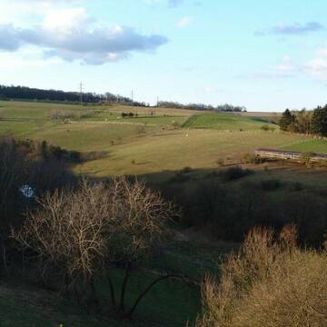
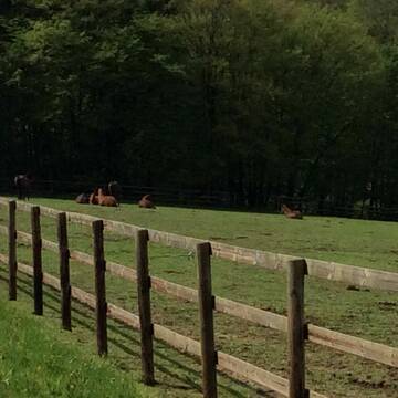
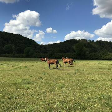
Weide in Dörnberg
Gesucht wird in "56379 Dörnberg, Deutschland"
117 Einträge
Deprecated: Creation of dynamic property Zend_View::$listObjects is deprecated in /var/www/stall-frei/htdocs/staging.stall-frei.de/library/vendor/shardj/zf1-future/library/Zend/View/Abstract.php on line 308
Deprecated: Creation of dynamic property Zend_View::$listMode is deprecated in /var/www/stall-frei/htdocs/staging.stall-frei.de/library/vendor/shardj/zf1-future/library/Zend/View/Abstract.php on line 308
Deprecated: Creation of dynamic property Zend_View::$renderedObjects is deprecated in /var/www/stall-frei/htdocs/staging.stall-frei.de/library/vendor/shardj/zf1-future/library/Zend/View/Abstract.php on line 308
Deprecated: Creation of dynamic property Zend_View::$index is deprecated in /var/www/stall-frei/htdocs/staging.stall-frei.de/library/vendor/shardj/zf1-future/library/Zend/View/Abstract.php on line 308
Deprecated: Creation of dynamic property Zend_View::$displayMode is deprecated in /var/www/stall-frei/htdocs/staging.stall-frei.de/library/vendor/shardj/zf1-future/library/Zend/View/Abstract.php on line 308
Deprecated: Creation of dynamic property Zend_View::$remarketingIds is deprecated in /var/www/stall-frei/htdocs/staging.stall-frei.de/library/vendor/shardj/zf1-future/library/Zend/View/Abstract.php on line 308
Deprecated: Creation of dynamic property Zend_View::$listItem is deprecated in /var/www/stall-frei/htdocs/staging.stall-frei.de/library/vendor/shardj/zf1-future/library/Zend/View/Abstract.php on line 308
Deprecated: Creation of dynamic property Zend_View::$object is deprecated in /var/www/stall-frei/htdocs/staging.stall-frei.de/library/vendor/shardj/zf1-future/library/Zend/View/Abstract.php on line 308
Deprecated: Creation of dynamic property Zend_View::$attributes is deprecated in /var/www/stall-frei/htdocs/staging.stall-frei.de/library/vendor/shardj/zf1-future/library/Zend/View/Abstract.php on line 308
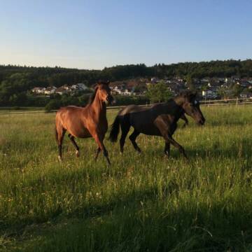
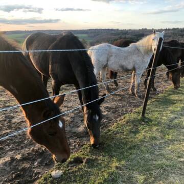
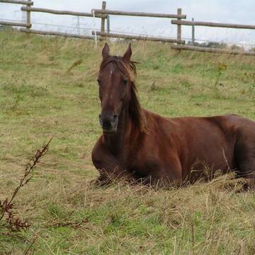
Ganzjahresweide Lilienhof Oberlibbach
Hünstetten-Oberlibbach
Norbert Bremser
@Tobias-Bremser
Rentnerweide
Wallachweide
Bremsenfalle
Elektrozaun
Ganzjahresweide
Besuch der Weide: täglich
Zufütterung von Heu oder Silage
7 weitere...
P+
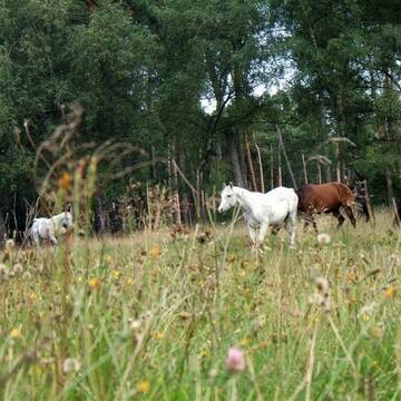
Ganzjahresweiden auch für Reconvaleszenz
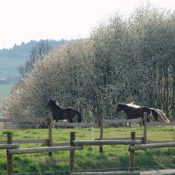
Schlangenbad-Wambach
Offenstall-Pferdepension
@Pferdepension-Rhein-Main
Gemischte Herde
Hengstweide
Elektrozaun
Lattenzaun
Frühjahrsweide
Ganzjahresweide
Besuch der Weide: täglich
Zufütterung von Heu oder Silage
13 weitere...
ganz aktuell
P+
Deprecated: Creation of dynamic property Zend_View_Helper_Ads::$adLink is deprecated in /var/www/stall-frei/htdocs/staging.stall-frei.de/library/Psf/View/Helper/Ads.php on line 108

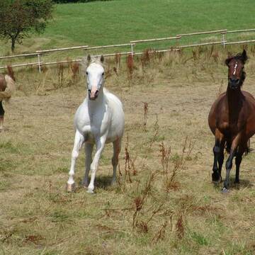
Offenstall/Paddockbox für Pony oder Kleinpferd
Glashütten
Tatjana Bommersheim
@TatjanaBommersheim
Wir haben ab dem 1.04.26 eine Platz in einem unsere Offenställe (Wallach oder Stute)und eine unserer Paddockboxen (Wallach oder S
neu
R
Offenstallplätze wieder frei
Boppard-Holzfeld
Peterhof
@Peterhof
Gemischte Herde
Jungtierweide
Elektrozaun
Lattenzaun
Frühjahrsweide
Ganzjahresweide
Besuch der Weide: täglich
Zufütterung von Heu oder Silage
10 weitere...
P

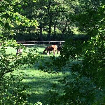
Pferdeglück im Grünen -Gestüt im Naturpark Taunu...
Weilrod
Etzauer-Muehle
@Etzauer-Muehle
Jungtierweide
Stutenweide
Bremsenfalle
Elektrozaun
Frühjahrsweide
Ganzjahresweide
Besuch der Weide: täglich
Zufütterung von Heu oder Silage
10 weitere...
P+
Leider kein Vorschaubild
Leider kein Vorschaubild
Hof Lenzenberg - nur Wallache
Niedernhausen
Familie-Bonadt
@Familie-Bonadt
Hengstweide
Jungtierweide
Elektrozaun
Mit Auto und Anhänger erreichbar
Frühjahrsweide
Herbstweide
6 weitere...
B


Job gesucht?
Mechtersen
STALL-FREIde Marketing
@STALL-FREI-Marketing
Sie suchen einen Job und arbeiten gerne mit Pferden oder auf Reitanlagen?
Besuchen Sie jetzt unseren Stellenmarkt!
Leider kein Vorschaubild
Leider kein Vorschaubild
Fohlenweide kl. familiäre Stutenherde Offenstall
Bubach
Julia
@Pferdeparadies_
Jungtierweide
Rentnerweide
Bremsenfalle
Elektrozaun
Frühjahrsweide
Ganzjahresweide
Besuch der Weide: täglich
Zufütterung von Heu oder Silage
8 weitere...
B
Leider kein Vorschaubild
Leider kein Vorschaubild
Rentnerplatz in Offenstall- und Weidehaltung frei
Burglahr
Eddahof
@Eddahof
Rentnerweide
Elektrozaun
Mit Auto und Anhänger erreichbar
Ganzjahresweide
Besuch der Weide: täglich
Zufütterung von Kraftfutter
1 weitere...
B

Große Weiden im idyllischen Siegtal, artgerecht
Eitorf
Union Gestüt
@Union-Gestuet
Rentnerweide
Stutenweide
Lattenzaun
Mit Auto und Anhänger erreichbar
Frühjahrsweide
Ganzjahresweide
Besuch der Weide: täglich
Zufütterung von Heu oder Silage
7 weitere...
P+
Leider kein Vorschaubild
Leider kein Vorschaubild
Biete Sommerweideplatz, gerne für Wallach
Sinzig
Peter Malborn
@PeterInLoehndorf
Rentnerweide
Mit Auto und Anhänger erreichbar
Tränke
Frühjahrsweide
Herbstweide
Besuch der Weide: täglich
2 weitere...
B
Deprecated: Creation of dynamic property Zend_View::$pageCount is deprecated in /var/www/stall-frei/htdocs/staging.stall-frei.de/library/vendor/shardj/zf1-future/library/Zend/View/Abstract.php on line 308
Deprecated: Creation of dynamic property Zend_View::$itemCountPerPage is deprecated in /var/www/stall-frei/htdocs/staging.stall-frei.de/library/vendor/shardj/zf1-future/library/Zend/View/Abstract.php on line 308
Deprecated: Creation of dynamic property Zend_View::$first is deprecated in /var/www/stall-frei/htdocs/staging.stall-frei.de/library/vendor/shardj/zf1-future/library/Zend/View/Abstract.php on line 308
Deprecated: Creation of dynamic property Zend_View::$current is deprecated in /var/www/stall-frei/htdocs/staging.stall-frei.de/library/vendor/shardj/zf1-future/library/Zend/View/Abstract.php on line 308
Deprecated: Creation of dynamic property Zend_View::$last is deprecated in /var/www/stall-frei/htdocs/staging.stall-frei.de/library/vendor/shardj/zf1-future/library/Zend/View/Abstract.php on line 308
Deprecated: Creation of dynamic property Zend_View::$next is deprecated in /var/www/stall-frei/htdocs/staging.stall-frei.de/library/vendor/shardj/zf1-future/library/Zend/View/Abstract.php on line 308
Deprecated: Creation of dynamic property Zend_View::$pagesInRange is deprecated in /var/www/stall-frei/htdocs/staging.stall-frei.de/library/vendor/shardj/zf1-future/library/Zend/View/Abstract.php on line 308
Deprecated: Creation of dynamic property Zend_View::$firstPageInRange is deprecated in /var/www/stall-frei/htdocs/staging.stall-frei.de/library/vendor/shardj/zf1-future/library/Zend/View/Abstract.php on line 308
Deprecated: Creation of dynamic property Zend_View::$lastPageInRange is deprecated in /var/www/stall-frei/htdocs/staging.stall-frei.de/library/vendor/shardj/zf1-future/library/Zend/View/Abstract.php on line 308
Deprecated: Creation of dynamic property Zend_View::$currentItemCount is deprecated in /var/www/stall-frei/htdocs/staging.stall-frei.de/library/vendor/shardj/zf1-future/library/Zend/View/Abstract.php on line 308
Deprecated: Creation of dynamic property Zend_View::$totalItemCount is deprecated in /var/www/stall-frei/htdocs/staging.stall-frei.de/library/vendor/shardj/zf1-future/library/Zend/View/Abstract.php on line 308
Deprecated: Creation of dynamic property Zend_View::$firstItemNumber is deprecated in /var/www/stall-frei/htdocs/staging.stall-frei.de/library/vendor/shardj/zf1-future/library/Zend/View/Abstract.php on line 308
Deprecated: Creation of dynamic property Zend_View::$lastItemNumber is deprecated in /var/www/stall-frei/htdocs/staging.stall-frei.de/library/vendor/shardj/zf1-future/library/Zend/View/Abstract.php on line 308
Deprecated: Creation of dynamic property Zend_View::$router is deprecated in /var/www/stall-frei/htdocs/staging.stall-frei.de/library/vendor/shardj/zf1-future/library/Zend/View/Abstract.php on line 308
Deprecated: Creation of dynamic property Zend_View::$urlParams is deprecated in /var/www/stall-frei/htdocs/staging.stall-frei.de/library/vendor/shardj/zf1-future/library/Zend/View/Abstract.php on line 308
Deprecated: Creation of dynamic property Zend_View::$showAds is deprecated in /var/www/stall-frei/htdocs/staging.stall-frei.de/library/vendor/shardj/zf1-future/library/Zend/View/Abstract.php on line 308
Deprecated: Creation of dynamic property Zend_View::$objectIds is deprecated in /var/www/stall-frei/htdocs/staging.stall-frei.de/library/vendor/shardj/zf1-future/library/Zend/View/Abstract.php on line 308
Deprecated: Creation of dynamic property Zend_View::$showNavbar is deprecated in /var/www/stall-frei/htdocs/staging.stall-frei.de/library/vendor/shardj/zf1-future/library/Zend/View/Abstract.php on line 308
Deprecated: Creation of dynamic property Zend_View::$showBreadcrumb is deprecated in /var/www/stall-frei/htdocs/staging.stall-frei.de/library/vendor/shardj/zf1-future/library/Zend/View/Abstract.php on line 308
Deprecated: Creation of dynamic property Zend_View::$showFooter is deprecated in /var/www/stall-frei/htdocs/staging.stall-frei.de/library/vendor/shardj/zf1-future/library/Zend/View/Abstract.php on line 308
Deprecated: Creation of dynamic property Zend_View::$showInternalAds is deprecated in /var/www/stall-frei/htdocs/staging.stall-frei.de/library/vendor/shardj/zf1-future/library/Zend/View/Abstract.php on line 308
Deprecated: Creation of dynamic property Zend_View::$blNoContent is deprecated in /var/www/stall-frei/htdocs/staging.stall-frei.de/library/vendor/shardj/zf1-future/library/Zend/View/Abstract.php on line 308
Deprecated: Creation of dynamic property Zend_View::$sMetaDesc is deprecated in /var/www/stall-frei/htdocs/staging.stall-frei.de/library/vendor/shardj/zf1-future/library/Zend/View/Abstract.php on line 308
Deprecated: Creation of dynamic property Zend_View::$useGmaps is deprecated in /var/www/stall-frei/htdocs/staging.stall-frei.de/library/vendor/shardj/zf1-future/library/Zend/View/Abstract.php on line 308
Deprecated: Creation of dynamic property Zend_View::$touches is deprecated in /var/www/stall-frei/htdocs/staging.stall-frei.de/library/vendor/shardj/zf1-future/library/Zend/View/Abstract.php on line 308
Deprecated: Creation of dynamic property Zend_View::$oProject is deprecated in /var/www/stall-frei/htdocs/staging.stall-frei.de/library/vendor/shardj/zf1-future/library/Zend/View/Abstract.php on line 308
Deprecated: Creation of dynamic property Zend_View::$pageHeadline is deprecated in /var/www/stall-frei/htdocs/staging.stall-frei.de/library/vendor/shardj/zf1-future/library/Zend/View/Abstract.php on line 308
Deprecated: Creation of dynamic property Zend_View::$disableLocationField is deprecated in /var/www/stall-frei/htdocs/staging.stall-frei.de/library/vendor/shardj/zf1-future/library/Zend/View/Abstract.php on line 308
Deprecated: Creation of dynamic property Zend_View::$isSearch is deprecated in /var/www/stall-frei/htdocs/staging.stall-frei.de/library/vendor/shardj/zf1-future/library/Zend/View/Abstract.php on line 308
Deprecated: Creation of dynamic property Zend_View::$pageTitle is deprecated in /var/www/stall-frei/htdocs/staging.stall-frei.de/library/vendor/shardj/zf1-future/library/Zend/View/Abstract.php on line 308
Deprecated: Creation of dynamic property Psf_Form_Element_Text::$class is deprecated in /var/www/stall-frei/htdocs/staging.stall-frei.de/library/vendor/shardj/zf1-future/library/Zend/Form/Element.php on line 874
Deprecated: Creation of dynamic property Psf_Form_Element_Text::$size is deprecated in /var/www/stall-frei/htdocs/staging.stall-frei.de/library/vendor/shardj/zf1-future/library/Zend/Form/Element.php on line 874
Deprecated: Creation of dynamic property Psf_Form_Element_Text::$placeholder is deprecated in /var/www/stall-frei/htdocs/staging.stall-frei.de/library/vendor/shardj/zf1-future/library/Zend/Form/Element.php on line 874
Deprecated: Creation of dynamic property Psf_Form_Element_Hidden::$class is deprecated in /var/www/stall-frei/htdocs/staging.stall-frei.de/library/vendor/shardj/zf1-future/library/Zend/Form/Element.php on line 874
Deprecated: Creation of dynamic property Psf_Form_Element_Hidden::$class is deprecated in /var/www/stall-frei/htdocs/staging.stall-frei.de/library/vendor/shardj/zf1-future/library/Zend/Form/Element.php on line 874
Deprecated: Creation of dynamic property Psf_Form_Element_Hidden::$class is deprecated in /var/www/stall-frei/htdocs/staging.stall-frei.de/library/vendor/shardj/zf1-future/library/Zend/Form/Element.php on line 874
Deprecated: Creation of dynamic property Psf_Form_Element_Hidden::$class is deprecated in /var/www/stall-frei/htdocs/staging.stall-frei.de/library/vendor/shardj/zf1-future/library/Zend/Form/Element.php on line 874
Deprecated: Creation of dynamic property Psf_Form_Element_Select::$class is deprecated in /var/www/stall-frei/htdocs/staging.stall-frei.de/library/vendor/shardj/zf1-future/library/Zend/Form/Element.php on line 874
Deprecated: Creation of dynamic property Psf_Form_Element_Select::$class is deprecated in /var/www/stall-frei/htdocs/staging.stall-frei.de/library/vendor/shardj/zf1-future/library/Zend/Form/Element.php on line 874
Deprecated: Creation of dynamic property Psf_Form_Element_Select::$class is deprecated in /var/www/stall-frei/htdocs/staging.stall-frei.de/library/vendor/shardj/zf1-future/library/Zend/Form/Element.php on line 874
Deprecated: Creation of dynamic property Psf_Form_Element_Text::$class is deprecated in /var/www/stall-frei/htdocs/staging.stall-frei.de/library/vendor/shardj/zf1-future/library/Zend/Form/Element.php on line 874
Deprecated: Creation of dynamic property Psf_Form_Element_Checkbox::$label is deprecated in /var/www/stall-frei/htdocs/staging.stall-frei.de/library/vendor/shardj/zf1-future/library/Zend/Form/Element.php on line 874
Deprecated: Creation of dynamic property Zend_View::$sort is deprecated in /var/www/stall-frei/htdocs/staging.stall-frei.de/library/vendor/shardj/zf1-future/library/Zend/View/Abstract.php on line 308
Deprecated: Creation of dynamic property Zend_View::$searchLocation is deprecated in /var/www/stall-frei/htdocs/staging.stall-frei.de/library/vendor/shardj/zf1-future/library/Zend/View/Abstract.php on line 308
Deprecated: Creation of dynamic property Zend_View::$locationHint is deprecated in /var/www/stall-frei/htdocs/staging.stall-frei.de/library/vendor/shardj/zf1-future/library/Zend/View/Abstract.php on line 308
Psf_GeoCoder_Abstract::getLocation: Dörnberg Get Location CachedOrLive
Psf_GeoCoder_Abstract::getCachedOrLive: Dörnberg
Psf_GeoCoder_Abstract::convertLocationResult
{"documentation":"https:\/\/opencagedata.com\/api","licenses":[{"name":"see attribution guide","url":"https:\/\/opencagedata.com\/credits"}],"results":[{"bounds":{"northeast":{"lat":50.3435132,"lng":7.9068843},"southwest":{"lat":50.3109083,"lng":7.8689305}},"components":{"ISO_3166-1_alpha-2":"DE","ISO_3166-1_alpha-3":"DEU","ISO_3166-2":["DE-RP"],"_category":"place","_normalized_city":"D\u00f6rnberg","_type":"village","continent":"Europe","country":"Deutschland","country_code":"de","county":"Rhein-Lahn-Kreis","municipality":"Diez","political_union":"European Union","postcode":"56379","state":"Rheinland-Pfalz","state_code":"RP","village":"D\u00f6rnberg"},"confidence":7,"formatted":"56379 D\u00f6rnberg, Deutschland","geometry":{"lat":50.3256326,"lng":7.8833914}},{"bounds":{"northeast":{"lat":51.3188667,"lng":8.4195604},"southwest":{"lat":51.3177715,"lng":8.416985}},"components":{"ISO_3166-1_alpha-2":"DE","ISO_3166-1_alpha-3":"DEU","ISO_3166-2":["DE-NW"],"_category":"natural\/water","_normalized_city":"Bestwig","_type":"nature_reserve","continent":"Europe","country":"Deutschland","country_code":"de","county":"Hochsauerlandkreis","nature_reserve":"D\u00f6rnberg","political_union":"European Union","postcode":"59909","state":"Nordrhein-Westfalen","state_code":"NW","town":"Bestwig"},"confidence":9,"formatted":"D\u00f6rnberg, 59909 Bestwig, Deutschland","geometry":{"lat":51.3182982,"lng":8.4179254}},{"bounds":{"northeast":{"lat":52.0905014,"lng":8.5151765},"southwest":{"lat":52.0142691,"lng":8.420952}},"components":{"ISO_3166-1_alpha-2":"DE","ISO_3166-1_alpha-3":"DEU","ISO_3166-2":["DE-NW"],"_category":"place","_normalized_city":"Bielefeld","_type":"neighbourhood","city":"Bielefeld","continent":"Europe","country":"Deutschland","country_code":"de","political_union":"European Union","postcode":"33619","quarter":"Dornberg","state":"Nordrhein-Westfalen","state_code":"NW"},"confidence":7,"formatted":"33619 Bielefeld, Deutschland","geometry":{"lat":52.0471898,"lng":8.4540006}},{"bounds":{"northeast":{"lat":51.3598247,"lng":9.381977},"southwest":{"lat":51.3151925,"lng":9.3128085}},"components":{"ISO_3166-1_alpha-2":"DE","ISO_3166-1_alpha-3":"DEU","ISO_3166-2":["DE-HE"],"_category":"place","_normalized_city":"D\u00f6rnberg","_type":"village","continent":"Europe","country":"Deutschland","country_code":"de","county":"Landkreis Kassel","municipality":"Habichtswald","political_union":"European Union","state":"Hessen","state_code":"HE","village":"D\u00f6rnberg"},"confidence":7,"formatted":"D\u00f6rnberg, Hessen, Deutschland","geometry":{"lat":51.3426724,"lng":9.3432901}},{"bounds":{"northeast":{"lat":50.7118957,"lng":10.5117455},"southwest":{"lat":50.7117957,"lng":10.5116455}},"components":{"ISO_3166-1_alpha-2":"DE","ISO_3166-1_alpha-3":"DEU","ISO_3166-2":["DE-TH"],"_category":"natural\/water","_normalized_city":"Schmalkalden","_type":"peak","continent":"Europe","country":"Deutschland","country_code":"de","county":"Landkreis Schmalkalden-Meiningen","peak":"D\u00f6rnberg","political_union":"European Union","state":"Th\u00fcringen","state_code":"TH","town":"Schmalkalden"},"confidence":9,"formatted":"D\u00f6rnberg, Schmalkalden, Th\u00fcringen, Deutschland","geometry":{"lat":50.7118457,"lng":10.5116955}},{"bounds":{"northeast":{"lat":49.8754516,"lng":9.1120521},"southwest":{"lat":49.8753516,"lng":9.1119521}},"components":{"ISO_3166-1_alpha-2":"DE","ISO_3166-1_alpha-3":"DEU","ISO_3166-2":["DE-BY"],"_category":"natural\/water","_normalized_city":"Gro\u00dfwallstadt","_type":"peak","continent":"Europe","country":"Deutschland","country_code":"de","county":"Landkreis Miltenberg","peak":"D\u00f6rnberg","political_union":"European Union","postcode":"63853","state":"Bayern","state_code":"BY","village":"Gro\u00dfwallstadt"},"confidence":9,"formatted":"D\u00f6rnberg, 63853 Gro\u00dfwallstadt, Deutschland","geometry":{"lat":49.8754016,"lng":9.1120021}},{"bounds":{"northeast":{"lat":50.40255,"lng":7.9114389},"southwest":{"lat":50.40245,"lng":7.9113389}},"components":{"ISO_3166-1_alpha-2":"DE","ISO_3166-1_alpha-3":"DEU","ISO_3166-2":["DE-RP"],"_category":"natural\/water","_normalized_city":"Eppenrod","_type":"peak","continent":"Europe","country":"Deutschland","country_code":"de","county":"Rhein-Lahn-Kreis","municipality":"Diez","peak":"D\u00f6rnberg","political_union":"European Union","postcode":"56412","state":"Rheinland-Pfalz","state_code":"RP","village":"Eppenrod"},"confidence":9,"formatted":"D\u00f6rnberg, 56412 Eppenrod, Deutschland","geometry":{"lat":50.4025,"lng":7.9113889}},{"bounds":{"northeast":{"lat":51.2236849,"lng":9.0209331},"southwest":{"lat":51.2235849,"lng":9.0208331}},"components":{"ISO_3166-1_alpha-2":"DE","ISO_3166-1_alpha-3":"DEU","ISO_3166-2":["DE-HE"],"_category":"natural\/water","_normalized_city":"Sachsenhausen","_type":"peak","continent":"Europe","country":"Deutschland","country_code":"de","county":"Landkreis Waldeck-Frankenberg","municipality":"Waldeck","peak":"D\u00f6rnberg","political_union":"European Union","postcode":"34513","state":"Hessen","state_code":"HE","village":"Sachsenhausen"},"confidence":9,"formatted":"D\u00f6rnberg, 34513 Sachsenhausen, Deutschland","geometry":{"lat":51.2236349,"lng":9.0208831}},{"bounds":{"northeast":{"lat":51.025518,"lng":9.0738242},"southwest":{"lat":51.025418,"lng":9.0737242}},"components":{"ISO_3166-1_alpha-2":"DE","ISO_3166-1_alpha-3":"DEU","ISO_3166-2":["DE-HE"],"_category":"natural\/water","_normalized_city":"Dodenhausen","_type":"peak","continent":"Europe","country":"Deutschland","country_code":"de","county":"Landkreis Waldeck-Frankenberg","municipality":"Haina (Kloster)","peak":"D\u00f6rnberg","political_union":"European Union","state":"Hessen","state_code":"HE","village":"Dodenhausen"},"confidence":9,"formatted":"D\u00f6rnberg, Dodenhausen, Hessen, Deutschland","geometry":{"lat":51.025468,"lng":9.0737742}},{"components":{"ISO_3166-1_alpha-2":"FR","ISO_3166-1_alpha-3":"FRA","ISO_3166-2":["FR-NAQ","FR-16"],"_category":"road","_normalized_city":"Nanteuil-en-Vall\u00e9e","_type":"road","city":"Nanteuil-en-Vall\u00e9e","continent":"Europe","country":"France","country_code":"fr","county":"Charente","local_authority":"Communaut\u00e9 de communes Val-de-Charente","political_union":"European Union","postcode":"16700","road":"La Dorni\u00e8re","state":"Nouvelle-Aquitaine","state_code":"NAQ"},"confidence":2,"formatted":"La Dorni\u00e8re, 16700 Nanteuil-en-Vall\u00e9e, France","geometry":{"lat":45.980343,"lng":0.359367}}],"status":{"code":200,"message":"OK"},"stay_informed":{"blog":"https:\/\/blog.opencagedata.com","mastodon":"https:\/\/en.osm.town\/@opencage"},"thanks":"For using an OpenCage API","timestamp":{"created_http":"Mon, 09 Feb 2026 08:19:47 GMT","created_unix":1770625187},"total_results":10}Array
(
[0] => stdClass Object
(
[bounds] => stdClass Object
(
[northeast] => stdClass Object
(
[lat] => 50.3435132
[lng] => 7.9068843
)
[southwest] => stdClass Object
(
[lat] => 50.3109083
[lng] => 7.8689305
)
)
[components] => stdClass Object
(
[ISO_3166-1_alpha-2] => DE
[ISO_3166-1_alpha-3] => DEU
[ISO_3166-2] => Array
(
[0] => DE-RP
)
[_category] => place
[_normalized_city] => Dörnberg
[_type] => village
[continent] => Europe
[country] => Deutschland
[country_code] => de
[county] => Rhein-Lahn-Kreis
[municipality] => Diez
[political_union] => European Union
[postcode] => 56379
[state] => Rheinland-Pfalz
[state_code] => RP
[village] => Dörnberg
)
[confidence] => 7
[formatted] => 56379 Dörnberg, Deutschland
[geometry] => stdClass Object
(
[lat] => 50.3256326
[lng] => 7.8833914
)
)
[1] => stdClass Object
(
[bounds] => stdClass Object
(
[northeast] => stdClass Object
(
[lat] => 51.3188667
[lng] => 8.4195604
)
[southwest] => stdClass Object
(
[lat] => 51.3177715
[lng] => 8.416985
)
)
[components] => stdClass Object
(
[ISO_3166-1_alpha-2] => DE
[ISO_3166-1_alpha-3] => DEU
[ISO_3166-2] => Array
(
[0] => DE-NW
)
[_category] => natural/water
[_normalized_city] => Bestwig
[_type] => nature_reserve
[continent] => Europe
[country] => Deutschland
[country_code] => de
[county] => Hochsauerlandkreis
[nature_reserve] => Dörnberg
[political_union] => European Union
[postcode] => 59909
[state] => Nordrhein-Westfalen
[state_code] => NW
[town] => Bestwig
)
[confidence] => 9
[formatted] => Dörnberg, 59909 Bestwig, Deutschland
[geometry] => stdClass Object
(
[lat] => 51.3182982
[lng] => 8.4179254
)
)
[2] => stdClass Object
(
[bounds] => stdClass Object
(
[northeast] => stdClass Object
(
[lat] => 52.0905014
[lng] => 8.5151765
)
[southwest] => stdClass Object
(
[lat] => 52.0142691
[lng] => 8.420952
)
)
[components] => stdClass Object
(
[ISO_3166-1_alpha-2] => DE
[ISO_3166-1_alpha-3] => DEU
[ISO_3166-2] => Array
(
[0] => DE-NW
)
[_category] => place
[_normalized_city] => Bielefeld
[_type] => neighbourhood
[city] => Bielefeld
[continent] => Europe
[country] => Deutschland
[country_code] => de
[political_union] => European Union
[postcode] => 33619
[quarter] => Dornberg
[state] => Nordrhein-Westfalen
[state_code] => NW
)
[confidence] => 7
[formatted] => 33619 Bielefeld, Deutschland
[geometry] => stdClass Object
(
[lat] => 52.0471898
[lng] => 8.4540006
)
)
[3] => stdClass Object
(
[bounds] => stdClass Object
(
[northeast] => stdClass Object
(
[lat] => 51.3598247
[lng] => 9.381977
)
[southwest] => stdClass Object
(
[lat] => 51.3151925
[lng] => 9.3128085
)
)
[components] => stdClass Object
(
[ISO_3166-1_alpha-2] => DE
[ISO_3166-1_alpha-3] => DEU
[ISO_3166-2] => Array
(
[0] => DE-HE
)
[_category] => place
[_normalized_city] => Dörnberg
[_type] => village
[continent] => Europe
[country] => Deutschland
[country_code] => de
[county] => Landkreis Kassel
[municipality] => Habichtswald
[political_union] => European Union
[state] => Hessen
[state_code] => HE
[village] => Dörnberg
)
[confidence] => 7
[formatted] => Dörnberg, Hessen, Deutschland
[geometry] => stdClass Object
(
[lat] => 51.3426724
[lng] => 9.3432901
)
)
[4] => stdClass Object
(
[bounds] => stdClass Object
(
[northeast] => stdClass Object
(
[lat] => 50.7118957
[lng] => 10.5117455
)
[southwest] => stdClass Object
(
[lat] => 50.7117957
[lng] => 10.5116455
)
)
[components] => stdClass Object
(
[ISO_3166-1_alpha-2] => DE
[ISO_3166-1_alpha-3] => DEU
[ISO_3166-2] => Array
(
[0] => DE-TH
)
[_category] => natural/water
[_normalized_city] => Schmalkalden
[_type] => peak
[continent] => Europe
[country] => Deutschland
[country_code] => de
[county] => Landkreis Schmalkalden-Meiningen
[peak] => Dörnberg
[political_union] => European Union
[state] => Thüringen
[state_code] => TH
[town] => Schmalkalden
)
[confidence] => 9
[formatted] => Dörnberg, Schmalkalden, Thüringen, Deutschland
[geometry] => stdClass Object
(
[lat] => 50.7118457
[lng] => 10.5116955
)
)
[5] => stdClass Object
(
[bounds] => stdClass Object
(
[northeast] => stdClass Object
(
[lat] => 49.8754516
[lng] => 9.1120521
)
[southwest] => stdClass Object
(
[lat] => 49.8753516
[lng] => 9.1119521
)
)
[components] => stdClass Object
(
[ISO_3166-1_alpha-2] => DE
[ISO_3166-1_alpha-3] => DEU
[ISO_3166-2] => Array
(
[0] => DE-BY
)
[_category] => natural/water
[_normalized_city] => Großwallstadt
[_type] => peak
[continent] => Europe
[country] => Deutschland
[country_code] => de
[county] => Landkreis Miltenberg
[peak] => Dörnberg
[political_union] => European Union
[postcode] => 63853
[state] => Bayern
[state_code] => BY
[village] => Großwallstadt
)
[confidence] => 9
[formatted] => Dörnberg, 63853 Großwallstadt, Deutschland
[geometry] => stdClass Object
(
[lat] => 49.8754016
[lng] => 9.1120021
)
)
[6] => stdClass Object
(
[bounds] => stdClass Object
(
[northeast] => stdClass Object
(
[lat] => 50.40255
[lng] => 7.9114389
)
[southwest] => stdClass Object
(
[lat] => 50.40245
[lng] => 7.9113389
)
)
[components] => stdClass Object
(
[ISO_3166-1_alpha-2] => DE
[ISO_3166-1_alpha-3] => DEU
[ISO_3166-2] => Array
(
[0] => DE-RP
)
[_category] => natural/water
[_normalized_city] => Eppenrod
[_type] => peak
[continent] => Europe
[country] => Deutschland
[country_code] => de
[county] => Rhein-Lahn-Kreis
[municipality] => Diez
[peak] => Dörnberg
[political_union] => European Union
[postcode] => 56412
[state] => Rheinland-Pfalz
[state_code] => RP
[village] => Eppenrod
)
[confidence] => 9
[formatted] => Dörnberg, 56412 Eppenrod, Deutschland
[geometry] => stdClass Object
(
[lat] => 50.4025
[lng] => 7.9113889
)
)
[7] => stdClass Object
(
[bounds] => stdClass Object
(
[northeast] => stdClass Object
(
[lat] => 51.2236849
[lng] => 9.0209331
)
[southwest] => stdClass Object
(
[lat] => 51.2235849
[lng] => 9.0208331
)
)
[components] => stdClass Object
(
[ISO_3166-1_alpha-2] => DE
[ISO_3166-1_alpha-3] => DEU
[ISO_3166-2] => Array
(
[0] => DE-HE
)
[_category] => natural/water
[_normalized_city] => Sachsenhausen
[_type] => peak
[continent] => Europe
[country] => Deutschland
[country_code] => de
[county] => Landkreis Waldeck-Frankenberg
[municipality] => Waldeck
[peak] => Dörnberg
[political_union] => European Union
[postcode] => 34513
[state] => Hessen
[state_code] => HE
[village] => Sachsenhausen
)
[confidence] => 9
[formatted] => Dörnberg, 34513 Sachsenhausen, Deutschland
[geometry] => stdClass Object
(
[lat] => 51.2236349
[lng] => 9.0208831
)
)
[8] => stdClass Object
(
[bounds] => stdClass Object
(
[northeast] => stdClass Object
(
[lat] => 51.025518
[lng] => 9.0738242
)
[southwest] => stdClass Object
(
[lat] => 51.025418
[lng] => 9.0737242
)
)
[components] => stdClass Object
(
[ISO_3166-1_alpha-2] => DE
[ISO_3166-1_alpha-3] => DEU
[ISO_3166-2] => Array
(
[0] => DE-HE
)
[_category] => natural/water
[_normalized_city] => Dodenhausen
[_type] => peak
[continent] => Europe
[country] => Deutschland
[country_code] => de
[county] => Landkreis Waldeck-Frankenberg
[municipality] => Haina (Kloster)
[peak] => Dörnberg
[political_union] => European Union
[state] => Hessen
[state_code] => HE
[village] => Dodenhausen
)
[confidence] => 9
[formatted] => Dörnberg, Dodenhausen, Hessen, Deutschland
[geometry] => stdClass Object
(
[lat] => 51.025468
[lng] => 9.0737742
)
)
[9] => stdClass Object
(
[components] => stdClass Object
(
[ISO_3166-1_alpha-2] => FR
[ISO_3166-1_alpha-3] => FRA
[ISO_3166-2] => Array
(
[0] => FR-NAQ
[1] => FR-16
)
[_category] => road
[_normalized_city] => Nanteuil-en-Vallée
[_type] => road
[city] => Nanteuil-en-Vallée
[continent] => Europe
[country] => France
[country_code] => fr
[county] => Charente
[local_authority] => Communauté de communes Val-de-Charente
[political_union] => European Union
[postcode] => 16700
[road] => La Dornière
[state] => Nouvelle-Aquitaine
[state_code] => NAQ
)
[confidence] => 2
[formatted] => La Dornière, 16700 Nanteuil-en-Vallée, France
[geometry] => stdClass Object
(
[lat] => 45.980343
[lng] => 0.359367
)
)
)
Psf_GeoCoder_OpenCageData::getKeyMap: 0
stdClass Object
(
    [bounds] => stdClass Object
        (
            [northeast] => stdClass Object
                (
                    [lat] => 50.3435132
                    [lng] => 7.9068843
                )

            [southwest] => stdClass Object
                (
                    [lat] => 50.3109083
                    [lng] => 7.8689305
                )

        )

    [components] => stdClass Object
        (
            [ISO_3166-1_alpha-2] => DE
            [ISO_3166-1_alpha-3] => DEU
            [ISO_3166-2] => Array
                (
                    [0] => DE-RP
                )

            [_category] => place
            [_normalized_city] => Dörnberg
            [_type] => village
            [continent] => Europe
            [country] => Deutschland
            [country_code] => de
            [county] => Rhein-Lahn-Kreis
            [municipality] => Diez
            [political_union] => European Union
            [postcode] => 56379
            [state] => Rheinland-Pfalz
            [state_code] => RP
            [village] => Dörnberg
        )

    [confidence] => 7
    [formatted] => 56379 Dörnberg, Deutschland
    [geometry] => stdClass Object
        (
            [lat] => 50.3256326
            [lng] => 7.8833914
        )

)
Psf_GeoCoder_OpenCageData::getCounty: Rhein-Lahn-Kreis
Psf_GeoCoder_OpenCageData::addMissingData REFETCH!
Array
(
    [address] => 56379 Dörnberg, Deutschland
    [type] => village
    [street] =>
    [city] => Dörnberg
    [county] => Rhein-Lahn-Kreis
    [state] => Rheinland-Pfalz
    [zip] => 56379
    [country] => Deutschland
    [suburb] =>
    [countrycode] => de
    [latitude] => 50.3256326
    [longitude] => 7.8833914
    [accuracy] => 1
    [confidence] => 7
    [bounds] => stdClass Object
        (
            [northeast] => stdClass Object
                (
                    [lat] => 50.3435132
                    [lng] => 7.9068843
                )

            [southwest] => stdClass Object
                (
                    [lat] => 50.3109083
                    [lng] => 7.8689305
                )

        )

)
reformat!
Array
(
    [address] => 56379 Dörnberg, Deutschland
    [type] => village
    [street] =>
    [city] => Dörnberg
    [county] => Rhein-Lahn-Kreis
    [state] => Rheinland-Pfalz
    [zip] => 56379
    [country] => Deutschland
    [suburb] =>
    [countrycode] => de
    [latitude] => 50.3256326
    [longitude] => 7.8833914
    [accuracy] => 1
    [confidence] => 7
    [bounds] => stdClass Object
        (
            [northeast] => stdClass Object
                (
                    [lat] => 50.3435132
                    [lng] => 7.9068843
                )

            [southwest] => stdClass Object
                (
                    [lat] => 50.3109083
                    [lng] => 7.8689305
                )

        )

    [place] => 56379 Dörnberg, Rheinland-Pfalz
    [hash] => 52088618ce7e278529435a0bf97ec738
)
Psf_GeoCoder_OpenCageData::getKeyMap: 1
stdClass Object
(
    [bounds] => stdClass Object
        (
            [northeast] => stdClass Object
                (
                    [lat] => 51.3188667
                    [lng] => 8.4195604
                )

            [southwest] => stdClass Object
                (
                    [lat] => 51.3177715
                    [lng] => 8.416985
                )

        )

    [components] => stdClass Object
        (
            [ISO_3166-1_alpha-2] => DE
            [ISO_3166-1_alpha-3] => DEU
            [ISO_3166-2] => Array
                (
                    [0] => DE-NW
                )

            [_category] => natural/water
            [_normalized_city] => Bestwig
            [_type] => nature_reserve
            [continent] => Europe
            [country] => Deutschland
            [country_code] => de
            [county] => Hochsauerlandkreis
            [nature_reserve] => Dörnberg
            [political_union] => European Union
            [postcode] => 59909
            [state] => Nordrhein-Westfalen
            [state_code] => NW
            [town] => Bestwig
        )

    [confidence] => 9
    [formatted] => Dörnberg, 59909 Bestwig, Deutschland
    [geometry] => stdClass Object
        (
            [lat] => 51.3182982
            [lng] => 8.4179254
        )

)
Psf_GeoCoder_OpenCageData::getCounty: Hochsauerlandkreis
Psf_GeoCoder_OpenCageData::addMissingData REFETCH!
Array
(
    [address] => Dörnberg, 59909 Bestwig, Deutschland
    [type] => nature_reserve
    [street] =>
    [city] => Bestwig
    [county] => Hochsauerlandkreis
    [state] => Nordrhein-Westfalen
    [zip] => 59909
    [country] => Deutschland
    [suburb] =>
    [countrycode] => de
    [latitude] => 51.3182982
    [longitude] => 8.4179254
    [accuracy] => 1
    [confidence] => 9
    [bounds] => stdClass Object
        (
            [northeast] => stdClass Object
                (
                    [lat] => 51.3188667
                    [lng] => 8.4195604
                )

            [southwest] => stdClass Object
                (
                    [lat] => 51.3177715
                    [lng] => 8.416985
                )

        )

)
reformat!
Array
(
    [address] => Dörnberg, 59909 Bestwig, Deutschland
    [type] => nature_reserve
    [street] =>
    [city] => Bestwig
    [county] => Hochsauerlandkreis
    [state] => Nordrhein-Westfalen
    [zip] => 59909
    [country] => Deutschland
    [suburb] =>
    [countrycode] => de
    [latitude] => 51.3182982
    [longitude] => 8.4179254
    [accuracy] => 1
    [confidence] => 9
    [bounds] => stdClass Object
        (
            [northeast] => stdClass Object
                (
                    [lat] => 51.3188667
                    [lng] => 8.4195604
                )

            [southwest] => stdClass Object
                (
                    [lat] => 51.3177715
                    [lng] => 8.416985
                )

        )

    [place] => 59909 Bestwig, Nordrhein-Westfalen
    [hash] => c784d965da3842069416f697f28fec8c
)
Psf_GeoCoder_OpenCageData::getKeyMap: 2
stdClass Object
(
    [bounds] => stdClass Object
        (
            [northeast] => stdClass Object
                (
                    [lat] => 52.0905014
                    [lng] => 8.5151765
                )

            [southwest] => stdClass Object
                (
                    [lat] => 52.0142691
                    [lng] => 8.420952
                )

        )

    [components] => stdClass Object
        (
            [ISO_3166-1_alpha-2] => DE
            [ISO_3166-1_alpha-3] => DEU
            [ISO_3166-2] => Array
                (
                    [0] => DE-NW
                )

            [_category] => place
            [_normalized_city] => Bielefeld
            [_type] => neighbourhood
            [city] => Bielefeld
            [continent] => Europe
            [country] => Deutschland
            [country_code] => de
            [political_union] => European Union
            [postcode] => 33619
            [quarter] => Dornberg
            [state] => Nordrhein-Westfalen
            [state_code] => NW
        )

    [confidence] => 7
    [formatted] => 33619 Bielefeld, Deutschland
    [geometry] => stdClass Object
        (
            [lat] => 52.0471898
            [lng] => 8.4540006
        )

)
Psf_GeoCoder_OpenCageData::getCounty: Bielefeld
Psf_GeoCoder_OpenCageData::addMissingData REFETCH!
Array
(
    [address] => 33619 Bielefeld, Deutschland
    [type] => neighbourhood
    [street] =>
    [city] => Bielefeld
    [county] => Bielefeld
    [state] => Nordrhein-Westfalen
    [zip] => 33619
    [country] => Deutschland
    [suburb] =>
    [countrycode] => de
    [latitude] => 52.0471898
    [longitude] => 8.4540006
    [accuracy] => 1
    [confidence] => 7
    [bounds] => stdClass Object
        (
            [northeast] => stdClass Object
                (
                    [lat] => 52.0905014
                    [lng] => 8.5151765
                )

            [southwest] => stdClass Object
                (
                    [lat] => 52.0142691
                    [lng] => 8.420952
                )

        )

)
reformat!
Array
(
    [address] => 33619 Bielefeld, Deutschland
    [type] => neighbourhood
    [street] =>
    [city] => Bielefeld
    [county] => Bielefeld
    [state] => Nordrhein-Westfalen
    [zip] => 33619
    [country] => Deutschland
    [suburb] =>
    [countrycode] => de
    [latitude] => 52.0471898
    [longitude] => 8.4540006
    [accuracy] => 1
    [confidence] => 7
    [bounds] => stdClass Object
        (
            [northeast] => stdClass Object
                (
                    [lat] => 52.0905014
                    [lng] => 8.5151765
                )

            [southwest] => stdClass Object
                (
                    [lat] => 52.0142691
                    [lng] => 8.420952
                )

        )

    [place] => 33619 Bielefeld, Nordrhein-Westfalen
    [hash] => a9c5c4f93e35dc08c7873dc64d058a23
)
Psf_GeoCoder_OpenCageData::getKeyMap: 3
stdClass Object
(
    [bounds] => stdClass Object
        (
            [northeast] => stdClass Object
                (
                    [lat] => 51.3598247
                    [lng] => 9.381977
                )

            [southwest] => stdClass Object
                (
                    [lat] => 51.3151925
                    [lng] => 9.3128085
                )

        )

    [components] => stdClass Object
        (
            [ISO_3166-1_alpha-2] => DE
            [ISO_3166-1_alpha-3] => DEU
            [ISO_3166-2] => Array
                (
                    [0] => DE-HE
                )

            [_category] => place
            [_normalized_city] => Dörnberg
            [_type] => village
            [continent] => Europe
            [country] => Deutschland
            [country_code] => de
            [county] => Landkreis Kassel
            [municipality] => Habichtswald
            [political_union] => European Union
            [state] => Hessen
            [state_code] => HE
            [village] => Dörnberg
        )

    [confidence] => 7
    [formatted] => Dörnberg, Hessen, Deutschland
    [geometry] => stdClass Object
        (
            [lat] => 51.3426724
            [lng] => 9.3432901
        )

)
Psf_GeoCoder_OpenCageData::getCounty: Kassel
Psf_GeoCoder_OpenCageData::addMissingData REFETCH!
Array
(
    [address] => Dörnberg, Hessen, Deutschland
    [type] => village
    [street] =>
    [city] => Dörnberg
    [county] => Kassel
    [state] => Hessen
    [zip] =>
    [country] => Deutschland
    [suburb] =>
    [countrycode] => de
    [latitude] => 51.3426724
    [longitude] => 9.3432901
    [accuracy] => 1
    [confidence] => 7
    [bounds] => stdClass Object
        (
            [northeast] => stdClass Object
                (
                    [lat] => 51.3598247
                    [lng] => 9.381977
                )

            [southwest] => stdClass Object
                (
                    [lat] => 51.3151925
                    [lng] => 9.3128085
                )

        )

)
reformat!
Array
(
    [address] => Dörnberg, Hessen, Deutschland
    [type] => village
    [street] =>
    [city] => Dörnberg
    [county] => Kassel
    [state] => Hessen
    [zip] =>
    [country] => Deutschland
    [suburb] =>
    [countrycode] => de
    [latitude] => 51.3426724
    [longitude] => 9.3432901
    [accuracy] => 1
    [confidence] => 7
    [bounds] => stdClass Object
        (
            [northeast] => stdClass Object
                (
                    [lat] => 51.3598247
                    [lng] => 9.381977
                )

            [southwest] => stdClass Object
                (
                    [lat] => 51.3151925
                    [lng] => 9.3128085
                )

        )

    [place] => Dörnberg, Hessen
    [hash] => 62d1c8c0321ef08650070d6806edb291
)
Psf_GeoCoder_OpenCageData::getKeyMap: 4
stdClass Object
(
    [bounds] => stdClass Object
        (
            [northeast] => stdClass Object
                (
                    [lat] => 50.7118957
                    [lng] => 10.5117455
                )

            [southwest] => stdClass Object
                (
                    [lat] => 50.7117957
                    [lng] => 10.5116455
                )

        )

    [components] => stdClass Object
        (
            [ISO_3166-1_alpha-2] => DE
            [ISO_3166-1_alpha-3] => DEU
            [ISO_3166-2] => Array
                (
                    [0] => DE-TH
                )

            [_category] => natural/water
            [_normalized_city] => Schmalkalden
            [_type] => peak
            [continent] => Europe
            [country] => Deutschland
            [country_code] => de
            [county] => Landkreis Schmalkalden-Meiningen
            [peak] => Dörnberg
            [political_union] => European Union
            [state] => Thüringen
            [state_code] => TH
            [town] => Schmalkalden
        )

    [confidence] => 9
    [formatted] => Dörnberg, Schmalkalden, Thüringen, Deutschland
    [geometry] => stdClass Object
        (
            [lat] => 50.7118457
            [lng] => 10.5116955
        )

)
Psf_GeoCoder_OpenCageData::getCounty: Schmalkalden-Meiningen
Psf_GeoCoder_OpenCageData::addMissingData REFETCH!
Array
(
    [address] => Dörnberg, Schmalkalden, Thüringen, Deutschland
    [type] => peak
    [street] =>
    [city] => Schmalkalden
    [county] => Schmalkalden-Meiningen
    [state] => Thüringen
    [zip] =>
    [country] => Deutschland
    [suburb] =>
    [countrycode] => de
    [latitude] => 50.7118457
    [longitude] => 10.5116955
    [accuracy] => 1
    [confidence] => 9
    [bounds] => stdClass Object
        (
            [northeast] => stdClass Object
                (
                    [lat] => 50.7118957
                    [lng] => 10.5117455
                )

            [southwest] => stdClass Object
                (
                    [lat] => 50.7117957
                    [lng] => 10.5116455
                )

        )

)
reformat!
Array
(
    [address] => Dörnberg, Schmalkalden, Thüringen, Deutschland
    [type] => peak
    [street] =>
    [city] => Schmalkalden
    [county] => Schmalkalden-Meiningen
    [state] => Thüringen
    [zip] =>
    [country] => Deutschland
    [suburb] =>
    [countrycode] => de
    [latitude] => 50.7118457
    [longitude] => 10.5116955
    [accuracy] => 1
    [confidence] => 9
    [bounds] => stdClass Object
        (
            [northeast] => stdClass Object
                (
                    [lat] => 50.7118957
                    [lng] => 10.5117455
                )

            [southwest] => stdClass Object
                (
                    [lat] => 50.7117957
                    [lng] => 10.5116455
                )

        )

    [place] => Schmalkalden, Thüringen
    [hash] => 509173ee5408751d525a818b02ef9b9d
)
Psf_GeoCoder_OpenCageData::getKeyMap: 5
stdClass Object
(
    [bounds] => stdClass Object
        (
            [northeast] => stdClass Object
                (
                    [lat] => 49.8754516
                    [lng] => 9.1120521
                )

            [southwest] => stdClass Object
                (
                    [lat] => 49.8753516
                    [lng] => 9.1119521
                )

        )

    [components] => stdClass Object
        (
            [ISO_3166-1_alpha-2] => DE
            [ISO_3166-1_alpha-3] => DEU
            [ISO_3166-2] => Array
                (
                    [0] => DE-BY
                )

            [_category] => natural/water
            [_normalized_city] => Großwallstadt
            [_type] => peak
            [continent] => Europe
            [country] => Deutschland
            [country_code] => de
            [county] => Landkreis Miltenberg
            [peak] => Dörnberg
            [political_union] => European Union
            [postcode] => 63853
            [state] => Bayern
            [state_code] => BY
            [village] => Großwallstadt
        )

    [confidence] => 9
    [formatted] => Dörnberg, 63853 Großwallstadt, Deutschland
    [geometry] => stdClass Object
        (
            [lat] => 49.8754016
            [lng] => 9.1120021
        )

)
Psf_GeoCoder_OpenCageData::getCounty: Miltenberg
Psf_GeoCoder_OpenCageData::addMissingData REFETCH!
Array
(
    [address] => Dörnberg, 63853 Großwallstadt, Deutschland
    [type] => peak
    [street] =>
    [city] => Großwallstadt
    [county] => Miltenberg
    [state] => Bayern
    [zip] => 63853
    [country] => Deutschland
    [suburb] =>
    [countrycode] => de
    [latitude] => 49.8754016
    [longitude] => 9.1120021
    [accuracy] => 1
    [confidence] => 9
    [bounds] => stdClass Object
        (
            [northeast] => stdClass Object
                (
                    [lat] => 49.8754516
                    [lng] => 9.1120521
                )

            [southwest] => stdClass Object
                (
                    [lat] => 49.8753516
                    [lng] => 9.1119521
                )

        )

)
reformat!
Array
(
    [address] => Dörnberg, 63853 Großwallstadt, Deutschland
    [type] => peak
    [street] =>
    [city] => Großwallstadt
    [county] => Miltenberg
    [state] => Bayern
    [zip] => 63853
    [country] => Deutschland
    [suburb] =>
    [countrycode] => de
    [latitude] => 49.8754016
    [longitude] => 9.1120021
    [accuracy] => 1
    [confidence] => 9
    [bounds] => stdClass Object
        (
            [northeast] => stdClass Object
                (
                    [lat] => 49.8754516
                    [lng] => 9.1120521
                )

            [southwest] => stdClass Object
                (
                    [lat] => 49.8753516
                    [lng] => 9.1119521
                )

        )

    [place] => 63853 Großwallstadt, Bayern
    [hash] => 81f0bf6b54957ed6ed4dd61834b51b3a
)
Psf_GeoCoder_OpenCageData::getKeyMap: 6
stdClass Object
(
    [bounds] => stdClass Object
        (
            [northeast] => stdClass Object
                (
                    [lat] => 50.40255
                    [lng] => 7.9114389
                )

            [southwest] => stdClass Object
                (
                    [lat] => 50.40245
                    [lng] => 7.9113389
                )

        )

    [components] => stdClass Object
        (
            [ISO_3166-1_alpha-2] => DE
            [ISO_3166-1_alpha-3] => DEU
            [ISO_3166-2] => Array
                (
                    [0] => DE-RP
                )

            [_category] => natural/water
            [_normalized_city] => Eppenrod
            [_type] => peak
            [continent] => Europe
            [country] => Deutschland
            [country_code] => de
            [county] => Rhein-Lahn-Kreis
            [municipality] => Diez
            [peak] => Dörnberg
            [political_union] => European Union
            [postcode] => 56412
            [state] => Rheinland-Pfalz
            [state_code] => RP
            [village] => Eppenrod
        )

    [confidence] => 9
    [formatted] => Dörnberg, 56412 Eppenrod, Deutschland
    [geometry] => stdClass Object
        (
            [lat] => 50.4025
            [lng] => 7.9113889
        )

)
Psf_GeoCoder_OpenCageData::getCounty: Rhein-Lahn-Kreis
Psf_GeoCoder_OpenCageData::addMissingData REFETCH!
Array
(
    [address] => Dörnberg, 56412 Eppenrod, Deutschland
    [type] => peak
    [street] =>
    [city] => Eppenrod
    [county] => Rhein-Lahn-Kreis
    [state] => Rheinland-Pfalz
    [zip] => 56412
    [country] => Deutschland
    [suburb] =>
    [countrycode] => de
    [latitude] => 50.4025
    [longitude] => 7.9113889
    [accuracy] => 1
    [confidence] => 9
    [bounds] => stdClass Object
        (
            [northeast] => stdClass Object
                (
                    [lat] => 50.40255
                    [lng] => 7.9114389
                )

            [southwest] => stdClass Object
                (
                    [lat] => 50.40245
                    [lng] => 7.9113389
                )

        )

)
reformat!
Array
(
    [address] => Dörnberg, 56412 Eppenrod, Deutschland
    [type] => peak
    [street] =>
    [city] => Eppenrod
    [county] => Rhein-Lahn-Kreis
    [state] => Rheinland-Pfalz
    [zip] => 56412
    [country] => Deutschland
    [suburb] =>
    [countrycode] => de
    [latitude] => 50.4025
    [longitude] => 7.9113889
    [accuracy] => 1
    [confidence] => 9
    [bounds] => stdClass Object
        (
            [northeast] => stdClass Object
                (
                    [lat] => 50.40255
                    [lng] => 7.9114389
                )

            [southwest] => stdClass Object
                (
                    [lat] => 50.40245
                    [lng] => 7.9113389
                )

        )

    [place] => 56412 Eppenrod, Rheinland-Pfalz
    [hash] => 0f979e996cbdd86cd5716c34be0f3b87
)
Psf_GeoCoder_OpenCageData::getKeyMap: 7
stdClass Object
(
    [bounds] => stdClass Object
        (
            [northeast] => stdClass Object
                (
                    [lat] => 51.2236849
                    [lng] => 9.0209331
                )

            [southwest] => stdClass Object
                (
                    [lat] => 51.2235849
                    [lng] => 9.0208331
                )

        )

    [components] => stdClass Object
        (
            [ISO_3166-1_alpha-2] => DE
            [ISO_3166-1_alpha-3] => DEU
            [ISO_3166-2] => Array
                (
                    [0] => DE-HE
                )

            [_category] => natural/water
            [_normalized_city] => Sachsenhausen
            [_type] => peak
            [continent] => Europe
            [country] => Deutschland
            [country_code] => de
            [county] => Landkreis Waldeck-Frankenberg
            [municipality] => Waldeck
            [peak] => Dörnberg
            [political_union] => European Union
            [postcode] => 34513
            [state] => Hessen
            [state_code] => HE
            [village] => Sachsenhausen
        )

    [confidence] => 9
    [formatted] => Dörnberg, 34513 Sachsenhausen, Deutschland
    [geometry] => stdClass Object
        (
            [lat] => 51.2236349
            [lng] => 9.0208831
        )

)
Psf_GeoCoder_OpenCageData::getCounty: Waldeck-Frankenberg
Psf_GeoCoder_OpenCageData::addMissingData REFETCH!
Array
(
    [address] => Dörnberg, 34513 Sachsenhausen, Deutschland
    [type] => peak
    [street] =>
    [city] => Sachsenhausen
    [county] => Waldeck-Frankenberg
    [state] => Hessen
    [zip] => 34513
    [country] => Deutschland
    [suburb] =>
    [countrycode] => de
    [latitude] => 51.2236349
    [longitude] => 9.0208831
    [accuracy] => 1
    [confidence] => 9
    [bounds] => stdClass Object
        (
            [northeast] => stdClass Object
                (
                    [lat] => 51.2236849
                    [lng] => 9.0209331
                )

            [southwest] => stdClass Object
                (
                    [lat] => 51.2235849
                    [lng] => 9.0208331
                )

        )

)
reformat!
Array
(
    [address] => Dörnberg, 34513 Sachsenhausen, Deutschland
    [type] => peak
    [street] =>
    [city] => Sachsenhausen
    [county] => Waldeck-Frankenberg
    [state] => Hessen
    [zip] => 34513
    [country] => Deutschland
    [suburb] =>
    [countrycode] => de
    [latitude] => 51.2236349
    [longitude] => 9.0208831
    [accuracy] => 1
    [confidence] => 9
    [bounds] => stdClass Object
        (
            [northeast] => stdClass Object
                (
                    [lat] => 51.2236849
                    [lng] => 9.0209331
                )

            [southwest] => stdClass Object
                (
                    [lat] => 51.2235849
                    [lng] => 9.0208331
                )

        )

    [place] => 34513 Sachsenhausen, Hessen
    [hash] => 794a0a445aa8afe0a7d426321d5195af
)
Psf_GeoCoder_OpenCageData::getKeyMap: 8
stdClass Object
(
    [bounds] => stdClass Object
        (
            [northeast] => stdClass Object
                (
                    [lat] => 51.025518
                    [lng] => 9.0738242
                )

            [southwest] => stdClass Object
                (
                    [lat] => 51.025418
                    [lng] => 9.0737242
                )

        )

    [components] => stdClass Object
        (
            [ISO_3166-1_alpha-2] => DE
            [ISO_3166-1_alpha-3] => DEU
            [ISO_3166-2] => Array
                (
                    [0] => DE-HE
                )

            [_category] => natural/water
            [_normalized_city] => Dodenhausen
            [_type] => peak
            [continent] => Europe
            [country] => Deutschland
            [country_code] => de
            [county] => Landkreis Waldeck-Frankenberg
            [municipality] => Haina (Kloster)
            [peak] => Dörnberg
            [political_union] => European Union
            [state] => Hessen
            [state_code] => HE
            [village] => Dodenhausen
        )

    [confidence] => 9
    [formatted] => Dörnberg, Dodenhausen, Hessen, Deutschland
    [geometry] => stdClass Object
        (
            [lat] => 51.025468
            [lng] => 9.0737742
        )

)
Psf_GeoCoder_OpenCageData::getCounty: Waldeck-Frankenberg
Psf_GeoCoder_OpenCageData::addMissingData REFETCH!
Array
(
    [address] => Dörnberg, Dodenhausen, Hessen, Deutschland
    [type] => peak
    [street] =>
    [city] => Dodenhausen
    [county] => Waldeck-Frankenberg
    [state] => Hessen
    [zip] =>
    [country] => Deutschland
    [suburb] =>
    [countrycode] => de
    [latitude] => 51.025468
    [longitude] => 9.0737742
    [accuracy] => 1
    [confidence] => 9
    [bounds] => stdClass Object
        (
            [northeast] => stdClass Object
                (
                    [lat] => 51.025518
                    [lng] => 9.0738242
                )

            [southwest] => stdClass Object
                (
                    [lat] => 51.025418
                    [lng] => 9.0737242
                )

        )

)
reformat!
Array
(
    [address] => Dörnberg, Dodenhausen, Hessen, Deutschland
    [type] => peak
    [street] =>
    [city] => Dodenhausen
    [county] => Waldeck-Frankenberg
    [state] => Hessen
    [zip] =>
    [country] => Deutschland
    [suburb] =>
    [countrycode] => de
    [latitude] => 51.025468
    [longitude] => 9.0737742
    [accuracy] => 1
    [confidence] => 9
    [bounds] => stdClass Object
        (
            [northeast] => stdClass Object
                (
                    [lat] => 51.025518
                    [lng] => 9.0738242
                )

            [southwest] => stdClass Object
                (
                    [lat] => 51.025418
                    [lng] => 9.0737242
                )

        )

    [place] => Dodenhausen, Hessen
    [hash] => c1072235daccb401612dd0c84eb24da8
)
Psf_GeoCoder_OpenCageData::getKeyMap: 9
stdClass Object
(
    [components] => stdClass Object
        (
            [ISO_3166-1_alpha-2] => FR
            [ISO_3166-1_alpha-3] => FRA
            [ISO_3166-2] => Array
                (
                    [0] => FR-NAQ
                    [1] => FR-16
                )

            [_category] => road
            [_normalized_city] => Nanteuil-en-Vallée
            [_type] => road
            [city] => Nanteuil-en-Vallée
            [continent] => Europe
            [country] => France
            [country_code] => fr
            [county] => Charente
            [local_authority] => Communauté de communes Val-de-Charente
            [political_union] => European Union
            [postcode] => 16700
            [road] => La Dornière
            [state] => Nouvelle-Aquitaine
            [state_code] => NAQ
        )

    [confidence] => 2
    [formatted] => La Dornière, 16700 Nanteuil-en-Vallée, France
    [geometry] => stdClass Object
        (
            [lat] => 45.980343
            [lng] => 0.359367
        )

)
Psf_GeoCoder_OpenCageData::getCounty: Charente
Psf_GeoCoder_OpenCageData::addMissingData REFETCH!
Array
(
    [address] => La Dornière, 16700 Nanteuil-en-Vallée, France
    [type] => road
    [street] => La Dornière
    [city] => Nanteuil-en-Vallée
    [county] => Charente
    [state] => Nouvelle-Aquitaine
    [zip] => 16700
    [country] => France
    [suburb] =>
    [countrycode] => fr
    [latitude] => 45.980343
    [longitude] => 0.359367
    [accuracy] => 1
    [confidence] => 2
    [bounds] =>
)
reformat!
Array
(
    [address] => La Dornière, 16700 Nanteuil-en-Vallée, France
    [type] => road
    [street] => La Dornière
    [city] => Nanteuil-en-Vallée
    [county] => Charente
    [state] => Nouvelle-Aquitaine
    [zip] => 16700
    [country] => France
    [suburb] =>
    [countrycode] => fr
    [latitude] => 45.980343
    [longitude] => 0.359367
    [accuracy] => 1
    [confidence] => 2
    [bounds] =>
    [place] => La Dornière, 16700 Nanteuil-en-Vallée, Nouvelle-Aquitaine
    [hash] => 37146a7832c515c3696ce0912b75c2f9
)
Deprecated: Creation of dynamic property Zend_View::$locationHintStyle is deprecated in /var/www/stall-frei/htdocs/staging.stall-frei.de/library/vendor/shardj/zf1-future/library/Zend/View/Abstract.php on line 308
Deprecated: Creation of dynamic property Zend_View::$adGeoLocation is deprecated in /var/www/stall-frei/htdocs/staging.stall-frei.de/library/vendor/shardj/zf1-future/library/Zend/View/Abstract.php on line 308
Deprecated: Creation of dynamic property Zend_View::$recordCount is deprecated in /var/www/stall-frei/htdocs/staging.stall-frei.de/library/vendor/shardj/zf1-future/library/Zend/View/Abstract.php on line 308
Deprecated: explode(): Passing null to parameter #2 ($string) of type string is deprecated in /var/www/stall-frei/htdocs/staging.stall-frei.de/application/models/SearchAgent.php on line 100
Deprecated: explode(): Passing null to parameter #2 ($string) of type string is deprecated in /var/www/stall-frei/htdocs/staging.stall-frei.de/application/models/SearchAgent.php on line 100
Deprecated: explode(): Passing null to parameter #2 ($string) of type string is deprecated in /var/www/stall-frei/htdocs/staging.stall-frei.de/application/models/SearchAgent.php on line 100
Deprecated: explode(): Passing null to parameter #2 ($string) of type string is deprecated in /var/www/stall-frei/htdocs/staging.stall-frei.de/application/models/SearchAgent.php on line 100
Deprecated: trim(): Passing null to parameter #1 ($string) of type string is deprecated in /var/www/stall-frei/htdocs/staging.stall-frei.de/application/models/Account/Search.php on line 82
Warning: Cannot modify header information - headers already sent by (output started at /var/www/stall-frei/htdocs/staging.stall-frei.de/library/vendor/shardj/zf1-future/library/Zend/View/Abstract.php:308) in /var/www/stall-frei/htdocs/staging.stall-frei.de/application/models/Account/Search.php on line 71
Deprecated: Creation of dynamic property Zend_View::$paginationParams is deprecated in /var/www/stall-frei/htdocs/staging.stall-frei.de/library/vendor/shardj/zf1-future/library/Zend/View/Abstract.php on line 308
Deprecated: Creation of dynamic property Zend_View::$objectPaginator is deprecated in /var/www/stall-frei/htdocs/staging.stall-frei.de/library/vendor/shardj/zf1-future/library/Zend/View/Abstract.php on line 308
Deprecated: Creation of dynamic property Zend_View::$featuredObjects is deprecated in /var/www/stall-frei/htdocs/staging.stall-frei.de/library/vendor/shardj/zf1-future/library/Zend/View/Abstract.php on line 308
Deprecated: Creation of dynamic property Zend_View::$hints is deprecated in /var/www/stall-frei/htdocs/staging.stall-frei.de/library/vendor/shardj/zf1-future/library/Zend/View/Abstract.php on line 308
Deprecated: Creation of dynamic property Zend_View::$attributeHints is deprecated in /var/www/stall-frei/htdocs/staging.stall-frei.de/library/vendor/shardj/zf1-future/library/Zend/View/Abstract.php on line 308
Deprecated: Creation of dynamic property Zend_View::$oSearchForm is deprecated in /var/www/stall-frei/htdocs/staging.stall-frei.de/library/vendor/shardj/zf1-future/library/Zend/View/Abstract.php on line 308