Deprecated: Creation of dynamic property Zend_View::$sMode is deprecated in /var/www/stall-frei/htdocs/staging.stall-frei.de/library/vendor/shardj/zf1-future/library/Zend/View/Abstract.php on line 308
Stallplatz oder Offenstall in Haaren
Gesucht wird in "Haaren, Aachen, Nordrhein-Westfalen, Deutschland"
6.333 Einträge
Deprecated: Creation of dynamic property Zend_View::$listObjects is deprecated in /var/www/stall-frei/htdocs/staging.stall-frei.de/library/vendor/shardj/zf1-future/library/Zend/View/Abstract.php on line 308
Gesponsort


Deprecated: Creation of dynamic property Zend_View::$listMode is deprecated in /var/www/stall-frei/htdocs/staging.stall-frei.de/library/vendor/shardj/zf1-future/library/Zend/View/Abstract.php on line 308
Deprecated: Creation of dynamic property Zend_View::$renderedObjects is deprecated in /var/www/stall-frei/htdocs/staging.stall-frei.de/library/vendor/shardj/zf1-future/library/Zend/View/Abstract.php on line 308
Deprecated: Creation of dynamic property Zend_View::$index is deprecated in /var/www/stall-frei/htdocs/staging.stall-frei.de/library/vendor/shardj/zf1-future/library/Zend/View/Abstract.php on line 308
Deprecated: Creation of dynamic property Zend_View::$displayMode is deprecated in /var/www/stall-frei/htdocs/staging.stall-frei.de/library/vendor/shardj/zf1-future/library/Zend/View/Abstract.php on line 308
Deprecated: Creation of dynamic property Zend_View::$remarketingIds is deprecated in /var/www/stall-frei/htdocs/staging.stall-frei.de/library/vendor/shardj/zf1-future/library/Zend/View/Abstract.php on line 308
Deprecated: Creation of dynamic property Zend_View::$listItem is deprecated in /var/www/stall-frei/htdocs/staging.stall-frei.de/library/vendor/shardj/zf1-future/library/Zend/View/Abstract.php on line 308
Deprecated: Creation of dynamic property Zend_View::$object is deprecated in /var/www/stall-frei/htdocs/staging.stall-frei.de/library/vendor/shardj/zf1-future/library/Zend/View/Abstract.php on line 308
Deprecated: Creation of dynamic property Zend_View::$attributes is deprecated in /var/www/stall-frei/htdocs/staging.stall-frei.de/library/vendor/shardj/zf1-future/library/Zend/View/Abstract.php on line 308
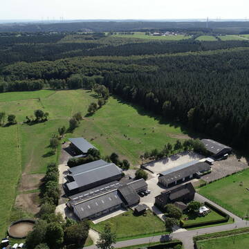
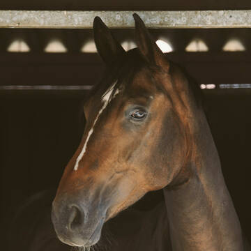
Turnier/Freizeit/Aufzucht/Rentnerstall
Hürtgenwald
Reitstall-Fassbender
@Reitstall-Fassbender
FN-Mitglied
Freizeitstall
Vermieten
Hunde willkommen
Krankenbox
Gnadenbrothof
Notfallboxen
26 weitere...
P
Leider kein Vorschaubild
Leider kein Vorschaubild
Offenstall frei, Vollpension, Rentner
Walhorn
Julia
@Julia.h
Freizeitstall
Geländestrecke
Vermieten
Hunde willkommen
Krankenbox
Notfallboxen
12 weitere...
B
Deprecated: Creation of dynamic property Zend_View_Helper_Ads::$adLink is deprecated in /var/www/stall-frei/htdocs/staging.stall-frei.de/library/Psf/View/Helper/Ads.php on line 108

Job gesucht?
Mechtersen
STALL-FREIde Marketing
@STALL-FREI-Marketing
Sie suchen einen Job und arbeiten gerne mit Pferden oder auf Reitanlagen?
Besuchen Sie jetzt unseren Stellenmarkt!
Leider kein Vorschaubild
Leider kein Vorschaubild
Pferdebox 4,50m x 4m, mit Fenster
Baesweiler
Schmitz Pferdezucht
@K.Schlemmer
FN-Mitglied
Pferdeausbildung
Führanlage
Paddock
Fohlenaufzucht möglich
Pferdezucht
Innenbox
10 weitere...
B

Familiärer Offenstall am Ortsrand von Koslar
Jülich Koslar
Alexander Jost
@Alexander_Jost
FN-Mitglied
Freizeitstall
Vermieten
Hunde willkommen
Krankenbox
Offenstall
5 weitere...
P
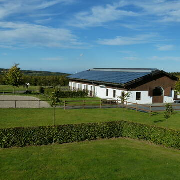
Gut Heidbüchel-Stall Menniken
Großhau
Monique Menniken
@Finy-Menniken
Fahrstall, Kutschwagen
Freizeitstall
Führanlage
Longierzirkel/Roundpen
Gnadenbrothof
Hengsthaltung möglich
Außenbox mit Paddock
Außenboxen
25 weitere...
P
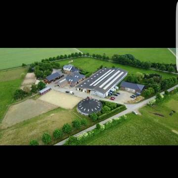
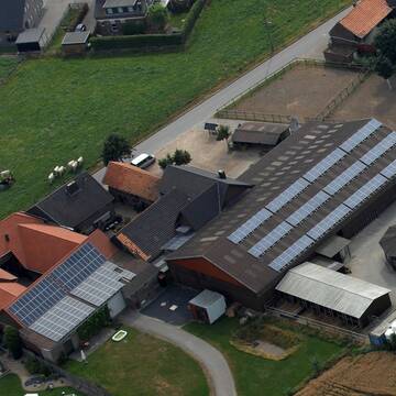
Eifelhof Bock - Pferdepension Bock
Hürtgenwald
Pferdepension-Bock1
@Pferdepension-Bock1
Freizeitstall
Vermieten
Krankenbox
Longierzirkel/Roundpen
Allergikerstall
Notfallboxen
18 weitere...
P

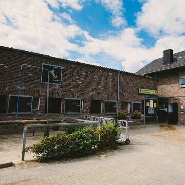
Liebevoll geführter Aktivstall in der Eifel
Hürtgenwald
Bosselbacher-Hof
@Bosselbacher-Hof
Freizeitstall
Gastronomie
Hunde willkommen
Krankenbox
Hufrehe geeignet
Notfallboxen
Bewegungsstall
Laufstall
13 weitere...
P

Das Beste für die Hufe
Mechtersen
STALL-FREIde Marketing
@STALL-FREI-Marketing
Hufschmiede und Hufpfleger in Ihrer Nähe


FN-Pferdeanlage mit allem Komfort
Heinsberg
Reitsportzentrum Pütt
@ReitsportzentrumPuett
FN-Mitglied
Freizeitstall
Vermieten
Führanlage
Longierzirkel/Roundpen
Hengsthaltung möglich
Pferdezucht
21 weitere...
aktuell
P+
Leider kein Vorschaubild
Leider kein Vorschaubild
Offenstall frei , Halle, Platz, ab 180 Euro mtl
Heinsberg
Stallgasse
@M.N.
Freizeitstall
Vermieten
Reithalle
Reitplatz (z.B. Dressur, Springen, Reining)
Offenstall
6 weitere...
B
Leider kein Vorschaubild
Leider kein Vorschaubild
Offenstallplatz frei, Infos in Kleinanzeigen
Belgien, Kettenis
Elke Klinkenberg
@ElkeK
Freizeitstall
Geländestrecke
Vermieten
Krankenbox
Paddock
Gnadenbrothof
zuckerreduziertes Heu
9 weitere...
B
Werde Teil von STALL-FREI.de
Du hast eine Pferdebox frei? Freie Plätze im Offenstall, Pferdestall oder der Reitanlage kostenlos anbieten.
Deprecated: Creation of dynamic property Zend_View::$pageCount is deprecated in /var/www/stall-frei/htdocs/staging.stall-frei.de/library/vendor/shardj/zf1-future/library/Zend/View/Abstract.php on line 308
Deprecated: Creation of dynamic property Zend_View::$itemCountPerPage is deprecated in /var/www/stall-frei/htdocs/staging.stall-frei.de/library/vendor/shardj/zf1-future/library/Zend/View/Abstract.php on line 308
Deprecated: Creation of dynamic property Zend_View::$first is deprecated in /var/www/stall-frei/htdocs/staging.stall-frei.de/library/vendor/shardj/zf1-future/library/Zend/View/Abstract.php on line 308
Deprecated: Creation of dynamic property Zend_View::$current is deprecated in /var/www/stall-frei/htdocs/staging.stall-frei.de/library/vendor/shardj/zf1-future/library/Zend/View/Abstract.php on line 308
Deprecated: Creation of dynamic property Zend_View::$last is deprecated in /var/www/stall-frei/htdocs/staging.stall-frei.de/library/vendor/shardj/zf1-future/library/Zend/View/Abstract.php on line 308
Deprecated: Creation of dynamic property Zend_View::$previous is deprecated in /var/www/stall-frei/htdocs/staging.stall-frei.de/library/vendor/shardj/zf1-future/library/Zend/View/Abstract.php on line 308
Deprecated: Creation of dynamic property Zend_View::$next is deprecated in /var/www/stall-frei/htdocs/staging.stall-frei.de/library/vendor/shardj/zf1-future/library/Zend/View/Abstract.php on line 308
Deprecated: Creation of dynamic property Zend_View::$pagesInRange is deprecated in /var/www/stall-frei/htdocs/staging.stall-frei.de/library/vendor/shardj/zf1-future/library/Zend/View/Abstract.php on line 308
Deprecated: Creation of dynamic property Zend_View::$firstPageInRange is deprecated in /var/www/stall-frei/htdocs/staging.stall-frei.de/library/vendor/shardj/zf1-future/library/Zend/View/Abstract.php on line 308
Deprecated: Creation of dynamic property Zend_View::$lastPageInRange is deprecated in /var/www/stall-frei/htdocs/staging.stall-frei.de/library/vendor/shardj/zf1-future/library/Zend/View/Abstract.php on line 308
Deprecated: Creation of dynamic property Zend_View::$currentItemCount is deprecated in /var/www/stall-frei/htdocs/staging.stall-frei.de/library/vendor/shardj/zf1-future/library/Zend/View/Abstract.php on line 308
Deprecated: Creation of dynamic property Zend_View::$totalItemCount is deprecated in /var/www/stall-frei/htdocs/staging.stall-frei.de/library/vendor/shardj/zf1-future/library/Zend/View/Abstract.php on line 308
Deprecated: Creation of dynamic property Zend_View::$firstItemNumber is deprecated in /var/www/stall-frei/htdocs/staging.stall-frei.de/library/vendor/shardj/zf1-future/library/Zend/View/Abstract.php on line 308
Deprecated: Creation of dynamic property Zend_View::$lastItemNumber is deprecated in /var/www/stall-frei/htdocs/staging.stall-frei.de/library/vendor/shardj/zf1-future/library/Zend/View/Abstract.php on line 308
Deprecated: Creation of dynamic property Zend_View::$router is deprecated in /var/www/stall-frei/htdocs/staging.stall-frei.de/library/vendor/shardj/zf1-future/library/Zend/View/Abstract.php on line 308
Deprecated: Creation of dynamic property Zend_View::$urlParams is deprecated in /var/www/stall-frei/htdocs/staging.stall-frei.de/library/vendor/shardj/zf1-future/library/Zend/View/Abstract.php on line 308
Deprecated: Creation of dynamic property Zend_View::$showAds is deprecated in /var/www/stall-frei/htdocs/staging.stall-frei.de/library/vendor/shardj/zf1-future/library/Zend/View/Abstract.php on line 308
Deprecated: Creation of dynamic property Zend_View::$objectIds is deprecated in /var/www/stall-frei/htdocs/staging.stall-frei.de/library/vendor/shardj/zf1-future/library/Zend/View/Abstract.php on line 308
Deprecated: Creation of dynamic property Zend_View::$showNavbar is deprecated in /var/www/stall-frei/htdocs/staging.stall-frei.de/library/vendor/shardj/zf1-future/library/Zend/View/Abstract.php on line 308
Deprecated: Creation of dynamic property Zend_View::$showBreadcrumb is deprecated in /var/www/stall-frei/htdocs/staging.stall-frei.de/library/vendor/shardj/zf1-future/library/Zend/View/Abstract.php on line 308
Deprecated: Creation of dynamic property Zend_View::$showFooter is deprecated in /var/www/stall-frei/htdocs/staging.stall-frei.de/library/vendor/shardj/zf1-future/library/Zend/View/Abstract.php on line 308
Deprecated: Creation of dynamic property Zend_View::$showInternalAds is deprecated in /var/www/stall-frei/htdocs/staging.stall-frei.de/library/vendor/shardj/zf1-future/library/Zend/View/Abstract.php on line 308
Deprecated: Creation of dynamic property Zend_View::$blNoContent is deprecated in /var/www/stall-frei/htdocs/staging.stall-frei.de/library/vendor/shardj/zf1-future/library/Zend/View/Abstract.php on line 308
Deprecated: Creation of dynamic property Zend_View::$sMetaDesc is deprecated in /var/www/stall-frei/htdocs/staging.stall-frei.de/library/vendor/shardj/zf1-future/library/Zend/View/Abstract.php on line 308
Deprecated: Creation of dynamic property Zend_View::$useGmaps is deprecated in /var/www/stall-frei/htdocs/staging.stall-frei.de/library/vendor/shardj/zf1-future/library/Zend/View/Abstract.php on line 308
Deprecated: Creation of dynamic property Zend_View::$touches is deprecated in /var/www/stall-frei/htdocs/staging.stall-frei.de/library/vendor/shardj/zf1-future/library/Zend/View/Abstract.php on line 308
Deprecated: Creation of dynamic property Zend_View::$oProject is deprecated in /var/www/stall-frei/htdocs/staging.stall-frei.de/library/vendor/shardj/zf1-future/library/Zend/View/Abstract.php on line 308
Deprecated: Creation of dynamic property Zend_View::$pageHeadline is deprecated in /var/www/stall-frei/htdocs/staging.stall-frei.de/library/vendor/shardj/zf1-future/library/Zend/View/Abstract.php on line 308
Deprecated: Creation of dynamic property Zend_View::$disableLocationField is deprecated in /var/www/stall-frei/htdocs/staging.stall-frei.de/library/vendor/shardj/zf1-future/library/Zend/View/Abstract.php on line 308
Deprecated: Creation of dynamic property Zend_View::$isSearch is deprecated in /var/www/stall-frei/htdocs/staging.stall-frei.de/library/vendor/shardj/zf1-future/library/Zend/View/Abstract.php on line 308
Deprecated: Creation of dynamic property Zend_View::$pageTitle is deprecated in /var/www/stall-frei/htdocs/staging.stall-frei.de/library/vendor/shardj/zf1-future/library/Zend/View/Abstract.php on line 308
Deprecated: Creation of dynamic property Psf_Form_Element_Text::$class is deprecated in /var/www/stall-frei/htdocs/staging.stall-frei.de/library/vendor/shardj/zf1-future/library/Zend/Form/Element.php on line 874
Deprecated: Creation of dynamic property Psf_Form_Element_Text::$size is deprecated in /var/www/stall-frei/htdocs/staging.stall-frei.de/library/vendor/shardj/zf1-future/library/Zend/Form/Element.php on line 874
Deprecated: Creation of dynamic property Psf_Form_Element_Text::$placeholder is deprecated in /var/www/stall-frei/htdocs/staging.stall-frei.de/library/vendor/shardj/zf1-future/library/Zend/Form/Element.php on line 874
Deprecated: Creation of dynamic property Psf_Form_Element_Hidden::$class is deprecated in /var/www/stall-frei/htdocs/staging.stall-frei.de/library/vendor/shardj/zf1-future/library/Zend/Form/Element.php on line 874
Deprecated: Creation of dynamic property Psf_Form_Element_Hidden::$class is deprecated in /var/www/stall-frei/htdocs/staging.stall-frei.de/library/vendor/shardj/zf1-future/library/Zend/Form/Element.php on line 874
Deprecated: Creation of dynamic property Psf_Form_Element_Hidden::$class is deprecated in /var/www/stall-frei/htdocs/staging.stall-frei.de/library/vendor/shardj/zf1-future/library/Zend/Form/Element.php on line 874
Deprecated: Creation of dynamic property Psf_Form_Element_Hidden::$class is deprecated in /var/www/stall-frei/htdocs/staging.stall-frei.de/library/vendor/shardj/zf1-future/library/Zend/Form/Element.php on line 874
Deprecated: Creation of dynamic property Psf_Form_Element_Select::$class is deprecated in /var/www/stall-frei/htdocs/staging.stall-frei.de/library/vendor/shardj/zf1-future/library/Zend/Form/Element.php on line 874
Deprecated: Creation of dynamic property Psf_Form_Element_Select::$class is deprecated in /var/www/stall-frei/htdocs/staging.stall-frei.de/library/vendor/shardj/zf1-future/library/Zend/Form/Element.php on line 874
Deprecated: Creation of dynamic property Psf_Form_Element_Select::$class is deprecated in /var/www/stall-frei/htdocs/staging.stall-frei.de/library/vendor/shardj/zf1-future/library/Zend/Form/Element.php on line 874
Deprecated: Creation of dynamic property Psf_Form_Element_Select::$class is deprecated in /var/www/stall-frei/htdocs/staging.stall-frei.de/library/vendor/shardj/zf1-future/library/Zend/Form/Element.php on line 874
Deprecated: Creation of dynamic property Psf_Form_Element_Text::$class is deprecated in /var/www/stall-frei/htdocs/staging.stall-frei.de/library/vendor/shardj/zf1-future/library/Zend/Form/Element.php on line 874
Deprecated: Creation of dynamic property Psf_Form_Element_Checkbox::$label is deprecated in /var/www/stall-frei/htdocs/staging.stall-frei.de/library/vendor/shardj/zf1-future/library/Zend/Form/Element.php on line 874
Deprecated: Creation of dynamic property Zend_View::$sort is deprecated in /var/www/stall-frei/htdocs/staging.stall-frei.de/library/vendor/shardj/zf1-future/library/Zend/View/Abstract.php on line 308
Deprecated: Creation of dynamic property Zend_View::$searchLocation is deprecated in /var/www/stall-frei/htdocs/staging.stall-frei.de/library/vendor/shardj/zf1-future/library/Zend/View/Abstract.php on line 308
Deprecated: Creation of dynamic property Zend_View::$locationHint is deprecated in /var/www/stall-frei/htdocs/staging.stall-frei.de/library/vendor/shardj/zf1-future/library/Zend/View/Abstract.php on line 308
Psf_GeoCoder_Abstract::getLocation: Haaren Get Location CachedOrLive
Psf_GeoCoder_Abstract::getCachedOrLive: Haaren
Psf_GeoCoder_Abstract::convertLocationResult
{"documentation":"https:\/\/opencagedata.com\/api","licenses":[{"name":"see attribution guide","url":"https:\/\/opencagedata.com\/credits"}],"results":[{"bounds":{"northeast":{"lat":50.8085105,"lng":6.1911818},"southwest":{"lat":50.782953,"lng":6.1088493}},"components":{"ISO_3166-1_alpha-2":"DE","ISO_3166-1_alpha-3":"DEU","ISO_3166-2":["DE-NW"],"_category":"place","_normalized_city":"Aachen","_type":"neighbourhood","city":"Aachen","continent":"Europe","country":"Deutschland","country_code":"de","county":"St\u00e4dteregion Aachen","political_union":"European Union","state":"Nordrhein-Westfalen","state_code":"NW","suburb":"Haaren"},"confidence":7,"formatted":"Haaren, Aachen, Nordrhein-Westfalen, Deutschland","geometry":{"lat":50.795364,"lng":6.1268326}},{"bounds":{"northeast":{"lat":51.1108037,"lng":6.0562727},"southwest":{"lat":51.0708037,"lng":6.0162727}},"components":{"ISO_3166-1_alpha-2":"DE","ISO_3166-1_alpha-3":"DEU","ISO_3166-2":["DE-NW"],"_category":"place","_normalized_city":"Waldfeucht","_type":"village","city":"Waldfeucht","continent":"Europe","country":"Deutschland","country_code":"de","county":"Kreis Heinsberg","political_union":"European Union","state":"Nordrhein-Westfalen","state_code":"NW","village":"Haaren"},"confidence":7,"formatted":"Haaren, Nordrhein-Westfalen, Deutschland","geometry":{"lat":51.0908037,"lng":6.0362727}},{"bounds":{"northeast":{"lat":51.6154334,"lng":8.7543242},"southwest":{"lat":51.5411531,"lng":8.6436292}},"components":{"ISO_3166-1_alpha-2":"DE","ISO_3166-1_alpha-3":"DEU","ISO_3166-2":["DE-NW"],"_category":"place","_normalized_city":"Bad W\u00fcnnenberg","_type":"neighbourhood","continent":"Europe","country":"Deutschland","country_code":"de","county":"Kreis Paderborn","political_union":"European Union","state":"Nordrhein-Westfalen","state_code":"NW","suburb":"Haaren","town":"Bad W\u00fcnnenberg"},"confidence":7,"formatted":"Haaren, Bad W\u00fcnnenberg, Nordrhein-Westfalen, Deutschland","geometry":{"lat":51.5685175,"lng":8.7283348}},{"bounds":{"northeast":{"lat":51.7128659,"lng":7.9382523},"southwest":{"lat":51.6728659,"lng":7.8982523}},"components":{"ISO_3166-1_alpha-2":"DE","ISO_3166-1_alpha-3":"DEU","ISO_3166-2":["DE-NW"],"_category":"place","_normalized_city":"Hamm","_type":"hamlet","city":"Hamm","city_district":"Uentrop","continent":"Europe","country":"Deutschland","country_code":"de","hamlet":"Haaren","political_union":"European Union","postcode":"59071","state":"Nordrhein-Westfalen","state_code":"NW"},"confidence":7,"formatted":"Haaren, 59071 Hamm, Deutschland","geometry":{"lat":51.6928659,"lng":7.9182523}},{"bounds":{"northeast":{"lat":53.2319315,"lng":8.2269617},"southwest":{"lat":53.1398681,"lng":8.0745498}},"components":{"ISO_3166-1_alpha-2":"DE","ISO_3166-1_alpha-3":"DEU","ISO_3166-2":["DE-NI"],"_category":"natural\/water","_normalized_city":"Bad Zwischenahn","_type":"river","continent":"Europe","country":"Deutschland","country_code":"de","county":"Landkreis Ammerland","municipality":"Bad Zwischenahn","political_union":"European Union","river":"Haaren","state":"Niedersachsen","state_code":"NI"},"confidence":6,"formatted":"Haaren, Bad Zwischenahn, Niedersachsen, Deutschland","geometry":{"lat":53.1505918,"lng":8.1346911}},{"bounds":{"northeast":{"lat":52.979894,"lng":12.0039706},"southwest":{"lat":52.9625869,"lng":11.9627436}},"components":{"ISO_3166-1_alpha-2":"DE","ISO_3166-1_alpha-3":"DEU","ISO_3166-2":["DE-BB"],"_category":"place","_normalized_city":"Bad Wilsnack","_type":"hamlet","continent":"Europe","country":"Deutschland","country_code":"de","county":"Prignitz","hamlet":"Haaren","municipality":"Bad Wilsnack\/Weisen","political_union":"European Union","state":"Brandenburg","state_code":"BB","town":"Bad Wilsnack"},"confidence":7,"formatted":"Haaren, Bad Wilsnack, Brandenburg, Deutschland","geometry":{"lat":52.9707775,"lng":11.9857809}},{"bounds":{"northeast":{"lat":52.353959,"lng":8.2052229},"southwest":{"lat":52.313959,"lng":8.1652229}},"components":{"ISO_3166-1_alpha-2":"DE","ISO_3166-1_alpha-3":"DEU","ISO_3166-2":["DE-NI"],"_category":"place","_normalized_city":"Ostercappeln","_type":"hamlet","continent":"Europe","country":"Deutschland","country_code":"de","county":"Landkreis Osnabr\u00fcck","hamlet":"Haaren","political_union":"European Union","postcode":"49179","state":"Niedersachsen","state_code":"NI","town":"Ostercappeln"},"confidence":7,"formatted":"Haaren, 49179 Ostercappeln, Deutschland","geometry":{"lat":52.333959,"lng":8.1852229}},{"components":{"ISO_3166-1_alpha-2":"FR","ISO_3166-1_alpha-3":"FRA","ISO_3166-2":["FR-PAC","FR-13"],"_category":"road","_normalized_city":"Eygui\u00e8res","_type":"road","city":"Eygui\u00e8res","continent":"Europe","country":"France","country_code":"fr","county":"Bouches-du-Rh\u00f4ne","local_authority":"Aix-Marseille-Provence","political_union":"European Union","postcode":"13430","road":"Chemin des Arenes","state":"Provence-Alpes-C\u00f4te d'Azur","state_code":"PAC"},"confidence":2,"formatted":"Chemin des Arenes, 13430 Eygui\u00e8res, France","geometry":{"lat":43.693865,"lng":5.023056}},{"components":{"ISO_3166-1_alpha-2":"FR","ISO_3166-1_alpha-3":"FRA","ISO_3166-2":["FR-ARA","FR-01"],"_category":"road","_normalized_city":"Dagneux","_type":"road","city":"Dagneux","continent":"Europe","country":"France","country_code":"fr","county":"Ain","local_authority":"Communaut\u00e9 de communes de la C\u00f4ti\u00e8re \u00e0 Montluel","political_union":"European Union","postcode":"01120","road":"Chemin des Arenes","state":"Auvergne-Rh\u00f4ne-Alpes","state_code":"ARA"},"confidence":2,"formatted":"Chemin des Arenes, 01120 Dagneux, France","geometry":{"lat":45.855099,"lng":5.081117}},{"components":{"ISO_3166-1_alpha-2":"FR","ISO_3166-1_alpha-3":"FRA","ISO_3166-2":["FR-PDL","FR-44"],"_category":"road","_normalized_city":"Saint-S\u00e9bastien-sur-Loire","_type":"road","city":"Saint-S\u00e9bastien-sur-Loire","continent":"Europe","country":"France","country_code":"fr","county":"Loire-Atlantique","local_authority":"Nantes M\u00e9tropole","political_union":"European Union","postcode":"44230","road":"Rue des Harengs","state":"Pays de la Loire","state_code":"PDL"},"confidence":2,"formatted":"Rue des Harengs, 44230 Saint-S\u00e9bastien-sur-Loire, France","geometry":{"lat":47.202794,"lng":-1.516251}}],"status":{"code":200,"message":"OK"},"stay_informed":{"blog":"https:\/\/blog.opencagedata.com","mastodon":"https:\/\/en.osm.town\/@opencage"},"thanks":"For using an OpenCage API","timestamp":{"created_http":"Mon, 09 Feb 2026 02:33:10 GMT","created_unix":1770604390},"total_results":10}Array
(
[0] => stdClass Object
(
[bounds] => stdClass Object
(
[northeast] => stdClass Object
(
[lat] => 50.8085105
[lng] => 6.1911818
)
[southwest] => stdClass Object
(
[lat] => 50.782953
[lng] => 6.1088493
)
)
[components] => stdClass Object
(
[ISO_3166-1_alpha-2] => DE
[ISO_3166-1_alpha-3] => DEU
[ISO_3166-2] => Array
(
[0] => DE-NW
)
[_category] => place
[_normalized_city] => Aachen
[_type] => neighbourhood
[city] => Aachen
[continent] => Europe
[country] => Deutschland
[country_code] => de
[county] => Städteregion Aachen
[political_union] => European Union
[state] => Nordrhein-Westfalen
[state_code] => NW
[suburb] => Haaren
)
[confidence] => 7
[formatted] => Haaren, Aachen, Nordrhein-Westfalen, Deutschland
[geometry] => stdClass Object
(
[lat] => 50.795364
[lng] => 6.1268326
)
)
[1] => stdClass Object
(
[bounds] => stdClass Object
(
[northeast] => stdClass Object
(
[lat] => 51.1108037
[lng] => 6.0562727
)
[southwest] => stdClass Object
(
[lat] => 51.0708037
[lng] => 6.0162727
)
)
[components] => stdClass Object
(
[ISO_3166-1_alpha-2] => DE
[ISO_3166-1_alpha-3] => DEU
[ISO_3166-2] => Array
(
[0] => DE-NW
)
[_category] => place
[_normalized_city] => Waldfeucht
[_type] => village
[city] => Waldfeucht
[continent] => Europe
[country] => Deutschland
[country_code] => de
[county] => Kreis Heinsberg
[political_union] => European Union
[state] => Nordrhein-Westfalen
[state_code] => NW
[village] => Haaren
)
[confidence] => 7
[formatted] => Haaren, Nordrhein-Westfalen, Deutschland
[geometry] => stdClass Object
(
[lat] => 51.0908037
[lng] => 6.0362727
)
)
[2] => stdClass Object
(
[bounds] => stdClass Object
(
[northeast] => stdClass Object
(
[lat] => 51.6154334
[lng] => 8.7543242
)
[southwest] => stdClass Object
(
[lat] => 51.5411531
[lng] => 8.6436292
)
)
[components] => stdClass Object
(
[ISO_3166-1_alpha-2] => DE
[ISO_3166-1_alpha-3] => DEU
[ISO_3166-2] => Array
(
[0] => DE-NW
)
[_category] => place
[_normalized_city] => Bad Wünnenberg
[_type] => neighbourhood
[continent] => Europe
[country] => Deutschland
[country_code] => de
[county] => Kreis Paderborn
[political_union] => European Union
[state] => Nordrhein-Westfalen
[state_code] => NW
[suburb] => Haaren
[town] => Bad Wünnenberg
)
[confidence] => 7
[formatted] => Haaren, Bad Wünnenberg, Nordrhein-Westfalen, Deutschland
[geometry] => stdClass Object
(
[lat] => 51.5685175
[lng] => 8.7283348
)
)
[3] => stdClass Object
(
[bounds] => stdClass Object
(
[northeast] => stdClass Object
(
[lat] => 51.7128659
[lng] => 7.9382523
)
[southwest] => stdClass Object
(
[lat] => 51.6728659
[lng] => 7.8982523
)
)
[components] => stdClass Object
(
[ISO_3166-1_alpha-2] => DE
[ISO_3166-1_alpha-3] => DEU
[ISO_3166-2] => Array
(
[0] => DE-NW
)
[_category] => place
[_normalized_city] => Hamm
[_type] => hamlet
[city] => Hamm
[city_district] => Uentrop
[continent] => Europe
[country] => Deutschland
[country_code] => de
[hamlet] => Haaren
[political_union] => European Union
[postcode] => 59071
[state] => Nordrhein-Westfalen
[state_code] => NW
)
[confidence] => 7
[formatted] => Haaren, 59071 Hamm, Deutschland
[geometry] => stdClass Object
(
[lat] => 51.6928659
[lng] => 7.9182523
)
)
[4] => stdClass Object
(
[bounds] => stdClass Object
(
[northeast] => stdClass Object
(
[lat] => 53.2319315
[lng] => 8.2269617
)
[southwest] => stdClass Object
(
[lat] => 53.1398681
[lng] => 8.0745498
)
)
[components] => stdClass Object
(
[ISO_3166-1_alpha-2] => DE
[ISO_3166-1_alpha-3] => DEU
[ISO_3166-2] => Array
(
[0] => DE-NI
)
[_category] => natural/water
[_normalized_city] => Bad Zwischenahn
[_type] => river
[continent] => Europe
[country] => Deutschland
[country_code] => de
[county] => Landkreis Ammerland
[municipality] => Bad Zwischenahn
[political_union] => European Union
[river] => Haaren
[state] => Niedersachsen
[state_code] => NI
)
[confidence] => 6
[formatted] => Haaren, Bad Zwischenahn, Niedersachsen, Deutschland
[geometry] => stdClass Object
(
[lat] => 53.1505918
[lng] => 8.1346911
)
)
[5] => stdClass Object
(
[bounds] => stdClass Object
(
[northeast] => stdClass Object
(
[lat] => 52.979894
[lng] => 12.0039706
)
[southwest] => stdClass Object
(
[lat] => 52.9625869
[lng] => 11.9627436
)
)
[components] => stdClass Object
(
[ISO_3166-1_alpha-2] => DE
[ISO_3166-1_alpha-3] => DEU
[ISO_3166-2] => Array
(
[0] => DE-BB
)
[_category] => place
[_normalized_city] => Bad Wilsnack
[_type] => hamlet
[continent] => Europe
[country] => Deutschland
[country_code] => de
[county] => Prignitz
[hamlet] => Haaren
[municipality] => Bad Wilsnack/Weisen
[political_union] => European Union
[state] => Brandenburg
[state_code] => BB
[town] => Bad Wilsnack
)
[confidence] => 7
[formatted] => Haaren, Bad Wilsnack, Brandenburg, Deutschland
[geometry] => stdClass Object
(
[lat] => 52.9707775
[lng] => 11.9857809
)
)
[6] => stdClass Object
(
[bounds] => stdClass Object
(
[northeast] => stdClass Object
(
[lat] => 52.353959
[lng] => 8.2052229
)
[southwest] => stdClass Object
(
[lat] => 52.313959
[lng] => 8.1652229
)
)
[components] => stdClass Object
(
[ISO_3166-1_alpha-2] => DE
[ISO_3166-1_alpha-3] => DEU
[ISO_3166-2] => Array
(
[0] => DE-NI
)
[_category] => place
[_normalized_city] => Ostercappeln
[_type] => hamlet
[continent] => Europe
[country] => Deutschland
[country_code] => de
[county] => Landkreis Osnabrück
[hamlet] => Haaren
[political_union] => European Union
[postcode] => 49179
[state] => Niedersachsen
[state_code] => NI
[town] => Ostercappeln
)
[confidence] => 7
[formatted] => Haaren, 49179 Ostercappeln, Deutschland
[geometry] => stdClass Object
(
[lat] => 52.333959
[lng] => 8.1852229
)
)
[7] => stdClass Object
(
[components] => stdClass Object
(
[ISO_3166-1_alpha-2] => FR
[ISO_3166-1_alpha-3] => FRA
[ISO_3166-2] => Array
(
[0] => FR-PAC
[1] => FR-13
)
[_category] => road
[_normalized_city] => Eyguières
[_type] => road
[city] => Eyguières
[continent] => Europe
[country] => France
[country_code] => fr
[county] => Bouches-du-Rhône
[local_authority] => Aix-Marseille-Provence
[political_union] => European Union
[postcode] => 13430
[road] => Chemin des Arenes
[state] => Provence-Alpes-Côte d'Azur
[state_code] => PAC
)
[confidence] => 2
[formatted] => Chemin des Arenes, 13430 Eyguières, France
[geometry] => stdClass Object
(
[lat] => 43.693865
[lng] => 5.023056
)
)
[8] => stdClass Object
(
[components] => stdClass Object
(
[ISO_3166-1_alpha-2] => FR
[ISO_3166-1_alpha-3] => FRA
[ISO_3166-2] => Array
(
[0] => FR-ARA
[1] => FR-01
)
[_category] => road
[_normalized_city] => Dagneux
[_type] => road
[city] => Dagneux
[continent] => Europe
[country] => France
[country_code] => fr
[county] => Ain
[local_authority] => Communauté de communes de la Côtière à Montluel
[political_union] => European Union
[postcode] => 01120
[road] => Chemin des Arenes
[state] => Auvergne-Rhône-Alpes
[state_code] => ARA
)
[confidence] => 2
[formatted] => Chemin des Arenes, 01120 Dagneux, France
[geometry] => stdClass Object
(
[lat] => 45.855099
[lng] => 5.081117
)
)
[9] => stdClass Object
(
[components] => stdClass Object
(
[ISO_3166-1_alpha-2] => FR
[ISO_3166-1_alpha-3] => FRA
[ISO_3166-2] => Array
(
[0] => FR-PDL
[1] => FR-44
)
[_category] => road
[_normalized_city] => Saint-Sébastien-sur-Loire
[_type] => road
[city] => Saint-Sébastien-sur-Loire
[continent] => Europe
[country] => France
[country_code] => fr
[county] => Loire-Atlantique
[local_authority] => Nantes Métropole
[political_union] => European Union
[postcode] => 44230
[road] => Rue des Harengs
[state] => Pays de la Loire
[state_code] => PDL
)
[confidence] => 2
[formatted] => Rue des Harengs, 44230 Saint-Sébastien-sur-Loire, France
[geometry] => stdClass Object
(
[lat] => 47.202794
[lng] => -1.516251
)
)
)
Psf_GeoCoder_OpenCageData::getKeyMap: 0
stdClass Object
(
    [bounds] => stdClass Object
        (
            [northeast] => stdClass Object
                (
                    [lat] => 50.8085105
                    [lng] => 6.1911818
                )

            [southwest] => stdClass Object
                (
                    [lat] => 50.782953
                    [lng] => 6.1088493
                )

        )

    [components] => stdClass Object
        (
            [ISO_3166-1_alpha-2] => DE
            [ISO_3166-1_alpha-3] => DEU
            [ISO_3166-2] => Array
                (
                    [0] => DE-NW
                )

            [_category] => place
            [_normalized_city] => Aachen
            [_type] => neighbourhood
            [city] => Aachen
            [continent] => Europe
            [country] => Deutschland
            [country_code] => de
            [county] => Städteregion Aachen
            [political_union] => European Union
            [state] => Nordrhein-Westfalen
            [state_code] => NW
            [suburb] => Haaren
        )

    [confidence] => 7
    [formatted] => Haaren, Aachen, Nordrhein-Westfalen, Deutschland
    [geometry] => stdClass Object
        (
            [lat] => 50.795364
            [lng] => 6.1268326
        )

)
Psf_GeoCoder_OpenCageData::getCounty: Städteregion Aachen
Psf_GeoCoder_OpenCageData::addMissingData REFETCH!
Array
(
    [address] => Haaren, Aachen, Nordrhein-Westfalen, Deutschland
    [type] => neighbourhood
    [street] =>
    [city] => Haaren
    [county] => Städteregion Aachen
    [state] => Nordrhein-Westfalen
    [zip] =>
    [country] => Deutschland
    [suburb] => Haaren
    [countrycode] => de
    [latitude] => 50.795364
    [longitude] => 6.1268326
    [accuracy] => 1
    [confidence] => 7
    [bounds] => stdClass Object
        (
            [northeast] => stdClass Object
                (
                    [lat] => 50.8085105
                    [lng] => 6.1911818
                )

            [southwest] => stdClass Object
                (
                    [lat] => 50.782953
                    [lng] => 6.1088493
                )

        )

)
reformat!
Array
(
    [address] => Haaren, Aachen, Nordrhein-Westfalen, Deutschland
    [type] => neighbourhood
    [street] =>
    [city] => Haaren
    [county] => Städteregion Aachen
    [state] => Nordrhein-Westfalen
    [zip] =>
    [country] => Deutschland
    [suburb] => Haaren
    [countrycode] => de
    [latitude] => 50.795364
    [longitude] => 6.1268326
    [accuracy] => 1
    [confidence] => 7
    [bounds] => stdClass Object
        (
            [northeast] => stdClass Object
                (
                    [lat] => 50.8085105
                    [lng] => 6.1911818
                )

            [southwest] => stdClass Object
                (
                    [lat] => 50.782953
                    [lng] => 6.1088493
                )

        )

    [place] => Haaren, Nordrhein-Westfalen
    [hash] => 8a130d16db887581d49e0c3382927b74
)
Psf_GeoCoder_OpenCageData::getKeyMap: 1
stdClass Object
(
    [bounds] => stdClass Object
        (
            [northeast] => stdClass Object
                (
                    [lat] => 51.1108037
                    [lng] => 6.0562727
                )

            [southwest] => stdClass Object
                (
                    [lat] => 51.0708037
                    [lng] => 6.0162727
                )

        )

    [components] => stdClass Object
        (
            [ISO_3166-1_alpha-2] => DE
            [ISO_3166-1_alpha-3] => DEU
            [ISO_3166-2] => Array
                (
                    [0] => DE-NW
                )

            [_category] => place
            [_normalized_city] => Waldfeucht
            [_type] => village
            [city] => Waldfeucht
            [continent] => Europe
            [country] => Deutschland
            [country_code] => de
            [county] => Kreis Heinsberg
            [political_union] => European Union
            [state] => Nordrhein-Westfalen
            [state_code] => NW
            [village] => Haaren
        )

    [confidence] => 7
    [formatted] => Haaren, Nordrhein-Westfalen, Deutschland
    [geometry] => stdClass Object
        (
            [lat] => 51.0908037
            [lng] => 6.0362727
        )

)
Psf_GeoCoder_OpenCageData::getCounty: Heinsberg
Psf_GeoCoder_OpenCageData::addMissingData REFETCH!
Array
(
    [address] => Haaren, Nordrhein-Westfalen, Deutschland
    [type] => village
    [street] =>
    [city] => Haaren
    [county] => Heinsberg
    [state] => Nordrhein-Westfalen
    [zip] =>
    [country] => Deutschland
    [suburb] =>
    [countrycode] => de
    [latitude] => 51.0908037
    [longitude] => 6.0362727
    [accuracy] => 1
    [confidence] => 7
    [bounds] => stdClass Object
        (
            [northeast] => stdClass Object
                (
                    [lat] => 51.1108037
                    [lng] => 6.0562727
                )

            [southwest] => stdClass Object
                (
                    [lat] => 51.0708037
                    [lng] => 6.0162727
                )

        )

)
reformat!
Array
(
    [address] => Haaren, Nordrhein-Westfalen, Deutschland
    [type] => village
    [street] =>
    [city] => Haaren
    [county] => Heinsberg
    [state] => Nordrhein-Westfalen
    [zip] =>
    [country] => Deutschland
    [suburb] =>
    [countrycode] => de
    [latitude] => 51.0908037
    [longitude] => 6.0362727
    [accuracy] => 1
    [confidence] => 7
    [bounds] => stdClass Object
        (
            [northeast] => stdClass Object
                (
                    [lat] => 51.1108037
                    [lng] => 6.0562727
                )

            [southwest] => stdClass Object
                (
                    [lat] => 51.0708037
                    [lng] => 6.0162727
                )

        )

    [place] => Haaren, Nordrhein-Westfalen
    [hash] => 8a130d16db887581d49e0c3382927b74
)
Psf_GeoCoder_OpenCageData::getKeyMap: 2
stdClass Object
(
    [bounds] => stdClass Object
        (
            [northeast] => stdClass Object
                (
                    [lat] => 51.6154334
                    [lng] => 8.7543242
                )

            [southwest] => stdClass Object
                (
                    [lat] => 51.5411531
                    [lng] => 8.6436292
                )

        )

    [components] => stdClass Object
        (
            [ISO_3166-1_alpha-2] => DE
            [ISO_3166-1_alpha-3] => DEU
            [ISO_3166-2] => Array
                (
                    [0] => DE-NW
                )

            [_category] => place
            [_normalized_city] => Bad Wünnenberg
            [_type] => neighbourhood
            [continent] => Europe
            [country] => Deutschland
            [country_code] => de
            [county] => Kreis Paderborn
            [political_union] => European Union
            [state] => Nordrhein-Westfalen
            [state_code] => NW
            [suburb] => Haaren
            [town] => Bad Wünnenberg
        )

    [confidence] => 7
    [formatted] => Haaren, Bad Wünnenberg, Nordrhein-Westfalen, Deutschland
    [geometry] => stdClass Object
        (
            [lat] => 51.5685175
            [lng] => 8.7283348
        )

)
Psf_GeoCoder_OpenCageData::getCounty: Paderborn
Psf_GeoCoder_OpenCageData::addMissingData REFETCH!
Array
(
    [address] => Haaren, Bad Wünnenberg, Nordrhein-Westfalen, Deutschland
    [type] => neighbourhood
    [street] =>
    [city] => Bad Wünnenberg
    [county] => Paderborn
    [state] => Nordrhein-Westfalen
    [zip] =>
    [country] => Deutschland
    [suburb] => Haaren
    [countrycode] => de
    [latitude] => 51.5685175
    [longitude] => 8.7283348
    [accuracy] => 1
    [confidence] => 7
    [bounds] => stdClass Object
        (
            [northeast] => stdClass Object
                (
                    [lat] => 51.6154334
                    [lng] => 8.7543242
                )

            [southwest] => stdClass Object
                (
                    [lat] => 51.5411531
                    [lng] => 8.6436292
                )

        )

)
reformat!
Array
(
    [address] => Haaren, Bad Wünnenberg, Nordrhein-Westfalen, Deutschland
    [type] => neighbourhood
    [street] =>
    [city] => Bad Wünnenberg
    [county] => Paderborn
    [state] => Nordrhein-Westfalen
    [zip] =>
    [country] => Deutschland
    [suburb] => Haaren
    [countrycode] => de
    [latitude] => 51.5685175
    [longitude] => 8.7283348
    [accuracy] => 1
    [confidence] => 7
    [bounds] => stdClass Object
        (
            [northeast] => stdClass Object
                (
                    [lat] => 51.6154334
                    [lng] => 8.7543242
                )

            [southwest] => stdClass Object
                (
                    [lat] => 51.5411531
                    [lng] => 8.6436292
                )

        )

    [place] => Bad Wünnenberg, Nordrhein-Westfalen
    [hash] => b119a8cd24ff3f805a815f3e3b5dd4f7
)
Psf_GeoCoder_OpenCageData::getKeyMap: 3
stdClass Object
(
    [bounds] => stdClass Object
        (
            [northeast] => stdClass Object
                (
                    [lat] => 51.7128659
                    [lng] => 7.9382523
                )

            [southwest] => stdClass Object
                (
                    [lat] => 51.6728659
                    [lng] => 7.8982523
                )

        )

    [components] => stdClass Object
        (
            [ISO_3166-1_alpha-2] => DE
            [ISO_3166-1_alpha-3] => DEU
            [ISO_3166-2] => Array
                (
                    [0] => DE-NW
                )

            [_category] => place
            [_normalized_city] => Hamm
            [_type] => hamlet
            [city] => Hamm
            [city_district] => Uentrop
            [continent] => Europe
            [country] => Deutschland
            [country_code] => de
            [hamlet] => Haaren
            [political_union] => European Union
            [postcode] => 59071
            [state] => Nordrhein-Westfalen
            [state_code] => NW
        )

    [confidence] => 7
    [formatted] => Haaren, 59071 Hamm, Deutschland
    [geometry] => stdClass Object
        (
            [lat] => 51.6928659
            [lng] => 7.9182523
        )

)
Psf_GeoCoder_OpenCageData::getCounty: Hamm
Psf_GeoCoder_OpenCageData::addMissingData REFETCH!
Array
(
    [address] => Haaren, 59071 Hamm, Deutschland
    [type] => hamlet
    [street] => Haaren
    [city] => Hamm
    [county] => Hamm
    [state] => Nordrhein-Westfalen
    [zip] => 59071
    [country] => Deutschland
    [suburb] =>
    [countrycode] => de
    [latitude] => 51.6928659
    [longitude] => 7.9182523
    [accuracy] => 1
    [confidence] => 7
    [bounds] => stdClass Object
        (
            [northeast] => stdClass Object
                (
                    [lat] => 51.7128659
                    [lng] => 7.9382523
                )

            [southwest] => stdClass Object
                (
                    [lat] => 51.6728659
                    [lng] => 7.8982523
                )

        )

)
reformat!
Array
(
    [address] => Haaren, 59071 Hamm, Deutschland
    [type] => hamlet
    [street] => Haaren
    [city] => Hamm
    [county] => Hamm
    [state] => Nordrhein-Westfalen
    [zip] => 59071
    [country] => Deutschland
    [suburb] =>
    [countrycode] => de
    [latitude] => 51.6928659
    [longitude] => 7.9182523
    [accuracy] => 1
    [confidence] => 7
    [bounds] => stdClass Object
        (
            [northeast] => stdClass Object
                (
                    [lat] => 51.7128659
                    [lng] => 7.9382523
                )

            [southwest] => stdClass Object
                (
                    [lat] => 51.6728659
                    [lng] => 7.8982523
                )

        )

    [place] => Haaren, 59071 Hamm, Nordrhein-Westfalen
    [hash] => b52a4dfa4f54f0e8823c83597a62c9f6
)
Psf_GeoCoder_OpenCageData::getKeyMap: 4
stdClass Object
(
    [bounds] => stdClass Object
        (
            [northeast] => stdClass Object
                (
                    [lat] => 53.2319315
                    [lng] => 8.2269617
                )

            [southwest] => stdClass Object
                (
                    [lat] => 53.1398681
                    [lng] => 8.0745498
                )

        )

    [components] => stdClass Object
        (
            [ISO_3166-1_alpha-2] => DE
            [ISO_3166-1_alpha-3] => DEU
            [ISO_3166-2] => Array
                (
                    [0] => DE-NI
                )

            [_category] => natural/water
            [_normalized_city] => Bad Zwischenahn
            [_type] => river
            [continent] => Europe
            [country] => Deutschland
            [country_code] => de
            [county] => Landkreis Ammerland
            [municipality] => Bad Zwischenahn
            [political_union] => European Union
            [river] => Haaren
            [state] => Niedersachsen
            [state_code] => NI
        )

    [confidence] => 6
    [formatted] => Haaren, Bad Zwischenahn, Niedersachsen, Deutschland
    [geometry] => stdClass Object
        (
            [lat] => 53.1505918
            [lng] => 8.1346911
        )

)
Psf_GeoCoder_OpenCageData::getCounty: Ammerland
Psf_GeoCoder_OpenCageData::addMissingData REFETCH!
Array
(
    [address] => Haaren, Bad Zwischenahn, Niedersachsen, Deutschland
    [type] => river
    [street] =>
    [city] =>
    [county] => Ammerland
    [state] => Niedersachsen
    [zip] =>
    [country] => Deutschland
    [suburb] =>
    [countrycode] => de
    [latitude] => 53.1505918
    [longitude] => 8.1346911
    [accuracy] => 1
    [confidence] => 6
    [bounds] => stdClass Object
        (
            [northeast] => stdClass Object
                (
                    [lat] => 53.2319315
                    [lng] => 8.2269617
                )

            [southwest] => stdClass Object
                (
                    [lat] => 53.1398681
                    [lng] => 8.0745498
                )

        )

)
reformat!
Array
(
    [address] => Haaren, Bad Zwischenahn, Niedersachsen, Deutschland
    [type] => river
    [street] =>
    [city] =>
    [county] => Ammerland
    [state] => Niedersachsen
    [zip] =>
    [country] => Deutschland
    [suburb] =>
    [countrycode] => de
    [latitude] => 53.1505918
    [longitude] => 8.1346911
    [accuracy] => 1
    [confidence] => 6
    [bounds] => stdClass Object
        (
            [northeast] => stdClass Object
                (
                    [lat] => 53.2319315
                    [lng] => 8.2269617
                )

            [southwest] => stdClass Object
                (
                    [lat] => 53.1398681
                    [lng] => 8.0745498
                )

        )

    [place] => , Niedersachsen
    [hash] => 90072ee385ac31fd1afcb34411e0ef26
)
Psf_GeoCoder_OpenCageData::getKeyMap: 5
stdClass Object
(
    [bounds] => stdClass Object
        (
            [northeast] => stdClass Object
                (
                    [lat] => 52.979894
                    [lng] => 12.0039706
                )

            [southwest] => stdClass Object
                (
                    [lat] => 52.9625869
                    [lng] => 11.9627436
                )

        )

    [components] => stdClass Object
        (
            [ISO_3166-1_alpha-2] => DE
            [ISO_3166-1_alpha-3] => DEU
            [ISO_3166-2] => Array
                (
                    [0] => DE-BB
                )

            [_category] => place
            [_normalized_city] => Bad Wilsnack
            [_type] => hamlet
            [continent] => Europe
            [country] => Deutschland
            [country_code] => de
            [county] => Prignitz
            [hamlet] => Haaren
            [municipality] => Bad Wilsnack/Weisen
            [political_union] => European Union
            [state] => Brandenburg
            [state_code] => BB
            [town] => Bad Wilsnack
        )

    [confidence] => 7
    [formatted] => Haaren, Bad Wilsnack, Brandenburg, Deutschland
    [geometry] => stdClass Object
        (
            [lat] => 52.9707775
            [lng] => 11.9857809
        )

)
Psf_GeoCoder_OpenCageData::getCounty: Prignitz
Psf_GeoCoder_OpenCageData::addMissingData REFETCH!
Array
(
    [address] => Haaren, Bad Wilsnack, Brandenburg, Deutschland
    [type] => hamlet
    [street] => Haaren
    [city] => Bad Wilsnack
    [county] => Prignitz
    [state] => Brandenburg
    [zip] =>
    [country] => Deutschland
    [suburb] =>
    [countrycode] => de
    [latitude] => 52.9707775
    [longitude] => 11.9857809
    [accuracy] => 1
    [confidence] => 7
    [bounds] => stdClass Object
        (
            [northeast] => stdClass Object
                (
                    [lat] => 52.979894
                    [lng] => 12.0039706
                )

            [southwest] => stdClass Object
                (
                    [lat] => 52.9625869
                    [lng] => 11.9627436
                )

        )

)
reformat!
Array
(
    [address] => Haaren, Bad Wilsnack, Brandenburg, Deutschland
    [type] => hamlet
    [street] => Haaren
    [city] => Bad Wilsnack
    [county] => Prignitz
    [state] => Brandenburg
    [zip] =>
    [country] => Deutschland
    [suburb] =>
    [countrycode] => de
    [latitude] => 52.9707775
    [longitude] => 11.9857809
    [accuracy] => 1
    [confidence] => 7
    [bounds] => stdClass Object
        (
            [northeast] => stdClass Object
                (
                    [lat] => 52.979894
                    [lng] => 12.0039706
                )

            [southwest] => stdClass Object
                (
                    [lat] => 52.9625869
                    [lng] => 11.9627436
                )

        )

    [place] => Haaren, Bad Wilsnack, Brandenburg
    [hash] => 2ebccb8959bfbeded8ae171e21a6164e
)
Psf_GeoCoder_OpenCageData::getKeyMap: 6
stdClass Object
(
    [bounds] => stdClass Object
        (
            [northeast] => stdClass Object
                (
                    [lat] => 52.353959
                    [lng] => 8.2052229
                )

            [southwest] => stdClass Object
                (
                    [lat] => 52.313959
                    [lng] => 8.1652229
                )

        )

    [components] => stdClass Object
        (
            [ISO_3166-1_alpha-2] => DE
            [ISO_3166-1_alpha-3] => DEU
            [ISO_3166-2] => Array
                (
                    [0] => DE-NI
                )

            [_category] => place
            [_normalized_city] => Ostercappeln
            [_type] => hamlet
            [continent] => Europe
            [country] => Deutschland
            [country_code] => de
            [county] => Landkreis Osnabrück
            [hamlet] => Haaren
            [political_union] => European Union
            [postcode] => 49179
            [state] => Niedersachsen
            [state_code] => NI
            [town] => Ostercappeln
        )

    [confidence] => 7
    [formatted] => Haaren, 49179 Ostercappeln, Deutschland
    [geometry] => stdClass Object
        (
            [lat] => 52.333959
            [lng] => 8.1852229
        )

)
Psf_GeoCoder_OpenCageData::getCounty: Osnabrück
Psf_GeoCoder_OpenCageData::addMissingData REFETCH!
Array
(
    [address] => Haaren, 49179 Ostercappeln, Deutschland
    [type] => hamlet
    [street] => Haaren
    [city] => Ostercappeln
    [county] => Osnabrück
    [state] => Niedersachsen
    [zip] => 49179
    [country] => Deutschland
    [suburb] =>
    [countrycode] => de
    [latitude] => 52.333959
    [longitude] => 8.1852229
    [accuracy] => 1
    [confidence] => 7
    [bounds] => stdClass Object
        (
            [northeast] => stdClass Object
                (
                    [lat] => 52.353959
                    [lng] => 8.2052229
                )

            [southwest] => stdClass Object
                (
                    [lat] => 52.313959
                    [lng] => 8.1652229
                )

        )

)
reformat!
Array
(
    [address] => Haaren, 49179 Ostercappeln, Deutschland
    [type] => hamlet
    [street] => Haaren
    [city] => Ostercappeln
    [county] => Osnabrück
    [state] => Niedersachsen
    [zip] => 49179
    [country] => Deutschland
    [suburb] =>
    [countrycode] => de
    [latitude] => 52.333959
    [longitude] => 8.1852229
    [accuracy] => 1
    [confidence] => 7
    [bounds] => stdClass Object
        (
            [northeast] => stdClass Object
                (
                    [lat] => 52.353959
                    [lng] => 8.2052229
                )

            [southwest] => stdClass Object
                (
                    [lat] => 52.313959
                    [lng] => 8.1652229
                )

        )

    [place] => Haaren, 49179 Ostercappeln, Niedersachsen
    [hash] => 314e215971777c6a69db262909ae337b
)
Psf_GeoCoder_OpenCageData::getKeyMap: 7
stdClass Object
(
    [components] => stdClass Object
        (
            [ISO_3166-1_alpha-2] => FR
            [ISO_3166-1_alpha-3] => FRA
            [ISO_3166-2] => Array
                (
                    [0] => FR-PAC
                    [1] => FR-13
                )

            [_category] => road
            [_normalized_city] => Eyguières
            [_type] => road
            [city] => Eyguières
            [continent] => Europe
            [country] => France
            [country_code] => fr
            [county] => Bouches-du-Rhône
            [local_authority] => Aix-Marseille-Provence
            [political_union] => European Union
            [postcode] => 13430
            [road] => Chemin des Arenes
            [state] => Provence-Alpes-Côte d'Azur
            [state_code] => PAC
        )

    [confidence] => 2
    [formatted] => Chemin des Arenes, 13430 Eyguières, France
    [geometry] => stdClass Object
        (
            [lat] => 43.693865
            [lng] => 5.023056
        )

)
Psf_GeoCoder_OpenCageData::getCounty: Bouches-du-Rhône
Psf_GeoCoder_OpenCageData::addMissingData REFETCH!
Array
(
    [address] => Chemin des Arenes, 13430 Eyguières, France
    [type] => road
    [street] => Chemin des Arenes
    [city] => Eyguières
    [county] => Bouches-du-Rhône
    [state] => Provence-Alpes-Côte d'Azur
    [zip] => 13430
    [country] => France
    [suburb] =>
    [countrycode] => fr
    [latitude] => 43.693865
    [longitude] => 5.023056
    [accuracy] => 1
    [confidence] => 2
    [bounds] =>
)
reformat!
Array
(
    [address] => Chemin des Arenes, 13430 Eyguières, France
    [type] => road
    [street] => Chemin des Arenes
    [city] => Eyguières
    [county] => Bouches-du-Rhône
    [state] => Provence-Alpes-Côte d'Azur
    [zip] => 13430
    [country] => France
    [suburb] =>
    [countrycode] => fr
    [latitude] => 43.693865
    [longitude] => 5.023056
    [accuracy] => 1
    [confidence] => 2
    [bounds] =>
    [place] => Chemin des Arenes, 13430 Eyguières, Provence-Alpes-Côte d'Azur
    [hash] => 95c14e70a7557fd9c2084499b14dfcca
)
Psf_GeoCoder_OpenCageData::getKeyMap: 8
stdClass Object
(
    [components] => stdClass Object
        (
            [ISO_3166-1_alpha-2] => FR
            [ISO_3166-1_alpha-3] => FRA
            [ISO_3166-2] => Array
                (
                    [0] => FR-ARA
                    [1] => FR-01
                )

            [_category] => road
            [_normalized_city] => Dagneux
            [_type] => road
            [city] => Dagneux
            [continent] => Europe
            [country] => France
            [country_code] => fr
            [county] => Ain
            [local_authority] => Communauté de communes de la Côtière à Montluel
            [political_union] => European Union
            [postcode] => 01120
            [road] => Chemin des Arenes
            [state] => Auvergne-Rhône-Alpes
            [state_code] => ARA
        )

    [confidence] => 2
    [formatted] => Chemin des Arenes, 01120 Dagneux, France
    [geometry] => stdClass Object
        (
            [lat] => 45.855099
            [lng] => 5.081117
        )

)
Psf_GeoCoder_OpenCageData::getCounty: Ain
Psf_GeoCoder_OpenCageData::addMissingData REFETCH!
Array
(
    [address] => Chemin des Arenes, 01120 Dagneux, France
    [type] => road
    [street] => Chemin des Arenes
    [city] => Dagneux
    [county] => Ain
    [state] => Auvergne-Rhône-Alpes
    [zip] => 01120
    [country] => France
    [suburb] =>
    [countrycode] => fr
    [latitude] => 45.855099
    [longitude] => 5.081117
    [accuracy] => 1
    [confidence] => 2
    [bounds] =>
)
reformat!
Array
(
    [address] => Chemin des Arenes, 01120 Dagneux, France
    [type] => road
    [street] => Chemin des Arenes
    [city] => Dagneux
    [county] => Ain
    [state] => Auvergne-Rhône-Alpes
    [zip] => 01120
    [country] => France
    [suburb] =>
    [countrycode] => fr
    [latitude] => 45.855099
    [longitude] => 5.081117
    [accuracy] => 1
    [confidence] => 2
    [bounds] =>
    [place] => Chemin des Arenes, 01120 Dagneux, Auvergne-Rhône-Alpes
    [hash] => 6ef500bcaa6dc3eb9e042fe62d20082b
)
Psf_GeoCoder_OpenCageData::getKeyMap: 9
stdClass Object
(
    [components] => stdClass Object
        (
            [ISO_3166-1_alpha-2] => FR
            [ISO_3166-1_alpha-3] => FRA
            [ISO_3166-2] => Array
                (
                    [0] => FR-PDL
                    [1] => FR-44
                )

            [_category] => road
            [_normalized_city] => Saint-Sébastien-sur-Loire
            [_type] => road
            [city] => Saint-Sébastien-sur-Loire
            [continent] => Europe
            [country] => France
            [country_code] => fr
            [county] => Loire-Atlantique
            [local_authority] => Nantes Métropole
            [political_union] => European Union
            [postcode] => 44230
            [road] => Rue des Harengs
            [state] => Pays de la Loire
            [state_code] => PDL
        )

    [confidence] => 2
    [formatted] => Rue des Harengs, 44230 Saint-Sébastien-sur-Loire, France
    [geometry] => stdClass Object
        (
            [lat] => 47.202794
            [lng] => -1.516251
        )

)
Psf_GeoCoder_OpenCageData::getCounty: Loire-Atlantique
Psf_GeoCoder_OpenCageData::addMissingData REFETCH!
Array
(
    [address] => Rue des Harengs, 44230 Saint-Sébastien-sur-Loire, France
    [type] => road
    [street] => Rue des Harengs
    [city] => Saint-Sébastien-sur-Loire
    [county] => Loire-Atlantique
    [state] => Pays de la Loire
    [zip] => 44230
    [country] => France
    [suburb] =>
    [countrycode] => fr
    [latitude] => 47.202794
    [longitude] => -1.516251
    [accuracy] => 1
    [confidence] => 2
    [bounds] =>
)
reformat!
Array
(
    [address] => Rue des Harengs, 44230 Saint-Sébastien-sur-Loire, France
    [type] => road
    [street] => Rue des Harengs
    [city] => Saint-Sébastien-sur-Loire
    [county] => Loire-Atlantique
    [state] => Pays de la Loire
    [zip] => 44230
    [country] => France
    [suburb] =>
    [countrycode] => fr
    [latitude] => 47.202794
    [longitude] => -1.516251
    [accuracy] => 1
    [confidence] => 2
    [bounds] =>
    [place] => Rue des Harengs, 44230 Saint-Sébastien-sur-Loire, Pays de la Loire
    [hash] => c0f458e75e8e072e51bf75101cb42204
)
Deprecated: Creation of dynamic property Zend_View::$locationHintStyle is deprecated in /var/www/stall-frei/htdocs/staging.stall-frei.de/library/vendor/shardj/zf1-future/library/Zend/View/Abstract.php on line 308
Deprecated: Creation of dynamic property Zend_View::$adGeoLocation is deprecated in /var/www/stall-frei/htdocs/staging.stall-frei.de/library/vendor/shardj/zf1-future/library/Zend/View/Abstract.php on line 308
Deprecated: Creation of dynamic property Zend_View::$recordCount is deprecated in /var/www/stall-frei/htdocs/staging.stall-frei.de/library/vendor/shardj/zf1-future/library/Zend/View/Abstract.php on line 308
Deprecated: Creation of dynamic property Zend_View::$paginationParams is deprecated in /var/www/stall-frei/htdocs/staging.stall-frei.de/library/vendor/shardj/zf1-future/library/Zend/View/Abstract.php on line 308
Deprecated: Creation of dynamic property Zend_View::$objectPaginator is deprecated in /var/www/stall-frei/htdocs/staging.stall-frei.de/library/vendor/shardj/zf1-future/library/Zend/View/Abstract.php on line 308
Deprecated: Creation of dynamic property Zend_View::$featuredObjects is deprecated in /var/www/stall-frei/htdocs/staging.stall-frei.de/library/vendor/shardj/zf1-future/library/Zend/View/Abstract.php on line 308
Deprecated: Creation of dynamic property Zend_View::$hints is deprecated in /var/www/stall-frei/htdocs/staging.stall-frei.de/library/vendor/shardj/zf1-future/library/Zend/View/Abstract.php on line 308
Deprecated: Creation of dynamic property Zend_View::$attributeHints is deprecated in /var/www/stall-frei/htdocs/staging.stall-frei.de/library/vendor/shardj/zf1-future/library/Zend/View/Abstract.php on line 308
Deprecated: Creation of dynamic property Zend_View::$oSearchForm is deprecated in /var/www/stall-frei/htdocs/staging.stall-frei.de/library/vendor/shardj/zf1-future/library/Zend/View/Abstract.php on line 308