Deprecated: Creation of dynamic property Zend_View::$sMode is deprecated in /var/www/stall-frei/htdocs/staging.stall-frei.de/library/vendor/shardj/zf1-future/library/Zend/View/Abstract.php on line 308
Stallplatz oder Offenstall in Kall
Gesucht wird in "53925 Kall"
6.334 Einträge
Deprecated: Creation of dynamic property Zend_View::$listObjects is deprecated in /var/www/stall-frei/htdocs/staging.stall-frei.de/library/vendor/shardj/zf1-future/library/Zend/View/Abstract.php on line 308
Gesponsort


Deprecated: Creation of dynamic property Zend_View::$listMode is deprecated in /var/www/stall-frei/htdocs/staging.stall-frei.de/library/vendor/shardj/zf1-future/library/Zend/View/Abstract.php on line 308
Deprecated: Creation of dynamic property Zend_View::$renderedObjects is deprecated in /var/www/stall-frei/htdocs/staging.stall-frei.de/library/vendor/shardj/zf1-future/library/Zend/View/Abstract.php on line 308
Deprecated: Creation of dynamic property Zend_View::$index is deprecated in /var/www/stall-frei/htdocs/staging.stall-frei.de/library/vendor/shardj/zf1-future/library/Zend/View/Abstract.php on line 308
Deprecated: Creation of dynamic property Zend_View::$displayMode is deprecated in /var/www/stall-frei/htdocs/staging.stall-frei.de/library/vendor/shardj/zf1-future/library/Zend/View/Abstract.php on line 308
Deprecated: Creation of dynamic property Zend_View::$remarketingIds is deprecated in /var/www/stall-frei/htdocs/staging.stall-frei.de/library/vendor/shardj/zf1-future/library/Zend/View/Abstract.php on line 308
Deprecated: Creation of dynamic property Zend_View::$listItem is deprecated in /var/www/stall-frei/htdocs/staging.stall-frei.de/library/vendor/shardj/zf1-future/library/Zend/View/Abstract.php on line 308
Deprecated: Creation of dynamic property Zend_View::$object is deprecated in /var/www/stall-frei/htdocs/staging.stall-frei.de/library/vendor/shardj/zf1-future/library/Zend/View/Abstract.php on line 308
Deprecated: Creation of dynamic property Zend_View::$attributes is deprecated in /var/www/stall-frei/htdocs/staging.stall-frei.de/library/vendor/shardj/zf1-future/library/Zend/View/Abstract.php on line 308

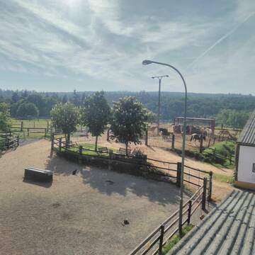
HIT Aktivstall Rosenhof
Mechernich
Aktivstall-Rosenhof
@Aktivstall-Rosenhof
Fahrstall, Kutschwagen
Freizeitstall
Vermieten
Hunde willkommen
Krankenbox
Allergikerstall
bedampftes/gewaschenes Heu
30 weitere...
S
Deprecated: Creation of dynamic property Zend_View_Helper_Ads::$adLink is deprecated in /var/www/stall-frei/htdocs/staging.stall-frei.de/library/Psf/View/Helper/Ads.php on line 108

Das Beste für die Hufe
Mechtersen
STALL-FREIde Marketing
@STALL-FREI-Marketing
Hufschmiede und Hufpfleger in Ihrer Nähe
Reitanlage Hubertushof
Kall-Keldenich
Reitanlage-Hubertushof
@Reitanlage-Hubertushof
FN-Mitglied
Freizeitstall
Hunde willkommen
Longierzirkel/Roundpen
Hengsthaltung möglich
Außenbox mit Paddock
Innenbox
22 weitere...
P
Leider kein Vorschaubild
Leider kein Vorschaubild
Rentnerplatz für Ponywallach mit Familienans.160...
hellenthal
Leonards
@Leonards
Pflegepferd
Wanderreiten
Paddock
Pensions- und Gastboxen
Allergikerstall
Gnadenbrothof
Außenboxen
Paddock Trail
11 weitere...
B
Reitstall Schlaeger - Tomberger Mühle
Euskirchen
Reitstall-Schlaeger
@Reitstall-Schlaeger
FN-Mitglied
Freizeitstall
Vermieten
Führanlage
Hunde willkommen
Außenboxen
Innenbox
20 weitere...
S


Pferdepension, Rentnerpferde willkommen
Blankenheim/Waldorf
Itzbacher-Hof
@Itzbacher-Hof
FN-Mitglied
Freizeitstall
Vermieten
Krankenbox
Paddock
Allergikerstall
Gnadenbrothof
24 weitere...
P+

Boxen frei
Blankenheim
Heinrichshof Blankenheim
@HeinrichshofBlankenheim
FN-Mitglied
Freizeitstall
Vermieten
Hunde willkommen
Krankenbox
bedampftes/gewaschenes Heu
28 weitere...
P

Offenstall für Pferde
Hellenthal, Ramscheid
Beate-Roemer
@Beate-Roemer
VFD-Mitglied
Wanderreiten
Vermieten
Longierzirkel/Roundpen
Paddock
Außenbox mit Paddock
Außenboxen
14 weitere...
P


Hof Klein
Dahlem
Hof-Klein
@Hof-Klein
FN-Mitglied
Freizeitstall
Vermieten
Hunde willkommen
Krankenbox
Allergikerstall
Hufrehe geeignet
29 weitere...
P+

Job gesucht?
Mechtersen
STALL-FREIde Marketing
@STALL-FREI-Marketing
Sie suchen einen Job und arbeiten gerne mit Pferden oder auf Reitanlagen?
Besuchen Sie jetzt unseren Stellenmarkt!

Offenstall mit 24h Heu/Weide und Reitplatz
Mechernich
Veronika Contempree
@Veronika_Contempree
Freizeitstall
Krankenbox
Paddock
Notfallboxen
Offenstall
8 weitere...
P
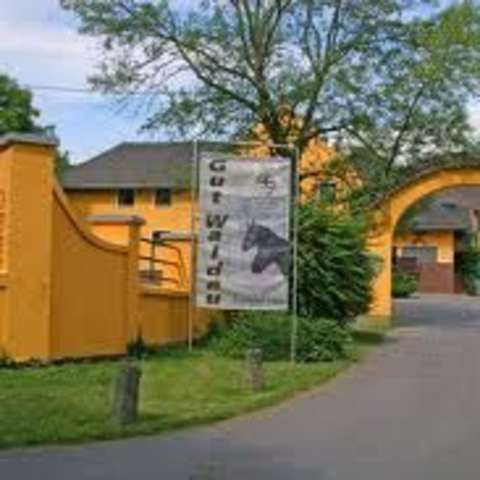
Gut Waldau - Die Reitanlage in Region Köln/Bonn
Rheinbach
Horseconcept Gut Waldau GmbH
@Horseconcept-Gut-Waldau-GmbH
FN-Mitglied
Freizeitstall
Vermieten
Verpachten
Führanlage
Hunde willkommen
Allergikerstall
Fohlenaufzucht möglich
34 weitere...
aktuell
S
Deprecated: Creation of dynamic property Zend_View::$pageCount is deprecated in /var/www/stall-frei/htdocs/staging.stall-frei.de/library/vendor/shardj/zf1-future/library/Zend/View/Abstract.php on line 308
Deprecated: Creation of dynamic property Zend_View::$itemCountPerPage is deprecated in /var/www/stall-frei/htdocs/staging.stall-frei.de/library/vendor/shardj/zf1-future/library/Zend/View/Abstract.php on line 308
Deprecated: Creation of dynamic property Zend_View::$first is deprecated in /var/www/stall-frei/htdocs/staging.stall-frei.de/library/vendor/shardj/zf1-future/library/Zend/View/Abstract.php on line 308
Deprecated: Creation of dynamic property Zend_View::$current is deprecated in /var/www/stall-frei/htdocs/staging.stall-frei.de/library/vendor/shardj/zf1-future/library/Zend/View/Abstract.php on line 308
Deprecated: Creation of dynamic property Zend_View::$last is deprecated in /var/www/stall-frei/htdocs/staging.stall-frei.de/library/vendor/shardj/zf1-future/library/Zend/View/Abstract.php on line 308
Deprecated: Creation of dynamic property Zend_View::$next is deprecated in /var/www/stall-frei/htdocs/staging.stall-frei.de/library/vendor/shardj/zf1-future/library/Zend/View/Abstract.php on line 308
Deprecated: Creation of dynamic property Zend_View::$pagesInRange is deprecated in /var/www/stall-frei/htdocs/staging.stall-frei.de/library/vendor/shardj/zf1-future/library/Zend/View/Abstract.php on line 308
Deprecated: Creation of dynamic property Zend_View::$firstPageInRange is deprecated in /var/www/stall-frei/htdocs/staging.stall-frei.de/library/vendor/shardj/zf1-future/library/Zend/View/Abstract.php on line 308
Deprecated: Creation of dynamic property Zend_View::$lastPageInRange is deprecated in /var/www/stall-frei/htdocs/staging.stall-frei.de/library/vendor/shardj/zf1-future/library/Zend/View/Abstract.php on line 308
Deprecated: Creation of dynamic property Zend_View::$currentItemCount is deprecated in /var/www/stall-frei/htdocs/staging.stall-frei.de/library/vendor/shardj/zf1-future/library/Zend/View/Abstract.php on line 308
Deprecated: Creation of dynamic property Zend_View::$totalItemCount is deprecated in /var/www/stall-frei/htdocs/staging.stall-frei.de/library/vendor/shardj/zf1-future/library/Zend/View/Abstract.php on line 308
Deprecated: Creation of dynamic property Zend_View::$firstItemNumber is deprecated in /var/www/stall-frei/htdocs/staging.stall-frei.de/library/vendor/shardj/zf1-future/library/Zend/View/Abstract.php on line 308
Deprecated: Creation of dynamic property Zend_View::$lastItemNumber is deprecated in /var/www/stall-frei/htdocs/staging.stall-frei.de/library/vendor/shardj/zf1-future/library/Zend/View/Abstract.php on line 308
Deprecated: Creation of dynamic property Zend_View::$router is deprecated in /var/www/stall-frei/htdocs/staging.stall-frei.de/library/vendor/shardj/zf1-future/library/Zend/View/Abstract.php on line 308
Deprecated: Creation of dynamic property Zend_View::$urlParams is deprecated in /var/www/stall-frei/htdocs/staging.stall-frei.de/library/vendor/shardj/zf1-future/library/Zend/View/Abstract.php on line 308
Deprecated: Creation of dynamic property Zend_View::$showAds is deprecated in /var/www/stall-frei/htdocs/staging.stall-frei.de/library/vendor/shardj/zf1-future/library/Zend/View/Abstract.php on line 308
Deprecated: Creation of dynamic property Zend_View::$objectIds is deprecated in /var/www/stall-frei/htdocs/staging.stall-frei.de/library/vendor/shardj/zf1-future/library/Zend/View/Abstract.php on line 308
Deprecated: Creation of dynamic property Zend_View::$showNavbar is deprecated in /var/www/stall-frei/htdocs/staging.stall-frei.de/library/vendor/shardj/zf1-future/library/Zend/View/Abstract.php on line 308
Deprecated: Creation of dynamic property Zend_View::$showBreadcrumb is deprecated in /var/www/stall-frei/htdocs/staging.stall-frei.de/library/vendor/shardj/zf1-future/library/Zend/View/Abstract.php on line 308
Deprecated: Creation of dynamic property Zend_View::$showFooter is deprecated in /var/www/stall-frei/htdocs/staging.stall-frei.de/library/vendor/shardj/zf1-future/library/Zend/View/Abstract.php on line 308
Deprecated: Creation of dynamic property Zend_View::$showInternalAds is deprecated in /var/www/stall-frei/htdocs/staging.stall-frei.de/library/vendor/shardj/zf1-future/library/Zend/View/Abstract.php on line 308
Deprecated: Creation of dynamic property Zend_View::$blNoContent is deprecated in /var/www/stall-frei/htdocs/staging.stall-frei.de/library/vendor/shardj/zf1-future/library/Zend/View/Abstract.php on line 308
Deprecated: Creation of dynamic property Zend_View::$sMetaDesc is deprecated in /var/www/stall-frei/htdocs/staging.stall-frei.de/library/vendor/shardj/zf1-future/library/Zend/View/Abstract.php on line 308
Deprecated: Creation of dynamic property Zend_View::$useGmaps is deprecated in /var/www/stall-frei/htdocs/staging.stall-frei.de/library/vendor/shardj/zf1-future/library/Zend/View/Abstract.php on line 308
Deprecated: Creation of dynamic property Zend_View::$touches is deprecated in /var/www/stall-frei/htdocs/staging.stall-frei.de/library/vendor/shardj/zf1-future/library/Zend/View/Abstract.php on line 308
Deprecated: Creation of dynamic property Zend_View::$oProject is deprecated in /var/www/stall-frei/htdocs/staging.stall-frei.de/library/vendor/shardj/zf1-future/library/Zend/View/Abstract.php on line 308
Deprecated: Creation of dynamic property Zend_View::$pageHeadline is deprecated in /var/www/stall-frei/htdocs/staging.stall-frei.de/library/vendor/shardj/zf1-future/library/Zend/View/Abstract.php on line 308
Deprecated: Creation of dynamic property Zend_View::$disableLocationField is deprecated in /var/www/stall-frei/htdocs/staging.stall-frei.de/library/vendor/shardj/zf1-future/library/Zend/View/Abstract.php on line 308
Deprecated: Creation of dynamic property Zend_View::$isSearch is deprecated in /var/www/stall-frei/htdocs/staging.stall-frei.de/library/vendor/shardj/zf1-future/library/Zend/View/Abstract.php on line 308
Deprecated: Creation of dynamic property Zend_View::$pageTitle is deprecated in /var/www/stall-frei/htdocs/staging.stall-frei.de/library/vendor/shardj/zf1-future/library/Zend/View/Abstract.php on line 308
Deprecated: Creation of dynamic property Psf_Form_Element_Text::$class is deprecated in /var/www/stall-frei/htdocs/staging.stall-frei.de/library/vendor/shardj/zf1-future/library/Zend/Form/Element.php on line 874
Deprecated: Creation of dynamic property Psf_Form_Element_Text::$size is deprecated in /var/www/stall-frei/htdocs/staging.stall-frei.de/library/vendor/shardj/zf1-future/library/Zend/Form/Element.php on line 874
Deprecated: Creation of dynamic property Psf_Form_Element_Text::$placeholder is deprecated in /var/www/stall-frei/htdocs/staging.stall-frei.de/library/vendor/shardj/zf1-future/library/Zend/Form/Element.php on line 874
Deprecated: Creation of dynamic property Psf_Form_Element_Hidden::$class is deprecated in /var/www/stall-frei/htdocs/staging.stall-frei.de/library/vendor/shardj/zf1-future/library/Zend/Form/Element.php on line 874
Deprecated: Creation of dynamic property Psf_Form_Element_Hidden::$class is deprecated in /var/www/stall-frei/htdocs/staging.stall-frei.de/library/vendor/shardj/zf1-future/library/Zend/Form/Element.php on line 874
Deprecated: Creation of dynamic property Psf_Form_Element_Hidden::$class is deprecated in /var/www/stall-frei/htdocs/staging.stall-frei.de/library/vendor/shardj/zf1-future/library/Zend/Form/Element.php on line 874
Deprecated: Creation of dynamic property Psf_Form_Element_Hidden::$class is deprecated in /var/www/stall-frei/htdocs/staging.stall-frei.de/library/vendor/shardj/zf1-future/library/Zend/Form/Element.php on line 874
Deprecated: Creation of dynamic property Psf_Form_Element_Select::$class is deprecated in /var/www/stall-frei/htdocs/staging.stall-frei.de/library/vendor/shardj/zf1-future/library/Zend/Form/Element.php on line 874
Deprecated: Creation of dynamic property Psf_Form_Element_Select::$class is deprecated in /var/www/stall-frei/htdocs/staging.stall-frei.de/library/vendor/shardj/zf1-future/library/Zend/Form/Element.php on line 874
Deprecated: Creation of dynamic property Psf_Form_Element_Select::$class is deprecated in /var/www/stall-frei/htdocs/staging.stall-frei.de/library/vendor/shardj/zf1-future/library/Zend/Form/Element.php on line 874
Deprecated: Creation of dynamic property Psf_Form_Element_Select::$class is deprecated in /var/www/stall-frei/htdocs/staging.stall-frei.de/library/vendor/shardj/zf1-future/library/Zend/Form/Element.php on line 874
Deprecated: Creation of dynamic property Psf_Form_Element_Text::$class is deprecated in /var/www/stall-frei/htdocs/staging.stall-frei.de/library/vendor/shardj/zf1-future/library/Zend/Form/Element.php on line 874
Deprecated: Creation of dynamic property Psf_Form_Element_Checkbox::$label is deprecated in /var/www/stall-frei/htdocs/staging.stall-frei.de/library/vendor/shardj/zf1-future/library/Zend/Form/Element.php on line 874
Deprecated: Creation of dynamic property Zend_View::$sort is deprecated in /var/www/stall-frei/htdocs/staging.stall-frei.de/library/vendor/shardj/zf1-future/library/Zend/View/Abstract.php on line 308
Deprecated: Creation of dynamic property Zend_View::$searchLocation is deprecated in /var/www/stall-frei/htdocs/staging.stall-frei.de/library/vendor/shardj/zf1-future/library/Zend/View/Abstract.php on line 308
Deprecated: Creation of dynamic property Zend_View::$locationHint is deprecated in /var/www/stall-frei/htdocs/staging.stall-frei.de/library/vendor/shardj/zf1-future/library/Zend/View/Abstract.php on line 308
Psf_GeoCoder_Abstract::getLocation: Rinnen Get Location CachedOrLive
Psf_GeoCoder_Abstract::getCachedOrLive: Rinnen
Psf_GeoCoder_OpenCageData::makeApiRequest: response:
Array
(
[documentation] => https://opencagedata.com/api
[licenses] => Array
(
[0] => Array
(
[name] => see attribution guide
[url] => https://opencagedata.com/credits
)
)
[results] => Array
(
[0] => Array
(
[bounds] => Array
(
[northeast] => Array
(
[lat] => 50.5334292
[lng] => 6.563031
)
[southwest] => Array
(
[lat] => 50.4934292
[lng] => 6.523031
)
)
[components] => Array
(
[ISO_3166-1_alpha-2] => DE
[ISO_3166-1_alpha-3] => DEU
[ISO_3166-2] => Array
(
[0] => DE-NW
)
[_category] => place
[_normalized_city] => Kall
[_type] => village
[continent] => Europe
[country] => Deutschland
[country_code] => de
[county] => Kreis Euskirchen
[political_union] => European Union
[postcode] => 53925
[state] => Nordrhein-Westfalen
[state_code] => NW
[town] => Kall
[village] => Rinnen
)
[confidence] => 7
[formatted] => 53925 Rinnen, Deutschland
[geometry] => Array
(
[lat] => 50.5134292
[lng] => 6.543031
)
)
[1] => Array
(
[bounds] => Array
(
[northeast] => Array
(
[lat] => 49.150006
[lng] => 9.6887583
)
[southwest] => Array
(
[lat] => 49.110006
[lng] => 9.6487583
)
)
[components] => Array
(
[ISO_3166-1_alpha-2] => DE
[ISO_3166-1_alpha-3] => DEU
[ISO_3166-2] => Array
(
[0] => DE-BW
)
[_category] => place
[_normalized_city] => Michelfeld
[_type] => hamlet
[continent] => Europe
[country] => Deutschland
[country_code] => de
[county] => Landkreis Schwäbisch Hall
[hamlet] => Rinnen
[municipality] => VVG der Stadt Schwäbisch Hall
[political_union] => European Union
[postcode] => 74545
[state] => Baden-Württemberg
[state_code] => BW
[village] => Michelfeld
)
[confidence] => 7
[formatted] => Rinnen, 74545 Michelfeld, Deutschland
[geometry] => Array
(
[lat] => 49.130006
[lng] => 9.6687583
)
)
[2] => Array
(
[bounds] => Array
(
[northeast] => Array
(
[lat] => 48.1973864
[lng] => 8.7923736
)
[southwest] => Array
(
[lat] => 48.1794845
[lng] => 8.7559029
)
)
[components] => Array
(
[ISO_3166-1_alpha-2] => DE
[ISO_3166-1_alpha-3] => DEU
[ISO_3166-2] => Array
(
[0] => DE-BW
)
[_category] => place
[_normalized_city] => Weilen unter den Rinnen
[_type] => village
[continent] => Europe
[country] => Deutschland
[country_code] => de
[county] => Zollernalbkreis
[municipality] => GVV Oberes Schlichemtal
[political_union] => European Union
[postcode] => 72367
[state] => Baden-Württemberg
[state_code] => BW
[village] => Weilen unter den Rinnen
)
[confidence] => 7
[formatted] => 72367 Weilen unter den Rinnen, Deutschland
[geometry] => Array
(
[lat] => 48.1892472
[lng] => 8.7662297
)
)
[3] => Array
(
[components] => Array
(
[ISO_3166-1_alpha-2] => FR
[ISO_3166-1_alpha-3] => FRA
[ISO_3166-2] => Array
(
[0] => FR-IDF
[1] => FR-92
)
[_category] => road
[_normalized_city] => Levallois-Perret
[_type] => road
[city] => Levallois-Perret
[continent] => Europe
[country] => France
[country_code] => fr
[county] => Hauts-de-Seine
[local_authority] => Métropole du Grand Paris
[political_union] => European Union
[postcode] => 92300
[road] => Rue Charles Deutschmann
[state] => Île-de-France
[state_code] => IDF
)
[confidence] => 3
[formatted] => Rue Charles Deutschmann, 92300 Levallois-Perret, France
[geometry] => Array
(
[lat] => 48.900049
[lng] => 2.2842
)
)
[4] => Array
(
[components] => Array
(
[ISO_3166-1_alpha-2] => FR
[ISO_3166-1_alpha-3] => FRA
[ISO_3166-2] => Array
(
[0] => FR-GES
[1] => FR-6AE
[2] => FR-68
)
[_category] => road
[_normalized_city] => Mooslargue
[_type] => road
[city] => Mooslargue
[continent] => Europe
[country] => France
[country_code] => fr
[county] => Haut-Rhin
[local_authority] => Communauté de communes Sud Alsace Largue
[political_union] => European Union
[postcode] => 68580
[road] => Rue des Binnen
[state] => Grand Est
[state_code] => GES
)
[confidence] => 2
[formatted] => Rue des Binnen, 68580 Mooslargue, France
[geometry] => Array
(
[lat] => 47.518533
[lng] => 7.210134
)
)
[5] => Array
(
[components] => Array
(
[ISO_3166-1_alpha-2] => FR
[ISO_3166-1_alpha-3] => FRA
[ISO_3166-2] => Array
(
[0] => FR-BRE
[1] => FR-22
)
[_category] => road
[_normalized_city] => Penvénan
[_type] => road
[city] => Penvénan
[continent] => Europe
[country] => France
[country_code] => fr
[county] => Côtes-d'Armor
[local_authority] => Lannion-Trégor Communauté
[political_union] => European Union
[postcode] => 22710
[road] => Binen
[state] => Bretagne
[state_code] => BRE
)
[confidence] => 2
[formatted] => Binen, 22710 Penvénan, France
[geometry] => Array
(
[lat] => 48.799699
[lng] => -3.308782
)
)
[6] => Array
(
[components] => Array
(
[ISO_3166-1_alpha-2] => FR
[ISO_3166-1_alpha-3] => FRA
[ISO_3166-2] => Array
(
[0] => FR-GES
[1] => FR-6AE
[2] => FR-68
)
[_category] => road
[_normalized_city] => Burnhaupt-le-Haut
[_type] => road
[city] => Burnhaupt-le-Haut
[continent] => Europe
[country] => France
[country_code] => fr
[county] => Haut-Rhin
[local_authority] => Communauté de communes de la Vallée de la Doller et du Soultzbach
[political_union] => European Union
[postcode] => 68520
[road] => Rue Binnen
[state] => Grand Est
[state_code] => GES
)
[confidence] => 2
[formatted] => Rue Binnen, 68520 Burnhaupt-le-Haut, France
[geometry] => Array
(
[lat] => 47.730438
[lng] => 7.14766
)
)
[7] => Array
(
[components] => Array
(
[ISO_3166-1_alpha-2] => FR
[ISO_3166-1_alpha-3] => FRA
[ISO_3166-2] => Array
(
[0] => FR-GES
[1] => FR-6AE
[2] => FR-67
)
[_category] => road
[_normalized_city] => Limersheim
[_type] => road
[city] => Limersheim
[continent] => Europe
[country] => France
[country_code] => fr
[county] => Bas-Rhin
[local_authority] => Communauté de communes du Canton d'Erstein
[political_union] => European Union
[postcode] => 67150
[road] => Rue Binnen
[state] => Grand Est
[state_code] => GES
)
[confidence] => 2
[formatted] => Rue Binnen, 67150 Limersheim, France
[geometry] => Array
(
[lat] => 48.453782
[lng] => 7.642219
)
)
[8] => Array
(
[components] => Array
(
[ISO_3166-1_alpha-2] => FR
[ISO_3166-1_alpha-3] => FRA
[ISO_3166-2] => Array
(
[0] => FR-BRE
[1] => FR-35
)
[_category] => road
[_normalized_city] => Val-Couesnon
[_type] => road
[city] => Val-Couesnon
[continent] => Europe
[country] => France
[country_code] => fr
[county] => Ille-et-Vilaine
[local_authority] => Couesnon Marches de Bretagne
[political_union] => European Union
[postcode] => 35460
[road] => Rinan
[state] => Bretagne
[state_code] => BRE
)
[confidence] => 2
[formatted] => Rinan, 35460 Val-Couesnon, France
[geometry] => Array
(
[lat] => 48.399191
[lng] => -1.484833
)
)
[9] => Array
(
[components] => Array
(
[ISO_3166-1_alpha-2] => FR
[ISO_3166-1_alpha-3] => FRA
[ISO_3166-2] => Array
(
[0] => FR-PDL
[1] => FR-44
)
[_category] => road
[_normalized_city] => Batz-sur-Mer
[_type] => road
[city] => Batz-sur-Mer
[continent] => Europe
[country] => France
[country_code] => fr
[county] => Loire-Atlantique
[local_authority] => Communauté d'agglomération de la Presqu'île de Guérande - Atlantique
[political_union] => European Union
[postcode] => 44740
[road] => Impasse de l'Etang du Binen
[state] => Pays de la Loire
[state_code] => PDL
)
[confidence] => 10
[formatted] => Impasse de l'Etang du Binen, 44740 Batz-sur-Mer, France
[geometry] => Array
(
[lat] => 47.277301
[lng] => -2.455227
)
)
)
[status] => Array
(
[code] => 200
[message] => OK
)
[stay_informed] => Array
(
[blog] => https://blog.opencagedata.com
[mastodon] => https://en.osm.town/@opencage
)
[thanks] => For using an OpenCage API
[timestamp] => Array
(
[created_http] => Sat, 07 Feb 2026 14:59:46 GMT
[created_unix] => 1770476386
)
[total_results] => 10
)
Psf_GeoCoder_Abstract::convertLocationResult
{"documentation":"https:\/\/opencagedata.com\/api","licenses":[{"name":"see attribution guide","url":"https:\/\/opencagedata.com\/credits"}],"results":[{"bounds":{"northeast":{"lat":50.5334292,"lng":6.563031},"southwest":{"lat":50.4934292,"lng":6.523031}},"components":{"ISO_3166-1_alpha-2":"DE","ISO_3166-1_alpha-3":"DEU","ISO_3166-2":["DE-NW"],"_category":"place","_normalized_city":"Kall","_type":"village","continent":"Europe","country":"Deutschland","country_code":"de","county":"Kreis Euskirchen","political_union":"European Union","postcode":"53925","state":"Nordrhein-Westfalen","state_code":"NW","town":"Kall","village":"Rinnen"},"confidence":7,"formatted":"53925 Rinnen, Deutschland","geometry":{"lat":50.5134292,"lng":6.543031}},{"bounds":{"northeast":{"lat":49.150006,"lng":9.6887583},"southwest":{"lat":49.110006,"lng":9.6487583}},"components":{"ISO_3166-1_alpha-2":"DE","ISO_3166-1_alpha-3":"DEU","ISO_3166-2":["DE-BW"],"_category":"place","_normalized_city":"Michelfeld","_type":"hamlet","continent":"Europe","country":"Deutschland","country_code":"de","county":"Landkreis Schw\u00e4bisch Hall","hamlet":"Rinnen","municipality":"VVG der Stadt Schw\u00e4bisch Hall","political_union":"European Union","postcode":"74545","state":"Baden-W\u00fcrttemberg","state_code":"BW","village":"Michelfeld"},"confidence":7,"formatted":"Rinnen, 74545 Michelfeld, Deutschland","geometry":{"lat":49.130006,"lng":9.6687583}},{"bounds":{"northeast":{"lat":48.1973864,"lng":8.7923736},"southwest":{"lat":48.1794845,"lng":8.7559029}},"components":{"ISO_3166-1_alpha-2":"DE","ISO_3166-1_alpha-3":"DEU","ISO_3166-2":["DE-BW"],"_category":"place","_normalized_city":"Weilen unter den Rinnen","_type":"village","continent":"Europe","country":"Deutschland","country_code":"de","county":"Zollernalbkreis","municipality":"GVV Oberes Schlichemtal","political_union":"European Union","postcode":"72367","state":"Baden-W\u00fcrttemberg","state_code":"BW","village":"Weilen unter den Rinnen"},"confidence":7,"formatted":"72367 Weilen unter den Rinnen, Deutschland","geometry":{"lat":48.1892472,"lng":8.7662297}},{"components":{"ISO_3166-1_alpha-2":"FR","ISO_3166-1_alpha-3":"FRA","ISO_3166-2":["FR-IDF","FR-92"],"_category":"road","_normalized_city":"Levallois-Perret","_type":"road","city":"Levallois-Perret","continent":"Europe","country":"France","country_code":"fr","county":"Hauts-de-Seine","local_authority":"M\u00e9tropole du Grand Paris","political_union":"European Union","postcode":"92300","road":"Rue Charles Deutschmann","state":"\u00cele-de-France","state_code":"IDF"},"confidence":3,"formatted":"Rue Charles Deutschmann, 92300 Levallois-Perret, France","geometry":{"lat":48.900049,"lng":2.2842}},{"components":{"ISO_3166-1_alpha-2":"FR","ISO_3166-1_alpha-3":"FRA","ISO_3166-2":["FR-GES","FR-6AE","FR-68"],"_category":"road","_normalized_city":"Mooslargue","_type":"road","city":"Mooslargue","continent":"Europe","country":"France","country_code":"fr","county":"Haut-Rhin","local_authority":"Communaut\u00e9 de communes Sud Alsace Largue","political_union":"European Union","postcode":"68580","road":"Rue des Binnen","state":"Grand Est","state_code":"GES"},"confidence":2,"formatted":"Rue des Binnen, 68580 Mooslargue, France","geometry":{"lat":47.518533,"lng":7.210134}},{"components":{"ISO_3166-1_alpha-2":"FR","ISO_3166-1_alpha-3":"FRA","ISO_3166-2":["FR-BRE","FR-22"],"_category":"road","_normalized_city":"Penv\u00e9nan","_type":"road","city":"Penv\u00e9nan","continent":"Europe","country":"France","country_code":"fr","county":"C\u00f4tes-d'Armor","local_authority":"Lannion-Tr\u00e9gor Communaut\u00e9","political_union":"European Union","postcode":"22710","road":"Binen","state":"Bretagne","state_code":"BRE"},"confidence":2,"formatted":"Binen, 22710 Penv\u00e9nan, France","geometry":{"lat":48.799699,"lng":-3.308782}},{"components":{"ISO_3166-1_alpha-2":"FR","ISO_3166-1_alpha-3":"FRA","ISO_3166-2":["FR-GES","FR-6AE","FR-68"],"_category":"road","_normalized_city":"Burnhaupt-le-Haut","_type":"road","city":"Burnhaupt-le-Haut","continent":"Europe","country":"France","country_code":"fr","county":"Haut-Rhin","local_authority":"Communaut\u00e9 de communes de la Vall\u00e9e de la Doller et du Soultzbach","political_union":"European Union","postcode":"68520","road":"Rue Binnen","state":"Grand Est","state_code":"GES"},"confidence":2,"formatted":"Rue Binnen, 68520 Burnhaupt-le-Haut, France","geometry":{"lat":47.730438,"lng":7.14766}},{"components":{"ISO_3166-1_alpha-2":"FR","ISO_3166-1_alpha-3":"FRA","ISO_3166-2":["FR-GES","FR-6AE","FR-67"],"_category":"road","_normalized_city":"Limersheim","_type":"road","city":"Limersheim","continent":"Europe","country":"France","country_code":"fr","county":"Bas-Rhin","local_authority":"Communaut\u00e9 de communes du Canton d'Erstein","political_union":"European Union","postcode":"67150","road":"Rue Binnen","state":"Grand Est","state_code":"GES"},"confidence":2,"formatted":"Rue Binnen, 67150 Limersheim, France","geometry":{"lat":48.453782,"lng":7.642219}},{"components":{"ISO_3166-1_alpha-2":"FR","ISO_3166-1_alpha-3":"FRA","ISO_3166-2":["FR-BRE","FR-35"],"_category":"road","_normalized_city":"Val-Couesnon","_type":"road","city":"Val-Couesnon","continent":"Europe","country":"France","country_code":"fr","county":"Ille-et-Vilaine","local_authority":"Couesnon Marches de Bretagne","political_union":"European Union","postcode":"35460","road":"Rinan","state":"Bretagne","state_code":"BRE"},"confidence":2,"formatted":"Rinan, 35460 Val-Couesnon, France","geometry":{"lat":48.399191,"lng":-1.484833}},{"components":{"ISO_3166-1_alpha-2":"FR","ISO_3166-1_alpha-3":"FRA","ISO_3166-2":["FR-PDL","FR-44"],"_category":"road","_normalized_city":"Batz-sur-Mer","_type":"road","city":"Batz-sur-Mer","continent":"Europe","country":"France","country_code":"fr","county":"Loire-Atlantique","local_authority":"Communaut\u00e9 d'agglom\u00e9ration de la Presqu'\u00eele de Gu\u00e9rande - Atlantique","political_union":"European Union","postcode":"44740","road":"Impasse de l'Etang du Binen","state":"Pays de la Loire","state_code":"PDL"},"confidence":10,"formatted":"Impasse de l'Etang du Binen, 44740 Batz-sur-Mer, France","geometry":{"lat":47.277301,"lng":-2.455227}}],"status":{"code":200,"message":"OK"},"stay_informed":{"blog":"https:\/\/blog.opencagedata.com","mastodon":"https:\/\/en.osm.town\/@opencage"},"thanks":"For using an OpenCage API","timestamp":{"created_http":"Sat, 07 Feb 2026 14:59:46 GMT","created_unix":1770476386},"total_results":10}Array
(
[0] => stdClass Object
(
[bounds] => stdClass Object
(
[northeast] => stdClass Object
(
[lat] => 50.5334292
[lng] => 6.563031
)
[southwest] => stdClass Object
(
[lat] => 50.4934292
[lng] => 6.523031
)
)
[components] => stdClass Object
(
[ISO_3166-1_alpha-2] => DE
[ISO_3166-1_alpha-3] => DEU
[ISO_3166-2] => Array
(
[0] => DE-NW
)
[_category] => place
[_normalized_city] => Kall
[_type] => village
[continent] => Europe
[country] => Deutschland
[country_code] => de
[county] => Kreis Euskirchen
[political_union] => European Union
[postcode] => 53925
[state] => Nordrhein-Westfalen
[state_code] => NW
[town] => Kall
[village] => Rinnen
)
[confidence] => 7
[formatted] => 53925 Rinnen, Deutschland
[geometry] => stdClass Object
(
[lat] => 50.5134292
[lng] => 6.543031
)
)
[1] => stdClass Object
(
[bounds] => stdClass Object
(
[northeast] => stdClass Object
(
[lat] => 49.150006
[lng] => 9.6887583
)
[southwest] => stdClass Object
(
[lat] => 49.110006
[lng] => 9.6487583
)
)
[components] => stdClass Object
(
[ISO_3166-1_alpha-2] => DE
[ISO_3166-1_alpha-3] => DEU
[ISO_3166-2] => Array
(
[0] => DE-BW
)
[_category] => place
[_normalized_city] => Michelfeld
[_type] => hamlet
[continent] => Europe
[country] => Deutschland
[country_code] => de
[county] => Landkreis Schwäbisch Hall
[hamlet] => Rinnen
[municipality] => VVG der Stadt Schwäbisch Hall
[political_union] => European Union
[postcode] => 74545
[state] => Baden-Württemberg
[state_code] => BW
[village] => Michelfeld
)
[confidence] => 7
[formatted] => Rinnen, 74545 Michelfeld, Deutschland
[geometry] => stdClass Object
(
[lat] => 49.130006
[lng] => 9.6687583
)
)
[2] => stdClass Object
(
[bounds] => stdClass Object
(
[northeast] => stdClass Object
(
[lat] => 48.1973864
[lng] => 8.7923736
)
[southwest] => stdClass Object
(
[lat] => 48.1794845
[lng] => 8.7559029
)
)
[components] => stdClass Object
(
[ISO_3166-1_alpha-2] => DE
[ISO_3166-1_alpha-3] => DEU
[ISO_3166-2] => Array
(
[0] => DE-BW
)
[_category] => place
[_normalized_city] => Weilen unter den Rinnen
[_type] => village
[continent] => Europe
[country] => Deutschland
[country_code] => de
[county] => Zollernalbkreis
[municipality] => GVV Oberes Schlichemtal
[political_union] => European Union
[postcode] => 72367
[state] => Baden-Württemberg
[state_code] => BW
[village] => Weilen unter den Rinnen
)
[confidence] => 7
[formatted] => 72367 Weilen unter den Rinnen, Deutschland
[geometry] => stdClass Object
(
[lat] => 48.1892472
[lng] => 8.7662297
)
)
[3] => stdClass Object
(
[components] => stdClass Object
(
[ISO_3166-1_alpha-2] => FR
[ISO_3166-1_alpha-3] => FRA
[ISO_3166-2] => Array
(
[0] => FR-IDF
[1] => FR-92
)
[_category] => road
[_normalized_city] => Levallois-Perret
[_type] => road
[city] => Levallois-Perret
[continent] => Europe
[country] => France
[country_code] => fr
[county] => Hauts-de-Seine
[local_authority] => Métropole du Grand Paris
[political_union] => European Union
[postcode] => 92300
[road] => Rue Charles Deutschmann
[state] => Île-de-France
[state_code] => IDF
)
[confidence] => 3
[formatted] => Rue Charles Deutschmann, 92300 Levallois-Perret, France
[geometry] => stdClass Object
(
[lat] => 48.900049
[lng] => 2.2842
)
)
[4] => stdClass Object
(
[components] => stdClass Object
(
[ISO_3166-1_alpha-2] => FR
[ISO_3166-1_alpha-3] => FRA
[ISO_3166-2] => Array
(
[0] => FR-GES
[1] => FR-6AE
[2] => FR-68
)
[_category] => road
[_normalized_city] => Mooslargue
[_type] => road
[city] => Mooslargue
[continent] => Europe
[country] => France
[country_code] => fr
[county] => Haut-Rhin
[local_authority] => Communauté de communes Sud Alsace Largue
[political_union] => European Union
[postcode] => 68580
[road] => Rue des Binnen
[state] => Grand Est
[state_code] => GES
)
[confidence] => 2
[formatted] => Rue des Binnen, 68580 Mooslargue, France
[geometry] => stdClass Object
(
[lat] => 47.518533
[lng] => 7.210134
)
)
[5] => stdClass Object
(
[components] => stdClass Object
(
[ISO_3166-1_alpha-2] => FR
[ISO_3166-1_alpha-3] => FRA
[ISO_3166-2] => Array
(
[0] => FR-BRE
[1] => FR-22
)
[_category] => road
[_normalized_city] => Penvénan
[_type] => road
[city] => Penvénan
[continent] => Europe
[country] => France
[country_code] => fr
[county] => Côtes-d'Armor
[local_authority] => Lannion-Trégor Communauté
[political_union] => European Union
[postcode] => 22710
[road] => Binen
[state] => Bretagne
[state_code] => BRE
)
[confidence] => 2
[formatted] => Binen, 22710 Penvénan, France
[geometry] => stdClass Object
(
[lat] => 48.799699
[lng] => -3.308782
)
)
[6] => stdClass Object
(
[components] => stdClass Object
(
[ISO_3166-1_alpha-2] => FR
[ISO_3166-1_alpha-3] => FRA
[ISO_3166-2] => Array
(
[0] => FR-GES
[1] => FR-6AE
[2] => FR-68
)
[_category] => road
[_normalized_city] => Burnhaupt-le-Haut
[_type] => road
[city] => Burnhaupt-le-Haut
[continent] => Europe
[country] => France
[country_code] => fr
[county] => Haut-Rhin
[local_authority] => Communauté de communes de la Vallée de la Doller et du Soultzbach
[political_union] => European Union
[postcode] => 68520
[road] => Rue Binnen
[state] => Grand Est
[state_code] => GES
)
[confidence] => 2
[formatted] => Rue Binnen, 68520 Burnhaupt-le-Haut, France
[geometry] => stdClass Object
(
[lat] => 47.730438
[lng] => 7.14766
)
)
[7] => stdClass Object
(
[components] => stdClass Object
(
[ISO_3166-1_alpha-2] => FR
[ISO_3166-1_alpha-3] => FRA
[ISO_3166-2] => Array
(
[0] => FR-GES
[1] => FR-6AE
[2] => FR-67
)
[_category] => road
[_normalized_city] => Limersheim
[_type] => road
[city] => Limersheim
[continent] => Europe
[country] => France
[country_code] => fr
[county] => Bas-Rhin
[local_authority] => Communauté de communes du Canton d'Erstein
[political_union] => European Union
[postcode] => 67150
[road] => Rue Binnen
[state] => Grand Est
[state_code] => GES
)
[confidence] => 2
[formatted] => Rue Binnen, 67150 Limersheim, France
[geometry] => stdClass Object
(
[lat] => 48.453782
[lng] => 7.642219
)
)
[8] => stdClass Object
(
[components] => stdClass Object
(
[ISO_3166-1_alpha-2] => FR
[ISO_3166-1_alpha-3] => FRA
[ISO_3166-2] => Array
(
[0] => FR-BRE
[1] => FR-35
)
[_category] => road
[_normalized_city] => Val-Couesnon
[_type] => road
[city] => Val-Couesnon
[continent] => Europe
[country] => France
[country_code] => fr
[county] => Ille-et-Vilaine
[local_authority] => Couesnon Marches de Bretagne
[political_union] => European Union
[postcode] => 35460
[road] => Rinan
[state] => Bretagne
[state_code] => BRE
)
[confidence] => 2
[formatted] => Rinan, 35460 Val-Couesnon, France
[geometry] => stdClass Object
(
[lat] => 48.399191
[lng] => -1.484833
)
)
[9] => stdClass Object
(
[components] => stdClass Object
(
[ISO_3166-1_alpha-2] => FR
[ISO_3166-1_alpha-3] => FRA
[ISO_3166-2] => Array
(
[0] => FR-PDL
[1] => FR-44
)
[_category] => road
[_normalized_city] => Batz-sur-Mer
[_type] => road
[city] => Batz-sur-Mer
[continent] => Europe
[country] => France
[country_code] => fr
[county] => Loire-Atlantique
[local_authority] => Communauté d'agglomération de la Presqu'île de Guérande - Atlantique
[political_union] => European Union
[postcode] => 44740
[road] => Impasse de l'Etang du Binen
[state] => Pays de la Loire
[state_code] => PDL
)
[confidence] => 10
[formatted] => Impasse de l'Etang du Binen, 44740 Batz-sur-Mer, France
[geometry] => stdClass Object
(
[lat] => 47.277301
[lng] => -2.455227
)
)
)
Psf_GeoCoder_OpenCageData::getKeyMap: 0
stdClass Object
(
    [bounds] => stdClass Object
        (
            [northeast] => stdClass Object
                (
                    [lat] => 50.5334292
                    [lng] => 6.563031
                )

            [southwest] => stdClass Object
                (
                    [lat] => 50.4934292
                    [lng] => 6.523031
                )

        )

    [components] => stdClass Object
        (
            [ISO_3166-1_alpha-2] => DE
            [ISO_3166-1_alpha-3] => DEU
            [ISO_3166-2] => Array
                (
                    [0] => DE-NW
                )

            [_category] => place
            [_normalized_city] => Kall
            [_type] => village
            [continent] => Europe
            [country] => Deutschland
            [country_code] => de
            [county] => Kreis Euskirchen
            [political_union] => European Union
            [postcode] => 53925
            [state] => Nordrhein-Westfalen
            [state_code] => NW
            [town] => Kall
            [village] => Rinnen
        )

    [confidence] => 7
    [formatted] => 53925 Rinnen, Deutschland
    [geometry] => stdClass Object
        (
            [lat] => 50.5134292
            [lng] => 6.543031
        )

)
Psf_GeoCoder_OpenCageData::getCounty: Euskirchen
Psf_GeoCoder_OpenCageData::addMissingData REFETCH!
Array
(
    [address] => 53925 Rinnen, Deutschland
    [type] => village
    [street] =>
    [city] => Kall
    [county] => Euskirchen
    [state] => Nordrhein-Westfalen
    [zip] => 53925
    [country] => Deutschland
    [suburb] =>
    [countrycode] => de
    [latitude] => 50.5134292
    [longitude] => 6.543031
    [accuracy] => 1
    [confidence] => 7
    [bounds] => stdClass Object
        (
            [northeast] => stdClass Object
                (
                    [lat] => 50.5334292
                    [lng] => 6.563031
                )

            [southwest] => stdClass Object
                (
                    [lat] => 50.4934292
                    [lng] => 6.523031
                )

        )

)
reformat!
Array
(
    [address] => 53925 Kall
    [type] => village
    [street] =>
    [city] => Kall
    [county] => Euskirchen
    [state] => Nordrhein-Westfalen
    [zip] => 53925
    [country] => Deutschland
    [suburb] =>
    [countrycode] => de
    [latitude] => 50.5134292
    [longitude] => 6.543031
    [accuracy] => 1
    [confidence] => 7
    [bounds] => stdClass Object
        (
            [northeast] => stdClass Object
                (
                    [lat] => 50.5334292
                    [lng] => 6.563031
                )

            [southwest] => stdClass Object
                (
                    [lat] => 50.4934292
                    [lng] => 6.523031
                )

        )

    [place] => 53925 Kall, Nordrhein-Westfalen
    [hash] => f539995658b702097e3ef07b7ab16e62
)
Psf_GeoCoder_OpenCageData::getKeyMap: 1
stdClass Object
(
    [bounds] => stdClass Object
        (
            [northeast] => stdClass Object
                (
                    [lat] => 49.150006
                    [lng] => 9.6887583
                )

            [southwest] => stdClass Object
                (
                    [lat] => 49.110006
                    [lng] => 9.6487583
                )

        )

    [components] => stdClass Object
        (
            [ISO_3166-1_alpha-2] => DE
            [ISO_3166-1_alpha-3] => DEU
            [ISO_3166-2] => Array
                (
                    [0] => DE-BW
                )

            [_category] => place
            [_normalized_city] => Michelfeld
            [_type] => hamlet
            [continent] => Europe
            [country] => Deutschland
            [country_code] => de
            [county] => Landkreis Schwäbisch Hall
            [hamlet] => Rinnen
            [municipality] => VVG der Stadt Schwäbisch Hall
            [political_union] => European Union
            [postcode] => 74545
            [state] => Baden-Württemberg
            [state_code] => BW
            [village] => Michelfeld
        )

    [confidence] => 7
    [formatted] => Rinnen, 74545 Michelfeld, Deutschland
    [geometry] => stdClass Object
        (
            [lat] => 49.130006
            [lng] => 9.6687583
        )

)
Psf_GeoCoder_OpenCageData::getCounty: Schwäbisch Hall
Psf_GeoCoder_OpenCageData::addMissingData REFETCH!
Array
(
    [address] => Rinnen, 74545 Michelfeld, Deutschland
    [type] => hamlet
    [street] => Rinnen
    [city] => Michelfeld
    [county] => Schwäbisch Hall
    [state] => Baden-Württemberg
    [zip] => 74545
    [country] => Deutschland
    [suburb] =>
    [countrycode] => de
    [latitude] => 49.130006
    [longitude] => 9.6687583
    [accuracy] => 1
    [confidence] => 7
    [bounds] => stdClass Object
        (
            [northeast] => stdClass Object
                (
                    [lat] => 49.150006
                    [lng] => 9.6887583
                )

            [southwest] => stdClass Object
                (
                    [lat] => 49.110006
                    [lng] => 9.6487583
                )

        )

)
reformat!
Array
(
    [address] => Rinnen, 74545 Michelfeld, Deutschland
    [type] => hamlet
    [street] => Rinnen
    [city] => Michelfeld
    [county] => Schwäbisch Hall
    [state] => Baden-Württemberg
    [zip] => 74545
    [country] => Deutschland
    [suburb] =>
    [countrycode] => de
    [latitude] => 49.130006
    [longitude] => 9.6687583
    [accuracy] => 1
    [confidence] => 7
    [bounds] => stdClass Object
        (
            [northeast] => stdClass Object
                (
                    [lat] => 49.150006
                    [lng] => 9.6887583
                )

            [southwest] => stdClass Object
                (
                    [lat] => 49.110006
                    [lng] => 9.6487583
                )

        )

    [place] => Rinnen, 74545 Michelfeld, Baden-Württemberg
    [hash] => 9c679be9d79b56b4295f15fd3c78eac0
)
Psf_GeoCoder_OpenCageData::getKeyMap: 2
stdClass Object
(
    [bounds] => stdClass Object
        (
            [northeast] => stdClass Object
                (
                    [lat] => 48.1973864
                    [lng] => 8.7923736
                )

            [southwest] => stdClass Object
                (
                    [lat] => 48.1794845
                    [lng] => 8.7559029
                )

        )

    [components] => stdClass Object
        (
            [ISO_3166-1_alpha-2] => DE
            [ISO_3166-1_alpha-3] => DEU
            [ISO_3166-2] => Array
                (
                    [0] => DE-BW
                )

            [_category] => place
            [_normalized_city] => Weilen unter den Rinnen
            [_type] => village
            [continent] => Europe
            [country] => Deutschland
            [country_code] => de
            [county] => Zollernalbkreis
            [municipality] => GVV Oberes Schlichemtal
            [political_union] => European Union
            [postcode] => 72367
            [state] => Baden-Württemberg
            [state_code] => BW
            [village] => Weilen unter den Rinnen
        )

    [confidence] => 7
    [formatted] => 72367 Weilen unter den Rinnen, Deutschland
    [geometry] => stdClass Object
        (
            [lat] => 48.1892472
            [lng] => 8.7662297
        )

)
Psf_GeoCoder_OpenCageData::getCounty: Zollernalbkreis
Psf_GeoCoder_OpenCageData::addMissingData REFETCH!
Array
(
    [address] => 72367 Weilen unter den Rinnen, Deutschland
    [type] => village
    [street] =>
    [city] => Weilen unter den Rinnen
    [county] => Zollernalbkreis
    [state] => Baden-Württemberg
    [zip] => 72367
    [country] => Deutschland
    [suburb] =>
    [countrycode] => de
    [latitude] => 48.1892472
    [longitude] => 8.7662297
    [accuracy] => 1
    [confidence] => 7
    [bounds] => stdClass Object
        (
            [northeast] => stdClass Object
                (
                    [lat] => 48.1973864
                    [lng] => 8.7923736
                )

            [southwest] => stdClass Object
                (
                    [lat] => 48.1794845
                    [lng] => 8.7559029
                )

        )

)
reformat!
Array
(
    [address] => 72367 Weilen unter den Rinnen, Deutschland
    [type] => village
    [street] =>
    [city] => Weilen unter den Rinnen
    [county] => Zollernalbkreis
    [state] => Baden-Württemberg
    [zip] => 72367
    [country] => Deutschland
    [suburb] =>
    [countrycode] => de
    [latitude] => 48.1892472
    [longitude] => 8.7662297
    [accuracy] => 1
    [confidence] => 7
    [bounds] => stdClass Object
        (
            [northeast] => stdClass Object
                (
                    [lat] => 48.1973864
                    [lng] => 8.7923736
                )

            [southwest] => stdClass Object
                (
                    [lat] => 48.1794845
                    [lng] => 8.7559029
                )

        )

    [place] => 72367 Weilen unter den Rinnen, Baden-Württemberg
    [hash] => ed2a302f0f8e5c4b57253d2595b8a096
)
Psf_GeoCoder_OpenCageData::getKeyMap: 3
stdClass Object
(
    [components] => stdClass Object
        (
            [ISO_3166-1_alpha-2] => FR
            [ISO_3166-1_alpha-3] => FRA
            [ISO_3166-2] => Array
                (
                    [0] => FR-IDF
                    [1] => FR-92
                )

            [_category] => road
            [_normalized_city] => Levallois-Perret
            [_type] => road
            [city] => Levallois-Perret
            [continent] => Europe
            [country] => France
            [country_code] => fr
            [county] => Hauts-de-Seine
            [local_authority] => Métropole du Grand Paris
            [political_union] => European Union
            [postcode] => 92300
            [road] => Rue Charles Deutschmann
            [state] => Île-de-France
            [state_code] => IDF
        )

    [confidence] => 3
    [formatted] => Rue Charles Deutschmann, 92300 Levallois-Perret, France
    [geometry] => stdClass Object
        (
            [lat] => 48.900049
            [lng] => 2.2842
        )

)
Psf_GeoCoder_OpenCageData::getCounty: Hauts-de-Seine
Psf_GeoCoder_OpenCageData::addMissingData REFETCH!
Array
(
    [address] => Rue Charles Deutschmann, 92300 Levallois-Perret, France
    [type] => road
    [street] => Rue Charles Deutschmann
    [city] => Levallois-Perret
    [county] => Hauts-de-Seine
    [state] => Île-de-France
    [zip] => 92300
    [country] => France
    [suburb] =>
    [countrycode] => fr
    [latitude] => 48.900049
    [longitude] => 2.2842
    [accuracy] => 1
    [confidence] => 3
    [bounds] =>
)
reformat!
Array
(
    [address] => Rue Charles Deutschmann, 92300 Levallois-Perret, France
    [type] => road
    [street] => Rue Charles Deutschmann
    [city] => Levallois-Perret
    [county] => Hauts-de-Seine
    [state] => Île-de-France
    [zip] => 92300
    [country] => France
    [suburb] =>
    [countrycode] => fr
    [latitude] => 48.900049
    [longitude] => 2.2842
    [accuracy] => 1
    [confidence] => 3
    [bounds] =>
    [place] => Rue Charles Deutschmann, 92300 Levallois-Perret, Île-de-France
    [hash] => b7dc44def3990e8a7eaf18e019eca466
)
Psf_GeoCoder_OpenCageData::getKeyMap: 4
stdClass Object
(
    [components] => stdClass Object
        (
            [ISO_3166-1_alpha-2] => FR
            [ISO_3166-1_alpha-3] => FRA
            [ISO_3166-2] => Array
                (
                    [0] => FR-GES
                    [1] => FR-6AE
                    [2] => FR-68
                )

            [_category] => road
            [_normalized_city] => Mooslargue
            [_type] => road
            [city] => Mooslargue
            [continent] => Europe
            [country] => France
            [country_code] => fr
            [county] => Haut-Rhin
            [local_authority] => Communauté de communes Sud Alsace Largue
            [political_union] => European Union
            [postcode] => 68580
            [road] => Rue des Binnen
            [state] => Grand Est
            [state_code] => GES
        )

    [confidence] => 2
    [formatted] => Rue des Binnen, 68580 Mooslargue, France
    [geometry] => stdClass Object
        (
            [lat] => 47.518533
            [lng] => 7.210134
        )

)
Psf_GeoCoder_OpenCageData::getCounty: Haut-Rhin
Psf_GeoCoder_OpenCageData::addMissingData REFETCH!
Array
(
    [address] => Rue des Binnen, 68580 Mooslargue, France
    [type] => road
    [street] => Rue des Binnen
    [city] => Mooslargue
    [county] => Haut-Rhin
    [state] => Grand Est
    [zip] => 68580
    [country] => France
    [suburb] =>
    [countrycode] => fr
    [latitude] => 47.518533
    [longitude] => 7.210134
    [accuracy] => 1
    [confidence] => 2
    [bounds] =>
)
reformat!
Array
(
    [address] => Rue des Binnen, 68580 Mooslargue, France
    [type] => road
    [street] => Rue des Binnen
    [city] => Mooslargue
    [county] => Haut-Rhin
    [state] => Grand Est
    [zip] => 68580
    [country] => France
    [suburb] =>
    [countrycode] => fr
    [latitude] => 47.518533
    [longitude] => 7.210134
    [accuracy] => 1
    [confidence] => 2
    [bounds] =>
    [place] => Rue des Binnen, 68580 Mooslargue, Grand Est
    [hash] => 50516ae963a446ccdae8d50eaa9f2415
)
Psf_GeoCoder_OpenCageData::getKeyMap: 5
stdClass Object
(
    [components] => stdClass Object
        (
            [ISO_3166-1_alpha-2] => FR
            [ISO_3166-1_alpha-3] => FRA
            [ISO_3166-2] => Array
                (
                    [0] => FR-BRE
                    [1] => FR-22
                )

            [_category] => road
            [_normalized_city] => Penvénan
            [_type] => road
            [city] => Penvénan
            [continent] => Europe
            [country] => France
            [country_code] => fr
            [county] => Côtes-d'Armor
            [local_authority] => Lannion-Trégor Communauté
            [political_union] => European Union
            [postcode] => 22710
            [road] => Binen
            [state] => Bretagne
            [state_code] => BRE
        )

    [confidence] => 2
    [formatted] => Binen, 22710 Penvénan, France
    [geometry] => stdClass Object
        (
            [lat] => 48.799699
            [lng] => -3.308782
        )

)
Psf_GeoCoder_OpenCageData::getCounty: Côtes-d'Armor
Psf_GeoCoder_OpenCageData::addMissingData REFETCH!
Array
(
    [address] => Binen, 22710 Penvénan, France
    [type] => road
    [street] => Binen
    [city] => Penvénan
    [county] => Côtes-d'Armor
    [state] => Bretagne
    [zip] => 22710
    [country] => France
    [suburb] =>
    [countrycode] => fr
    [latitude] => 48.799699
    [longitude] => -3.308782
    [accuracy] => 1
    [confidence] => 2
    [bounds] =>
)
reformat!
Array
(
    [address] => Binen, 22710 Penvénan, France
    [type] => road
    [street] => Binen
    [city] => Penvénan
    [county] => Côtes-d'Armor
    [state] => Bretagne
    [zip] => 22710
    [country] => France
    [suburb] =>
    [countrycode] => fr
    [latitude] => 48.799699
    [longitude] => -3.308782
    [accuracy] => 1
    [confidence] => 2
    [bounds] =>
    [place] => Binen, 22710 Penvénan, Bretagne
    [hash] => ca06ab016ce88ed0a2131f857aa00c28
)
Psf_GeoCoder_OpenCageData::getKeyMap: 6
stdClass Object
(
    [components] => stdClass Object
        (
            [ISO_3166-1_alpha-2] => FR
            [ISO_3166-1_alpha-3] => FRA
            [ISO_3166-2] => Array
                (
                    [0] => FR-GES
                    [1] => FR-6AE
                    [2] => FR-68
                )

            [_category] => road
            [_normalized_city] => Burnhaupt-le-Haut
            [_type] => road
            [city] => Burnhaupt-le-Haut
            [continent] => Europe
            [country] => France
            [country_code] => fr
            [county] => Haut-Rhin
            [local_authority] => Communauté de communes de la Vallée de la Doller et du Soultzbach
            [political_union] => European Union
            [postcode] => 68520
            [road] => Rue Binnen
            [state] => Grand Est
            [state_code] => GES
        )

    [confidence] => 2
    [formatted] => Rue Binnen, 68520 Burnhaupt-le-Haut, France
    [geometry] => stdClass Object
        (
            [lat] => 47.730438
            [lng] => 7.14766
        )

)
Psf_GeoCoder_OpenCageData::getCounty: Haut-Rhin
Psf_GeoCoder_OpenCageData::addMissingData REFETCH!
Array
(
    [address] => Rue Binnen, 68520 Burnhaupt-le-Haut, France
    [type] => road
    [street] => Rue Binnen
    [city] => Burnhaupt-le-Haut
    [county] => Haut-Rhin
    [state] => Grand Est
    [zip] => 68520
    [country] => France
    [suburb] =>
    [countrycode] => fr
    [latitude] => 47.730438
    [longitude] => 7.14766
    [accuracy] => 1
    [confidence] => 2
    [bounds] =>
)
reformat!
Array
(
    [address] => Rue Binnen, 68520 Burnhaupt-le-Haut, France
    [type] => road
    [street] => Rue Binnen
    [city] => Burnhaupt-le-Haut
    [county] => Haut-Rhin
    [state] => Grand Est
    [zip] => 68520
    [country] => France
    [suburb] =>
    [countrycode] => fr
    [latitude] => 47.730438
    [longitude] => 7.14766
    [accuracy] => 1
    [confidence] => 2
    [bounds] =>
    [place] => Rue Binnen, 68520 Burnhaupt-le-Haut, Grand Est
    [hash] => 66becd539f8cc4e8da669b293d8b9368
)
Psf_GeoCoder_OpenCageData::getKeyMap: 7
stdClass Object
(
    [components] => stdClass Object
        (
            [ISO_3166-1_alpha-2] => FR
            [ISO_3166-1_alpha-3] => FRA
            [ISO_3166-2] => Array
                (
                    [0] => FR-GES
                    [1] => FR-6AE
                    [2] => FR-67
                )

            [_category] => road
            [_normalized_city] => Limersheim
            [_type] => road
            [city] => Limersheim
            [continent] => Europe
            [country] => France
            [country_code] => fr
            [county] => Bas-Rhin
            [local_authority] => Communauté de communes du Canton d'Erstein
            [political_union] => European Union
            [postcode] => 67150
            [road] => Rue Binnen
            [state] => Grand Est
            [state_code] => GES
        )

    [confidence] => 2
    [formatted] => Rue Binnen, 67150 Limersheim, France
    [geometry] => stdClass Object
        (
            [lat] => 48.453782
            [lng] => 7.642219
        )

)
Psf_GeoCoder_OpenCageData::getCounty: Bas-Rhin
Psf_GeoCoder_OpenCageData::addMissingData REFETCH!
Array
(
    [address] => Rue Binnen, 67150 Limersheim, France
    [type] => road
    [street] => Rue Binnen
    [city] => Limersheim
    [county] => Bas-Rhin
    [state] => Grand Est
    [zip] => 67150
    [country] => France
    [suburb] =>
    [countrycode] => fr
    [latitude] => 48.453782
    [longitude] => 7.642219
    [accuracy] => 1
    [confidence] => 2
    [bounds] =>
)
reformat!
Array
(
    [address] => Rue Binnen, 67150 Limersheim, France
    [type] => road
    [street] => Rue Binnen
    [city] => Limersheim
    [county] => Bas-Rhin
    [state] => Grand Est
    [zip] => 67150
    [country] => France
    [suburb] =>
    [countrycode] => fr
    [latitude] => 48.453782
    [longitude] => 7.642219
    [accuracy] => 1
    [confidence] => 2
    [bounds] =>
    [place] => Rue Binnen, 67150 Limersheim, Grand Est
    [hash] => d427af25d22fe992211eccba76bd482e
)
Psf_GeoCoder_OpenCageData::getKeyMap: 8
stdClass Object
(
    [components] => stdClass Object
        (
            [ISO_3166-1_alpha-2] => FR
            [ISO_3166-1_alpha-3] => FRA
            [ISO_3166-2] => Array
                (
                    [0] => FR-BRE
                    [1] => FR-35
                )

            [_category] => road
            [_normalized_city] => Val-Couesnon
            [_type] => road
            [city] => Val-Couesnon
            [continent] => Europe
            [country] => France
            [country_code] => fr
            [county] => Ille-et-Vilaine
            [local_authority] => Couesnon Marches de Bretagne
            [political_union] => European Union
            [postcode] => 35460
            [road] => Rinan
            [state] => Bretagne
            [state_code] => BRE
        )

    [confidence] => 2
    [formatted] => Rinan, 35460 Val-Couesnon, France
    [geometry] => stdClass Object
        (
            [lat] => 48.399191
            [lng] => -1.484833
        )

)
Psf_GeoCoder_OpenCageData::getCounty: Ille-et-Vilaine
Psf_GeoCoder_OpenCageData::addMissingData REFETCH!
Array
(
    [address] => Rinan, 35460 Val-Couesnon, France
    [type] => road
    [street] => Rinan
    [city] => Val-Couesnon
    [county] => Ille-et-Vilaine
    [state] => Bretagne
    [zip] => 35460
    [country] => France
    [suburb] =>
    [countrycode] => fr
    [latitude] => 48.399191
    [longitude] => -1.484833
    [accuracy] => 1
    [confidence] => 2
    [bounds] =>
)
reformat!
Array
(
    [address] => Rinan, 35460 Val-Couesnon, France
    [type] => road
    [street] => Rinan
    [city] => Val-Couesnon
    [county] => Ille-et-Vilaine
    [state] => Bretagne
    [zip] => 35460
    [country] => France
    [suburb] =>
    [countrycode] => fr
    [latitude] => 48.399191
    [longitude] => -1.484833
    [accuracy] => 1
    [confidence] => 2
    [bounds] =>
    [place] => Rinan, 35460 Val-Couesnon, Bretagne
    [hash] => 3364510b4df70e3ddbbc6efc242d02ae
)
Psf_GeoCoder_OpenCageData::getKeyMap: 9
stdClass Object
(
    [components] => stdClass Object
        (
            [ISO_3166-1_alpha-2] => FR
            [ISO_3166-1_alpha-3] => FRA
            [ISO_3166-2] => Array
                (
                    [0] => FR-PDL
                    [1] => FR-44
                )

            [_category] => road
            [_normalized_city] => Batz-sur-Mer
            [_type] => road
            [city] => Batz-sur-Mer
            [continent] => Europe
            [country] => France
            [country_code] => fr
            [county] => Loire-Atlantique
            [local_authority] => Communauté d'agglomération de la Presqu'île de Guérande - Atlantique
            [political_union] => European Union
            [postcode] => 44740
            [road] => Impasse de l'Etang du Binen
            [state] => Pays de la Loire
            [state_code] => PDL
        )

    [confidence] => 10
    [formatted] => Impasse de l'Etang du Binen, 44740 Batz-sur-Mer, France
    [geometry] => stdClass Object
        (
            [lat] => 47.277301
            [lng] => -2.455227
        )

)
Psf_GeoCoder_OpenCageData::getCounty: Loire-Atlantique
Psf_GeoCoder_OpenCageData::addMissingData REFETCH!
Array
(
    [address] => Impasse de l'Etang du Binen, 44740 Batz-sur-Mer, France
    [type] => road
    [street] => Impasse de l'Etang du Binen
    [city] => Batz-sur-Mer
    [county] => Loire-Atlantique
    [state] => Pays de la Loire
    [zip] => 44740
    [country] => France
    [suburb] =>
    [countrycode] => fr
    [latitude] => 47.277301
    [longitude] => -2.455227
    [accuracy] => 1
    [confidence] => 10
    [bounds] =>
)
reformat!
Array
(
    [address] => Impasse de l'Etang du Binen, 44740 Batz-sur-Mer, France
    [type] => road
    [street] => Impasse de l'Etang du Binen
    [city] => Batz-sur-Mer
    [county] => Loire-Atlantique
    [state] => Pays de la Loire
    [zip] => 44740
    [country] => France
    [suburb] =>
    [countrycode] => fr
    [latitude] => 47.277301
    [longitude] => -2.455227
    [accuracy] => 1
    [confidence] => 10
    [bounds] =>
    [place] => Impasse de l'Etang du Binen, 44740 Batz-sur-Mer, Pays de la Loire
    [hash] => 02a6ec3c862426a8bc7dfc7da99cbd2d
)
Deprecated: Creation of dynamic property Zend_View::$locationHintStyle is deprecated in /var/www/stall-frei/htdocs/staging.stall-frei.de/library/vendor/shardj/zf1-future/library/Zend/View/Abstract.php on line 308
Deprecated: Creation of dynamic property Zend_View::$adGeoLocation is deprecated in /var/www/stall-frei/htdocs/staging.stall-frei.de/library/vendor/shardj/zf1-future/library/Zend/View/Abstract.php on line 308
Deprecated: Creation of dynamic property Zend_View::$recordCount is deprecated in /var/www/stall-frei/htdocs/staging.stall-frei.de/library/vendor/shardj/zf1-future/library/Zend/View/Abstract.php on line 308
Deprecated: explode(): Passing null to parameter #2 ($string) of type string is deprecated in /var/www/stall-frei/htdocs/staging.stall-frei.de/application/models/SearchAgent.php on line 100
Deprecated: explode(): Passing null to parameter #2 ($string) of type string is deprecated in /var/www/stall-frei/htdocs/staging.stall-frei.de/application/models/SearchAgent.php on line 100
Deprecated: explode(): Passing null to parameter #2 ($string) of type string is deprecated in /var/www/stall-frei/htdocs/staging.stall-frei.de/application/models/SearchAgent.php on line 100
Deprecated: explode(): Passing null to parameter #2 ($string) of type string is deprecated in /var/www/stall-frei/htdocs/staging.stall-frei.de/application/models/SearchAgent.php on line 100
Deprecated: explode(): Passing null to parameter #2 ($string) of type string is deprecated in /var/www/stall-frei/htdocs/staging.stall-frei.de/application/models/SearchAgent.php on line 100
Deprecated: explode(): Passing null to parameter #2 ($string) of type string is deprecated in /var/www/stall-frei/htdocs/staging.stall-frei.de/application/models/SearchAgent.php on line 100
Deprecated: explode(): Passing null to parameter #2 ($string) of type string is deprecated in /var/www/stall-frei/htdocs/staging.stall-frei.de/application/models/SearchAgent.php on line 100
Deprecated: explode(): Passing null to parameter #2 ($string) of type string is deprecated in /var/www/stall-frei/htdocs/staging.stall-frei.de/application/models/SearchAgent.php on line 100
Deprecated: explode(): Passing null to parameter #2 ($string) of type string is deprecated in /var/www/stall-frei/htdocs/staging.stall-frei.de/application/models/SearchAgent.php on line 100
Deprecated: trim(): Passing null to parameter #1 ($string) of type string is deprecated in /var/www/stall-frei/htdocs/staging.stall-frei.de/application/models/Account/Search.php on line 82
Warning: Cannot modify header information - headers already sent by (output started at /var/www/stall-frei/htdocs/staging.stall-frei.de/library/vendor/shardj/zf1-future/library/Zend/View/Abstract.php:308) in /var/www/stall-frei/htdocs/staging.stall-frei.de/application/models/Account/Search.php on line 71
Deprecated: Creation of dynamic property Zend_View::$paginationParams is deprecated in /var/www/stall-frei/htdocs/staging.stall-frei.de/library/vendor/shardj/zf1-future/library/Zend/View/Abstract.php on line 308
Deprecated: Creation of dynamic property Zend_View::$objectPaginator is deprecated in /var/www/stall-frei/htdocs/staging.stall-frei.de/library/vendor/shardj/zf1-future/library/Zend/View/Abstract.php on line 308
Deprecated: Creation of dynamic property Zend_View::$featuredObjects is deprecated in /var/www/stall-frei/htdocs/staging.stall-frei.de/library/vendor/shardj/zf1-future/library/Zend/View/Abstract.php on line 308
Deprecated: Creation of dynamic property Zend_View::$hints is deprecated in /var/www/stall-frei/htdocs/staging.stall-frei.de/library/vendor/shardj/zf1-future/library/Zend/View/Abstract.php on line 308
Deprecated: Creation of dynamic property Zend_View::$attributeHints is deprecated in /var/www/stall-frei/htdocs/staging.stall-frei.de/library/vendor/shardj/zf1-future/library/Zend/View/Abstract.php on line 308
Deprecated: Creation of dynamic property Zend_View::$oSearchForm is deprecated in /var/www/stall-frei/htdocs/staging.stall-frei.de/library/vendor/shardj/zf1-future/library/Zend/View/Abstract.php on line 308