Deprecated: Creation of dynamic property Zend_View::$sMode is deprecated in /var/www/stall-frei/htdocs/staging.stall-frei.de/library/vendor/shardj/zf1-future/library/Zend/View/Abstract.php on line 308
Stallplatz oder Offenstall in Brandenberg
Gesucht wird in "52393 Brandenberg, Deutschland"
6.333 Einträge
Deprecated: Creation of dynamic property Zend_View::$listObjects is deprecated in /var/www/stall-frei/htdocs/staging.stall-frei.de/library/vendor/shardj/zf1-future/library/Zend/View/Abstract.php on line 308
Gesponsort


Deprecated: Creation of dynamic property Zend_View::$listMode is deprecated in /var/www/stall-frei/htdocs/staging.stall-frei.de/library/vendor/shardj/zf1-future/library/Zend/View/Abstract.php on line 308
Deprecated: Creation of dynamic property Zend_View::$renderedObjects is deprecated in /var/www/stall-frei/htdocs/staging.stall-frei.de/library/vendor/shardj/zf1-future/library/Zend/View/Abstract.php on line 308
Deprecated: Creation of dynamic property Zend_View::$index is deprecated in /var/www/stall-frei/htdocs/staging.stall-frei.de/library/vendor/shardj/zf1-future/library/Zend/View/Abstract.php on line 308
Deprecated: Creation of dynamic property Zend_View::$displayMode is deprecated in /var/www/stall-frei/htdocs/staging.stall-frei.de/library/vendor/shardj/zf1-future/library/Zend/View/Abstract.php on line 308
Deprecated: Creation of dynamic property Zend_View::$remarketingIds is deprecated in /var/www/stall-frei/htdocs/staging.stall-frei.de/library/vendor/shardj/zf1-future/library/Zend/View/Abstract.php on line 308
Deprecated: Creation of dynamic property Zend_View::$listItem is deprecated in /var/www/stall-frei/htdocs/staging.stall-frei.de/library/vendor/shardj/zf1-future/library/Zend/View/Abstract.php on line 308
Deprecated: Creation of dynamic property Zend_View::$object is deprecated in /var/www/stall-frei/htdocs/staging.stall-frei.de/library/vendor/shardj/zf1-future/library/Zend/View/Abstract.php on line 308
Deprecated: Creation of dynamic property Zend_View::$attributes is deprecated in /var/www/stall-frei/htdocs/staging.stall-frei.de/library/vendor/shardj/zf1-future/library/Zend/View/Abstract.php on line 308

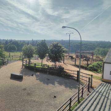
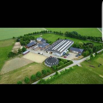
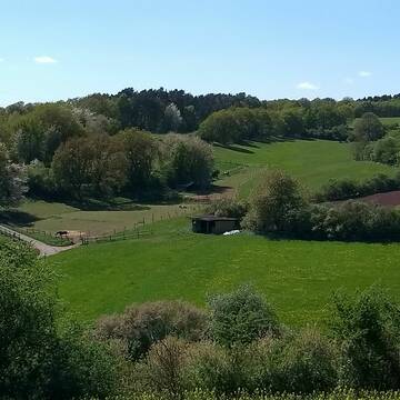
HIT Aktivstall Rosenhof
Mechernich
Aktivstall-Rosenhof
@Aktivstall-Rosenhof
Fahrstall, Kutschwagen
Freizeitstall
Vermieten
Hunde willkommen
Krankenbox
Allergikerstall
bedampftes/gewaschenes Heu
30 weitere...
S

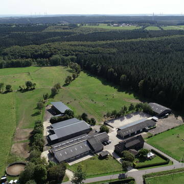
Liebevoll geführter Aktivstall in der Eifel
Hürtgenwald
Bosselbacher-Hof
@Bosselbacher-Hof
Freizeitstall
Gastronomie
Hunde willkommen
Krankenbox
Hufrehe geeignet
Notfallboxen
Bewegungsstall
Laufstall
13 weitere...
P
Deprecated: Creation of dynamic property Zend_View_Helper_Ads::$adLink is deprecated in /var/www/stall-frei/htdocs/staging.stall-frei.de/library/Psf/View/Helper/Ads.php on line 108

Heu und Heulage verkaufen
Mechtersen
STALL-FREIde Marketing
@STALL-FREI-Marketing
Verkaufen Sie Ihr Heu und Ihre Heulage direkt an Reiter, Pferdeställe und Reitanlagen
Gut Heidbüchel-Stall Menniken
Großhau
Monique Menniken
@Finy-Menniken
Fahrstall, Kutschwagen
Freizeitstall
Führanlage
Longierzirkel/Roundpen
Gnadenbrothof
Hengsthaltung möglich
Außenbox mit Paddock
Außenboxen
25 weitere...
P
Einstallplätze frei Offenstall Paddockboxen Box
Nideggen
Verena-Fusari
@Verena-Fusari
Freizeitstall
Vermieten
Krankenbox
Longierzirkel/Roundpen
Allergikerstall
Gnadenbrothof
17 weitere...
P
Eifelhof Bock - Pferdepension Bock
Hürtgenwald
Pferdepension-Bock1
@Pferdepension-Bock1
Freizeitstall
Vermieten
Krankenbox
Longierzirkel/Roundpen
Allergikerstall
Notfallboxen
18 weitere...
P

Futtersack HeuToy, Fressbremse in pink
Mechtersen
STALL-FREIde Marketing
@STALL-FREI-Marketing
Stundenlange Beschäftigung die
Koliken vorbeugt, geringe Staubinhalation mit
steuerbarer Futterentnahme
Turnier/Freizeit/Aufzucht/Rentnerstall
Hürtgenwald
Reitstall-Fassbender
@Reitstall-Fassbender
FN-Mitglied
Freizeitstall
Vermieten
Hunde willkommen
Krankenbox
Gnadenbrothof
Notfallboxen
26 weitere...
P
Leider kein Vorschaubild
Leider kein Vorschaubild
Paddockbox
Hürtgenwald-Hürtgen
A. Kluß
@Ann-Kathrin_Kl
Vermieten
Paddock
Reitplatz (z.B. Dressur, Springen, Reining)
Allergikerstall
Fohlenaufzucht möglich
Außenbox mit Paddock
Außenboxen
11 weitere...
neu
B

Stallplätze frei - Vollpension
Düren
Hannah Enger
@HannahEnger
FN-Mitglied
Freizeitstall
Vermieten
Führanlage
Hunde willkommen
Notfallboxen
23 weitere...
neu
P
Pferde-Einstellplätze
Heimbach
Gut-Kohnental
@Gut-Kohnental
Freizeitstall
Reitlehrer und -unterricht
Vermieten
Hunde willkommen
Paddock
Allergikerstall
bedampftes/gewaschenes Heu
15 weitere...
P

3 Stallplätze in der Eifel frei
Heimbach- Vlatten
Diana GJ
@Diana82
Freizeitstall
Vermieten
Hunde willkommen
Krankenbox
Gnadenbrothof
Notfallboxen
10 weitere...
P
Deprecated: Creation of dynamic property Zend_View::$pageCount is deprecated in /var/www/stall-frei/htdocs/staging.stall-frei.de/library/vendor/shardj/zf1-future/library/Zend/View/Abstract.php on line 308
Deprecated: Creation of dynamic property Zend_View::$itemCountPerPage is deprecated in /var/www/stall-frei/htdocs/staging.stall-frei.de/library/vendor/shardj/zf1-future/library/Zend/View/Abstract.php on line 308
Deprecated: Creation of dynamic property Zend_View::$first is deprecated in /var/www/stall-frei/htdocs/staging.stall-frei.de/library/vendor/shardj/zf1-future/library/Zend/View/Abstract.php on line 308
Deprecated: Creation of dynamic property Zend_View::$current is deprecated in /var/www/stall-frei/htdocs/staging.stall-frei.de/library/vendor/shardj/zf1-future/library/Zend/View/Abstract.php on line 308
Deprecated: Creation of dynamic property Zend_View::$last is deprecated in /var/www/stall-frei/htdocs/staging.stall-frei.de/library/vendor/shardj/zf1-future/library/Zend/View/Abstract.php on line 308
Deprecated: Creation of dynamic property Zend_View::$next is deprecated in /var/www/stall-frei/htdocs/staging.stall-frei.de/library/vendor/shardj/zf1-future/library/Zend/View/Abstract.php on line 308
Deprecated: Creation of dynamic property Zend_View::$pagesInRange is deprecated in /var/www/stall-frei/htdocs/staging.stall-frei.de/library/vendor/shardj/zf1-future/library/Zend/View/Abstract.php on line 308
Deprecated: Creation of dynamic property Zend_View::$firstPageInRange is deprecated in /var/www/stall-frei/htdocs/staging.stall-frei.de/library/vendor/shardj/zf1-future/library/Zend/View/Abstract.php on line 308
Deprecated: Creation of dynamic property Zend_View::$lastPageInRange is deprecated in /var/www/stall-frei/htdocs/staging.stall-frei.de/library/vendor/shardj/zf1-future/library/Zend/View/Abstract.php on line 308
Deprecated: Creation of dynamic property Zend_View::$currentItemCount is deprecated in /var/www/stall-frei/htdocs/staging.stall-frei.de/library/vendor/shardj/zf1-future/library/Zend/View/Abstract.php on line 308
Deprecated: Creation of dynamic property Zend_View::$totalItemCount is deprecated in /var/www/stall-frei/htdocs/staging.stall-frei.de/library/vendor/shardj/zf1-future/library/Zend/View/Abstract.php on line 308
Deprecated: Creation of dynamic property Zend_View::$firstItemNumber is deprecated in /var/www/stall-frei/htdocs/staging.stall-frei.de/library/vendor/shardj/zf1-future/library/Zend/View/Abstract.php on line 308
Deprecated: Creation of dynamic property Zend_View::$lastItemNumber is deprecated in /var/www/stall-frei/htdocs/staging.stall-frei.de/library/vendor/shardj/zf1-future/library/Zend/View/Abstract.php on line 308
Deprecated: Creation of dynamic property Zend_View::$router is deprecated in /var/www/stall-frei/htdocs/staging.stall-frei.de/library/vendor/shardj/zf1-future/library/Zend/View/Abstract.php on line 308
Deprecated: Creation of dynamic property Zend_View::$urlParams is deprecated in /var/www/stall-frei/htdocs/staging.stall-frei.de/library/vendor/shardj/zf1-future/library/Zend/View/Abstract.php on line 308
Deprecated: Creation of dynamic property Zend_View::$showAds is deprecated in /var/www/stall-frei/htdocs/staging.stall-frei.de/library/vendor/shardj/zf1-future/library/Zend/View/Abstract.php on line 308
Deprecated: Creation of dynamic property Zend_View::$objectIds is deprecated in /var/www/stall-frei/htdocs/staging.stall-frei.de/library/vendor/shardj/zf1-future/library/Zend/View/Abstract.php on line 308
Deprecated: Creation of dynamic property Zend_View::$showNavbar is deprecated in /var/www/stall-frei/htdocs/staging.stall-frei.de/library/vendor/shardj/zf1-future/library/Zend/View/Abstract.php on line 308
Deprecated: Creation of dynamic property Zend_View::$showBreadcrumb is deprecated in /var/www/stall-frei/htdocs/staging.stall-frei.de/library/vendor/shardj/zf1-future/library/Zend/View/Abstract.php on line 308
Deprecated: Creation of dynamic property Zend_View::$showFooter is deprecated in /var/www/stall-frei/htdocs/staging.stall-frei.de/library/vendor/shardj/zf1-future/library/Zend/View/Abstract.php on line 308
Deprecated: Creation of dynamic property Zend_View::$showInternalAds is deprecated in /var/www/stall-frei/htdocs/staging.stall-frei.de/library/vendor/shardj/zf1-future/library/Zend/View/Abstract.php on line 308
Deprecated: Creation of dynamic property Zend_View::$blNoContent is deprecated in /var/www/stall-frei/htdocs/staging.stall-frei.de/library/vendor/shardj/zf1-future/library/Zend/View/Abstract.php on line 308
Deprecated: Creation of dynamic property Zend_View::$sMetaDesc is deprecated in /var/www/stall-frei/htdocs/staging.stall-frei.de/library/vendor/shardj/zf1-future/library/Zend/View/Abstract.php on line 308
Deprecated: Creation of dynamic property Zend_View::$useGmaps is deprecated in /var/www/stall-frei/htdocs/staging.stall-frei.de/library/vendor/shardj/zf1-future/library/Zend/View/Abstract.php on line 308
Deprecated: Creation of dynamic property Zend_View::$touches is deprecated in /var/www/stall-frei/htdocs/staging.stall-frei.de/library/vendor/shardj/zf1-future/library/Zend/View/Abstract.php on line 308
Deprecated: Creation of dynamic property Zend_View::$oProject is deprecated in /var/www/stall-frei/htdocs/staging.stall-frei.de/library/vendor/shardj/zf1-future/library/Zend/View/Abstract.php on line 308
Deprecated: Creation of dynamic property Zend_View::$pageHeadline is deprecated in /var/www/stall-frei/htdocs/staging.stall-frei.de/library/vendor/shardj/zf1-future/library/Zend/View/Abstract.php on line 308
Deprecated: Creation of dynamic property Zend_View::$disableLocationField is deprecated in /var/www/stall-frei/htdocs/staging.stall-frei.de/library/vendor/shardj/zf1-future/library/Zend/View/Abstract.php on line 308
Deprecated: Creation of dynamic property Zend_View::$isSearch is deprecated in /var/www/stall-frei/htdocs/staging.stall-frei.de/library/vendor/shardj/zf1-future/library/Zend/View/Abstract.php on line 308
Deprecated: Creation of dynamic property Zend_View::$pageTitle is deprecated in /var/www/stall-frei/htdocs/staging.stall-frei.de/library/vendor/shardj/zf1-future/library/Zend/View/Abstract.php on line 308
Deprecated: Creation of dynamic property Psf_Form_Element_Text::$class is deprecated in /var/www/stall-frei/htdocs/staging.stall-frei.de/library/vendor/shardj/zf1-future/library/Zend/Form/Element.php on line 874
Deprecated: Creation of dynamic property Psf_Form_Element_Text::$size is deprecated in /var/www/stall-frei/htdocs/staging.stall-frei.de/library/vendor/shardj/zf1-future/library/Zend/Form/Element.php on line 874
Deprecated: Creation of dynamic property Psf_Form_Element_Text::$placeholder is deprecated in /var/www/stall-frei/htdocs/staging.stall-frei.de/library/vendor/shardj/zf1-future/library/Zend/Form/Element.php on line 874
Deprecated: Creation of dynamic property Psf_Form_Element_Hidden::$class is deprecated in /var/www/stall-frei/htdocs/staging.stall-frei.de/library/vendor/shardj/zf1-future/library/Zend/Form/Element.php on line 874
Deprecated: Creation of dynamic property Psf_Form_Element_Hidden::$class is deprecated in /var/www/stall-frei/htdocs/staging.stall-frei.de/library/vendor/shardj/zf1-future/library/Zend/Form/Element.php on line 874
Deprecated: Creation of dynamic property Psf_Form_Element_Hidden::$class is deprecated in /var/www/stall-frei/htdocs/staging.stall-frei.de/library/vendor/shardj/zf1-future/library/Zend/Form/Element.php on line 874
Deprecated: Creation of dynamic property Psf_Form_Element_Hidden::$class is deprecated in /var/www/stall-frei/htdocs/staging.stall-frei.de/library/vendor/shardj/zf1-future/library/Zend/Form/Element.php on line 874
Deprecated: Creation of dynamic property Psf_Form_Element_Select::$class is deprecated in /var/www/stall-frei/htdocs/staging.stall-frei.de/library/vendor/shardj/zf1-future/library/Zend/Form/Element.php on line 874
Deprecated: Creation of dynamic property Psf_Form_Element_Select::$class is deprecated in /var/www/stall-frei/htdocs/staging.stall-frei.de/library/vendor/shardj/zf1-future/library/Zend/Form/Element.php on line 874
Deprecated: Creation of dynamic property Psf_Form_Element_Select::$class is deprecated in /var/www/stall-frei/htdocs/staging.stall-frei.de/library/vendor/shardj/zf1-future/library/Zend/Form/Element.php on line 874
Deprecated: Creation of dynamic property Psf_Form_Element_Select::$class is deprecated in /var/www/stall-frei/htdocs/staging.stall-frei.de/library/vendor/shardj/zf1-future/library/Zend/Form/Element.php on line 874
Deprecated: Creation of dynamic property Psf_Form_Element_Text::$class is deprecated in /var/www/stall-frei/htdocs/staging.stall-frei.de/library/vendor/shardj/zf1-future/library/Zend/Form/Element.php on line 874
Deprecated: Creation of dynamic property Psf_Form_Element_Checkbox::$label is deprecated in /var/www/stall-frei/htdocs/staging.stall-frei.de/library/vendor/shardj/zf1-future/library/Zend/Form/Element.php on line 874
Deprecated: Creation of dynamic property Zend_View::$sort is deprecated in /var/www/stall-frei/htdocs/staging.stall-frei.de/library/vendor/shardj/zf1-future/library/Zend/View/Abstract.php on line 308
Deprecated: Creation of dynamic property Zend_View::$searchLocation is deprecated in /var/www/stall-frei/htdocs/staging.stall-frei.de/library/vendor/shardj/zf1-future/library/Zend/View/Abstract.php on line 308
Deprecated: Creation of dynamic property Zend_View::$locationHint is deprecated in /var/www/stall-frei/htdocs/staging.stall-frei.de/library/vendor/shardj/zf1-future/library/Zend/View/Abstract.php on line 308
Psf_GeoCoder_Abstract::getLocation: Brandenberg Get Location CachedOrLive
Psf_GeoCoder_Abstract::getCachedOrLive: Brandenberg
Psf_GeoCoder_OpenCageData::makeApiRequest: response:
Array
(
[documentation] => https://opencagedata.com/api
[licenses] => Array
(
[0] => Array
(
[name] => see attribution guide
[url] => https://opencagedata.com/credits
)
)
[results] => Array
(
[0] => Array
(
[bounds] => Array
(
[northeast] => Array
(
[lat] => 50.7209492
[lng] => 6.4310876
)
[southwest] => Array
(
[lat] => 50.6809492
[lng] => 6.3910876
)
)
[components] => Array
(
[ISO_3166-1_alpha-2] => DE
[ISO_3166-1_alpha-3] => DEU
[ISO_3166-2] => Array
(
[0] => DE-NW
)
[_category] => place
[_normalized_city] => Hürtgenwald
[_type] => village
[city] => Hürtgenwald
[continent] => Europe
[country] => Deutschland
[country_code] => de
[county] => Kreis Düren
[political_union] => European Union
[postcode] => 52393
[state] => Nordrhein-Westfalen
[state_code] => NW
[village] => Brandenberg
)
[confidence] => 7
[formatted] => 52393 Brandenberg, Deutschland
[geometry] => Array
(
[lat] => 50.7009492
[lng] => 6.4110876
)
)
[1] => Array
(
[bounds] => Array
(
[northeast] => Array
(
[lat] => 47.8579799
[lng] => 7.993364
)
[southwest] => Array
(
[lat] => 47.8179799
[lng] => 7.953364
)
)
[components] => Array
(
[ISO_3166-1_alpha-2] => DE
[ISO_3166-1_alpha-3] => DEU
[ISO_3166-2] => Array
(
[0] => DE-BW
)
[_category] => place
[_normalized_city] => Todtnau
[_type] => village
[continent] => Europe
[country] => Deutschland
[country_code] => de
[county] => Landkreis Lörrach
[political_union] => European Union
[postcode] => 79674
[state] => Baden-Württemberg
[state_code] => BW
[town] => Todtnau
[village] => Brandenberg
)
[confidence] => 7
[formatted] => 79674 Brandenberg, Deutschland
[geometry] => Array
(
[lat] => 47.8379799
[lng] => 7.973364
)
)
[2] => Array
(
[bounds] => Array
(
[northeast] => Array
(
[lat] => 48.1525855
[lng] => 11.1220153
)
[southwest] => Array
(
[lat] => 48.1125855
[lng] => 11.0820153
)
)
[components] => Array
(
[ISO_3166-1_alpha-2] => DE
[ISO_3166-1_alpha-3] => DEU
[ISO_3166-2] => Array
(
[0] => DE-BY
)
[_category] => place
[_normalized_city] => Moorenweis
[_type] => hamlet
[continent] => Europe
[country] => Deutschland
[country_code] => de
[county] => Landkreis Fürstenfeldbruck
[hamlet] => Brandenberg
[political_union] => European Union
[postcode] => 82299
[state] => Bayern
[state_code] => BY
[village] => Moorenweis
)
[confidence] => 7
[formatted] => Brandenberg, 82299 Moorenweis, Deutschland
[geometry] => Array
(
[lat] => 48.1325855
[lng] => 11.1020153
)
)
[3] => Array
(
[bounds] => Array
(
[northeast] => Array
(
[lat] => 51.7681037
[lng] => 6.0082667
)
[southwest] => Array
(
[lat] => 51.7680037
[lng] => 6.0081667
)
)
[components] => Array
(
[ISO_3166-1_alpha-2] => DE
[ISO_3166-1_alpha-3] => DEU
[ISO_3166-2] => Array
(
[0] => DE-NW
)
[_category] => natural/water
[_normalized_city] => Kranenburg
[_type] => peak
[continent] => Europe
[country] => Deutschland
[country_code] => de
[county] => Kreis Kleve
[peak] => Brandenberg
[political_union] => European Union
[postcode] => 47559
[state] => Nordrhein-Westfalen
[state_code] => NW
[town] => Kranenburg
)
[confidence] => 9
[formatted] => Brandenberg, 47559 Kranenburg, Deutschland
[geometry] => Array
(
[lat] => 51.7680537
[lng] => 6.0082167
)
)
[4] => Array
(
[bounds] => Array
(
[northeast] => Array
(
[lat] => 49.8525312
[lng] => 6.6331614
)
[southwest] => Array
(
[lat] => 49.8524312
[lng] => 6.6330614
)
)
[components] => Array
(
[ISO_3166-1_alpha-2] => DE
[ISO_3166-1_alpha-3] => DEU
[ISO_3166-2] => Array
(
[0] => DE-RP
)
[_category] => natural/water
[_normalized_city] => Welschbillig
[_type] => peak
[continent] => Europe
[country] => Deutschland
[country_code] => de
[county] => Landkreis Trier-Saarburg
[municipality] => Trier-Land
[peak] => Brandenberg
[political_union] => European Union
[postcode] => 54306
[state] => Rheinland-Pfalz
[state_code] => RP
[village] => Welschbillig
)
[confidence] => 9
[formatted] => Brandenberg, 54306 Welschbillig, Deutschland
[geometry] => Array
(
[lat] => 49.8524812
[lng] => 6.6331114
)
)
[5] => Array
(
[bounds] => Array
(
[northeast] => Array
(
[lat] => 51.4046583
[lng] => 8.2862781
)
[southwest] => Array
(
[lat] => 51.4045583
[lng] => 8.2861781
)
)
[components] => Array
(
[ISO_3166-1_alpha-2] => DE
[ISO_3166-1_alpha-3] => DEU
[ISO_3166-2] => Array
(
[0] => DE-NW
)
[_category] => natural/water
[_normalized_city] => Warstein
[_type] => peak
[continent] => Europe
[country] => Deutschland
[country_code] => de
[county] => Kreis Soest
[peak] => Brandenberg
[political_union] => European Union
[state] => Nordrhein-Westfalen
[state_code] => NW
[town] => Warstein
)
[confidence] => 9
[formatted] => Brandenberg, Warstein, Nordrhein-Westfalen, Deutschland
[geometry] => Array
(
[lat] => 51.4046083
[lng] => 8.2862281
)
)
[6] => Array
(
[bounds] => Array
(
[northeast] => Array
(
[lat] => 51.2648281
[lng] => 7.8001687
)
[southwest] => Array
(
[lat] => 51.2647281
[lng] => 7.8000687
)
)
[components] => Array
(
[ISO_3166-1_alpha-2] => DE
[ISO_3166-1_alpha-3] => DEU
[ISO_3166-2] => Array
(
[0] => DE-NW
)
[_category] => natural/water
[_normalized_city] => Neuenrade
[_type] => peak
[continent] => Europe
[country] => Deutschland
[country_code] => de
[county] => Märkischer Kreis
[peak] => Brandenberg
[political_union] => European Union
[postcode] => 58809
[state] => Nordrhein-Westfalen
[state_code] => NW
[town] => Neuenrade
)
[confidence] => 9
[formatted] => Brandenberg, 58809 Neuenrade, Deutschland
[geometry] => Array
(
[lat] => 51.2647781
[lng] => 7.8001187
)
)
[7] => Array
(
[bounds] => Array
(
[northeast] => Array
(
[lat] => 51.3398255
[lng] => 7.7627802
)
[southwest] => Array
(
[lat] => 51.3397255
[lng] => 7.7626802
)
)
[components] => Array
(
[ISO_3166-1_alpha-2] => DE
[ISO_3166-1_alpha-3] => DEU
[ISO_3166-2] => Array
(
[0] => DE-NW
)
[_category] => natural/water
[_normalized_city] => Hemer
[_type] => peak
[continent] => Europe
[country] => Deutschland
[country_code] => de
[county] => Märkischer Kreis
[peak] => Brandenberg
[political_union] => European Union
[postcode] => 58675
[state] => Nordrhein-Westfalen
[state_code] => NW
[town] => Hemer
)
[confidence] => 9
[formatted] => Brandenberg, 58675 Hemer, Deutschland
[geometry] => Array
(
[lat] => 51.3397755
[lng] => 7.7627302
)
)
[8] => Array
(
[bounds] => Array
(
[northeast] => Array
(
[lat] => 49.9958983
[lng] => 9.2737319
)
[southwest] => Array
(
[lat] => 49.9957983
[lng] => 9.2736319
)
)
[components] => Array
(
[ISO_3166-1_alpha-2] => DE
[ISO_3166-1_alpha-3] => DEU
[ISO_3166-2] => Array
(
[0] => DE-BY
)
[_category] => natural/water
[_normalized_city] => Bessenbach
[_type] => peak
[continent] => Europe
[country] => Deutschland
[country_code] => de
[county] => Landkreis Aschaffenburg
[municipality] => Bessenbach
[peak] => Brandenberg
[political_union] => European Union
[postcode] => 63846
[state] => Bayern
[state_code] => BY
)
[confidence] => 9
[formatted] => Brandenberg, 63846 Bessenbach, Deutschland
[geometry] => Array
(
[lat] => 49.9958483
[lng] => 9.2736819
)
)
[9] => Array
(
[bounds] => Array
(
[northeast] => Array
(
[lat] => 47.6757258
[lng] => 11.4573557
)
[southwest] => Array
(
[lat] => 47.6756258
[lng] => 11.4572557
)
)
[components] => Array
(
[ISO_3166-1_alpha-2] => DE
[ISO_3166-1_alpha-3] => DEU
[ISO_3166-2] => Array
(
[0] => DE-BY
)
[_category] => natural/water
[_normalized_city] => Benediktbeuern
[_type] => peak
[continent] => Europe
[country] => Deutschland
[country_code] => de
[county] => Landkreis Bad Tölz-Wolfratshausen
[municipality] => Benediktbeuern (VGem)
[peak] => Brandenberg
[political_union] => European Union
[state] => Bayern
[state_code] => BY
[village] => Benediktbeuern
)
[confidence] => 9
[formatted] => Brandenberg, Benediktbeuern, Bayern, Deutschland
[geometry] => Array
(
[lat] => 47.6756758
[lng] => 11.4573057
)
)
)
[status] => Array
(
[code] => 200
[message] => OK
)
[stay_informed] => Array
(
[blog] => https://blog.opencagedata.com
[mastodon] => https://en.osm.town/@opencage
)
[thanks] => For using an OpenCage API
[timestamp] => Array
(
[created_http] => Mon, 09 Feb 2026 03:01:20 GMT
[created_unix] => 1770606080
)
[total_results] => 10
)
Psf_GeoCoder_Abstract::convertLocationResult
{"documentation":"https:\/\/opencagedata.com\/api","licenses":[{"name":"see attribution guide","url":"https:\/\/opencagedata.com\/credits"}],"results":[{"bounds":{"northeast":{"lat":50.7209492,"lng":6.4310876},"southwest":{"lat":50.6809492,"lng":6.3910876}},"components":{"ISO_3166-1_alpha-2":"DE","ISO_3166-1_alpha-3":"DEU","ISO_3166-2":["DE-NW"],"_category":"place","_normalized_city":"H\u00fcrtgenwald","_type":"village","city":"H\u00fcrtgenwald","continent":"Europe","country":"Deutschland","country_code":"de","county":"Kreis D\u00fcren","political_union":"European Union","postcode":"52393","state":"Nordrhein-Westfalen","state_code":"NW","village":"Brandenberg"},"confidence":7,"formatted":"52393 Brandenberg, Deutschland","geometry":{"lat":50.7009492,"lng":6.4110876}},{"bounds":{"northeast":{"lat":47.8579799,"lng":7.993364},"southwest":{"lat":47.8179799,"lng":7.953364}},"components":{"ISO_3166-1_alpha-2":"DE","ISO_3166-1_alpha-3":"DEU","ISO_3166-2":["DE-BW"],"_category":"place","_normalized_city":"Todtnau","_type":"village","continent":"Europe","country":"Deutschland","country_code":"de","county":"Landkreis L\u00f6rrach","political_union":"European Union","postcode":"79674","state":"Baden-W\u00fcrttemberg","state_code":"BW","town":"Todtnau","village":"Brandenberg"},"confidence":7,"formatted":"79674 Brandenberg, Deutschland","geometry":{"lat":47.8379799,"lng":7.973364}},{"bounds":{"northeast":{"lat":48.1525855,"lng":11.1220153},"southwest":{"lat":48.1125855,"lng":11.0820153}},"components":{"ISO_3166-1_alpha-2":"DE","ISO_3166-1_alpha-3":"DEU","ISO_3166-2":["DE-BY"],"_category":"place","_normalized_city":"Moorenweis","_type":"hamlet","continent":"Europe","country":"Deutschland","country_code":"de","county":"Landkreis F\u00fcrstenfeldbruck","hamlet":"Brandenberg","political_union":"European Union","postcode":"82299","state":"Bayern","state_code":"BY","village":"Moorenweis"},"confidence":7,"formatted":"Brandenberg, 82299 Moorenweis, Deutschland","geometry":{"lat":48.1325855,"lng":11.1020153}},{"bounds":{"northeast":{"lat":51.7681037,"lng":6.0082667},"southwest":{"lat":51.7680037,"lng":6.0081667}},"components":{"ISO_3166-1_alpha-2":"DE","ISO_3166-1_alpha-3":"DEU","ISO_3166-2":["DE-NW"],"_category":"natural\/water","_normalized_city":"Kranenburg","_type":"peak","continent":"Europe","country":"Deutschland","country_code":"de","county":"Kreis Kleve","peak":"Brandenberg","political_union":"European Union","postcode":"47559","state":"Nordrhein-Westfalen","state_code":"NW","town":"Kranenburg"},"confidence":9,"formatted":"Brandenberg, 47559 Kranenburg, Deutschland","geometry":{"lat":51.7680537,"lng":6.0082167}},{"bounds":{"northeast":{"lat":49.8525312,"lng":6.6331614},"southwest":{"lat":49.8524312,"lng":6.6330614}},"components":{"ISO_3166-1_alpha-2":"DE","ISO_3166-1_alpha-3":"DEU","ISO_3166-2":["DE-RP"],"_category":"natural\/water","_normalized_city":"Welschbillig","_type":"peak","continent":"Europe","country":"Deutschland","country_code":"de","county":"Landkreis Trier-Saarburg","municipality":"Trier-Land","peak":"Brandenberg","political_union":"European Union","postcode":"54306","state":"Rheinland-Pfalz","state_code":"RP","village":"Welschbillig"},"confidence":9,"formatted":"Brandenberg, 54306 Welschbillig, Deutschland","geometry":{"lat":49.8524812,"lng":6.6331114}},{"bounds":{"northeast":{"lat":51.4046583,"lng":8.2862781},"southwest":{"lat":51.4045583,"lng":8.2861781}},"components":{"ISO_3166-1_alpha-2":"DE","ISO_3166-1_alpha-3":"DEU","ISO_3166-2":["DE-NW"],"_category":"natural\/water","_normalized_city":"Warstein","_type":"peak","continent":"Europe","country":"Deutschland","country_code":"de","county":"Kreis Soest","peak":"Brandenberg","political_union":"European Union","state":"Nordrhein-Westfalen","state_code":"NW","town":"Warstein"},"confidence":9,"formatted":"Brandenberg, Warstein, Nordrhein-Westfalen, Deutschland","geometry":{"lat":51.4046083,"lng":8.2862281}},{"bounds":{"northeast":{"lat":51.2648281,"lng":7.8001687},"southwest":{"lat":51.2647281,"lng":7.8000687}},"components":{"ISO_3166-1_alpha-2":"DE","ISO_3166-1_alpha-3":"DEU","ISO_3166-2":["DE-NW"],"_category":"natural\/water","_normalized_city":"Neuenrade","_type":"peak","continent":"Europe","country":"Deutschland","country_code":"de","county":"M\u00e4rkischer Kreis","peak":"Brandenberg","political_union":"European Union","postcode":"58809","state":"Nordrhein-Westfalen","state_code":"NW","town":"Neuenrade"},"confidence":9,"formatted":"Brandenberg, 58809 Neuenrade, Deutschland","geometry":{"lat":51.2647781,"lng":7.8001187}},{"bounds":{"northeast":{"lat":51.3398255,"lng":7.7627802},"southwest":{"lat":51.3397255,"lng":7.7626802}},"components":{"ISO_3166-1_alpha-2":"DE","ISO_3166-1_alpha-3":"DEU","ISO_3166-2":["DE-NW"],"_category":"natural\/water","_normalized_city":"Hemer","_type":"peak","continent":"Europe","country":"Deutschland","country_code":"de","county":"M\u00e4rkischer Kreis","peak":"Brandenberg","political_union":"European Union","postcode":"58675","state":"Nordrhein-Westfalen","state_code":"NW","town":"Hemer"},"confidence":9,"formatted":"Brandenberg, 58675 Hemer, Deutschland","geometry":{"lat":51.3397755,"lng":7.7627302}},{"bounds":{"northeast":{"lat":49.9958983,"lng":9.2737319},"southwest":{"lat":49.9957983,"lng":9.2736319}},"components":{"ISO_3166-1_alpha-2":"DE","ISO_3166-1_alpha-3":"DEU","ISO_3166-2":["DE-BY"],"_category":"natural\/water","_normalized_city":"Bessenbach","_type":"peak","continent":"Europe","country":"Deutschland","country_code":"de","county":"Landkreis Aschaffenburg","municipality":"Bessenbach","peak":"Brandenberg","political_union":"European Union","postcode":"63846","state":"Bayern","state_code":"BY"},"confidence":9,"formatted":"Brandenberg, 63846 Bessenbach, Deutschland","geometry":{"lat":49.9958483,"lng":9.2736819}},{"bounds":{"northeast":{"lat":47.6757258,"lng":11.4573557},"southwest":{"lat":47.6756258,"lng":11.4572557}},"components":{"ISO_3166-1_alpha-2":"DE","ISO_3166-1_alpha-3":"DEU","ISO_3166-2":["DE-BY"],"_category":"natural\/water","_normalized_city":"Benediktbeuern","_type":"peak","continent":"Europe","country":"Deutschland","country_code":"de","county":"Landkreis Bad T\u00f6lz-Wolfratshausen","municipality":"Benediktbeuern (VGem)","peak":"Brandenberg","political_union":"European Union","state":"Bayern","state_code":"BY","village":"Benediktbeuern"},"confidence":9,"formatted":"Brandenberg, Benediktbeuern, Bayern, Deutschland","geometry":{"lat":47.6756758,"lng":11.4573057}}],"status":{"code":200,"message":"OK"},"stay_informed":{"blog":"https:\/\/blog.opencagedata.com","mastodon":"https:\/\/en.osm.town\/@opencage"},"thanks":"For using an OpenCage API","timestamp":{"created_http":"Mon, 09 Feb 2026 03:01:20 GMT","created_unix":1770606080},"total_results":10}Array
(
[0] => stdClass Object
(
[bounds] => stdClass Object
(
[northeast] => stdClass Object
(
[lat] => 50.7209492
[lng] => 6.4310876
)
[southwest] => stdClass Object
(
[lat] => 50.6809492
[lng] => 6.3910876
)
)
[components] => stdClass Object
(
[ISO_3166-1_alpha-2] => DE
[ISO_3166-1_alpha-3] => DEU
[ISO_3166-2] => Array
(
[0] => DE-NW
)
[_category] => place
[_normalized_city] => Hürtgenwald
[_type] => village
[city] => Hürtgenwald
[continent] => Europe
[country] => Deutschland
[country_code] => de
[county] => Kreis Düren
[political_union] => European Union
[postcode] => 52393
[state] => Nordrhein-Westfalen
[state_code] => NW
[village] => Brandenberg
)
[confidence] => 7
[formatted] => 52393 Brandenberg, Deutschland
[geometry] => stdClass Object
(
[lat] => 50.7009492
[lng] => 6.4110876
)
)
[1] => stdClass Object
(
[bounds] => stdClass Object
(
[northeast] => stdClass Object
(
[lat] => 47.8579799
[lng] => 7.993364
)
[southwest] => stdClass Object
(
[lat] => 47.8179799
[lng] => 7.953364
)
)
[components] => stdClass Object
(
[ISO_3166-1_alpha-2] => DE
[ISO_3166-1_alpha-3] => DEU
[ISO_3166-2] => Array
(
[0] => DE-BW
)
[_category] => place
[_normalized_city] => Todtnau
[_type] => village
[continent] => Europe
[country] => Deutschland
[country_code] => de
[county] => Landkreis Lörrach
[political_union] => European Union
[postcode] => 79674
[state] => Baden-Württemberg
[state_code] => BW
[town] => Todtnau
[village] => Brandenberg
)
[confidence] => 7
[formatted] => 79674 Brandenberg, Deutschland
[geometry] => stdClass Object
(
[lat] => 47.8379799
[lng] => 7.973364
)
)
[2] => stdClass Object
(
[bounds] => stdClass Object
(
[northeast] => stdClass Object
(
[lat] => 48.1525855
[lng] => 11.1220153
)
[southwest] => stdClass Object
(
[lat] => 48.1125855
[lng] => 11.0820153
)
)
[components] => stdClass Object
(
[ISO_3166-1_alpha-2] => DE
[ISO_3166-1_alpha-3] => DEU
[ISO_3166-2] => Array
(
[0] => DE-BY
)
[_category] => place
[_normalized_city] => Moorenweis
[_type] => hamlet
[continent] => Europe
[country] => Deutschland
[country_code] => de
[county] => Landkreis Fürstenfeldbruck
[hamlet] => Brandenberg
[political_union] => European Union
[postcode] => 82299
[state] => Bayern
[state_code] => BY
[village] => Moorenweis
)
[confidence] => 7
[formatted] => Brandenberg, 82299 Moorenweis, Deutschland
[geometry] => stdClass Object
(
[lat] => 48.1325855
[lng] => 11.1020153
)
)
[3] => stdClass Object
(
[bounds] => stdClass Object
(
[northeast] => stdClass Object
(
[lat] => 51.7681037
[lng] => 6.0082667
)
[southwest] => stdClass Object
(
[lat] => 51.7680037
[lng] => 6.0081667
)
)
[components] => stdClass Object
(
[ISO_3166-1_alpha-2] => DE
[ISO_3166-1_alpha-3] => DEU
[ISO_3166-2] => Array
(
[0] => DE-NW
)
[_category] => natural/water
[_normalized_city] => Kranenburg
[_type] => peak
[continent] => Europe
[country] => Deutschland
[country_code] => de
[county] => Kreis Kleve
[peak] => Brandenberg
[political_union] => European Union
[postcode] => 47559
[state] => Nordrhein-Westfalen
[state_code] => NW
[town] => Kranenburg
)
[confidence] => 9
[formatted] => Brandenberg, 47559 Kranenburg, Deutschland
[geometry] => stdClass Object
(
[lat] => 51.7680537
[lng] => 6.0082167
)
)
[4] => stdClass Object
(
[bounds] => stdClass Object
(
[northeast] => stdClass Object
(
[lat] => 49.8525312
[lng] => 6.6331614
)
[southwest] => stdClass Object
(
[lat] => 49.8524312
[lng] => 6.6330614
)
)
[components] => stdClass Object
(
[ISO_3166-1_alpha-2] => DE
[ISO_3166-1_alpha-3] => DEU
[ISO_3166-2] => Array
(
[0] => DE-RP
)
[_category] => natural/water
[_normalized_city] => Welschbillig
[_type] => peak
[continent] => Europe
[country] => Deutschland
[country_code] => de
[county] => Landkreis Trier-Saarburg
[municipality] => Trier-Land
[peak] => Brandenberg
[political_union] => European Union
[postcode] => 54306
[state] => Rheinland-Pfalz
[state_code] => RP
[village] => Welschbillig
)
[confidence] => 9
[formatted] => Brandenberg, 54306 Welschbillig, Deutschland
[geometry] => stdClass Object
(
[lat] => 49.8524812
[lng] => 6.6331114
)
)
[5] => stdClass Object
(
[bounds] => stdClass Object
(
[northeast] => stdClass Object
(
[lat] => 51.4046583
[lng] => 8.2862781
)
[southwest] => stdClass Object
(
[lat] => 51.4045583
[lng] => 8.2861781
)
)
[components] => stdClass Object
(
[ISO_3166-1_alpha-2] => DE
[ISO_3166-1_alpha-3] => DEU
[ISO_3166-2] => Array
(
[0] => DE-NW
)
[_category] => natural/water
[_normalized_city] => Warstein
[_type] => peak
[continent] => Europe
[country] => Deutschland
[country_code] => de
[county] => Kreis Soest
[peak] => Brandenberg
[political_union] => European Union
[state] => Nordrhein-Westfalen
[state_code] => NW
[town] => Warstein
)
[confidence] => 9
[formatted] => Brandenberg, Warstein, Nordrhein-Westfalen, Deutschland
[geometry] => stdClass Object
(
[lat] => 51.4046083
[lng] => 8.2862281
)
)
[6] => stdClass Object
(
[bounds] => stdClass Object
(
[northeast] => stdClass Object
(
[lat] => 51.2648281
[lng] => 7.8001687
)
[southwest] => stdClass Object
(
[lat] => 51.2647281
[lng] => 7.8000687
)
)
[components] => stdClass Object
(
[ISO_3166-1_alpha-2] => DE
[ISO_3166-1_alpha-3] => DEU
[ISO_3166-2] => Array
(
[0] => DE-NW
)
[_category] => natural/water
[_normalized_city] => Neuenrade
[_type] => peak
[continent] => Europe
[country] => Deutschland
[country_code] => de
[county] => Märkischer Kreis
[peak] => Brandenberg
[political_union] => European Union
[postcode] => 58809
[state] => Nordrhein-Westfalen
[state_code] => NW
[town] => Neuenrade
)
[confidence] => 9
[formatted] => Brandenberg, 58809 Neuenrade, Deutschland
[geometry] => stdClass Object
(
[lat] => 51.2647781
[lng] => 7.8001187
)
)
[7] => stdClass Object
(
[bounds] => stdClass Object
(
[northeast] => stdClass Object
(
[lat] => 51.3398255
[lng] => 7.7627802
)
[southwest] => stdClass Object
(
[lat] => 51.3397255
[lng] => 7.7626802
)
)
[components] => stdClass Object
(
[ISO_3166-1_alpha-2] => DE
[ISO_3166-1_alpha-3] => DEU
[ISO_3166-2] => Array
(
[0] => DE-NW
)
[_category] => natural/water
[_normalized_city] => Hemer
[_type] => peak
[continent] => Europe
[country] => Deutschland
[country_code] => de
[county] => Märkischer Kreis
[peak] => Brandenberg
[political_union] => European Union
[postcode] => 58675
[state] => Nordrhein-Westfalen
[state_code] => NW
[town] => Hemer
)
[confidence] => 9
[formatted] => Brandenberg, 58675 Hemer, Deutschland
[geometry] => stdClass Object
(
[lat] => 51.3397755
[lng] => 7.7627302
)
)
[8] => stdClass Object
(
[bounds] => stdClass Object
(
[northeast] => stdClass Object
(
[lat] => 49.9958983
[lng] => 9.2737319
)
[southwest] => stdClass Object
(
[lat] => 49.9957983
[lng] => 9.2736319
)
)
[components] => stdClass Object
(
[ISO_3166-1_alpha-2] => DE
[ISO_3166-1_alpha-3] => DEU
[ISO_3166-2] => Array
(
[0] => DE-BY
)
[_category] => natural/water
[_normalized_city] => Bessenbach
[_type] => peak
[continent] => Europe
[country] => Deutschland
[country_code] => de
[county] => Landkreis Aschaffenburg
[municipality] => Bessenbach
[peak] => Brandenberg
[political_union] => European Union
[postcode] => 63846
[state] => Bayern
[state_code] => BY
)
[confidence] => 9
[formatted] => Brandenberg, 63846 Bessenbach, Deutschland
[geometry] => stdClass Object
(
[lat] => 49.9958483
[lng] => 9.2736819
)
)
[9] => stdClass Object
(
[bounds] => stdClass Object
(
[northeast] => stdClass Object
(
[lat] => 47.6757258
[lng] => 11.4573557
)
[southwest] => stdClass Object
(
[lat] => 47.6756258
[lng] => 11.4572557
)
)
[components] => stdClass Object
(
[ISO_3166-1_alpha-2] => DE
[ISO_3166-1_alpha-3] => DEU
[ISO_3166-2] => Array
(
[0] => DE-BY
)
[_category] => natural/water
[_normalized_city] => Benediktbeuern
[_type] => peak
[continent] => Europe
[country] => Deutschland
[country_code] => de
[county] => Landkreis Bad Tölz-Wolfratshausen
[municipality] => Benediktbeuern (VGem)
[peak] => Brandenberg
[political_union] => European Union
[state] => Bayern
[state_code] => BY
[village] => Benediktbeuern
)
[confidence] => 9
[formatted] => Brandenberg, Benediktbeuern, Bayern, Deutschland
[geometry] => stdClass Object
(
[lat] => 47.6756758
[lng] => 11.4573057
)
)
)
Psf_GeoCoder_OpenCageData::getKeyMap: 0
stdClass Object
(
    [bounds] => stdClass Object
        (
            [northeast] => stdClass Object
                (
                    [lat] => 50.7209492
                    [lng] => 6.4310876
                )

            [southwest] => stdClass Object
                (
                    [lat] => 50.6809492
                    [lng] => 6.3910876
                )

        )

    [components] => stdClass Object
        (
            [ISO_3166-1_alpha-2] => DE
            [ISO_3166-1_alpha-3] => DEU
            [ISO_3166-2] => Array
                (
                    [0] => DE-NW
                )

            [_category] => place
            [_normalized_city] => Hürtgenwald
            [_type] => village
            [city] => Hürtgenwald
            [continent] => Europe
            [country] => Deutschland
            [country_code] => de
            [county] => Kreis Düren
            [political_union] => European Union
            [postcode] => 52393
            [state] => Nordrhein-Westfalen
            [state_code] => NW
            [village] => Brandenberg
        )

    [confidence] => 7
    [formatted] => 52393 Brandenberg, Deutschland
    [geometry] => stdClass Object
        (
            [lat] => 50.7009492
            [lng] => 6.4110876
        )

)
Psf_GeoCoder_OpenCageData::getCounty: Düren
Psf_GeoCoder_OpenCageData::addMissingData REFETCH!
Array
(
    [address] => 52393 Brandenberg, Deutschland
    [type] => village
    [street] =>
    [city] => Brandenberg
    [county] => Düren
    [state] => Nordrhein-Westfalen
    [zip] => 52393
    [country] => Deutschland
    [suburb] =>
    [countrycode] => de
    [latitude] => 50.7009492
    [longitude] => 6.4110876
    [accuracy] => 1
    [confidence] => 7
    [bounds] => stdClass Object
        (
            [northeast] => stdClass Object
                (
                    [lat] => 50.7209492
                    [lng] => 6.4310876
                )

            [southwest] => stdClass Object
                (
                    [lat] => 50.6809492
                    [lng] => 6.3910876
                )

        )

)
reformat!
Array
(
    [address] => 52393 Brandenberg, Deutschland
    [type] => village
    [street] =>
    [city] => Brandenberg
    [county] => Düren
    [state] => Nordrhein-Westfalen
    [zip] => 52393
    [country] => Deutschland
    [suburb] =>
    [countrycode] => de
    [latitude] => 50.7009492
    [longitude] => 6.4110876
    [accuracy] => 1
    [confidence] => 7
    [bounds] => stdClass Object
        (
            [northeast] => stdClass Object
                (
                    [lat] => 50.7209492
                    [lng] => 6.4310876
                )

            [southwest] => stdClass Object
                (
                    [lat] => 50.6809492
                    [lng] => 6.3910876
                )

        )

    [place] => 52393 Brandenberg, Nordrhein-Westfalen
    [hash] => 591e544620f5784da8913ef375937d3d
)
Psf_GeoCoder_OpenCageData::getKeyMap: 1
stdClass Object
(
    [bounds] => stdClass Object
        (
            [northeast] => stdClass Object
                (
                    [lat] => 47.8579799
                    [lng] => 7.993364
                )

            [southwest] => stdClass Object
                (
                    [lat] => 47.8179799
                    [lng] => 7.953364
                )

        )

    [components] => stdClass Object
        (
            [ISO_3166-1_alpha-2] => DE
            [ISO_3166-1_alpha-3] => DEU
            [ISO_3166-2] => Array
                (
                    [0] => DE-BW
                )

            [_category] => place
            [_normalized_city] => Todtnau
            [_type] => village
            [continent] => Europe
            [country] => Deutschland
            [country_code] => de
            [county] => Landkreis Lörrach
            [political_union] => European Union
            [postcode] => 79674
            [state] => Baden-Württemberg
            [state_code] => BW
            [town] => Todtnau
            [village] => Brandenberg
        )

    [confidence] => 7
    [formatted] => 79674 Brandenberg, Deutschland
    [geometry] => stdClass Object
        (
            [lat] => 47.8379799
            [lng] => 7.973364
        )

)
Psf_GeoCoder_OpenCageData::getCounty: Lörrach
Psf_GeoCoder_OpenCageData::addMissingData REFETCH!
Array
(
    [address] => 79674 Brandenberg, Deutschland
    [type] => village
    [street] =>
    [city] => Todtnau
    [county] => Lörrach
    [state] => Baden-Württemberg
    [zip] => 79674
    [country] => Deutschland
    [suburb] =>
    [countrycode] => de
    [latitude] => 47.8379799
    [longitude] => 7.973364
    [accuracy] => 1
    [confidence] => 7
    [bounds] => stdClass Object
        (
            [northeast] => stdClass Object
                (
                    [lat] => 47.8579799
                    [lng] => 7.993364
                )

            [southwest] => stdClass Object
                (
                    [lat] => 47.8179799
                    [lng] => 7.953364
                )

        )

)
reformat!
Array
(
    [address] => 79674 Todtnau
    [type] => village
    [street] =>
    [city] => Todtnau
    [county] => Lörrach
    [state] => Baden-Württemberg
    [zip] => 79674
    [country] => Deutschland
    [suburb] =>
    [countrycode] => de
    [latitude] => 47.8379799
    [longitude] => 7.973364
    [accuracy] => 1
    [confidence] => 7
    [bounds] => stdClass Object
        (
            [northeast] => stdClass Object
                (
                    [lat] => 47.8579799
                    [lng] => 7.993364
                )

            [southwest] => stdClass Object
                (
                    [lat] => 47.8179799
                    [lng] => 7.953364
                )

        )

    [place] => 79674 Todtnau, Baden-Württemberg
    [hash] => 98948a51df45561c30b19eb3978bade2
)
Psf_GeoCoder_OpenCageData::getKeyMap: 2
stdClass Object
(
    [bounds] => stdClass Object
        (
            [northeast] => stdClass Object
                (
                    [lat] => 48.1525855
                    [lng] => 11.1220153
                )

            [southwest] => stdClass Object
                (
                    [lat] => 48.1125855
                    [lng] => 11.0820153
                )

        )

    [components] => stdClass Object
        (
            [ISO_3166-1_alpha-2] => DE
            [ISO_3166-1_alpha-3] => DEU
            [ISO_3166-2] => Array
                (
                    [0] => DE-BY
                )

            [_category] => place
            [_normalized_city] => Moorenweis
            [_type] => hamlet
            [continent] => Europe
            [country] => Deutschland
            [country_code] => de
            [county] => Landkreis Fürstenfeldbruck
            [hamlet] => Brandenberg
            [political_union] => European Union
            [postcode] => 82299
            [state] => Bayern
            [state_code] => BY
            [village] => Moorenweis
        )

    [confidence] => 7
    [formatted] => Brandenberg, 82299 Moorenweis, Deutschland
    [geometry] => stdClass Object
        (
            [lat] => 48.1325855
            [lng] => 11.1020153
        )

)
Psf_GeoCoder_OpenCageData::getCounty: Fürstenfeldbruck
Psf_GeoCoder_OpenCageData::addMissingData REFETCH!
Array
(
    [address] => Brandenberg, 82299 Moorenweis, Deutschland
    [type] => hamlet
    [street] => Brandenberg
    [city] => Moorenweis
    [county] => Fürstenfeldbruck
    [state] => Bayern
    [zip] => 82299
    [country] => Deutschland
    [suburb] =>
    [countrycode] => de
    [latitude] => 48.1325855
    [longitude] => 11.1020153
    [accuracy] => 1
    [confidence] => 7
    [bounds] => stdClass Object
        (
            [northeast] => stdClass Object
                (
                    [lat] => 48.1525855
                    [lng] => 11.1220153
                )

            [southwest] => stdClass Object
                (
                    [lat] => 48.1125855
                    [lng] => 11.0820153
                )

        )

)
reformat!
Array
(
    [address] => Brandenberg, 82299 Moorenweis, Deutschland
    [type] => hamlet
    [street] => Brandenberg
    [city] => Moorenweis
    [county] => Fürstenfeldbruck
    [state] => Bayern
    [zip] => 82299
    [country] => Deutschland
    [suburb] =>
    [countrycode] => de
    [latitude] => 48.1325855
    [longitude] => 11.1020153
    [accuracy] => 1
    [confidence] => 7
    [bounds] => stdClass Object
        (
            [northeast] => stdClass Object
                (
                    [lat] => 48.1525855
                    [lng] => 11.1220153
                )

            [southwest] => stdClass Object
                (
                    [lat] => 48.1125855
                    [lng] => 11.0820153
                )

        )

    [place] => Brandenberg, 82299 Moorenweis, Bayern
    [hash] => ec6b75abc7831e3847e59599b81ef282
)
Psf_GeoCoder_OpenCageData::getKeyMap: 3
stdClass Object
(
    [bounds] => stdClass Object
        (
            [northeast] => stdClass Object
                (
                    [lat] => 51.7681037
                    [lng] => 6.0082667
                )

            [southwest] => stdClass Object
                (
                    [lat] => 51.7680037
                    [lng] => 6.0081667
                )

        )

    [components] => stdClass Object
        (
            [ISO_3166-1_alpha-2] => DE
            [ISO_3166-1_alpha-3] => DEU
            [ISO_3166-2] => Array
                (
                    [0] => DE-NW
                )

            [_category] => natural/water
            [_normalized_city] => Kranenburg
            [_type] => peak
            [continent] => Europe
            [country] => Deutschland
            [country_code] => de
            [county] => Kreis Kleve
            [peak] => Brandenberg
            [political_union] => European Union
            [postcode] => 47559
            [state] => Nordrhein-Westfalen
            [state_code] => NW
            [town] => Kranenburg
        )

    [confidence] => 9
    [formatted] => Brandenberg, 47559 Kranenburg, Deutschland
    [geometry] => stdClass Object
        (
            [lat] => 51.7680537
            [lng] => 6.0082167
        )

)
Psf_GeoCoder_OpenCageData::getCounty: Kleve
Psf_GeoCoder_OpenCageData::addMissingData REFETCH!
Array
(
    [address] => Brandenberg, 47559 Kranenburg, Deutschland
    [type] => peak
    [street] =>
    [city] => Kranenburg
    [county] => Kleve
    [state] => Nordrhein-Westfalen
    [zip] => 47559
    [country] => Deutschland
    [suburb] =>
    [countrycode] => de
    [latitude] => 51.7680537
    [longitude] => 6.0082167
    [accuracy] => 1
    [confidence] => 9
    [bounds] => stdClass Object
        (
            [northeast] => stdClass Object
                (
                    [lat] => 51.7681037
                    [lng] => 6.0082667
                )

            [southwest] => stdClass Object
                (
                    [lat] => 51.7680037
                    [lng] => 6.0081667
                )

        )

)
reformat!
Array
(
    [address] => Brandenberg, 47559 Kranenburg, Deutschland
    [type] => peak
    [street] =>
    [city] => Kranenburg
    [county] => Kleve
    [state] => Nordrhein-Westfalen
    [zip] => 47559
    [country] => Deutschland
    [suburb] =>
    [countrycode] => de
    [latitude] => 51.7680537
    [longitude] => 6.0082167
    [accuracy] => 1
    [confidence] => 9
    [bounds] => stdClass Object
        (
            [northeast] => stdClass Object
                (
                    [lat] => 51.7681037
                    [lng] => 6.0082667
                )

            [southwest] => stdClass Object
                (
                    [lat] => 51.7680037
                    [lng] => 6.0081667
                )

        )

    [place] => 47559 Kranenburg, Nordrhein-Westfalen
    [hash] => 5c893e6bf3817b04e411e1ccf5dc15d4
)
Psf_GeoCoder_OpenCageData::getKeyMap: 4
stdClass Object
(
    [bounds] => stdClass Object
        (
            [northeast] => stdClass Object
                (
                    [lat] => 49.8525312
                    [lng] => 6.6331614
                )

            [southwest] => stdClass Object
                (
                    [lat] => 49.8524312
                    [lng] => 6.6330614
                )

        )

    [components] => stdClass Object
        (
            [ISO_3166-1_alpha-2] => DE
            [ISO_3166-1_alpha-3] => DEU
            [ISO_3166-2] => Array
                (
                    [0] => DE-RP
                )

            [_category] => natural/water
            [_normalized_city] => Welschbillig
            [_type] => peak
            [continent] => Europe
            [country] => Deutschland
            [country_code] => de
            [county] => Landkreis Trier-Saarburg
            [municipality] => Trier-Land
            [peak] => Brandenberg
            [political_union] => European Union
            [postcode] => 54306
            [state] => Rheinland-Pfalz
            [state_code] => RP
            [village] => Welschbillig
        )

    [confidence] => 9
    [formatted] => Brandenberg, 54306 Welschbillig, Deutschland
    [geometry] => stdClass Object
        (
            [lat] => 49.8524812
            [lng] => 6.6331114
        )

)
Psf_GeoCoder_OpenCageData::getCounty: Trier-Saarburg
Psf_GeoCoder_OpenCageData::addMissingData REFETCH!
Array
(
    [address] => Brandenberg, 54306 Welschbillig, Deutschland
    [type] => peak
    [street] =>
    [city] => Welschbillig
    [county] => Trier-Saarburg
    [state] => Rheinland-Pfalz
    [zip] => 54306
    [country] => Deutschland
    [suburb] =>
    [countrycode] => de
    [latitude] => 49.8524812
    [longitude] => 6.6331114
    [accuracy] => 1
    [confidence] => 9
    [bounds] => stdClass Object
        (
            [northeast] => stdClass Object
                (
                    [lat] => 49.8525312
                    [lng] => 6.6331614
                )

            [southwest] => stdClass Object
                (
                    [lat] => 49.8524312
                    [lng] => 6.6330614
                )

        )

)
reformat!
Array
(
    [address] => Brandenberg, 54306 Welschbillig, Deutschland
    [type] => peak
    [street] =>
    [city] => Welschbillig
    [county] => Trier-Saarburg
    [state] => Rheinland-Pfalz
    [zip] => 54306
    [country] => Deutschland
    [suburb] =>
    [countrycode] => de
    [latitude] => 49.8524812
    [longitude] => 6.6331114
    [accuracy] => 1
    [confidence] => 9
    [bounds] => stdClass Object
        (
            [northeast] => stdClass Object
                (
                    [lat] => 49.8525312
                    [lng] => 6.6331614
                )

            [southwest] => stdClass Object
                (
                    [lat] => 49.8524312
                    [lng] => 6.6330614
                )

        )

    [place] => 54306 Welschbillig, Rheinland-Pfalz
    [hash] => cf14c87473caf1bea7d96729fe99af68
)
Psf_GeoCoder_OpenCageData::getKeyMap: 5
stdClass Object
(
    [bounds] => stdClass Object
        (
            [northeast] => stdClass Object
                (
                    [lat] => 51.4046583
                    [lng] => 8.2862781
                )

            [southwest] => stdClass Object
                (
                    [lat] => 51.4045583
                    [lng] => 8.2861781
                )

        )

    [components] => stdClass Object
        (
            [ISO_3166-1_alpha-2] => DE
            [ISO_3166-1_alpha-3] => DEU
            [ISO_3166-2] => Array
                (
                    [0] => DE-NW
                )

            [_category] => natural/water
            [_normalized_city] => Warstein
            [_type] => peak
            [continent] => Europe
            [country] => Deutschland
            [country_code] => de
            [county] => Kreis Soest
            [peak] => Brandenberg
            [political_union] => European Union
            [state] => Nordrhein-Westfalen
            [state_code] => NW
            [town] => Warstein
        )

    [confidence] => 9
    [formatted] => Brandenberg, Warstein, Nordrhein-Westfalen, Deutschland
    [geometry] => stdClass Object
        (
            [lat] => 51.4046083
            [lng] => 8.2862281
        )

)
Psf_GeoCoder_OpenCageData::getCounty: Soest
Psf_GeoCoder_OpenCageData::addMissingData REFETCH!
Array
(
    [address] => Brandenberg, Warstein, Nordrhein-Westfalen, Deutschland
    [type] => peak
    [street] =>
    [city] => Warstein
    [county] => Soest
    [state] => Nordrhein-Westfalen
    [zip] =>
    [country] => Deutschland
    [suburb] =>
    [countrycode] => de
    [latitude] => 51.4046083
    [longitude] => 8.2862281
    [accuracy] => 1
    [confidence] => 9
    [bounds] => stdClass Object
        (
            [northeast] => stdClass Object
                (
                    [lat] => 51.4046583
                    [lng] => 8.2862781
                )

            [southwest] => stdClass Object
                (
                    [lat] => 51.4045583
                    [lng] => 8.2861781
                )

        )

)
reformat!
Array
(
    [address] => Brandenberg, Warstein, Nordrhein-Westfalen, Deutschland
    [type] => peak
    [street] =>
    [city] => Warstein
    [county] => Soest
    [state] => Nordrhein-Westfalen
    [zip] =>
    [country] => Deutschland
    [suburb] =>
    [countrycode] => de
    [latitude] => 51.4046083
    [longitude] => 8.2862281
    [accuracy] => 1
    [confidence] => 9
    [bounds] => stdClass Object
        (
            [northeast] => stdClass Object
                (
                    [lat] => 51.4046583
                    [lng] => 8.2862781
                )

            [southwest] => stdClass Object
                (
                    [lat] => 51.4045583
                    [lng] => 8.2861781
                )

        )

    [place] => Warstein, Nordrhein-Westfalen
    [hash] => 8f6fb6d13029cbafa14d73e38bb978f7
)
Psf_GeoCoder_OpenCageData::getKeyMap: 6
stdClass Object
(
    [bounds] => stdClass Object
        (
            [northeast] => stdClass Object
                (
                    [lat] => 51.2648281
                    [lng] => 7.8001687
                )

            [southwest] => stdClass Object
                (
                    [lat] => 51.2647281
                    [lng] => 7.8000687
                )

        )

    [components] => stdClass Object
        (
            [ISO_3166-1_alpha-2] => DE
            [ISO_3166-1_alpha-3] => DEU
            [ISO_3166-2] => Array
                (
                    [0] => DE-NW
                )

            [_category] => natural/water
            [_normalized_city] => Neuenrade
            [_type] => peak
            [continent] => Europe
            [country] => Deutschland
            [country_code] => de
            [county] => Märkischer Kreis
            [peak] => Brandenberg
            [political_union] => European Union
            [postcode] => 58809
            [state] => Nordrhein-Westfalen
            [state_code] => NW
            [town] => Neuenrade
        )

    [confidence] => 9
    [formatted] => Brandenberg, 58809 Neuenrade, Deutschland
    [geometry] => stdClass Object
        (
            [lat] => 51.2647781
            [lng] => 7.8001187
        )

)
Psf_GeoCoder_OpenCageData::getCounty: Märkischer Kreis
Psf_GeoCoder_OpenCageData::addMissingData REFETCH!
Array
(
    [address] => Brandenberg, 58809 Neuenrade, Deutschland
    [type] => peak
    [street] =>
    [city] => Neuenrade
    [county] => Märkischer Kreis
    [state] => Nordrhein-Westfalen
    [zip] => 58809
    [country] => Deutschland
    [suburb] =>
    [countrycode] => de
    [latitude] => 51.2647781
    [longitude] => 7.8001187
    [accuracy] => 1
    [confidence] => 9
    [bounds] => stdClass Object
        (
            [northeast] => stdClass Object
                (
                    [lat] => 51.2648281
                    [lng] => 7.8001687
                )

            [southwest] => stdClass Object
                (
                    [lat] => 51.2647281
                    [lng] => 7.8000687
                )

        )

)
reformat!
Array
(
    [address] => Brandenberg, 58809 Neuenrade, Deutschland
    [type] => peak
    [street] =>
    [city] => Neuenrade
    [county] => Märkischer Kreis
    [state] => Nordrhein-Westfalen
    [zip] => 58809
    [country] => Deutschland
    [suburb] =>
    [countrycode] => de
    [latitude] => 51.2647781
    [longitude] => 7.8001187
    [accuracy] => 1
    [confidence] => 9
    [bounds] => stdClass Object
        (
            [northeast] => stdClass Object
                (
                    [lat] => 51.2648281
                    [lng] => 7.8001687
                )

            [southwest] => stdClass Object
                (
                    [lat] => 51.2647281
                    [lng] => 7.8000687
                )

        )

    [place] => 58809 Neuenrade, Nordrhein-Westfalen
    [hash] => 119c0bc3446fe7167c60cfa4e384ae28
)
Psf_GeoCoder_OpenCageData::getKeyMap: 7
stdClass Object
(
    [bounds] => stdClass Object
        (
            [northeast] => stdClass Object
                (
                    [lat] => 51.3398255
                    [lng] => 7.7627802
                )

            [southwest] => stdClass Object
                (
                    [lat] => 51.3397255
                    [lng] => 7.7626802
                )

        )

    [components] => stdClass Object
        (
            [ISO_3166-1_alpha-2] => DE
            [ISO_3166-1_alpha-3] => DEU
            [ISO_3166-2] => Array
                (
                    [0] => DE-NW
                )

            [_category] => natural/water
            [_normalized_city] => Hemer
            [_type] => peak
            [continent] => Europe
            [country] => Deutschland
            [country_code] => de
            [county] => Märkischer Kreis
            [peak] => Brandenberg
            [political_union] => European Union
            [postcode] => 58675
            [state] => Nordrhein-Westfalen
            [state_code] => NW
            [town] => Hemer
        )

    [confidence] => 9
    [formatted] => Brandenberg, 58675 Hemer, Deutschland
    [geometry] => stdClass Object
        (
            [lat] => 51.3397755
            [lng] => 7.7627302
        )

)
Psf_GeoCoder_OpenCageData::getCounty: Märkischer Kreis
Psf_GeoCoder_OpenCageData::addMissingData REFETCH!
Array
(
    [address] => Brandenberg, 58675 Hemer, Deutschland
    [type] => peak
    [street] =>
    [city] => Hemer
    [county] => Märkischer Kreis
    [state] => Nordrhein-Westfalen
    [zip] => 58675
    [country] => Deutschland
    [suburb] =>
    [countrycode] => de
    [latitude] => 51.3397755
    [longitude] => 7.7627302
    [accuracy] => 1
    [confidence] => 9
    [bounds] => stdClass Object
        (
            [northeast] => stdClass Object
                (
                    [lat] => 51.3398255
                    [lng] => 7.7627802
                )

            [southwest] => stdClass Object
                (
                    [lat] => 51.3397255
                    [lng] => 7.7626802
                )

        )

)
reformat!
Array
(
    [address] => Brandenberg, 58675 Hemer, Deutschland
    [type] => peak
    [street] =>
    [city] => Hemer
    [county] => Märkischer Kreis
    [state] => Nordrhein-Westfalen
    [zip] => 58675
    [country] => Deutschland
    [suburb] =>
    [countrycode] => de
    [latitude] => 51.3397755
    [longitude] => 7.7627302
    [accuracy] => 1
    [confidence] => 9
    [bounds] => stdClass Object
        (
            [northeast] => stdClass Object
                (
                    [lat] => 51.3398255
                    [lng] => 7.7627802
                )

            [southwest] => stdClass Object
                (
                    [lat] => 51.3397255
                    [lng] => 7.7626802
                )

        )

    [place] => 58675 Hemer, Nordrhein-Westfalen
    [hash] => 8667e294d8f4bae820a3ab42cf6e7df3
)
Psf_GeoCoder_OpenCageData::getKeyMap: 8
stdClass Object
(
    [bounds] => stdClass Object
        (
            [northeast] => stdClass Object
                (
                    [lat] => 49.9958983
                    [lng] => 9.2737319
                )

            [southwest] => stdClass Object
                (
                    [lat] => 49.9957983
                    [lng] => 9.2736319
                )

        )

    [components] => stdClass Object
        (
            [ISO_3166-1_alpha-2] => DE
            [ISO_3166-1_alpha-3] => DEU
            [ISO_3166-2] => Array
                (
                    [0] => DE-BY
                )

            [_category] => natural/water
            [_normalized_city] => Bessenbach
            [_type] => peak
            [continent] => Europe
            [country] => Deutschland
            [country_code] => de
            [county] => Landkreis Aschaffenburg
            [municipality] => Bessenbach
            [peak] => Brandenberg
            [political_union] => European Union
            [postcode] => 63846
            [state] => Bayern
            [state_code] => BY
        )

    [confidence] => 9
    [formatted] => Brandenberg, 63846 Bessenbach, Deutschland
    [geometry] => stdClass Object
        (
            [lat] => 49.9958483
            [lng] => 9.2736819
        )

)
Psf_GeoCoder_OpenCageData::getCounty: Aschaffenburg
Psf_GeoCoder_OpenCageData::addMissingData REFETCH!
Array
(
    [address] => Brandenberg, 63846 Bessenbach, Deutschland
    [type] => peak
    [street] =>
    [city] =>
    [county] => Aschaffenburg
    [state] => Bayern
    [zip] => 63846
    [country] => Deutschland
    [suburb] =>
    [countrycode] => de
    [latitude] => 49.9958483
    [longitude] => 9.2736819
    [accuracy] => 1
    [confidence] => 9
    [bounds] => stdClass Object
        (
            [northeast] => stdClass Object
                (
                    [lat] => 49.9958983
                    [lng] => 9.2737319
                )

            [southwest] => stdClass Object
                (
                    [lat] => 49.9957983
                    [lng] => 9.2736319
                )

        )

)
reformat!
Array
(
    [address] => Brandenberg, 63846 Bessenbach, Deutschland
    [type] => peak
    [street] =>
    [city] =>
    [county] => Aschaffenburg
    [state] => Bayern
    [zip] => 63846
    [country] => Deutschland
    [suburb] =>
    [countrycode] => de
    [latitude] => 49.9958483
    [longitude] => 9.2736819
    [accuracy] => 1
    [confidence] => 9
    [bounds] => stdClass Object
        (
            [northeast] => stdClass Object
                (
                    [lat] => 49.9958983
                    [lng] => 9.2737319
                )

            [southwest] => stdClass Object
                (
                    [lat] => 49.9957983
                    [lng] => 9.2736319
                )

        )

    [place] => 63846 , Bayern
    [hash] => 12de4e377f8e824eba97d48e7441a3c0
)
Psf_GeoCoder_OpenCageData::getKeyMap: 9
stdClass Object
(
    [bounds] => stdClass Object
        (
            [northeast] => stdClass Object
                (
                    [lat] => 47.6757258
                    [lng] => 11.4573557
                )

            [southwest] => stdClass Object
                (
                    [lat] => 47.6756258
                    [lng] => 11.4572557
                )

        )

    [components] => stdClass Object
        (
            [ISO_3166-1_alpha-2] => DE
            [ISO_3166-1_alpha-3] => DEU
            [ISO_3166-2] => Array
                (
                    [0] => DE-BY
                )

            [_category] => natural/water
            [_normalized_city] => Benediktbeuern
            [_type] => peak
            [continent] => Europe
            [country] => Deutschland
            [country_code] => de
            [county] => Landkreis Bad Tölz-Wolfratshausen
            [municipality] => Benediktbeuern (VGem)
            [peak] => Brandenberg
            [political_union] => European Union
            [state] => Bayern
            [state_code] => BY
            [village] => Benediktbeuern
        )

    [confidence] => 9
    [formatted] => Brandenberg, Benediktbeuern, Bayern, Deutschland
    [geometry] => stdClass Object
        (
            [lat] => 47.6756758
            [lng] => 11.4573057
        )

)
Psf_GeoCoder_OpenCageData::getCounty: Bad Tölz-Wolfratshausen
Psf_GeoCoder_OpenCageData::addMissingData REFETCH!
Array
(
    [address] => Brandenberg, Benediktbeuern, Bayern, Deutschland
    [type] => peak
    [street] =>
    [city] => Benediktbeuern
    [county] => Bad Tölz-Wolfratshausen
    [state] => Bayern
    [zip] =>
    [country] => Deutschland
    [suburb] =>
    [countrycode] => de
    [latitude] => 47.6756758
    [longitude] => 11.4573057
    [accuracy] => 1
    [confidence] => 9
    [bounds] => stdClass Object
        (
            [northeast] => stdClass Object
                (
                    [lat] => 47.6757258
                    [lng] => 11.4573557
                )

            [southwest] => stdClass Object
                (
                    [lat] => 47.6756258
                    [lng] => 11.4572557
                )

        )

)
reformat!
Array
(
    [address] => Brandenberg, Benediktbeuern, Bayern, Deutschland
    [type] => peak
    [street] =>
    [city] => Benediktbeuern
    [county] => Bad Tölz-Wolfratshausen
    [state] => Bayern
    [zip] =>
    [country] => Deutschland
    [suburb] =>
    [countrycode] => de
    [latitude] => 47.6756758
    [longitude] => 11.4573057
    [accuracy] => 1
    [confidence] => 9
    [bounds] => stdClass Object
        (
            [northeast] => stdClass Object
                (
                    [lat] => 47.6757258
                    [lng] => 11.4573557
                )

            [southwest] => stdClass Object
                (
                    [lat] => 47.6756258
                    [lng] => 11.4572557
                )

        )

    [place] => Benediktbeuern, Bayern
    [hash] => fef95ebf35188b9a3569e7d8007bd239
)
Deprecated: Creation of dynamic property Zend_View::$locationHintStyle is deprecated in /var/www/stall-frei/htdocs/staging.stall-frei.de/library/vendor/shardj/zf1-future/library/Zend/View/Abstract.php on line 308
Deprecated: Creation of dynamic property Zend_View::$adGeoLocation is deprecated in /var/www/stall-frei/htdocs/staging.stall-frei.de/library/vendor/shardj/zf1-future/library/Zend/View/Abstract.php on line 308
Deprecated: Creation of dynamic property Zend_View::$recordCount is deprecated in /var/www/stall-frei/htdocs/staging.stall-frei.de/library/vendor/shardj/zf1-future/library/Zend/View/Abstract.php on line 308
Deprecated: explode(): Passing null to parameter #2 ($string) of type string is deprecated in /var/www/stall-frei/htdocs/staging.stall-frei.de/application/models/SearchAgent.php on line 100
Deprecated: explode(): Passing null to parameter #2 ($string) of type string is deprecated in /var/www/stall-frei/htdocs/staging.stall-frei.de/application/models/SearchAgent.php on line 100
Deprecated: explode(): Passing null to parameter #2 ($string) of type string is deprecated in /var/www/stall-frei/htdocs/staging.stall-frei.de/application/models/SearchAgent.php on line 100
Deprecated: explode(): Passing null to parameter #2 ($string) of type string is deprecated in /var/www/stall-frei/htdocs/staging.stall-frei.de/application/models/SearchAgent.php on line 100
Deprecated: explode(): Passing null to parameter #2 ($string) of type string is deprecated in /var/www/stall-frei/htdocs/staging.stall-frei.de/application/models/SearchAgent.php on line 100
Deprecated: explode(): Passing null to parameter #2 ($string) of type string is deprecated in /var/www/stall-frei/htdocs/staging.stall-frei.de/application/models/SearchAgent.php on line 100
Deprecated: explode(): Passing null to parameter #2 ($string) of type string is deprecated in /var/www/stall-frei/htdocs/staging.stall-frei.de/application/models/SearchAgent.php on line 100
Deprecated: explode(): Passing null to parameter #2 ($string) of type string is deprecated in /var/www/stall-frei/htdocs/staging.stall-frei.de/application/models/SearchAgent.php on line 100
Deprecated: explode(): Passing null to parameter #2 ($string) of type string is deprecated in /var/www/stall-frei/htdocs/staging.stall-frei.de/application/models/SearchAgent.php on line 100
Deprecated: trim(): Passing null to parameter #1 ($string) of type string is deprecated in /var/www/stall-frei/htdocs/staging.stall-frei.de/application/models/Account/Search.php on line 82
Warning: Cannot modify header information - headers already sent by (output started at /var/www/stall-frei/htdocs/staging.stall-frei.de/library/vendor/shardj/zf1-future/library/Zend/View/Abstract.php:308) in /var/www/stall-frei/htdocs/staging.stall-frei.de/application/models/Account/Search.php on line 71
Deprecated: Creation of dynamic property Zend_View::$paginationParams is deprecated in /var/www/stall-frei/htdocs/staging.stall-frei.de/library/vendor/shardj/zf1-future/library/Zend/View/Abstract.php on line 308
Deprecated: Creation of dynamic property Zend_View::$objectPaginator is deprecated in /var/www/stall-frei/htdocs/staging.stall-frei.de/library/vendor/shardj/zf1-future/library/Zend/View/Abstract.php on line 308
Deprecated: Creation of dynamic property Zend_View::$featuredObjects is deprecated in /var/www/stall-frei/htdocs/staging.stall-frei.de/library/vendor/shardj/zf1-future/library/Zend/View/Abstract.php on line 308
Deprecated: Creation of dynamic property Zend_View::$hints is deprecated in /var/www/stall-frei/htdocs/staging.stall-frei.de/library/vendor/shardj/zf1-future/library/Zend/View/Abstract.php on line 308
Deprecated: Creation of dynamic property Zend_View::$attributeHints is deprecated in /var/www/stall-frei/htdocs/staging.stall-frei.de/library/vendor/shardj/zf1-future/library/Zend/View/Abstract.php on line 308
Deprecated: Creation of dynamic property Zend_View::$oSearchForm is deprecated in /var/www/stall-frei/htdocs/staging.stall-frei.de/library/vendor/shardj/zf1-future/library/Zend/View/Abstract.php on line 308